 By
By  July 15th, 2026
NASA’s DAVINCI Venus lander.
Image credit: NASA GSFC visualization by CI Labs Michael Lentz and others
Last month, Crater Island in Utah was used as a proxy for Venus.
Project officials from NASA’s DAVINCI (Deep Atmosphere Venus Investigation of Noble gases, Chemistry, and Imaging) descent probe used the area to test a prototype camera system destined to deep dive through the hellish atmosphere of Venus.
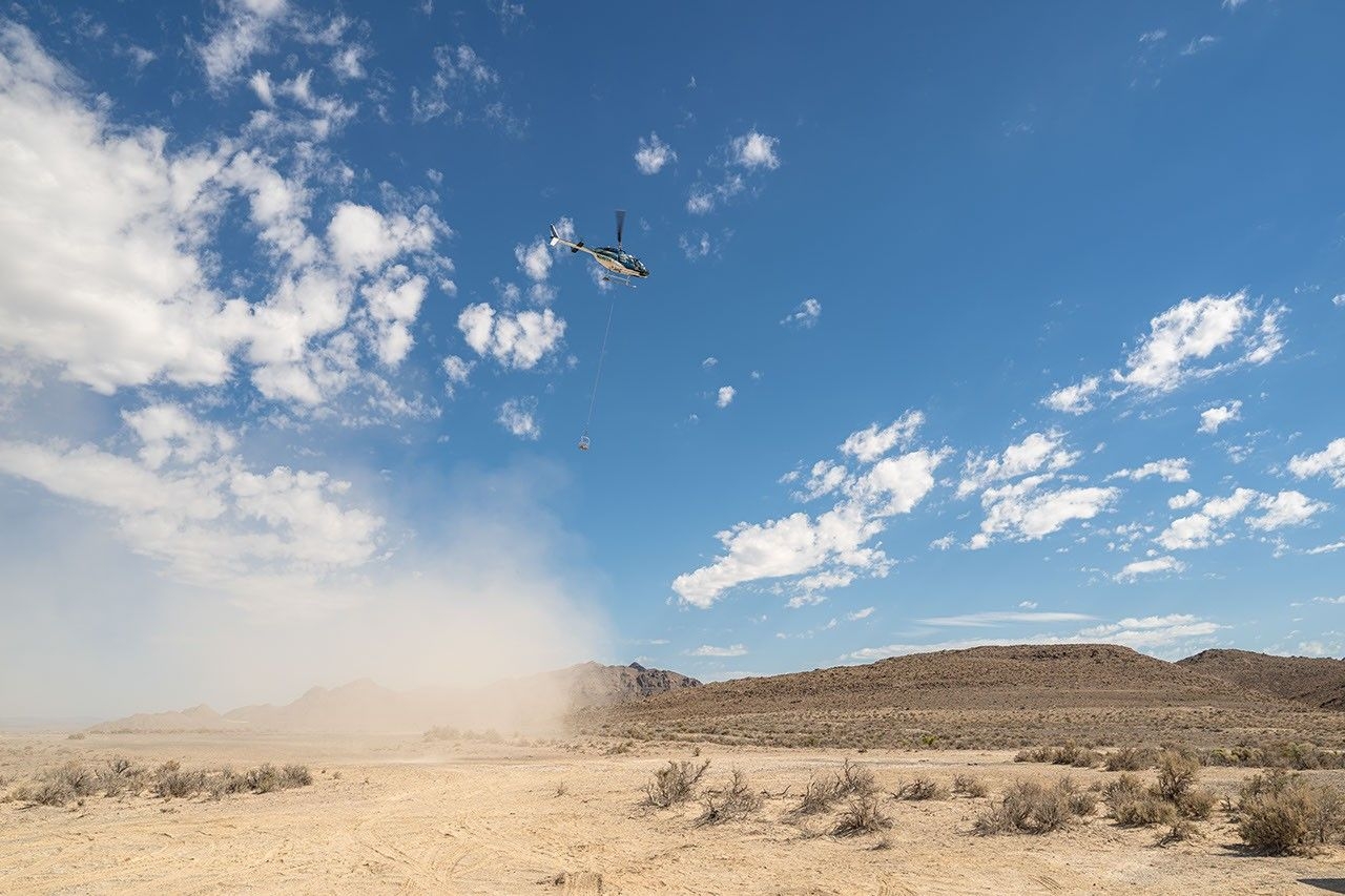
A helicopter carries a basket of nine instruments during a series of tests (June 23-25, 2026) in Utah to trial-run a prototype camera system that will one day fly aboard NASA’s DAVINCI probe to Venus.
Image credit: NASA/Mike Guinto
During its 60-minute descent at Venus, the DAVINCI probe will capture images, measure the atmospheric chemistry, and explore the environment of that world.
DAVINCI IS due for launch in the early 2030s.
Basket of instruments
A helicopter flying in U.S. Air Force restricted space over Crater Island, Utah, carried a basket of nine instruments during a series of tests June 23-25, 2026.
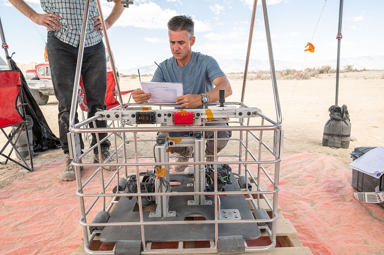
Brent Bos, a research physicist at NASA’s Goddard Space Flight Center in Greenbelt, Maryland, does a pre-flight check of a basket of instruments.
Image credit: NASA/Mike Guinto
Crater Island is a complex of mountains in northern Utah doubling for the mountainous region on Venus called Alpha Regio – the target for the DAVINCI descent probe.
On each of 10 flights, the helicopter ascended into the sky and then descended over nearly 40 minutes to the Utah landscape as the camera system snapped optical and infrared images taken as the chopper descended.
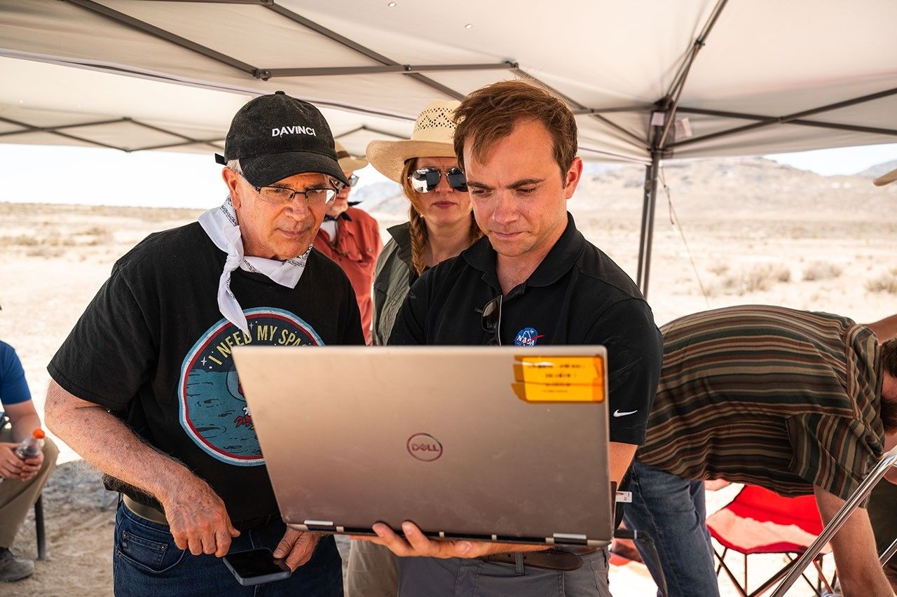
Pictured are DAVINCI’s (left to right) Jim Garvin, mission principal investigator; Erika Kohler, acting deputy principal investigator; and Matthew Mullin, space laser engineer. They evaluated the camera system that will one day fly aboard NASA’s DAVINCI mission probe to Venus.
Image credit: NASA/Mike Guinto
Imaging techniques and technology
Inside the tangling basket were nine instruments, including infrared cameras and pressure and temperature sensors that simulated the ones that will fly on the Venus probe, plus GPS units, gyroscopes, and a magnetometer to track the position and motion of the basket.
Scientists were later able to recreate the landscape in detail using only the images acquired. Those reconstructions have given the DAVINCI team confidence that their imaging techniques and technology also will work to reveal the geology of Alpha Regio.
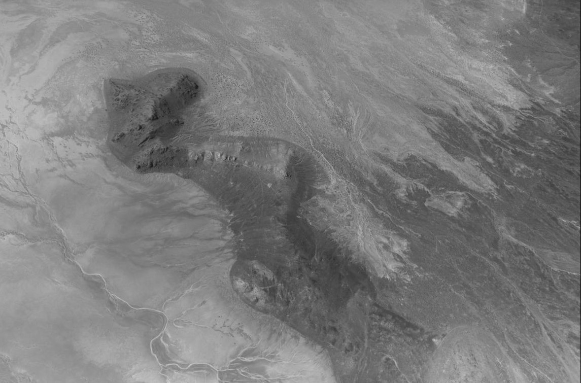
Infrared image taken over Crater Island, Utah, during a June 24, 2026, test of the camera system that will one day fly aboard NASA’s DAVINCI mission to Venus. The images were captured with a Malin Space Science Systems camera tuned to the near-infrared wavelengths that DAVINCI will use to see through Venus’s thick clouds and capture images of the Alpha Regio region as the probe descends toward the planet’s surface.
Imagae credit: Malin Space Science Systems/NASA/Jay Friedlander
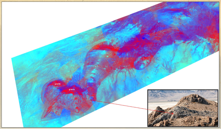
A preliminary three-dimensional view of ridges at Crater Island, Utah, as measured by the DAVINCI imaging system test campaign on June 23-25, 2026. The colors were added to distinguish rock types. The inset image in the bottom right is a helicopter view of the area.
Image credit: NASA Goddard/Jim Garvin
Go to descent video at:
https://x.com/NASASolarSystem/status/2077150426730828274/video/1
 Posted in Space News

