
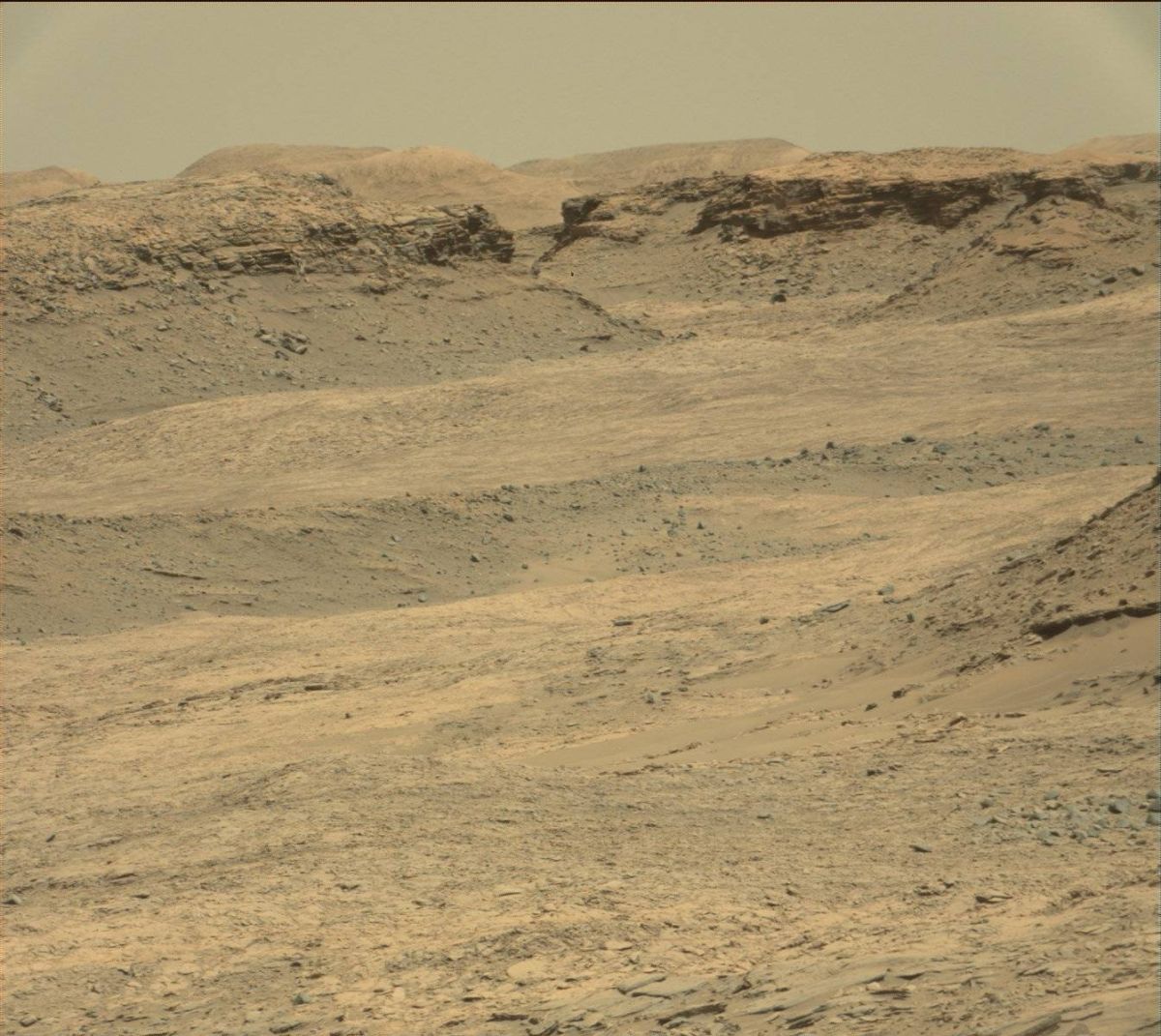
Curiosity Navcam Left B image taken on Sol 1316, April 19, 2016.
Credit: NASA/JPL-Caltech
NASA’s Curiosity Mars rover is now in Sol 1317, with all activities planned for last weekend done successfully.
Ken Herkenhoff of the USGS Astrogeology Science Center in Flagstaff, Arizona also reports that the robot has completed a full wheel imaging session using its Mars Hand Lens Imager (MAHLI).
High silica
The science team decided to return to the “Lubango” outcrop based on Chemistry and Camera (ChemCam) results that show unusually high silica there.
A Sol 1316 plan called for a drive back toward Lubango to find good targets for drilling, Herkenhoff adds. Before the drive, ChemCam and Mastcam will observe bedrock targets “Outapi” and “Okongo,” and the rover is on tap to acquire a mosaic of “Piambo.”
Curiosity Mastcam Right image taken on Sol 1314, April 17, 2016.
Credit: NASA/JPL-Caltech/MSSS
Curiosity’s Mastcam was scheduled to take images of the Lubango area, and Navcam will search for dust devils.
Active Dynamic Albedo of Neutrons (DAN) measurements are planned both before and after a short drive of Curiosity, and the Chemistry & Mineralogy X-Ray Diffraction/X-Ray Fluorescence Instrument (CheMin) is to perform calibration activities overnight.
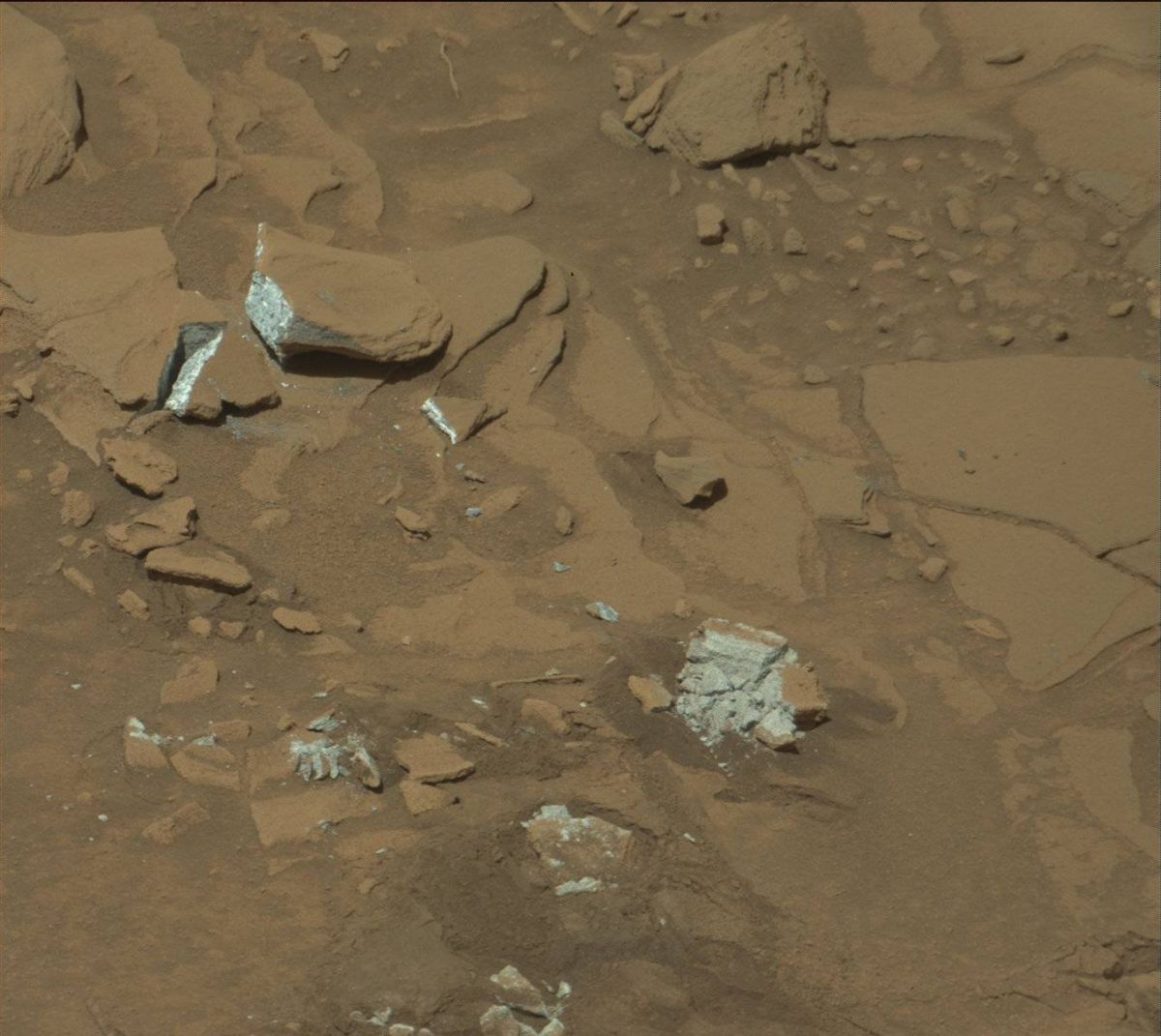
Curiosity Mastcam Right image taken on Sol 1314, April 17, 2016.
Credit: NASA/JPL-Caltech/MSSS
New map
Meanwhile, a new map has been issued that shows the route driven by the Mars rover through the 1316 Martian day, or sol, of the rover’s mission on Mars (April, 19, 2016).
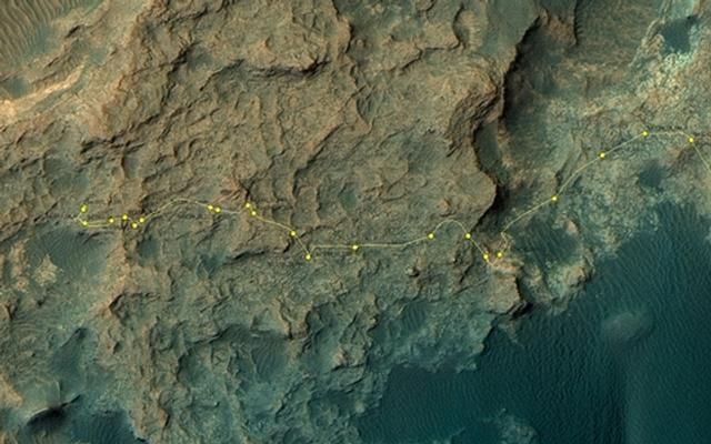
Credit: NASA/JPL-Caltech/Univ. of Arizona
Numbering of the dots along the line indicate the sol number of each drive. North is up.
From Sol 1315 to Sol 1316, Curiosity had driven a straight line distance of about 50.66 feet (15.44 meters).
Since touching down in Bradbury Landing in August 2012, Curiosity has driven 7.91 miles (12.73 kilometers).
The base image from the map is from the High Resolution Imaging Science Experiment Camera (HiRISE) in NASA’s Mars Reconnaissance Orbiter.


Many thanks, Leonard. to think what man has accomplished just in your lifetime !