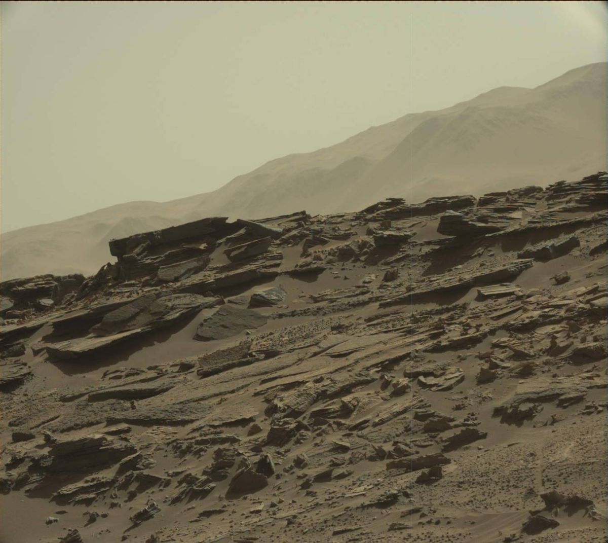
Curiosity Mastcam Left image taken on Sol 1274, March 7, 2016.
Credit: NASA/JPL-Caltech/MSSS
Word from the Mars Curiosity team is that last weekend’s drive of the rover went well.
That wheeling away on Mars put the robot in “a great location for some contact science, right near the contact between the “Murray” and “Stimson” formations, with some interesting veins and textures in the nearby rocks,” reports Ryan Anderson, a planetary scientist at the USGS Astrogeology Science Center in Flagstaff, Arizona.
The Curiosity Mars rover is at this moment in Sol 1276.
Nice location
“Given our nice location, we opted not to do any driving in the Sol 1275 plan and instead study the area in front of us,” Anderson adds.
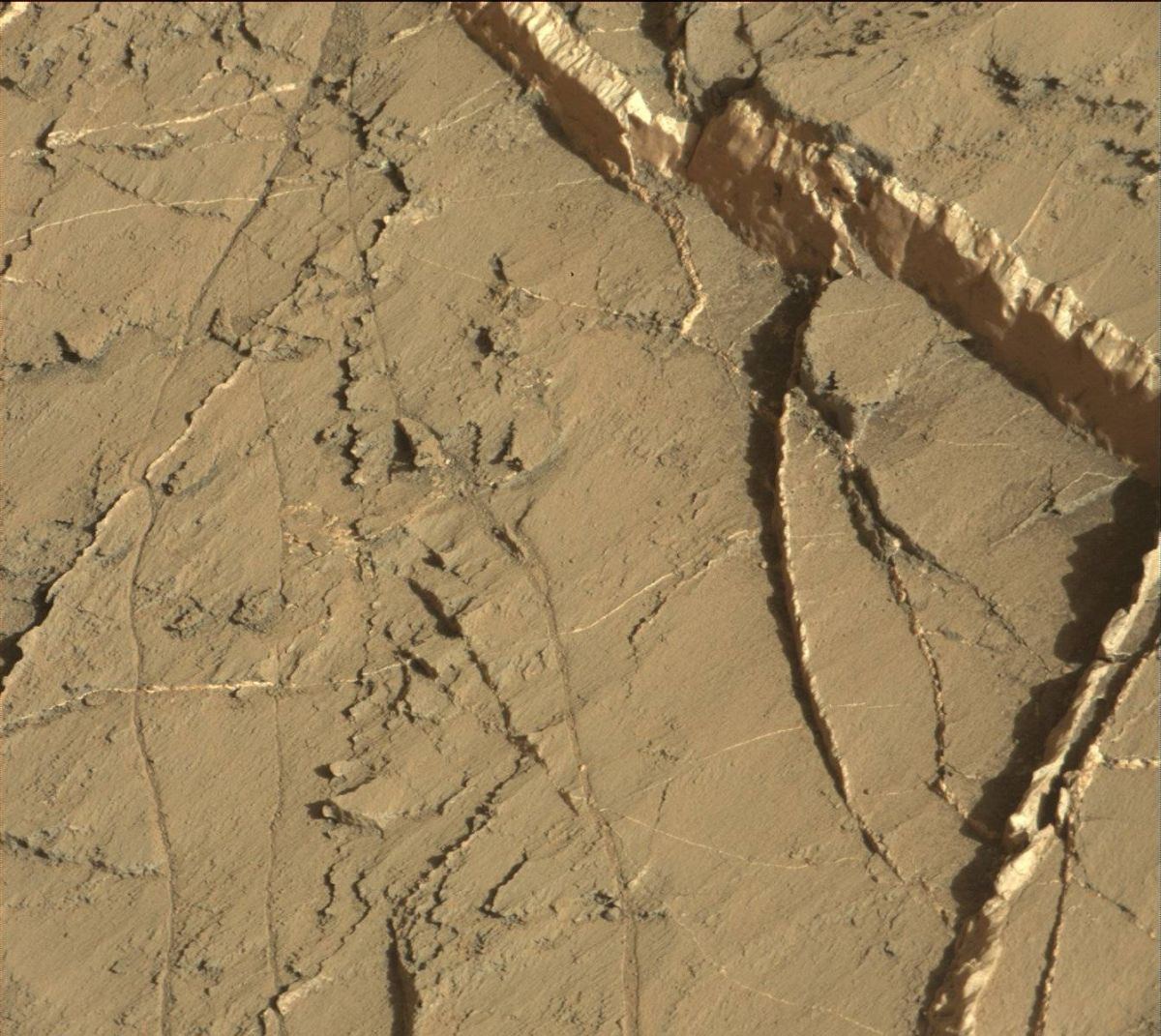
Curiosity Mastcam Right image taken on Sol 1274, March 7, 2016.
Image Credit: NASA/JPL-Caltech/MSSS
The Sol 1275 plan started off with a Chemistry & Camera (ChemCam) passive sky observation and ChemCam’s laser-induced breakdown spectroscopy and Remote Micro-Imager (RMI) observations of the targets “Palmhorst”, “Palmwag”, and “Mirabib.”
Mastcam took documentation images of each of the ChemCam targets, plus a couple of mosaics of the Murray-Stimson contact.
Later in the day, the robot used its Mars Hand Lens Imager (MAHLI) to capture images of Mirabib before and after brushing the dust off, as well as mosaics of Palmwag and Palmhorst.
Curiosity’s Alpha Particle X-Ray Spectrometer (APXS) then analyzed the composition of Palmwag and then did an overnight measurement of Mirabib.
Knobby textures
In the March 8 plan, the goal was to place the rover in position to study some interesting knobby textures. Prior to the drive, Navcam will do some atmospheric measurements and ChemCam will analyze the targets “Duruchaus”, “Eiseb”, and “Aranos”.
As usual, Mastcam will take some documentation images of the ChemCam targets.
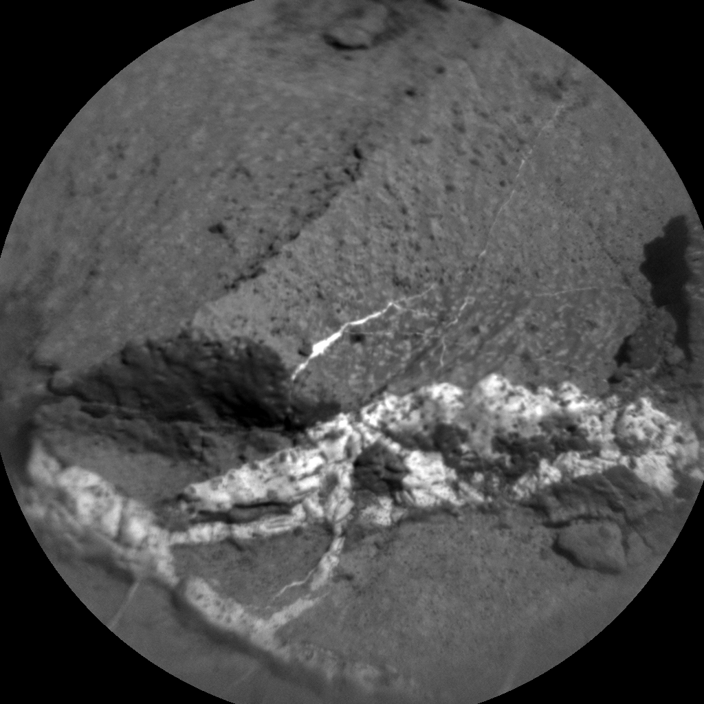
Curiosity ChemCam Remote Micro-Imager photo, take on Sol 1275. March 8, 2016.
Credit: NASA/JPL-Caltech/LANL
Mastcam also has a mosaic of fine laminations in the rock at the Murray-Stimson contact, another mosaic to extend the coverage of the contact, and a small 2×1 mosaic of Mirabib and nearby veins using all of Mastcam’s science filters.
Onward to Naukluft plateau
“After that, we will do a short drive toward the knobby texture followed by post-drive imaging. The knobby texture is not in a great position for us to continue driving after we analyze it, so we’ll likely return back to our current position before continuing up onto Naukluft plateau,” Anderson concludes.
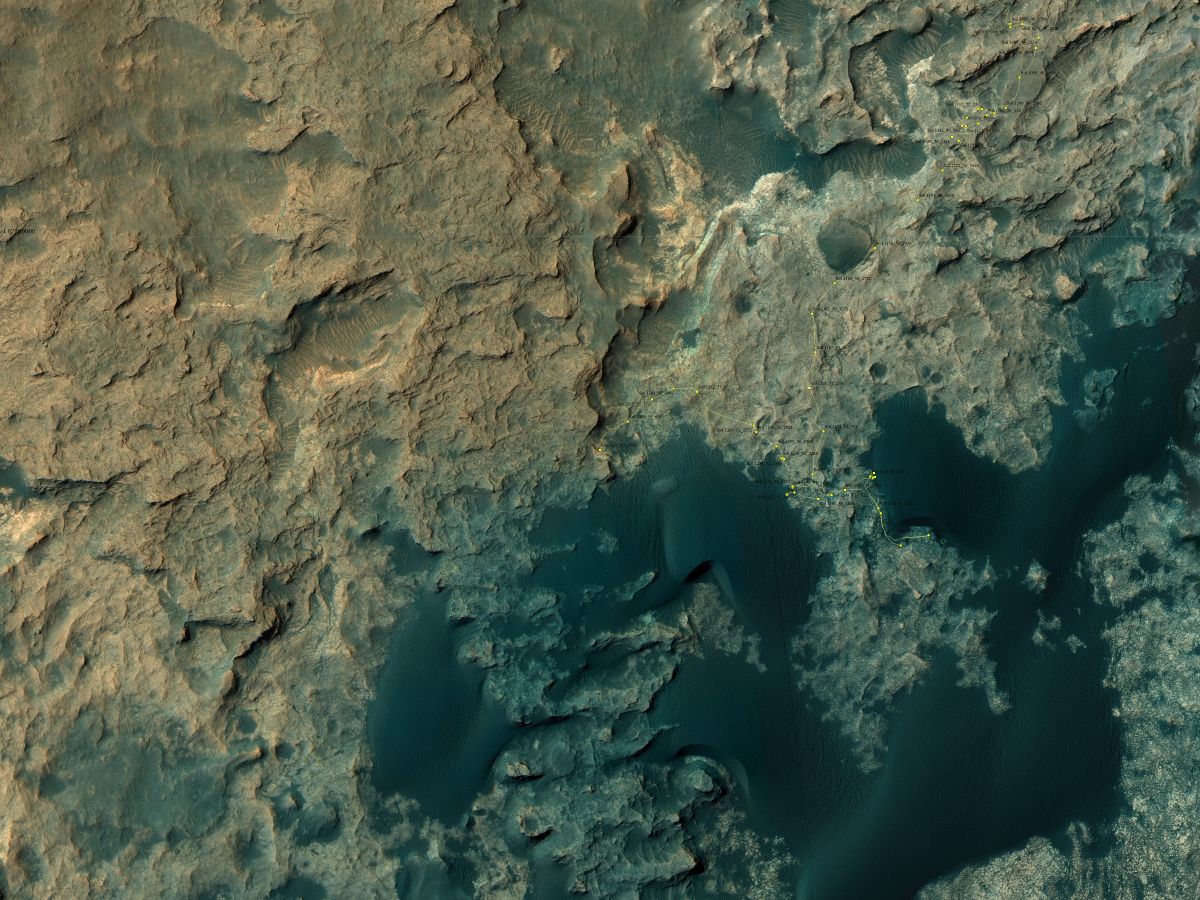
Curiosity Rover’s Location for Sol 1274
This map shows the route driven by NASA’s Mars rover Curiosity through the 1274 Martian day, or sol, of the rover’s mission as of (March, 7, 2016
Numbering of the dots along the line indicate the sol number of each drive. North is up. From Sol 1269 to Sol 1274, Curiosity had driven a straight line distance of about 130.45 feet (39.76 meters).
The base image from the map is from the High Resolution Imaging Science Experiment Camera (HiRISE) in NASA’s Mars Reconnaissance Orbiter.
Image Credit: NASA/JPL-Caltech/Univ. of Arizona
Dates of planned rover activities are subject to change due to a variety of factors related to the Martian environment, communication relays and rover status.

