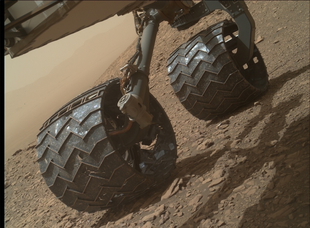
Mars Hand Lens Imager (MAHLI) photo taken on April 22, 2018, Sol 2030.
Credit: NASA/JPL-Caltech/MSSS
Abigail Fraeman, a planetary geologist at NASA’s Jet Propulsion Laboratory in Pasadena, California, reports that the robot drove a little over 52 feet (16 meters) to the east over last weekend.
“The rover is currently skirting around the southern edge of a small, blocky impact crater on its way north off the Vera Rubin Ridge,” Fraeman explains. The rover’s Mars Hand Lens Imager (MAHLI) was used to take images of the rover wheels.
Tracking damage
“We do this activity, dubbed Full MAHLI Wheel Imaging (or FMWI in NASA acronym speak), every few hundred meters to track damage to Curiosity’s wheels caused by the terrain. It’s important for us to take this observation in order to estimate how much farther the rover will be able to drive before the wheels become inoperable, and also to understand if the sharp edges of the broken wheels risk damaging the nearby cables,” Fraeman explains. “So far, we estimate we’re in pretty great shape for our plans to drive a lot farther up Mt. Sharp!”
Fraeman added that the last few years, the robot has been actively working to mitigate wheel damage in several ways.
“JPL engineers developed some smart driving algorithms called ‘traction control’ that reduce forces on Curiosity’s wheels as the rover climbs over rocks. Geologists like myself also help by planning drive paths over terrain that is safer for the wheels.”
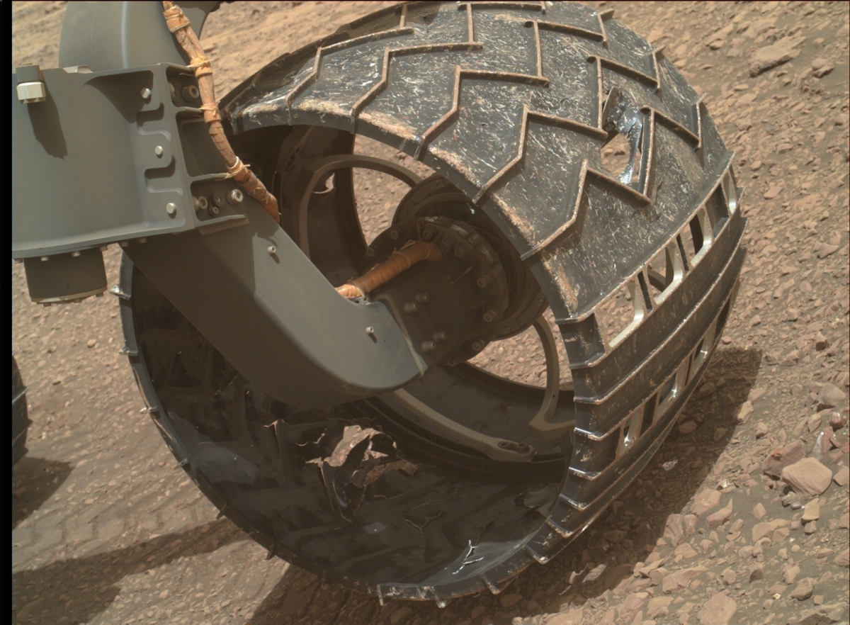
Mars Hand Lens Imager (MAHLI) photo taken on April 22, 2018, Sol 2030.
Credit: NASA/JPL-Caltech/MSSS
Sol-to-sol
The robot’s driving is determined on a sol-to-sol basis in tactically staffed roles known as Surface Properties Scientist (SPS).
“Strategically, we also work with the orbital datasets to predict what the terrain ahead will look like, and we use these predictions to choose long-term paths that will be easiest on the wheels without sacrificing science,” Fraeman points out.
Sharp edges
Curiosity’s path from the last few sols have been dictated by driving along terrain that looks darker and bluer compared to the nearby bright, tan rocks.
“This path corresponds to terrain that is filled with pebbles and hard-packed sand, and we think it’s a little nicer for the wheels than the bright bedrock, which can sometimes have sharp edges. The geologic term for these sharp edged rocks is ventifacts, and they are formed by wind erosion over millions of years. While they probably won’t hurt the wheels too much, we’d prefer to avoid them when possible,” Fraeman concludes.

