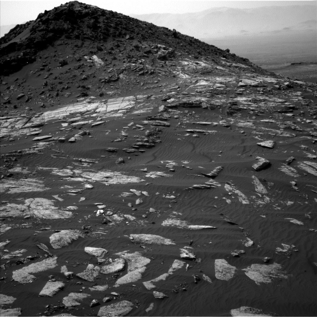
Curiosity Navcam Left B image taken on Sol 1610, February 15, 2017.
Credit: NASA/JPL-Caltec
Now in Sol 1611, the Curiosity Mars rover is on location to survey several potential targets.
On Sol 1610 the Curiosity Mars rover drove nearly 89 feet (27 meters).
Dark bedrock
A dark patch of bedrock, appropriately named “Patch Mountain” was chosen for Curiosity’s Chemistry and Camera (ChemCam), Right Mastcam, and Mars Hand Lens Imager (MAHLI) observations.
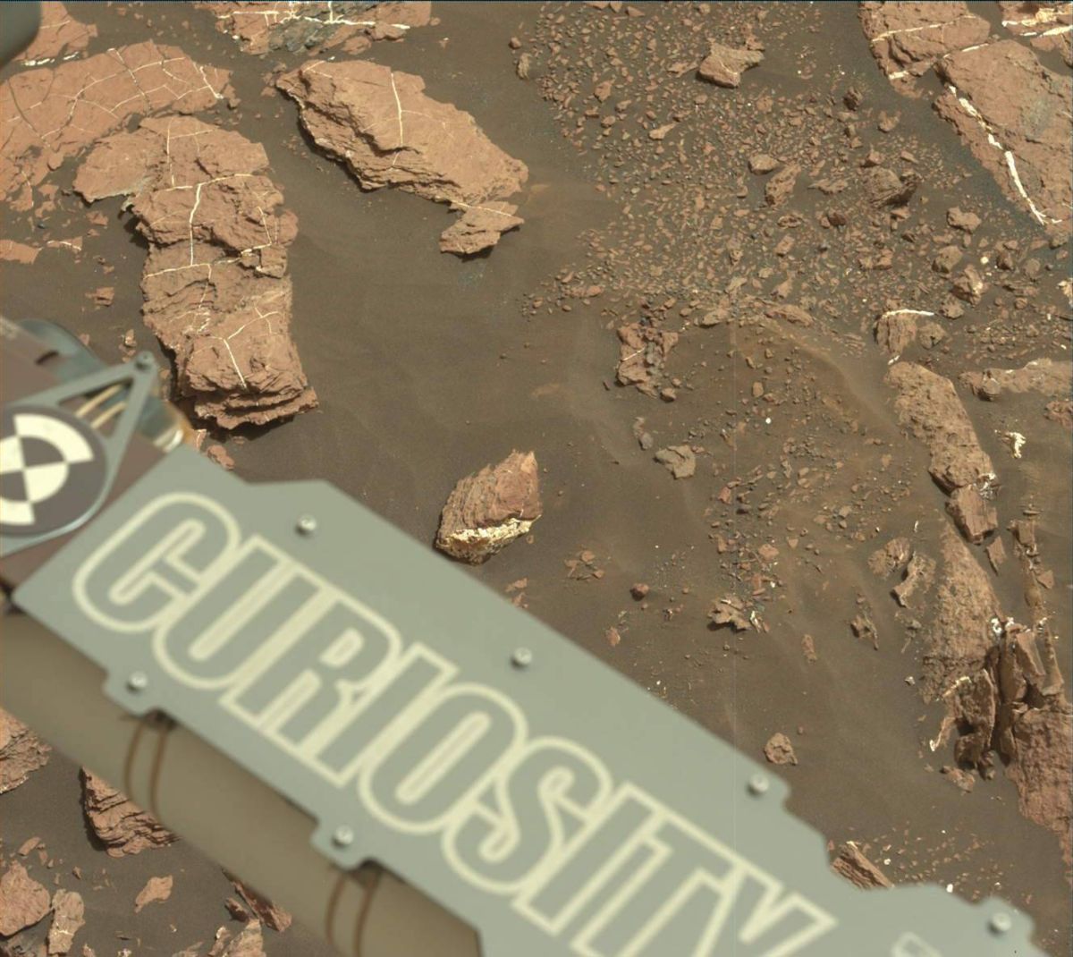
Curiosity Mastcam Left image taken on Sol 1610, February 15, 2017.
Credit: NASA/JPL-Caltech/MSSS
The MAHLI imaging was moved after the ChemCam observation so that the laser-induced breakdown spectroscopy (LIBS) impact spots would be visible, reports Ken Herkenhoff of the USGS Astrogeology Science Center in Flagstaff, Arizona.
An additional MAHLI image was added to the standard full suite, to provide a 3-image mosaic from 5 centimeters.
Future driving
“Then the rover will drive again, and take images afterward to enable planning more activities on Sol 1612,” Herkenhoff adds.
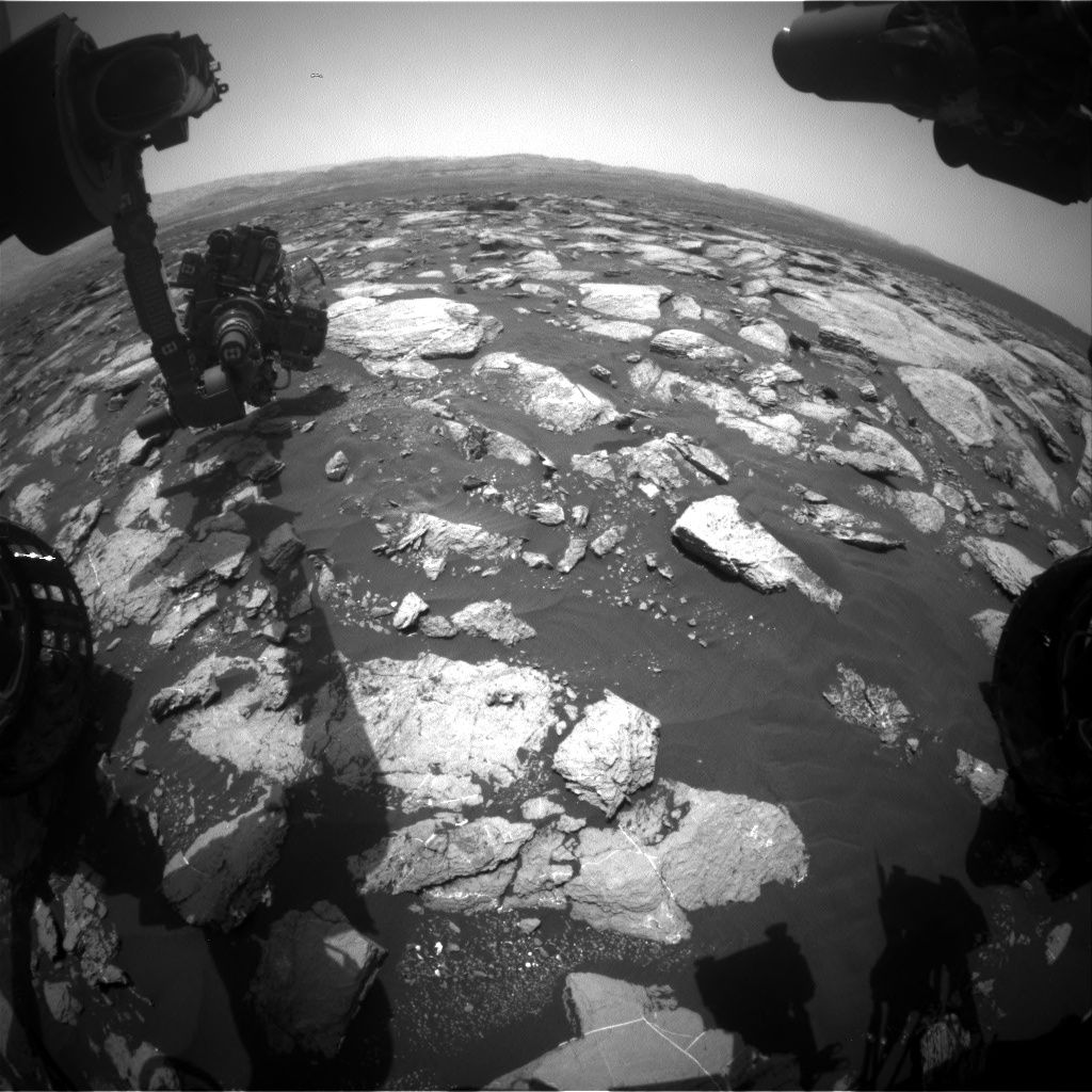
Curiosity Front Hazcam Right B image taken on Sol 1611, February 16, 2017.
Credit: NASA/JPL-Caltech
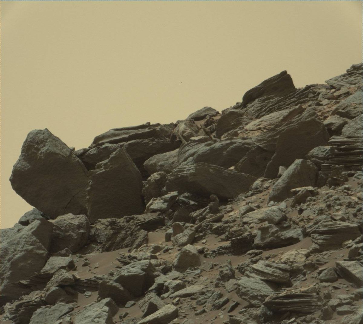
Curiosity Mastcam Right image taken on Sol 1610, February 15, 2017.
Credit: NASA/JPL-Caltech/MSSS
Just before sunset, the robot’s Navcam will search for dust devils and
the Rover Environmental Monitoring Station (REMS) will complete the second part of their flight software update.
Dates of planned rover activities are subject to change due to a variety of factors related to the Martian environment, communication relays and rover status.
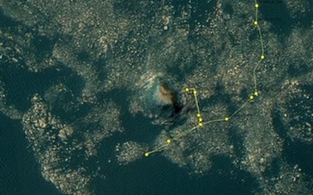
This map shows the route driven by NASA’s Mars rover Curiosity through the 1610 Martian day, or sol, of the rover’s mission on Mars (February 15, 2017).
From Sol 1608 to Sol 1610, Curiosity had driven a straight line distance of about 71.89 feet (21.91 meters). Since touching down in Bradbury Landing in August 2012, Curiosity has driven 9.67 miles (15.56 kilometers).
The base image from the map is from the High Resolution Imaging Science Experiment Camera (HiRISE) in NASA’s Mars Reconnaissance Orbiter.
Credit: NASA/JPL-CALTECH/University of Arizona

