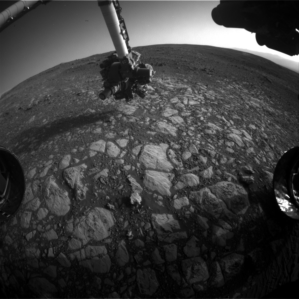
Curiosity Front Hazcam Right B image acquired on Sol 2013, April 5, 2018.
Credit: NASA/JPL-Caltech
Now in Sol 2014, NASA’s Mars Curiosity rover recently completed a drive of 125 feet (38 meters) reaching a location that researchers call Region 13 of Vera Rubin Ridge.
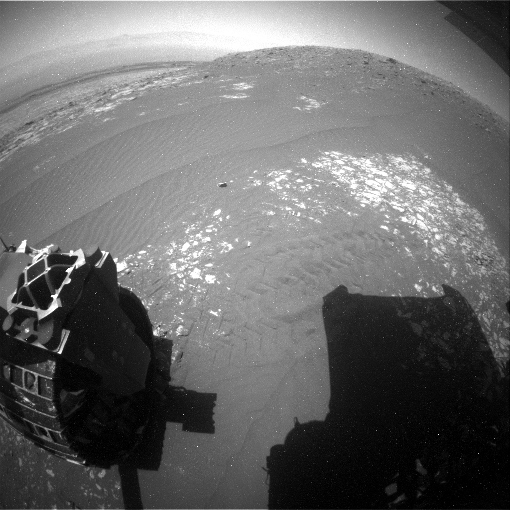
Curiosity Navcam Right B image taken on Sol 2013, April 5, 2018.
Credit: NASA/JPL-Caltech
Reports Roger Wiens, a geochemist at the Los Alamos National Laboratory in New Mexico: That spot has been subdivided into separate nearby sites, with the current one as B1, still near the edge of the hematite “hotspot” identified from orbit by the Compact Reconnaissance Imaging Spectrometer for Mars (CRISM) instrument on the Mars Reconnaissance Orbiter.
Float rocks
“Curiosity is flirting with the boundary of the mapped “Biwabik” quadrangle; pretty soon we will drive into it for a while and start using target names from northern Minnesota,” Wiens points out. “The Biwabik name was selected because of the city’s connection with the Mesabi Range, which contains large deposits of Precambrian iron ore.”
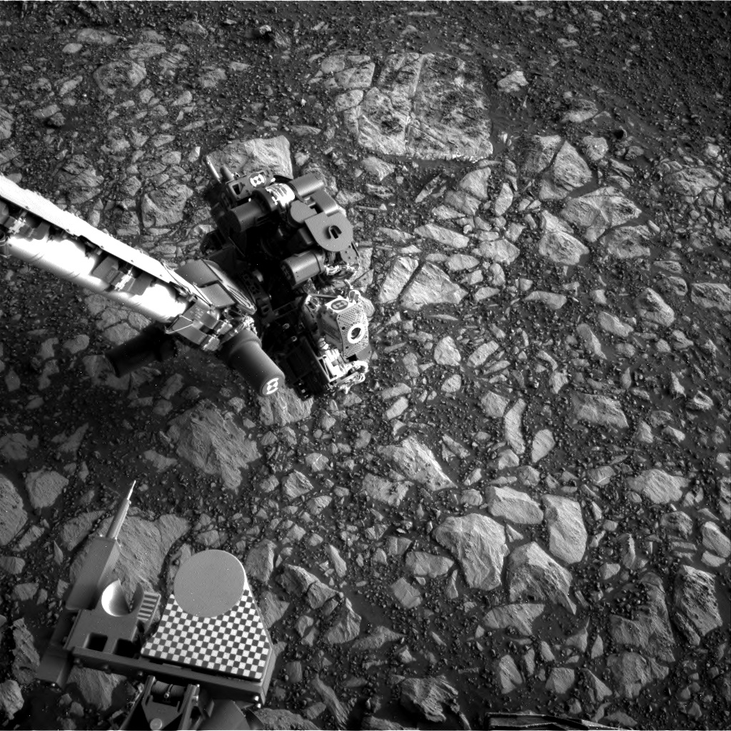
Curiosity Rear Hazcam Left B image taken on Sol 2013, April 5, 2018.
Credit: NASA/JPL-Caltech
The rover is back into the “Torridon” quad with Scottish names, a quad that Curiosity has been exploring most of the sols in the last several weeks. “The team is intrigued to see some fields of dark, blocky float rocks nearby,” Wiens adds.
Science duties
Curiosity’s planned science duties include Chemistry and Camera (ChemCam), Mastcam, Mars Hand Lens Imager (MAHLI), and Alpha Particle X-Ray Spectrometer (APXS) observations on “Lingarabay” and “Kinloch”.
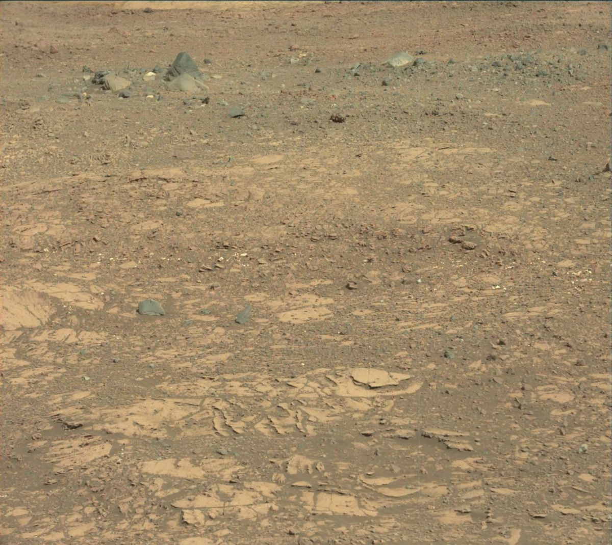
Curiosity Mastcam Left image acquired on Sol 2012, April 4, 2018.
Credit: NASA/JPL-Caltech/MSSS
The robot’s Dust Removal Tool will be used on the first of the two targets, which will be an overnight APXS target.
MAHLI’s observation distances will be 25 centimeters and 5 centimeters. Mastcam’s right-side camera will stay busy, with a 5×1 mosaic on the “hematite hotspot”, a 2×1 on “Galloway”, a 5×1 on “Foula”, a 5×1 on “Suilven” (targeting grain sizes along a ripple crest) and a single image on “Arrochar.”
Additional measurements, Wiens adds, include Dynamic Albedo of Neutrons (DAN) passive, Rover Environmental Monitoring Station (REMS) and Radiation Assessment Detector (RAD) acquisitions, Mastcam sun tau measurement, crater rim extinction, and calibration target observations as well as the rover making a drive direction 4×1 observation.

Curiosity Mars Hand Lens Imager (MAHLI) produced this image on Sol 2013, April 5, 2018.
Credit: NASA/JPL-Caltech/MSSS
Robot inhabitants
Wiens provided some interesting factoids: “Mars is the only known planet inhabited exclusively by active robots. It has been this way for over fourteen Earth years, with a cumulative total of twenty-six Earth years of roving by four vehicles. Together these rovers have logged over 70 kilometers of distance, well over half of that by the Opportunity rover. (Curiosity will likely hit the 20 kilometer mark later this year).
Credit: NASA/JPL-Caltech/Univ. of Arizona
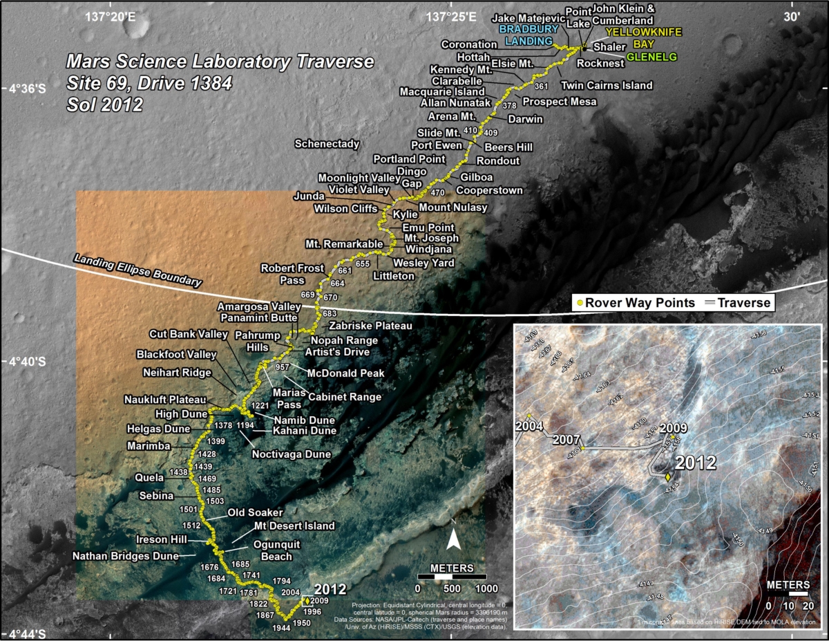
Updated traverse map
A new Curiosity’s traverse map through Sol 2012 has been issued.
The map shows the route driven by NASA’s Mars rover Curiosity through the 2012 Martian day, or sol, of the rover’s mission on Mars (April 04, 2018).
Numbering of the dots along the line indicate the sol number of each drive. North is up. The scale bar is 1 kilometer (~0.62 mile).
From Sol 2009 to Sol 2012, Curiosity had driven a straight line distance of about 66.38 feet (20.23 meters), bringing the rover’s total odometry for the mission to 11.59 miles (18.65 kilometers).
The base image from the map is from the High Resolution Imaging Science Experiment Camera (HiRISE) in NASA’s Mars Reconnaissance Orbiter.

