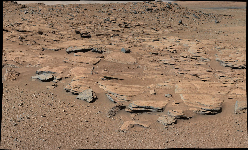
This image taken by the Mast Camera (Mastcam) on NASA’s Curiosity Mars rover just north of the “Kimberley” waypoint shows beds of sandstone inclined to the southwest toward Mount Sharp and away from the Gale Crater rim.
Image Credit: NASA/JPL-Caltech/MSSS
NASA’s Curiosity Mars rover continues on its 5 mile (8 kilometer) journey from its landing site in August 2012 to its current work site at the base of Mount Sharp.
The robot has uncovered clues about the changing shape of the crater floor during an era of lakes, according to research scientists.
Curiosity currently is investigating the lowest sedimentary layers of Mount Sharp, a section of rock 500 feet (150 meters) high, dubbed the Murray formation. Rivers carried sand and silt to the lake, depositing the sediments at the mouth of the river to form deltas similar to those found at river mouths on Earth. This cycle occurred over and over again.

NASA’s Mars rover Curiosity acquired this image on December 11, 2014 using its Mars Hand Lens Imager (MAHLI), located on the turret at the end of the rover’s robotic arm.
Image Credit: NASA/JPL-Caltech/MSSS
Meanwhile, attention is also being paid to the wear and tear on the rover’s set of wheels. Damage to the wheels due to drives over rough terrain is carefully monitored.
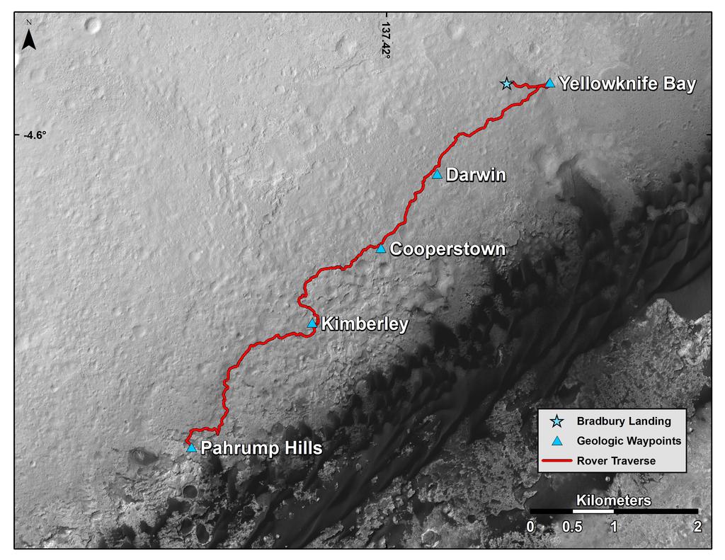
This map shows the route driven by NASA’s Curiosity Mars rover from the location where it landed in August 2012 to the “Pahrump Hills” outcrop, which is part of the basal layer of Mount Sharp.
The traverse line covers drives completed through the 817th Martian day, or sol, of Curiosity’s work on Mars (Nov. 23, 2014).
Image Credit: NASA/JPL-Caltech/Univ. of Arizona

