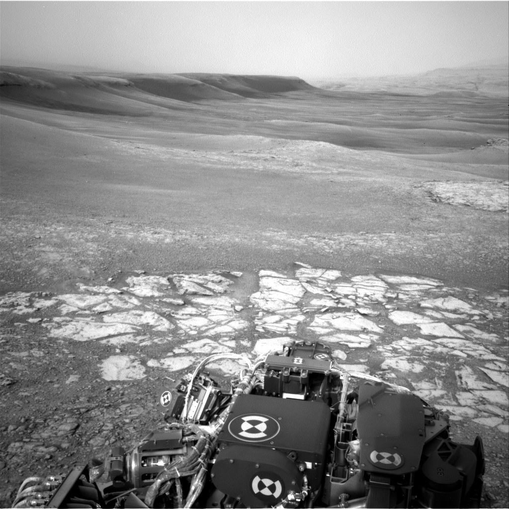
Curiosity Navcam Left A photo taken on Sol 2299, January 24, 2019.
Credit: NASA/JPL-Caltech
NASA’s Curiosity Mars rover is carrying out Sol 2299 duties.
The robot has moved for the first time since December 13, 2018 moving toward a new geological unit that scientists label as the “Clay-Bearing Unit” (CBU).

Curiosity Front Hazcam Left A photo taken on Sol 2299, January 24, 2019.
Credit: NASA/JPL-Caltech
Scott Guzewich, an atmospheric scientist at NASA’s Goddard Space Flight Center in Greenbelt, Maryland reports: “Curiosity is continuing the first phase of its journey to the clay-bearing unit…with a series of ‘touch-and-go’ driving sols.”
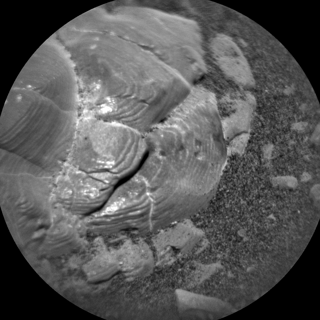
Melrose place
During these sols, the rover does contact science with its Mars Hand Lens Imager (MAHLI) and Alpha Particle X-Ray Spectrometer (APXS) in the morning, some additional remote sensing as time permits, and then drives away to a new location during the afternoon.

Curiosity Navcam Right A image taken on Sol 2299, January 24, 2019.
Credit: NASA/JPL-Caltech
“We want to closely examine the bedrock as we drive to help understand how the Vera Rubin Ridge and the clay unit are related,” Guzewich adds.
“Melrose” was the target for contact science. Additional Mastcam and Chemistry and Camera (ChemCam) observations were taken of other nearby geological targets.
“Curiosity is continuing to monitor a strong late-season dust storm,” Guzewich notes, “that’s increased the amount of dust locally for the last 1-2 weeks with Navcam and Mastcam observations of the atmosphere as well as an increased cadence of [Rover Environmental Monitoring Station] REMS meteorological observations.”
Curiosity ChemCam Remote Micro-Imager photo acquired on Sol 2299, January 24, 2019.
Credit: NASA/JPL-Caltech/LANL
Synergistic, collaborative discoveries
Roger Wiens, a geochemist at the Los Alamos National Laboratory in New Mexico, also notes that the Curiosity rover team, following previous rover teams, has organized itself into different campaigns to explore different geological units.
“Organizers are nominated to lead these campaigns, and their job is to help coordinate among the competing interests of the different instrument teams, helping to make synergistic, collaborative discoveries,” Wiens points out. “The organizers of the CBU campaign have been patiently waiting for their turn to lead the campaign. After all, their first meeting was well over a year ago, on October 3, 2017.”
Geological contact
The rover team is searching for the geological contact between bedrock of Vera Rubin Ridge and that of the Clay-Bearing Unit.
“The precise boundary is not clear from orbit, and it could also be a relatively gradual change as seen from rover images,” Wiens reports. “To have the best chance at observing the transition, Curiosity is doing relatively short drives, interspersed with frequent observations by both remote and contact instruments, as the terrain allows.”

Credit: NASA/JPL-Caltech/Univ. of Arizona
For example, the rover drove about 125 feet (38 meters) over the holiday weekend.
New road map
A new Curiosity traverse map through Sol 2297 has been posted.
The map shows the route driven by NASA’s Mars rover Curiosity through the 2297 Martian day, or sol, of the rover’s mission on Mars (January 22, 2019).
Numbering of the dots along the line indicate the sol number of each drive. North is up. The scale bar is 1 kilometer (~0.62 mile).
From Sol 2257 to Sol 2297, Curiosity had driven a straight line distance of about 115.54 feet (35.22 meters), bringing the rover’s total odometry for the mission that began in August 2012 to 12.38 miles (19.93 kilometers).
The base image from the map is from the High Resolution Imaging Science Experiment Camera (HiRISE) in NASA’s Mars Reconnaissance Orbiter.

