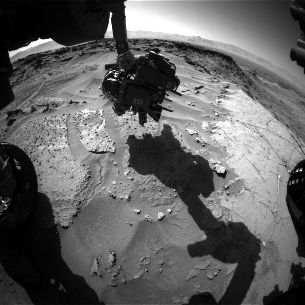
Curiosity Front Hazcam Left B image taken on Sol 1279, March 12, 2016.
Credit: NASA/JPL-Caltech
NASA’s Curiosity rover is a few hours from entering Sol 1280.
Reports Ryan Anderson, a planetary scientist at the USGS Astrogeology Science Center in Flagstaff, Arizona: “It’s time to wrap up our investigation of the interesting nodules at the contact between the Murray and Stimson formations and resume driving!”
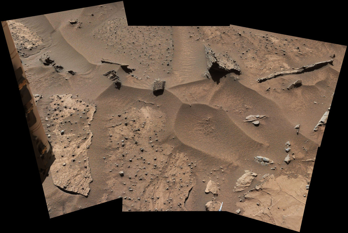
Knobbly textured sandstone on Mount Sharp. Patches of Martian sandstone visible in the lower-left and upper portions of this view from the Mast Camera (Mastcam) of NASA’s Curiosity Mars rover have a knobbly texture due to nodules apparently more resistant to erosion than the host rock in which some are still embedded.
Credit: NASA/JPL-Caltech/MSSS
The weekend starts off focused mostly on contact science.
Nodule looks
On Sol 1279, the Alpha Particle X-Ray Spectrometer (APXS) instrument was slated to analyze two neighboring locations on a group of nodules collectively called “Khomas”, and then on Sol 1280 APXS will analyze a third location on Khomas.
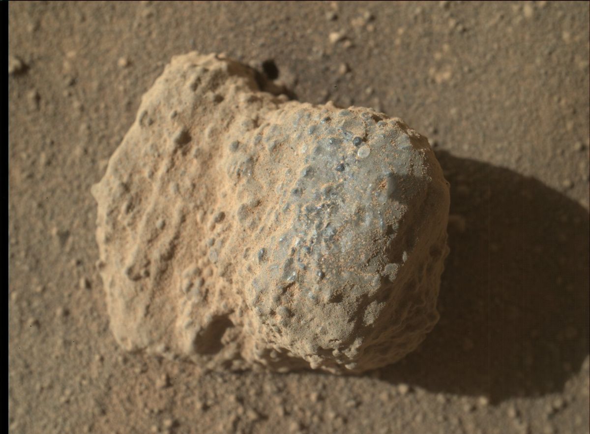
NASA’s Mars rover Curiosity acquired this image using its Mars Hand Lens Imager (MAHLI), located on the turret at the end of the rover’s robotic arm. Image taken on March 11, 2016, Sol 1278.
Imagery of this nodule shows individual grains of sand and laminations from the sandstone deposit in which the nodule formed. This nodule is about one inch (two centimeters) across.
Credit: NASA/JPL-Caltech/MSSS
The plan also tags Curiosity’s Mars Hand Lens Imager (MAHLI) to collect supporting images, taking pictures of the targets “Etendeka” and “Maieberg”.
In the morning on Sol 1280, the rover is scheduled to make some atmospheric measurements using Navcam, Mastcam, and the Chemistry & Camera (ChemCam), followed by a 20-spot ChemCam analysis of the target “Marienfluss”, right across the Murray-Stimson contact.
Mastcam is set to take a support image of Marienfluss, plus a small mosaic of a target called “Kerpfenkliff”.
Driving onto Naukluft plateau
“Then on Sol 1281, we will get moving again with a roughly 70 meter drive that should take us up onto the Naukluft plateau,” Anderson explains. During that drive of 230 feet, the rover’s Mars Descent Imager (MARDI) is scheduled to collect images of the terrain underneath the rover.
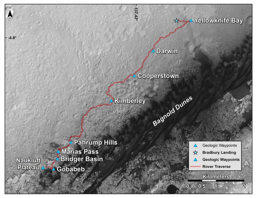
This map shows the route driven by NASA’s Curiosity Mars rover from where it landed in 2012 to its location in early March 2016, approaching “Naukluft Plateau.” As the rover continues up Mount SharpThe scale bar at lower right represents two kilometers (1.2 miles).The base image for the map is from the High Resolution Imaging Science Experiment (HiRISE) camera on NASA’s Mars Reconnaissance Orbiter. North is up. Bagnold Dunes form a band of dark, wind-blown material at the foot of Mount Sharp.
Credit: NASA/JPL-Caltech/Univ. of Arizona
Anderson notes that after the drive, the plan is to take post-drive imaging using Navcam to snag photos of Mt. Sharp. Doing so will help target potential long distance ChemCam remote micro-imager (RMI) images next week.
Planned rover activities are subject to change due to a variety of factors related to the Martian environment, communication relays and rover status.


In the second image, the color mastcam mosaic, there’s a trench formed by subsidence in the upper left hand corner, a common and widespread Martian process that goes unexplained and unstudied. In this case the right end of the trench cross-cuts a sand ripple. This is one example of several active present day processes that are getting no attention because of the overriding need to find out what happened billions of years ago.