
Curiosity Left B Navigation Camera photo taken Sol 2695, March 6, 2020.
Credit: NASA/JPL-Caltech
NASA’s Curiosity Mars rover is now carrying out Sol 2696 duties.
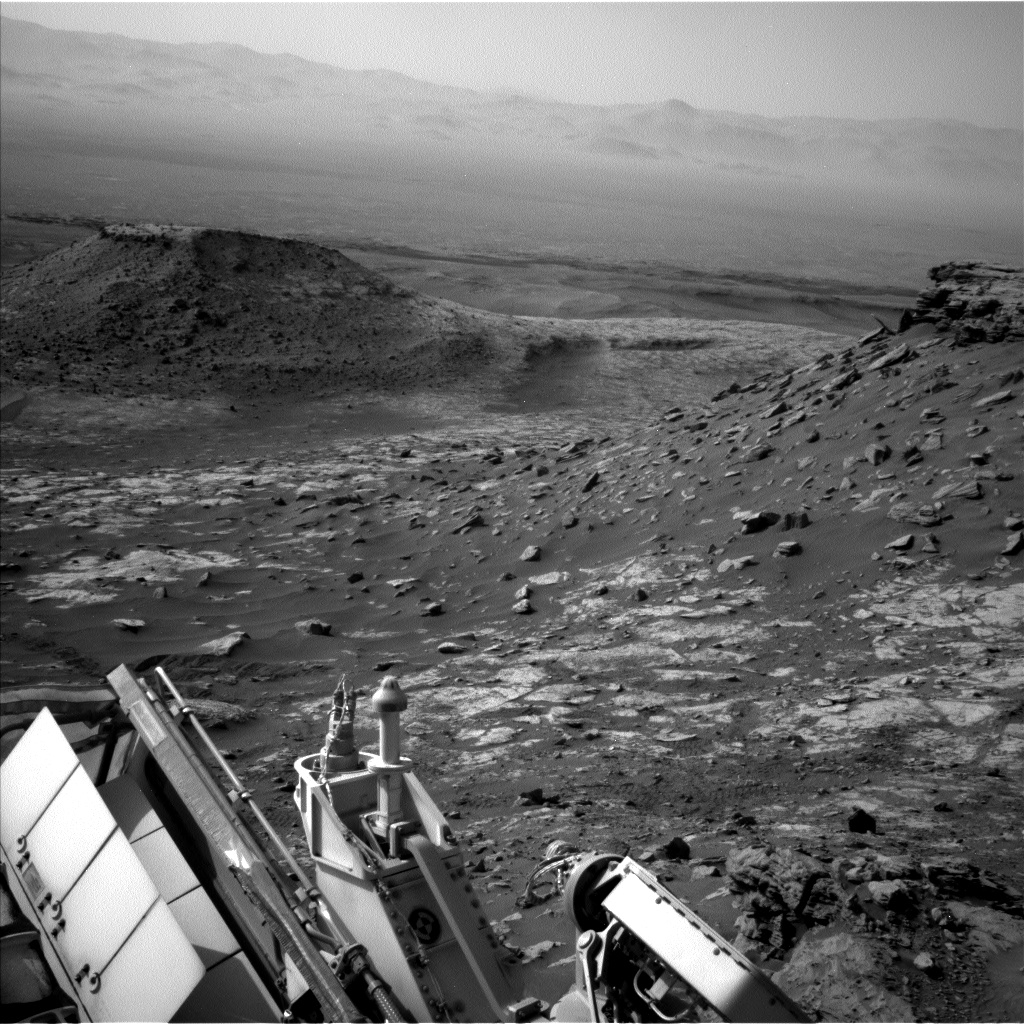
Reports Michelle Minitti, a planetary geologist at Framework in Silver Spring, Maryland: “Kudos to our rover drivers for making it up the steep, sandy slope below the “Greenheugh pediment” and delivering us to a stretch of geology we had our eyes on even before we landed in Gale crater!”

Curiosity Left B Navigation Camera photo taken Sol 2695, March 6, 2020.
Credit: NASA/JPL-Caltech
The geology planning group honored the achievement of making it to the current site by getting Curiosity cameras and laser on every little bit of rock planners could manage.

Curiosity Left B Navigation Camera photo taken Sol 2695, March 6, 2020.
Credit: NASA/JPL-Caltech
New parking spot
The robot’s Mars Hand Lens Imager (MAHLI) and Alpha Particle X-Ray Spectrometer (APXS) will analyze “Galloway Hills,” cleared of dust beforehand by the Dust Removal Tool (DRT), and “Ardwell Bay.”

Curiosity Left B Navigation Camera photo taken Sol 2695, March 6, 2020.
Credit: NASA/JPL-Caltech
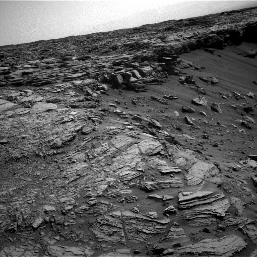
“The former is on a smoother, flatter part of the sandstone we are parked on, and the latter is an example of the resistant features that dot the sandstone in this part of the pediment,” Minitti adds. MAHLI will also acquire a mosaic looking edge on at a package of sandstone layers at the bedrock target “Chinglebraes.”
Chemical variability
Curiosity Left B Navigation Camera photo taken Sol 2695, March 6, 2020.
Credit: NASA/JPL-Caltech
Curiosity’s Chemistry and Camera (ChemCam) will sweep across the terrain in front and to the left of the rover to gather data that will help scientists understand the chemical variability of the pediment here.
Minitti explains that “Machrie Moor” and “Templars Park” are comparable to Galloway Hills in that they are flatter, smoother patches of bedrock. “Lowther Hills” is comparable to Ardwell Bay, as it is a collection of resistant features within the bedrock. “Cheviot Hills” appears to be a bit more of an oddball – it’s a dark, smooth block like those we have seen on “Western Butte” and “Tower Butte.”
Curiosity Left B Navigation Camera photo taken Sol 2695, March 6, 2020.
Credit: NASA/JPL-Caltech
“ChemCam will tell us if it is linked to the rocks we have seen before, or if it is just a particularly dust-free example of the pediment rocks,” Minitti notes.
High perch
Mastcam has plenty to look at from its high perch.

Curiosity Front Hazard Avoidance Camera Right B image acquired Sol 2695, March 6, 2020.
Credit: NASA/JPL-Caltech
It will acquire a stereo mosaic looking across the scene, dubbed “Enard Bay” to get higher resolution and color views of the beds exposed there.
“Another large mosaic will cover the terrain into which we will drive over the weekend. The mosaic includes the drive target “East Lothian” and will give us an idea of the distribution of textures and structures of the bedrock we will be exploring for the near term,” Minitti says. “At the opposite end of the spectrum from a large mosaic, Mastcam will also take a single image of “Gars Bheinn,” one of the few blocks in the workspace that is relatively free of dust. The hope is that the image will give us a clearer view of the sandstone’s grain size and texture.”
Lookout for clouds, dust devils
Minitti concludes: “Now that we do not have a steep cliff in our front windshield, the skies stretch largely unencumbered above and around us. Navcam will take a 360 degree look around for dust devils on two different sols, and will acquire movies looking for clouds both in the afternoon and early morning. Mastcam and Navcam will assess the dustiness of the atmosphere by gazing across Gale crater from our great viewpoint.”

Credit: NASA/JPL-Caltech/Univ. of Arizona
New road map
Meanwhile, a newly released map shows the route driven by NASA’s Mars rover Curiosity through the 2695 Martian day, or sol, of the rover’s mission on Mars (March 6, 2020).
Numbering of the dots along the line indicate the sol number of each drive. North is up. The scale bar is 1 kilometer (~0.62 mile).
From Sol 2693 to Sol 2695, Curiosity had driven a straight line distance of about 9.78 feet (2.98 meters), bringing the rover’s total odometry for the mission to 13.6 miles (21.89 kilometers).
The base image from the map is from the High Resolution Imaging Science Experiment Camera (HiRISE) in NASA’s Mars Reconnaissance Orbiter.

