
Curiosity Front Hazcam Left B image taken on Sol 1313, April 16, 2016.
Image Credit: NASA/JPL-Caltech
NASA’s Curiosity rover is about to enter Sol 1314 on its Mars exploration adventure.
The word from rover science planners is that Curiosity has moved into an area where there are no good brushable targets in the robotic arm workspace, so the dust removal tool will not be used.
However, tactical planning included a trio of targets for the Mars Hand Lens Imager (MAHLI) and use of the Alpha Particle X-Ray Spectrometer (APXS) to make measurements of natural surfaces.
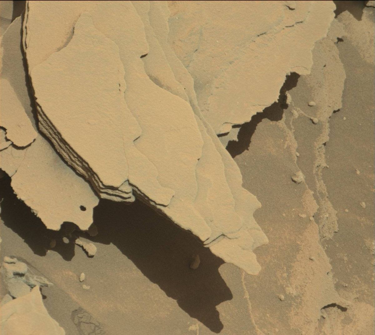
Selected outcrop
Ken Herkenhoff of the USGS Astrogeology Science Center in Flagstaff, Arizona reports that the Sol 1313 plan was to start with a mid-day Chemistry & Camera (ChemCam) observation of the sky and Mastcam images of the Sun to measure the amount of dust in the atmosphere.
The plan also called for Curiosity’s robotic arm would be deployed to take MAHLI images of “Kasane” and “Uau,” on either side of a bright/dark boundary in a selected outcrop.
Curiosity’s Mastcam Right image taken on Sol 1312, April 15, 2016.
Credit: NASA/JPL-Caltech/MSSS
MAHLI was then to take pictures of another bedrock target dubbed “Onesi” and of the rover wheels.
The rover’s APXS was slated to be placed on Onesi and then on Uau for detailed study.
“Early the next morning, Navcam will search for clouds and Mastcam will measure dust again by imaging the Sun,” Herkenhoff explains. Later that morning, MAHLI will take pictures of the Rover Environmental Monitoring Station’s ultraviolet sensor, which is done periodically to see how much dust is on the sensor, he adds.
Broken/crushed rocks
Herkenhoff notes that remote sensing instruments are to get busy: Mastcam will take a multispectral image of “Gariep,” a few rocks that were broken/crushed by the rover wheels, and then ChemCam and Mastcam will observe Uau, Kasane and a bedrock target named “Kolmanskop.”
The Remote Micro-Imager (RMI) is slated to acquire a mosaic of Mount Sharp. Also, Mastcam will take stereo images of the “Rasthoff” area and image the Sun again, and Navcam will search for clouds.
Finally, the APXS will be placed on Kasane for an overnight integration, in parallel with a Sample Analysis at Mars (SAM) Instrument Suite scrubber cleaning activity.

Wheel damage assessment. NASA’s Mars rover Curiosity acquired this image using its Mars Hand Lens Imager (MAHLI), located on the turret at the end of the rover’s robotic arm, on April 16, 2016, Sol 1313.
Credit: NASA/JPL-Caltech/MSSS
Wheel imagery
Lastly, on Sol 1315, the plan calls for the rover to complete a full set of MAHLI wheel images, bumping in between images to ensure that all parts of the wheels are imaged, Herkenhoff says.
“The usual set of post-drive images will then be acquired to set us up for planning on Monday, when we will probably drive again,” Herkenhoff concludes.
As always, planned rover activities are subject to change due to a variety of factors related to the Martian environment, communication relays and rover status.
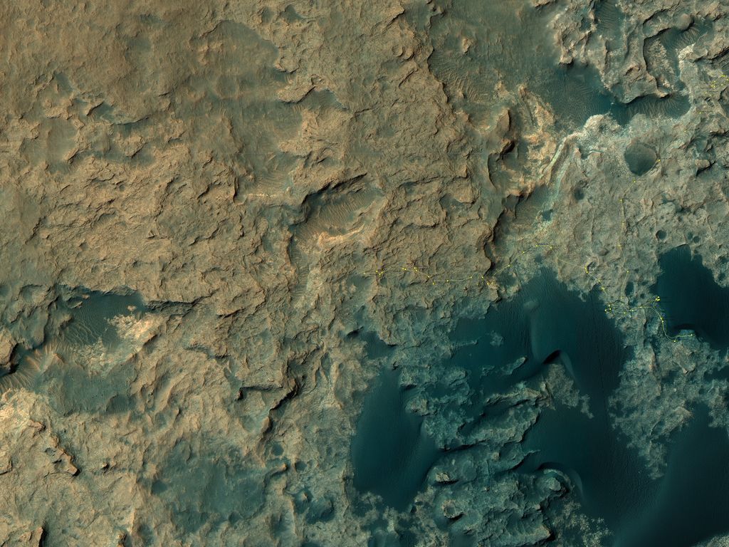
Curiosity Rover’s Location for Sol 1310.
This map shows the route driven by NASA’s Mars rover Curiosity through the 1310 Martian day, or sol, of the rover’s mission on Mars (April, 13, 2016).
Numbering of the dots along the line indicate the sol number of each drive. North is up. From Sol 1309 to Sol 1310, Curiosity had driven a straight line distance of about 67.09 feet (20.45 meters). Since touching down in Bradbury Landing in August 2012, Curiosity has driven 7.88 miles (12.68 kilometers).
The base image from the map is from the High Resolution Imaging Science Experiment Camera (HiRISE) in NASA’s Mars Reconnaissance Orbiter.
Credit: NASA/JPL-Caltech/Univ. of Arizona

