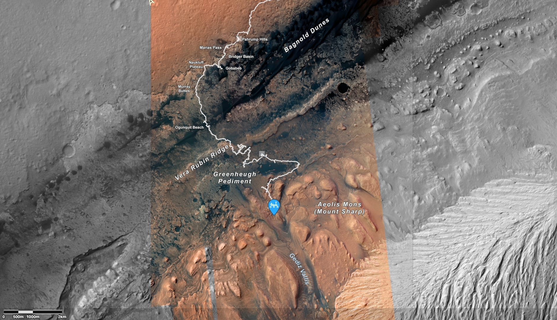
Curiosity’s location as of Sol 3744. Distance driven to this sol, 18.44 miles/29.68 kilometers.
Image credit: NASA/JPL-Caltech/Univ. of Arizona
NASA’s Curiosity Mars rover at Gale Crater is now performing Sol 3746 duties.
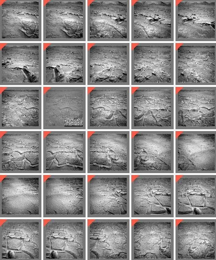
Reports Lauren Edgar, a planetary geologist at the USGS Astrogeology Science Center in Flagstaff, Arizona: “The team was eagerly awaiting our downlink this morning to hear how the drill attempt from Sol 3742 went. The images came down and indeed there was a drill hole…a mini drill hole…and sadly not deep enough to get to a sufficient depth for the drill assembly to start collecting sample.”

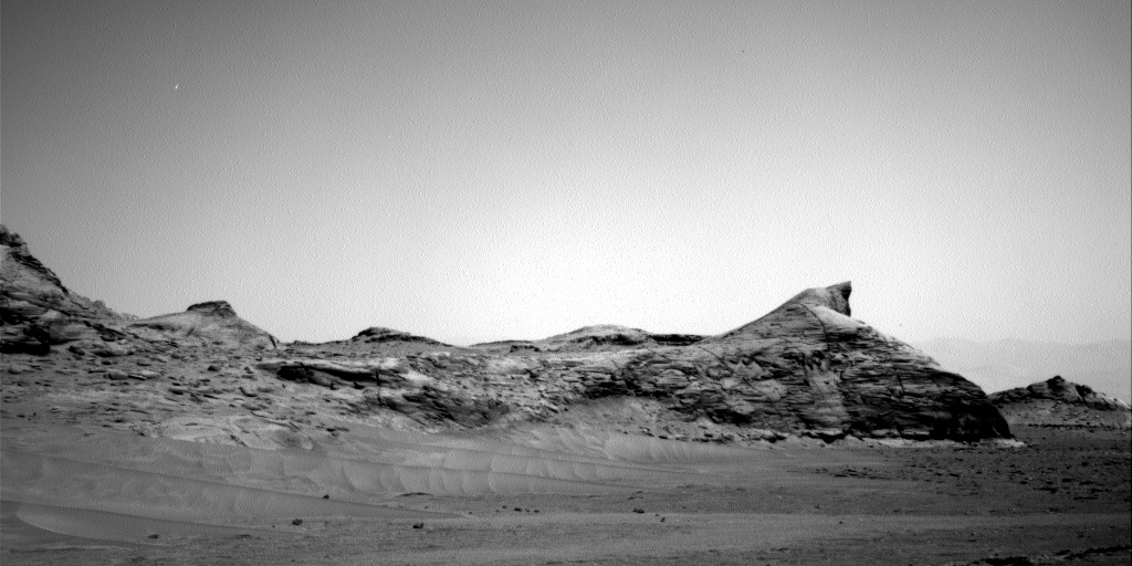
Curiosity Mars Hand Lens Imager (MAHLI) photo produced on Sol 3744, February 17, 2023,
Image credit: NASA/JPL-Caltech/MSSS
This was the robot’s fourth attempt to drill the marker band, Edgar adds, “and we gave it our best shot from both a geology and engineering perspective. Unfortunately these rocks do not want to cooperate – they’re hard and they weather into resistant and recessive beds which make them very challenging to drill.”

Mosaic view of “Marker Band Valley” taken by Curiosity on December 16, 2022.
Image credit: NASA/JPL-Caltech/MSSS
Difficult decision
Edgar notes that the Curiosity team made the difficult decision to get back on the road, without a drill sample from this location.
“I can imagine future rover scientists telling tall tales of these marker band rocks and the one that got away,” Edgar relates, with scientists saying: “that was the hardest rock I’ve ever seen! It looked me right in the eye and then jumped out of the net (drill bit assembly)…”
“All kidding aside, we’ve learned a lot about these rocks from remote sensing, contact science, and drill attempts, and the team is excited to analyze the data and think about what else lies ahead,” Edgar reports.
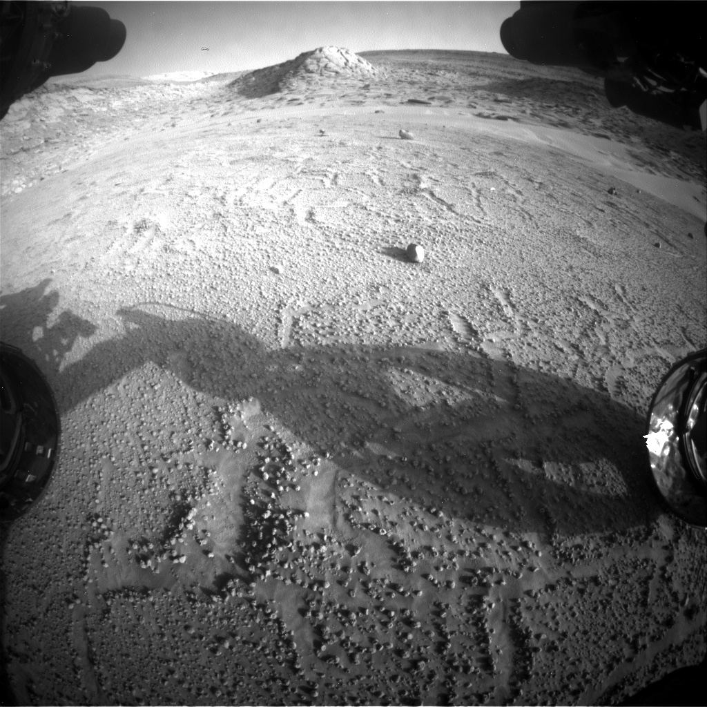
Curiosity Right B Navigation Camera image acquired on Sol 3745, February 17, 2023.
Image credit: NASA/JPL-Caltech
Attempted drill hole
The recent two-sol plan (Sols 3744-3745) is focused on wrapping up science at the “Dinira” drill site.
The rover’s Mars Hand Lens Imager (MAHLI) and the Alpha Particle X-Ray Spectrometer (APXS) will analyze the mini drill hole and drill tailings, and the Chemistry and Camera (ChemCam) and Mastcam will also investigate the chemistry and texture at the attempted “Dinira” drill hole.
The team also planned a long distance ChemCam Remote Micro-Imager (RMI) mosaic to study some distant stratigraphy, Edgar adds, “which is a good reminder that there’s still a lot to explore ahead!”

Curiosity Right B Navigation Camera image acquired on Sol 3745, February 17, 2023.
Image credit: NASA/JPL-Caltech
Drive to the south
The plan calls for a rover drive of roughly 318 feet (97 meters) to the south, “to get us back on track to traverse across the marker band,” Edgar explains.

Curiosity Right B Navigation Camera image acquired on Sol 3745, February 17, 2023.
Image credit: NASA/JPL-Caltech
The second sol includes some untargeted observations, including an autonomously selected ChemCam AEGIS activity. AEGIS stands for Autonomous Exploration for Gathering Increased Science – a software suite that permits the rover to autonomously detect and prioritize targets.

Curiosity Right B Navigation Camera image acquired on Sol 3745, February 17, 2023.
Image credit: NASA/JPL-Caltech
Curiosity will also acquire a number of environmental observations to monitor dust in the atmosphere and search for noctilucent clouds at twilight.

Curiosity Left B Navigation Camera photo taken on Sol 3744, February 17, 2023.
Image credit: NASA/JPL-Caltech

Curiosity Left B Navigation Camera photo taken on Sol 3744, February 17, 2023.
Image credit: NASA/JPL-Caltech
Curiosity Left B Navigation Camera photos taken on Sol 3744, February 17, 2023.
Image credit: NASA/JPL-Caltech
“So we’ll say goodbye to the “Encanto” and “Dinira” drill target vicinity,” Edgar concludes, saying “these targets were not charming and did not deliver wealth as their names may have suggested, but we’ll always remember their elusive and intriguing qualities!”
Curiosity Front Hazard Avoidance Camera Right B image taken on Sol 3744, February 17, 2023.
Image credit: NASA/JPL-Caltech

