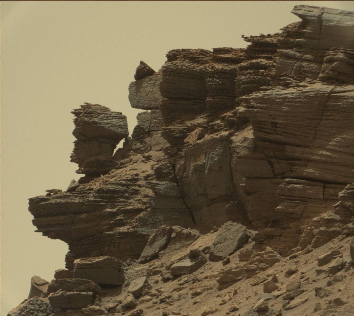
Curiosity Mastcam Right image taken on Sol 1437, August 21, 2016.
Credit: NASA/JPL-Caltech/MSSS
The Curiosity rover on Mars carried out a drive over the weekend, but halted a bit early, “but everything is looking good and we will continue to drive in today’s plan,” reported Ryan Anderson, a planetary scientist at the USGS Astrogeology Science Center in Flagstaff, Arizona on Monday.
Now in Sol 1439, the plan for the rover starts off with Chemistry & Camera (ChemCam) observations of the layered rock targets “Quibala” and “Quibaxe.”
The rover’s Mastcam is set to then image Quibala, followed by taking mosaics that document the stratigraphy in the nearby buttes as well as the locations called “Quibaxe”, “Quipungo” and “Quicombo.”
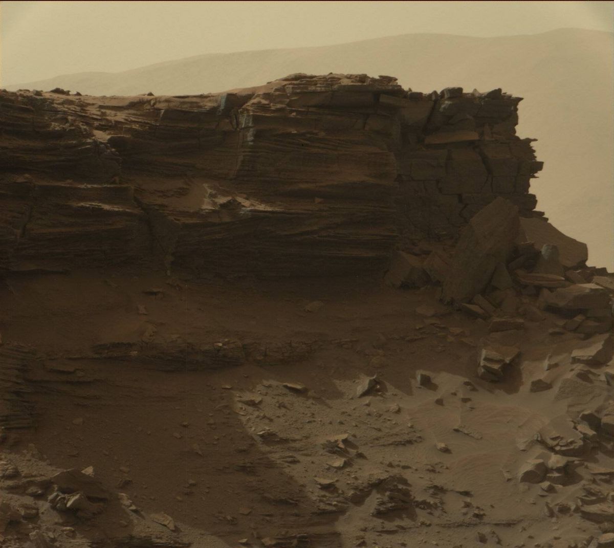
Curiosity Mastcam Right image taken on Sol 1433, August 17, 2016.
Credit: NASA/JPL-Caltech/MSSS
More driving, auto-observations
Anderson adds that after these functions, the schedule calls for the rover to drive, with follow up post-drive imaging as well as use of ChemCam AEGIS software, that is, an Autonomous Exploration for Gathering Increased Science (AEGIS) observation. This software allows Curiosity to autonomously select targets for the laser and telescopic camera of its ChemCam instrument.
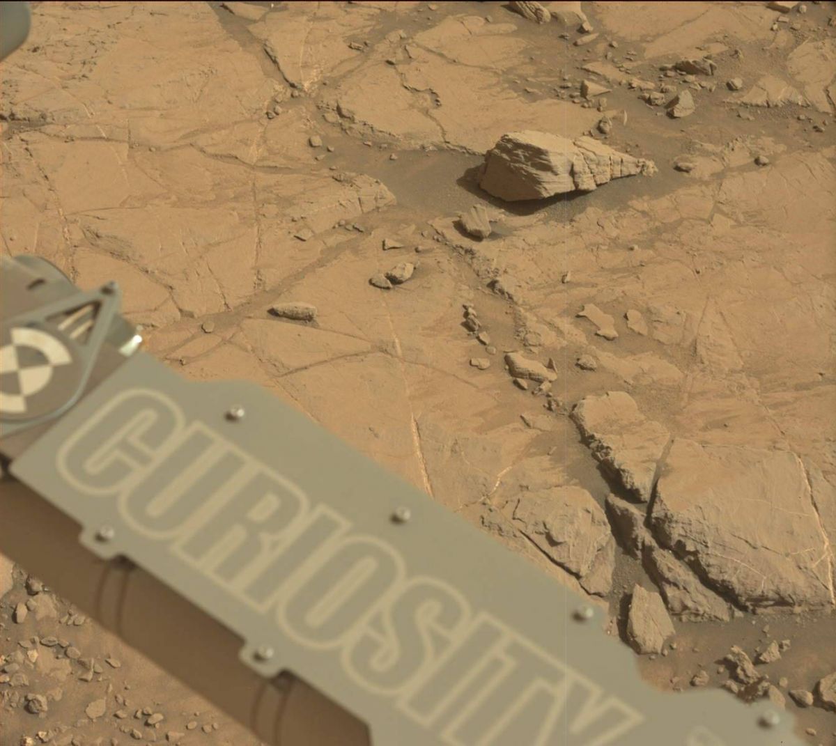
Curiosity Navcam Left B image taken on Sol 1438, August 22, 2016.
Credit: NASA/JPL-Caltech
The following morning, Anderson adds, the robot’s Mastcam and Navcam have on tap atmospheric observations, and then in the afternoon ChemCam will analyze its calibration targets.
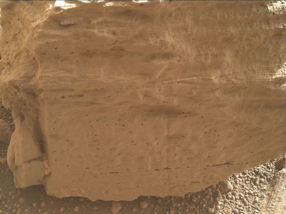
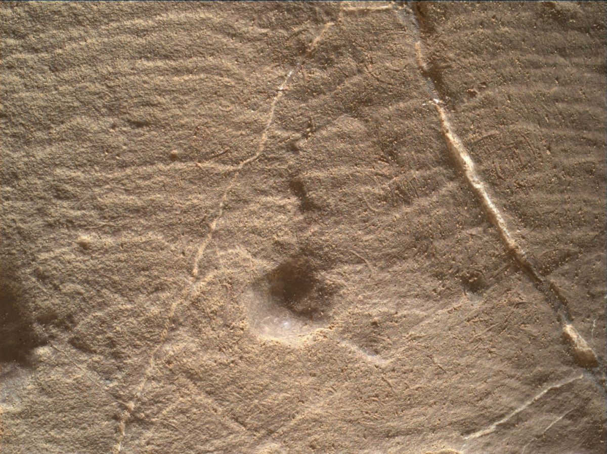
Mars Hand Lens Imager (MAHLI) image taken on August 22, 2016, Sol 1438.
Credit: NASA/JPL-Caltech/MSSS
Rover’s location
Meanwhile, a new map has been posted by the Jet Propulsion Laboratory showing the rover’s location for Sol 1435.
Mars Hand Lens Imager (MAHLI) image taken on August 22, 2016, Sol 1438.
Credit: NASA/JPL-Caltech/MSSS
The map shows the route driven by Curiosity through the 1435 Martian day, or sol, of the Mars machinery as of August, 19, 2016.
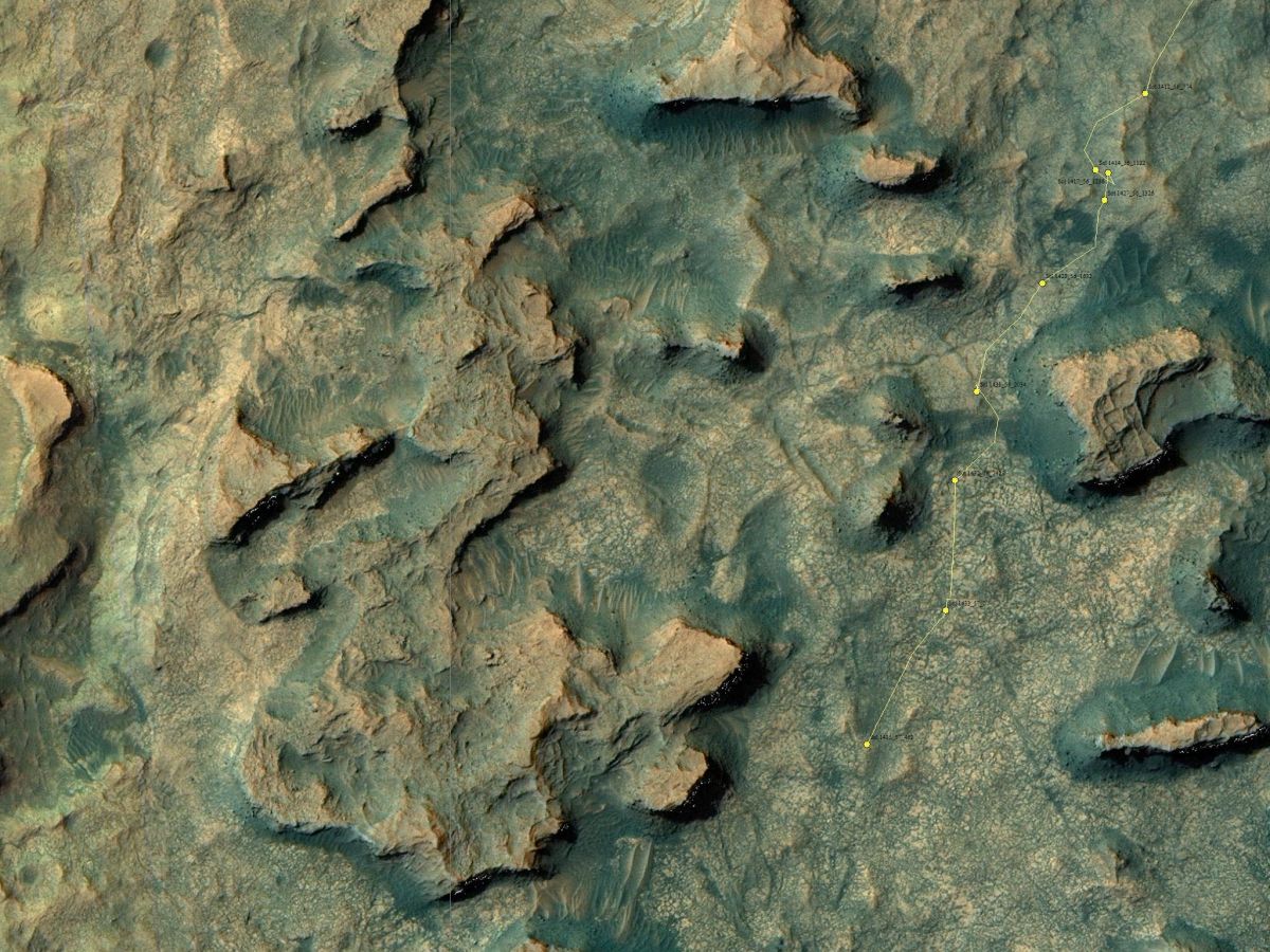
The base image from the map is from the High Resolution Imaging Science Experiment Camera (HiRISE) in NASA’s Mars Reconnaissance Orbiter.
Credit: NASA/JPL-Caltech/Univ. of Arizona
Numbering of the dots along the line indicate the sol number of each drive. North is up.
From Sol 1433 to Sol 1435, Curiosity had driven a straight line distance of about 205.80 feet (62.73 meters).
Since touching down in August 2012, Curiosity has driven 8.61 miles (13.85 kilometers).

