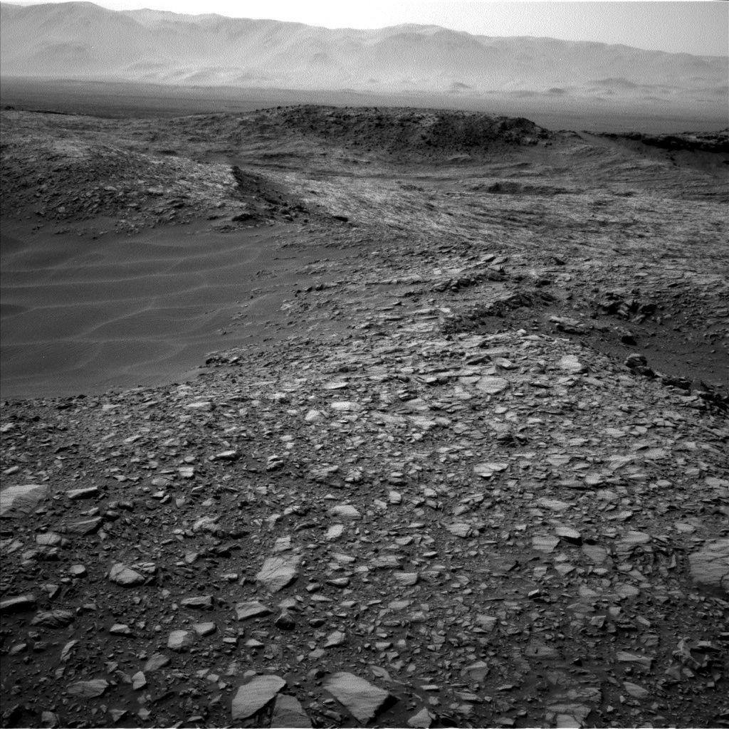
Curiosity Navcam Left B image taken on Sol 1387, July 1, 2016.
Credit: NASA/JPL-Caltech
The very independent Curiosity Mars rover is to be busy wheeling into the long 4th of July weekend.
A number of sols are being planned by Earth operators, explains Ryan Anderson, a planetary scientist at the USGS Astrogeology Science Center in Flagstaff, Arizona.
At this writing, Curiosity is just wrapping up Sol 1387 activities.
Rock, soil targets
Anderson says that the plan for this sol was having the Chemistry & Camera (ChemCam) to find analyze two targets: a rock named “Noordoewer” and a soil named “Savates.”
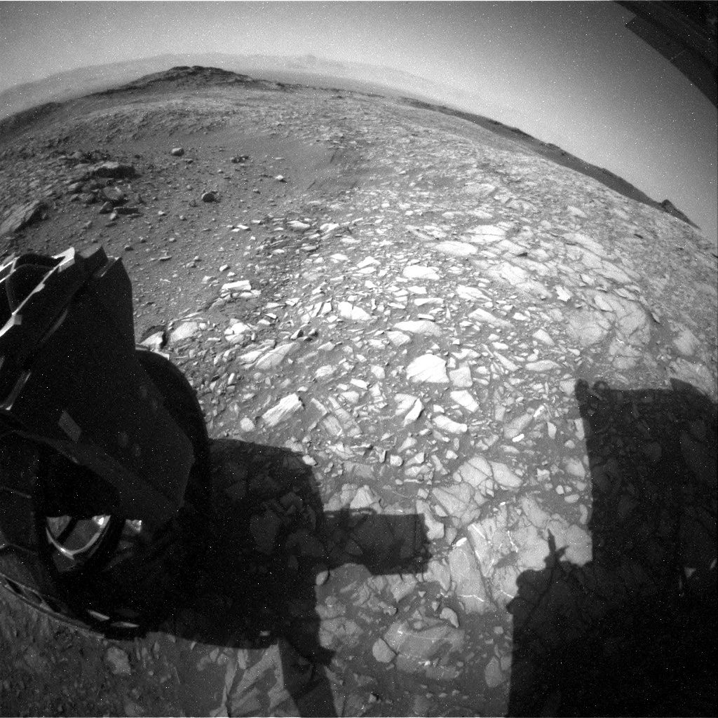
Curiosity image taken by Rear Hazcam Left B on Sol 1387, July 1, 2016.
Credit: NASA/JPL-Caltech
Mastcam was also set to document those targets and take a mosaic of the “Murray Buttes”. After that, the rover was to perform a short drive, followed by post drive imaging, Anderson notes.
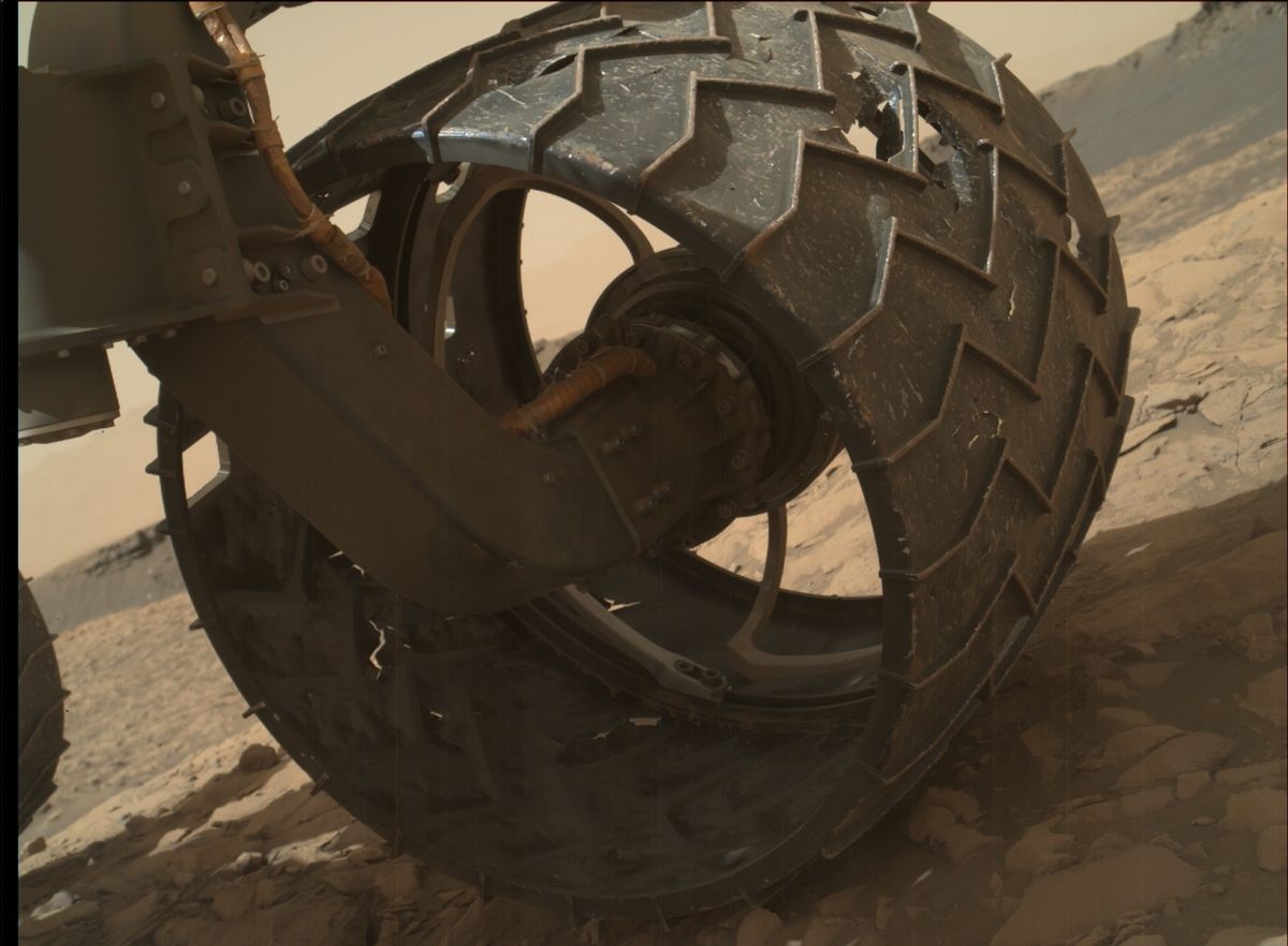
Curiosity Mars Hand Lens Imager (MAHLI) image taken on June 30, 2016, Sol 1386.
Credit: NASA/JPL-Caltech/MSSS
Lastly, a request is in, Anderson adds, for the rover’s Navcam to take imagery of Mt. Sharp along with the post drive imaging to help target more long distance ChemCam Remote Microscopic Imager (RMI) images.
“On Sol 1388, we have an easy day: ChemCam has a calibration observation and Navcam has a couple of atmospheric monitoring observations,” Anderson explains.
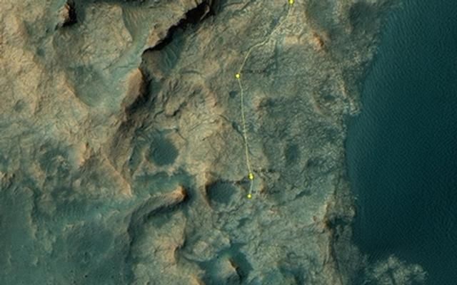
This map shows the route driven by NASA’s Mars rover Curiosity through the 1387 Martian day, or sol, of the rover’s mission on Mars (July, 01, 2016).
From Sol 1386 to Sol 1387, Curiosity had driven a straight line distance of about 41.43 feet (12.63 meters).
Since touching down in Bradbury Landing in August 2012, Curiosity has driven 8.22 miles (13.23 kilometers).
The base image from the map is from the High Resolution Imaging Science Experiment Camera (HiRISE) in NASA’s Mars Reconnaissance Orbiter.
Credit: NASA/JPL-Caltech/Univ. of Arizona

