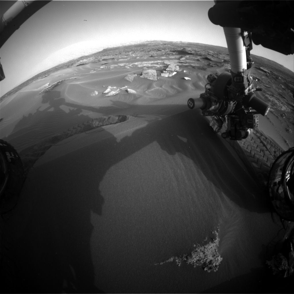
Curiosity Hazcam Right B image acquired on Sol 1688, May 6, 2017.
Credit: NASA/JPL-Caltech
NASA’s Curiosity Mars rover is now performing Sol 1689 science duties
Reports Michelle Minitti, a planetary geologist for Framework in Silver Spring, Maryland, the robot has parked itself in front of a megaripple.
Compare and contrast
In surveying the sandy feature, scientists are studying its physical and chemical characteristics, comparing and contrasting it to the sands investigated during the rover’s recent Bagnold dune campaign.
Over the weekend, the plan calls for high priority observations of the megaripple, Minitti notes.
Curiosity planning includes Mars Hand Lens Imager (MAHLI) and Alpha Particle X-Ray Spectrometer (APXS) observations of the target “Schoolhouse Ledge” along the ripple crest, and the target “Man of War Brook” along the flank of the ripple.
Curiosity Mastcam Left image taken on Sol 1686, May 4, 2017.
Credit: NASA/JPL-Caltech/MSSS
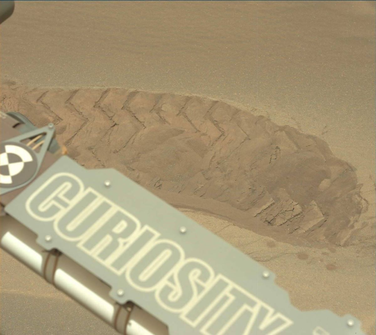
Wheel scuff
To keep the structure of the ripple crest pristine for MAHLI photography, the rover’s Chemistry & Camera (ChemCam) shot laser pulses across another part of the ripple crest – the target “Gilpatrick Ledge.”
“We also used ChemCam to interrogate the target “The Gorge,” located inside the wheel scuff the rover planners purposely cut into the ripple to expose its interior structure,” Minitti adds.
Iron-bearing minerals
Also in the plans was use of the robot’s Mastcam, using filters at specific wavelengths of light to help constrain what iron-bearing minerals are present within the sands.
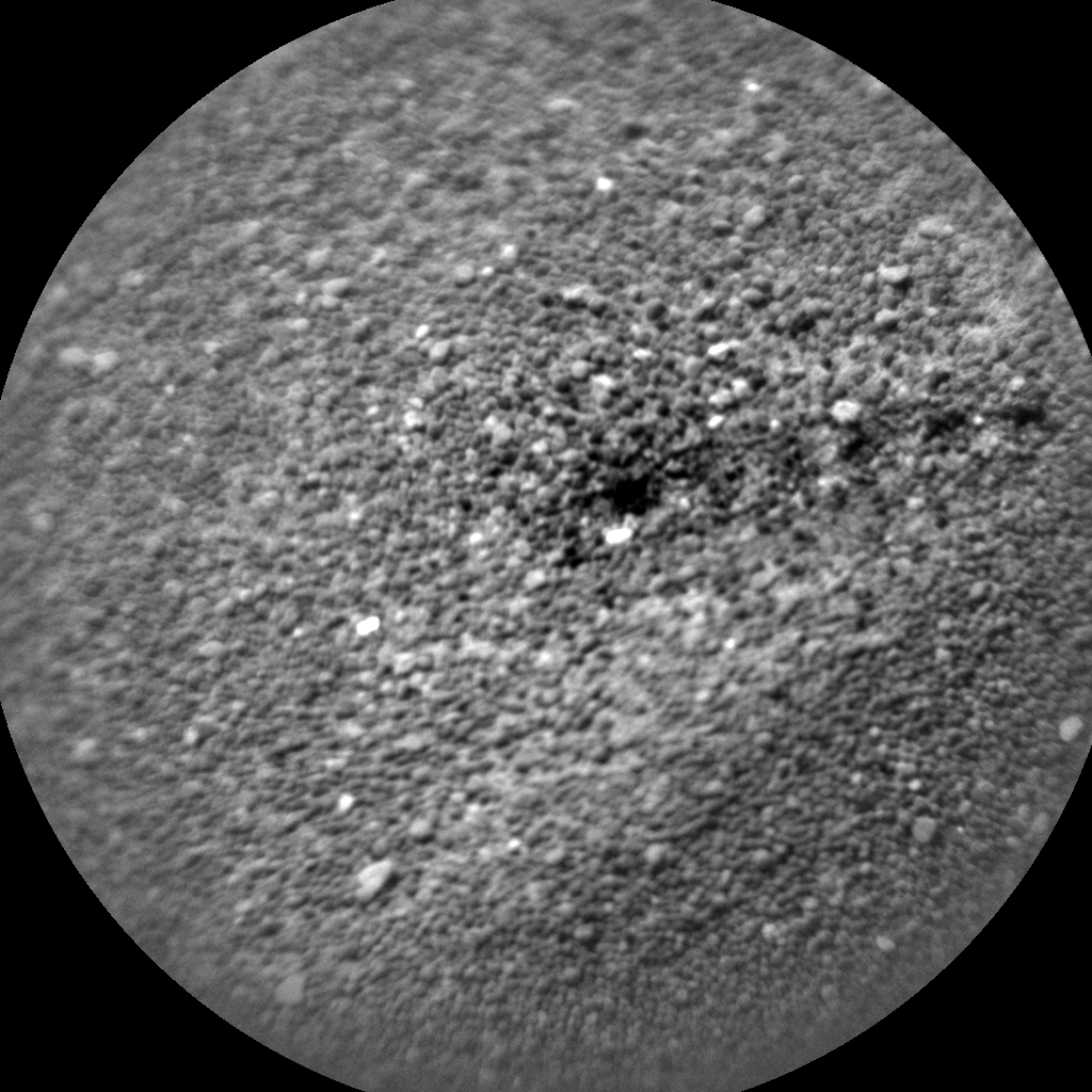
Laser pulses dot sand dune. Curiosity ChemCam Remote Micro-Imager photo taken on Sol 1687, May 5, 2017.
Image Credit: NASA/JPL-Caltech/LANL
The target for this observation was “Cobbosseecontee Lake,” which one Maine-dwelling member of the science team insisted was not challenging to say. It is actually pretty phonetic, Minitti suggests.
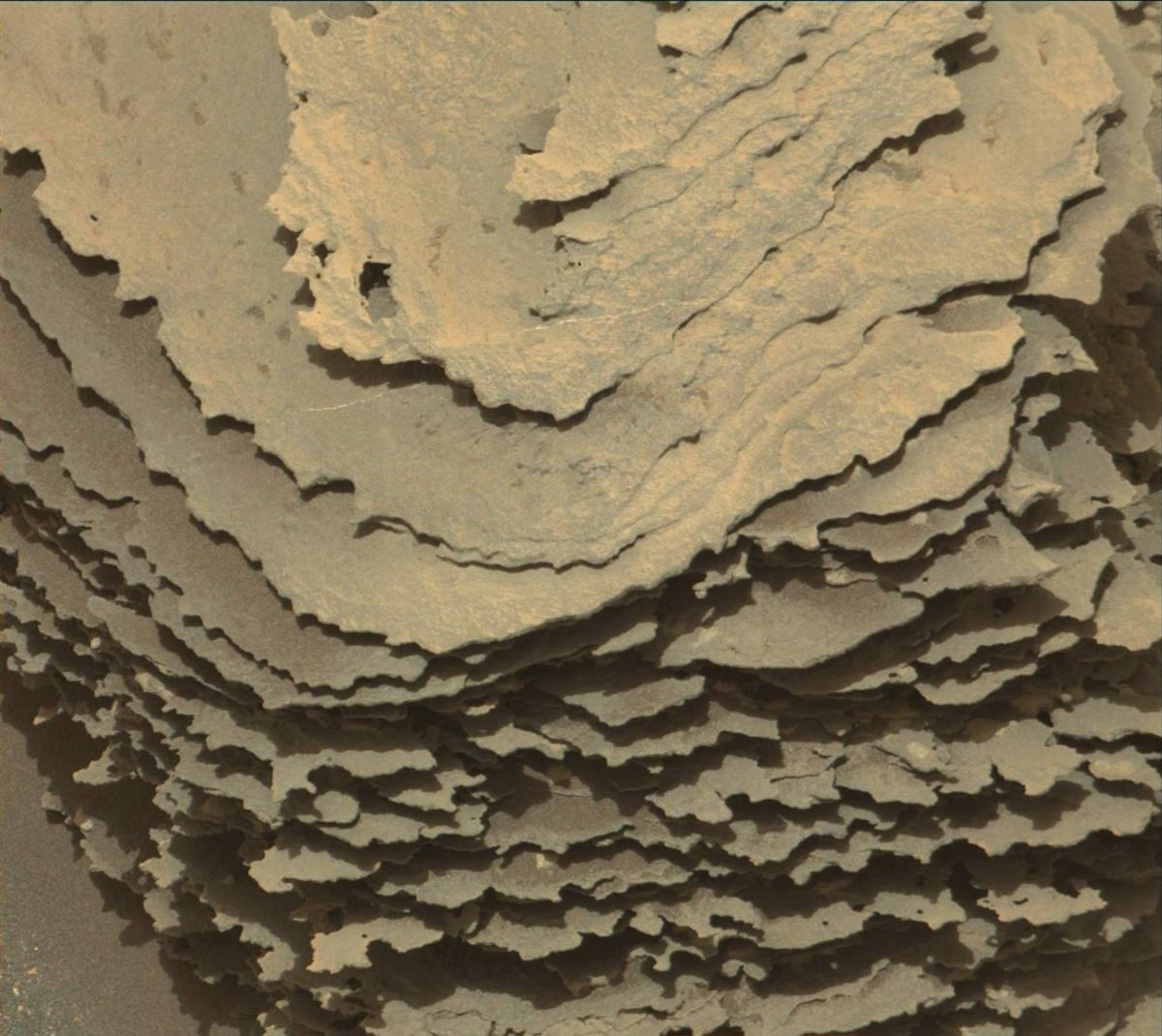
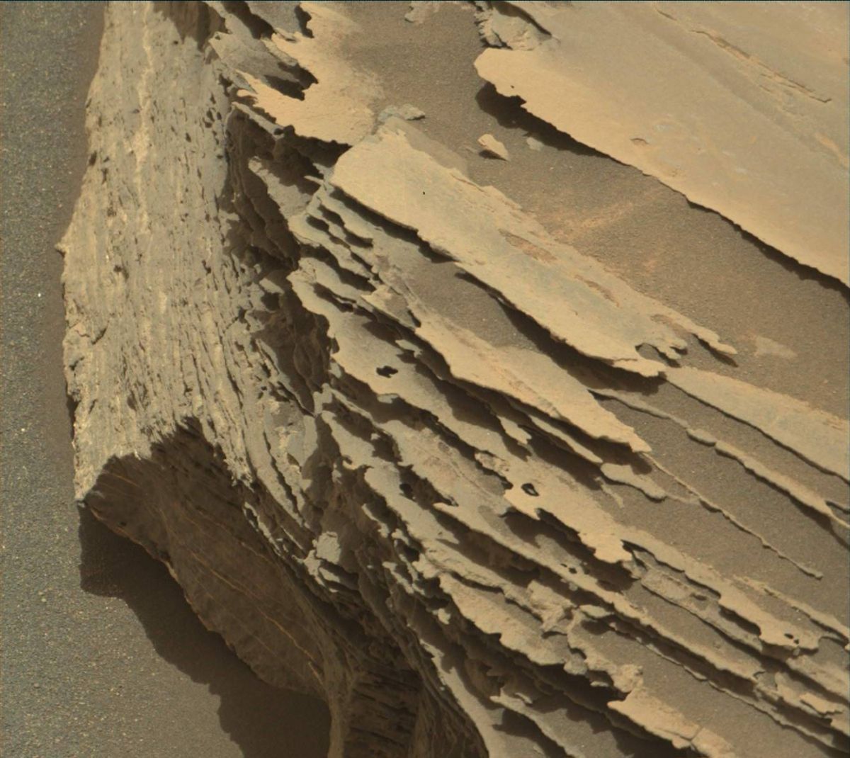
Well-layered bedrock
“Even with our focus on the megaripple,” Minitti adds, “there was still time to image the rocks around us with Mastcam, including an expanse of well-layered bedrock south of us called “Amphitheater Valley.”
Lastly, Curiosity began taking a series of Mars Descent Imager (MARDI) images – “one image acquired each evening we are parked at the megaripple – to look for wind-induced changes,” Minitti notes. “These change detection images help the team understand if (or how) wind activity and direction are changing as we leave the Bagnold dunes.”
Curiosity Mastcam Right image taken on Sol 1686, May 4, 2017.
Credit: NASA/JPL-Caltech/MSSS
Also on the schedule is a dust devil survey to look for telltale signs of wind activity, as well as acquiring a long Dynamic Albedo of Neutrons (DAN) passive observation, and taking regular Radiation Assessment Detector (RAD) and Rover Environmental Monitoring Station (REMS) measurements.
Curiosity Mastcam Right image taken on Sol 1686, May 4, 2017.
Credit: NASA/JPL-Caltech/MSSS

