Credit: NASA/JPL-Caltech/Univ. of Arizona
The Curiosity Mars rover has just entered Sol 1448, continuing to investigate the surrounding scenery of buttes and distant features.
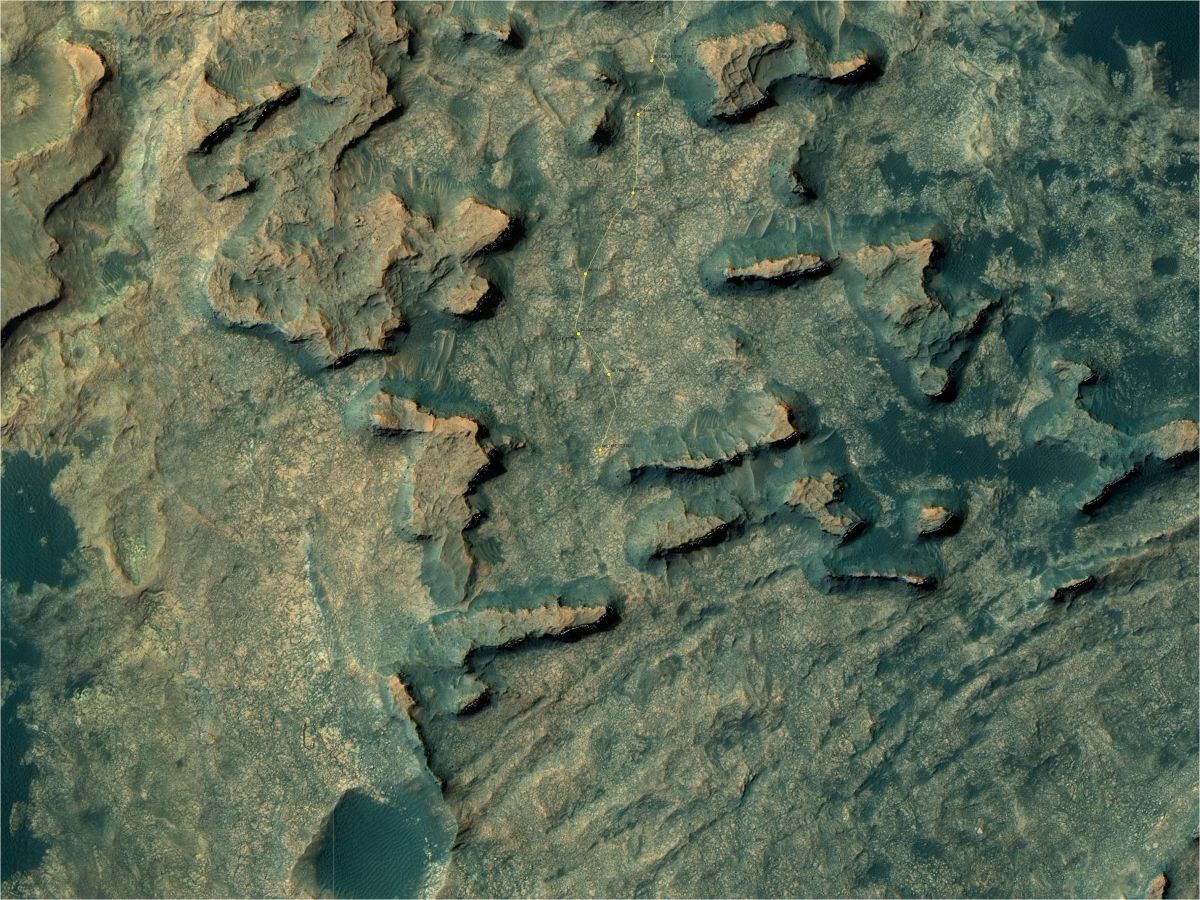
A new map has been released showing the NASA robot’s location through the 1446 Martian day, or sol, of the rover’s mission on Mars (August, 31, 2016).

Curiosity Navcam Right B image taken on Sol 1446, August 31, 2016.
Credit: NASA/JPL-Caltech
Numbering of the dots along the line indicate the sol number of each drive. North is up.

Curiosity Navcam Left B image taken on Sol 1446, August 31, 2016.
Credit: NASA/JPL-Caltech
From Sol 1439 to Sol 1446, Curiosity had driven a straight line distance of about 167.19 feet (50.96 meters).
Since touching down in August 2012, Curiosity has driven 8.69 miles (13.98 kilometers).
The base image from the map is from the High Resolution Imaging Science Experiment Camera (HiRISE) in NASA’s Mars Reconnaissance Orbiter.
In a newly posted report from Ken Herkenhoff of the USGS Astrogeology Science Center in Flagstaff, Arizona, he notes that the rover roved – almost 175 feet (53 meters), ending up in an area with nice exposures of bedrock.
Laser cleaning
“We were interested in taking MAHLI [Mars Hand Lens Imager] close-up images of the bedrock but were concerned that they would not be very useful if the surface as dusty as it typically is,” Herkenhoff explains. “We therefore considered using the ChemCam laser to clean off some of the dust and get chemical information before deploying the arm, but recognized that the MAHLI targets would be partly shadowed by the arm turret, which would make the MAHLI images more difficult to interpret.”
Maximize drive distance
A decision was made not to include the MAHLI images in the plan, and focus instead on Mastcam imaging of the nearby buttes and maximizing the drive distance.

Mars Hand Lens Imager (MAHLI) photo taken on August 28, 2016, Sol 1444.
Credit: NASA/JPL-Caltech/MSSS
Science team members for the robot were able to fit ChemCam and Mastcam observations of the “Luxilo” bedrock target into the plan, along with Right Mastcam images of “Caxito.”
After the drive and usual post-drive imaging, the Sample Analysis at Mars (SAM) scrubber was to be cleaned overnight.
On Sol 1449, Mastcam was to again measure the amount of dust in the Martian atmosphere.

