
Curiosity Mars Hand Lens Imager photo produced on Sol 2793, June 14, 2020.
Credit: NASA/JPL-Caltech/MSSS
NASA’s Curiosity Mars rover is now performing Sol 2795 tasks.
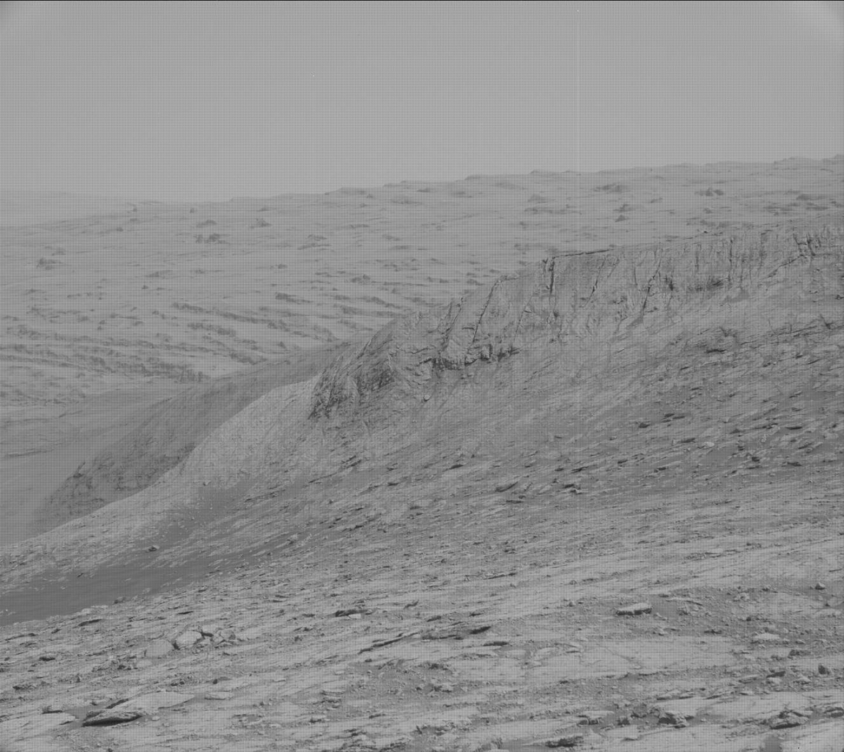
Bloodstone Hill – Curiosity Mast Camera Left image acquired on Sol 2793, June 14, 2020.
Credit: NASA/JPL-Caltech/MSSS
Reports Kristen Bennett, a planetary geologist at the USGS Astrogeology Science Center in Flagstaff, Arizona:
“A few months ago, Curiosity drove up on top of the ‘Greenheugh pediment’ to investigate the capping unit that is visible on top. After Curiosity drove off the pediment, the rover has been driving along the base of the pediment scarp and is about to reach the eastern edge. An interesting feature that is located at the eastern edge of the pediment is called ‘Bloodstone Hill’ – a light-toned mound that the team has been observing in long distance images for the entire mission.”

Curiosity Mast Camera Left image acquired on Sol 2793, June 14, 2020.
Credit: NASA/JPL-Caltech/MSSS
Questions raised
Bennett adds that Bloodstone Hill was even visible from Curiosity’s landing site!
“This light-toned mound is located right at the edge of the pediment, although it does not appear to have the pediment capping unit on top. Bloodstone Hill caught the team’s attention because it is so bright, which raises many questions,” Bennett explains.
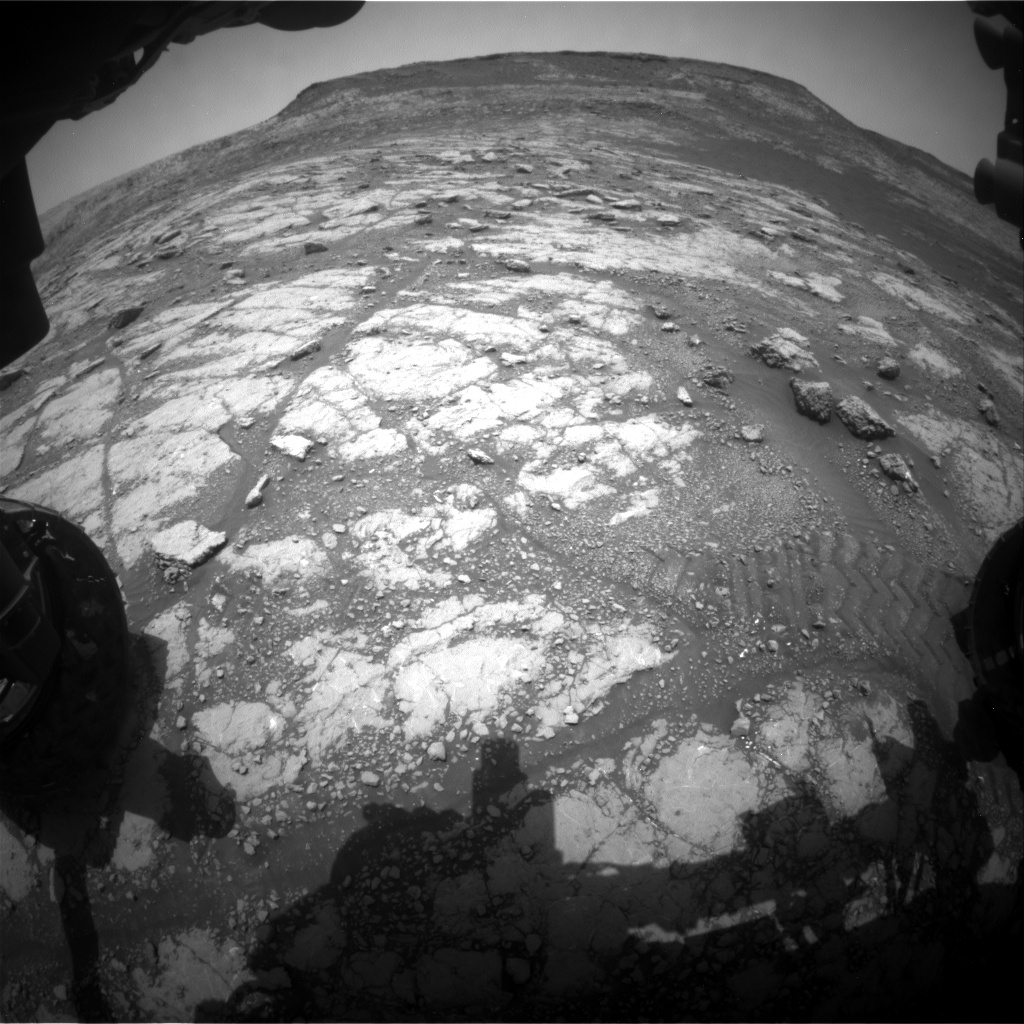
Curiosity Front Hazard Avoidance Camera Left B image taken on Sol 2794, June 15, 2020.
Credit: NASA/JPL-Caltech
Is it bright because it is covered in dust…a different mineralogy…a different alteration history?
“Now Curiosity is approaching Bloodstone Hill, and we can start answering some of these questions,” Bennett says.
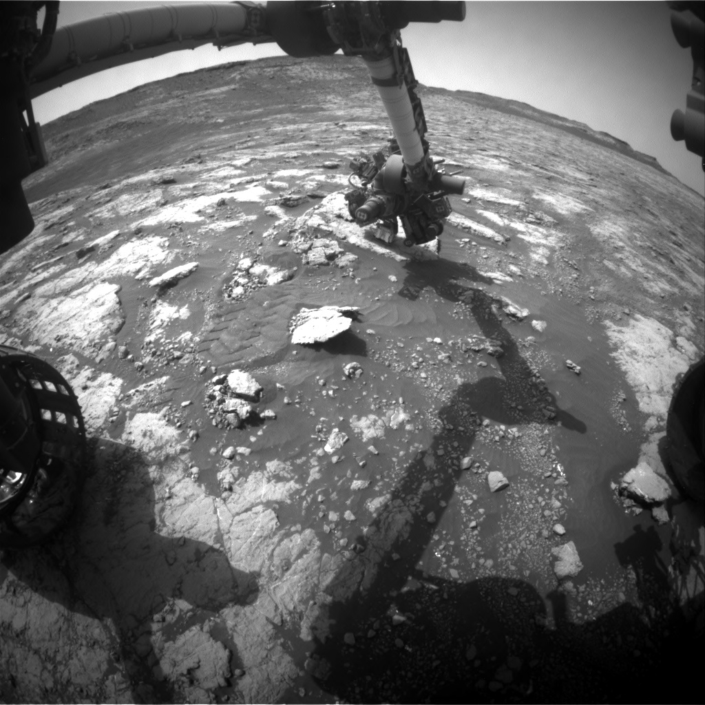
Curiosity Front Hazard Avoidance Camera Left B photo taken on Sol 2793, June 14, 2020.
Credit: NASA/JPL-Caltech
Multispectral mosaic
A new plan has as the main event a long drive that will place Curiosity close to the base of Bloodstone Hill.
Another important piece of the plan is the Mastcam multispectral mosaic that will be taken of Bloodstone Hill.

Curiosity Chemistry & Camera Remote Micro-Imager (RMI) photo acquired on Sol 2794, June 15, 2020.
Credit: NASA/JPL-Caltech/LANL
“As we approach this feature,” Bennett continues, “the team is gathering more data that will help us plan our investigation at this location. Multispectral observations can help identify variations in color and/or mineralogy across the outcrop. If the multispectral mosaic reveals any interesting variations, we can target those areas once we arrive at Bloodstone Hill.”
Nodule-rich bedrock
Additionally, several other Mastcam observations in the plan will document fractures or troughs between bedrock patches as well as the contact between the pediment capping unit and the strata below.
Credit: NASA/JPL-Caltech/Univ. of Arizona
The rover’s Chemistry and Camera (ChemCam) will also target “Earlish” to investigate the chemistry of nodule-rich bedrock in this area.
Lastly, a Mars Descent Imager (MARDI) image will be taken after the drive to document the terrain underneath the rover, Bennett concludes.
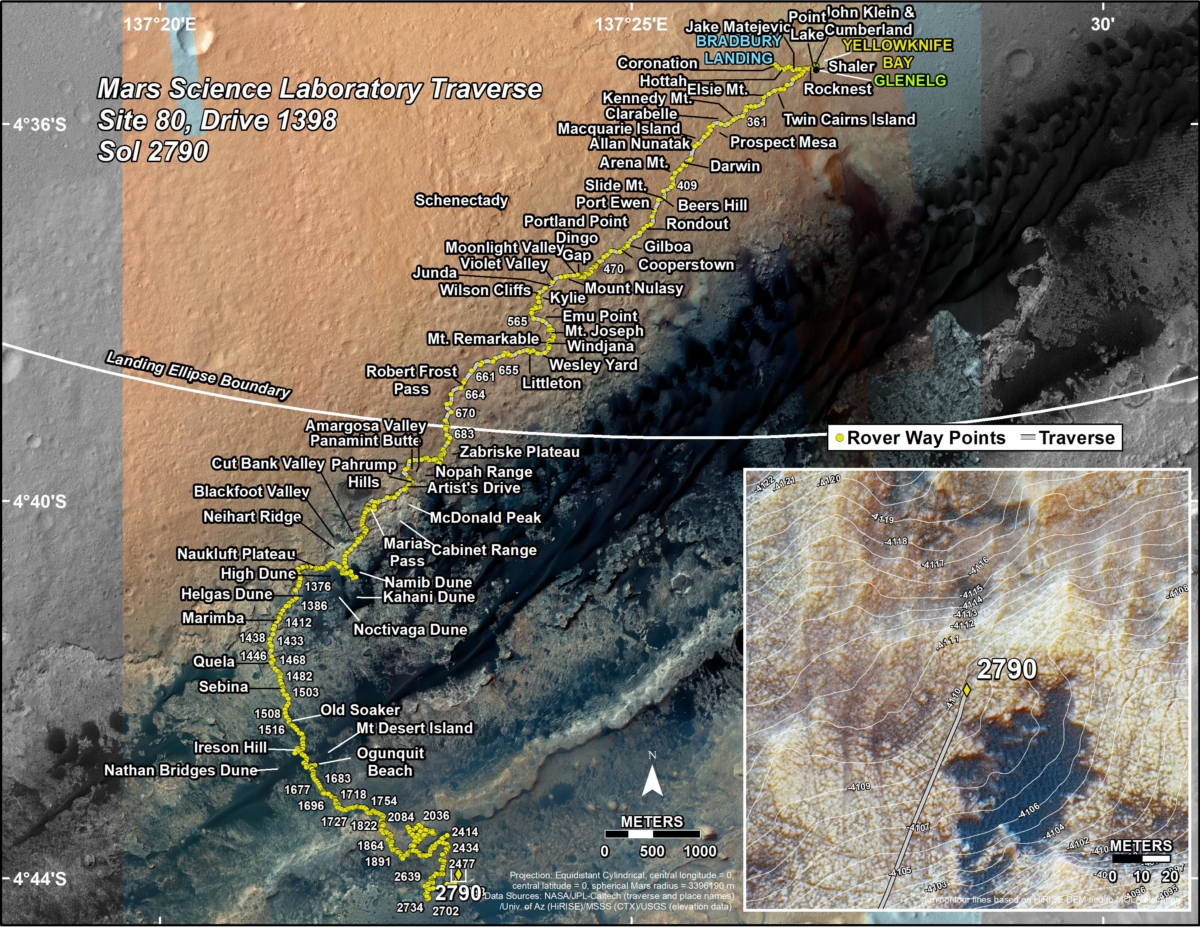
New road map
A newly issued map shows the route driven by NASA’s Mars rover Curiosity through the 2790 Martian day, or sol, of the rover’s mission on Mars (June 12, 2020).
Numbering of the dots along the line indicate the sol number of each drive. North is up. The scale bar is 1 kilometer (~0.62 mile).
From Sol 2788 to Sol 2790, Curiosity had driven a straight line distance of about 308.42 feet (94.01 meters), bringing the rover’s total odometry for the mission to 13.97 miles (22.48 kilometers).
The base image from the map is from the High Resolution Imaging Science Experiment Camera (HiRISE) in NASA’s Mars Reconnaissance Orbiter.

