
Mars rover Curiosity Navcam Right B image taken Sol 1648, March 26, 2017.
Credit: NASA/JPL-Caltech
NASA’s Curiosity Mars rover is busy working science duties, now in Sol 1651.
“Sol 1650 activities completed as expected, so it’s time to start scooping,” reports Lauren Edgar, a research geologist at the USGS Astrogeology Science Center in Flagstaff, Arizona.
The plan focused on acquiring Scoop #1 and dropping off a portion of the sample to the Sample Analysis at Mars (SAM) Instrument Suite.
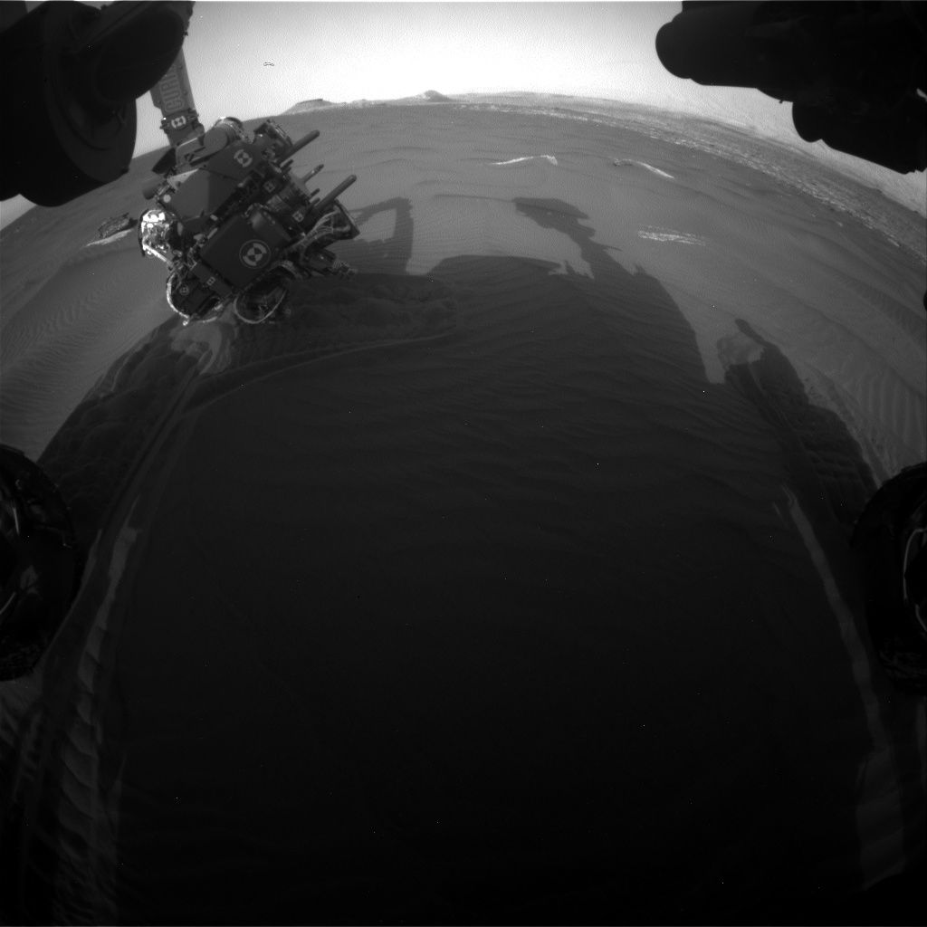
Curiosity Front Hazcam Right B image acquired on Sol 1650, March 28, 2017.
Credit: NASA/JPL-Caltech
“This is the first of four intended scoops at this location, aimed at sampling different grain sizes and their composition,” Edgar adds.
Wheel scuff
In the plan, a Mastcam mosaic of “Kennebago Divide” is to document some possible layering exposed by the wheel scuff on the right side of the robot’s workspace.

Curiosity Navcam Right B image taken on Sol 1650, March 28, 2017.
Credit: NASA/JPL-Caltech
“We’ll also take several Mastcam images for change detection to monitor active sand movement,” Edgar notes. Then the arm backbone was slated to start retracting the arm and a vibration was to clean the Alpha Particle X-Ray Spectrometer (APXS).
Ripple crest
After that, the plan called for use of the Mars Hand Lens Imager (MAHLI) to image “Flanders Bay” and Scoop #1 locations (prior to
scooping), and a very close-up image of the “Avery Peak” ripple crest.
“Next up, we’ll acquire Scoop #1! The sample will be sieved, and the fine-grained portion (<150 microns) will be delivered to SAM. These are all very power intensive activities so there wasn’t much room for other science during Sol 1650, but the plan today should accommodate more activities and context observations.

Curiosity Mars Hand Lens Imager (MAHLI), located on the turret at the end of the rover’s robotic arm, acquired this image on Sol 1650, March 28, 2017.
Credit: NASA/JPL-Caltech/MSSS
“In the meantime, sitting on ‘Ogunquit Beach’ is providing a pretty great view,” Edgar concludes.
New traverse map
Meanwhile a new Curiosity traverse map has been released, showing the route taken by the robot trough Sol 1648.

The base image from the map is from the High Resolution Imaging Science Experiment Camera (HiRISE) in NASA’s Mars Reconnaissance Orbiter.
Credit: NASA/JPL-CalTech/University of Arizona
This map shows the route driven by NASA’s Mars rover Curiosity through the 1648 Martian day, or sol, of the rover’s mission on Mars as of March 27, 2017.
Numbering of the dots along the line indicate the sol number of each drive. North is up. The scale bar is 1 kilometer (~0.62 mile).
From Sol 1646 to Sol 1648, Curiosity drove a straight line distance of about 23.97 feet (7.31 meters), bringing the rover’s total odometry for the mission to 9.89 miles (15.92 kilometers).

