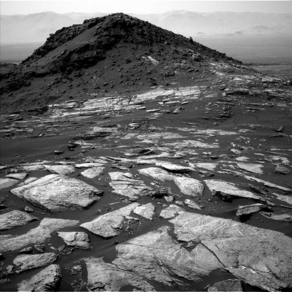
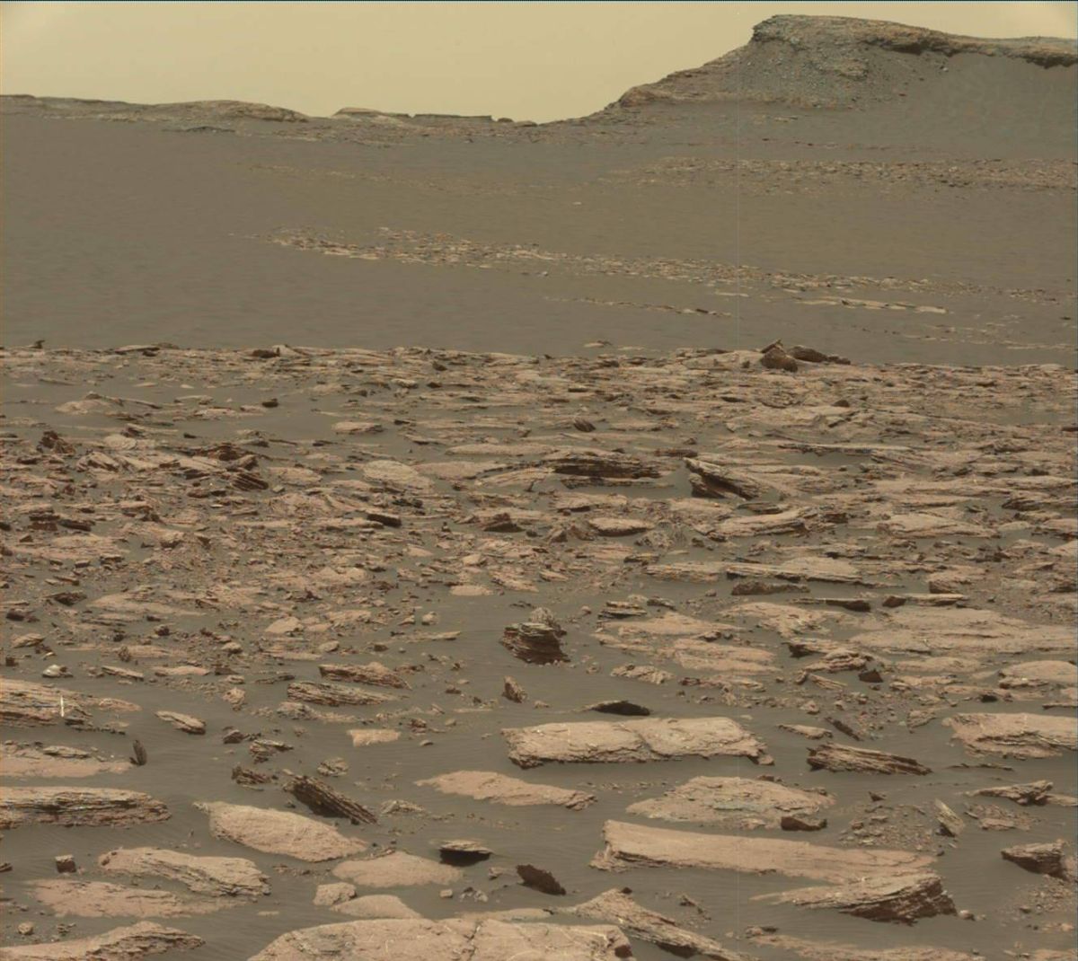
Curiosity Navcam Left B image taken on Sol 1596, February 1, 2017.
Credit: NASA/JPL-Caltech
NASA’s Curiosity rover is now carrying out Sol 1597 duties.
Last weekend, the rover drove roughly 85 feet (26 meters) to the southwest, as scientists prepare for another investigation of active sand dunes.
“We’re still a few more drives away from the dunes, but looking forward to the next campaign,” reports Lauren Edgar, a research geologist at the USGS Astrogeology Science Center in Flagstaff, Arizona.
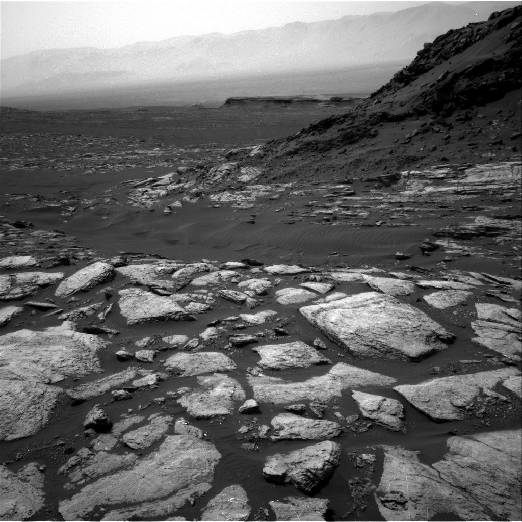
Curiosity Navcam Right B image taken on Sol 1596, February 1, 2017.
Credit: NASA/JPL-Caltech
Sedimentary structures
In the plans, some contact science and Mastcam imaging and another drive.
That plan starts with a short Alpha Particle X-Ray Spectrometer (APXS)
integration and Mars Hand Lens Imager (MAHLI) photography of “Isleboro” to characterize the composition, grain size, and sedimentary structures exposed in a typical block of the Murray formation.
Then the plan calls for use of the robot’s Mastcam to document some color variations and stratification at “Parker Bog,” and to assess fracture patterns at “Jim Pond.”
Also on the schedule is taking a Mastcam image to monitor the deck and characterize the movement of sand.
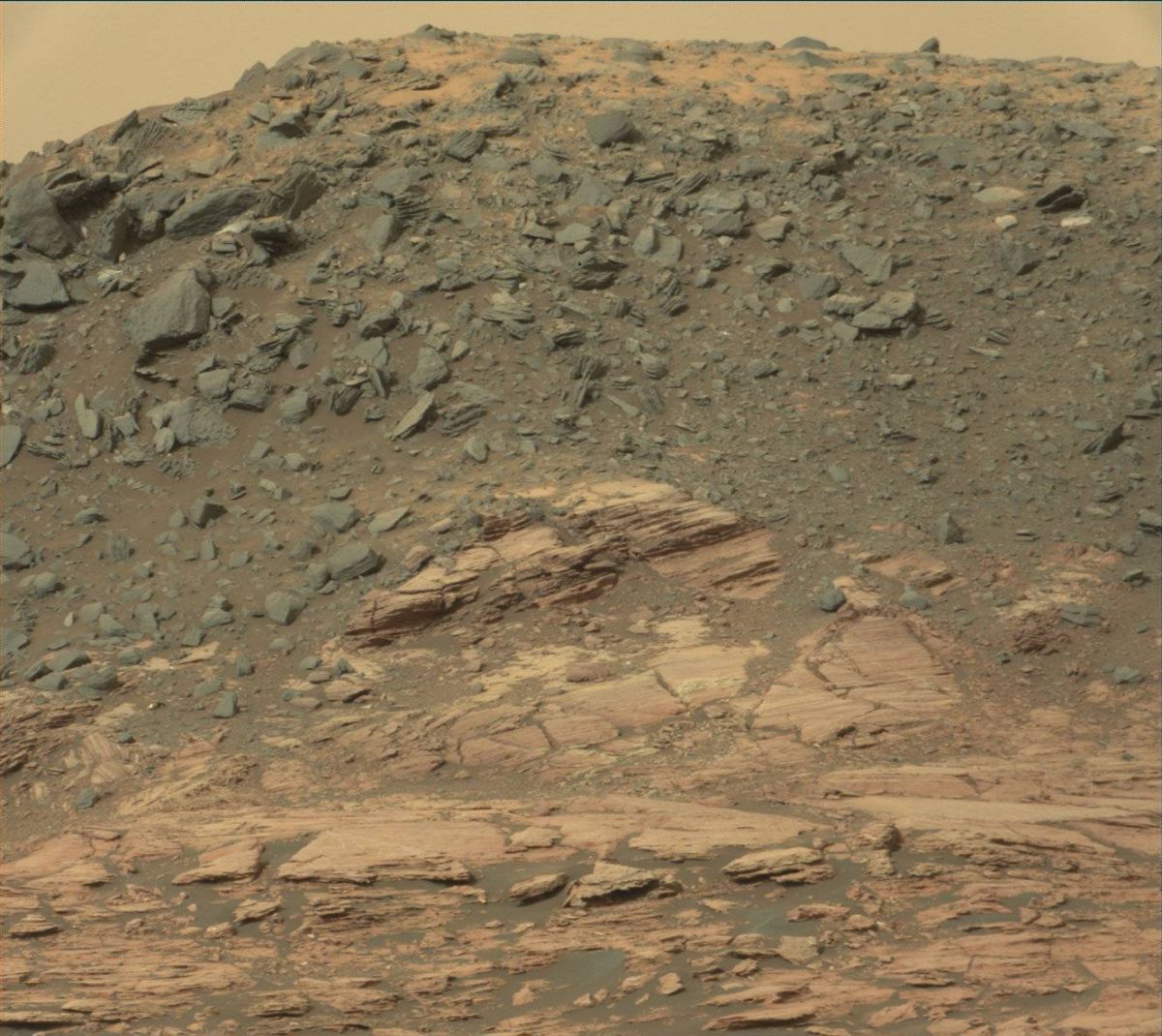
“Ireson Hill” as seen in this Curiosity Mastcam image taken on January 25, 2017, Sol 1590.
Credit: NASA/JPL-Caltech/MSSS
Still recovering
The Chemistry & Camera (ChemCam) instrument continues its recovery activities with a laser-induced breakdown spectroscopy (LIBS) observation of the titanium calibration target.
“Then Curiosity will drive further to the southwest,” Edgar adds, and acquire post-drive imaging for context and targeting, including an upper tier Navcam frame to prepare for more imaging of “Ireson Hill.”
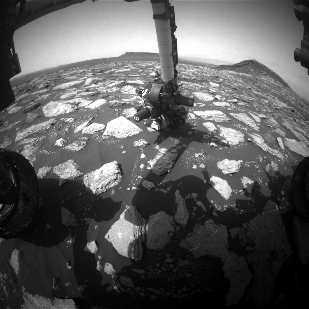
Curiosity Front Hazcam Left B image taken on Sol 1596, January 31, 2017.
Credit: NASA/JPL-Caltech
The second sol is devoted to environmental monitoring, with Mastcam and Navcam observations to assess dust in the atmosphere and search for dust devils, Edgar concludes.
Curiosity Mastcam Left image taken on Sol 1594, January 29, 2017.
Credit: NASA/JPL-Caltech/MSSS
Travel distance
From Sol 1591 to Sol 1594, Curiosity had driven a straight line distance of about 84.39 feet (25.72 meters).
Since touching down in Bradbury Landing in August 2012, Curiosity has driven 9.55 miles (15.37 kilometers) as of January 30, 2017.
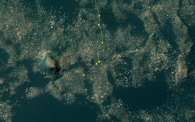
Curiosity rover’s location for Sol 1594.
The base image of this map is from the High Resolution Imaging Science Experiment Camera (HiRISE) in NASA’s Mars Reconnaissance Orbiter.
Credit: NASA/JPL-CALTECH/University of Arizona

