Curiosity Front Hazcam Right B image taken on Sol 1484, October 8, 2016.
Credit: NASA/JPL-Caltech
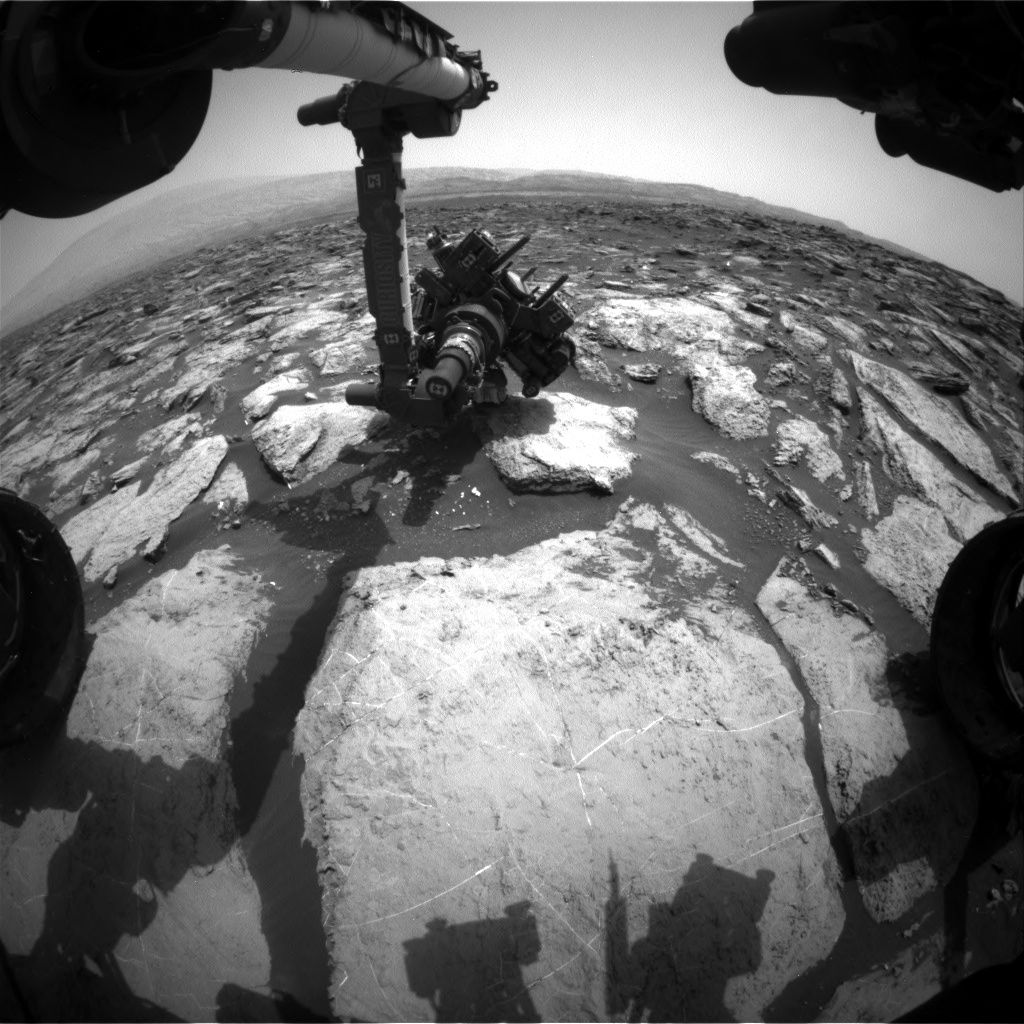
Now in Sol 1485, NASA’s Curiosity rover recently made a drive of over 130 feet (40 meters) up the flank of Mt. Sharp on Sol 1482.
After that trek, the rover was in position to explore multiple bedrock blocks within reach of the robot’s arm for carrying out a weekend plan, reports Ken Herkenhoff of the USGS Astrogeology Science Center in Flagstaff, Arizona.
Brush off
A smooth patch on a nearby block named “Serowe” was selected for brushing by the rover’s dust removal tool (DRT).
The Sol 1484 plan includes two dropoffs of the latest drill sample to the Sample Analysis at Mars (SAM) Instrument Suite. A full suite of Mars Hand Lens Imager (MAHLI) images are on tap to be taken, along with a short Alpha Particle X-Ray Spectrometer (APXS) measurement of “Tobane,” another bedrock block.

Curiosity Mars Hand Lens Imager (MAHLI) photo taken on October 6, 2016, Sol 1482.
Credit: NASA/JPL-Caltech/MSSS
New drive on schedule
Herkenhoff notes the plan calls for APXS to be placed on Serowe for an overnight integration. Early the next morning, the robot’s Navcam was to search for clouds and dust devils, and Mastcam will measure the amount of dust in the atmosphere.
Later on Sol 1485, the arm was to be stowed to allow Chemistry & Camera (ChemCam) and Mastcam observations of Serowe and Tobane. The rover’s Right Mastcam is to acquire a mosaic of laminated bedrock dubbed “Masunga.”
Then another drive is planned, along with the usual post-drive imaging.

Rover wheel damage is surveyed by Curiosity’s Mars Hand Lens Imager (MAHLI). Photo taken on October 6, 2016, Sol 1482.
Credit: NASA/JPL-Caltech/MSSS
Auto-science
The Autonomous Exploration for Gathering Increased Science (AEGIS) software is slated to be used to select a ChemCam target on Sol 1486, and Mastcam will again measure dust in the atmosphere.
Finally, Curiosity will sleep in preparation for Monday’s activities, Herkenhoff adds.
Planned rover activities are subject to change due to a variety of factors related to the Martian environment, communication relays and rover status.

Nearing 9 miles of travel since August 2012 landing.
Credit: NASA/JPL-Caltech/Univ. of Arizona
New map
A new map has been issued showing the Curiosity rover’s location for Sol 1482.
The map shows the route driven by NASA’s Mars rover Curiosity through the 1482 Martian day, or sol, of the rover’s mission on Mars.
Numbering of the dots along the line indicate the sol number of each drive. North is up.
From Sol 1480 to Sol 1482, Curiosity had driven a straight line distance of about 127.51 feet (38.87 meters).
Since touching down in August 2012, Curiosity has driven 8.98 miles (14.45 kilometers).
The base image from the map is from the High Resolution Imaging Science Experiment Camera (HiRISE) in NASA’s Mars Reconnaissance Orbiter.

