Curiosity Mastcam Left image taken on Sol 1282, March 15, 2016.
Credit: NASA/JPL-Caltech/MSSS
Curiosity successfully wheeled itself 85-feet (26-meters) on Sol 1282 “giving the rover nice views of interesting features in the Stimson unit,” reports Ken Herkenhoff of the USGS Astrogeology Science Center in Flagstaff, Arizona.
“Some of these features appear to be the result of erosion by windblown sand,” Herkenhoff adds and are the subject of Curiosity’s Right Mastcam mosaic planned for today, on Sol 1283.

Curiosity Navcam Left B image taken on Sol 1283, March 16, 2016
Credit: NASA/JPL-Caltech
The rover’s Chemistry & Camera (ChemCam) is on tap to measure elemental chemistry at the edge of one of the bedrock blocks and Mastcam will acquire another mosaic of a fracture named “Welwitschia Wash” before the rover drives away.
First-rate viewing
The view from the intended location, Herkenhoff reports, is roughly 130 feet (about 40 meters) toward the west and is expected to be excellent “because much of the Gale crater rim and Mt. Sharp will be visible, and the atmosphere is not as dusty as usual.

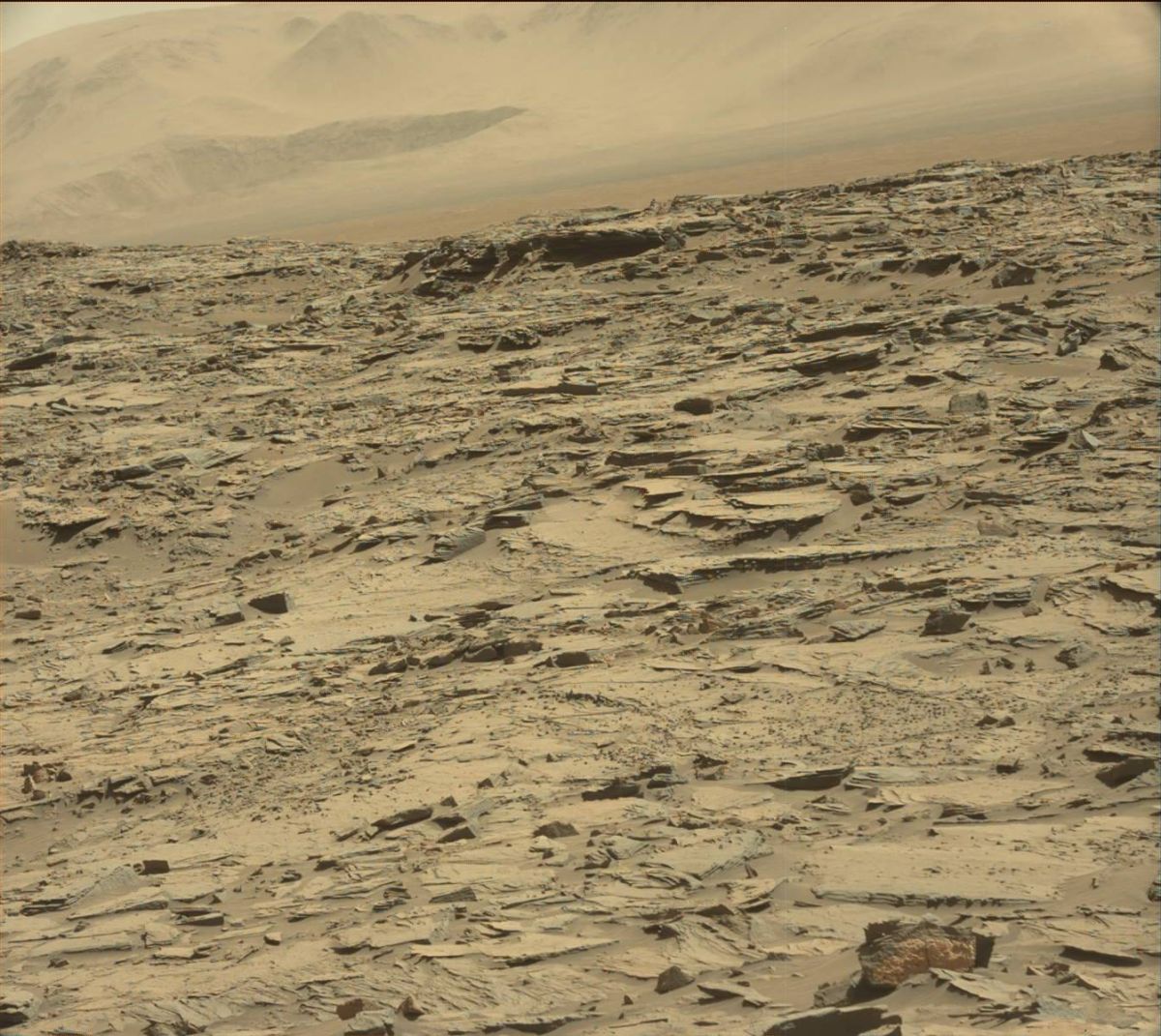
Curiosity Mastcam Left image taken on Sol 1281, March 14, 2016.
Credit: NASA/JPL-Caltech/MSSS
Other rover post-drive observations include ChemCam remote micro-imager (RMI) and Right Mastcam mosaics of features on Mt. Sharp that are so far away that they can be targeted accurately using available image data.
Also, the Left Navcam will be used to search for clouds and dust devils, Herkenhoff notes.
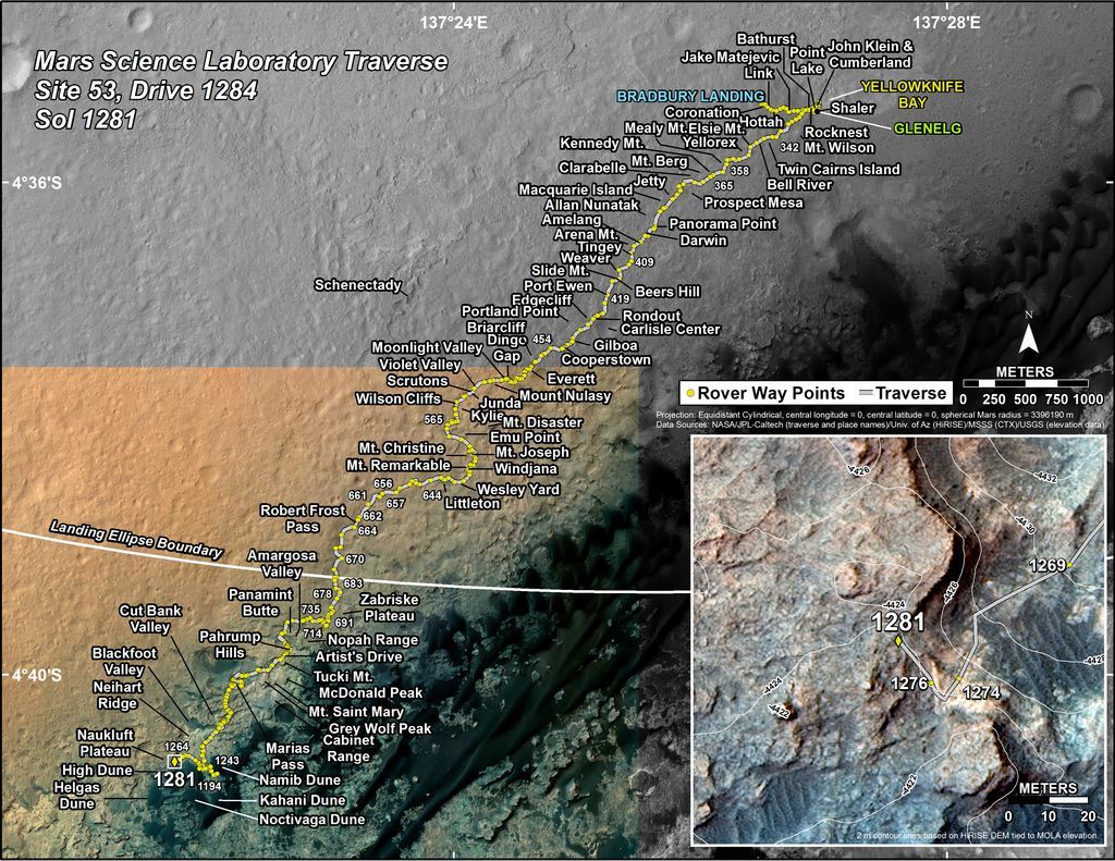
This map shows the route driven by NASA’s Mars rover Curiosity through the 1281 Martian day, or sol, of the rover’s mission on Mars (March, 14, 2016).
Numbering of the dots along the line indicate the sol number of each drive. North is up. The scale bar is 1 kilometer (~0.62 mile). From Sol 1276 to Sol 1281, Curiosity had driven a straight line distance of about 43.73 feet (13.33 meters).
The base image from the map is from the High Resolution Imaging Science Experiment Camera (HiRISE) in NASA’s Mars Reconnaissance Orbiter.
Credit: NASA/JPL-Caltech/Univ. of Arizona
Planned rover activities are subject to change due to a variety of factors related to the Martian environment, communication relays and rover status.

