Curiosity Rear Hazcam Right B image taken on Sol 1244, February 5, 2016.
Credit: NASA/JPL-Caltech
UPDATE: Curiosity is now in Sol 1245.
On Sol 1244, Curiosity did “bump” roughly 6 feet (2 meters) forward to get to a patch of bedrock. “The focus of the weekend plan is to study typical Murray formation bedrock, do some targeted remote sensing, and then drive towards the Naukluft Plateau,” explains Lauren Edgar at the USGS Astrogeology Science Center and a member of the Mars Science Laboratory science team. A three Sol plan has been scripted, Edgar adds, with rover inspection of an interesting patch of nodules. On the third sol, Curiosity is slated to drive towards the Naukluft Plateau, and acquire post-drive imaging to prepare for the upcoming week.
Bedrock target
In a few hours, NASA’s Curiosity Mars rover enters Sol 1245, landing on the Red Planet back in August 2012.
The rover is now focused on “bumping” towards a bedrock target to set researchers here on Earth on track for contact science in the upcoming weekend plan.
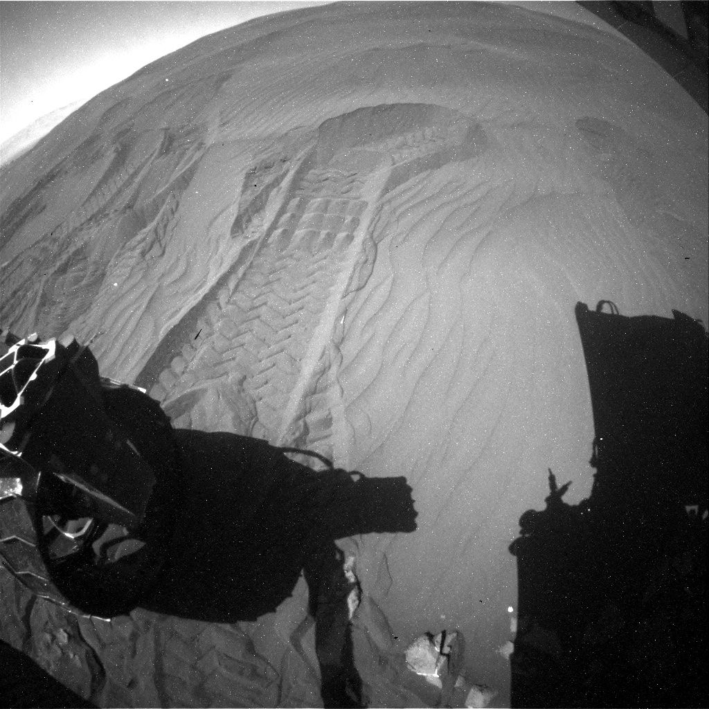
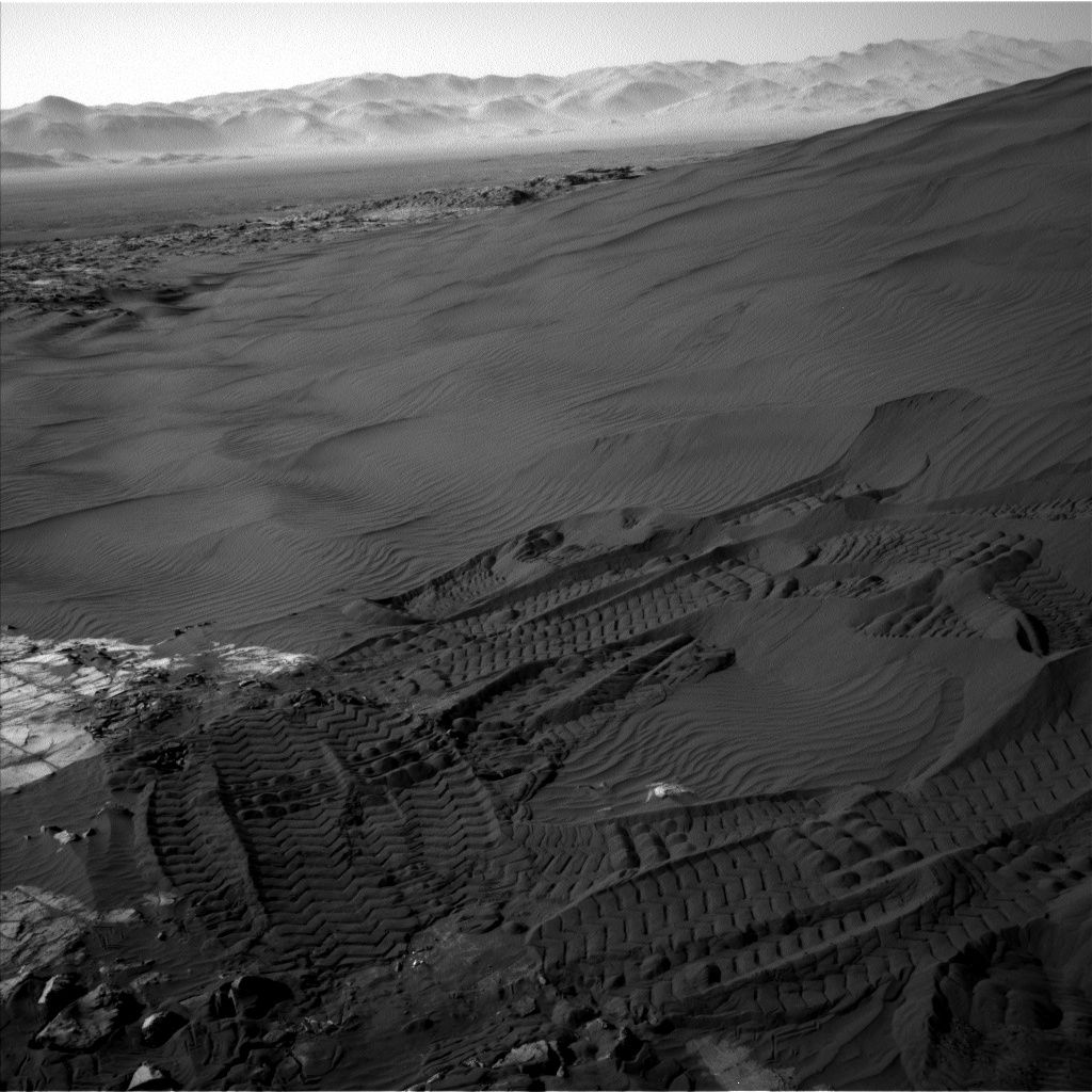
New Curiosity imagery shows that the robot used its rear wheels to create one last scuff in Namib Dune, documented as the robot drove away.
Explains Lauren Edgar, a research geologist at the USGS Astrogeology Science Center in Flagstaff, Arizona: “Looking forward to being back on bedrock!”
Curiosity Mastcam Left image taken on Sol 1244, February 5, 2016.
Credit: NASA/JPL-Caltech/MSSS
Curiosity Navcam Left B image taken on Sol 1244, February 5, 2016.
Credit: NASA/JPL-Caltech
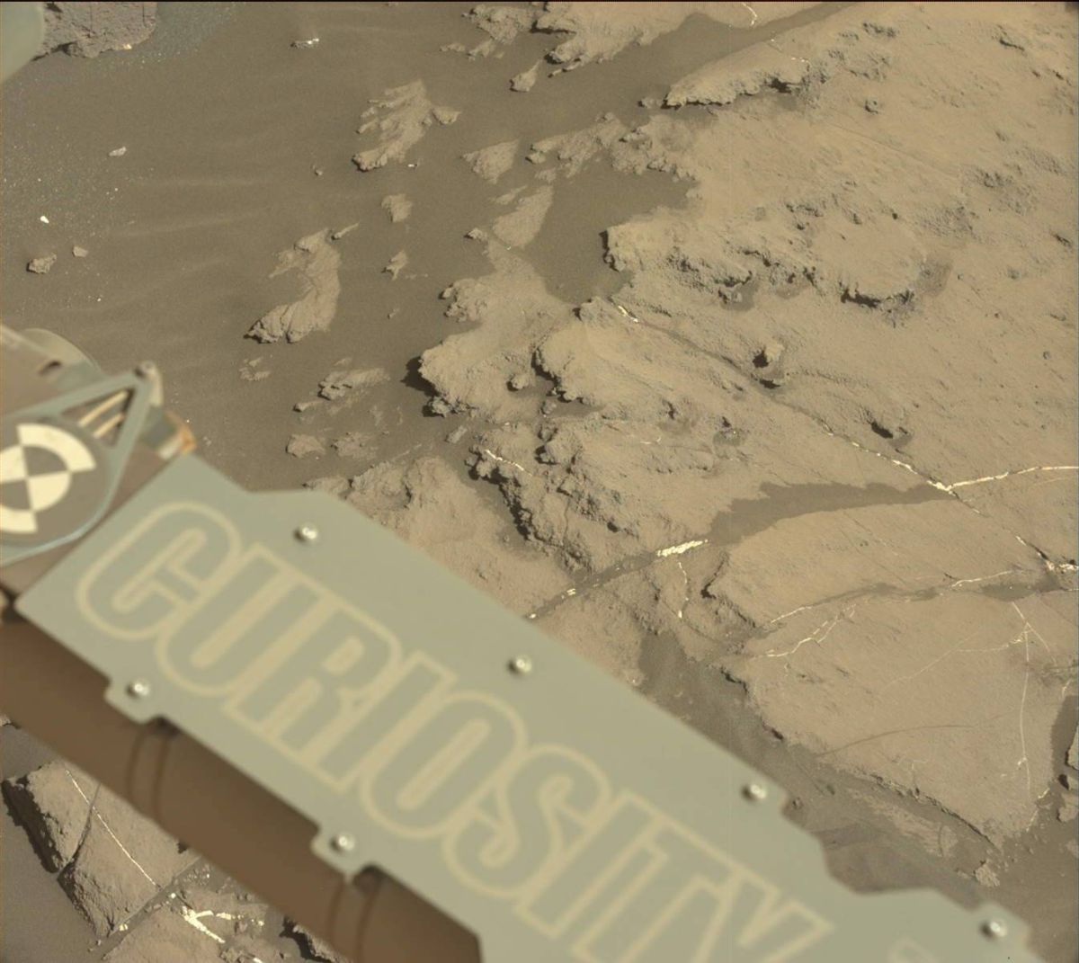
Freshly broken rock
“We decided to bump just a few meters away to a target that will allow us to characterize typical Murray formation bedrock,” Edgar adds.
Before the drive, the plan called for a Chemistry & Camera (ChemCam) passive observation of a distant crater to characterize the material that makes up the Gale crater walls,” Edgar points out. “We also planned a Mastcam image of a freshly broken rock named “Askevold,” and Mastcam deck monitoring to search for the movement of fines.”
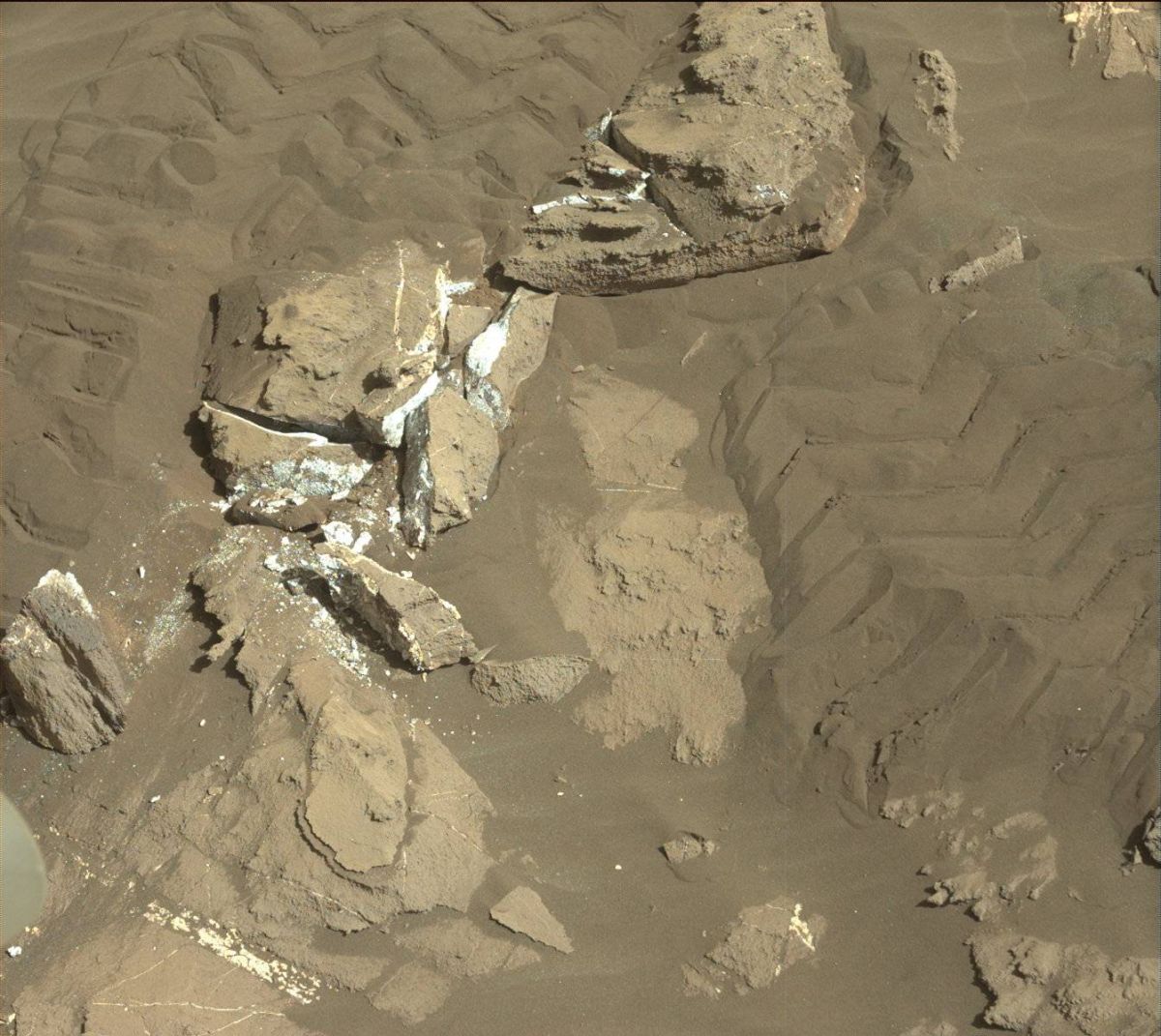
Image taken by Curiosity’s Mastcam Left camera on Sol 1243, February 4, 2016.
Credit: NASA/JPL-Caltech/MSSS
Undermine a ripple
That planned action had the rover driving forward slightly, turn its wheels to undermine a ripple, image it with Mastcam, and then drive towards the contact science target.
“After the drive we’ll acquire imaging to prepare for contact science and targeting in the weekend plan, and we’ll also do some ChemCam calibration activities,” Edgar adds.
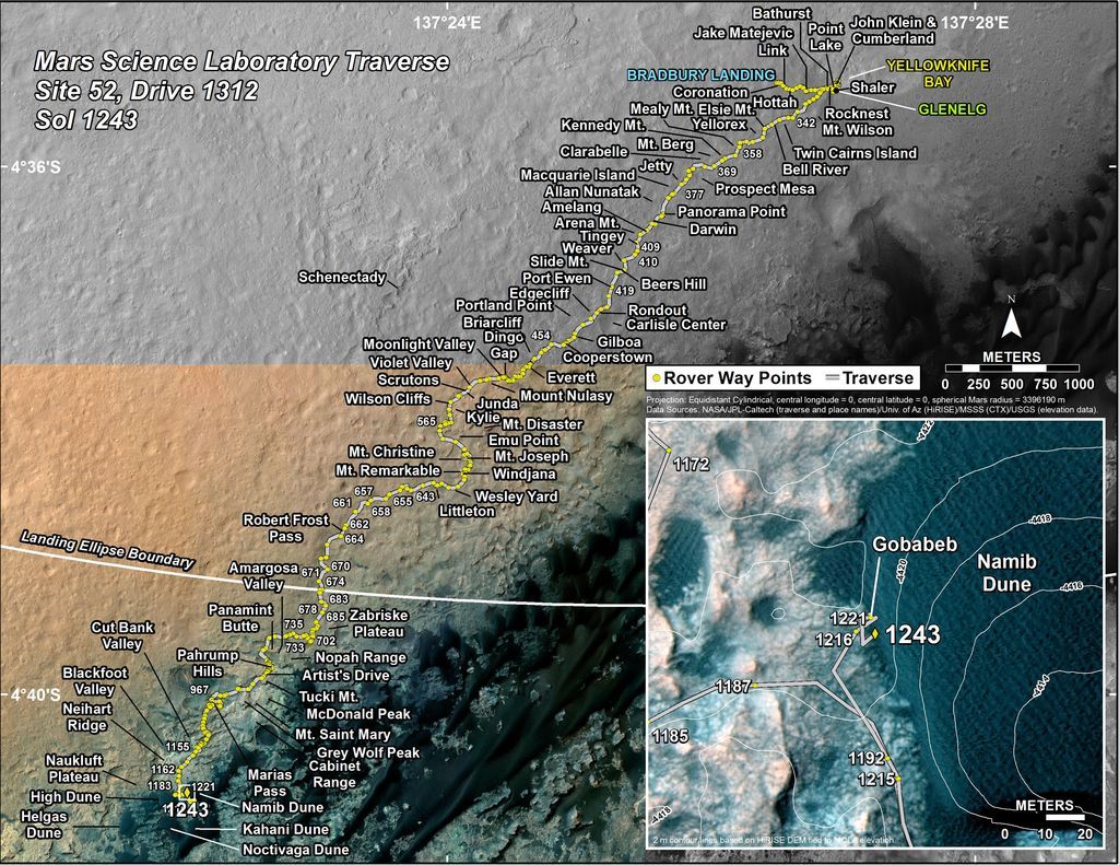
Curiosity’s Traverse Map Through Sol 1243.
This map shows the route driven by NASA’s Mars rover Curiosity through the 1243 Martian day, or sol, of the rover’s mission on Mars as of February 4, 2016.
Numbering of the dots along the line indicate the sol number of each drive. North is up. The scale bar is 1 kilometer (~0.62 mile).
From Sol 1221 to Sol 1243, Curiosity had driven a straight line distance of about 13.85 feet (4.22 meters).
The base image from the map is from the High Resolution Imaging Science Experiment Camera (HiRISE) onboard NASA’s Mars Reconnaissance Orbiter.
Image Credit: NASA/JPL-Caltech/Univ. of Arizona


Why isn’t anybody talking about the ripples with slip faces that cover Namib Dune? That’s the most surprising discovery of the visit. On Earth there are ripples and there are dunes and the distinction between them is very clear. Dunes usually have slip faces and ripples NEVER have slip faces, but on Mars there are smaller structures that we’ve been calling ripples covering the active dunes, that turn out to have active slip faces much like the big slip faces on the main dunes.