
Curiosity Front Hazcam Left B image taken on Sol 1222, January 13, 2016
Credit: NASA/JPL-Caltech
On Mars, the Curiosity rover’s Sol 1221 drive went well, notes USGS’s Ken Herkenhoff at the Astrogeology Science Center in Flagstaff, Arizona.
That drive included “a wheel scuff” in the dark sand dune, and the rover is in a good position for contact science,” he adds.
At this moment, the robot is engaged in activities during Sol 1223.
According to Herkenhoff, the Sol 1223-1224 plan calls for the robot to carry out arm activities, limited by the available power.
On tap is use of the Mars Hand Lens Imager (MAHLI) to take pictures of a couple of locations on the dune surface that has not been disturbed by the wheels, and of sand that was disturbed by the wheel scuff.

Image from Curiosity’s Mastcam Left taken on Sol 1221, January 12, 2016.
Credit: NASA/JPL-Caltech/MSSS
Undisturbed sand sampling
From there, the Alpha Particle X-Ray Spectrometer (APXS) is slated to be placed as close as possible to the scuffed sand for an overnight integration.
On Sol 1224, the robot’s scoop will be used to acquire a sample of the undisturbed dune sand, Herkenhoff reports.
This sample will be sieved and the finest material, less than 0.15 mm diameter grains, will be dropped into Curiosity’s Sample Analysis at Mars (SAM) Instrument inlet. “SAM will then analyze the sample overnight, into the wee hours of Sol 1225,” Herkenhoff adds.
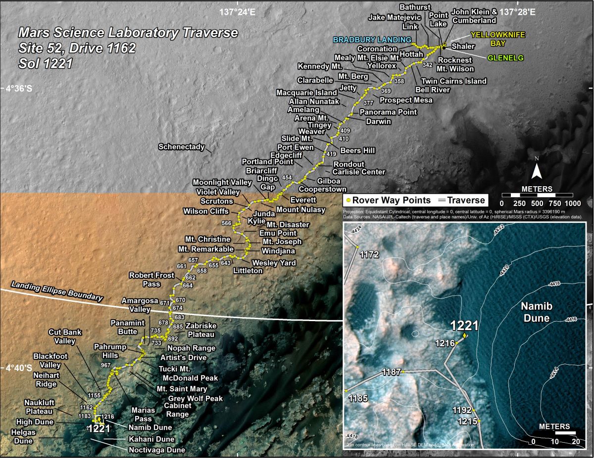
Curiosity’s Traverse Map Through Sol 1221. This map shows the route driven by NASA’s Mars rover Curiosity through the 1221 Martian day, or sol, of the rover’s mission on Mars as of January, 13, 2016.
Numbering of the dots along the line indicate the sol number of each drive. North is up. The scale bar is 1 kilometer (~0.62 mile). From Sol 1216 to Sol 1221, Curiosity had driven a straight line distance of about 16.51 feet (5.03 meters).
The base image from the map is from the High Resolution Imaging Science Experiment Camera (HiRISE) in NASA’s Mars Reconnaissance Orbiter.
Credit: NASA/JPL-Caltech/Univ. of Arizona
Dates of planned rover activities are subject to change due to a variety of factors related to the Martian environment, communication relays and rover status.

