
Shown here is a rendering of 13 candidate landing regions for Artemis III. Each region is approximately 9.3 by 9.3 miles (15 by 15 kilometers). A landing site is a location within those regions with an approximate 328-foot (100-meter) radius.
Credit: NASA
NASA has identified 13 candidate landing regions near the lunar South Pole.
Each region contains multiple potential landing sites for Artemis III, which will be the first of the Artemis missions to bring crew to the lunar surface, including the first woman to set foot on the Moon.
Details were presented in this NASA statement:
“Selecting these regions means we are one giant leap closer to returning humans to the Moon for the first time since Apollo,” said Mark Kirasich, deputy associate administrator for the Artemis Campaign Development Division at NASA Headquarters in Washington. “When we do, it will be unlike any mission that’s come before as astronauts venture into dark areas previously unexplored by humans and lay the groundwork for future long-term stays.”

Credit: Aerospace Corporation
Candidate regions
NASA identified the following candidate regions for an Artemis III lunar landing:
Faustini Rim A
Peak Near Shackleton
Connecting Ridge
Connecting Ridge Extension
de Gerlache Rim 1
de Gerlache Rim 2
de Gerlache-Kocher Massif
Haworth
Malapert Massif
Leibnitz Beta Plateau
Nobile Rim 1
Nobile Rim 2
Amundsen Rim
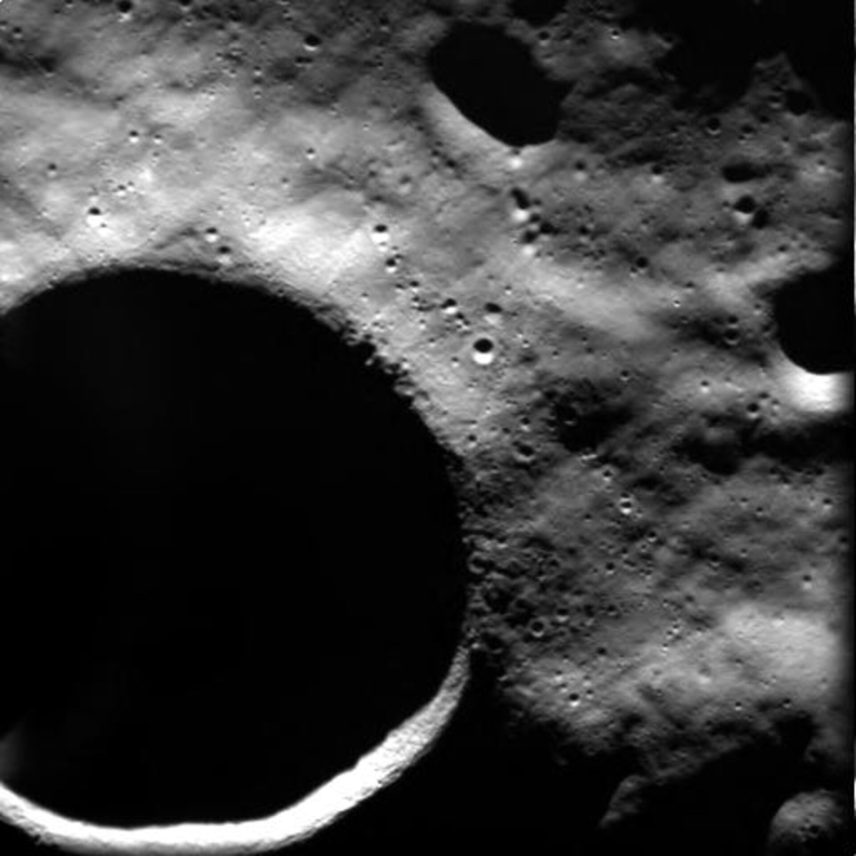
This image, taken by the advanced Moon Imaging Experiment (AMIE) on board ESA’s SMART-1 spacecraft, shows crater Shackleton on the Moon.
Credit: ESA
Diverse geologic features
“Each of these regions is located within six degrees of latitude of the lunar South Pole and, collectively, contain diverse geologic features. Together, the regions provide landing options for all potential Artemis III launch opportunities. Specific landing sites are tightly coupled to the timing of the launch window, so multiple regions ensure flexibility to launch throughout the year,” the NASA statement explains.
Other details include:
- To select the regions, an agencywide team of scientists and engineers assessed the area near the lunar South Pole using data from NASA’s Lunar Reconnaissance Orbiter and decades of publications and lunar science findings.
- In addition to considering launch window availability, the team evaluated regions based on their ability to accommodate a safe landing, using criteria including terrain slope, ease of communications with Earth, and lighting conditions.
- To determine accessibility, the team also considered combined capabilities of the Space Launch System rocket, the Orion spacecraft, and the SpaceX-provided Starship human landing system.
Permanently shadowed regions
“All regions considered are scientifically significant because of their proximity to the lunar South Pole, which is an area that contains permanently shadowed regions rich in resources and in terrain unexplored by humans,” according to the NASA press statement.

In this multi-temporal illumination map of the lunar south pole, Shackleton crater (19 km diameter) is in the center, the south pole is located approximately at 9 o’clock on its rim. The map was created from images from the camera aboard the Lunar Reconnaissance Orbiter.
Credits: NASA/GSFC/Arizona State University
“Several of the proposed sites within the regions are located among some of the oldest parts of the Moon, and together with the permanently shadowed regions, provide the opportunity to learn about the history of the Moon through previously unstudied lunar materials,” said Sarah Noble, Artemis lunar science lead for NASA’s Planetary Science Division.
According to the NASA release, the analysis team weighed other landing criteria with specific Artemis III science objectives, including the goal to land close enough to a permanently shadowed region to allow crew to conduct a moonwalk, while limiting disturbance when landing. This will allow crew to collect samples and conduct scientific analysis in an uncompromised area, yielding important information about the depth, distribution, and composition of water ice that was confirmed at the Moon’s South Pole.

NASA’s Lunar Reconnaissance Orbiter flies over Shackleton crater near the lunar south pole in this computer rendering.
Credit: NASA’s Scientific Visualization Studio
Access to sunlight
“The team identified regions that can fulfill the moonwalk objective by ensuring proximity to permanently shadowed regions, and also factored in other lighting conditions,” reports NASA. “All 13 regions contain sites that provide continuous access to sunlight throughout a 6.5-day period – the planned duration of the Artemis III surface mission. Access to sunlight is critical for a long-term stay at the Moon because it provides a power source and minimizes temperature variations.
“Developing a blueprint for exploring the solar system means learning how to use resources that are available to us while also preserving their scientific integrity”, said Jacob Bleacher, chief exploration scientist for NASA. “Lunar water ice is valuable from a scientific perspective and also as a resource, because from it we can extract oxygen and hydrogen for life support systems and fuel.”
NASA adds that it will select sites within regions for Artemis III after it identifies the mission’s target launch dates, which dictate transfer trajectories and surface environment conditions.
For more information on lunar south pole sites, go to:
Setting Up a Moon Base – But Where?
https://www.leonarddavid.com/setting-up-a-moon-base-but-where/
Moon’s South Pole: Crowd Control Needed?
https://www.leonarddavid.com/moons-south-pole-crowd-control-needed/
New Study on Moon’s South Pole Water Ice
https://www.leonarddavid.com/new-study-on-moons-south-pole-water-ice/


All 13 regions contain sites that provide continuous access to sunlight throughout a 6.5-day period. Is the 6.5 days here Earth Day or Moon Day?