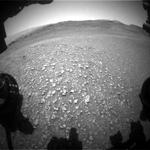
Curiosity Front Hazard Avoidance Camera Left B image taken on Sol 2932, November 4, 2020.
Credit: NASA/JPL-Caltech
NASA’s Curiosity Mars rover is now performing Sol 2933 tasks.

Curiosity Right B Navigation Camera image acquired on Sol 2932, November 4, 2020.
Credit: NASA/JPL-Caltech
“The rubbly terrain that Curiosity is currently driving over is reminiscent of other rubbly terrain encountered within the ‘Glen Torridon’ area and continues to be relatively easy to drive on,” reports Lucy Thompson, a planetary geologist at the University of New Brunswick; Fredericton, New Brunswick, Canada.
Curiosity drove a further 105 feet (32 meters) away from the “Mary Anning” and “Groken” drill site location.
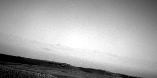
Curiosity Right B Navigation Camera image acquired on Sol 2932, November 4, 2020.
Credit: NASA/JPL-Caltech
“As we drive back towards the planned route to the sulfate unit, the main focus is to document the textures, relationships and chemistry of the rocks we encounter,” Thompson adds.
Previous terrains
The rover’s Alpha Particle X-Ray Spectrometer (APXS) has analyzed the pebble “Rachan” from the Sol 2931 rubbly workspace, with an APXS measurement on the rock target “Mail Beach”slated in the robot’s current workspace.
The Mars Hand Lens Imager (MAHLI) is also set to take close-up images of Mail Beach and scientists will be able to compare the composition and texture to Rachan and other rocks from previous rubbly terrains within Glen Torridon.

Curiosity Right B Navigation Camera image acquired on Sol 2932, November 4, 2020.
Credit: NASA/JPL-Caltech
Also planned is a Chemistry and Camera (ChemCam) We also planned a ChemCam Laser Induced Breakdown Spectroscopy (LIBS) measurement and accompanying Mastcam documentation imaging of the “Windy Standard” rock target, which will complement the APXS and MAHLI observations.
Textures and relationships
Thompson says that the science team also planned three large Mastcam mosaics (including “Corbett”) to document the textures and relationships between the more resistant bedrock ledges and the lower ground in this area.
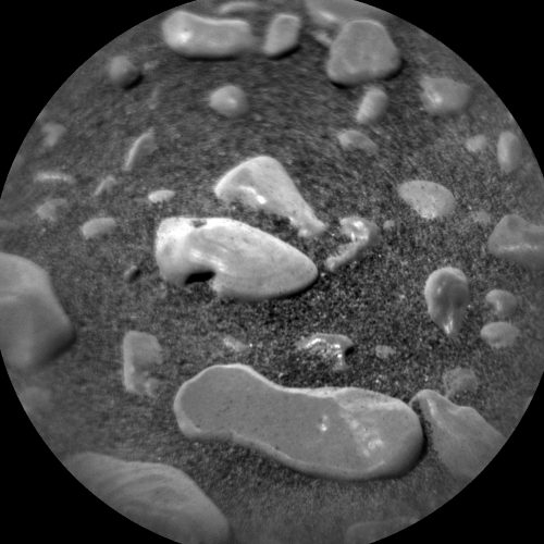
Curiosity Chemistry & Camera Remote Micro-Imager (RMI) photo acquired on Sol 2932, November 4, 2020.
Credit: NASA/JPL-Caltech/LANL
There are questions to pursue, Thompson adds: “Do these ledges represent a slightly different rock type that was perhaps deposited in a slightly different environment to the more typical low relief terrain? Are they more cemented and harder than surrounding rocks as a result of post-depositional processes? Might they provide clues as to what is happening as we get closer to the sulfate unit, that we are on route to?”
Resistant ledges
A planned drive should take Curiosity to another of the resistant ledges for interrogation by many of the robot’s instruments in the upcoming weekend plan.
To give Mars researchers a hint at the chemistry of the rocks at the end of the drive, Thompson explains, a post-drive ChemCam Autonomous Exploration for Gathering Increased Science (AEGIS) observation will be acquired. A planned post-drive Mars Descent Imager (MARDI) image will also give scientists a sense of what the ground beneath the rover’s wheels looks like.

Curiosity Mast Camera Left image taken on Sol 2931, November 3, 2020.
Credit: NASA/JPL-Caltech/MSSS
Dust devil survey
The environmental group was also busy planning observations of the atmosphere. These include a Mastcam basic tau mosaic pointed towards the sun and a Navcam line of sight observation, dust devil survey and suprahorizon movie.
Standard Rover Environmental Monitoring Station (REMS), Radiation Assessment Detector (RAD), and Dynamic Albedo of Neutrons (DAN) passive and active measurements are also scripted.
Lastly, Curiosity’s Chemistry & Mineralogy X-Ray Diffraction/X-Ray Fluorescence Instrument (CheMin) will dump the Groken drill fines, as they are done with their analysis of the sample, Thompson concludes.

