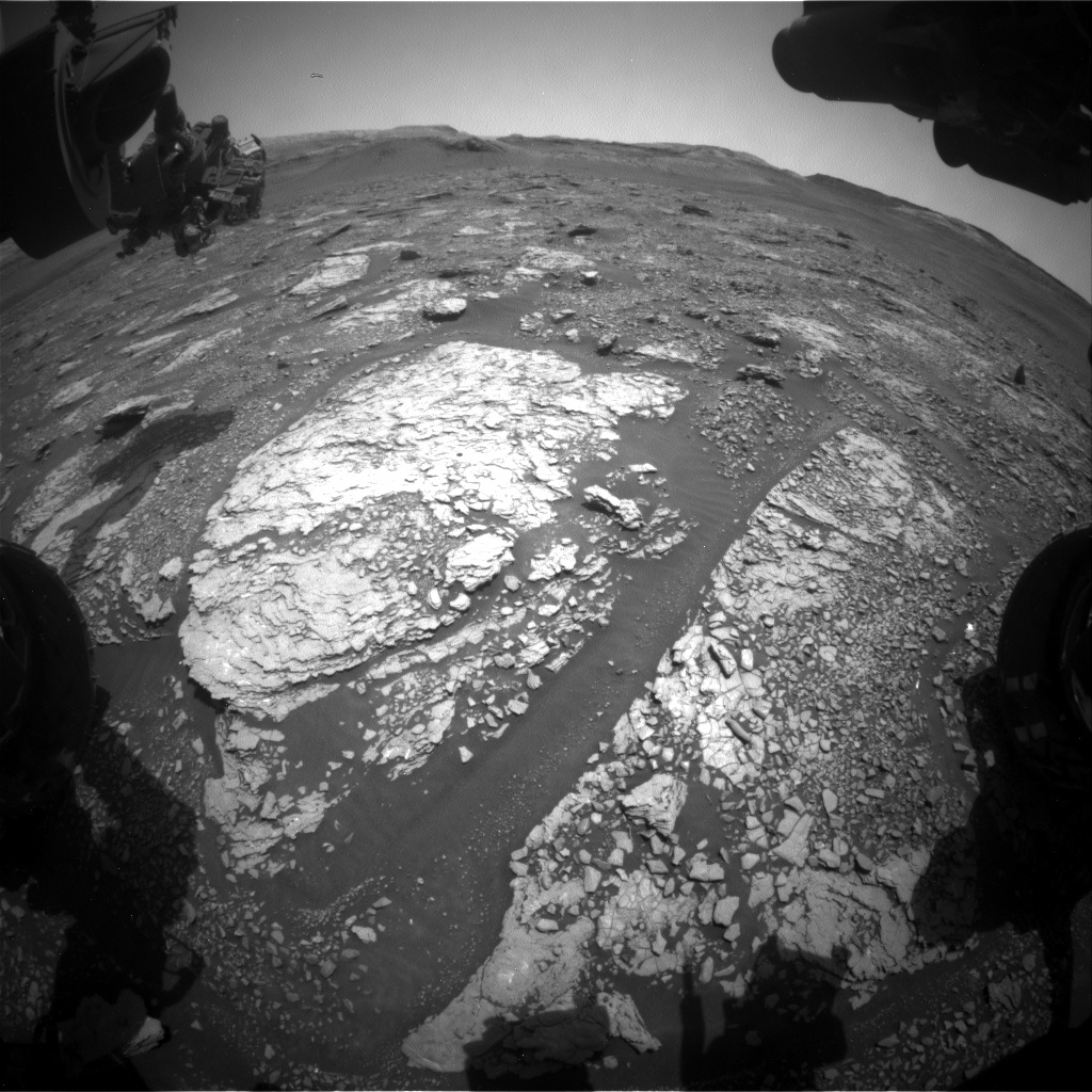
Front Hazcam image showing the current workspace with the two Mary Anning drill holes on the bedrock slab (just left of center), and Mount Sharp in the distance. The rover arm is extended out in the top left of the image, with the Alpha Particle X-Ray Spectrometer (APXS) sensor head pointing to the right. Image taken on Sol 2899, October 1, 2020.
Credit: NASA/JPL-Caltech
NASA’s Curiosity Mars rover is now performing Sol 2901 tasks.
Reports Lucy Thompson, a planetary geologist at University of New Brunswick; Fredericton, New Brunswick, Canada: “The first order of business for this three-sol plan [2901-2903] is to continue with arm diagnostic activities that could give Curiosity the all clear to bump to the next drill target at this location in the coming week.”
Thompson adds that all this still leaves plenty of time, power and data volume to plan a number of science activities.
These include continued characterization of the composition of the rock and soil at this location, with Chemistry and Camera (ChemCam) Laser Induced Breakdown Spectroscopy (LIBS) on “Skaw Beach” (soil target), “Wart” (resistant features in the bedrock) and “Balallan” (bedrock), accompanied by Mastcam documentation imaging.
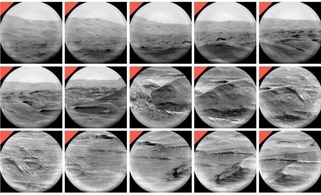
Partial mosaic taken by Curiosity’s Chemistry & Camera Remote Micro-Imager (RMI) telescope Sol 2900 October 2, 2020
Credit: NASA/JPL-Caltech/LANL
Ongoing mosaic
ChemCam will also capture some more Remote Micro-Imager (RMI) telescopic frames to add to the ongoing mosaic of the distant “Housedon Hill” area on Mount Sharp.
“The RMI mosaic will help the geologists on the team discern structures and textures within the rocks exposed in this area of Mount Sharp,” Thompson says, “which in turn might help us better understand their geological history.”
Change detection campaign
As well as studying the ancient processes that formed the rocks in Gale crater, Curiosity also monitors the current environment.
Such activities in this plan include Mastcam imaging of the nearby “Upper Ollach” sand and pebble target “as part of an ongoing change detection campaign to monitor movement of loose material by the wind,” Thompson notes.
The robot’s Mastcam will also image the crater rim, and along with Navcam, the sky, to monitor dust and opacity of the atmosphere.
A Navcam movie will also be acquired to record any dust devil activity.
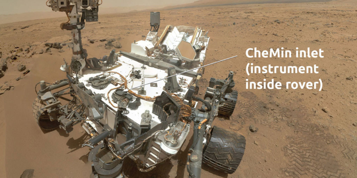
The Chemical and Mineralogy instrument, or CheMin for short, performs chemical analysis of powdered rock samples to identify the types and amounts of different minerals that are present.
Credit: NASA/JPL-Caltech
Next drilling
Finally, there is a Chemistry & Mineralogy X-Ray Diffraction/X-Ray Fluorescence Instrument (CheMin) empty cell and clean up activity on the last sol, in preparation for the rover’s next drill campaign.
Lastly, standard Rover Environmental Monitoring Station (REMS), Radiation Assessment Detector (RAD) and Dynamic Albedo of Neutrons (DAN) passive and active measurements are also planned, Thompson concludes.

