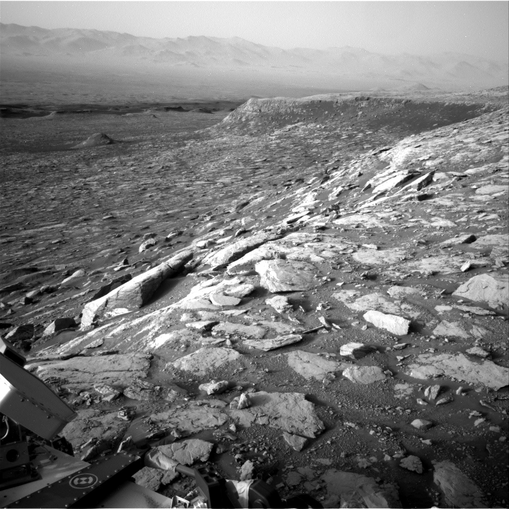
Image of outcrop called “Red Cliff,” a vertical cliff face seen in the mid-field of this Navcam image.
Curiosity Navcam Right B photo taken on Sol 2036, April 29, 2018.
Credit: NASA/JPL-Caltech
NASA’s Curiosity Mars rover is now performing Sol 2038 duties.
“A successful drive in the weekend plan set Curiosity up nicely for a full sol of contact and remote science,” reports Rachel Kronyak, a planetary geologist at the University of Tennessee in Knoxville. “The main priority during planning today was to image the outcrop we’ve called ‘Red Cliff,’ a beautiful vertical cliff face.”
The plan now calls for use of both the Chemistry and Camera (ChemCam) Remote Micro-Imager (RMI) and the rovers Mastcam to image Red Cliff, “which will give us a really nice, well-rounded dataset in order to fully characterize the features and sedimentary structures present in the outcrop,” Kronyak adds.
Bedrock targets
Aside from imaging, Curiosity is to assess some local bedrock targets.
With ChemCam’s Laser-Induced Breakdown Spectrometer (LIBS) on tap is analyzing targets “Paulsen Lake,” “Negaunee,” and “Nashwauk.”
With the robot’s Mars Hand Lens Imager (MAHLI) and Alpha Particle X-Ray Spectrometer (APXS) additional analyses on Nashwauk is to be performed.
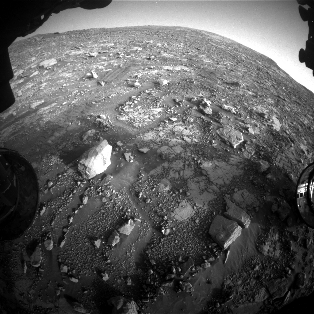
Curiosity Front Hazcam Left B image acquired on Sol 2036, April 29, 2018.
Credit: NASA/JPL-Caltech
Environmental measurements
Lastly, Curiosity is slated to do some standard environmental science activities, including the use of the Rover Environmental Monitoring Station (REMS), the Dynamic Albedo of Neutrons (DAN), and a tau measurement.
“During a tau observation, we use Mastcam to measure the optical depth of the atmosphere,” Kronyak notes. “This is particularly useful for understanding the scattering properties of the molecules and particles that are present in the martian atmosphere.”
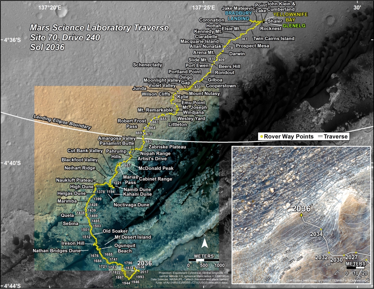
Credit: NASA/JPL-Caltech/Univ. of Arizona
Road map
A newly issued Curiosity traverse map through Sol 2036 shows the route driven by the rover through the 2036 Martian day, or sol, of the rover’s mission on Mars (April 30, 2018).
Numbering of the dots along the line indicate the sol number of each drive. North is up. The scale bar is 1 kilometer (~0.62 mile).
From Sol 2034 to Sol 2036, Curiosity had driven a straight line distance of about 89.38 feet (27.24 meters), bringing the rover’s total odometry for the mission to 11.73 miles (18.88 kilometers).
The base image from the map is from the High Resolution Imaging Science Experiment Camera (HiRISE) in NASA’s Mars Reconnaissance Orbiter.

