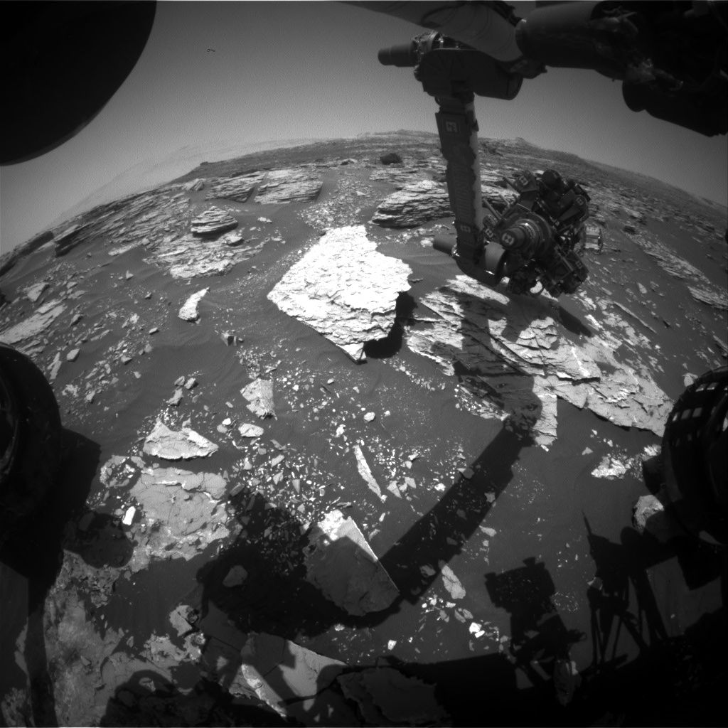
Curiosity Front Hazcam Right B image taken on Sol 1721, June 9, 2017.
Credit: NASA/JPL-Caltech
NASA’s Curiosity Mars rover is now in Sol 1722, carrying out a three sol duration plan to keep the robot busy over the weekend.
Reports Scott Guzewich, an atmospheric scientist at NASA’s Goddard Space Flight Center in Greenbelt, Maryland, almost the entirety of the first two sols (1722 and 1723) are dedicated to a Sample Analysis at Mars (SAM) Instrument Suite analysis of a “doggy bagged” sample from the Quela drill hole collected back in September 2016 (Sol 1464).
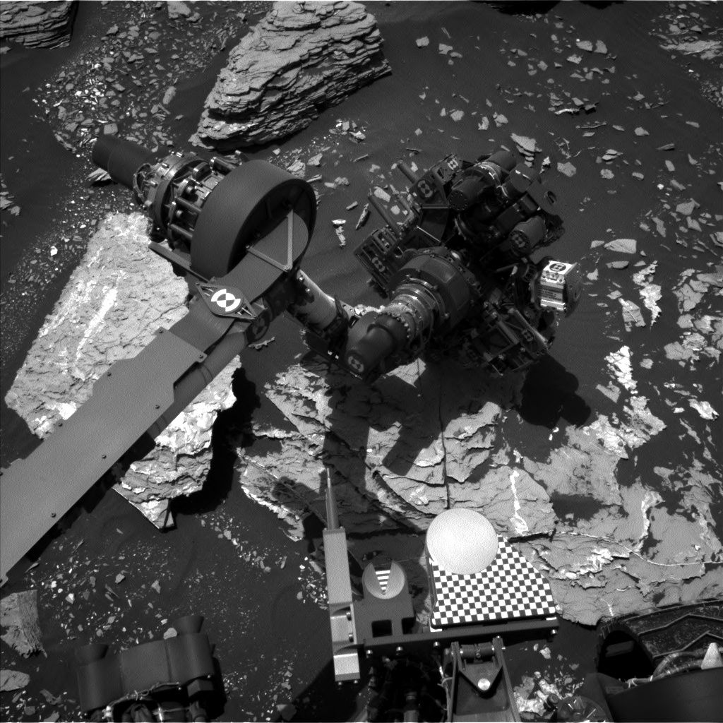
Curiosity Navcam Left B Sol 1721 June 9, 2017
Credit: NASA/JPL-Caltech
“Several times in the mission we’ve saved samples from our drill locations to analyze later,” Guzewich adds. “This SAM analysis will help us determine the precise chemical composition of the Martian bedrock and therefore improve our understanding of ancient Martian history.”
Bedrock, atmospheric observations
On the third sol of the rover plan (1724), the Chemistry & Camera (ChemCam) and Mastcam observations of a bedrock target termed “Old Point” is on tap.
Scheduled is an early morning science block on Sol 1725 before the start of that sol’s plan. “These morning activities help us understand how atmospheric conditions change at different times of day, for example, how the clouds and dust in the atmosphere vary between morning and afternoon,” Guzewich points out.
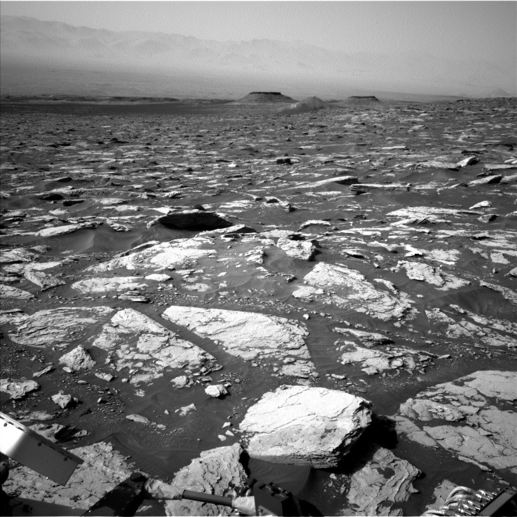
Curiosity Navcam Left B Sol 1721 June 9, 2017
Credit: NASA/JPL-Caltech
Diversity of minerals
In a JPL new release, it has been reported that scientists have found a wide diversity of minerals in the initial samples of rocks collected by the Curiosity rover in the lowermost layers of Mount Sharp on Mars, suggesting that conditions changed in the water environments on the planet over time.
The research underscores the liquid water and a chemical diversity at the site that could have been exploited by microbial life.
This appraisal – “Mineralogy of an ancient lacustrine mudstone succession from the Murray formation, Gale crater, Mars” – can be found here:
https://www.sciencedirect.com/science/article/pii/S0012821X17302005
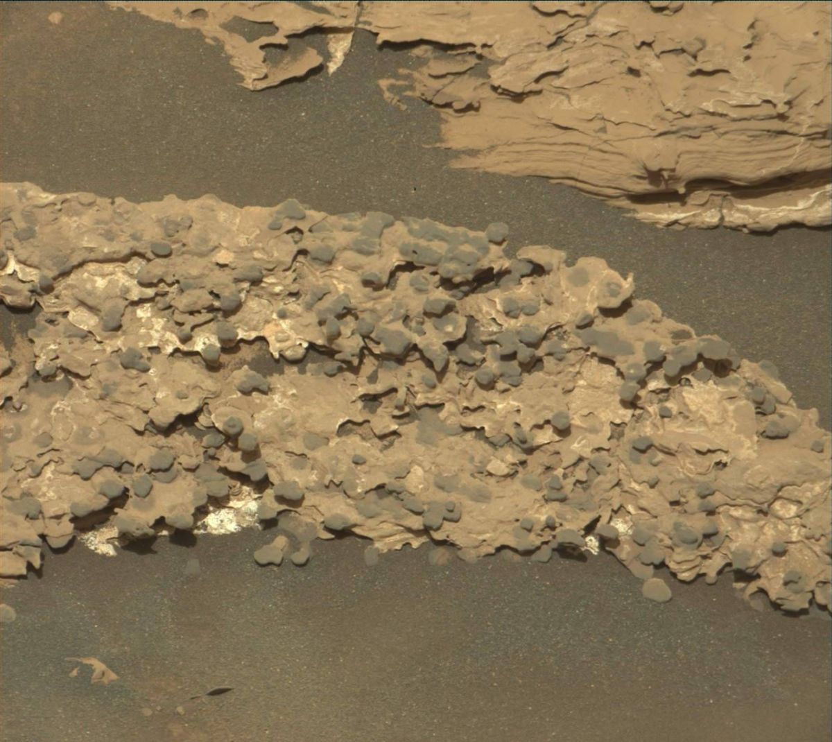
Mastcam Right image acquired on Sol 1718, June 6, 2017.
Credit: NASA/JPL-Caltech/MSSS
Traverse map
Meanwhile, a new Curiosity’s traverse map through Sol 1721 has been issued.
The map shows the route driven by NASA’s Mars rover Curiosity through the 1721 Martian day, or sol, of the rover’s mission on Mars (June 09, 2017).
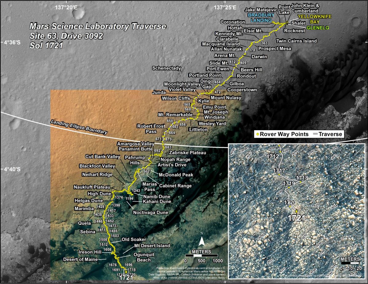
IMAGE CREDIT: NASA/JPL-CALTECH/UNIV. OF ARIZONA
Numbering of the dots along the line indicate the sol number of each drive. North is up. The scale bar is 1 kilometer (~0.62 mile).
From Sol 1720 to Sol 1721, Curiosity had driven a straight line distance of about 40.36 feet (12.30 meters), bringing the rover’s total odometry for the mission to 10.34 miles (16.65 kilometers).
The base image from the map is from the High Resolution Imaging Science Experiment Camera (HiRISE) in NASA’s Mars Reconnaissance Orbiter.

