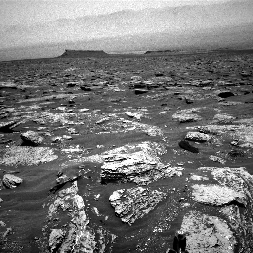
Curiosity Navcam Left B image taken on Sol 1717, June 5, 2017.
Credit: NASA/JPL-Caltech
NASA’s Curiosity Mars rover is busy at work performing Sol 1718 duties.
The robot has started to turn toward the east and southeast as it wheels toward Vera Rubin Ridge, reports Scott Guzewich, an atmospheric scientist at NASA’s Goddard Space Flight Center in Greenbelt, Maryland.
Curiosity Navcam Left B image taken on Sol 1717, June 5, 2017.
Credit: NASA/JPL-Caltech
Weighing priorities
After a busy and successful plan over last weekend, Guzewich notes that the rover science team members weighed priorities between using the Alpha Particle X-Ray Spectrometer (APXS) to study the bedrock Curiosity is driving over or drive farther along the path.
Sol 1718 plans took into account that the rover had only gained roughly 10 feet (3 meters) of elevation the robot’s last drive. “We decided to forgo contact science with APXS in favor of extending our drive distance,” Guzewich adds.
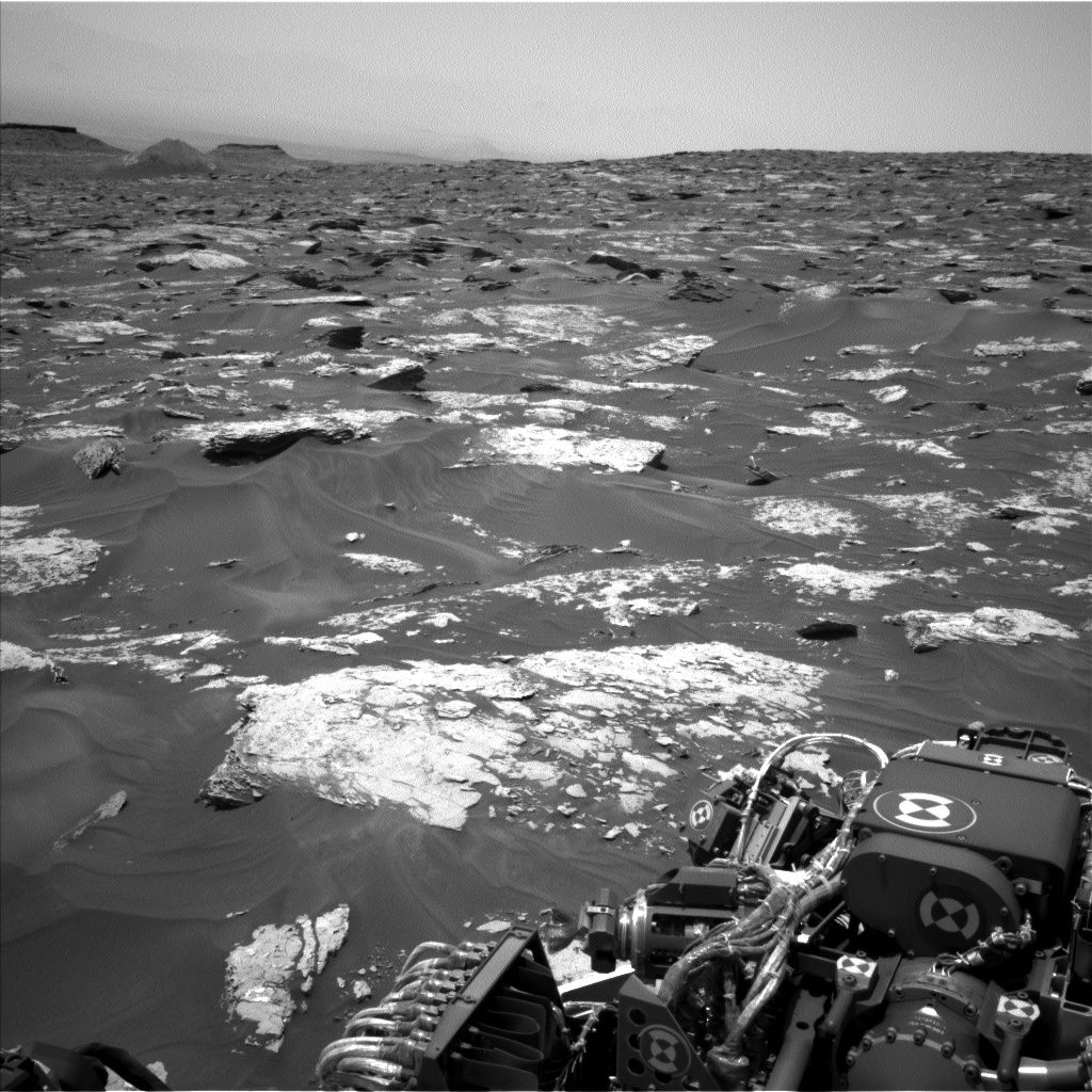
Bedrock interest
Curiosity Navcam Right B image taken on Sol 1716, June 4, 2017.
Credit: NASA/JPL-Caltech
The geology science theme group has found some interesting bedrock — “East Point,” “East Pond,” and “Eastern Point Harbor” — to target with Chemistry and Camera (ChemCam) and Mastcam before the drive begins.
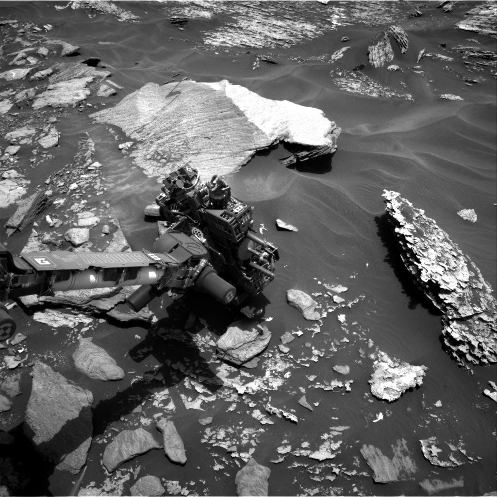
Curiosity Mastcam Left image acquired on Sol 1717, June 5, 2017.
Credit: NASA/JPL-Caltech/MSSS
After a drive of roughly 85 feet (26 meters), the plan calls for post-drive imaging to prepare for the next sol’s activities involving ChemCam, as well as Dynamic Albedo of Neutrons (DAN) and Rover Environmental Monitoring Station (REMS) observations, Guzewich points out.
On the trail
A newly issued Curiosity traverse map shows the route driven by Curiosity through the 1717 Martian day, or sol, of the rover’s mission on Mars (June 05, 2017).
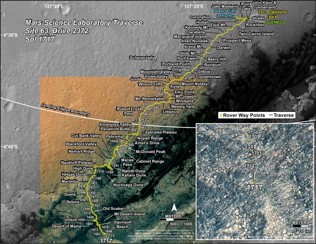
Credit: NASA/JPL-Caltech/University of Arizona
Numbering of the dots along the line indicate the sol number of each drive. North is up. The scale bar is 1 kilometer (~0.62 mile).
From Sol 1712 to Sol 1717, Curiosity had driven a straight line distance of about 85.55 feet (26.08 meters), bringing the rover’s total odometry for the mission to 10.29 miles (16.57 kilometers).
The base image from the map is from the High Resolution Imaging Science Experiment Camera (HiRISE) in NASA’s Mars Reconnaissance Orbiter.


Happy D-Day Mr Leonard: This is some of the very best content on the web regarding space activities. I found the Seti lecture on Martian Geology recently, but have yet to watch it. The Nils Fossae signature was one of the more promising sites for Carbon-Clay signatures harboring life as I remember (pre-Maven, Mangalayaan and TiGO).
Many thanks for your constancy and vigilance in gathering, integrating and publishing exceedingly relevant and up-to-date info.
Lee Jerome Avery Baker