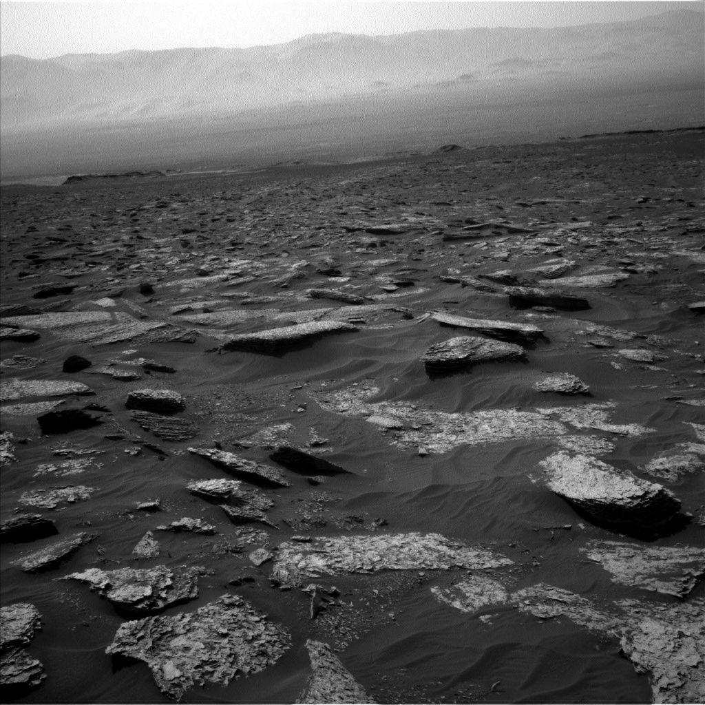
Curiosity Navcam Left B image taken on Sol 1712, May 31, 2017.
Credit: NASA/JPL-Caltech
NASA’s Curiosity Mars rover is carrying out Sol 1712 science duties.
Unfortunately the rover’s Sol 1713 activities were not uplinked due to an issue at the Deep Space Network (DSN) station, reports Lauren Edgar, a planetary geologist at the USGS in Flagstaff, Arizona.
A new plan has been scripted, focused on recovering the activities that were planned the previous day, Edgar notes. “The good news is that we’ll be in the same location for the start of the weekend plan, so we’ll be able to add some additional contact science targets at this interesting site.”
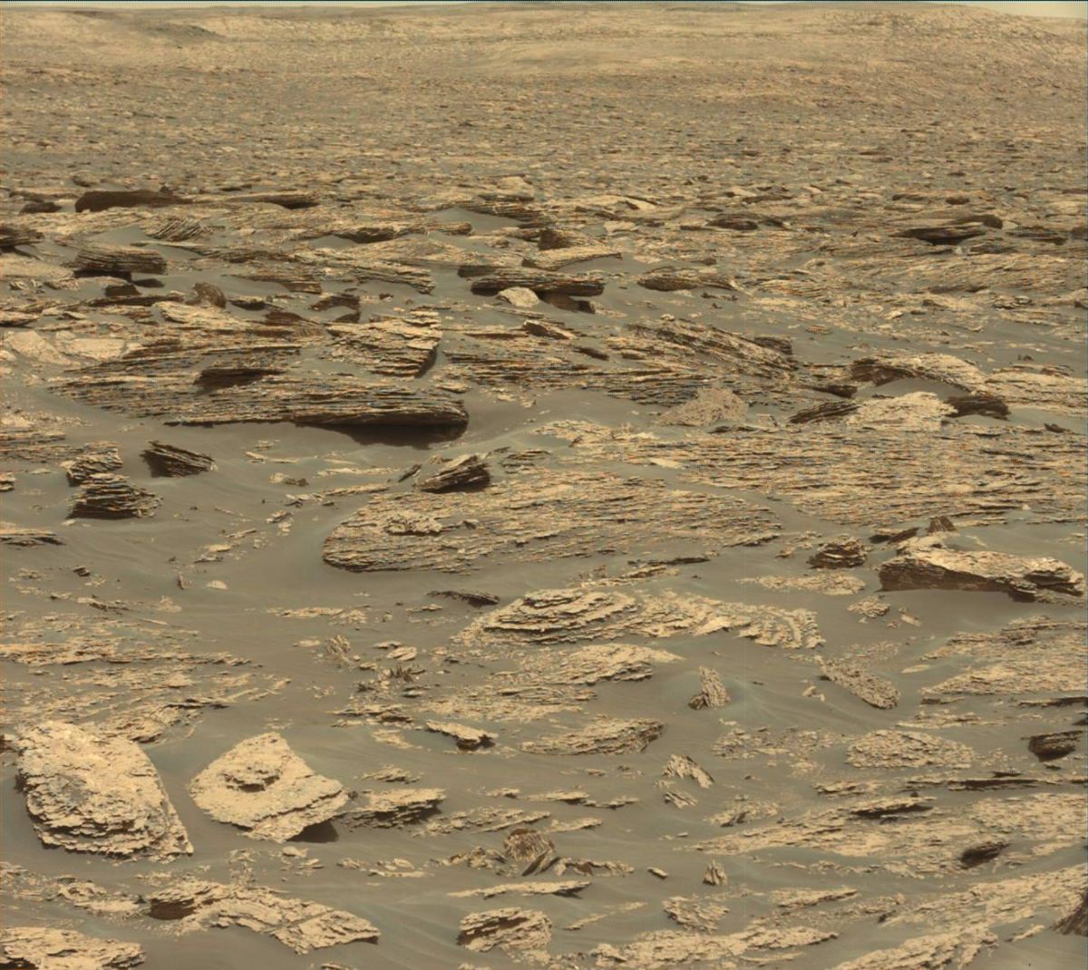
Curiosity Mastcam Left image acquired on Sol 1712, May 31, 2017.
Credit: NASA/JPL-Caltech/MSSS
Sedimentary structures
The plan kicks off with Curiosity creating Mastcam mosaics of “The Whitecap,” “Trap Rock,” and “Pond Island” to document some nearby sedimentary structures.
Then the Chemistry and Camera (ChemCam) will target “Heron Island” and “McNeil Point” to investigate variations in chemistry within the darker gray rocks in this area, Edgar adds. Also, there will be a ChemCam Remote Micro-Imager (RMI) acquisition to assess the grain size and stratification at “Sols Cliff.”
This will be followed by using the robot’s Navcam to carry out a dust devil survey to monitor atmospheric activity.
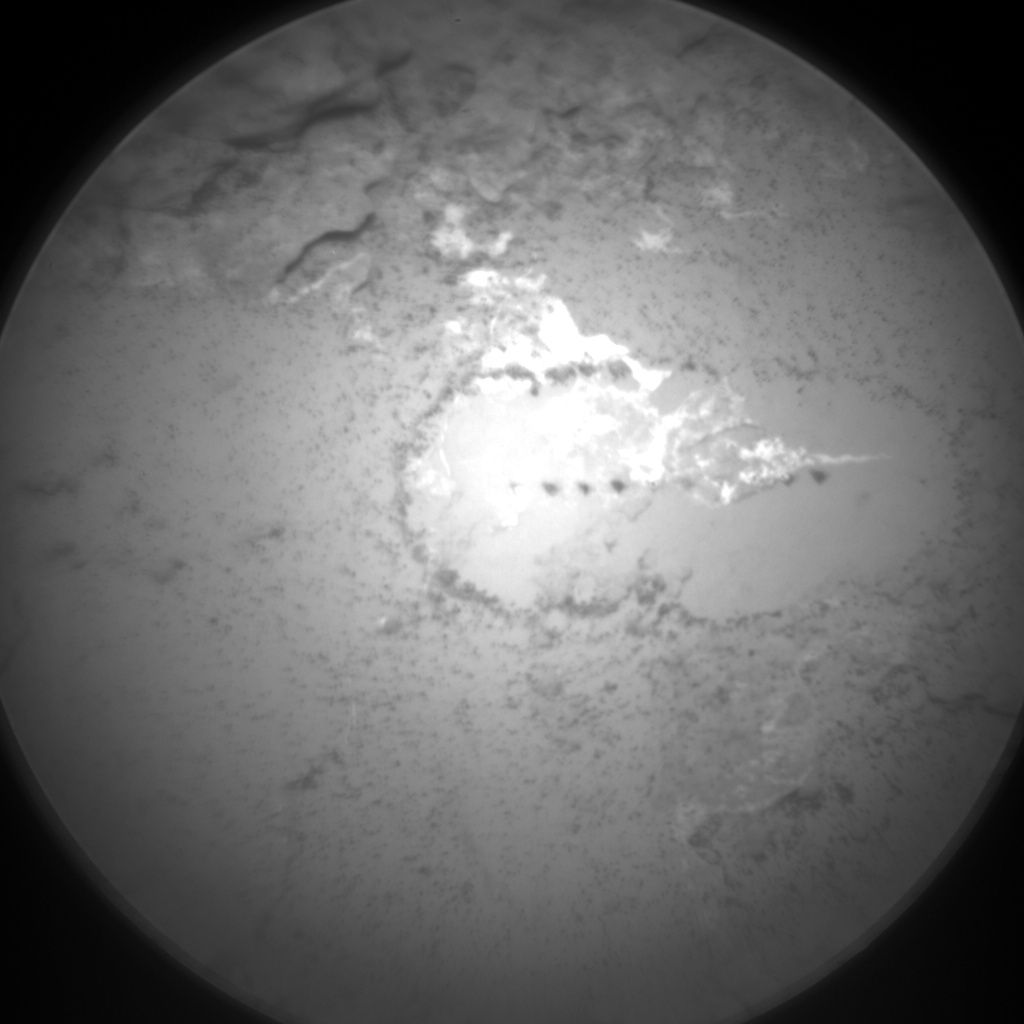
Curiosity ChemCam Remote Micro-Imager photo taken on Sol 1712, May 31, 2017.
Credit: NASA/JPL-Caltech/LANL
Juicy plan
Slightly later in the afternoon, the plan calls for acquisition of a Mastcam mosaic to document the contact science target “Prays Brook” and surrounding rocks, and a multispectral observation will be taken on “Heron Island.”
“The meat of the plan lies in the contact science,” Edgar says.
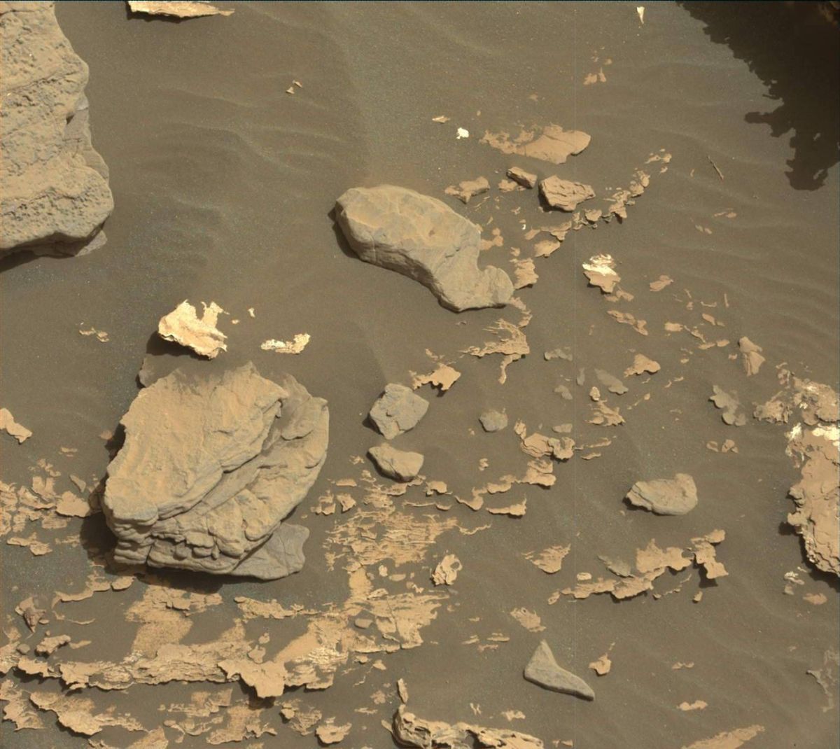
Curiosity Mastcam Left image acquired on Sol 1712, May 31, 2017.
Credit: NASA/JPL-Caltech/MSSS
Also on tap, Alpha Particle X-Ray Spectrometer (APXS) and Mars Hand Lens Imager (MAHLI) observations on “Berry Cove” and “Heron Island” to assess the darker gray rocks both with and without nodules, as well as a dog’s eye MAHLI mosaic along “Prays Brook” to characterize the contact between the dark gray rocks and the underlying typical Murray formation.
Edgar concludes that “It’s a juicy plan so I hope it all goes smoothly this time, and we’re looking forward to more contact science tomorrow before we hit the road to Vera Rubin Ridge.”
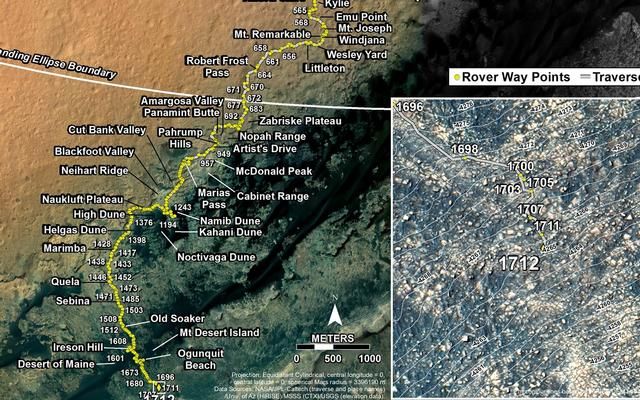
IMAGE CREDIT: NASA/JPL-CALTECH/UNIV. OF ARIZONA
Traverse map
A newly issued Curiosity’s traverse map through Sol 1712 shows the route driven by Curiosity through the 1712 Martian day, or sol, of the rover’s mission on Mars (May 31, 2017).
Numbering of the dots along the line indicate the sol number of each drive. North is up. The scale bar is 1 kilometer (~0.62 mile).
From Sol 1711 to Sol 1712, Curiosity had driven a straight line distance of about 23.26 feet (7.09 meters), bringing the rover’s total odometry for the mission to 10.28 miles (16.54 kilometers).
The base image from the map is from the High Resolution Imaging Science Experiment Camera (HiRISE) in NASA’s Mars Reconnaissance Orbiter.

