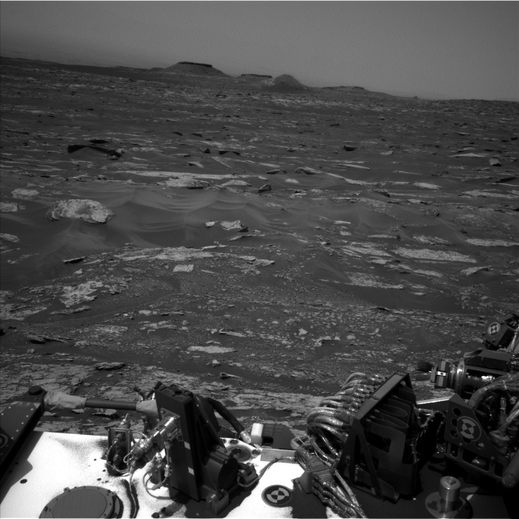
Curiosity Navcam Left B image taken on Sol 1693, May 11, 2017.
Credit: NASA/JPL-Caltech
NASA’s Curiosity rover on Mars is now performing Sol 1694 science duties.
Rachel Kronyak, a planetary geologist at the University of Tennessee in Knoxville, reports that two sols – 1693 and 1694 – involves the rover carrying out a suite of remote science observations before driving away and resuming its trek up Mount Sharp.
“These remote observations include a combination of atmospheric and bedrock measurements, giving us a really thorough dataset at this location,” Kronyak adds.
Passive sky scan
The robot is slated to make atmospheric observations, including a Chemistry and Camera (ChemCam) passive sky scan, a Navcam zenith movie, as well as a suprahorizon movie, and a few Mastcam images that measure atmospheric scattering.
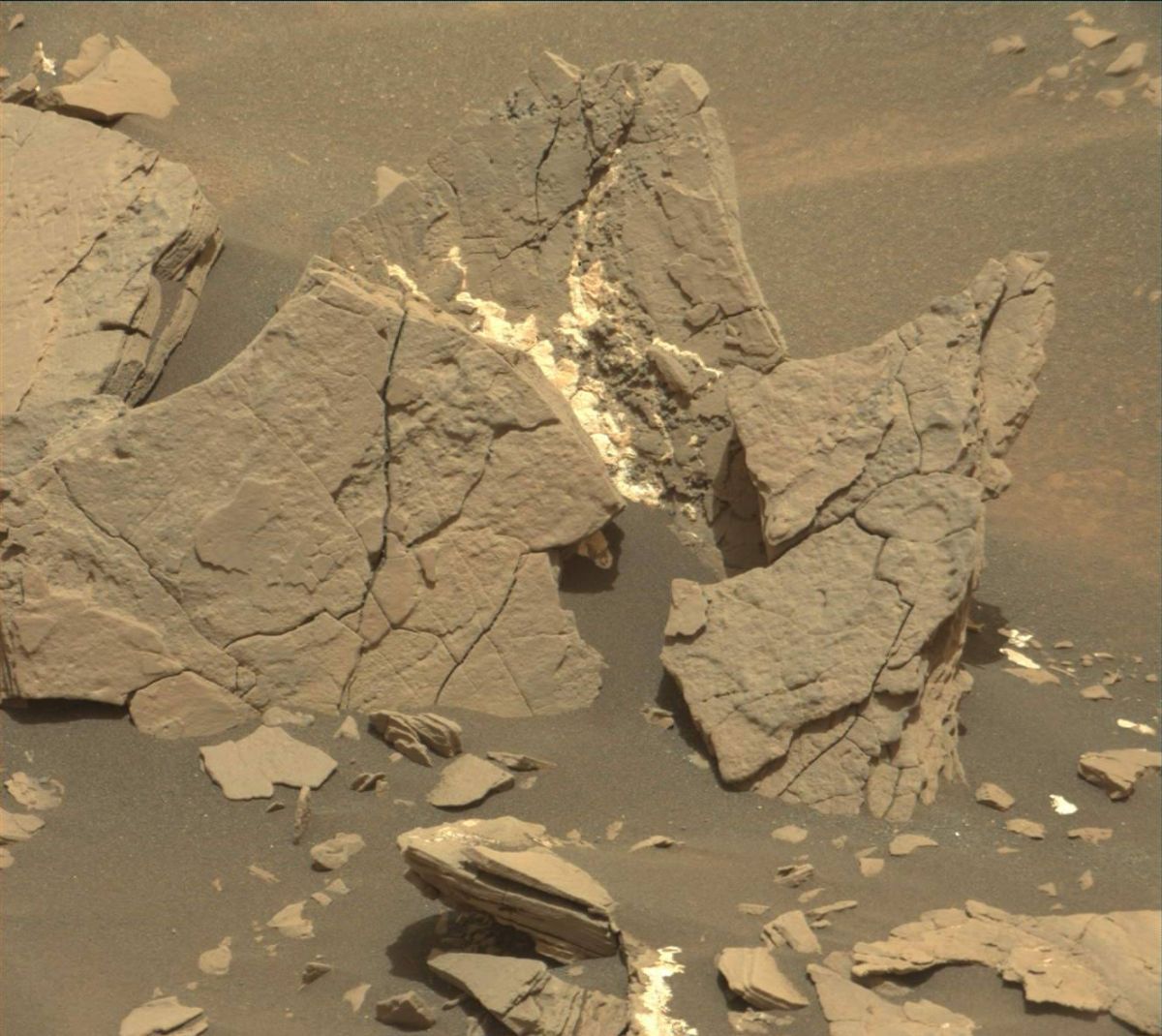
Dark bedrock target named “Bear Island” is seen in this Curiosity Mastcam Right image acquired on Sol 1692, May 10, 2017.
Credit: NASA/JPL-Caltech/MSSS
“For our bedrock observations, we will be conducting two ChemCam rasters and a Mastcam multispectral activity on the dark bedrock target named “Bear Island,” Kronyak adds. An initial look at Bear Island showed it to be interesting enough target to warrant further investigation by ChemCam and Mastcam.
Phobos imagery
Following a set of remote science observations, the plan calls for the robot to drive away and take some post-drive images in readiness for a busy weekend of contact and remote science.
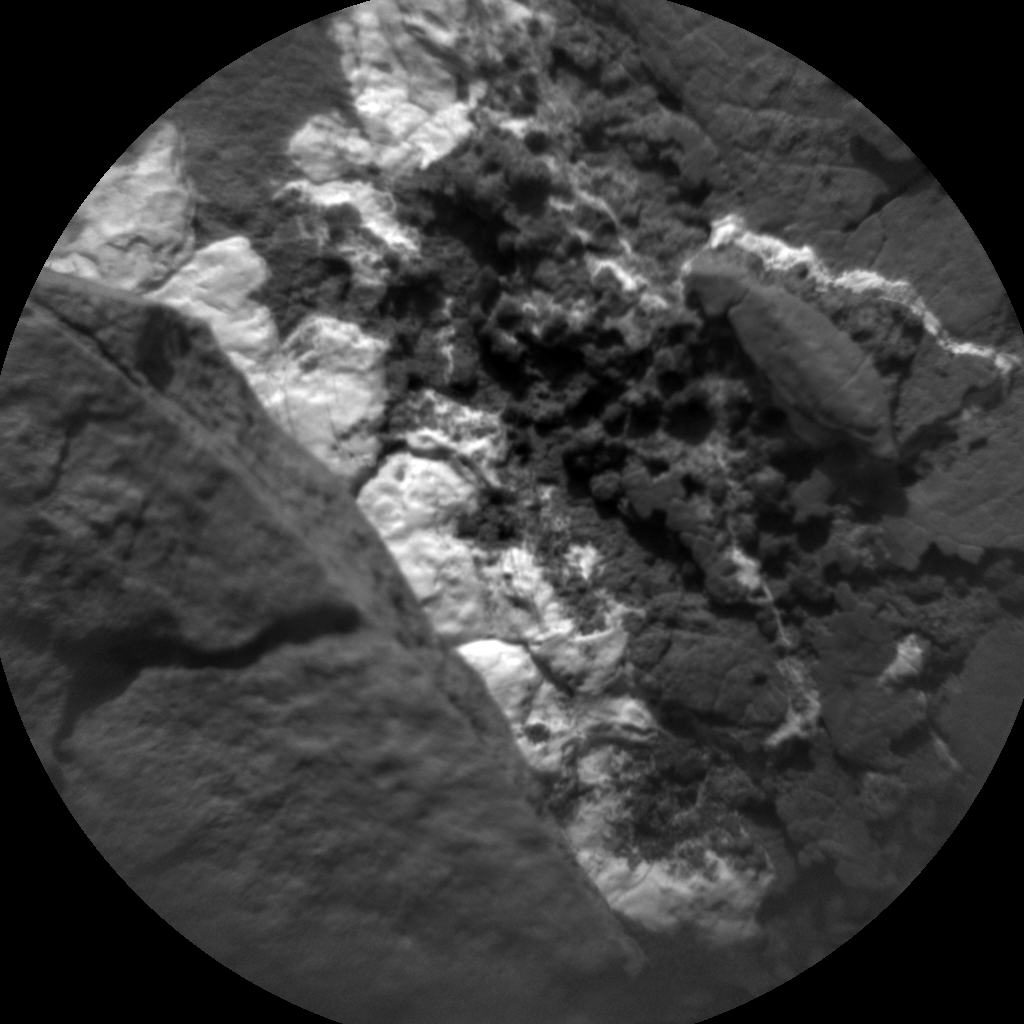
Curiosity ChemCam Remote Micro-Imager photo acquired on Sol 1693, May 11, 2017.
Credit: NASA/JPL-Caltech/LANL
“After the drive, we will be taking our third round of Phobos transit images,” Kronyak concludes, with Mastcam as well as an automated ChemCam Autonomous Exploration for Gathering Increased Science (AEGIS) observation.
On sol 1694, the planning script calls for producing a Navcam dust devil movie and calibrate the ChemCam instrument.
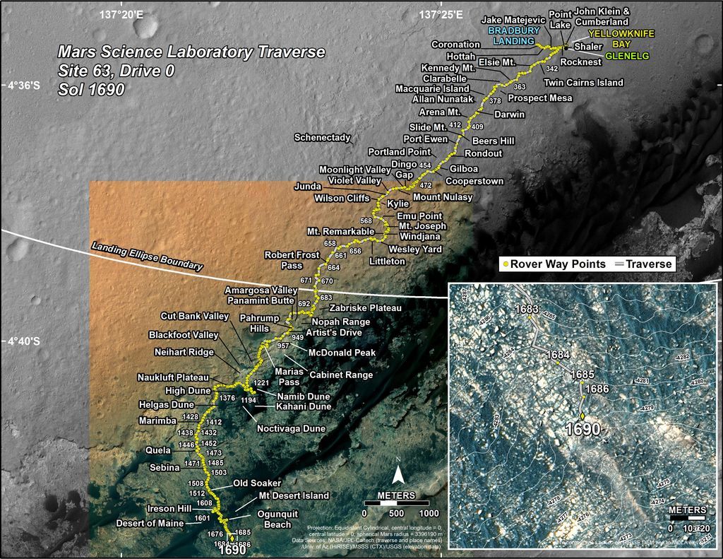
Route driven by Curiosity through the 1690 Martian day, or sol, of the rover’s mission on Mars (May 8, 2017).
Credit: NASA/JPL- Caltech/University of Arizona
New map
Meanwhile, a new map has been issued showing the route driven by Curiosity through the 1690 Martian day, or sol, of the rover’s mission on Mars (May 08, 2017).
Numbering of the dots along the line indicate the sol number of each drive. North is up. The scale bar is 1 kilometer (~0.62 mile).
From Sol 1686 to Sol 1690, Curiosity had driven a straight line distance of about 36.31 feet (11.07 meters), bringing the rover’s total odometry for the mission to 10.14 miles (16.32 kilometers).
The base image from the map is from the High Resolution Imaging Science Experiment Camera (HiRISE) in NASA’s Mars Reconnaissance Orbiter.

