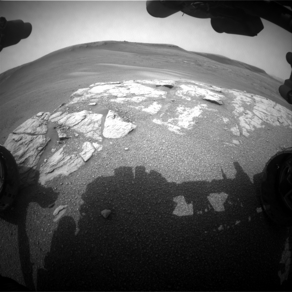
Curiosity Front Hazcam Right A photo taken on Sol 2316, February 10, 2019.
Credit: NASA/JPL-Caltech
NASA’s Curiosity Mars rover is now performing Sol 2317 tasks.
“Curiosity is driving across the clay-bearing unit, which is still a very new terrain with many details yet to be understood,” reports Susanne Schwenzer, a planetary geologist at The Open University, Milton Keynes in the U.K. “The region is covered in little pebbles – and has lots of small sand patches, too, both of which we continue to investigate.”
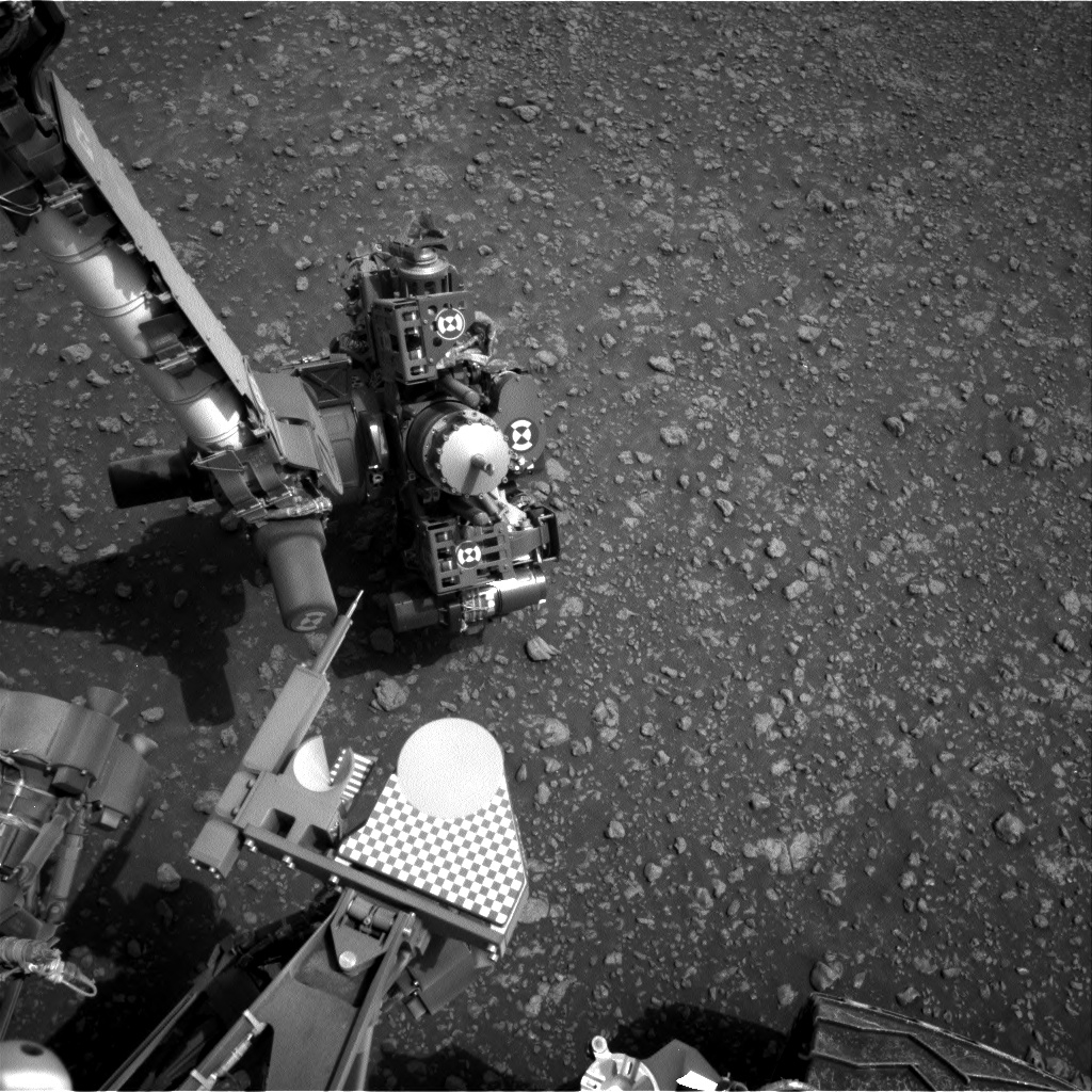
Curiosity Navcam Right A image acquired on Sol 2316, February 10, 2019.
Credit: NASA/JPL-Caltec
Little further north
A recent drive by the robot moved it a little further north – to be exact, Curiosity drove 95 feet (39 meters from its last location.
“The parking location presented us with the same pebbly-strewn surface as before, with the occasional small sand feature,” Schwenzer adds. With this terrain being new, and some small-scale sedimentary features spotted by the eagle-eyed sedimentologists on the team, there was a decision to use Curiosity’s Chemistry and Camera (ChemCam) on three pebbly targets, “Dauntless,” “Otter,” and Thistle.”
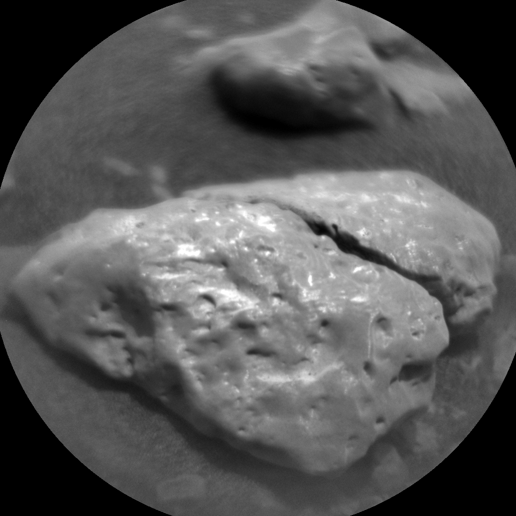
Curiosity ChemCam Remote Micro-Imager photo taken on Sol 2316, February 10, 2019.
Credit: NASA/JPL-Caltech/LANL
Large pebble
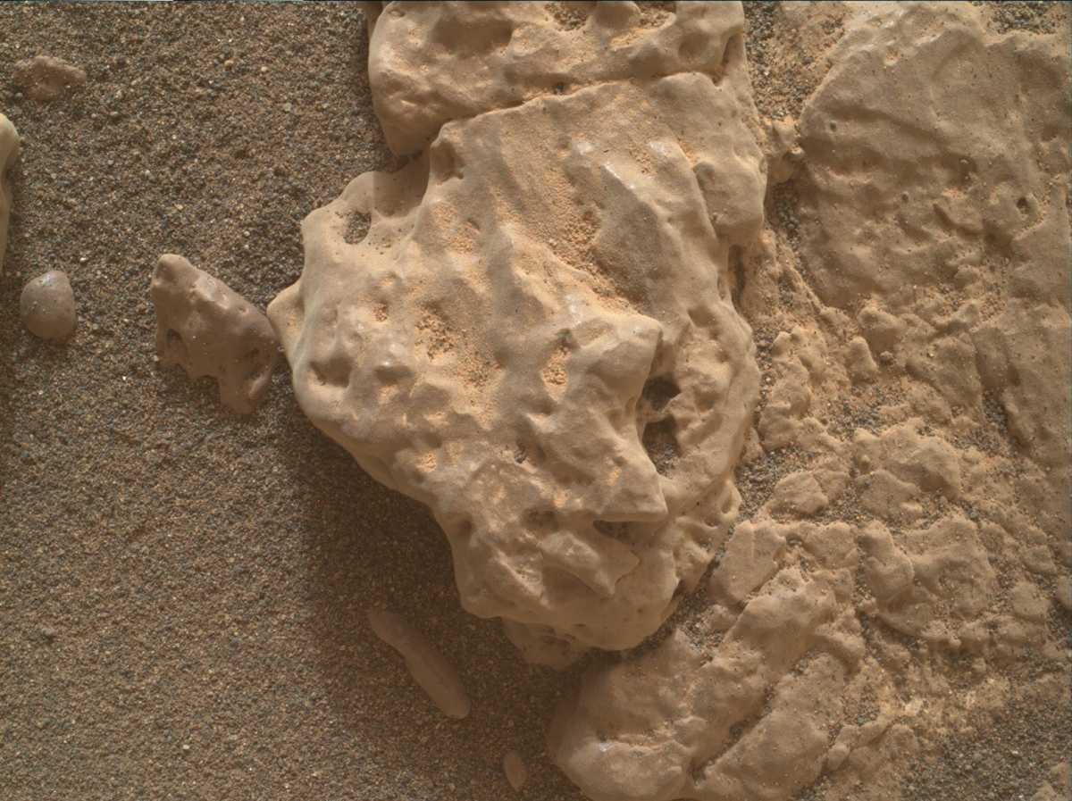
The team also found – for the first time in this new unit – a pebble large enough to get a full Alpha Particle X-Ray Spectrometer (APXS) raster on one continuous piece of rock.
“Yes, this is how small the pebbles are! We used the opportunity, named the target “Emerald,” and investigated it using a 3-spot APXS raster, accompanied by [Mars Hand Lens Imager] MAHLI observations on this target.
Explains Schwenzer: To put all the small pieces into context, scientists planned a large Mastcam multispectral raster investigation covering the workspace in front of the rover, and including the targets “Dauntless,” “Faoilean” (a sand patch), and the APXS target “Emerald.” That plan also covers some of the sedimentary details that were spotted in the post drive imaging. Two further Mastcam observations target aeolian features (target “River Brora”) and a small ridge ahead of the rover, named “Osprey.”
Curiosity Navcam Left A image taken on Sol 2316, February 10, 2019.
Credit: NASA/JPL-Caltech
Declining dust event
Mars environmental researchers included atmospheric opacity measurements with both Mastcam and Navcam, as well as cloud observation movies and a dust-devil survey in the weekly morning suite.
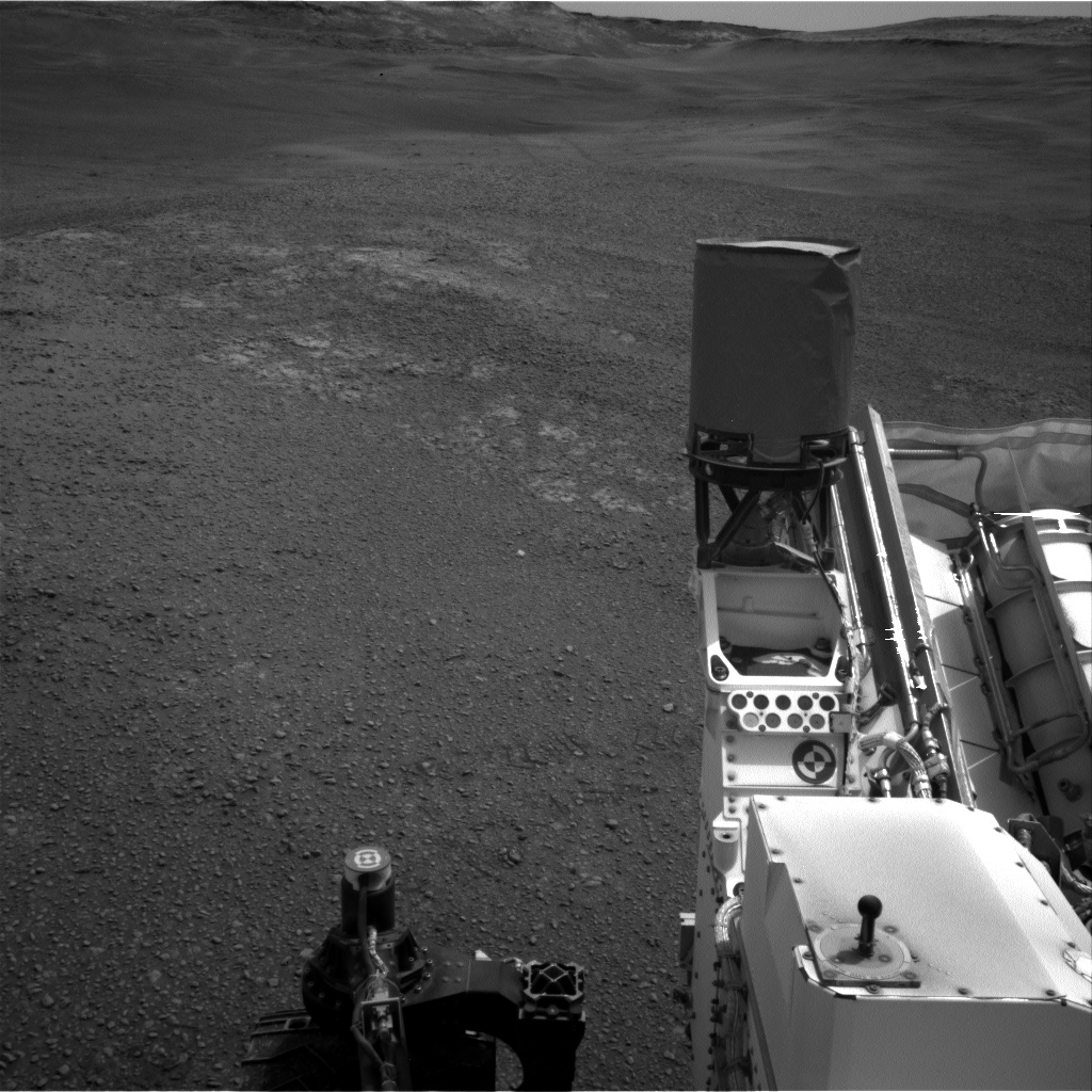
Curiosity Mars Hand Lens Imager (MAHLI) produced on Sol 2316, February 10, 2019. MAHLI, located on the turret at the end of the rover’s robotic arm.
Credit: NASA/JPL-Caltech/MSSS
“Now that the regional dust event has declined,” Schwenzer points out, “we are seeing an uptick in dust devils!”
A rover drive is targeted towards a small outcrop – the largest piece of continuous rock so far seen in the new terrain.
“Go, Curiosity, geo-minded Earthlings will love to get close and personal to an outcrop soon again!,” Schwenzer concludes.
Credit: NASA/JPL-Caltech/Univ. of Arizona
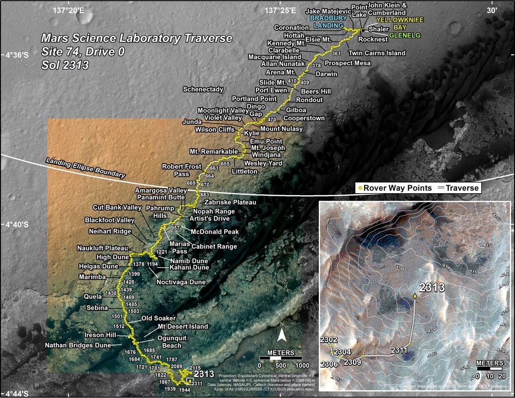
New road map
Meanwhile, a new Curiosity traverse map through Sol 2313 has been issued.
The map shows the route driven by NASA’s Mars rover Curiosity through the 2313 Martian day, or sol, of the rover’s mission on Mars (February 08, 2019).
Numbering of the dots along the line indicate the sol number of each drive. North is up. The scale bar is 1 kilometer (~0.62 mile).
From Sol 2311 to Sol 2313, Curiosity had driven a straight line distance of about 127.94 feet (38.99 meters), bringing the rover’s total odometry for the mission to 12.53 miles (20.16 kilometers).
The base image from the map is from the High Resolution Imaging Science Experiment Camera (HiRISE) in NASA’s Mars Reconnaissance Orbiter.

