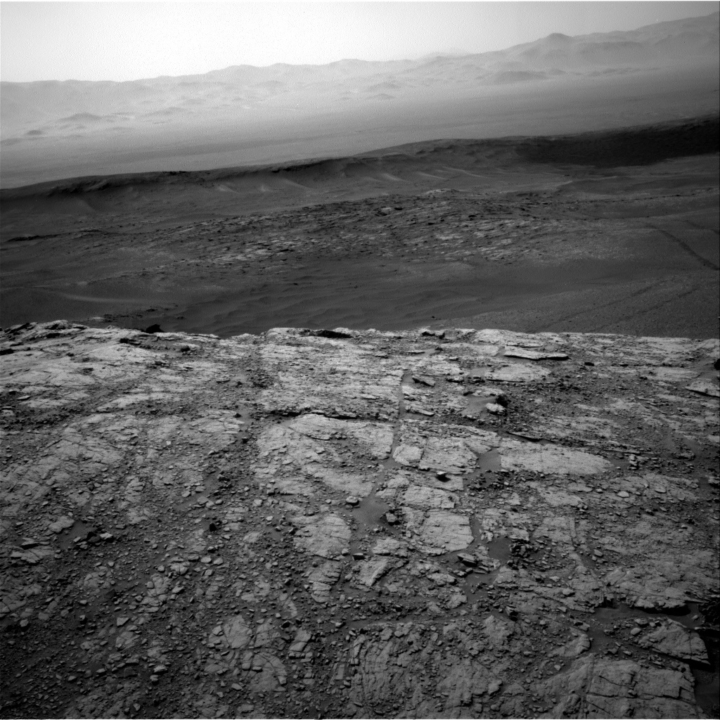
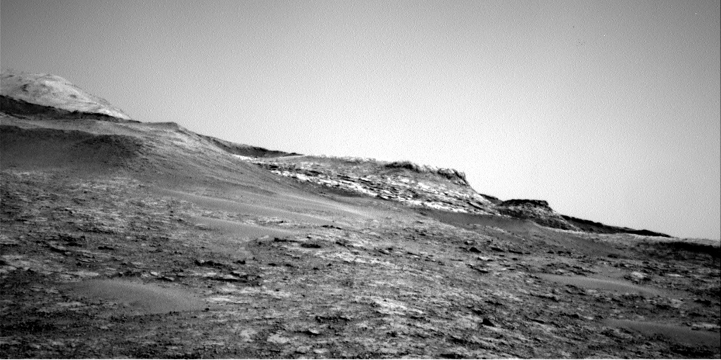
Curiosity Right Navigation Camera on Sol 2480. Several candidate drill sites have been identified, with a decision to drive to a relatively flat slab that is visible in the right portion of this image.
Credit: NASA/JPL-Caltech
NASA’s Curiosity is now carrying out Sol 2481 duties.
Reports Vivian Sun, a planetary Geologist at NASA’s Jet Propulsion Laboratory in Pasadena, California: “After a successful ascent to the top of the southern outcrop in the ‘Visionarium,’ we are now searching for our next drill site.”

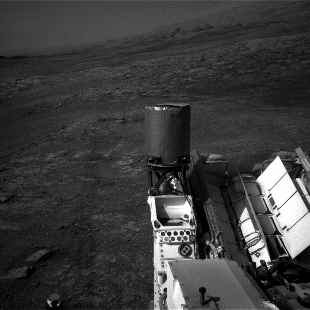
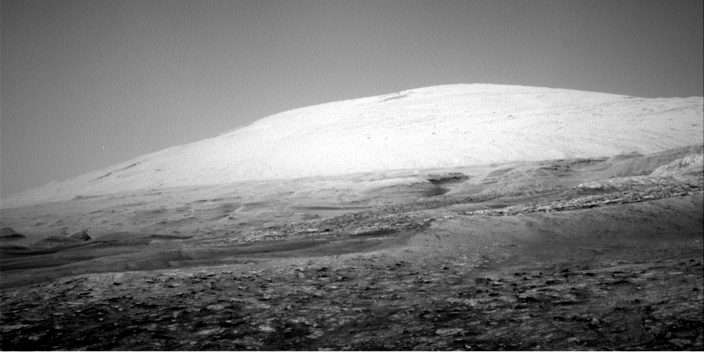
Curiosity Navcam Left B photo acquired on Sol 2480, July 29, 2019.
Credit: NASA/JPL-Caltech
Sun adds that there were no bedrock exposures available for contact science activities in Curiosity’s immediate workspace, so attention has now shifted to identify a drill site area, with the rover driving to that spot.
Drill site selection
“There are a number of factors we considered when selecting this drill site. We looked for bedrock that looked ‘in-place,’ meaning bedrock that likely has not been moved since it formed. While there can be ‘out-of-place’ rocks — or ‘float’ rocks — that are interesting, in-place bedrock can be more stable for drilling and its geologic context is simpler to interpret, Sun points out.
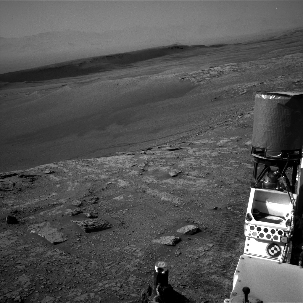
Curiosity Navcam Left B image taken on Sol 2480, July 29, 2019.
Credit: NASA/JPL-Caltech
Mars researchers have also prioritized larger bedrock exposures, as they need room to drill, discard, and analyze the sample, Sun adds. The size of the bedrock slab is even more important than usual at this location because science teams may consider drilling a second time and delivering sample for a possible Sample Analysis at Mars (SAM) Instrument Suite wet chemistry experiment.
Curiosity Navcam Right B photo taken on Sol 2480, July 29, 2019.
Credit: NASA/JPL-Caltech
“Lastly, we considered other practical constraints,” Sun continues, “like finding an area that gives us a good parking position and a level surface to drill on. Considering all of these factors, we identified several candidate sites and finally decided to drive to a relatively flat slab.”
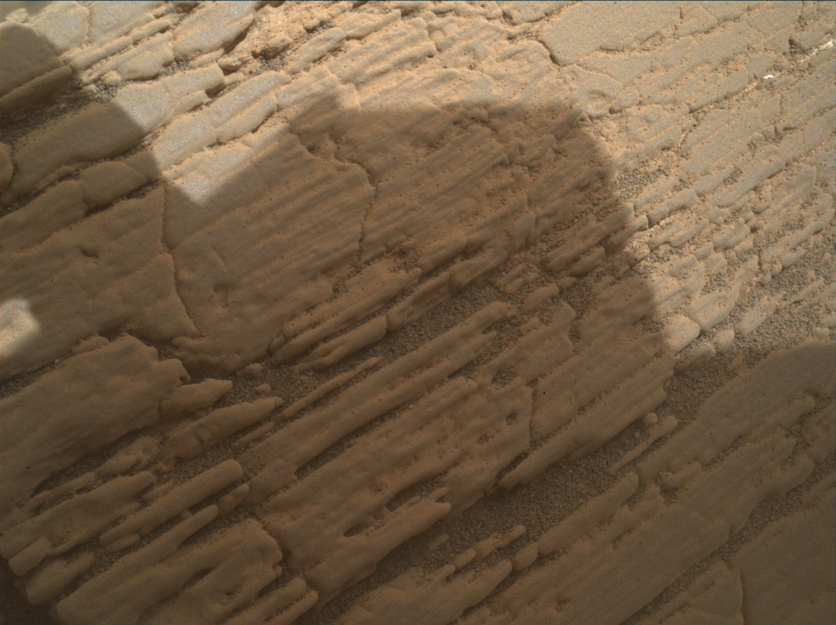
Curiosity Mars Hand Lens Imager (MAHLI) photo produced on Sol 2480, July 29, 2019.
Credit: NASA/JPL-Caltech/MSSS
Remote sensing activities
With the major drive decision out of the way, Curiosity team members then proceeded to plan the rest of the observations at the rover’s current location.
Since contact science was not on the plan, Mars researchers obtained some extra time for remote sensing activities and planned three Chemistry and Camera (ChemCam) measurements of some nearby bedrock (“Blaven,” “Glen Lyon,” “Glen Orchy”).
Curiosity Navcam Right B photo taken on Sol 2480, July 29, 2019.
Credit: NASA/JPL-Caltech
Sedimentary structures
“We also planned a large Mastcam mosaic of the bedrock exposures in front of us, dubbed the “Hebrides” region, which we imaged in the previous plan from a different angle. Imaging this area before we drive up to our drill site will help us examine sedimentary structures and provide context for our future drill sample,” Sun reports.
Curiosity Navcam Right B photo taken on Sol 2480, July 29, 2019.
Credit: NASA/JPL-Caltech
In addition to these observations, Mars team members also planned a suite of atmospheric observations including Navcam dust devil movies, crater rim extinction, and Mastcam tau observations.
“There is much to look forward to in the upcoming days,” Sun concludes, “with the start of our next drill campaign and excellent views from our future parking spot!”

Credit: NASA/JPL-Caltech/Univ. of Arizona
New road map
Curiosity has now driven 13.10 miles (21.08 kilometers) since landing on Mars in August 2012.
A newly released Curiosity traverse map through Sol 2480 shows the route driven by the robot through the 2480 Martian day, or sol.
Numbering of the dots along the line indicate the sol number of each drive. North is up. The scale bar is 1 kilometer (~0.62 mile).
From Sol 2477 to Sol 2480, Curiosity had driven a straight line distance of about 40.36 feet (12.30 meters), bringing the rover’s total odometry for the mission to 13.10 miles (21.08 kilometers).
The base image from the map is from the High Resolution Imaging Science Experiment Camera (HiRISE) in NASA’s Mars Reconnaissance Orbiter.

