Archive for the ‘Space News’ Category
 Author:
  June 4th, 2024
Image credit: SpaceX
The Federal Aviation Administration (FAA) has approved a license authorization for SpaceX Starship Flight 4.
“SpaceX met all safety and other licensing requirements for this test flight,” explains an FAA statement.
SpaceX has been eying a June 6 liftoff of the next Starship test flight.
For SpaceX details regarding the test flight, go to:
https://www.spacex.com/launches/mission/?missionId=starship-flight-4
As part of a request for license modification, SpaceX proposed three scenarios involving the Starship entry that would not require an investigation in the event of the loss of the vehicle.

SpaceX/Inside Outer Space screengrab
Scenarios
The FAA approved the scenarios, but if a different anomaly occurs with the Starship vehicle an investigation may be warranted as well as if an anomaly occurs with the Super Heavy booster rocket.
In addition, the FAA approved the mission profile that included a controlled and uncontrolled entry of the Starship vehicle.
If SpaceX chooses to execute an uncontrolled entry, the FAA statement explains, the company must communicate that decision to the FAA prior to launch.

Image credit: SpaceX
“As such, the loss of the Starship vehicle would be considered a planned event and an investigation will not be required,” concludes the FAA statement.
For details about the modifications and licensing go to:
 Posted in

Chang’e-6 lander/ascender image from the Moon’s far side.
Image credit: CNSA/CLEP
China’s Chang’e-6 lunar lander mission has lobbed far side snag and stash specimens into orbit around the Moon. The lander served as a temporary “launching pad.”
A 3,000-newton engine worked for about six minutes, pushing the ascender with its cache of lunar materials into lunar orbit.
If all continues on schedule, Chang’e-6’s ascender craft will carry out an autonomous rendezvous and docking with the mission’s orbiter-returner on Friday. After orbiting the Moon for around 14 days, the orbiter-returner combination will shove off on a Moon-Earth transfer orbit.
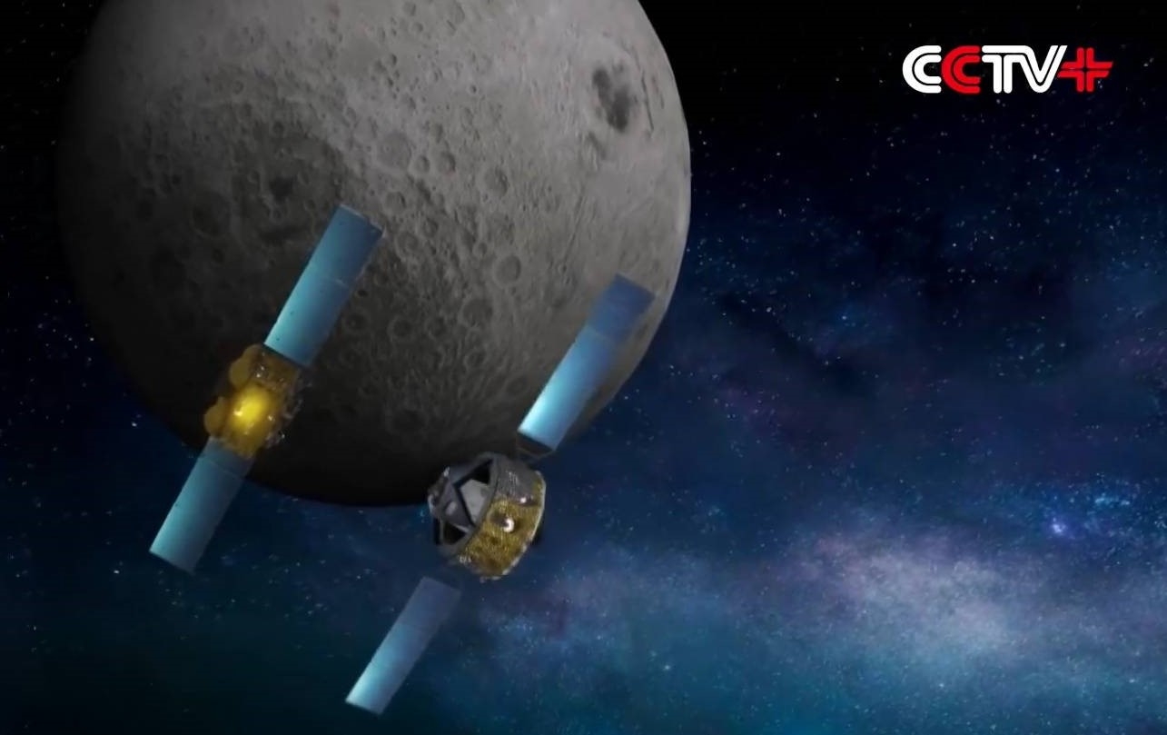
Ascender rendezvous and docking with returner craft for transfer of lunar samples.
Image credit: CNAS/CCTV
Mini-rover
The Chang’e-6 lander-ascender combination, separated from the orbiter-returner combination on May 30, touched down in the South Pole-Aitken (SPA) Basin on June 2.
From a post-landing panoramic image, the landing area was shown to be very flat.
“Looking into the distance, we can see some mountains, which are the edges of circular craters in the Apollo Basin located beyond the lunar surface,” said Ren Xin, researcher of the National Astronomical Observatories.
During sampling, the spacecraft adopted two methods of lunar far side sampling, including using a drill to collect subsurface samples, which lasted for about three hours, and grabbing samples on the surface with a robotic arm.

Mini-rover images Chang’e-6 lander/ascender.
Image credit: CNSA/CLEP
While not highlighted by China media, a mini-rover was deployed from the lander/ascender, a wheeled Wi-Fi-capable companion that imaged the scene before the lunar specimens were rocketed off the Moon.
This capability was showcased during China’s Zhurong Mars rover mission in 2021. Early in the mission, the rover deployed a Wi-Fi device that captured via an image the Red Planet lander and Zhurong rover positioned side-by-side.

Chang’e-6 pre-launch look with wheeled rover (left) attached.
Image credit: CNSA/CCTV/Inside Outer Space screengrab
Challenge ahead
Duan Chenglin from the Beijing Aerospace Control Center told China Central Television (CCTV) that the upcoming rendezvous and docking in Moon orbit of the ascender and returner craft is challenging.
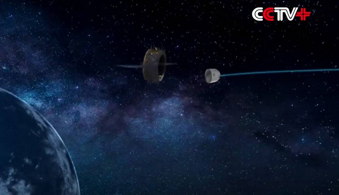
Returner craft lets loose the sample container for landing on Earth.
Image credit: CNSA/CCTV
“Rendezvous and docking processes for the space station are very different from those in lunar orbits,” Duan said. The rendezvous and docking of Chang’e-6’s ascender with the orbiter-returner combination in lunar orbit “will be subject to limited capabilities of ground system, short window period for entering the Moon-Earth transfer orbit, as well as limited energy and sunlight, so it must be completed within the planned time.”
Duan added that if the first rendezvous and docking fail, to reverse it for a second try will be highly likely to risk the missing of the window for returning from the moon to Earth, with the returner never being able to come back.”
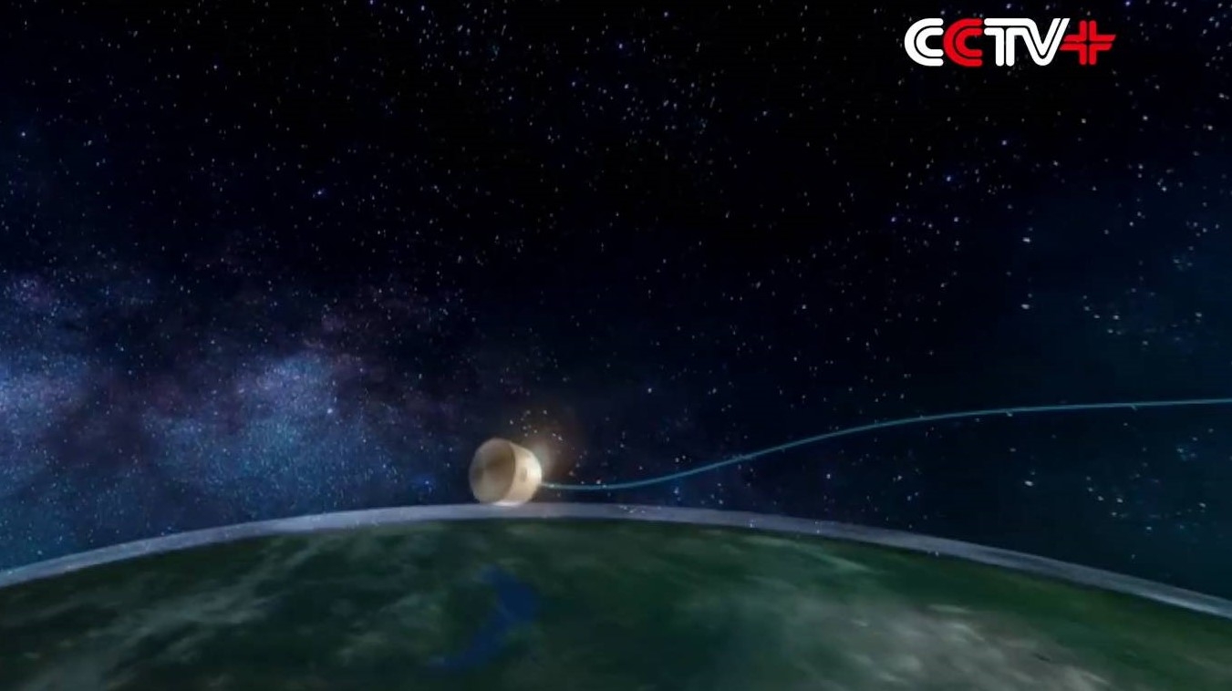
Capsule begins atmospheric re-entry.
Image credit: CNSA/CCTV
Back to Earth
Given success of rendezvous and docking, the Chang’e-6 probe’s ascender will transfer the samples to the returner, which will then bring the samples back to Earth.
After one to three corrections in about five days, the combination will reach a position above the Earth, where the returner will separate from the orbiter and start the phase of re-entering the atmosphere and returning to Earth.

Taking the heat as capsule maneuvers ever-deeper into Earth’s atmosphere before parachute touchdown.
Image credit: CNSA/CCTV
A capsule carrying the far side specimens will touchdown at a landing area at Siziwang Banner in the Inner Mongolia Autonomous Region.
Parachuting to Earth, that touchdown will mark the end of the Chang’e-6’s 53-day journey of flying to the Moon and back.
Go to this informative video at:
https://www.facebook.com/NewsContent.CCTVPLUS/videos/817958543594501

Puzzle pieces.
Image credit: Leonard David
New revelations have come to light regarding “Project” Moon Dust, long known by Freedom of Information investigators as a clandestine U.S. Air Force operation to retrieve leftovers associated with re-entered objects.
Over the decades, for example, hardware from Soviet Union space missions was recovered for intensive study by specialized teams, items collected by U.S. or U.S. allies under the name “Moon Dust.”

The newly-issued documents were made available by the “Government Attic” website, a site that posts electronic copies of Federal Government documents obtained under the Freedom of Information Act.

Example of recovered space clutter in Indonesia, identified as part of a Russian Soyuz A-2 rocket. Not from Moon Dust documents (shown as example of types of hardware that survive re-entry).
Image credit: Thomas Djamaluddin
Delicate issue
Posted June 3 on Government Attic as “Department of State (DOS) Communications Regarding Recovery of Deorbited Space Debris (Moon Dust), 1967-1972,” the released collection offers an eyeful.
The just declassified communiqués underscore that recovered space objects from non-U.S. launching states were considered a “delicate issue” and pieces recovered were of great interest, as they can be exploited to provide valuable information on inspection.
For example, there’s chasing down Soviet Union rocket bodies associated with Cosmos 208 in Nepal, recovering spheres two feet in diameter in Mexico, and Moon Dust individuals working with New Zealand officials to gather up fallen space clutter.

Signing of Outer Space Treaty.
Image credit: United Nations
U.S. mid-west fragments
In one message, there is pro/con deliberation about negotiations on the Outer Space Liability Convention at the United Nations that were in the final phase and what actions to take due to a fall of fragments from a Soviet satellite within the United States.
On August 28, 1970, a number of fragments from the Soviet satellite Cosmos 316 peppered a wide section of the U.S. mid-west – Oklahoma, Kansas, and Texas.
“The Department of State has physical custody of the Soviet space fragments, one document points out, “the largest of which is roughly a square, 4 ft by 4 ft, weighing 640 lbs.”
Additionally, “the Soviet Union was provided a full physical description of the fragments and invited to claim them if inspection confirmed Soviet origin. Soviet Embassy officers declined either to inspect or claim the fragments.”

The Soyuz 11 crew of Georgi T. Dobrovolski, left, Viktor I. Patsayev, and Vladislav N. Volkov in a Soyuz simulator. Image credit: courtesy of RKK Energia
In the once secret report, it explains that “if additional fragments are recovered which are suspected to have come from Cosmos 316, all of the fragments may be assembled and used for an appropriate time in further intelligence evaluations.”
Death of soviet cosmonauts
From an Intelligence Information Report under the Directorate of Intelligence, the declassified document discusses the 1971 death of Soyuz-11 cosmonauts “prior to reentry.”
This report explains that, “contrary to widespread popular belief,” the crew were dead before their vehicle reentered the Earth’s atmosphere. Electrocardiographic telemetry “indicated that the three cosmonaut’s hearts had stopped before the reentry procedure was begun.”
Cited in the report as the “fairly probable” cause for the accident was “some type of leakage from the spacecraft of which they were completely unaware.”
Furthermore, the deaths served to trigger the belated realization by Soviet space engineers, the report states, “that their pursuit of mission objectives has dangerously outstripped their design engineering.”
Rummaging through the government attic
As for governmentattic.org, it provides “electronic copies of thousands of interesting Federal Government documents obtained under the Freedom of Information Act. Fascinating historical documents, reports on items in the news, oddities and fun stuff and government bloopers, they’re all here. Think of browsing this site as rummaging through the Government’s Attic — hence our name,” the group’s website explains.
To cast your eyes on the “Department of State (DOS) Communications Regarding Recovery of Deorbited Space Debris (Moon Dust), 1967-1972” go to:
https://www.governmentattic.org/54docs/ProjMoondust1967-1972.pdf
Image credit: CNSA/CLEP
Image credit: CNSA/CLEP

Artwork depicts China’s Change’-6 lander/ascender on the Moon.
Image credit: CNSA
In a “groundbreaking” mission, China’s Chang’e-6 Moon lander wrapped up two days of drilling and scooping at its far side lunar landing spot.
The 8.35-metric-ton, multi-pronged Chang’e-6 mission involves an orbiter, a returner, a lander, and an ascender, built by the Beijing-based China Academy of Space Technology, a subsidiary of China Aerospace Science and Technology Corporation (CASC).
Given successful stowage of the lunar collectibles onboard the lander/ascender, the mission’s ascender rocketed off the lunar surface, headed for a rendezvous with the mission orbiter circling the Moon.
Prior to the ascent vehicle departure with its cache of collectibles, a small rover (with a wifi camera), traversed away from the lander, taking a photo of the lander + ascent vehicle combination.
If all goes well, a June 25 return capsule stuffed with the assortment of samples will parachute to Earth.

Image credit: CCTV/Inside Outer Space screengrab
Sealed for sendoff
The Chang’e-6 probe touched down at roughly 06:23 (Beijing Time) Sunday in the South Pole-Aitken (SPA) Basin.
The Chang’e-6 spacecraft departed the southern Chinese island province of Hainan on May 3, starting a projected 53-day mission to collect and bring back samples from the Moon’s far side.
As planned, the lander/ascender used a robotic arm and a drill to collect surface and underground substances. They were then placed in a container that was sealed for sendoff into lunar orbit, slated for transfer into a returner craft for the trek to Earth.
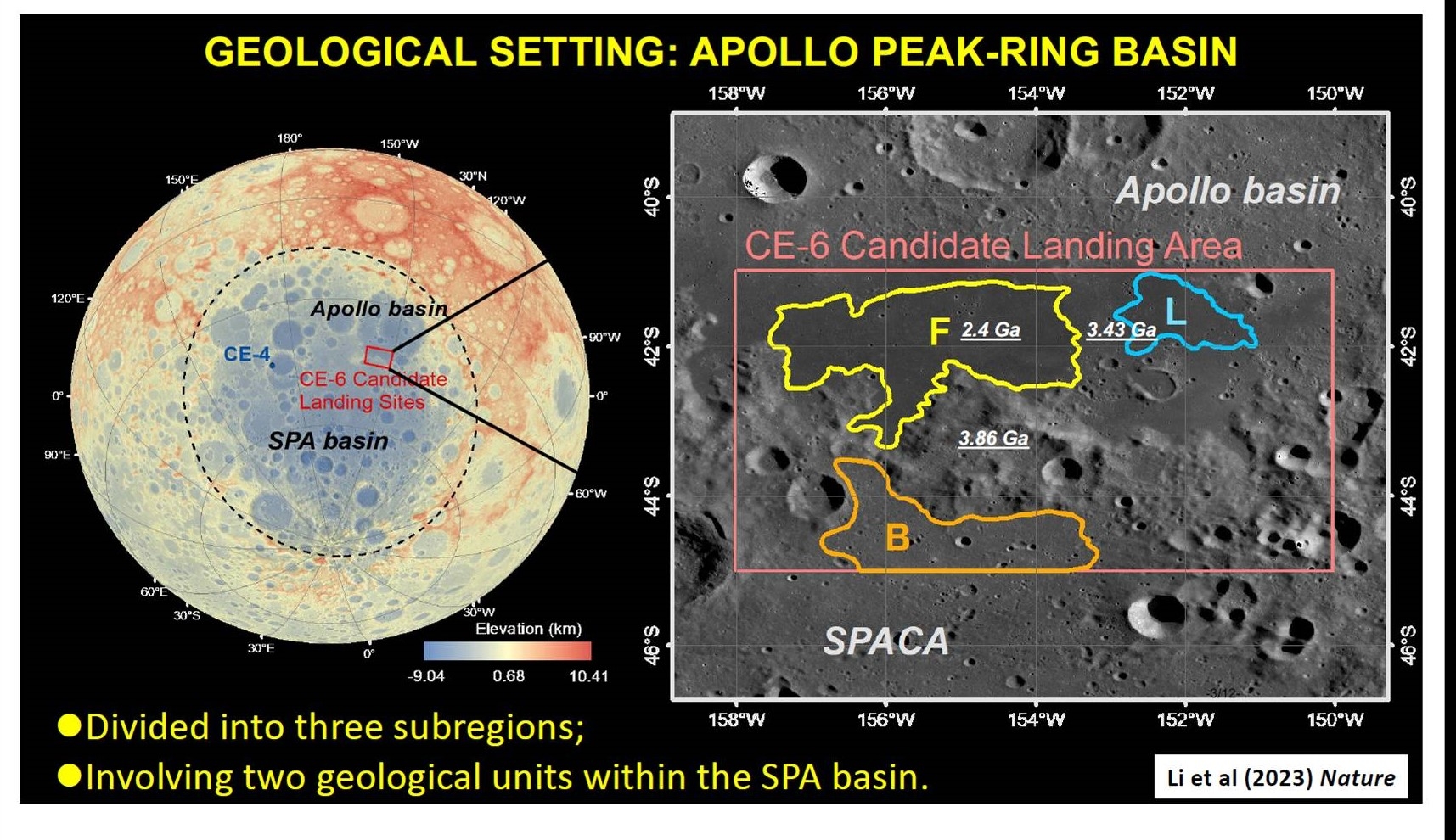
Image credit: James Head
According to Li Chunlai, deputy chief designer of the Chang’e-6 mission, the lander/ascender combination touched down precisely at the designated area, a locale likely to be basalt-rich and of important scientific value in unraveling the Moon’s past.
Simulation lab
Jin Shengyi from the CASC explained to Chinese media outlets that the Chang’e-6 probe development team has built a simulation lab to ensure a smooth sampling process.
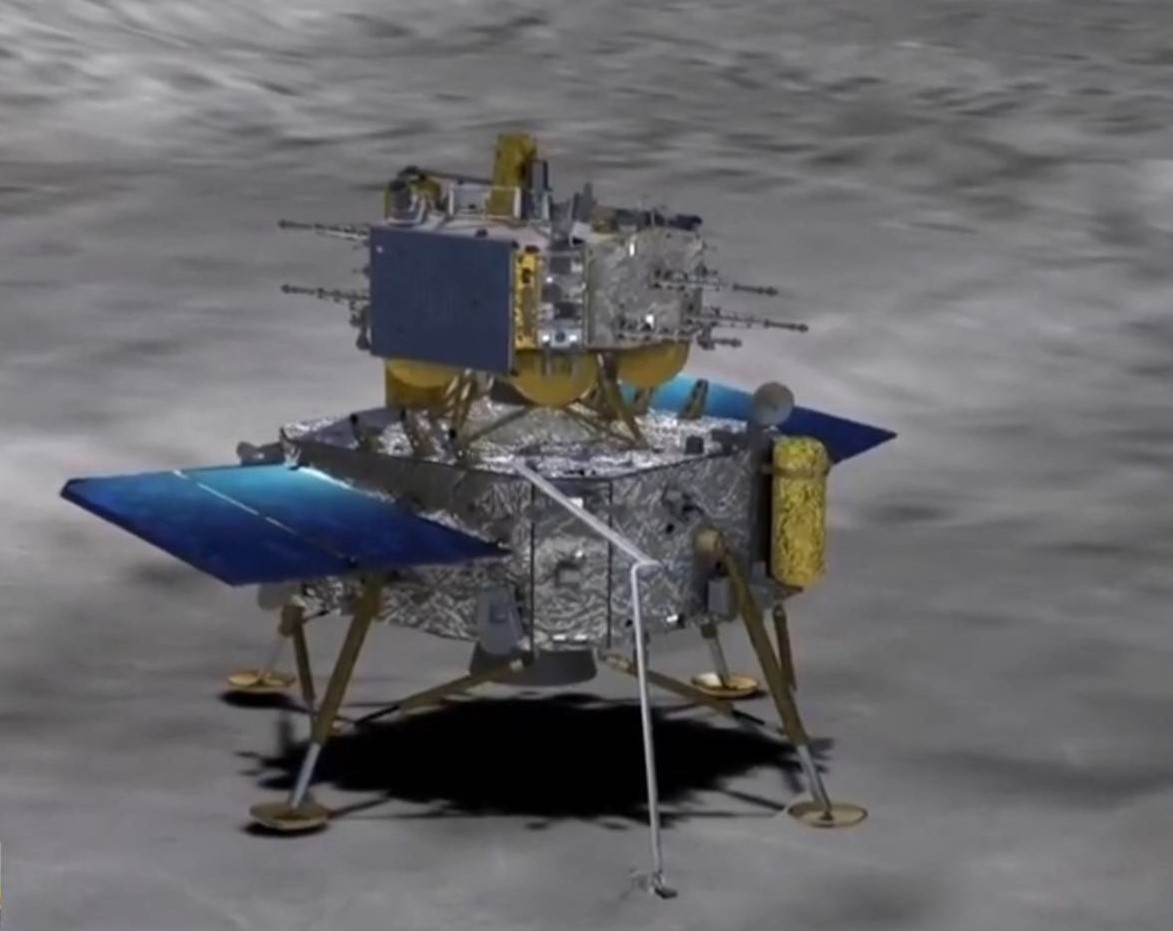
Artwork credit: CNSA/CCTV
A full-scale replica of the sampling area in view of the Chang’e-6 lander/ascender reportedly mimics rock distribution, and lunar soil conditions around the landing site. The simulated site here on Earth is geared to develop and verify sampling strategies and equipment control procedures.
Even with China’s Queqiao-2 relay satellite service, the far side sampling time of Chang’e-6 is reduced to about 14 hours, contrasted with the 22 hours used by its predecessor, China’s Chang’e-5 Moon sampling mission in the winter of 2020.

Image taken during 2020 mission of Chang’e-5 lunar sample project. Image credit: CNSA/CLEP
Chang’e-5 landed on the Moon’s near side and gathered 1,731 grams of samples, the first lunar substances obtained since NASA’s Apollo missions to the Moon by astronauts ended in December 1972.
China is the third nation, after the former Soviet Union and United States, to have brought back to Earth collected lunar specimens.
Autonomous, onboard intelligence
The sampling process utilized by Chang’e-6 involved autonomous, onboard intelligence and relyed on real-time data collected by lander/ascender sensors – thereby reducing Earth-Moon control interaction and instruction.
Soon after the Chang’e-6 touchdown, the craft’s solar panels and directional antennas unfolded, initial checks and setup were performed, followed by operation of lunar sampling hardware.
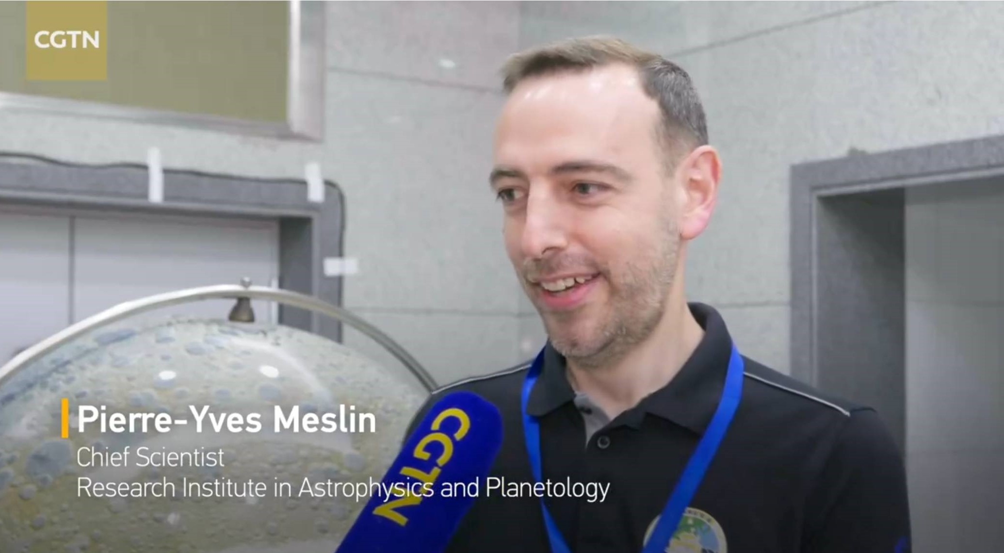
Image credit: CGTN/Inside Outer Space screengrab
European experiments
Meanwhile, also turned on were two European scientific experiments carried by the Chang’e-6 landing craft — a radon-measuring instrument from France’s national space agency and a dedicated negative ion instrument developed by the Swedish Institute of Space Physics with support from the European Space Agency.
The Detection of Outgassing RadoN (DORN) was developed by French scientists. It will detect radon isotopes and study the transmission and diffusion mechanisms of volatile compounds in the lunar environment.
Witnessing the progress of the Chang’e-6 mission in Beijing was Pierre-Yves Meslin, principal investigator of DORN from France. This first time measurement is expected to advise researchers on how radon might move from warm to cold regions of the Moon.
Artwork depicts China’s Change’-6 lander/ascender on the Moon.
Image credit: CNSA
China’s Chang’e-6 lunar mission has carried out a successful far side touchdown and is already busily gathering specimens for send-off to Earth.
The first batch of data has been relayed from the Chang’e-6 lander-ascender combination following its arrival on Sunday morning (Beijing Time).
The landing was aided by China’s newly positioned Queqiao-2 relay satellite to provide a stable communications link to mission controllers on Earth.

Image credit: CCTV/CLEP/Inside Outer Space screengrab

Image credit: CCTV/CLEP/Inside Outer Space screengrab

Engine interaction with lunar surface. Image credit: CCTV/CLEP/Inside Outer Space screengrab
Chang’e-6’s lander-ascender combination soft landed in the South Pole-Aitken (SPA) Basin, at an impact crater known as the Apollo Basin, located within the SPA Basin.
Landing process
A six-stage landing process enabled the craft’s soft landing: deceleration, quick adjustment, approaching, hovering, obstacle evasion and slow descending. Collectively, those stages spanned about a 900 second time period.
Deceleration happened at roughly 10 miles (15 kilometers) from the lunar surface, with the probe adjusting its angle, making it nearly perpendicular to the surface.
During the descent, an autonomous visual obstacle avoidance system was used to automatically detect obstacles, with a visible light camera selecting a comparatively safe landing area based on the brightness and darkness of the lunar surface.

Image credit: James Head
Obstacle avoidance
When reaching within two to three kilometers from the lunar surface, the probe entered the approaching stage and its optical sensors began scanning the landing area for obstacles.
The probe then entered a hovering stage when descending ever-closer to the Moon, with sensors working to scan the surface and quickly select a suitable space where all four of its legs would land on an even surface while evading obstacles.

Li Xiaoning. Image credit: CCTV/Inside Outer Space screengrab
At under a 100 feet (30 meters) altitude above the lunar surface, the probe entered its final landing stage, with its descending speed reduced to 4.5 miles per hour (two meters per second) until making the soft landing.
“So far, the entire Moon landing process is very smooth and successful. The power descent control is relatively accurate, while the relay link is uninterrupted. And the landing is smooth and steady. The ideal landing location creates a favorable environment for subsequent lunar sample collection,” said Li Xiaoning, an engineer from the Beijing Aerospace Control Center during a China Central Television (CCTV) interview.
China space watcher, Seger YU, suggests on X (formerly Twitter) that the Chang’e-6 landing point is located northeast of a pre-selected landing point, about 10 miles (16.7 kilometers) away.

Image credit: CNSA
Rapid sampling
China space officials have noted that the Change’-6 mission aims to realize key technologies of intelligent and rapid sampling, as well as takeoff and ascent from the far side of the Moon.
“The mission is quite tough, primarily due to the need to establish relay communications between the Earth and the far side of the Moon,” Li said. “We launched the Queqiao-2 relay satellite in the early stages, providing the necessary communications support for soft landing and sampling on the far side.”

Ge Ping, deputy director, Lunar Exploration and Space Engineering Center, China National Space Administration.
Image credit: CCTV/Inside Outer Space screengrab
Added Ge Ping, deputy director of the Lunar Exploration and Space Engineering Center under the China National Space Administration (CNSA): “We adopted rapid intelligent sampling and take-off and ascent from the Moon’s surface, which have laid a solid foundation for technologies, such as soft landing and sampling on extraterrestrial bodies.”
It is anticipated that by honing those skills they will be mirrored by China’s Mars sample return initiative in the comings years.

Image credit: Xingguo Zeng, et al.
Substantial challenge
Now busily at work, the Chang’e-6 lander is slated to finish lunar sampling tasks within two days. To do so, the spacecraft has two methods of lunar sampling: a drill to snag subsurface samples and grabbing samples on the surface with a robotic arm.
The landing site within the SPA Basin is expected to yield unique scientific data; the far side has been subjected to a longer history of impacts, indicating an older geological age for in-depth exploration. Also, the landing area – and flatness of the landscape — offers communications and telemetry conditions to execute the mission.

Ye Peijian, an academician of the Chinese Academy of Sciences.
Image credit: CCTV/Inside Outer Space screengrab
“It’s the first time in human history to retrieve lunar samples from the far side of the Moon,” Ye Peijian, an academician of the Chinese Academy of Sciences told CCTV.
“If Chinese scientists succeed in obtaining lunar regolith samples from the far side, there will be numerous technological achievements. This represents a significant advancement for us, but also poses a substantial challenge,” Ye added.

Image credit: CCTV/Inside Outer Space
Landing/sampling area
Chang’e-6 carries instruments to facilitate scientific research.
Zuo Wei, chief engineer of the Chang’e-6 mission, told CCTV one of that trio of instruments is the foreground camera, which captures high-definition images of the landing and sampling areas.
Another is the mineral spectral analysis instrument, Zuo said, which obtains spectral data at the sampling area to aid in analyzing the mineral composition there.
Another instrument is the structural detector, installed at the bottom of the lander, which detects the structure of the soil beneath the Moon’s surface and provides information for further drilling and sampling procedures, Zuo explained.

Image credit: CCTV/Inside Outer Space screengrab

Image credit: CCTV/Inside Outer Space screengrab

Image credit: CCTV/Inside Outer Space screengrab
International payloads
Also onboard the lander are several international payloads including a detector from France, a lunar surface negative ion analyzer from the European Space Agency (ESA) and a laser angle reflector from Italy.
As the first French-made instrument to land on the moon, the Detection of Outgassing RadoN (DORN) is dedicated to measuring the radioactive gas of radon on the moon’s surface.
The lunar surface negative ion analyzer developed by the ESA/Sweden will be used to detect negative ions and study the interaction between plasma and the lunar surface.
The laser retro-reflector developed by Italian scientists will be used for positioning and distance measurement in future lunar missions.

Pakistan ICUBE-Q. Image credit: CCTV/Inside Outer Space screengrab
In addition to scientific instruments from European countries, the probe also carried a cube satellite from Pakistan known as ICUBE-Q, which separated from the Chang’e-6 orbiter on May 8 to carry out exploration activities, such as capturing images of the Moon.
“Samples into our pocket”
The multi-component Chang’e-6 mission consists of an orbiter, a returner, a lander and an ascender.
Since the mission’s departure from China on May 3 it has carried out Earth-moon transfer, near-moon braking, lunar orbiting and landing descent. The lander-ascender combination separated from the orbiter-returner combination on May 30, said the China National Space Agency (CNSA).
“The drilling and collecting work are reaching an end,” advised Ren Depeng, a space expert from the China Aerospace Science and Technology Corporation (CASC).
“Now we have samples and the last action is to put the samples into our pocket. We can say that the drilling and collecting are progressing smoothly,” Ren told CCTV.

Image credit: Ascender (right) reaches orbiter to enable return of lunar samples.
Image credit: CGTN/Inside Outer Space screengrab
Moon-to-Earth journey
Following Chang’e-6’s drilling and sample collection duties, the probe will seal all the samples off before the ascender performs take-off preparations.
Ren added that the ascender will then blast off from the Moon’s surface, connect with the returner combination that has been waiting in orbit and transfer those collected samples into the returner combination.
That combination is set to conduct a Moon-to-Earth journey and return the specimens to the Earth under parachute, now eyeing a June 25 (Beijing Time) targeted landing.

Photo taking during Chang’e-5 surface sampling.
Credit: CCTV/Inside Outer Space screengrab
With samples on Earth, they will be transferred to a lunar receiving lab in Beijing for examination. The far side specimens are to be described and documented, prior to publication of a Chang’e-6 sample catalog.
The Chang’e-6 mission profile is essentially identical to China’s Chang’e-5 robotic Moon mission in late 2020. That earlier effort returned 1,731 grams of lunar materials from Northern Oceanus Procellarum near a huge volcanic complex, Mons Rümker, located in the northwest lunar near side.
Spectacular accomplishment
According to Jim Head, a lunar exploration authority at Brown University, the Chang’e-6 landing and sampling operations represent a spectacular accomplishment.
Head pointed out that China, with its earlier Chang’e-4 mission, demonstrated the first successful landing on the farside of the Moon, followed immediately by surface operations with the deployed Yutu-2 rover.

Yutu-2 rover as imaged by Chang’e-4 lander earlier in its far side mission.
Credit: CNSA/CLEP
The Chang’e-4 mission accomplished two very difficult tasks five years ago in 2019, Head said, with the help of the Queqiao-1 farside relay satellite.
“Now, with the help of the new Queqiao-2 far side communication satellite, China has successfully landed a sample return spacecraft, Chang’e-6, in the Apollo basin within the huge South Pole-Aitken basin, an area of intense scientific interest and importance,” Head told Inside Outer Space.
Mission critical steps
Successful return and analysis of these samples, currently undergoing collection and stowage, Head said, “will help to address age-old fundamental questions about the many differences between the lunar near side and far side, and what they mean about the origin and evolution of the Moon.”
The return of lunar samples from the nearside of the Moon by China’s Chang’e-5 mission in 2020, now followed by the successful landing on the lunar far side by the Chang’e-6 sample return mission, helps to orchestrate future projects, Head advised.
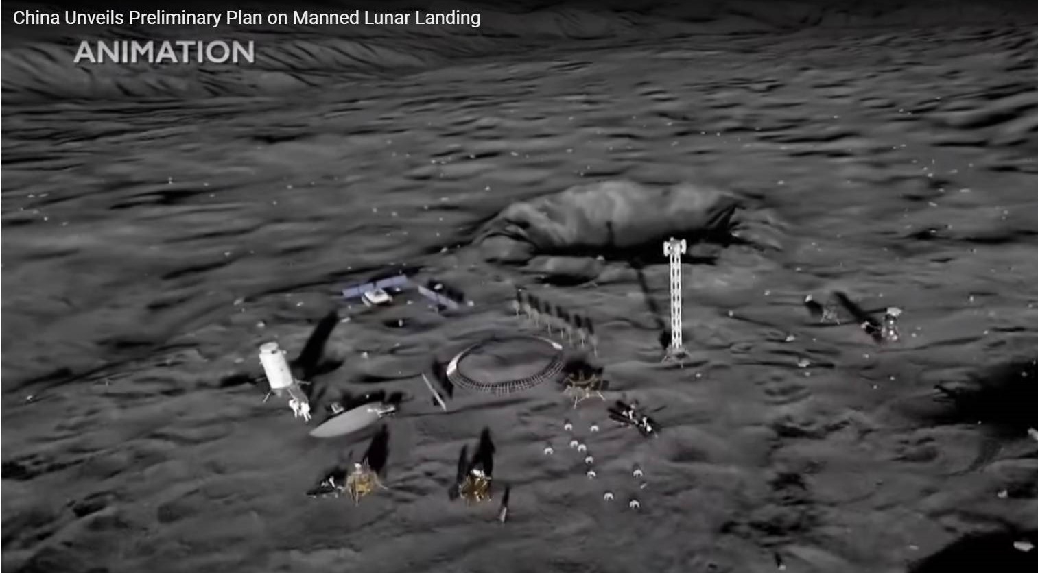
Artist’s view of International Lunar Research Station to be completed by 2035. Credit: CNSA
“It’s clearly very important practice for Chinese engineers and operations personnel, as each step of these missions duplicates important and mission-critical steps in the Chinese plans to land taikonauts on the Moon and robotically return samples from Mars,” Head said.
Go to these informative videos spotlighting the Chang’e-6 Moon landing (including a sampling of music, Blue Danube by Strauss:

Image credit: The Aerospace Corporation
Attention air travelers. After all that huffing and puffing, trying to get to the terminal departure gate on time, here’s another worry.
With your legs finally airworthy, up and tightly locked in the up position, make sure you’re at a window seat. That way you can keep an eye out for incoming space junk that could make your arrival, perhaps, destination doubtful.
Here’s a point to ponder: As the numbers of rocket launches and commercial aircraft flights increase, the probability of a catastrophic collision between an aircraft and reentering space debris is also growing.
That’s one of the highlights from new research led by Charlotte Hook of the Department of Political Science, University of British Columbia in Vancouver, British Columbia, Canada.
Growing risk
Hook told Inside Outer Space that there is a growing risk to aircraft from space debris as both airplane flights and uncontrolled reentries of space debris increase.
“It is forecast that there will be over 40 million flights in 2024 – a new record – and it is likely rocket launches will beat 2023’s record of 212 successful launches,” Hook said. “A piece of space debris as small as 300 grams can take down a plane. This risk is increasing by the growth of both industries.”
Hook points out that in 2022 an uncontrolled space debris reentry caused a combined 309 hours of delays in Europe after flights were grounded to avoid possible debris. “Spacefaring states could be liable for economic costs to airlines under international law.”
This risk to aircraft is entirely preventable, Hook contends, as the technology for controlled reentries exists. “Space companies don’t want to fork out the money to use controlled reentries and are instead exporting this risk onto airlines and passengers. States should mandate controlled reentries before an accident occurs, as recommended in the 2023 Montreal Recommendations.”

Confirmed SpaceX debris found in Australia.
Photo courtesy: Brad Tucker
Leaving re-entry to chance
Before there is a tragedy caused by an aircraft collision with debris from a rocket body or satellite, there are some items to consider, explains Hook and fellow researchers in their newly issued research paper.
- International and domestic laws that now exist might enable the recovery of economic losses resulting from uncontrolled reentries, but such losses should not be allowed to occur in the first place.
- Instead of leaving the location of a re-entry to chance, controlled reentries can be achieved with existing technologies and mission designs, directing reentries away from areas of high aircraft traffic.
- Moving to a controlled reentry regime would create a cost to space operators – but that cost is currently being externalized to the aviation industry.
- Multilateral solutions to create a controlled reentry regime should be pursued, as recommended in the 2023 Montreal Recommendations on Aviation Safety and Uncontrolled Space Object Reentries.
Operational hazard
In making their case, Hook and colleagues explain that in 1968, an uncontrolled rocket body used to launch the then Soviet Union’s Cosmos 253 satellite passed over the United Kingdom as it reentered the atmosphere.

Taking the fall. Space hardware dives into Earth’s atmosphere with some fragments possibly making their way to the ground.
Image credit: ESA/D.Ducros
There were over 80 observations of the reentering object reported. Two of those accounts came from pilots of passenger aircraft in flight, with most of the surviving debris landed in the English Channel. Nonetheless, it was observed at the time that the debris created “a small but not entirely negligible hazard to aircraft.”
The paper adds that, although there have been no verified collisions between aircraft and space debris, “aircraft at cruising altitudes have been damaged by collisions with unidentified objects. There have also been reports of space debris falling in the proximity of air operations, and in November 2022, airspace over southern Europe was closed for up to an hour to reduce the risk from a reentering rocket body.”
Moreover, the research team adds that there is an “underappreciated operational hazard” from uncontrolled space object reentries.
Space Shuttle Columbia
Hook and colleagues in the paper also focused on the tragic Space Shuttle Columbia disaster in 2003, tragically killing all seven astronauts on board during re-entry back to the Kennedy Space Center in Florida.

Space Shuttle Columbia debris, looking down the line of identified main fuselage fragments located on the grid system in the hangar.
Image Credit: Columbia Accident Investigation Board (CAIB)
“Aircraft in the area were not informed of the unfolding risk and at least nine of them flew through the resulting debris field for 40 minutes,” the paper points out.
“Although none was struck, an investigation later found that they had been subject to a risk of collision between 0.3 and 10%,” the research paper flags, “with the calamity later described as a “watershed moment for reentry safety.”
Highly worthy of attention
As for solutions, the paper observes that the risk posed to aircraft by uncontrolled reentries is highly worthy of attention.
“The aviation industry faces the possible loss of an aircraft, its crew, and passengers, as well as the near certainty of economic losses associated with precautionary closures of airspace. It therefore has an interest in seeing a move away from uncontrolled reentries. For many space companies, however, uncontrolled reentries remain a low-cost means of disposing of rocket bodies and satellites.”
For access to “Uncontrolled Reentries of Space Objects and Aviation Safety” in the pages of the Acta Astronautica journal, go to:

Image credit: Nicolas Sarter/Université Paris Cité/CNRS
A detailed look at both orbital and seismological data gathered at Mars point to a clear increase in the number of dust avalanches around the epicenters of two “Marsquakes.”
The seismic events were recorded during the NASA InSight lander mission to the Red Planet that performed duties at Elysium Planitia from May 2018 to the end of 2022.
“The first seismic event was caused by an impactor hitting the Martian surface. The second seismic event was the largest marsquake ever recorded. This finding sheds light on how endogenous and exogenous processes can currently shape the surface of Mars and trigger active mass wasting.”
The research findings have been reported by Antoine Lucas, a research scientist at the Institut de physique du globe de Paris in France.
Meteorite impact
Lucas and colleagues explain that the first seismic event under investigation, named S1000a, occurred on September 18, 2021. At that time, a meteorite impact led to a seismic signal registering a local Martian magnitude of 4.1, resulting in the formation of a crater approximately 500 feet (150 meters) in diameter.
A comparison of before and after orbital images of the area reveals a massive increase in new dust avalanches within a 12 mile (20 kilometers) radius of the epicenter, likely caused by intense surface acceleration and atmospheric blast. “To date, this is by far the largest number of avalanches triggered by an impact that has been spotted,” Lucas and the research team point out.

A sequence of images captured 8 months prior to S1222a and taken shortly after the marsquake.
Image credit: A. Lucas, et al.
Connection to ancient volcano?
The second seismic event, named S1222a, took place on May 4, 2022 and was the largest marsquake ever recorded. Estimated at a magnitude of 4.7, the rattle occurred near the Apollinaris volcano, with the epicenter estimated to lie at a depth of less than 12 miles (20 kilometers).
“Despite its energy being approximately 25 times greater than the S1000a impact event, orbital data reveal more gentle number of new avalanches. Nonetheless, the comparison of orbital images since 2005 with high-resolution images post-S1222a reveals a significant rise in avalanche occurrence, from 3% to 40% in certain areas, over one Martian year (equivalent to 687 Earth days).”
There are two potential interpretations of the Marsquake’s mechanism: a connection to the ancient volcano, Apollinaris Patera, although its current activity is deemed improbable. The second hypothesis posits a large geological structure — a 450 km-long ridge — as the probable seismic source, situated adjacent to the estimated epicenter location, the researchers explain.

This image shows InSight’s domed Wind and Thermal Shield that covers the Seismic Experiment for Interior Structure (SEIS) seismometer.
Image credit: NASA/JPL-Caltech
Groundwork ahead
“These findings not only lay the groundwork for future investigations into Martian seismic activity and its influence on surface and subsurface processes but also underscore the significance of surface process analysis in elucidating the mechanisms driving the Red Planet’s seismic phenomena,” the investigators conclude.
Along with the InSight recordings, data used was gleaned from the European Space Agency’s Mars Express as well as cameras aboard NASA’s Mars Reconnaissance Orbiter.
For more information, go to — “Possibly seismically triggered avalanches after the S1222a Marsquake and S1000a impact event” — at:
https://www.sciencedirect.com/science/article/abs/pii/S0019103523005213
Also, go to this animation with credits to Nicolas Sarter (illustration)/Antoine Lucas (animation), viewed at:
https://www.ipgp.fr/wp-content/uploads/2024/01/Animation_avalanche.gif

Wait-a-Minute! Image credit: Barbara David
Eye-patches on! Practice your best “grrr.” Plop down pieces of eight, doubloons and cue “Captain” Jack Sparrow!
It’s a wait-a-moment meeting. Get ready for the First Annual Space Piracy Conference, set for early next year.
The Center for the Study of Space Crime, Policy, and Governance (CSCPG) plans a two-day, invite only symposium that brings together experts prepared to review crime, piracy, and smuggling in space.
“Be among the first to discuss mitigating space crime and piracy, from the perspectives of investment, space law, space policy, intelligence, and the military,” notes the group.

Movie credit: Walt Disney Pictures/Jerry Bruckheimer Films
Risks of piracy
Asks the CSCPG: What are the risks of piracy in space and solutions to this potentially devastating economic and legal problem?
“Now is the time to start thinking and talking about mitigating the threat of piracy in space,” said Marc Feldman, Executive Director of the CSCPG. “As we like to say, and please forgive me, Leon Trotsky, but you may not be interested in space piracy, but space pirates are interested in you….”
Feldman, who has worked in the space venture sector for years, is co-author, with Hugh Taylor, of the soon-to-be published book Space Piracy: Preparing for a Criminal Crisis in Orbit.

Image credit: CSCPG/Wiley
Threat to space commerce, national security
“While crime and piracy in space are at this point largely theoretical problems, our view is that now is the time to start thinking about the issue and discussing potential solutions,” Taylor, publications director of the center, tells Inside Outer Space. “Space piracy is a threat to space commerce and national security.”
“Any serious analysis and planning process for the future of space commerce, as well as space aspects of national security, needs to consider the threat of piracy,” explains Gordon Roesler, a space system developer and retired US Navy Captain who serves as an advisor to the conference.
For more information on this event scheduled for next February, as well as the Center for the Study of Space Crime, Policy, and Governance (CSCPG), go to:

Ali Hajimiri, co-director of the Caltech Space-Based Solar Power Project.
Image credit: Caltech/Francesca Forquet
The thought of beaming energy to an energy-hungry Earth from space has long been studied, even advanced over 80 years ago in science fiction.
Fast forward to the 21st century, investigations here on Earth and now in space seemingly bolster the concept. Still, space solar power beaming is viewed by some as a truly far out and off-the-beam technology, an economically dubious concept that does make for good science fiction.

The SOLARIS initiative is preparing Europe to make future decisions regarding the prospect of space-based solar power.
Image credit: ESA/A. Treuer
I reached out to several technologists as to what’s new, what’s old, and what’s still missing to plug in space power transmission to Earth.
To read my new Space.com story – “Is it time to put a dimmer on the push for space solar power?” – go to:

Curiosity Front Hazard Avoidance Camera Right B image taken on Sol 4197, May 27, 2024.
Image credit: NASA/JPL-Caltech
NASA’s Curiosity Mars rover at Gale Crater is carrying out an array of extraterrestrial tasks.
Conor Hayes, a graduate student at York University in Toronto, Canada, reported on the robot’s duties on Sols 4193-4194.

Curiosity Mars Hand Lens Imager (MAHLI) photo produced on Sol 4197, May 27, 2024.
Image credit: NASA/JPL-Caltech/MSSS
A recent drive of Curiosity added up to nearly 100 feet (30 meters) as the rover continued to move towards the Gediz Vallis channel crossing. While it was executed perfectly, the “workspace” (the area in front of the rover that is reachable by the arm) “was not as exciting as we had anticipated, consisting mostly of sand and smaller rocks,” Hayes notes.

Curiosity Left B Navigation Camera image acquired on Sol 4197, May 27, 2024.
Image credit: NASA/JPL-Caltech
Straightforward transition
Consequently, it was decided to convert from a “contact science” plan where the rover’s robotic arm is unstowed for a lengthy list of activities before driving away on the second sol, to a “touch and go” plan.

Curiosity Left B Navigation Camera image acquired on Sol 4197, May 27, 2024.
Image credit: NASA/JPL-Caltech
Hayes adds that touch and go is where Mars researchers mostly focus on remote sensing and a more limited list of contact science activities (the “touch”) and drive away on the first sol (the “go”).

Curiosity Left B Navigation Camera image acquired on Sol 4197, May 27, 2024.
Image credit: NASA/JPL-Caltech
“From the environmental science side, these kinds of major plan reorganizations can be a bit stressful as they often involve lots of last-minute shuffling around of our pre-planned activities,” Hayes explains, “but the transition today was thankfully fairly straightforward.”

Curiosity Left B Navigation Camera image acquired on Sol 4197, May 27, 2024.
Image credit: NASA/JPL-Caltech
Good decision
The decision to convert the plan ended up being a good decision, Hayes continues, “as we parked with our left front wheel on top of a pile of small rocks, which limited the kinds of arm activities we could safely perform regardless of how interesting the workspace was.”
Moving the drive from the second to the first sol also means the rover team can relay more useful data down to Earth before plans were scripted for the long weekend that began last Friday.
“Despite the less interesting workspace (and setting aside the fact that calling any part of the surface of another planet ‘less interesting’ feels a little crazy), we’re still fitting a decent amount of science into this plan,” Hayes says.

Curiosity Left B Navigation Camera image acquired on Sol 4197, May 27, 2024.
Image credit: NASA/JPL-Caltech
Remote sensing
The plan called for first sol use of remote sensing, beginning with Chemistry and Camera (ChemCam) Laser Induced Breakdown Spectroscopy (LIBS) on “Lake Catherine” and two ChemCam Remote Micro-Imager (RMI) mosaics, one on the Kukenán butte “that’s filled up our eastern view for many months now and another on “Echo Ridge,” a feature near the rover that we’re currently driving towards in the hopes of understanding its origin,” Hayes reports.

Curiosity Left B Navigation Camera image acquired on Sol 4197, May 27, 2024.
Image credit: NASA/JPL-Caltech
Mastcam was to perform documentation of the LIBS target and take a couple of images of “Evelyn Lake” and “Emerson Lake,” two of the slightly larger rocks that lie just outside of the current workspace.
This remote sensing session was to wrap up with some environmental science, including a Mastcam tau to monitor the amount of dust in the atmosphere, a dust devil movie, and Navcam monitoring of the dust and sand on the rover deck.

Curiosity Right B Navigation Camera image taken on Sol 4197, May 27, 2024.
Image credit: NASA/JPL-Caltech
Deck monitoring
Before the rover’s drive, the plan scripted a brief unstowing of the robotic arm to acquire Mars Hand Lens Imager (MAHLI) observations of Lake Catherine.
Curiosity was to finish its first sol in this plan by driving away, followed by a standard suite of post-drive images to help us with Friday planning, including another Navcam deck monitoring mosaic to see if the drive moved around any of the sand and dust.
Look for dust devils
“Because we’ll be in a new location, the second sol of this plan [Sol 4194] is all untargeted remote sensing. ChemCam was to use AEGIS (Autonomous Exploration for Gathering Increased Science) – a software suite that permits the rover to autonomously detect and prioritize targets.

Curiosity Left B Navigation Camera image acquired on Sol 4197, May 27, 2024.
Image credit: NASA/JPL-Caltech
AEGIS was to autonomously search for a LIBS target in the rover’s new location, “then we’ll take a series of short Navcam movies to look for dust devils around the rover and a Navcam 3×1 line-of-sight mosaic to determine the amount of dust currently in the atmosphere within Gale,” Hayes points out.

Curiosity Left B Navigation Camera image acquired on Sol 4197, May 27, 2024.
Image credit: NASA/JPL-Caltech
High solar activity
Shortly after noon, Curiosity was slated to call it a day (or sol, really), Hayes continued, “and head back to sleep for the rest of this plan, occasionally waking up to phone home with the data it has gathered.”
As always, the Dynamic Albedo of Neutrons (DAN), the Radiation Assessment Detector (RAD), and the Rover Environmental Monitoring Station (REMS) “remain hard at work in the background, RAD particularly so given the high solar activity that has been seen recently,” Hayes concluded.