Archive for the ‘Space News’ Category
 Author:
 November 21st, 2015
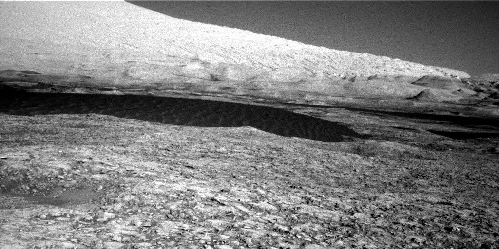
Dunes in sight! Curiosity Navcam Left B image taken on November 20, 2015, Sol 1169.
Credit: NASA/JPL-Caltech
Last week on Mars, NASA’s Curiosity rover has been wheeling ever-closer to the Bagnold Dunes – characterizing the bedrock and sand along the way.
Lauren Edgar of the USGS Astrogeology Science Center in Flagstaff, Arizona reports that the Bagnold Dunes “are tantalizingly close.”
On Sol 1167, Curiosity drove 128 feet (39 meters) “and the dunes are starting to look pretty big,” Edgar adds.
Curiosity also carried out a successful Sample Analysis at Mars (SAM) methane experiment – one Mars year after the previous high detections of methane.
The rover also made a drive of 120 feet (36.5 meters) on Sol 1168, Edgar says.

This view taken from orbit around Mars shows the sand dune that will be the first to be visited by NASA’s Curiosity Mars Rover along its route to higher layers of Mount Sharp.
The view covers an area about 1,250 feet (about 380 meters) across, showing a site called “Dune 1” in the “Bagnold Dunes” dune field.
The image was taken by the High Resolution Imaging Science Experiment (HiRISE) camera on NASA’s Mars Reconnaissance Orbiter. The image is in false color, combining information recorded by HiRISE in red, blue-green and infrared frequencies of light.
Credit: NASA/JPL-Caltech/Univ. of Arizona
Active dunes
The Bagnold Dunes skirt the northwestern flank of Mount Sharp.
As noted in a Jet Propulsion Laboratory release:
“No Mars rover has previously visited a sand dune, as opposed to smaller sand ripples or drifts. One dune Curiosity will investigate is as tall as a two-story building and as broad as a football field. The Bagnold Dunes are active: Images from orbit indicate some of them are migrating as much as about 3 feet (1 meter) per Earth year. No active dunes have been visited anywhere in the solar system besides Earth.”
Weekend plan
There’s a weekend three-Sol plan that starts with a number of environmental monitoring activities to assess atmospheric opacity and composition.
The second sol includes several Chemistry & Camera (ChemCam) and Mastcam activities to study the local bedrock and prepare for the upcoming dune investigation.
Edgar notes that use of Curiosity’s Navcam is on tap to search for dust devils and monitor clouds and wind, and to monitor the deck of the rover to look for dust and sand accumulation.
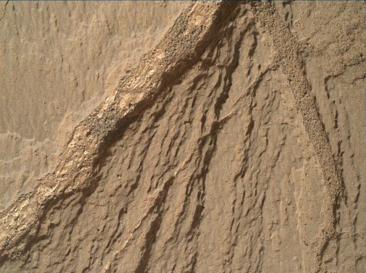
Curiosity’s Mars Hand Lens Imager (MAHLI) acquired this image on November 18, 2015, Sol 1167.
Credit: NASA/JPL-Caltech/MSSS
On the third Sol, the rover is to drive and take standard post-drive imaging.
The plan also includes SAM and Chemistry & Mineralogy X-Ray Diffraction/X-Ray Fluorescence Instrument (CheMin) activities to prepare for future sampling.
As always, conduct of planned rover activities are subject to change due to a variety of factors related to the Martian environment, communication relays and rover status.
 Posted in


What are the latest innovations in space technology, the prospects for a human mission to Mars, and the importance of sustaining American leadership in space exploration?
The Washington, D.C.-based Council on Foreign Relations held on November 19 a discussion on the future of space under their Emerging Technology Series
The Emerging Technology series explores the science behind innovative new technologies and the effects they will have on U.S. foreign policy, international relations, and the global economy.
The speakers:
- Lori Garver, General Manager, Air Line Pilots Association; Former Deputy Administrator, NASA
- John Logsdon, Professor Emeritus of Political Science and International Affairs, Elliott School of International Affairs, George Washington University
- Charles Miller, President, NexGen Space LLC
To view the discussion, go to this video, courtesy of the Council on Foreign Relations at:

Credit: ULA
The United Launch Alliance (ULA) announced today a new CubeSat rideshare program that offers universities the chance to compete for free CubeSat rides on future launches.
In a ULA announcement today: “ULA will offer universities the chance to compete for at least six CubeSat launch slots on two Atlas V missions, with a goal to eventually add university CubeSat slots to nearly every Atlas and Vulcan launch,” said Tory Bruno, ULA president and CEO.
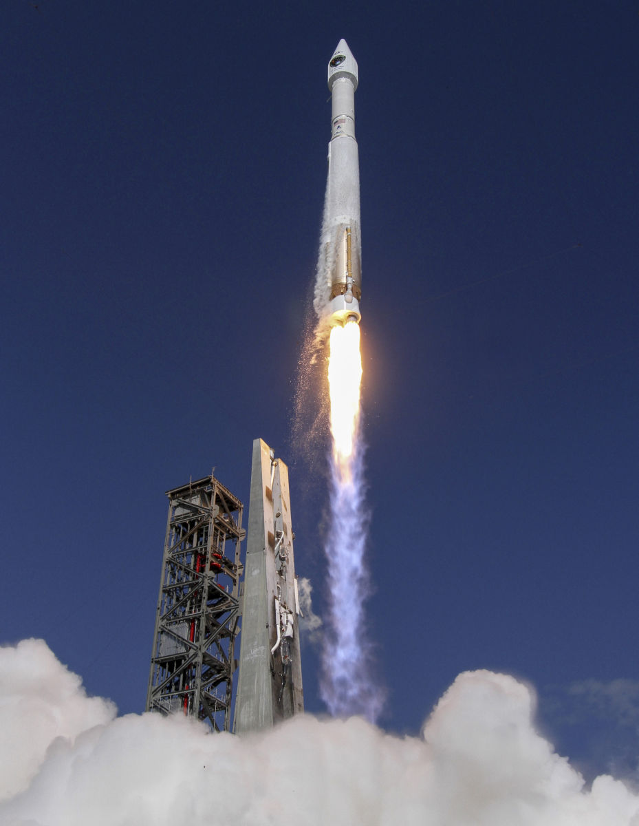
Atlas V liftoff.
Credit: ULA
CubeSats are miniaturized satellites originally designed for use in conjunction with university educational projects and are typically 10 cm x 10 cm x 10 cm (4 inches x 4 inches x 4 inches) and approximately 1.3 kg (3 lbs).
Formed in December 2006, ULA is a 50-50 joint venture owned by Lockheed Martin and The Boeing Company. ULA now provides the Atlas and Delta launch services for the Department of Defense, NASA, the National Reconnaissance Office and other organizations.
Fly for free
The first free CubeSat launch slot in 2017 is being offered to the University of Colorado Boulder.
CU-Boulder students have been building and operating small satellites for 20 years, including the Colorado Student Space Weather CubeSat launched on a ULA Atlas rocket in 2012.
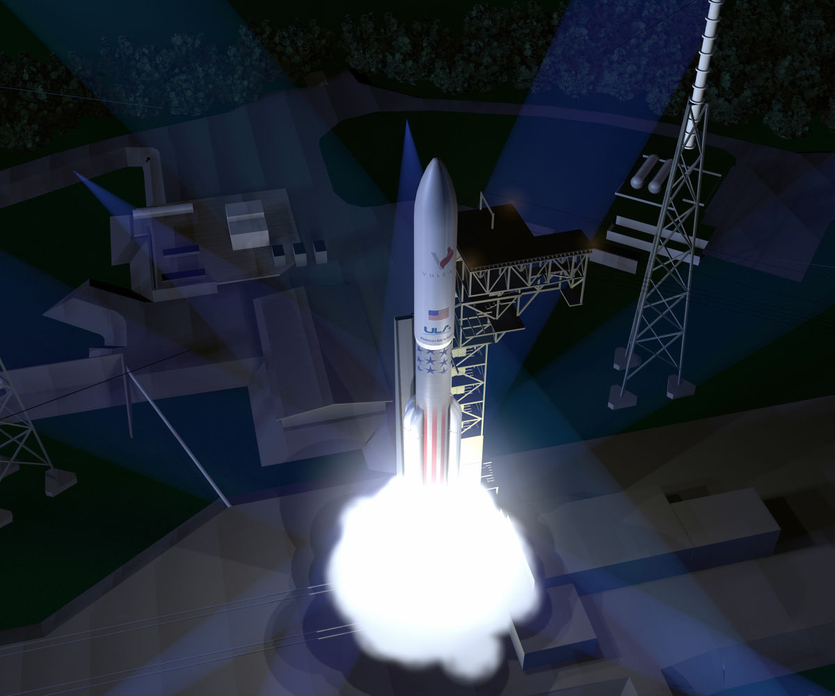
ULA’s Vulcan booster.
Credit: ULA
For those universities interested in taking advantage of this new ULA initiative, send an email to:
Deadline for your email is Dec. 18, 2015 – notifying ULA that you are interested in participating.
In early 2016, ULA will release a request for proposal (RFP) for the first competitive CubeSat launch slots. The selected universities will be announced in August 2016.
Name the new program
In addition, ULA is offering the nation’s universities the chance to help name the new CubeSat program.
Universities, educators and students can submit names for consideration to ULACubeSats@ulalaunch.com using a campus-issued email address.
Submissions are due by Dec.18, 2015. The winning name will be announced early next year, and the institution will receive a free CubeSat launch slot on a future mission.
For detailed information on this new program, go to:

Marswalker – but where on the Red Planet?
Credit: Dan Durda
Mars scientists and engineers have begun mulling over the ideal location for establishing a human outpost on the Red Planet. That best site would not only be of high scientific value — enabling the search for life on that planet, for example — but is also being eyed for local resources to help sustain expeditionary crews.
The First Landing Site/Exploration Zone Workshop for Human Missions to the Surface of Mars was held October 27-30 at the Lunar and Planetary Institute in Houston, Texas.
For my new Space.com story, go to:
Where Will the 1st Astronauts on Mars Land?
November 17, 2015 04:38pm ET
http://www.space.com/31143-manned-mars-landing-sites-workshop.html

Long March-3C rocket lifts off from the Xichang Satellite Launch Center.
Credit: China Space
The U.S.-China Economic and Security Review Commission (USCC) released today its 2015 annual report to Congress.
The 2015 report provides information on and analysis of developments in the U.S.-China security dynamic, U.S.-China bilateral trade and economic relations, and China’s evolving bilateral relationships with other nations.
Within the report, a Section 2 delves into China’s space and counterspace programs, provided to Inside Outer Space by the USCC.
Steady investment
In an introduction to that section, the report notes that China “has become one of the top space powers in the world” after decades of high prioritization and steady investment.
“China’s aspirations are driven by its assessment that space power enables the country’s military modernization and would allow it to challenge U.S. information superiority during a conflict,” the report states.
Among other purposes, the report contends, China’s space and counterspace programs are designed to support its conduct as part of its antiaccess/area denial strategy to prevent or impede U.S. intervention in a potential conflict.

China is rapidly developing robotic and human spaceflight skills.
Credit: CMSE
The U.S. Department of Defense defines ‘‘antiaccess’’ actions as those that are intended to slow deployment of an adversary’s forces into a theater or cause them to operate at distances farther from the conflict than they would prefer.
‘‘Area denial’’ actions affect maneuvers within a theater, and are intended to impede an adversary’s operations within areas where friendly forces cannot or will not prevent access.
Antisatellite systems
The report is rich in factoids and citations about China’s aspirations in space – both for civil and military purposes, including that country’s expanding deep space exploration agenda.

China’s human spaceflight program is moving forward on a multimodule space station in the 2020s.
Courtesy: CMSE
As listed in the report’s section focused on space, some of the conclusions are:
- — Although China’s space capabilities still generally lag behind those of the United States and Russia, its space program is expanding and accelerating rapidly as many other nations’ programs proceed with dwindling resources and limited goals.
- — China’s aspirations in space are driven by its judgment that space power enables the country’s military modernization, drives its economic and technological advancements, allows it to challenge U.S. information superiority during a conflict, and provides the Chinese Communist Party with significant domestic legitimacy and international prestige.

- European Space Agency (ESA) has outlined a number of space cooperation projects.
Credit: CMSE/Wei Yan Juan

— China likely has capitalized on international cooperation to acquire the bulk of the technology and expertise needed for most of its space programs. China probably will continue to pursue close cooperation with international partners to overcome specific technical challenges and to meet its research and development objectives and launch timelines.
— As China’s developmental counterspace capabilities become operational, China will be able to hold at risk U.S. national security satellites in every orbital regime.
— China is testing increasingly complex co-orbital proximity capabilities. Although it may not develop or operationally deploy all of these coorbital technologies for counterspace missions, China is setting a strong foundation for future co-orbital antisatellite systems that could include jammers, robotic arms, kinetic kill vehicles, and lasers.
— Civilian projects, such as China’s human spaceflight missions, directly support the development of People’s Liberation Army (PLA) space, counterspace, and conventional capabilities. Moreover, Chinese civilian and commercial satellites likely contribute to the PLA’s command, control, communications, computers, intelligence, surveillance, and reconnaissance (C4ISR) efforts whenever it is technically and logistically feasible for them to be so utilized, and they would probably be directly subordinate to the PLA during a crisis or conflict. Given the PLA’s central role in all of China’s space activities, U.S. cooperation with China on space issues could mean supporting the PLA’s space and counterspace capabilities.
— China’s rise as a major space power challenges decades of U.S. dominance in space—an arena in which the United States has substantial military, civilian, and commercial interests.
Note: The full report is now available at:

New Mexico’s Spaceport America.
Credit: Spaceport America
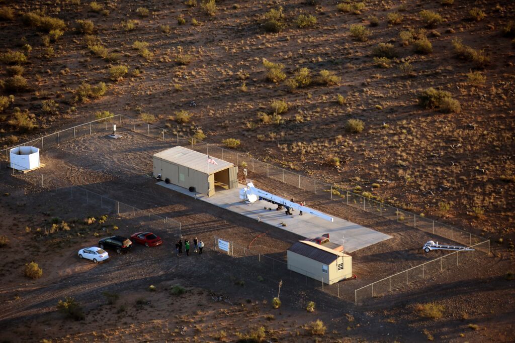
New Mexico’s Spaceport America has announced a “master development plan” that opens up more “build-to-suit” parcels within the North and East Campuses at the 18,000-acre facility in Southern New Mexico.
Roughly 250 acres surrounding Spaceport America’s Gateway to Space terminal — and the site’s 12,000-ft by 200-ft spaceway — will be divided into parcels of between four and 30 acres. Leasing costs would vary according to the size of the property and the tenants’ requirements.

Credit: Spaceport America
Another 100 acres within the vertical launch campus, ranging from 1.5- to 22-acre parcels, are also now ready for build-to-suit tenancy.
In a press statement, Spaceport America CEO, Christine Anderson, explained: “We are opening up several hundred acres in both our horizontal and vertical launch areas for build-to-suit tenancy and have also expanded our infrastructure to support ad-hoc flight test campaigns.”

Courtesy: Spaceport America
Free first flight
In addition to offering up new parcels of land within both the horizontal and vertical launch campuses, Spaceport America is welcoming qualified new prospective tenants with a First Flight is Free program.
This new take-to-the-air tactic is dubbed the “Reach for the Stars at Spaceport America” campaign targeted to commercial space and space-related technology companies.
Spaceport America is the first purpose-built commercial spaceport in the world. The FAA-licensed launch complex, situated on 18,000 acres adjacent to the U.S. Army White Sands Missile Range in southern New Mexico.
Spaceport America is destined to be the commercial launch site for Virgin Galactic’s SpaceShipTwo suborbital passenger flights. In addition, flight tests of Elon Musk’s SpaceX recoverable booster are to be staged at Spaceport America.
Recent launch
In a related development earlier this month, a suborbital launch was carried out from Spaceport America of an UP Aerospace SpaceLoft rocket.
The November 6 launch departed from Spaceport America’s Vertical Launch Complex-1 on the East Campus. The rocket flight represented Spaceport America’s 24th overall launch and the fourth from Spaceport America with NASA Flight Opportunities Program payloads.
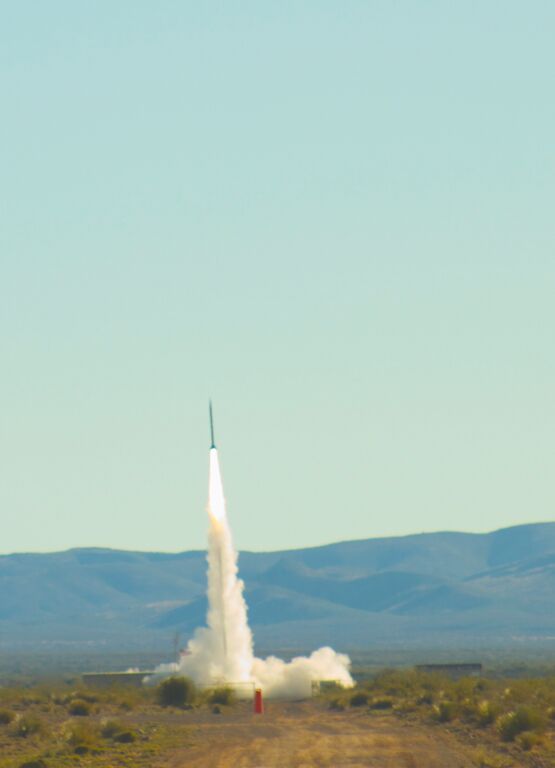
UP Aerospace SpaceLoft rocket on November 6 launch departing from Spaceport America’s Vertical Launch Complex-1.
Credit: Spaceport America
The SpaceLoft commercial research rocket reached a maximum altitude of approximately 75 miles (121 kilometers). The parachute recovery system brought the rocket and its payloads safely back to terra firma and were recovered intact downrange on the U.S. Army White Sands Missile Range as planned.
Re-entry capsule demonstrated
The recent flight showcased for the first time the capability to eject separate payloads that require independent re-entry into the atmosphere.
Three separate parachutes provided soft landing of payload components.
The debut of UP Aerospace’s new Automated Payload Deployment System (APDS) took place at 60 seconds into the rocket’s flight. At that point the system successfully released the nose fairing and ejected the 11-pound re-entry capsule named Maraia.
Maraia was designed and built by NASA’s Johnson Space Flight Center. The capsule was designed to re-enter Earth’s atmosphere independent of the launch vehicle to test controllability at Mach numbers reaching 3.5.
Post-launch, UP Aerospace President Jerry Larson said: “We look forward to offering our new independent re-entry capabilities which we have demonstrated with this mission to other customers in the future.”
“Everything worked great,” Larson told Inside Outer Space.
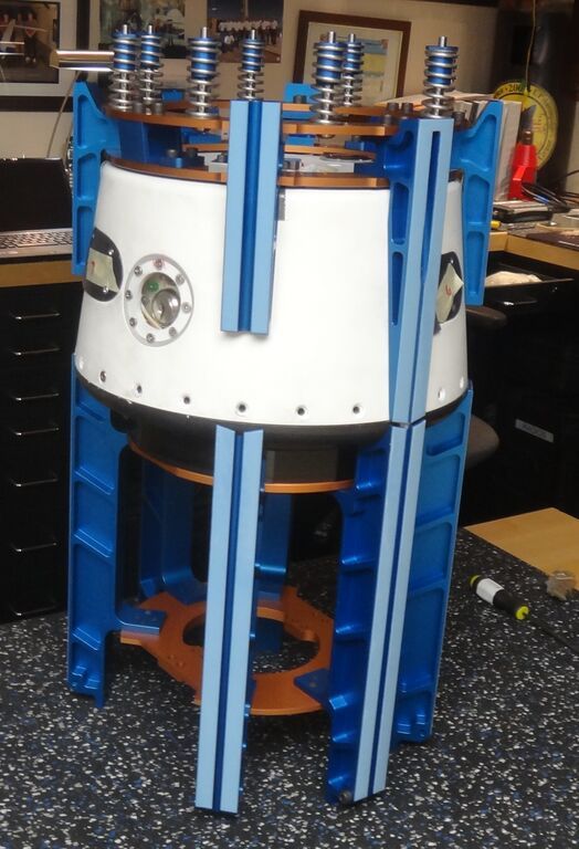
NASA’s Maraia return to Earth re-entry capsule mounted on launch cradles prior to loading it into the launch vehicle.
Credit: UP Aerospace
Payload packed
The remainder of the vehicle contained three other experiments by NASA’s AMES — Research Center, Purdue University, and New Mexico State University.
The payload flown on the UP Aerospace SL-10 rocket included the following:
- — Maraia Earth Return Capsule from NASA Johnson Space Center. This experiment tested a reentry capsule being developed to return small satellites and individual payloads from orbit on-demand.
— AVA from NASA Ames Research Center. This was a test of a developmental, low-cost avionics package, which will ultimately be used to monitor and control launcher systems designed for small satellites.
— Green Propellant experiment from Purdue University. This experiment studied surface tension behavior of a new “green” rocket propellant in low gravity. Results will be used to validate propellant management devices applicable to both geostationary and interplanetary spacecraft.
— SOF-2 from New Mexico State University. This experiment tested an autonomous, robotic method to identify unknown or changed inertia properties (mass, center of mass, moments of inertia) of a spacecraft. This will be used to enhance control capability of future on-orbit servicing missions such as satellite refueling, rescue, repair, and orbit debris removal.
UP Aerospace is headquartered in Denver, Colorado and is currently under contract to perform two additional missions for NASA in 2016.
Ashes into space
Also onboard the SpaceLoft XL rocket, the Houston-based Celestis flew its 14th memorial spaceflight that carried the ashes of flight participants to the edge of space.
The “Tribute Flight” placed a symbolic portion of the cremated remains of its flight participants into space on a spaceflight trajectory similar to NASA’s early Mercury manned missions of the 1960s
In addition, the first Celestis pet was onboard, called the final journey of “Apollo” – an Australian Shepherd dog that lived with the Michael Potter family of Los Angeles, California.
Post-recovery, the Celestis capsules and modules are to be returned to family members and loved ones, providing them with a flown keepsake.
In addition to its Earth Rise Service, Celestis also offers missions into Earth orbit, to the Moon, and into deep space.
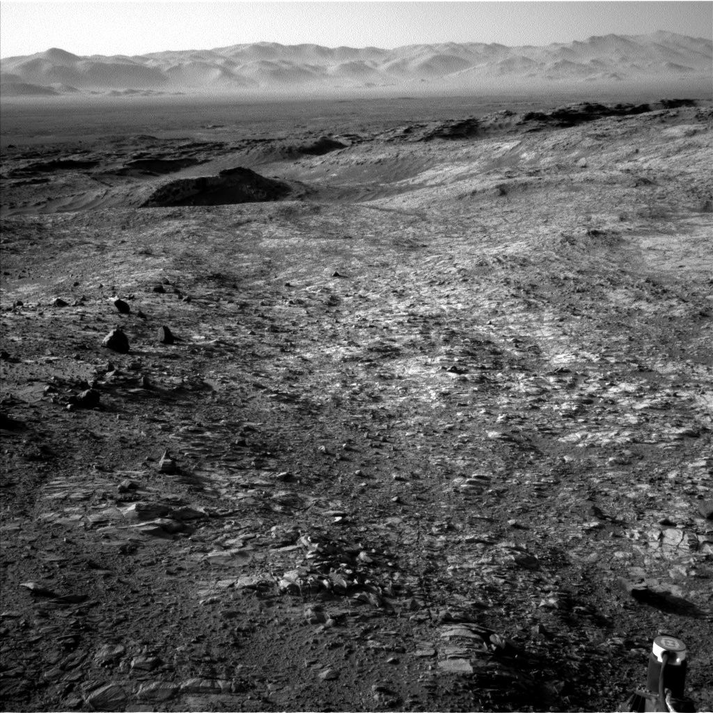
Curiosity Navcam Left B Sol 1158 November 9, 2015.
Credit: NASA/JPL-Caltech
Late last week, the rover wheeled 125 feet (38 meters) across the landscape to a new position.
According to Ken Herkenhoff of the USGS Astrogeology Science Center in Flagstaff, Arizona, the over the weekend plan calls for use of the Chemistry & Camera (ChemCam) instrument that looks at rocks and soils from a distance via a laser.
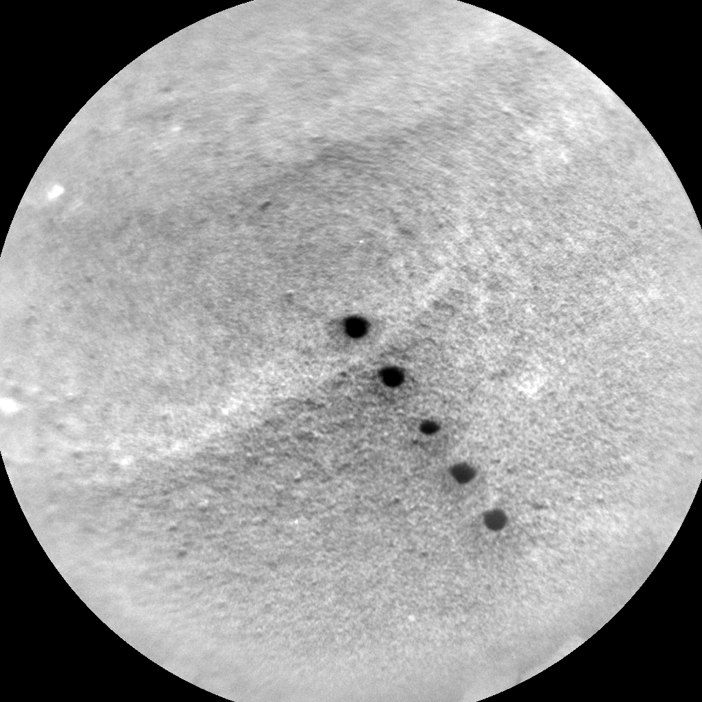
Curiosity ChemCam: Remote Micro-Image Curiosity on November 13, 2015, Sol 1162.
Credit: NASA/JPL-Caltech/LANL
Curiosity’s ChemCam analyzes the elemental composition of vaporized materials from areas smaller than 1 millimeter on the surface of Martian rocks and soils.
ChemCam and Mastcam were slated to observe one of the Bagnold Dunes that is a near-term goal for detailed investigation, plus other more nearby targets called “Swakop” and “Zaris.”
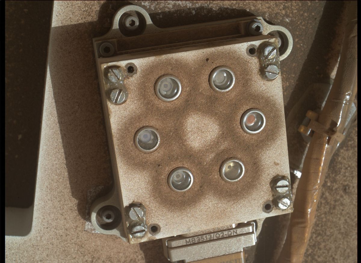
NASA’s Mars rover Curiosity acquired this image using its Mars Hand Lens Imager of Spain’s Rover Environmental Monitoring Station (REMS) ultraviolet sensor.
Credit: NASA/JPL-Caltech/MSSS
Software tool
Also slated was checkout of the Autonomous Exploration for Gathering Increased Science (AEGIS) software. That software tool that will help select targets for ChemCam and Mastcam. The checkout is followed by deployment of Curiosity’s robot arm.
The arm was deployed to take an image of Spain’s Rover Environmental Monitoring Station (REMS) ultraviolet sensor and a rock dubbed “Swartkloofberg.”
Then the Dust Removal Tool (DRT) will brush the dust off Swartkloofberg and the Mars Hand Lens Imager (MAHLI) will acquire mosaics of the brushed spot and of Swakop before the Alpha Particle X-Ray Spectrometer (APXS) is placed on the brushed spot for an overnight integration.
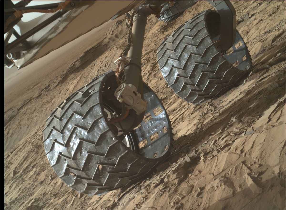
Damage watch – inspection of rover’s wheels. Curiosity acquired this image using its Mars Hand Lens Imager (MAHLI), located on the turret at the end of the rover’s robotic arm, on November 8, 2015, Sol 1157.
Credit: NASA/JPL-Caltech/MSSS
Next drive
On Sol 1165, the plan calls for the robotic arm to be stowed and the rover will drive farther south, again orienting the vehicle for REMS wind measurements.
After sunset, the Sample Analysis at Mars Instrument Suite (SAM) will clean its scrubbers – an engineering activity that has been performed twice before. Finally, the rover will go to sleep and recharge in preparation for the next sol’s activities, Herkenhoff reports.
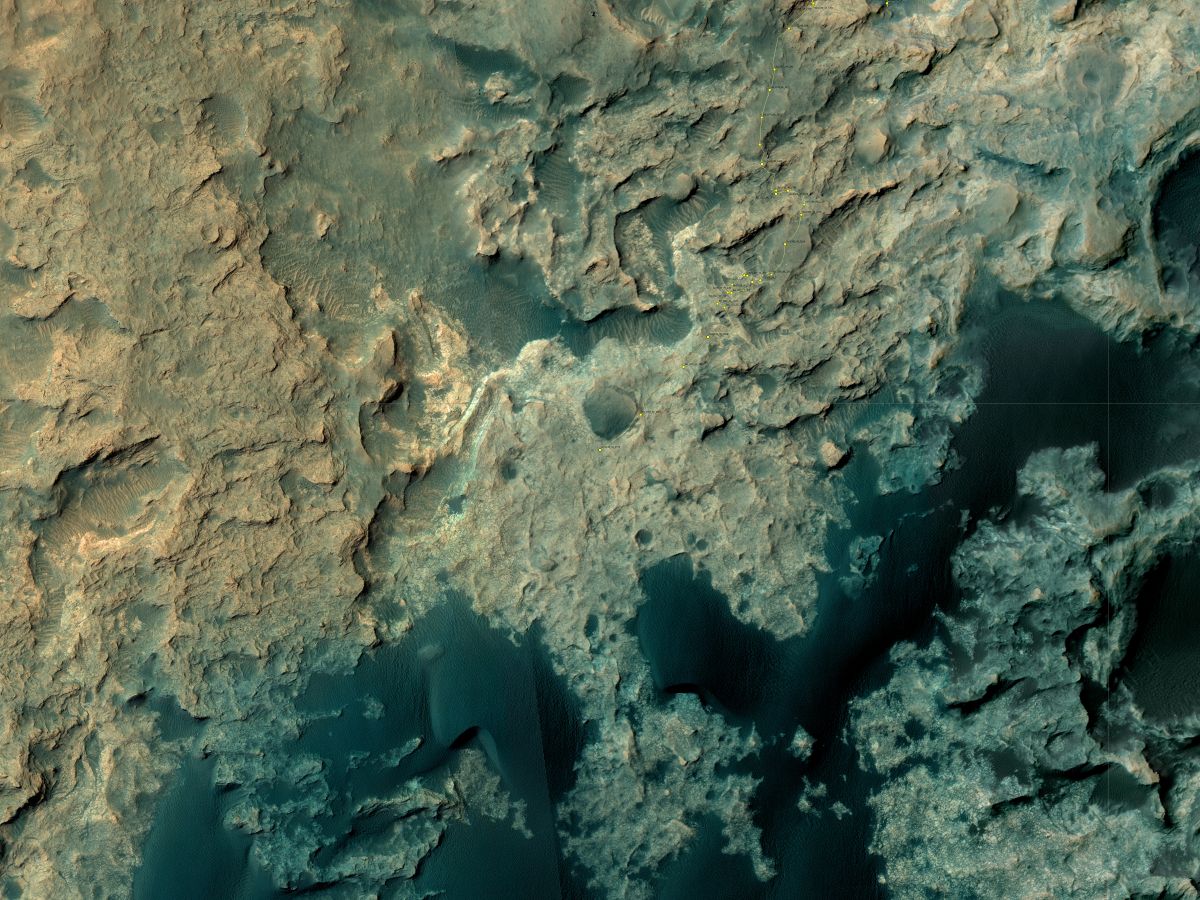
This map shows the route driven by NASA’s Mars rover Curiosity through the 1160 Martian day, or sol, of the rover’s mission on Mars (November, 11, 2015).
Numbering of the dots along the line indicate the sol number of each drive. North is up. From Sol 1158 to Sol 1160, Curiosity had driven a straight line distance of about 176.42 feet (53.77 meters).
The base image from the map is from the High Resolution Imaging Science Experiment Camera (HiRISE) in NASA’s Mars Reconnaissance Orbiter.
Credit: NASA/JPL-Caltech/Univ. of Arizona
Dates of planned rover activities detailed here are subject to change due to a variety of factors related to the Martian environment, communication relays and rover status.

Fiery fall of WT1190F.
Narrow field view recorded by the Dexter Southfield team showing part of a single frame from a movie camera.
Credit: Rapid Response Team/SETI Institute/IAC/UAE Space Agency
An international airborne campaign to observe the plunge to Earth of WT1190F – an unidentified space object – has claimed victory in documenting the fiery fall off of Sri Lanka.
In a statement from the SETI Institute’s rapid response team that included the International Astronomical Center in Abu Dhabi and the UAE Space Agency:

Aircraft observing team.
Credit: UAE Space Agency
“The remaining challenge proved to be the weather. It was raining in Sri Lanka. Much of our flight to the area saw haze above our flight altitude at 45,000 feet, but our navigator, pilot and first officer found a small clearing and managed to put the aircraft there at the right time. We had a perfect view of the WT1190F reentry, which was bright by naked eye. We have incredible imaging data and also succeeded in doing quality spectroscopy at blue and red wavelengths, which is a first for us in daytime conditions.”

Later stage of reentry as detected by the UAE Space Agency team.
Credit: Rapid Response Team/SETI Institute/IAC/UAE Space Agency
High-altitude explosion
According to the Ministry of Defense/Sri Lanka:
“The space debris named as ‘WT1190F’ had exploded at the time it entered the Earth’s atmosphere yesterday (13th Nov) according to the Mr. Chinthana Wijayawardana, Deputy Director (Media), Arthur C Clarke Institute for Modern Technologies. It had exploded about 100 kilometers above the sea level and the falling space debris, which blasted during re-entry, had burned off and no remains of it had splashed into the sea.”

Credit: TransAstra
A demonstration of asteroid mining technology was conducted November 12 at the White Sands Missile Range in New Mexico.
According to Joel Sercel of TransAstra Corporation, initial large scale testing of Optical Mining was completed — an innovative approach for extracting rocket propellants from asteroids that could soon make space rocks ubiquitous refueling stations for NASA astronauts and private sector industrial operations in space.

Large solar furnace at White Sands Missile Range in New Mexico was used to shed light on the idea of asteroid mining.
Credit: Drew Hamilton, White Sands Missile Range, New Mexico
The tests completed made use of up to 12 kilowatts of highly intense solar energy, thanks to the Army’s giant solar concentrator system. That hardware focused solar energy for up to minutes at a time onto a 4-inch circle on the surface of materials designed to simulate the properties of volatile rich asteroids.
Solar beam
“During the tests the simulants were inside of a cooled vacuum chamber behind a ¾-inch thick window constructed of purified fused quartz. The highly intense solar energy can easily melt stainless steel, but it passed through the quartz window with no apparent ill effect and transmitted its power to the stimulants inside the vacuum chamber,” Sercel told Inside Outer Space.

“The solar beam was observed to begin to drill into the surface of the asteroid simulant…releasing significant quantities of water and presumably other volatile materials,” Sercel reports. “The composition of fluids released other than water will be determined in post test analysis in the coming weeks.”
These effluents from the intense solar thermal reaction, Sercel adds, were successfully collected in a cryogenically cooled trap which has been designed to mimic an approach that could be used inexpensively in space to collect the gases released by the optical mining process.

Frost on the cryogenic cold trap immediately after it was removed from the vacuum chamber is water and other volitile chemicals previously trapped in the rock, but released by the heat of 2000 Suns at temperatures potentially as high as 3500 ºF.
Credit: TransAstra
Unlimited resource
Sercel and TransAstra benefited by support from both NASA with its NASA Innovative Advanced Concepts (NIAC) program, SBIR and ESI programs, and private sector investors that enabled the test.
“TransAstra Corporation is a new kind of aerospace company built on the belief that the future of humanity lies beyond the planetary surface,” Sercel said. “The asteroids represent a virtually unlimited resource for our species and the time has come to use these stepping stones to space for exploration, industrialization, and settlement beyond the Earth.”

Artist’s view of unidentified flying debris over Sri Lanka.
Credit: Don Davis/copyright Don Davis/Used with permission.
Updated: Langbroek of SatTrackCam Leiden, the Netherlands reports that the first imagery is in of the re-entry of artificial object WT1190F south of Sri Lanka at 6:18 UT today, coming from a trans-Lunar orbit.
Imagery is from a research aircraft organized by UAE Space Agency, IAC, NASA, ESA.
Go to:
https://youtu.be/YJT-q8_dl88
Whatever it was – but tagged object WT1190F – turned into a fireball finale south of Sri Lanka.
The unknown object — estimated to be one to three meters in length, was discovered in 2013 by Arizona University’s Catalina Astronomical observatory.
The object was expected to enter the atmosphere and start its burnout in an area above the Indian Ocean off the southern coast of Sri Lanka at around 06:19 GMT on November 13.
Researchers at the time thought it should be possible to observe the end-of-life object with the naked eye, expected to be as bright and visible as the full moon in daylight.
Viewing campaign
The UAE Space Agency and the Abu Dhabi-based International Astronomy Center have announced that they are co-organizing a joint mission to observe and study the entry of the unknown object – what is believed to be a chunk of human-made space debris.

The United Arab Emirates is sponsoring an airborne observing campaign to study the entry of space debris object WT1190F. The International Astronomical Center (IAC) in Abu Dhabi and the United Arab Emirates Space Agency is hosting a team of veteran U.S. and German observers of spacecraft re-entries to study the space debris returning to Earth on an asteroid-like orbit near Sri Lanka on November 13, 2015.
Credit: ESA
According to the UAE Space Agency, the co-operative mission will include international scientists from NASA, the European Space Agency (ESA), as well as scientists from a number of international space observatories.
The UAE mission involves a private aircraft that will be dispatched from Abu Dhabi on the morning of the entry event. The airplane will head to the site where the space object is expected to enter.
Small laboratory
The aircraft will remain airborne for approximately 30 minutes, while the team on-board will make their observations using special equipment before returning to Abu Dhabi.

The instrument teams onboard the aircraft are intent on observing the entry.
Credit: IAC/UAE Space Agency/NASA/ESA)
“After a day of hard work that saw the aircraft interior transformed into a small laboratory, over twenty cameras are now mounted and ready for deployment…so far, so good,” report the sky watching-ready scientists. “The weather could still make it challenging to position the aircraft at the right location in the right orientation to see the entry. Also, we hope that the object has enough mass and kinetic energy to see the entry in the daytime sky.”
Early warning and response
Explains HE Dr. Mohamed Nasser Al Ahbabi, Director General of the UAE Space Agency:
“The studies and data collected while this object enters the Earth’s atmosphere will be invaluable for our understanding of near Earth space objects movement and how they are affected by the various environmental factors. It will also represent an opportunity to validate strategies for how a global early warning and response system for space objects entering the Earth’s atmosphere can be managed and coordinated in the future.”
Fishing ban, no-fly zone
Meanwhile, the Ministry of Defense in Sri Lanka has announced a “Fishing Ban” and a No-Fly-Zone in the Southern sea area and over the sky given the incoming space debris.

Credit: Bill Gray/Project Pluto
The space junk is expected to fall into the ocean about 65 kilometers to 100 kilometers off the southern coast of Sri Lanka.
“According to the scientific information, its mass is not sufficient to cause any threat to the area as it appears to be manmade and quite small. Possibly it could burn-up when it enters the Earth’s atmosphere and remains will fall into the sea,” notes the Ministry of Defense. “In accordance with the current scientific information, its mass is not sufficient to cause any threat to the area.”
The object could be a remaining piece from an early moon mission and is expected to fall around 11:48 a.m. local time.
The Arthur C. Clarke Institute for Modern Technologies in Sri Lanka is coordinating related sky fall duties with the SETI Institute in California.

Mystery object caught on camera.
Credit: Marco Langbroek of SatTrackCam Leiden in The Netherlands.
New images
Marco Langbroek of SatTrackCam Leiden in The Netherlands reports that the object is artificial and is in a geocentered orbit in the Earth-Moon system with apogee at twice the lunar distance.
“It is probably one to two meters large and evidently hardware from some, as yet unidentified, lunar mission,” Langbroek reports.
Langbroek has imaged the object and an animated GIF of the images can be seen here:
http://sattrackcam.blogspot.nl/2015/11/small-unusual-artificial-object-wt1190f.html

