Archive for the ‘Space News’ Category
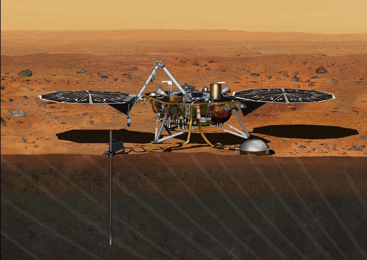
InSight Mars lander.
Credit: NASA/JPL
NASA’s InSight Mars lander is now safely back at its maker – Lockheed Martin Space Systems in Littleton, Colorado.
The spacecraft was successfully shipped back from Vandenberg Air Force Base to Denver on Saturday, Feb. 6. Its “return to sender” flight was onboard a C-17 aircraft from Vandenberg AFB to Buckley AFB.
InSight is currently housed in the Waterton Canyon campus in Littleton, Colorado company spokesman, Gary Napier, told Inside Outer Space.
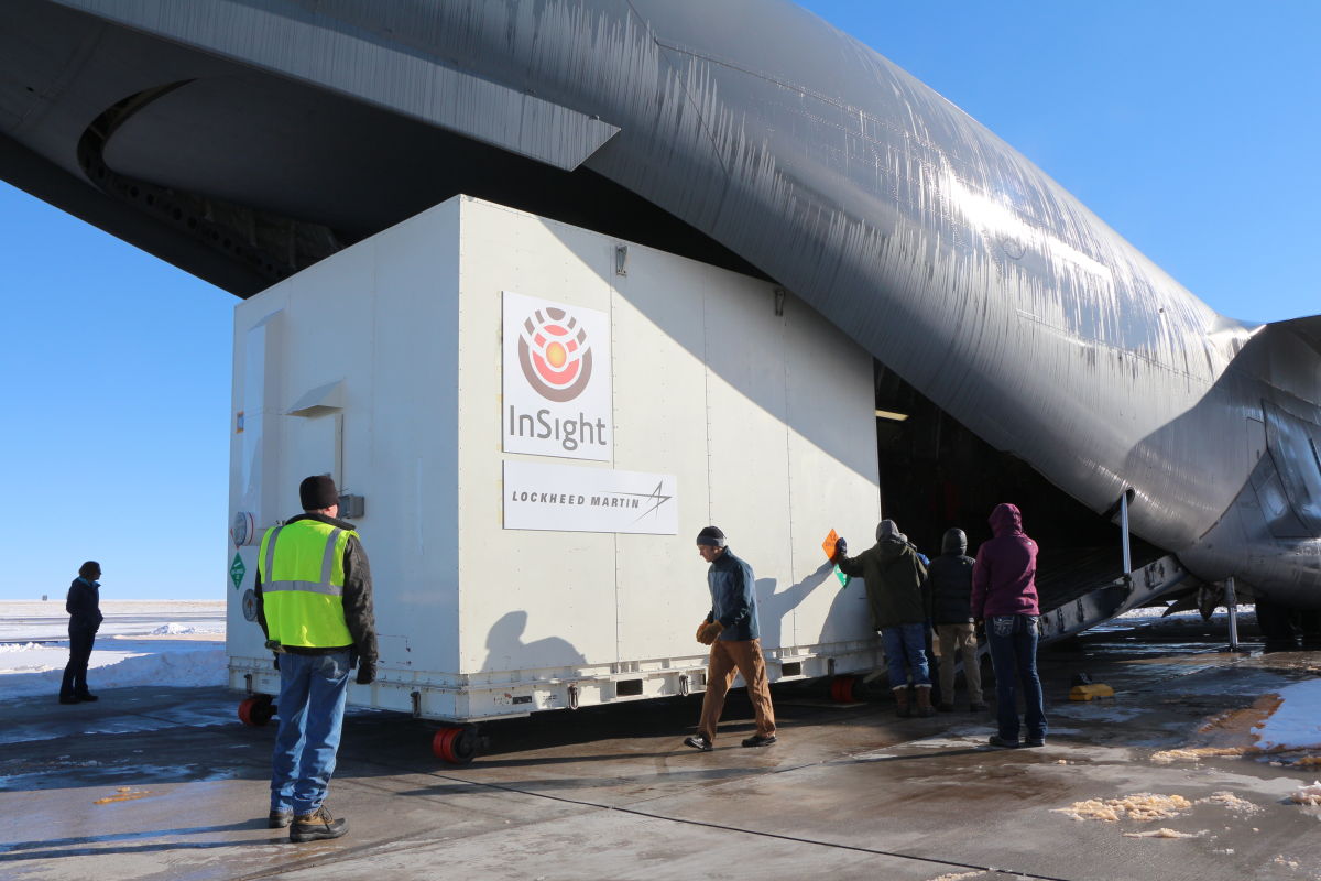
A crate containing NASA’s Mars-bound InSight spacecraft was loaded into a C-17 cargo aircraft at Buckley Air Force Base, Denver, for shipment to Vandenberg Air Force Base, California. The spacecraft, built by Lockheed Martin Space Systems, was shipped Dec. 16, 2015, for launch in March 2016. The spacecraft is now back at Lockheed Martin due to launch delay.
Credit: NASA/JPL-Caltech/Lockheed Martin
Seismic experiment
NASA decided to suspend the planned March 2016 launch of the Discovery-class Interior Exploration using Seismic Investigations Geodesy and Heat Transport (InSight). The launch scrub was due to unsuccessful attempts to repair a leak in a section of the prime instrument in the lander’s science payload.
The problem-plagued instrument was the sensitive Seismic Experiment for Interior Structure (SEIS).
SEIS is designed to take precise measurements of quakes and other internal activity on Mars to better understand the planet’s history and structure.
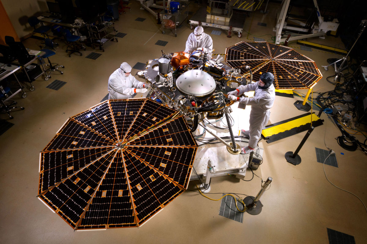
Pre-ship photo shows NASA’s InSight Mars lander spacecraft in a Lockheed Martin clean room near Denver. As part of a series of deployment tests, the spacecraft was commanded to deploy its solar arrays in the clean room to test and verify the exact process that it will use on the surface of Mars.
Credit: NASA/JPL-Caltech/Lockheed Martin
Leak problems
The SEIS had previously failed to retain vacuum conditions – a problem that was fixed. But during follow-up tests in extreme cold temperature (-49 degrees Fahrenheit/-45 degrees Celsius) another leak was detected.
Despite the repairs and the significant efforts of InSight teams, a cold pressure build-up, probably caused by a new leak, was detected on the sphere-shaped SEIS.
NASA officials determined there was insufficient time to resolve another leak, and complete the work and thorough testing required to ensure InSight’s mission.
Core sensors
“The thing that was leaking was the vacuum enclosure of the VBBs (Very Broad Band seismometers), which are the core sensors of the SEIS,” explains W. Bruce Banerdt Principal Investigator for InSight at the Jet Propulsion Laboratory (JPL) in Pasadena, California.
Credit: NASA/JPL
“We call it the ‘sphere’… although it is only quasi-spherical,” Banerdt told Inside Outer Space. “JPL and the French have been working shoulder to shoulder — both literally and figuratively — since the first leak was detected at the end of August,” he adds.
Along the same lines, teams are jointly putting together a plan forward, Banerdt notes, for producing a robust vacuum enclosure for the presumed launch of InSight in 2018.
Resources:
For more information on the SES, go to this video in French at:
https://www.youtube.com/watch?v=k3IOKszmnyo
For an English video on InSight, go to:
Credit: NASA/JPL-Caltech/MSSS
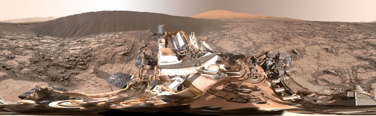
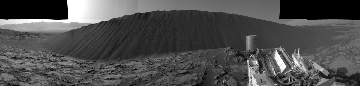
The folks at the Jet Propulsion Laboratory are offering your own controllable view of a full-circle panorama beside “Namib Dune” on Mars. The Curiosity mission’s examination of dunes in the Bagnold field, along the rover’s route up the lower slope of Mount Sharp, is the first close look at active sand dunes anywhere other than Earth.
The Curiosity rover-provided view shows the downwind face of Namib Dune on Mars that covers 360 degrees, including a portion of Mount Sharp on the horizon.
The site is part of the dark-sand “Bagnold Dunes” field along the northwestern flank of Mount Sharp.
The component images of the scene were taken on Dec. 18, 2015 by the Mast Camera (Mastcam) on the robot.
The bottom of the dune nearest the rover is about 23 feet (7 meters) from the camera. This downwind face of the dune rises at an inclination of about 28 degrees to a height of about 16 feet (5 meters) above the base. The center of the scene is toward the east; both ends are toward the west.
A color adjustment has been made approximating a white balance, so that rocks and sand appear approximately as they would appear under Earth’s sunlit sky.
The mission’s examination of dunes in the Bagnold field, along the rover’s route up the lower slope of Mount Sharp, is the first close look at active sand dunes anywhere other than Earth.
Malin Space Science Systems, San Diego, built and operates the rover’s Mastcam.
Go to:
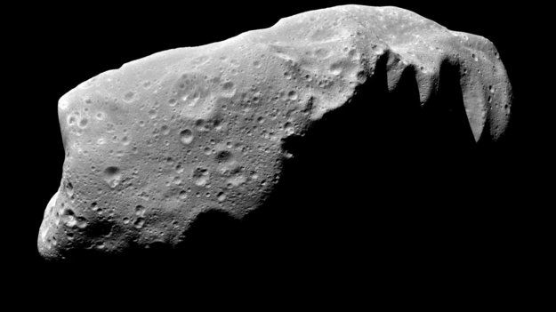
Asteroid Ida
Credit: NASA/PL
Organizers of Asteroid Day are staging a special press event tomorrow, February 9th, making use of multimedia platforms to accommodate speakers from around the world on current research on threatening asteroids.
The press conference is dedicated to reveal the events and partners for Asteroid Day 2016 and will start on Tuesday, February 9 at 1500 CET (1400 UTC). It is being held at ESA’s ESTEC technical center in Noordwijk, the Netherlands.
What is Asteroid Day?
Scheduled for June 30 around the world, this yearly event is a global movement to increase public awareness of potential asteroid collisions and the means to protect Earth. It was co-founded in 2015, by Dr. Brian May, astrophysicist and lead guitarist for the rock band Queen, Apollo astronaut Rusty Schweickart, and German filmmaker Grig Richters.

Credit: ESA/ESTEC
Asteroid Day is held on June 30 each year to mark Earth’s largest asteroid impact in recorded history, the Siberia Tunguska event, which devastated over 2000 square km, the size of a major metropolitan city.
In 2015, on the inaugural Asteroid Day, partners organized more than 150 events worldwide, educating millions of people and generating some 4 billion media impressions.
Resources:
To access the webcast, go to:
or
For additional information on Asteroid Day and the 100X Asteroid Declaration, go to:
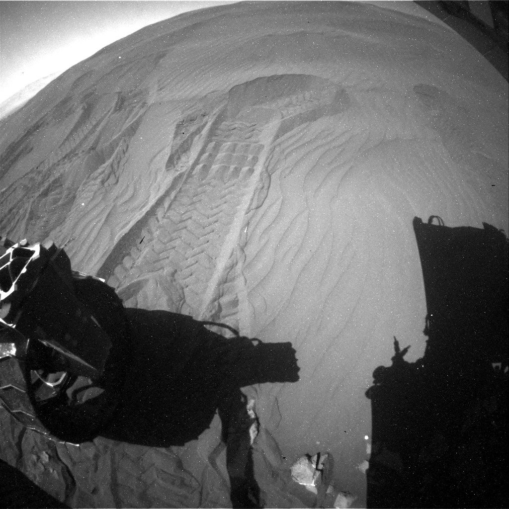
Curiosity Rear Hazcam Right B image taken on Sol 1244, February 5, 2016.
Credit: NASA/JPL-Caltech
UPDATE: Curiosity is now in Sol 1245.
On Sol 1244, Curiosity did “bump” roughly 6 feet (2 meters) forward to get to a patch of bedrock. “The focus of the weekend plan is to study typical Murray formation bedrock, do some targeted remote sensing, and then drive towards the Naukluft Plateau,” explains Lauren Edgar at the USGS Astrogeology Science Center and a member of the Mars Science Laboratory science team. A three Sol plan has been scripted, Edgar adds, with rover inspection of an interesting patch of nodules. On the third sol, Curiosity is slated to drive towards the Naukluft Plateau, and acquire post-drive imaging to prepare for the upcoming week.
Bedrock target
In a few hours, NASA’s Curiosity Mars rover enters Sol 1245, landing on the Red Planet back in August 2012.
The rover is now focused on “bumping” towards a bedrock target to set researchers here on Earth on track for contact science in the upcoming weekend plan.
New Curiosity imagery shows that the robot used its rear wheels to create one last scuff in Namib Dune, documented as the robot drove away.
Explains Lauren Edgar, a research geologist at the USGS Astrogeology Science Center in Flagstaff, Arizona: “Looking forward to being back on bedrock!”
Curiosity Mastcam Left image taken on Sol 1244, February 5, 2016.
Credit: NASA/JPL-Caltech/MSSS
Curiosity Navcam Left B image taken on Sol 1244, February 5, 2016.
Credit: NASA/JPL-Caltech
Freshly broken rock
“We decided to bump just a few meters away to a target that will allow us to characterize typical Murray formation bedrock,” Edgar adds.
Before the drive, the plan called for a Chemistry & Camera (ChemCam) passive observation of a distant crater to characterize the material that makes up the Gale crater walls,” Edgar points out. “We also planned a Mastcam image of a freshly broken rock named “Askevold,” and Mastcam deck monitoring to search for the movement of fines.”
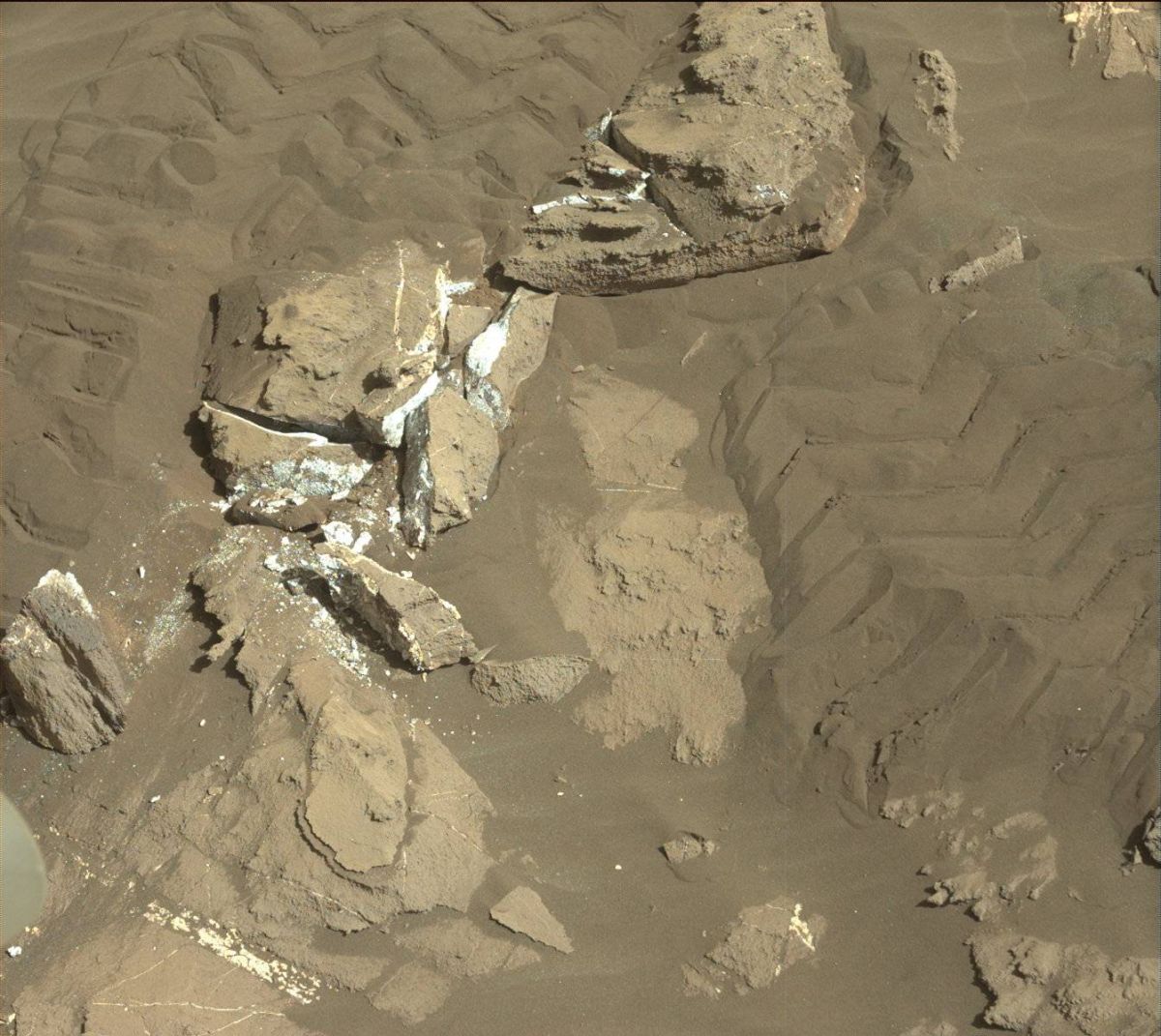
Image taken by Curiosity’s Mastcam Left camera on Sol 1243, February 4, 2016.
Credit: NASA/JPL-Caltech/MSSS
Undermine a ripple
That planned action had the rover driving forward slightly, turn its wheels to undermine a ripple, image it with Mastcam, and then drive towards the contact science target.
“After the drive we’ll acquire imaging to prepare for contact science and targeting in the weekend plan, and we’ll also do some ChemCam calibration activities,” Edgar adds.
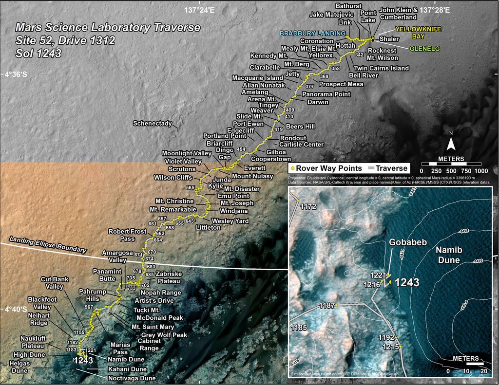
Curiosity’s Traverse Map Through Sol 1243.
This map shows the route driven by NASA’s Mars rover Curiosity through the 1243 Martian day, or sol, of the rover’s mission on Mars as of February 4, 2016.
Numbering of the dots along the line indicate the sol number of each drive. North is up. The scale bar is 1 kilometer (~0.62 mile).
From Sol 1221 to Sol 1243, Curiosity had driven a straight line distance of about 13.85 feet (4.22 meters).
The base image from the map is from the High Resolution Imaging Science Experiment Camera (HiRISE) onboard NASA’s Mars Reconnaissance Orbiter.
Image Credit: NASA/JPL-Caltech/Univ. of Arizona
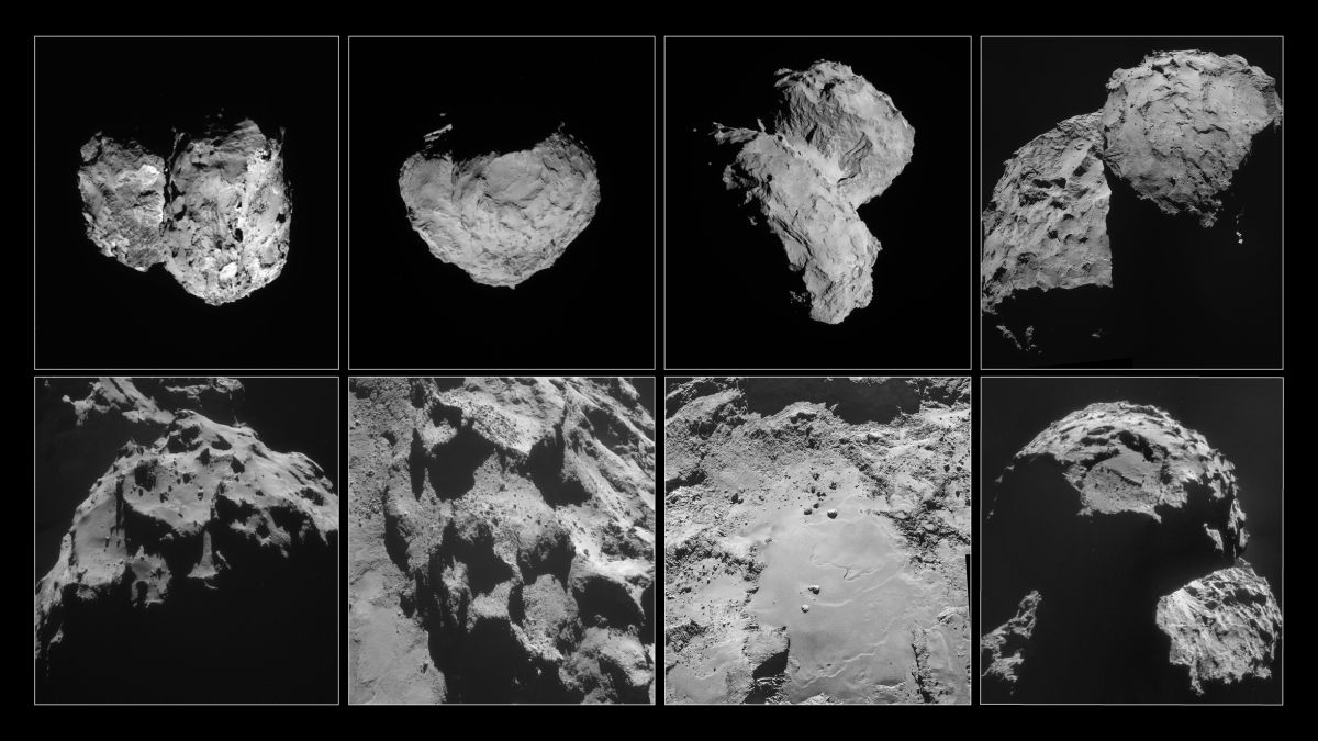
These images of comet 67P/Churyumov-Gerasimenko were taken by Rosetta’s navigation camera between August and November 2014.
Top row, left to right: Comet pictured on August 6, 2014, at a distance of 96 km; August 14, at a distance of 100 km; August 22, at a distance of 64 km; September 14, at a distance of 30 km.
Bottom row, left to right: Comet pictured on September 24, at a distance of 28 km; October 24, at a distance of 10 km; October 26, at a distance of 8 km; November 6, at a distance of 30 km.
Credit: ESA/Rosetta/NavCam – CC BY-SA IGO 3.0
Word from the European Space Agency (ESA) – there are no vast caverns inside Comet 67P/Churyumov-Gerasimenko.
A comet’s low density implies that these objects must be highly porous.
The view has been espoused that due to this porosity, huge empty caves may exist in the comet’s interior.
New study results have been published in the scientific journal, Nature. The research was led by Martin Pätzold, from Rheinische Institut für Umweltforschung an der Universität zu Köln, Germany. The team’s study has shown that Comet 67P/Churyumov-Gerasimenko is a low-density object…but they have also been able to rule out a cavernous interior.
The work is based on ESA’s Rosetta mission to Comet 67P/Churyumov-Gerasimenko.
Radio science
According to a ESA press statement, Pätzold’s team made their discovery by using radio science data to study the way the Rosetta orbiter is pulled by the gravity of the comet, which is generated by its mass.
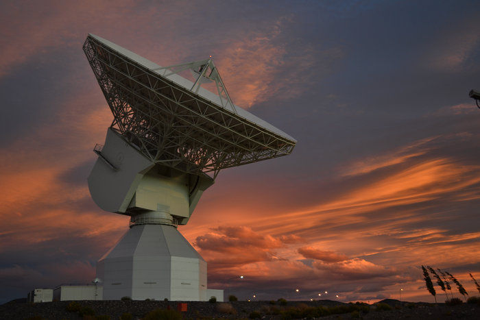
The frequency of the radio link to Earth from Rosetta to ESA’s 35-meter antenna at the New Norcia ground station in Australia is studied to spot caves on Comet 67P/Churyumov-Gerasimenko. The variations in the signals it received were analysed to give a picture of the gravity field across the comet.
Credit: ESA
The variations in the signals received were analyzed to give a picture of the gravity field across the comet. Large internal caverns would have been noticeable by a tell-tale drop in acceleration.
This finding is consistent with earlier results from Rosetta’s CONSERT radar experiment showing that the double-lobed comet’s “head” is fairly homogenous on spatial scales of a few tens of meters.
Controlled impact
This September, ESA’s Rosetta spacecraft will be guided to a “controlled impact” on the surface of the comet.
As Rosetta moves closer and closer to the complex gravity field of the comet, navigating the probe will become harder and harder.
The frequency of the radio link to Earth will be closely monitored – making use once again of ESA’s 35-meter antenna at the New Norcia ground station in Australia. The variations in the signals it receives will be scrutinized to give a picture of the gravity field across the comet – and a last ditch search for any large caverns in the comet.
The new research in Nature – “A homogeneous nucleus for comet 67P/Churyumov–Gerasimenko from its gravity field” — can be found at:
http://www.nature.com/nature/journal/v530/n7588/full/nature16535.html
![]() A U.S. congressional hearing was held today…and the hearing was loud, sound, critical and confusing.
A U.S. congressional hearing was held today…and the hearing was loud, sound, critical and confusing.
The U.S. House Space Subcommittee Committee “reviewed” NASA’s human space exploration proposals – particularly the big step to a human mission to Mars.
Moon first, Mars first, asteroid first, and whether or not the U.S. can afford any of it – all these topics and others were touched upon.
Another focus of the hearing was the challenges ahead for keeping programs on track through changing presidential administrations.
Talkfest 2016
On the “talk to Congress” docket were:
Tom Young, Former Director, Goddard Space Flight Center, NASA; Former President and Chief Operating Officer, Martin Marietta Corporation
John C. Sommerer, Chair, Technical Panel, Pathways to Exploration Report, National Academy of Sciences
Paul Spudis, Senior Scientist, Lunar and Planetary Institute

Credit: NASA/Langley Research Center
Video feedstock
Live video streaming of the hearing – “Charting a Course: Expert Perspectives on NASA’s Human Exploration Proposals” is available on the Committee’s website and YouTube at:
Written testimony
For readers out there, I put this list together…so take a look at the prepared text of the individual folks that testified:
1)
Thomas Young
2)
John C. Sommerer
3)
Paul D. Spudis
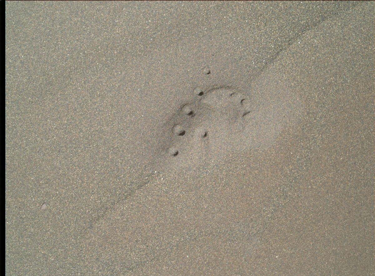
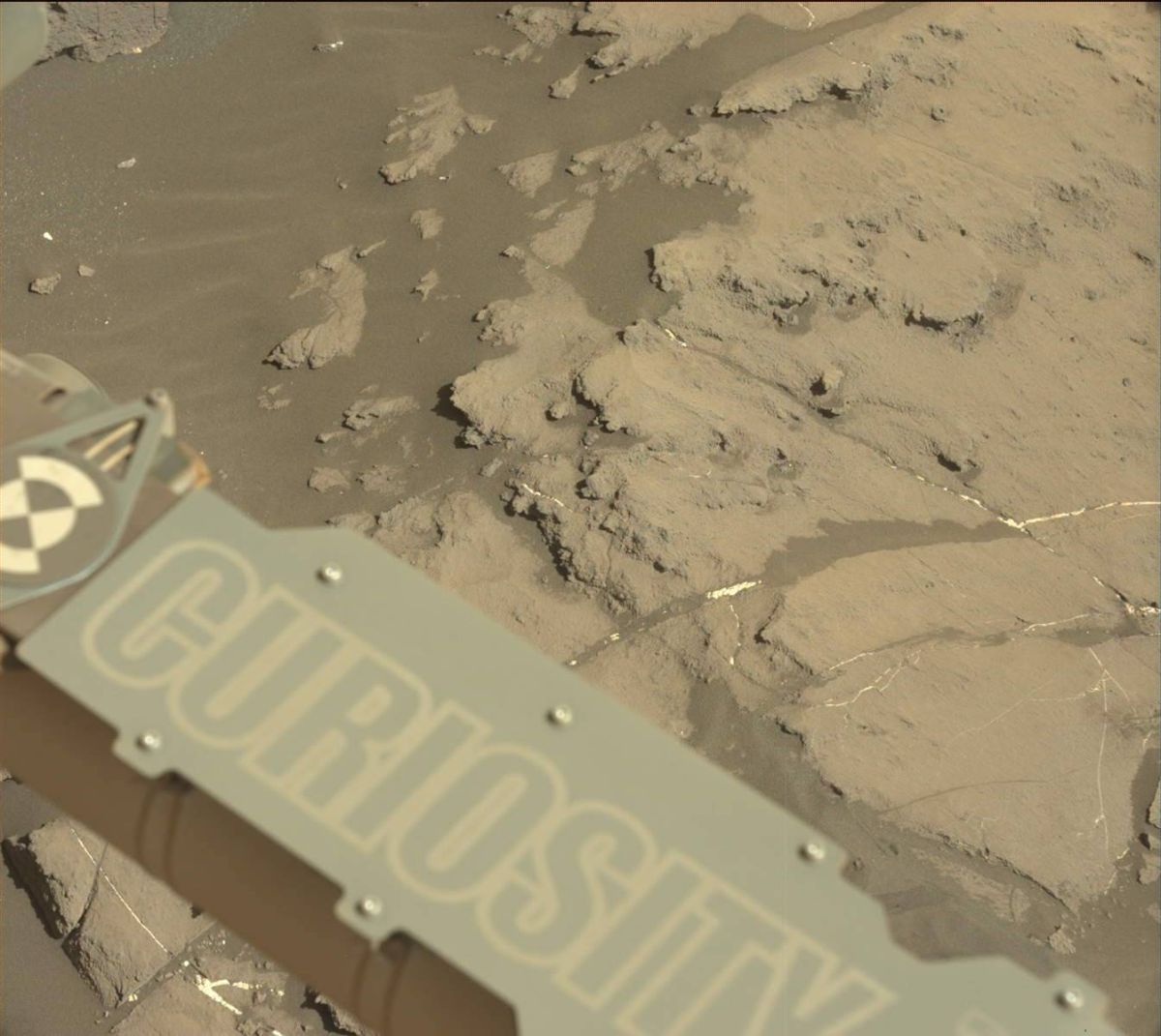
Laser-Induced Breakdown Spectrometer (LIBS) uses laser pulses to study sand scarp. Curiosity Mars Hand Lens Imager (MAHLI) took this image on February 2, 2016, Sol 1241
Credit: NASA/JPL-Caltech/MSSS
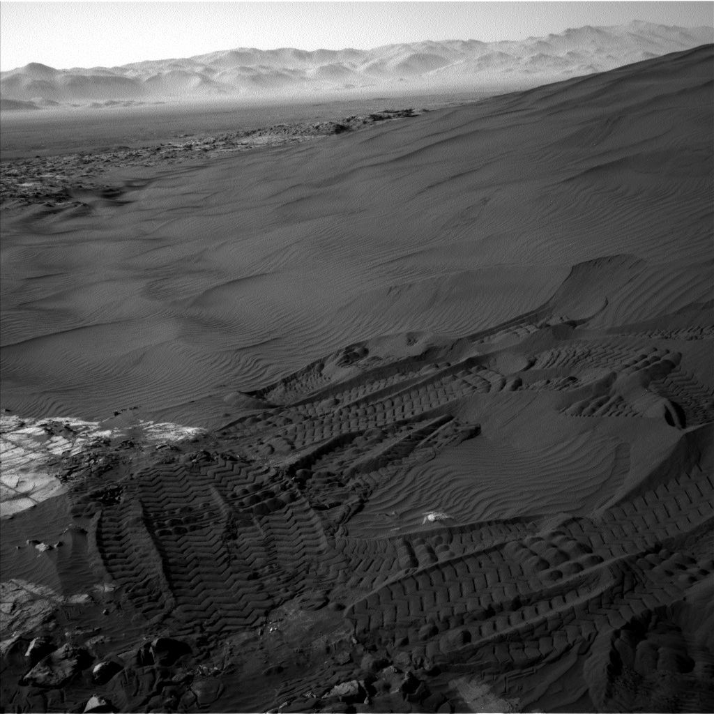
NASA’s Curiosity Mars rover remains parked at Namib dune.
While troubleshooting continues on the Collection and Handling for Interior Martian Rock Analysis (CHIMRA) anomaly, the rover’s robotic arm has been cleared for use.
In a few hours of this posting, the Mars robot will slip into Sol 1242.
Lauren Edgar, a research geologist at the USGS Astrogeology Science Center in Flagstaff reports that science investigations in this area are nearly completed
Plans are in work, Edgar says, to make use of the Mars Hand Lens Imager (MAHLI), located on the turret at the end of the rover’s robotic arm, to supplement Curiosity’s previously acquired selfie.
Also on tap are taking long-distance Chemistry & Camera (ChemCam) Remote Micro-Imager (RMI) mosaics to study layering on Mt. Sharp and the northern crater rim.
Ripple target
Previously, the rover had scuffed the edge of Namib Dune and collected scoops of sand from that dune. Curiosity’s examination of active sand dunes is the first ever done up close other than on Earth.
This view from NASA’s Curiosity Mars Rover shows the downwind side of “Namib Dune,” which stands about 13 feet (4 meters) high.
Credit: NASA/JPL-Caltech
Information gleaned from this research provides knowledge regarding active dune processes in conditions with much less atmosphere and less gravity than on Earth.
In other upcoming rover work, “we’ll also acquire a Mastcam image to document the target “Erongo,” and use Navcam to search for dust devils and monitor the atmosphere,” Edgar adds. “Then we’ll use MAHLI to document several of the scoop and dump locations.”
On the morning of Sol 1242, Mastcam and Navcam will image the ripple target “Epupa” under favorable morning illumination conditions, Edgar notes.
Dates of planned rover activities are subject to change due to a variety of factors related to the Martian environment, communication relays and rover status.

Courtesy: CIA
For all you flying saucer supporters, take a peek into the Central Intelligence Agency’s own “X-Files.”
The CIA declassified hundreds of documents in 1978 detailing the Agency’s investigations into Unidentified Flying Objects (UFOs). The documents date primarily from the late 1940s and 1950s.
There’s a vast amount of data contained in their Freedom of Information Act (FOIA) UFO collection, so the CIA decided to highlight a few documents both skeptics and believers will find interesting.
Courtesy: CIA
Within a new CIA blog on January 21, readers will find documents they claim X-Files character Agent Fox Mulder and Agent Dana Scully could use to investigate explanations for UFO sightings, such as:
Flying Saucers Reported Over East Germany, 1952; Flying Saucers Reported Over Spain and North Africa, 1952; Scientific Advisory Panel on Unidentified Flying Objects, January 1953, as well as Memorandum to the CIA Director on Flying Saucers, October 1952.
Courtesy: CIA
Go to:
https://www.cia.gov/news-information/blog/2016/take-a-peek-into-our-x-files.html
Also, the CIA issued “How to Investigate a Flying Saucer” that includes 10 tips when investigating a flying saucer at:

Credit: CNAS
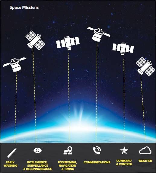
In an on-line story today from Defense One: “USAF Stands Up Space Mission Force to Counter Russia, China,” written by Patrick Tucker.
The story explains that today, on February 1, “the Air Force will stand up a Space Mission Force at the 50th Space Wing at Schriever Air Force Base, Colorado, the first of several steps meant to put more experienced and ready people in charge of watching U.S. military satellites.”
Later this year, the Defense One story adds, “the Air Force will stand up two more Space Mission Force crews in Colorado: one at the 21st Space Wing at Peterson Air Force Base and then one at the 460th Space Wing at Buckley Air Force Base.”
The Pentagon has been preparing for space war for decades, holding war games. “But the Space Mission Force represents an entirely different kind of buildup,” Tucker explains.
Limited war strategy for space
Credit: CNAS
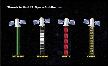
Meanwhile, late last month, the Center for a New American Security (CNAS) has issued: From Sanctuary to Battlefield – A Framework for a U.S. Defense and Deterrence Strategy for Space, authored by Elbridge Colby, the Robert M. Gates Senior Fellow at CNAS.
The revealing white paper details the vital importance of space to the United States and the increasing threat. The report outlines defense and deterrence for space and the need for a “limited war strategy for space,” along with a framework for favorably limiting war in space.
Credit: CNAS
The CNAS white paper explains that “the United States should continue to make clear that it would regard any attacks in space as constituting a grave form of escalation. But it should back that assertion with an ability to fight and prevail in a limited war in space. Nothing would be so likely to prevent any such war from happening, or to limit its baleful consequences should it break out, as a clear ability to do just that.”
Credit: CNAS
Resources:
For the Defense One story, “USAF Stands Up Space Mission Force to Counter Russia, China,” go to:
To access the new CNAS white paper, From Sanctuary to Battlefield – A Framework for a U.S. Defense and Deterrence Strategy for Space, go to:
http://www.cnas.org/from-sanctuary-to-battlefield#.Vq9t4NIrKt9

China’s Yutu robot was dispatched from the Chang’e 3 lander that softly touched down on the lunar landscape on December 14, 2013.
For the first time in a format easily accessible to all, downloads and downloads of science-quality images from China’s Chang’e 3 lander and Yutu rover are now available.
Check out her impressive new blog: “Fun with a new data set – Chang’e 3 lander and Yutu rover camera data.” Go to:
http://www.planetary.org/blogs/emily-lakdawalla/2016/01281656-fun-with-a-new-data-set-change.html

China’s Chang’e 3 lander.
Chinese Academy of Sciences/China National Space Administration/The Science and Application Center for Moon and Deepspace Exploration/Emily Lakdawalla

Map produced by Phil Stooke for the Atlas of Lunar Exploration, with many names assigned from a Chang’e 3 mission overview paper by Chunlai Li and coauthors. (Li, C. et al, 2015. The Chang’e 3 Mission Overview. Space Science Reviews, v. 190, pp. 85-101.)
Credit: Chinese Academy of Sciences/Phil Stooke

