Archive for the ‘Space News’ Category

This artist’s concept depicts NASA’s InSight Mars lander fully deployed for studying the deep interior of Mars. Robot arm would deploy the sensitive Seismic Experiment for Interior Structure (SEIS) device, white object in foreground.
Credit: NASA/JPL-Caltech
NASA announced today that the delayed InSight mission to Mars is back – headed for a May 2018 launch date, with landing on the Red Planet in late November 2018.
The Interior Exploration using Seismic Investigations, Geodesy and Heat Transport (InSight) mission was to fly this month. However, a vacuum leak in its prime science instrument prompted NASA last December to suspend preparations for launch.
InSight’s primary goal is to help us understand how rocky planets — including Earth — formed and evolved.
Redesign of SEIS
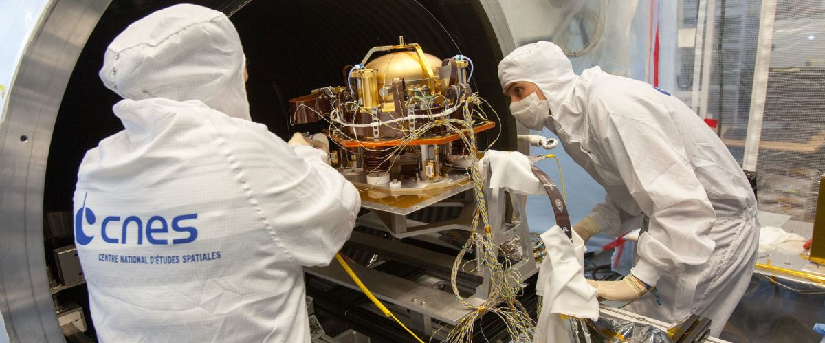
Preparing the SEIS instrument for thermal vacuum testing.
Credit: CNES / MALIGNE Frederick, 2015.
NASA’s Jet Propulsion Laboratory in Pasadena, California, will redesign, build and conduct qualifications of the new vacuum enclosure for the Seismic Experiment for Interior Structure (SEIS), the component that failed in pre-launch tests. The French space agency (CNES) will lead instrument level integration and test activities, allowing the InSight Project to take advantage of each organization’s proven strengths.
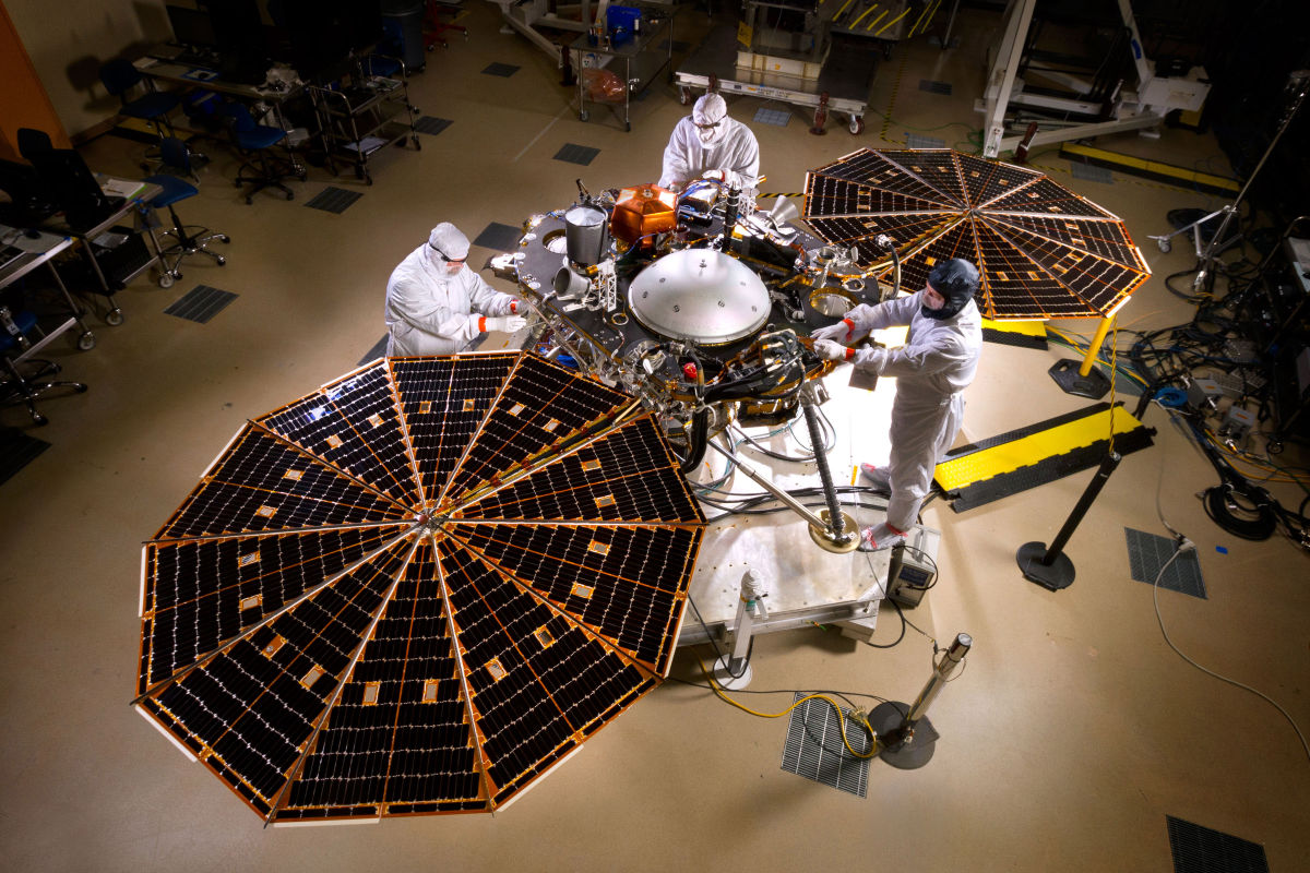
Pre-ship photo shows NASA’s InSight Mars lander spacecraft in a Lockheed Martin clean room near Denver. As part of a series of deployment tests, the spacecraft was commanded to deploy its solar arrays in the clean room to test and verify the exact process that it will use on the surface of Mars.
Credit: NASA/JPL-Caltech/Lockheed Martin
In storage
The InSight spacecraft, including cruise stage and lander, was built and tested by Lockheed Martin Space Systems in Denver. It was delivered to Vandenberg Air Force Base, California, in December 2015 in preparation for launch, and returned to Lockheed Martin’s Colorado facility last month for storage until spacecraft preparations resume in 2017.

InSight Mars lander undergoing a solar array deployment test in the MTF clean room at Lockheed Martin.
Credit: Lockheed Martin
Lockheed Martin’s spacecraft program manager for InSight, Stu Spath, said in a statement:
“We’re delighted that NASA has approved the launch of the InSight mission in May 2018. Our team worked hard to get the InSight spacecraft built and tested, and although InSight didn’t launch this year as planned, we know ultimately the scientific knowledge it will bring us is crucial to our understanding of how Mars and other rocky planets formed. Currently, we are preparing the spacecraft to go into storage at our Space Systems facility near Denver.”
The targeting of InSight’s launch to Mars begins May 5, 2018, with a Mars landing scheduled for Nov. 26, 2018.
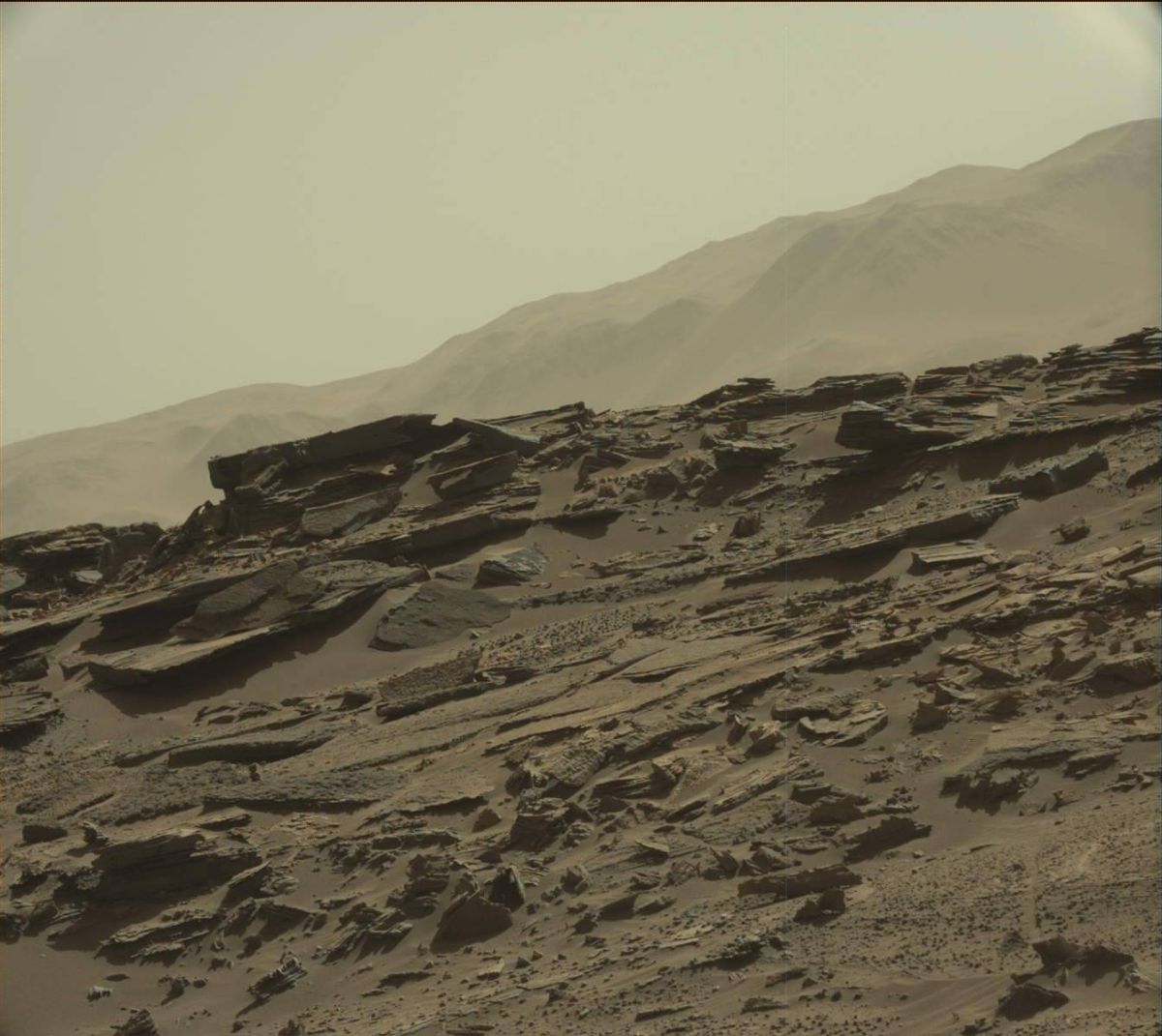
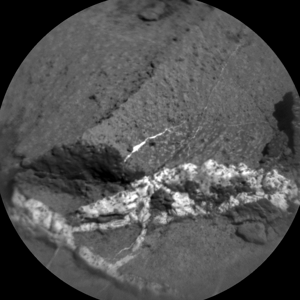
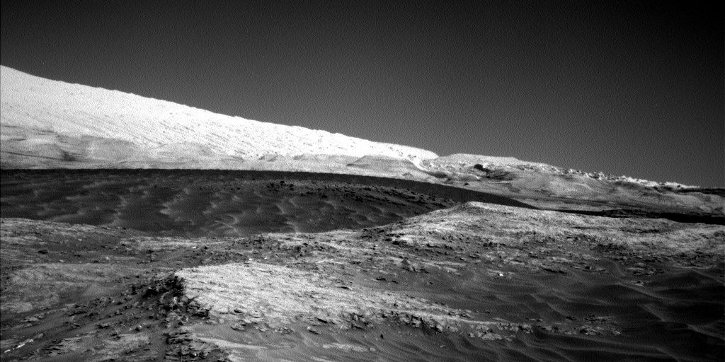
Curiosity Mastcam Left image taken on Sol 1274, March 7, 2016.
Credit: NASA/JPL-Caltech/MSSS
Word from the Mars Curiosity team is that last weekend’s drive of the rover went well.
That wheeling away on Mars put the robot in “a great location for some contact science, right near the contact between the “Murray” and “Stimson” formations, with some interesting veins and textures in the nearby rocks,” reports Ryan Anderson, a planetary scientist at the USGS Astrogeology Science Center in Flagstaff, Arizona.
The Curiosity Mars rover is at this moment in Sol 1276.
Nice location
“Given our nice location, we opted not to do any driving in the Sol 1275 plan and instead study the area in front of us,” Anderson adds.
Curiosity Mastcam Right image taken on Sol 1274, March 7, 2016.
Image Credit: NASA/JPL-Caltech/MSSS
The Sol 1275 plan started off with a Chemistry & Camera (ChemCam) passive sky observation and ChemCam’s laser-induced breakdown spectroscopy and Remote Micro-Imager (RMI) observations of the targets “Palmhorst”, “Palmwag”, and “Mirabib.”
Mastcam took documentation images of each of the ChemCam targets, plus a couple of mosaics of the Murray-Stimson contact.
Later in the day, the robot used its Mars Hand Lens Imager (MAHLI) to capture images of Mirabib before and after brushing the dust off, as well as mosaics of Palmwag and Palmhorst.
Curiosity’s Alpha Particle X-Ray Spectrometer (APXS) then analyzed the composition of Palmwag and then did an overnight measurement of Mirabib.
Knobby textures
In the March 8 plan, the goal was to place the rover in position to study some interesting knobby textures. Prior to the drive, Navcam will do some atmospheric measurements and ChemCam will analyze the targets “Duruchaus”, “Eiseb”, and “Aranos”.
As usual, Mastcam will take some documentation images of the ChemCam targets.
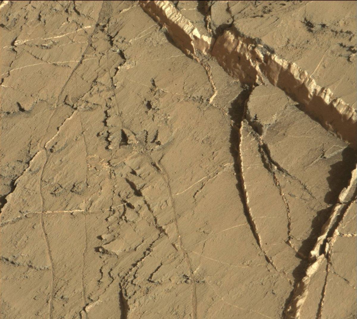
Curiosity ChemCam Remote Micro-Imager photo, take on Sol 1275. March 8, 2016.
Credit: NASA/JPL-Caltech/LANL
Mastcam also has a mosaic of fine laminations in the rock at the Murray-Stimson contact, another mosaic to extend the coverage of the contact, and a small 2×1 mosaic of Mirabib and nearby veins using all of Mastcam’s science filters.
Onward to Naukluft plateau
“After that, we will do a short drive toward the knobby texture followed by post-drive imaging. The knobby texture is not in a great position for us to continue driving after we analyze it, so we’ll likely return back to our current position before continuing up onto Naukluft plateau,” Anderson concludes.
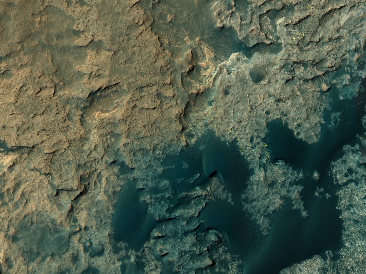
Curiosity Rover’s Location for Sol 1274
This map shows the route driven by NASA’s Mars rover Curiosity through the 1274 Martian day, or sol, of the rover’s mission as of (March, 7, 2016
Numbering of the dots along the line indicate the sol number of each drive. North is up. From Sol 1269 to Sol 1274, Curiosity had driven a straight line distance of about 130.45 feet (39.76 meters).
The base image from the map is from the High Resolution Imaging Science Experiment Camera (HiRISE) in NASA’s Mars Reconnaissance Orbiter.
Image Credit: NASA/JPL-Caltech/Univ. of Arizona
Dates of planned rover activities are subject to change due to a variety of factors related to the Martian environment, communication relays and rover status.

Courtesy of NASA/JPL-Caltech
NASA’s Jet Propulsion Laboratory (JPL) has always had solar system travel on its mind.
But a set of vintage travel posters are now available, depicting planets and moons within our solar system as potential vacation getaways.

Courtesy of NASA/JPL-Caltech/Credit: Invisible Creature Studio
“Imagination is our window into the future. At NASA/JPL we strive to be bold in advancing the edge of possibility so that someday, with the help of new generations of innovators and explorers, these visions of the future can become a reality,” explains the JPL website.
To download your own set of the posters, go to:
Curiosity’s Front Hazcam Right B image taken on Sol 1272, March 5, 2016.
Credit: NASA/JPL-Caltech
NASA’s Curiosity Mars rover is now in Sol 1273, with the weekend plan calling for driving up to the Naukluft Plateau.
On Sol 1273, the rover’s Mastcam is to acquire a multispectral image of the contact between the Murray and Stimson geologic units, explains Ken Herkenhoff of the USGS Astrogeology Science Center in Flagstaff, Arizona.
“This set of images, taken using all of the Mastcam filters, will be acquired just after noon, when the illumination of the contact should be better than in previous images,” Herkenhoff notes.
Also on tap is use of Curiosity’s Chemistry & Camera (ChemCam) instrument, along with the rover’s Mastcam to observe bedrock targets “Kleinberg” and “Tumas 2” and then acquire a stereo mosaic of a low ridge southwest of the rover.
Curiosity Navcam Left image taken on Sol 1271, March 4, 2016.
Credit: NASA/JPL-Caltech
Bedrock target
Herkenhoff adds that the Mars Hand Lens Imager (MAHLI) is slated to take images of a bedrock target named “Schwarzrand” before the dust removal tool brushes it off.
The MAHLI will then acquire a full suite of images of the brushed spot and of Kleinberg before the Alpha Particle X-Ray Spectrometer (APXS) is placed on Kleinberg to collect data. Then the APXS will be moved over to Schwarzrand data collection.
“The Sol 1274 plan starts with a drive toward the plateau to the southwest of the vehicle, followed by imaging needed to plan contact science in the new location,” Herkenhoff reports. Post-drive images of the likely drive direction, he adds, will also be acquired, “in case we decide not to do contact science on Monday.”
Curiosity’s Navcam Left B image taken on Sol 1271, March 4, 2016.
Credit: NASA/JPL-Caltech
These over the weekend planned rover activities are subject to change due to a variety of factors related to the Martian environment, communication relays and rover status.

Credit: NASA, ESA, and the Hubble Heritage Team (STScI/AURA)
An expert white paper has been released, calling upon the next U.S. administration and Congress to make space exploration and use a policy priority.
A coalition of 13 space organizations has released: “Ensuring U.S. Leadership in Space.”
Key issues
Despite a treasure trove of benefits that space has provided the United States, maintaining the country’s space leadership is not guaranteed, the white paper suggests.
There are four key issues spanning Civil, Commercial, and National Security Space that threaten U.S. leadership and require immediate attention:
Budget uncertainty; international competition; the space operating environment; and workforce trends.
Congested, contested, and competitive
In these key areas identified, the white paper flags a number of back-up statements, such as:
— NASA’s funding has fallen to historically low levels (adjusted for inflation) – below where it was during the mid-1990s – squeezing the agency’s ability to develop new missions for human exploration, astronomy, planetary science, Earth science, solar science, technology development, and aeronautics research, which has led to cost and schedule inefficiencies for ongoing programs and missions.
Credit: Lockheed Martin
— Fourteen countries – including North Korea – operate their own launch vehicles and more than 100 nations have some type of space program. At least four countries are presently investing billions of dollars in the development of new launch systems. The U.S. is beginning to win back market share of commercial satellite launches for the first time in over a decade. Policies that promote open competition and innovation should be prioritized to maintain this positive trend, but mission assurance for national security launches remains paramount.
— Space is an increasingly congested, contested, and competitive domain in which space-based assets are threatened by orbital debris as well as cyber and kinetic attacks. Moreover, there is risk introduced by both unintentional and intentional interference (jamming) of radiofrequencies by both terrestrial and space-based systems. This puts human missions at risk and threatens the safety of all space platforms.

LauncherOne hauls satellites into orbit.
Credit: Virgin Galactic
— Although the U.S. space workforce remains one of the largest in the world, the U.S. civilian space workforce has declined more than 17 percent since 2006 due to reduced U.S. space exports, reduced government space budgets, and increased foreign competition. As an example, of the world’s 25 largest commercial satellite operators, only one is based in the United States.
Actions needed
The white paper suggests several actions needed to continue U.S. leadership in space, such as:
- Commit to predictable budgets, fund robust investments, promote innovative partnerships, and repeal the Budget Control Act of 2011.
- Continue global space engagement.
- Restore American access to space.
- Encourage the continued use of fully competitive, innovative partnerships.
- Maintain, strengthen, and grow the domestic industrial base.
- Commit to a robust national security space program that maintains U.S. dominance of the high ground in space.
- Define and commit to new missions to expand the frontiers of science.
Coalition groups

Credit: M. Wade Holler
Director, Digital Content and Media Strategy
Explore Mars, Inc.
Used with permission
The Coalition is led by the American Institute of Aeronautics and Astronautics (AIAA), Commercial Spaceflight Foundation, and the Space Foundation, with members: Aerospace Industries Association, Aerospace States Association, American Astronautical Society, Coalition for Deep Space Exploration, Colorado Space Coalition, Satellite Industry Association, Silicon Valley Space Business Roundtable, Space Angels Network, Space Florida, and the Students for the Exploration and Development of Space.
The Coalition’s lead group, the American Institute of Aeronautics and Astronautics (AIAA), is an organization having more than 30,000 engineers and scientists from 88 countries dedicated to the global aerospace profession.
For the full white paper, go to:
http://www.aiaa.org/EnsuringUSLeadershipInSpace/
Also, go to:
http://www.aiaa.org/uploadedFiles/Whats_New/EnsuringUSLeadershipInSpace_FINAL.pdf
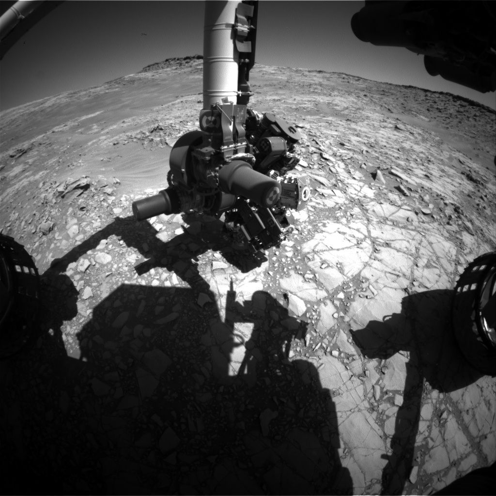
Curiosity rover’s Front Hazcam Right B acquired this image on Sol 1269, March 2, 2016.
Credit: NASA/JPL-Caltech
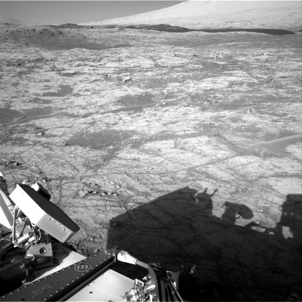
NASA’s Curiosity Mars rover is now in Sol 1270 and wheeling its way toward the Naukluft Plateau. Monday’s plan was full of driving and remote sensing.
Curiosity was slated to take Chemistry & Camera (ChemCam) and Mastcam observations of the target “Swartpunt.”
Curiosity Navcam Right B image taken on Sol 1269, March 2, 2016.
Credit: NASA/JPL-Caltech
Then the plan was to drive toward the Naukluft Plateau, and acquire post-drive imaging to prepare for future targeting and document the Murray formation along the way, explains Lauren Edgar, a research geologist at the USGS Astrogeology Science Center in Flagstaff and a member of the rover mission’s science team.
Atmosphere above Mount Sharp
Also on the “to do list” was a number of ChemCam calibration activities, and a Navcam movie to monitor the atmosphere above Mount Sharp.
“We’ll also acquire a large Mastcam mosaic to study the stratigraphy exposed on the east side of the Naukluft Plateau,” Edgar reports.
NASA’s Mars rover Curiosity acquired this image using its Mars Hand Lens Imager (MAHLI), located on the turret at the end of the rover’s robotic arm, on March 2, 2016, Sol 1269.
Credit: NASA/JPL-Caltech/MSSS
Dates of planned rover activities are subject to change due to a variety of factors related to the Martian environment, communication relays and rover status.

The European Space Agency’s ExoMars 2016 mission is set to launch on March 14 from the Baikonur Cosmodrome in Kazakhstan.
ExoMars is a joint endeavor between ESA and Russia’s Roscosmos space agency, and comprises the Trace Gas Orbiter (TGO) and Schiaparelli, an entry, descent and landing demonstrator.
Turns out that NASA’s Opportunity rover might have a ringside seat to view Schiaparelli’s descent and landing.
Schiaparelli is designed to demonstrate a range of technologies to enable a controlled landing on Mars in preparation for future missions. That lander will separate from the TGO on October 16 and land on Mars on October 19.
Schiaparelli’s primary landing site is a plain known as Meridiani Planum. This area interests scientists because it contains an ancient layer of hematite, an iron oxide that, on Earth, almost always forms in an environment containing liquid water.

The ExoMars 2016 entry, descent, and landing demonstrator module, also known as Schiaparelli, will touch down on Meridiani Planum, a relatively smooth, flat region on Mars, on October 19, 2016. The lowest areas on this map are shown in green, while the highest areas are dark brown. The large crater on the right (East) of the image is Endeavour, which is about 14 miles (22 kilometers) in diameter. Opportunity has been studying its western rim since 2011.
Credit: ESA/IRSPS/TAS-I
Sky show?
The veteran Opportunity rover landed in Meridiani Planum on January 25, 2004.
Opportunity is roughly 790 miles (1,275 kilometers) away from the center of Schiaparelli’s landing ellipse.

Scenic view from NASA’s Opportunity rover.
Credit: NASA/JPL-Caltech
There has been some contact between the Opportunity rover planners and ExoMars scientists on whether or not the U.S. rover would be in a position to capture the descent. “We will do it if possible,” notes Ray Arvidson of Washington University in Saint Louis. He is Mars Exploration Rover Deputy Principal Investigator.
Meridiani Planum is of interest to scientists because it contains an ancient layer of hematite, an iron oxide that, on Earth, almost always forms in an environment containing liquid water.
Smectite signature
Opportunity remains busy on Mars.
“We have been spending a lot of time mapping Knudsen Ridge, one of the southern walls bounding Marathon Valley,” Arvidson told Inside Outer Space. There are interesting structures with tan or dark rocks interwoven with recessive bright red rocks, he adds, with the latter perhaps carrying the smectite signature.”

Opportunity image from Front Hazcam, Sol 4297.
Credit: NASA/JPL-Caltech
Smectite is a clay mineral that yields information about the ancient environment of Mars.
Opportunity is exploring Marathon Valley on the rim of Endeavour crater. The rover is up on the very steep slopes of Knudsen Ridge.
Interesting and unique geology
Opportunity has been investigating the western rim of a 14-mile-wide (22-kilometer-wide) crater named Endeavour since 2011. This winter, it is examining rocks on the southern side of Marathon Valley which slices through Endeavor Crater’s rim from west to east. This is a location where observations by NASA’s Mars Reconnaissance Orbiter have mapped concentrations of clay minerals that would have formed under wet, non-acidic conditions.
Arvidson says that as the spring season arrives, Opportunity controllers will finish investigations at the current location with the rover wheeling to the northern side of Marathon Valley to finish up characterization of the dark boulder field.
“Still very interesting and unique geology for Marathon Valley,” Arvidson explains, “with the valley floor red rocks very unusual.”

Artist’s concept of the Tiangong-1 in Earth orbit.
Credit: CMSA
China is set to launch its second space laboratory – Tiangong-2 – in the third quarter of this year. That launch is to be followed by the liftoff of the piloted Shenzhou-11 spacecraft.
The state-run Xinhua news agency has reported that the fourth quarter launch of Shenzhou-11 will carry two crew members that will dock with the Tiangong-2.
Also on tap is first use of a cargo ship – Tianzhou-1 – in the first half of 2017, also headed for a link up with Tiangong-2.
The automated Tianzhou-1 ferry ship is to be rocketed into Earth orbit via a Long March-7 booster – a first test of which is slated in June, departing from China’s new Wenchang satellite launch center in south China’s Hainan Province.
Space station progress
Meanwhile, the China Academy of Launch Vehicle Technology is now engaged in final tests of the Long March 5 booster, also to undergo a maiden flight this year from Wenchang.
Chinese space planners have stated a core module of its space station will be orbited in 2018 to test related technologies and to research engineering issues. The station would become fully operational in about 2022, according to government sources.
China’s still operating Tiangong -1, launched in September 2011, was visited by a single uncrewed Shenzhou and two piloted Shenzhou missions between 2011 and 2013.
Different tasks
According to the China Radio International’s English Service, the yet-to-be launched Tiangong-2 was developed on the basis of its predecessor. However, Deputy Director of the Manned Space Program Office, Wu Ping, says the 2nd space lab will perform different tasks.
“The Tiangong-2 space lab will carry out various scientific experiments and space application experiments. Astronauts will stay in Tiangong-2 for a longer period of time, performing these experiments with key technologies involved,” CRI English.com reports.
Wu is reported as saying that the astronauts will stay in space for 30 days, doubling China’s previous record of the longest manned space mission.
Chief Engineer of Tiangong-2, Zhu Zongpeng, says the space lab was specifically designed for longer stays in space.
“A 30-day stay in space is an internationally recognized medium-range threshold for manned missions. We will complete the mission with the support of a manned spacecraft, so Tiangong-2 must be able to offer more storage space for daily supplies. Secondly, we have designed it to provide a more comfortable living and working environment for the astronauts.”
According to CRI English.com the chief engineer adds that Tiangong 2 will also test technologies that will eventually be applied to China’s first space station.
“The still to-be-tested technologies will focus on the maintenance of the space station. We have also built a mechanical arm, which will provide automatic maintenance services. We all know that astronauts face challenges and risks when they leave the space station to perform external maintenance. We can solve that problem if we use machines to do that.”
Over a dozen tasks and experiments are slated to take place on Tiangong 2 covering areas such as microgravity, fundamental physics, space material science and space life science, CRI English.com reports.

Image of China’s Chang’e 3 lunar lander taken by Yutu rover. Equipment on the stationary lander continues to operate after landing on the Moon in December of 2013.
Credit: Chinese Academy of Sciences
Moon lander still working
In other related matters, the Xinhua news agency noted on February 20 that China’s moon lander, Chang’e-3 entered its 28th lunar day. Chang’e-3 soft landed on the Moon in December 2013, later dispatching the Yutu rover.
China’s State Administration of Science, Technology and Industry for National Defense (SASTIND) said the robust lander has exceeded its design life by 14 months. The stationary lander’s astronomical telescope and other surveying devices it is carrying still work well, SASTIND reports.
Lastly, SASTIND points out that preparation for the country’s next lunar probe mission, Chang’e-5, is under way, and it is expected to be launched around 2017.

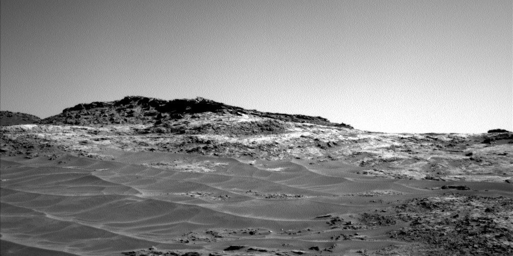
Curiosity Mastcam Left image taken on Sol 1264, February 25, 2016.
Credit: NASA/JPL-Caltech/MSSS
The weekend warrior, NASA’s Curiosity Mars rover, is now carrying out Sol 1266 duties – a plan that “has a nice mix of science and driving,” reports Ryan Anderson, a planetary scientist at the USGS Astrogeology Science Center in Flagstaff Arizona.
The rover is slated to have started off on Sol 1266 with Chemistry & Camera (ChemCam) observations of the targets “Ugab”, “Rooibank” and “Stockdale.”
Zapping tasks
“We will zap the Rooibank target using two different laser energies to see if that helps us figure out the amount of hydrogen in the target. Afterwards, Mastcam has some documentation images of the ChemCam targets, and then we will do some contact science,” Anderson adds.

Curiosity Navcam Left B image taken on Sol 1265 February 26, 2016.
Credit: NASA/JPL-Caltech
Also on tap is use of the Mars Hand Lens Imager (MAHLI) to take some images of “Waterburg”, then the Dust Removal Tool (DRT) is to brush the dust off of “Stockdale” and MAHLI will take some pictures of that target too.
Anderson explains that, after the DRT, Mastcam will observe the Stockdale target with all of its science filters, and the Alpha Particle X-Ray Spectrometer (APXS) is scheduled to do an overnight observation on the brushed location.
Mars mosaic
On Sol 1267, the plan calls for the Mastcam to take a big mosaic of the edge of the Naukluft plateau, “which will give us a nice view of the geology there and help us decide what to do as we get closer,” Anderson notes. “After that, the rover will continue driving toward the plateau and do the usual post-drive imaging, plus some additional Mastcam [picture taking] off to the right hand side of the rover.”

Curiosity Mastcam Left Sol 1264 February 25, 2016.
Credit: NASA/JPL-Caltech/MSSS
Next day, Sol 1268, the rover is to make untargeted observations. ChemCam has a passive sky observation, and Mastcam will observe its calibration targets so the filter observations of Stockdale can be calibrated, Anderson advises. To wrap up the plan, Navcam will do its usual atmospheric monitoring observations, he concludes.

Credit: NASA/JPL-Caltech
Rover activities over the next several Sols are subject to change due to a variety of factors related to the Martian environment, communication relays and rover status.

This map shows the route driven by NASA’s Mars rover Curiosity through the 1260 Martian day, or sol, of the rover’s mission on Mars as of February, 22, 2016. Numbering of the dots along the line indicate the sol number of each drive. North is up. The scale bar is 1 kilometer (roughly 0.62 mile). From Sol 1256 to Sol 1260, Curiosity had driven a straight line distance of about 22.14 feet (6.75 meters).The base image from the map is from the High Resolution Imaging Science Experiment Camera (HiRISE) in NASA’s Mars Reconnaissance Orbiter.
Credit: NASA/JPL-Caltech/Univ. of Arizona

Credit: NASA
The U.S. House Science, Space, and Technology Committee held a hearing on February 25, focusing on The Space Leadership Preservation Act and the need for stability at NASA despite changing presidential administrations.
Those testifying took on the key challenges facing NASA today, as well as what organizational changes might be made to ensure more stability for America’s civil space program.
Consistency in goals, constancy of purpose
In the past there have been suggestions of changing the management structure of NASA, perhaps modeling it after other agencies, such as the National Science Foundation. Doing so would perhaps provide more consistency in goals and constancy of purpose.
![]()
The hearing featured input from former astronaut and first female Space Shuttle pilot and commander, Eileen Collins, former NASA Administrator Michael Griffin, and Rep. John Culberson, author of the Space Leadership Preservation Act.
$20 billion+ of waste
Congressman Culberson pointed out that over the last three decades, “NASA programs have been cancelled due to cost-overruns, mismanagement or abrupt program changes at the start of each new administration. In the past 20 years alone, 27 programs have been cancelled resulting in over $20 billion wasted on uncompleted programs. That is unacceptable. Our space program is too important to continue on this path.”
Resources:
A background/hearing charter is available at:
Prepared testimony is available by going to:
— Michael Griffin, Former Administrator, NASA
— Eileen Collins, USAF (Retired); NASA Astronaut, Commander, STS-93 and 114; NASA Astronaut, Pilot, STS-63 and 94
— Cristina Chaplain, Director of Acquisition and Sourcing Management, U.S. Government Accountability Office (GAO)
To view the entire hearing, go to:

