Archive for the ‘Space News’ Category
 Author:
  July 27th, 2016
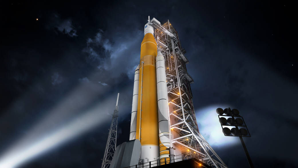
Space Launch System.
Credit: NASA
The U.S. Government Accountability Office (GAO) has issued two new reports on the overall status of NASA’s Space Launch System and the space agency’s next piloted program, Orion.
What GAO found in summary is that the SLS has resolved some technical issues and matured its design since GAO’s July 2015 report, but pressure remains on the program’s limited cost and schedule reserves.
This pressure, in turn, threatens its committed November 2018 launch readiness goal, the GAO reported.
Software: substantial risk
In reviewing the Orion program, what GAO found the project has overcome several technical challenges and made design changes to the crew capsule to reduce risk.

NASA’s Orion spacecraft headed outward to Mars.
Credit: Lockheed Martin
Known challenges, however, remain—such as development of the service module and the crew capsule heat shield, among others—that could cause cost increases and schedule delays as the program undergoes integration and test.
“Technical challenges are inherent in complex programs such as Orion, but if not carefully managed, they could result in cost overruns and schedule delays. For example, the program has identified software development as an area of substantial risk with a potential cost impact of more than $90 million and which may result in schedule delays,” the GAO report explains.
Resources
Reports:
NASA Human Space Exploration: Opportunity Nears to Reassess Launch Vehicle and Ground Systems Cost and Schedule: GAO-16-612, July 27.
- Report: http://www.gao.gov/products/GAO-16-612
- Highlights: http://www.gao.gov/assets/680/678693.pdf
- Podcast: http://www.gao.gov/multimedia/podcasts/678379
Orion Multi-Purpose Crew Vehicle: Action Needed to Improve Visibility into Cost, Schedule, and Capacity to Resolve Technical Challenges: GAO-16-620, July 27.
- Report: http://www.gao.gov/products/GAO-16-620
- Highlights: http://www.gao.gov/assets/680/678705.pdf
- Podcast: http://www.gao.gov/multimedia/podcasts/678379
 Posted in
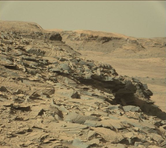
Taming a resource-rich Mars can assure that future inhabitants live long and prosper. This image taken by NASA’s Curiosity Mars rover: Mastcam Right image taken on Sol 1301, April 3, 2016.
Credit: NASA/JPL-Caltech/MSSS
A NASA technical memorandum has taken a detailed look at the prospect of putting in place a sustainable colony of people on the Red Planet. Such a settlement can be safe, affordable, and nurture independence of residents on Mars from Earth.
The document is titled Frontier In-Situ Resource Utilization for Enabling Sustained Human Presence on Mars, authored by Robert Moses and Dennis Bushnell of NASA’s Langley Research Center in Hampton, Virginia.
Massive resources
“There are massive resources on Mars obtainable from the atmosphere and extracted from the regolith which are capable of supporting human colonization,” the report explains. Using Martian resources, existing technologies could supply water, oxygen, fuel, and building materials, they write, “to relax the dependence on Earth during the buildup of a colony on Mars.”
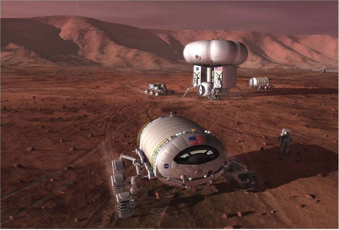
Early pioneering of Mars is expected to provide a gateway for developing the means to sustain a colony of people.
Credit: NASA/Pat Rawlings
Check out my new Space.com story on this important and wide-ranging paper. Go to:
Mars Colonists Must ꞌLive Off the Landꞌ: NASA Report
July 27, 2016/07:30am ET

Curiosity Mars Hand Lens Imager (MAHLI) image taken on July 24, 2016, Sol 1410.
Credit: NASA/JPL-Caltech/MSSS
NASA’s Curiosity Mars rover is now in Sol 1412.
Last weekend the rover made good progress, driving almost 223 feet (68 meters).
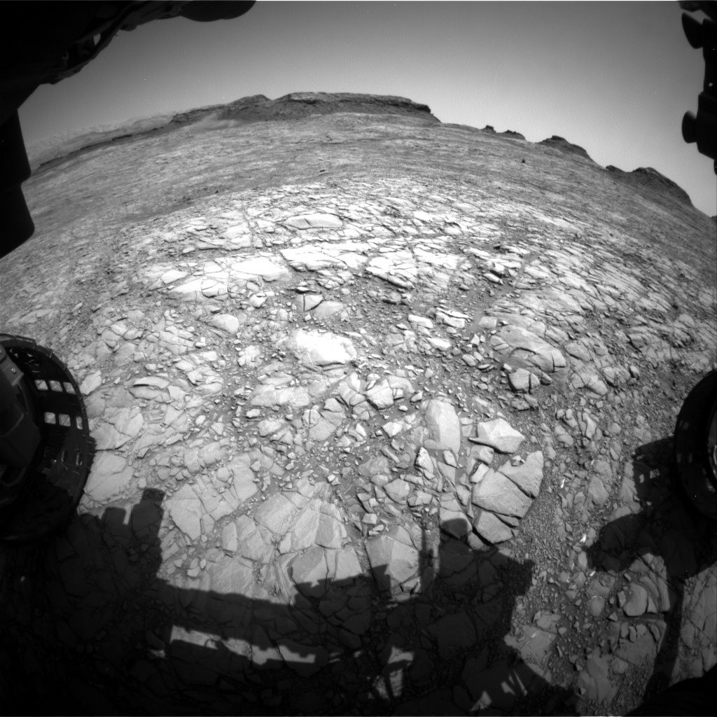
Image taken by Curiosity’s Front Hazcam Left B on Sol 1411, July 25, 2016.
Credit: NASA/JPL-Caltech
Before the drive, Curiosity’s Chemistry and Camera (ChemCam) and Mastcam were to observe bedrock targets “Jamba” and “Huambo” and the Right Mastcam was on tap to acquire a 3-image mosaic of a small depression called “Mungo.”
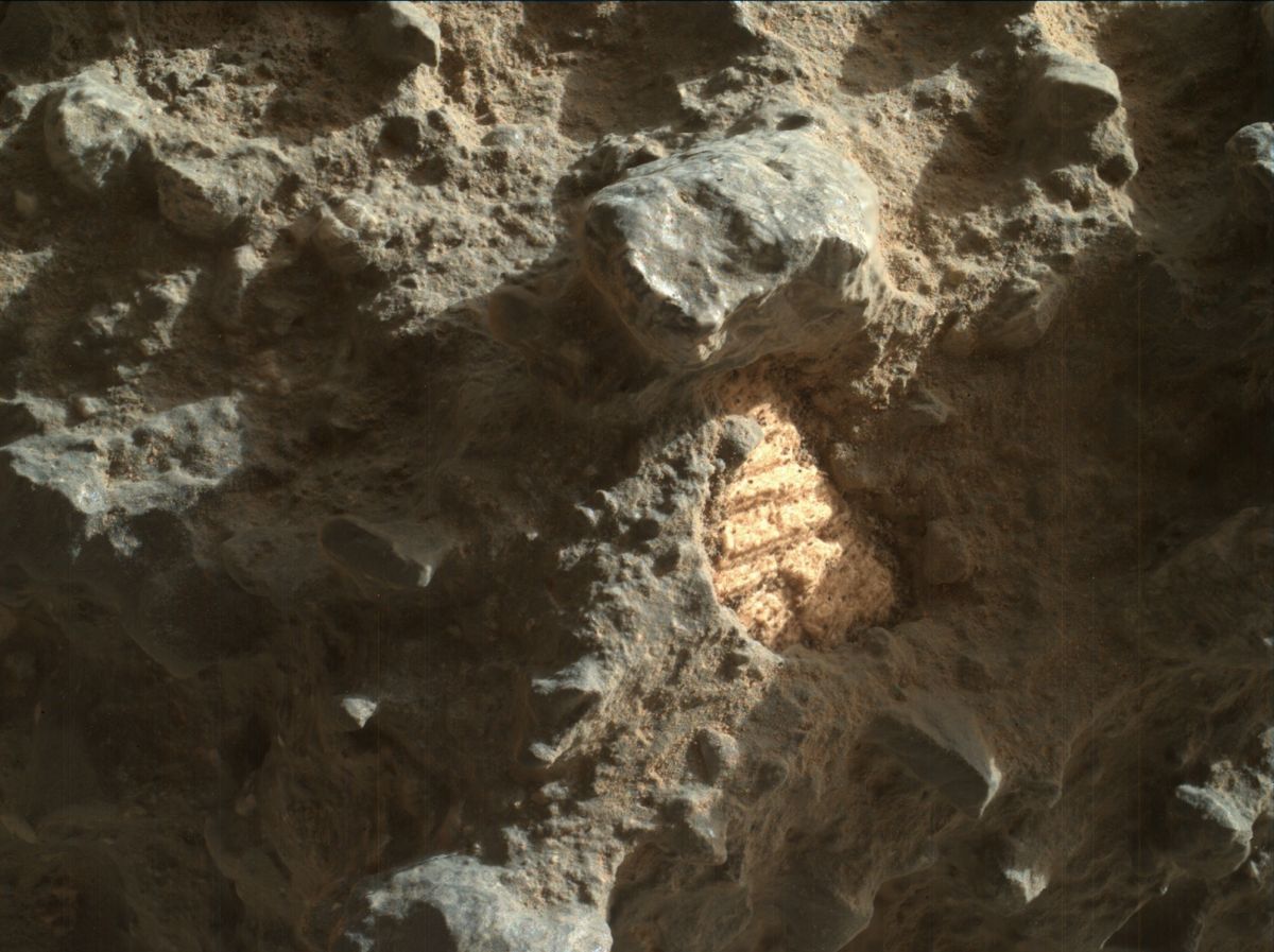
Curiosity Mars Hand Lens Imager (MAHLI) image taken on July 26, 2016, Sol 1411.
Credit: NASA/JPL-Caltech/MSSS
Atmospheric dustiness
After acquiring the post-drive imaging needed to plan future mobility, ChemCam was slated to use special software to autonomously select a new target for a Laser Induced Breakdown Spectroscopy (LIBS) raster.
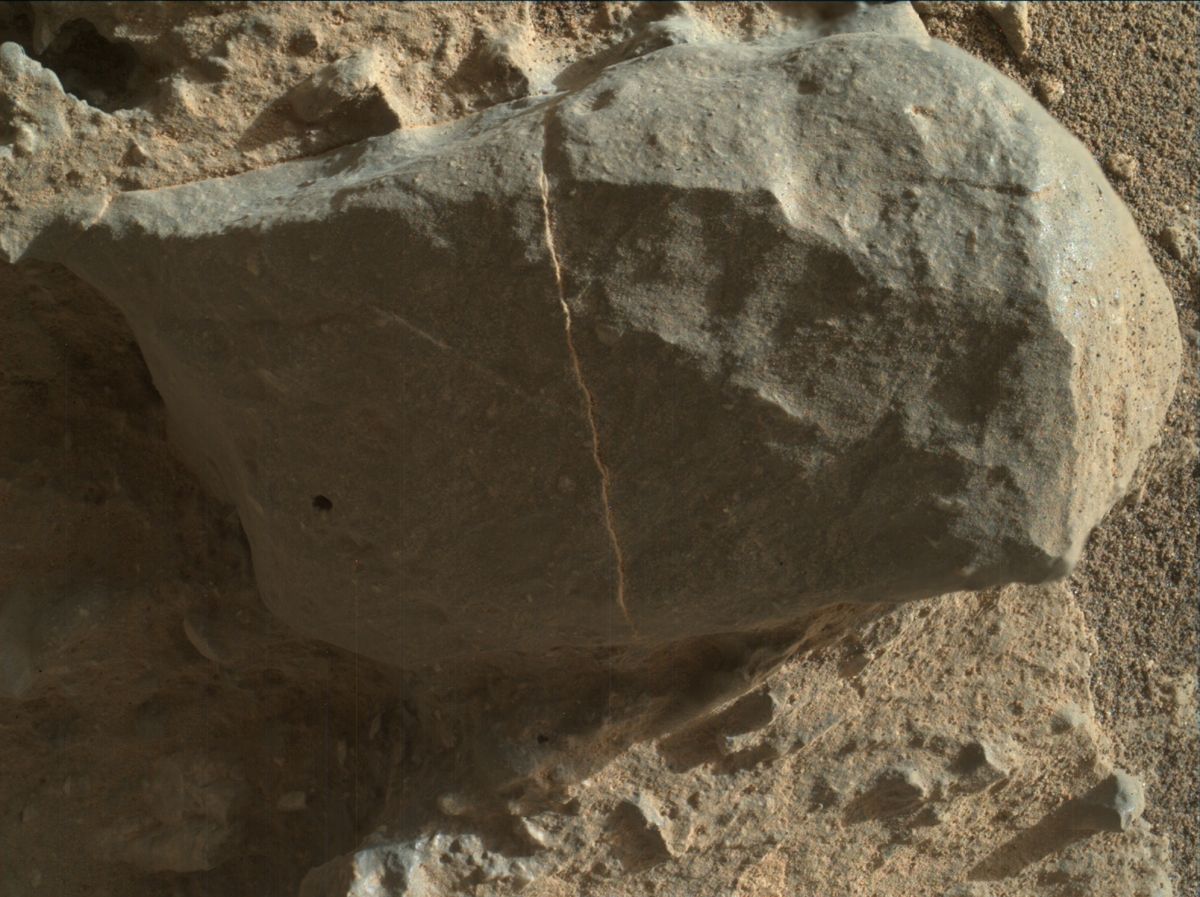
Curiosity Mars Hand Lens Imager (MAHLI) image taken on July 26, 2016, Sol 1411.
Credit: NASA/JPL-Caltech/MSSS
According to Ken Herkenhoff of the USGS Astrogeology Science Center in Flagstaff, Arizona, the robot’s Navcam was set to search for clouds and dust devils, and its Mastcam would measure the dustiness of the atmosphere. The dust measurements will be repeated at noon and mid-afternoon to look for changes during the day.
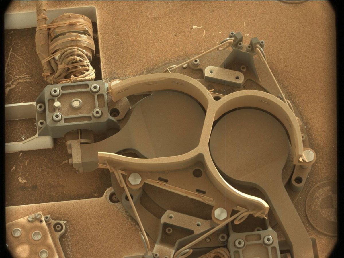
Dusty environment of Mars. Curiosity Mastcam Left image taken on Sol 1409, July 24, 2016.
Credit: NASA/JPL-Caltech/MSSS
Also on tap, Curiosity’s Right Mastcam was to acquire a 14-image mosaic of the Murray Buttes.
Dates of planned rover activities are subject to change due to a variety of factors related to the Martian environment, communication relays and rover status.
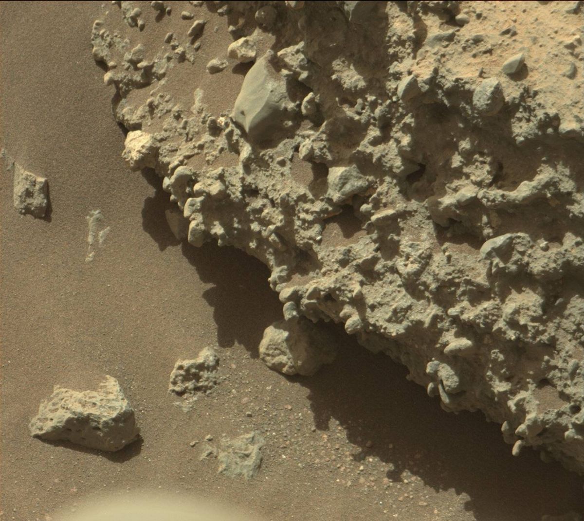
Curiosity Mastcam Right image taken on Sol 1407, July 21, 2016.
Credit: NASA/JPL-Caltech/MSSS
Now in Sol 1409, NASA’s Curiosity Mars rover has focused its observations on a blocky deposit dubbed “Bimbe.”
Other targets over the weekend that are under scrutiny with rover instruments are “Seeis”, “Seeheim”, “Wilhelmstal”, “Oranjemund” , “Funda” and “Zambezi”.

Curiosity Navcam Left B image taken on Sol 1407, July 21, 2016.
Credit: NASA/JPL-Caltech
Drive planned
On Sol 1410, the rover’s Chemistry & Camera (ChemCam) has an observation of the target “Mariental” with support from Mastcam.
“After that, we drive and do the usual post-drive imaging,” explains Ryan Anderson, a planetary scientist at the USGS Astrogeology Science Center in Flagstaff, Arizona.
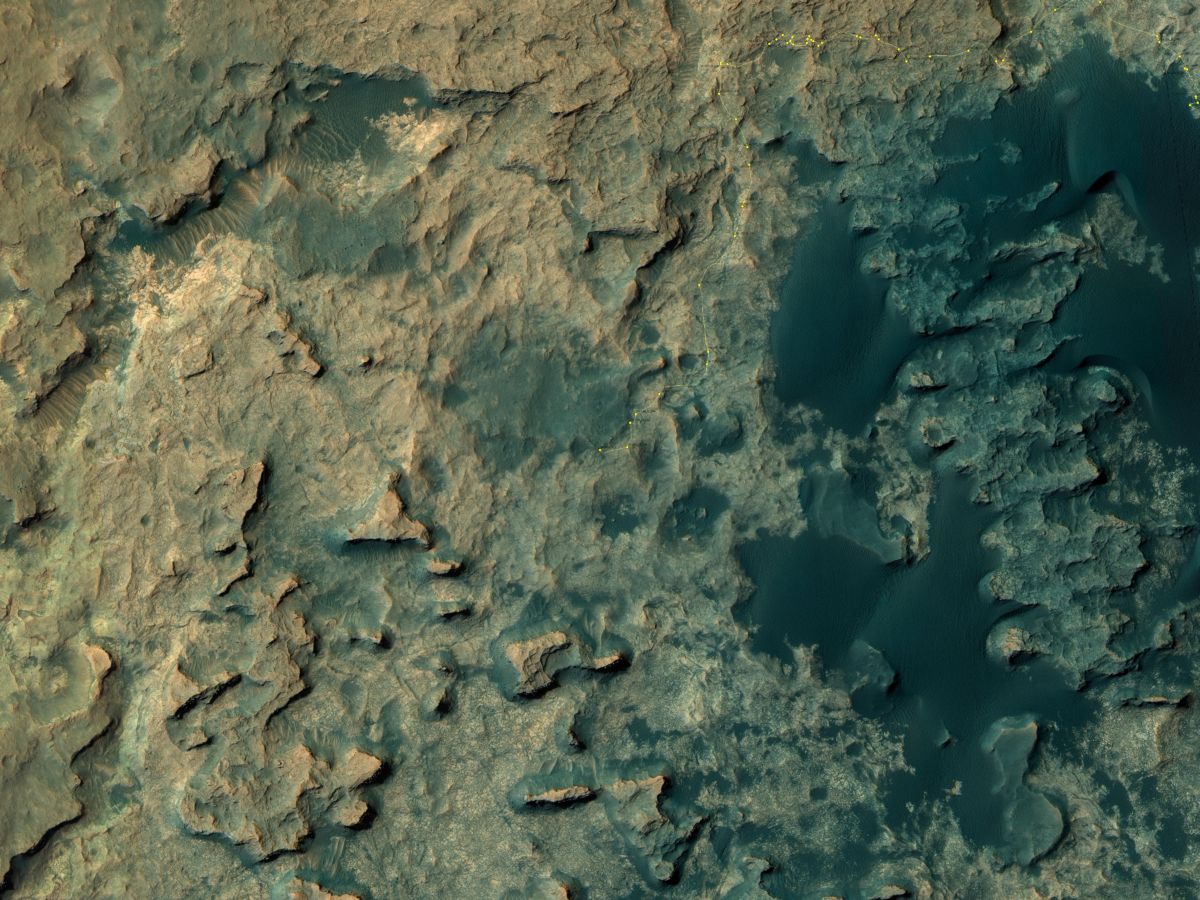
The base image from the map is from the High Resolution Imaging Science Experiment Camera (HiRISE) in NASA’s Mars Reconnaissance Orbiter.
Credit: NASA/JPL-Caltech/Univ. of Arizona
Rover deck deposits
On Sol 1411, the rover’s Mastcam has an observation of the rover deck to watch for dust and sand that end up on top of the rover, Anderson adds.
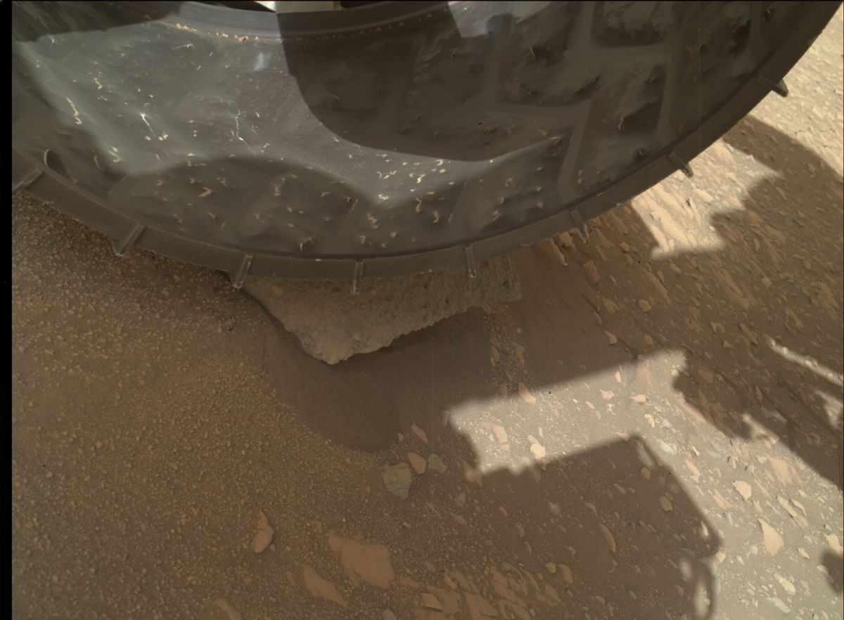
Wheel atop rock. Mars rover Curiosity acquired this image using its Mars Hand Lens Imager (MAHLI) on July 21, 2016, Sol 1407.
Credit: NASA/JPL-Caltech/MSSS
Dates of planned rover activities are subject to change due to a variety of factors related to the martian environment, communication relays and rover status.
New map
Meanwhile, a new map has been released showing the route driven by NASA’s Mars rover Curiosity through the 1405 Martian day, or sol, of the rover’s mission on Mars (July, 20, 2016).
Numbering of the dots along the line indicate the sol number of each drive. North is up.

NASA’s Mars rover Curiosity acquired this image using its Mars Hand Lens Imager (MAHLI) on July 21, 2016, Sol 1407.
Credit: NASA/JPL-Caltech/MSSS
From Sol 1401 to Sol 1405, Curiosity had driven a straight line distance of about 89.50 feet (27.28 meters).
Since touching down in Bradbury Landing in August 2012, Curiosity has driven 8.31 miles (13.37 kilometers).

Graphic above by Danielle Futselaar is the famous Drake Equation, representing the full spectrum of science undertaken at the SETI Institute. Wherever you are on Earth, the Drake Equation represents all explorations of our lives, and life beyond our home planet.
Credit: Danielle Futselaar/SETI Institute
There are new developments in the Search for Extraterrestrial Intelligence, or SETI for short.
In the SETI business, two game-changers are notable, explains Jill Tarter, Director, Center of SETI Research and the Bernard M. Oliver Chair for SETI.

Jill Tarter, Director, Center of SETI Research and the Bernard M. Oliver Chair for SETI.
Credit: SETI Institute
“I’ve spent my professional life searching for alien life. Over the span of my career, I’ve seen our equipment change dramatically, from custom built microchips and signal processors we had to design and build ourselves to the enterprise servers that run our search algorithms today,” Tarter explains in a newly issued communiqué from SETI central.
Those two game-changers are:
- The discovery that there are more planets than stars in the Milky Way; and
- The evidence of life thriving in the most extreme environments here on Earth.
More bio-friendly
“The universe appears to be a lot more bio-friendly to life than we once thought,” Tarter observes. “Now we want to find out if any of that potentially habitable real estate is actually inhabited.”
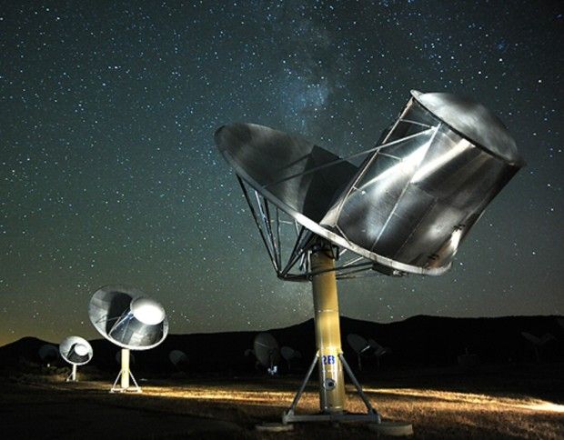
Giving a listen for other star folk, the Allen Telescope Array in California.
Credit: SETI Institute
Tarter underscores that SETI is a unique exploratory science that began in 1984 in partnership with NASA.
“Since 1993, however, we’ve had to rely on private sources of funding to continue this search that costs us $590,000 annually to cover staff and basic equipment. We need to raise $70,000 this summer to stay on track,” Tarter explains.
Campaign for SETI
The SETI Institute’s Allen Telescope Array scans the sky for signals 365 days a year.

Credit: SETI Institute
“It is the only facility that searches for SETI signals in near real time and thus it can better filter out interference from our own technologies,” Tarter points out. “Our tools are improving daily, but we need your help to keep them scanning the skies,” Tarter adds, “because it’s a pretty big search out there with so many exoplanets having the potential for life, and so many different types of signals to examine.”
To learn more about the campaign, go to:
https://teamseti.org/vid-donate-2?erid=1373805&trid=f81b6d67-4b24-4cc7-a7eb-763a917bfaa6
Also, tune into this informative You Tube video on SETI at:
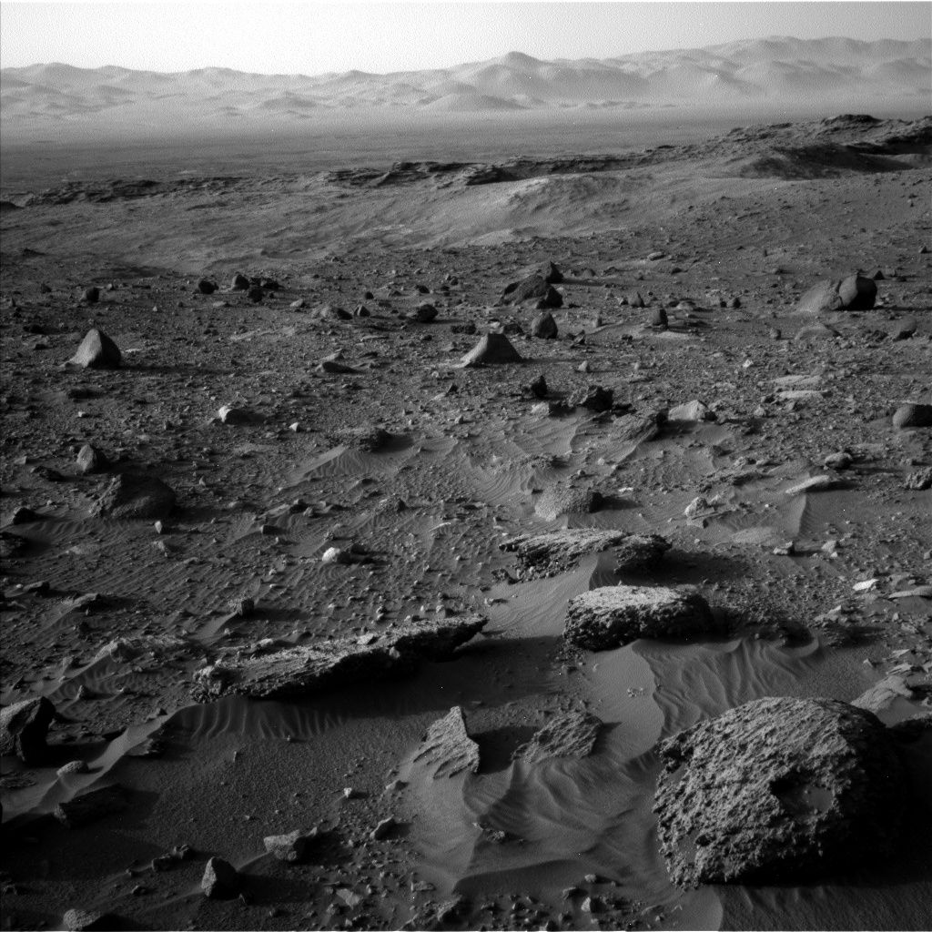
Curiosity Navcam Left B image taken on Sol 1405, July 19, 2016.
Credit: NASA/JPL-Caltech
New imagery has become available of NASA’s Mars Curiosity, busily at work on the Red Planet.
The rover is now in Sol 1406.

Curiosity used its Mars Hand Lens Imager (MAHLI) to acquire this up-close image on Sol 1405, July 19, 2016. MAHLI is located on the turret at the end of the rover’s robotic arm.
Credit: NASA/JPL-Caltech/MSSS
The rover landed in Mars’ Gale Crater in August 2012.
NASA recently approved an additional two-year extension, beginning Oct. 1, 2016, for the Mars Science Laboratory Project, which developed and operates Curiosity.

Curiosity Front Hazcam Left B image taken on Sol 1403, July 17, 2016.
Credit: NASA/JPL-Caltech
Well suited for life?
During its first year on Mars, the robot and science teams achieved a major goal by determining that — more than 3 billion years ago — the region offered fresh-water lakes and rivers with environmental conditions well-suited to supporting microbial life – if life has ever existed on Mars.
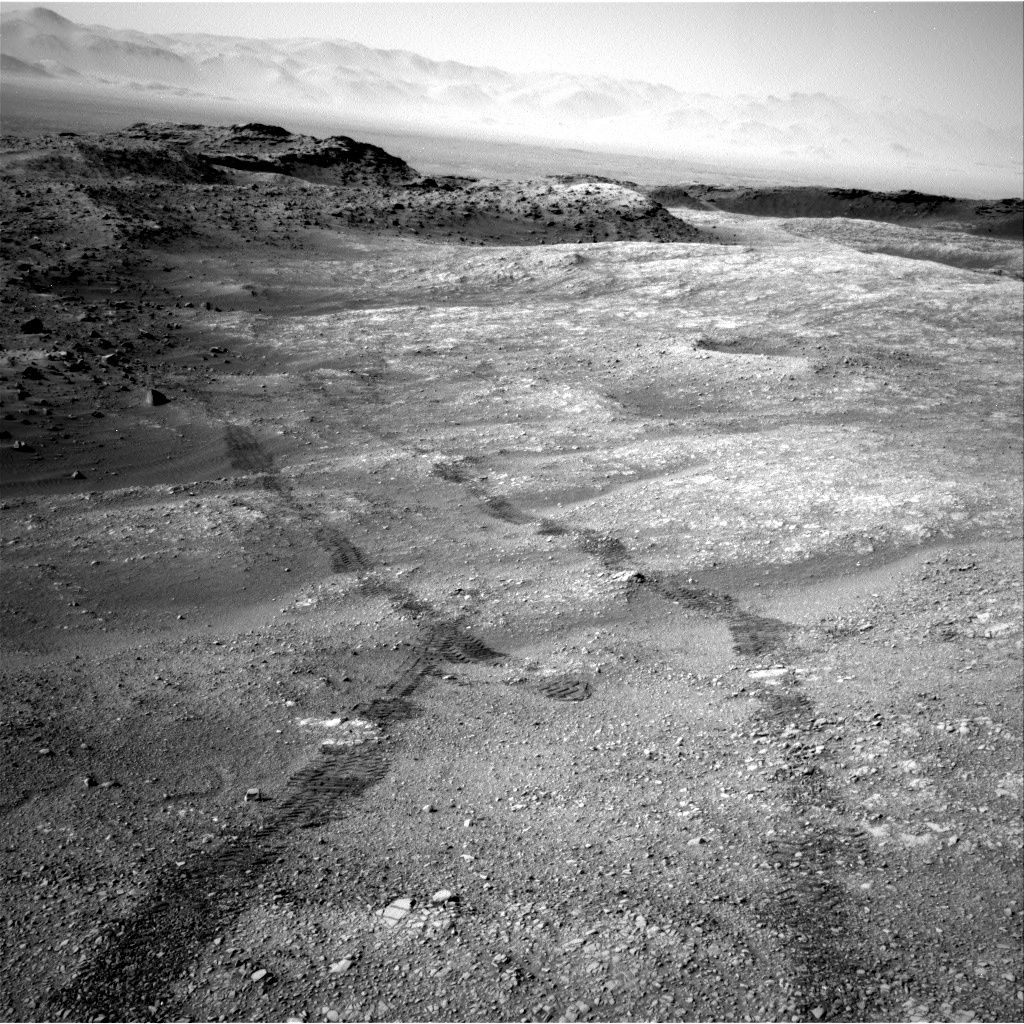
Curiosity Navcam Right B image taken on Sol 1401, July 15, 2016.
Credit: NASA/JPL-Caltech
In continuing its investigations, Curiosity continues to gather more data in regards to ancient wet environments on Mars and how and when they evolved to drier and less habitable conditions.
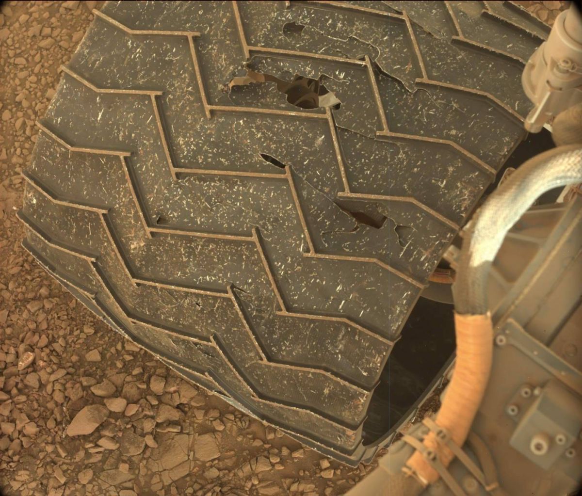
Curiosity Mastcam Left image of rover wheel damage, taken on Sol 1403 July 17, 2016.
Credit: NASA/JPL-Caltech/MSSS

Credit: Viking Mars Missions Education & Preservation Project (VMMEPP).
Four decades ago, NASA’s Viking Mars program scored nail-biting, back-to-back successes by becoming the first U.S. robotic missions to land safe and sound on the Red Planet and return images of the Martian landscape.
It was a momentous moment in time.
Like today’s robotic explorers, but decades ago, Viking scientists packed up their troubles, cares and woes to ask: Is there life on Mars?
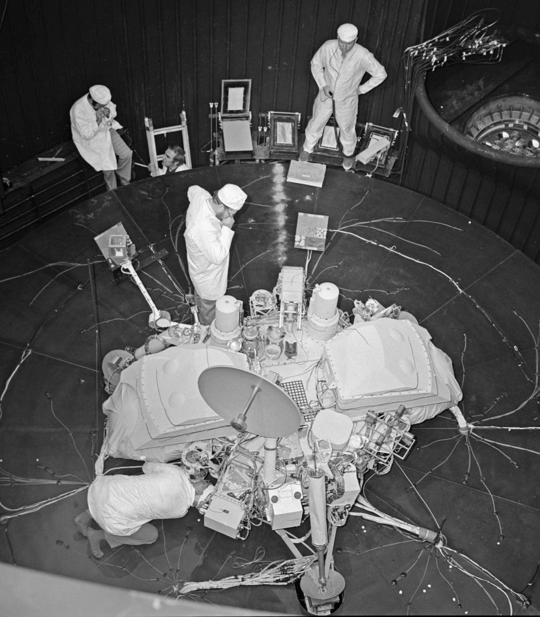
NASA’s two Viking landers were designed and built by Martin Marietta (now Lockheed Martin) at its facility near Denver. This image shows some Martin Marietta employees in a Viking lander test center.
Credit: Lockheed Martin
Twins to Mars
Twin spacecraft missions — each consisting of a lander and an orbiter – made their way to Mars and into the history books.
The Viking 1 lander stretched its legs down into the terrain of Chryse Planitia on July 20, 1976, with the Viking 2 lander touching down months later at Utopia Planitia on September 3.

Veterans of Viking: July 16 event at the Wings Over the Rockies Air & Space Museum in Denver, Colorado, organized by the Viking Mars Missions Education & Preservation Project and sponsored by Lockheed Martin in partnership with The Space Foundation and the museum.
Credit: Barbara David
Personal sagas
Viking-era scientists, engineers and former student interns recently joined together in a special salute to the past and share personal sagas about their daring, individual encounters with the Red Planet.

The first photo from the surface of Mars shows one of the Viking 1 lander’s footpads.
Credit: NASA/JPL
To read the full story, go to my new Space.com story:
Viking on Mars, 40 Years Later: Reflections on Pioneering the Red Planet
www.space.com/33481-viking-mars-landing-40-years-anniversary.html

USAF Gen. John Hyten, the head of Air Force Space Command, at 31st National Space Symposium held in Colorado Springs.
Credit: The Space Foundation
More details have been issued by the U.S. Air Force on a Space Mission Force or SMF.
The objective is to prepare and present space forces as a ready force capable of operating in a “contested, degraded and operationally-limited environment.”
According to the Air Force in a press statement, the SMF “will be the new standard for space operators to increase preparedness to operate their weapon systems and respond to the increasing threats to those same systems.”
Ready spacecrew
An SMF White Paper, dated June 29th, has been authored by General John E. Hyten, commander of Air Force Space Command. “The Space Mission Force construct is really quite simple; we are revamping our crews to respond appropriately to threats in a dynamic environment,” he said.
One key element of the SMF is that it establishes the Ready Spacecrew Program.
That initiative enhances training to create a force capable of performing combatant commander-directed missions in the face of dynamic and varied threats.
“The Ready Spacecrew Program will maintain foundational skills and, more importantly, will build new skills and emphasize innovation, decision making at the lowest levels and development and use of tactics to counter space threats,” notes the Air Force statement.

Artist’s view of the Missile Defense Agency’s Space Tracking and Surveillance System-Demonstrator (STSS-D) spacecraft tracking objects in space.
Photo credit: Northrop Grumman Corporation
No longer a sanctuary
The 50th Space Wing was the first wing to implement the Space Mission Force construct and begin rotations, which started on Feb. 1, 2016.
The 21st Space Wing implemented SMF on July 1, 2016 and the 460th Space Wing will transition to the SMF construct next year.
“Space as a global commons is vital to commerce and is an essential element of Joint Warfare and global stability,” Hyten explains in the White Paper. “Space is no longer a sanctuary where the United States or our allies and partners operate with impunity.”
In the White Paper, Hyten adds that the United States faces current and future challenges in space that demand an immediate change in how we organize, train, equip and employ our forces.
“Our Nation and our Air Force demand the presentation of expertly trained and professionally led spacecrews, capable of accomplishing their missions under combat conditions. I expect nothing less,” the general concludes in the White Paper.
For a copy of the SMF White Paper, go to:
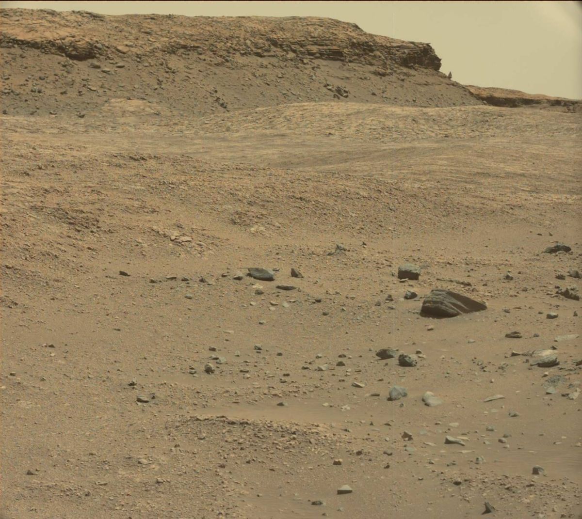
Curiosity Mastcam Left image taken on Sol 1400, July 14, 2016
Credit: NASA/JPL-Caltech/MSSS
NASA’s Curiosity rover on Mars is now in Sol 1402 activities, a weekend plan of duties ahead defined at “hefty.”
According to Lauren Edgar, a research geologist at the USGS Astrogeology Science Center in Flagstaff, Arizona, “we knew it would be a big plan going into the weekend.”
The plan jelled as it was confirmed that the rover’s drive of roughly 85 feet (26 meters) went well.
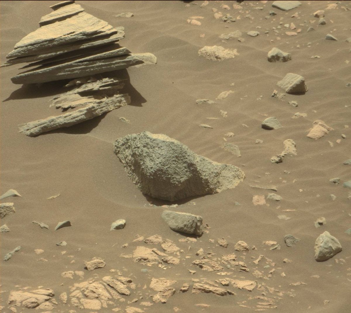
Curiosity Mastcam Right image taken on Sol 1400, July 14, 2016.
Credit: NASA/JPL-Caltech/MSSS
Bedrock observations
On Sol 1401, the first task by Mars researchers was to evaluate the local bedrock and select a target for contact science.
Science teams selected a target named “Uku” for Chemistry & Camera (ChemCam), Mastcam, Mars Hand Lens Imager (MAHLI) and Alpha Particle X-Ray Spectrometer (APXS) activities to assess the texture and composition of the Murray formation, Edgar adds. “We also planned a ChemCam observation on the target “Songo,” a disturbed block which looks more red than some of the surrounding rocks.”
The plan also includes some Mastcam mosaics of the “Bimbe” blocky deposit to see if researchers want to pursue some additional observations there next week.
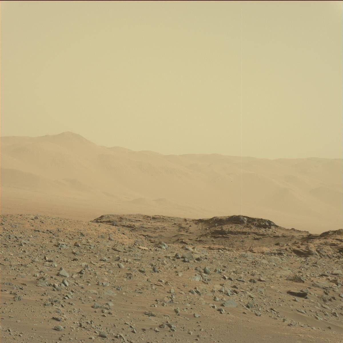
Curiosity Mastcam Left image taken on Sol 1400, July 14, 2016.
Credit: NASA/JPL-Caltech/MSSS
Working with MAVEN
In unwrapping weekend plans, Edgar reports in the first and third sols some environmental monitoring observations are to be coordinated with observations from NASA’s Mars Atmosphere and Volatile Evolution (MAVEN) spacecraft. It has been orbiting Mars since September 2014.
“This will give us a great dataset from the ground looking up, and from orbit looking down,” Edgar notes.

Teamed up with Curiosity, NASA’s Mars Atmosphere and Volatile Evolution (MAVEN) mission.
Credit: NASA/Goddard Space Flight Center
Power-hungry plan
Also in the weekend plan is MAHLI imaging of the Chemistry & Mineralogy X-Ray Diffraction/X-Ray Fluorescence Instrument inlet, as well as a Sample Analysis at Mars (SAM) Instrument Suite geochronology experiment.
“Not surprisingly, this is a very power-hungry plan,” Edgar says. “But we managed to get almost everything into the plan, and have set ourselves up for the possibility of more contact science on Monday. Should be a fun weekend in Gale crater!”
As always, dates of planned rover activities are subject to change due to a variety of factors related to the Martian environment, communication relays and rover status.

Credit: NASA/JPL/Caltech
The building of NASA’s next Mars rover has been given a go-ahead. Launch of the Mars machinery is targeted for the summer of 2020, arriving on the Red Planet in February of 2021.
In the hope of reducing risk and shaving off dollars, the 2020 rover would look much like its six-wheeled, one-ton predecessor, Curiosity, now prowling across the surface of the Red Planet.
But there are differences.
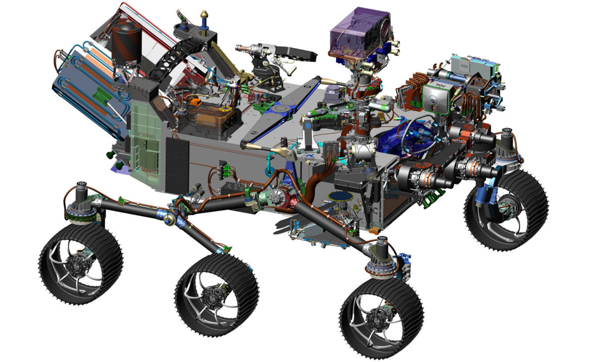
New computer generated image of Mars 2020.
Credit: NASA/JPL/Caltech
Now hear this
The rover will carry an array of new science instruments and enhancements to explore Mars as never before – including microphones. The Mars 2020 rover will record sounds during the vehicle’s descent to the surface, and also after the landing.

Where to land the NASA Mars 2020 rover? Scientists and engineers are assessing where best to land the Red Planet robot.
Credit: NASA/JPL
As was the case for getting the Curiosity rover down safe and sound, the 2020 rover will use the same “sky crane” landing system. Yes, another seven minutes of terror!
But thanks to the microphones, along with a suite of cameras, never-before-seen imagery and sounds will be captured of the entry, descent and landing (EDL) sequence.
Viewed as a public outreach tool, a microphone should hear the rover’s aluminum wheels rolling over rocks. The device should also prove useful in providing engineering information to ground controllers back on Earth.

One leading landing site – Jezero Crater paleolake.
Credit: Mars Landing Site Steering Committee/T. Goudge, et al.
Targeted landing zone
The Mars 2020 rover mission will have the ability to land in more challenging terrain thanks to two enhancements:
- A “range trigger” for timing of parachute opening; and
- Terrain-relative navigation that uses onboard analysis of downward-looking images taken during descent, matching them to a map that indicates zones designated unsafe for landing.
These capabilities should lead to shrinking any targeted landing zone by nearly half. Also, the rover can plop down closer to a specific science destination, adding up to less driving after landing.

NASA’s Mars 2020 rover is to seek signs of past life on Mars, collect and store a set of soil and rock samples that could be returned to Earth in the future. Shown here is an artistic representation of the robot’s SuperCam instrument during operation.
Credit: NASA
Sample collection
The Mars 2020 rover mission is designed to look for signs of past life in a region of Mars where the ancient environment was favorable for microbial life.
A unique task is for the robot to collect samples of Martian rock and soil, cache those specimens for pick-up and delivery back to Earth by a potential future mission.
Martian rocks and soil are to be sampled using a coring drill on the rover’s robotic arm. Samples are to be deposited into a rack of sample tubes. Once the samples have been hermetically sealed, about 30 of the tubes will be deposited on the ground at select locations as returnable caches for a possible future sample-retrieval mission.
Rover MOXIE
Also on tap is a first investigation on Mars into use of Martian resources to meet the needs of future human expeditions to the Red Planet.
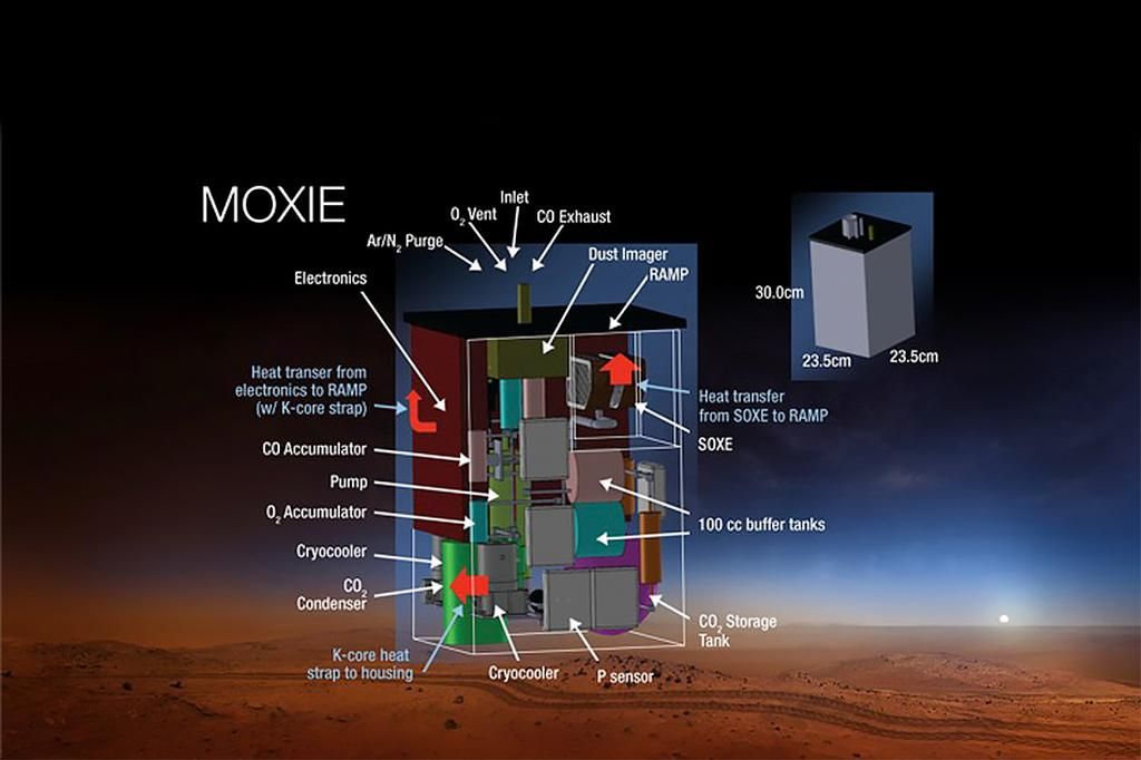
Credit: NASA/JPL/MIT
That device is called the Mars Oxygen ISRU Experiment or MOXIE for short.
MOXIE will extract oxygen from the Martian atmosphere, which is mostly carbon dioxide. Oxygen could serve in propulsion for a crew’s trip home, as well as for breathing.
MOXIE collects CO2 from the Martian atmosphere, compresses and stores it, then electrochemically splits the CO2 molecules into O2 and CO. The O2 is then analyzed for purity before being vented back out to the Mars atmosphere along with the CO and other exhaust products.

Human working with robot on Mars.
Credit: NASA
Sub-surface radar
The intent is that MOXIE will demonstrate an In-Situ Resource Utilization (ISRU) technology to enable propellant and consumable oxygen production from the Martian atmosphere, and also characterize atmospheric dust size and morphology to understand its effects on the operation of surface systems.
Another rover-toting technology that’s unique is use of ground-penetrating radar to assess sub-surface geologic structure – perhaps pockets of ice. That resource is expected to be essential in the future to help sustain expeditionary crews on Mars.
To relive seven minutes of terror that Curiosity and the Mars 2020 mission will endure, go to:

