Archive for the ‘Space News’ Category
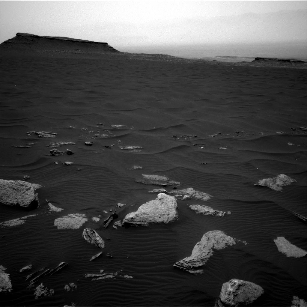
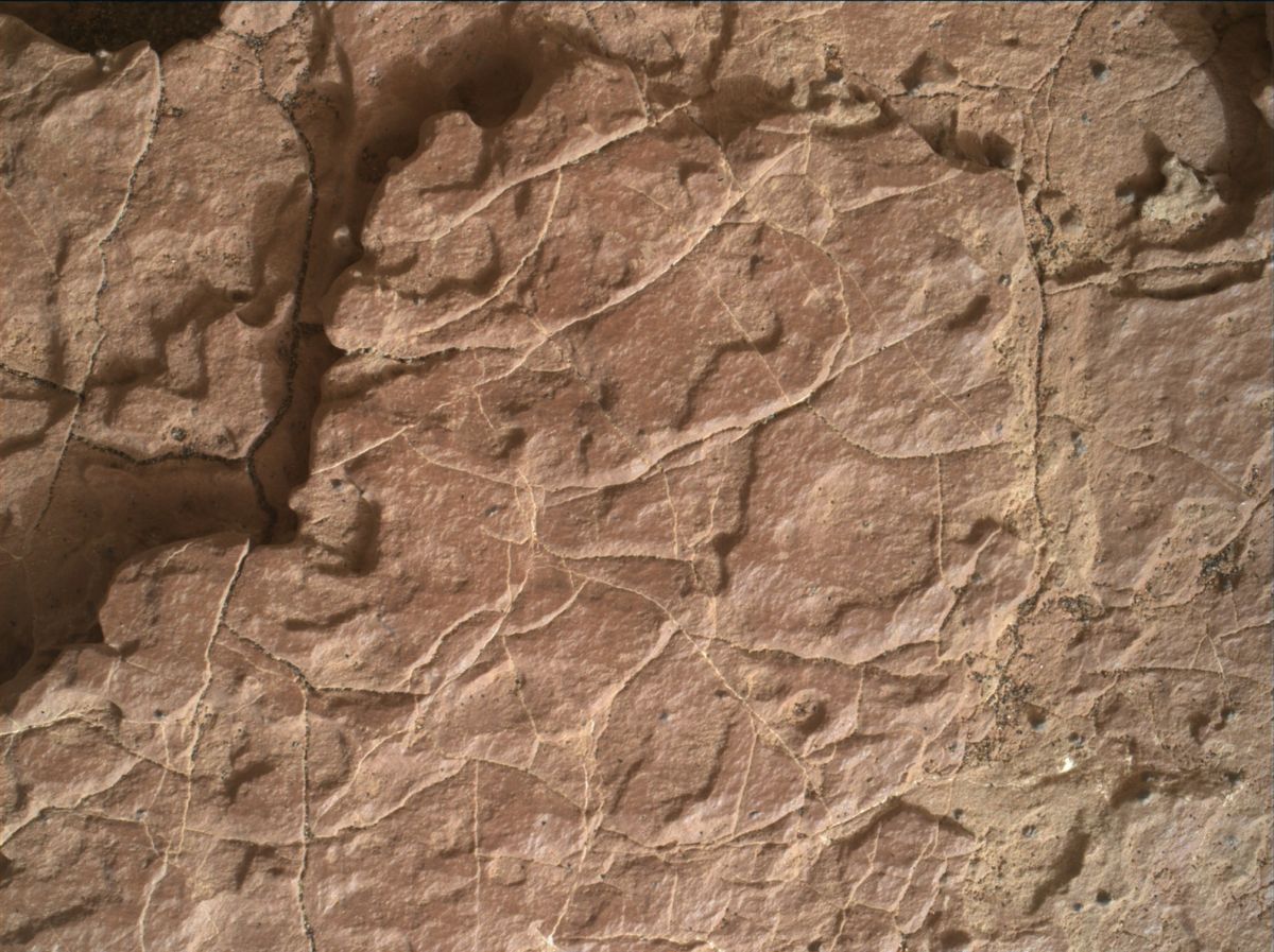
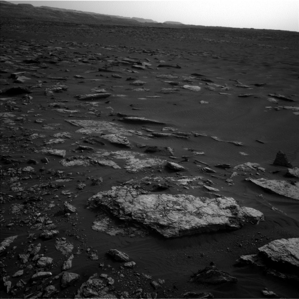
Curiosity Navcam Right B image taken on Sol 1636, March 14, 2017.
Credit: NASA/JPL-Caltech
NASA’s Curiosity Mars rover has wheeled into Sol 1636, taking in views of the Bagnold dunes and Murray Buttes.
Last weekend’s plan was successful, “and put us close to the third stop of the current campaign to study the Bagnold Dunes,” reports Ryan Anderson, a planetary scientist at the USGS Astrogeology Science Center in Flagstaff, Arizona.
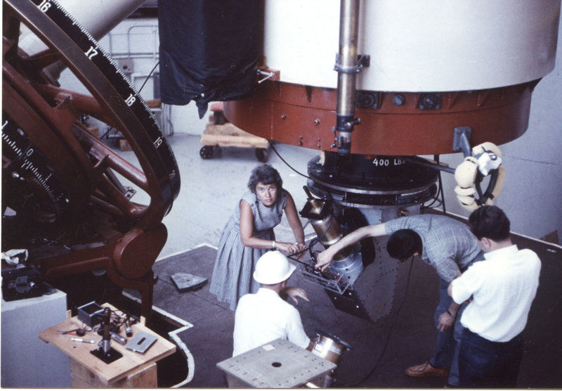
Pioneering astrophysicist, Vera Rubin, discovered evidence of dark matter and died in December 2016 at the age of 88. Rubin is seen here at the Lowell Observatory in Flagstaff, Arizona in 1965.
Credit: Carnegie Institution
Ridge observation
The Sol 1636 plan is scheduled to start off with a Chemistry & Camera (ChemCam) passive observation of Vera Rubin Ridge, with a supporting Mastcam mosaic.
ChemCam will also analyze the bedrock targets “Buck Cove Mountain” and “Smyrna Mills,” Anderson adds.
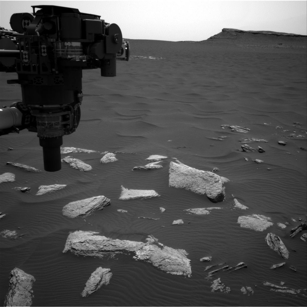
Curiosity Navcam Right B image taken on Sol 1636, March 14, 2017.
Credit: NASA/JPL-Caltech
“After that, we will do a short ‘bump’ to Stop 3 of the dune campaign, with post-drive imaging. In the afternoon after the drive,” Anderson notes, “ChemCam will do an automated AEGIS observation (likely to hit sand) and Navcam has a few atmospheric observations.”
Curiosity Mastcam Left image taken on Sol 1635, March 13, 2017.
Credit: NASA/JPL-Caltech/MSSS
AEGIS is specialized software and stands for Autonomous Exploration for Gathering Increased Science.
On the schedule is unstowing Curiosity’s robotic arm to prepare for contact science activities today.
Curiosity Mars Hand Lens Imager (MAHLI) image taken on March 12, 2017, Sol 1635. MAHLI is located on the turret at the end of the rover’s robotic arm.
Credit: NASA/JPL-Caltech/MSSS

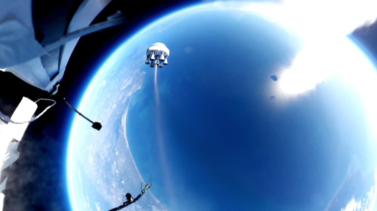
Balloon-launched rocket as step toward orbiting smallsats.
Credit: Zero 2 Infinity
Talk about get up and go!
Zero 2 Infinity of Barcelona, Spain has successfully launched its first rocket from the edge of space.
“This milestone opens the door for safer and more efficient space access for small satellites,” the group explains in a press statement.
Controlled ignition
The March 1st flight began a few miles off the Spanish coast with launch of the rocket-carrying balloon.
After the balloon soared to 16 miles (25 kilometers) altitude — more than twice the cruising altitude of commercial airplanes – the controlled ignition of the first Bloostar prototype took place, initiated from the facilities of the National Institute of Aerospace Technology (INTA) in El Arenosillo (Huelva, Spain).
Mission goals
According to the group, the goals of the mission were:
- validation of the telemetry systems in space conditions
- controlled ignition
- stabilization of the rocket
- monitoring of the launch sequence
- parachute deployment
- sea recovery
All these goals, Zero 2 Infinity notes, were achieved in full.
Credit: Zero 2 Infinity
Smallsat launcher
The mission carried out this month is part of the development of Bloostar – a small satellite launcher that makes use a stratospheric balloon as a first stage.
By initiating the rocket ignition from above airspace, the targeted orbit can be reached “with expediency and efficiency,” the group claims.
“This patented technique is less risky than any systems used until now. The rocket-powered phase starts already from above 95% of the mass of the atmosphere, getting there with no polluting emissions. Besides the environmental angle, this new method lets Zero 2 Infinity launch satellites with more flexibility (2 weeks notice), at a drastically lower cost and more often than ever before,” explains the organization’s press statement.
Credit: Zero 2 Infinity
Bloon…ing!
Zero 2 Infinity adds that they have already gathered Letters of Intent for future launches.
At the moment, the group is working on sending small satellites into orbit through its project Bloostar and has mid-term plans to send people to near space for science and leisure, an effort tagged project Bloon.
Check out this video, published on March 13, 2017, of the Zero 2 Infinity launch of its first rocket, a Bloostar prototype, from near space:
https://www.youtube.com/watch?v=DMYR-15EVOI&feature=youtu.be
Tianzhou-1 supply ship is being readied for April launch.
Credit: CCTV-Plus
The pace in China is quickening as the country’s first cargo spacecraft — Tianzhou-1 – moves toward its April launch.
In recent video reports via CCTV-Plus, details of the Tianzhou-1 cargo spacecraft show it to be 35 feet (10.6 meters) tall with its largest diameter at 11 feet (3.35 meters) and a weight of 13 tons. The upper part with the bigger diameter is designated as a warehouse while the lower part with smaller diameter will propel the spacecraft.
Payload ratio
As China’s largest and heaviest spacecraft, the Tianzhou-1 can send 6.5 tons of cargo into the space.
“The carrying capacity of Tianzhou-1 is designed according to the scale of the space station, aiming to achieve the highest carrying capacity with the lowest structural weight,” explains Bai Mingsheng, chief designer of Tianzhou-1 at China Aerospace Science and Technology Corporation.
There is an index for the spacecraft’s carrying capacity, or payload ratio as it is called. The payload ratio of Tianzhou-1 reaches 0.48, which ranks fairly high in the world, adds Bai.

China’s cargo ship will dock with the now-orbiting Tiangong-2 space lab and refuel that facility.
Credit: CMSE
Space lab link-up
The role of Tianzhou-1 is to provide propellant for the now-orbiting Tiangong-2 space lab. This fuel can help the lab maintain its proper orbiting height.
The Tianzhou-1 supply craft, if successfully launched, is expected to dock with the Earth circling space lab three times. During the docking, a new experiment of independent quick docking will be conducted, which requires that the two spacecraft dock with each other within six hours.
“This is a new experiment. If we can succeed, then the docking of manned spacecraft and cargo spacecraft will all use this technology. If the docking time could be cut short, our astronauts will be more comfortable, so there is a big point in doing so,” said Bai.
Vital mission
For Chinese space program officials, the Tianzhou-1 mission wraps up a second phase of China’s piloted space agenda and is a vital milestone for the country to establish a larger space station around 2022.
Tianzhou-1 supply ship.
Credit: CCTV-Plus
The Tianzhou-1 is scheduled to liftoff from the Wenchang space complex atop a Long March-7 Yao-2. That booster has been transported to the site in Wenchang City of south China’s Hainan Province on Saturday for pre-launch testing, according to the China Manned Space Engineering Office.
A Long March-7 completed its maiden flight mission on June 25, 2016 from the launch site in Wenchang. The Long March-7 Yao-2 type launcher has been optimized for lofting the Tianzhou-1.

Long March-7 maiden flight in June 2016.
Credit: New China
Launch preparations
At the launch area, the booster will undergo components testing, vertical assembly, and then placement of Tianzhou-1 on the rocket. Once these steps are completed, the rocket is to undergo four general checks and then transported to the pad for fueling.
“The rocket will be launched in April when the time is right,” explains Che Zhuming, a senior engineer at the launch center.
For video looks at preparations to launch Tianzhou-1, go to these CCTV-Plus posted items:
http://cd-pv.news.cctvplus.com/2017/0311/8045126_Preview_3951.mp4
http://cd-pv.news.cctvplus.com/2017/0311/8045106_Preview_3940.mp4
http://cd-pv.news.cctvplus.com/2017/0311/8045150_Preview_1750.mp4
http://cd-pv.news.cctvplus.com/2017/0311/8045140_Preview_4182.mp4

Courtesy: Explore Mars, Inc.
Last week, Congress passed S. 442: The National Aeronautics and Space Administration (NASA) Transition Authorization Act of 2017.
The bill originally introduced in the U.S. Senate by U.S. Sen. Ted Cruz (R-Texas), along with Sens. Bill Nelson (D-Fla.), Marco Rubio (R-Fla.), Gary Peters (D-Mich.), John Thune (R-S.D.), Tom Udall (D-N.M.), Patty Murray (D-Wash.), and John Cornyn (R-Texas).
In the House, the chairmen with committees of jurisdiction for the bill are U.S. Rep. Lamar Smith (R-Texas), chairman of the House Science, Space, and Technology Committee, and Rep. Brian Babin (R-Texas), chairman of the House Space Subcommittee.
Serious commitment
In a March 10 message from key champion of the bill, U.S. Senator Ted Cruz (R-Texas):

Credit: Bob Sauls – XP4D/Explore Mars, Inc. (used with permission)
“The legislation provides stability for NASA to sustain and build upon existing national space investments designed to advance space exploration and science with an overall authorization level of $19.508 billion for fiscal year 2017.”
“This legislation makes a serious commitment to the manned exploration of space and ensures that the Johnson Space Center remains the crown jewel of NASA’s human spaceflight missions,” Cruz points out.
“I look forward to the President signing this legislation,” Cruz adds, “which lays the groundwork for the mission to Mars and enables commercial space ventures to flourish, which will foster extraordinary economic growth and job creation throughout Texas.”

Artist concept of NASA’s Space Launch System (SLS) 70-metric-ton configuration launching to space. SLS will be the most powerful rocket ever built for deep space missions, including to Mars.
Credit: NASA
Highlights
Highlights of S. 442, The NASA Transition Authorization Act of 2017:
Sustaining National Space Commitments and Utilizing the International Space Station
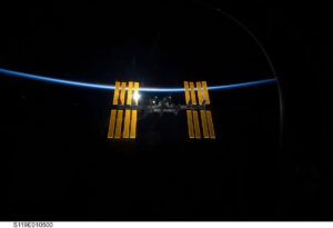
- Support for Continuity – Affirms Congress’ support for sustained space investments across presidential administrations to advance recent achievements in space exploration and space science. This includes the development of the Space Launch System heavy-lift rocket and the Orion crew vehicle for deep space exploration, maximizing utilization of the International Space Station (ISS), the James Webb Space Telescope, and continued commitment to a national, government-led space program.
- International Space Station – Supports full and complete utilization of the ISS through at least 2024, and the use of private sector companies partnering with NASA to deliver cargo and experiments. Also facilitates the development of vehicles to transport astronauts from U.S. soil to end our reliance on Russian launches for crew transport.
- Facilitating Commercialization and Economic Development of Low-Earth Orbit – Requires NASA to submit a report to Congress outlining a plan to facilitate a transformation of operations in low-earth orbit from a model largely reliant on government support to one reflecting a more commercially viable future.
International Space Station.
Credit: NASA

Advancing Human Deep Space Exploration
- Journey to Mars – Amends current law by adding human exploration of Mars as one of the goals and objectives of NASA and directs NASA to manage human space flight programs to enable humans to explore Mars and other destinations. Requires NASA to develop and submit a plan to Congress on a strategic framework and critical decision plan based on current technologies to achieve the exploration goals and objectives.
- Development of Deep Space Capabilities – Directs NASA to continue the development of the Space Launch System and Orion for a broad deep space mission set, with specific milestones for an uncrewed exploration mission by 2018 and a crewed exploration mission by 2021.
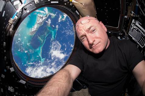
During his nearly one-year space mission, NASA astronaut Scott Kelly took a selfie with the Bahamas from 250 miles above Earth aboard the International Space Station.
Credit: Scott Kelly/NASA
Medical Monitoring of Astronauts
- Medical Effects of Space – Authorizes NASA to provide for the medical monitoring, diagnosis, and treatment of astronauts, including scientific and medical tests for psychological and medical conditions deemed by NASA to be associated with human space flight.
- Recognizing Impact of Scott Kelly’s 340 Days in Space –Gives recognition that the 340-day space mission of Scott Kelly aboard the ISS generated new insight into how the human body adjusts to weightlessness, isolation, radiation, and the stress of long-duration space flight and will help support the physical and mental well-being of astronauts during longer space exploration missions in the future.
To read the full bill, go to:
http://www.cruz.senate.gov/files/documents/Bills/20170215_NASA.pdf
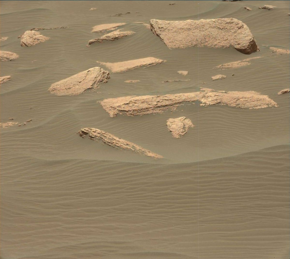
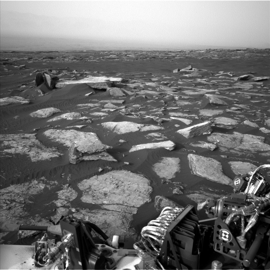
Curiosity Mastcam Left image taken on Sol 1631, March 8, 2017.
Credit: NASA/JPL-Caltech/MSSS
Now performing Sol 1634 duties, NASA’s Curiosity Mars rover wheeled roughly 95 feet (29 meters) to the south on Sol 1632.
The robot is in good position for weekend tasks, reports Ken Herkenhoff of the USGS Astrogeology Science Center in Flagstaff, Arizona.
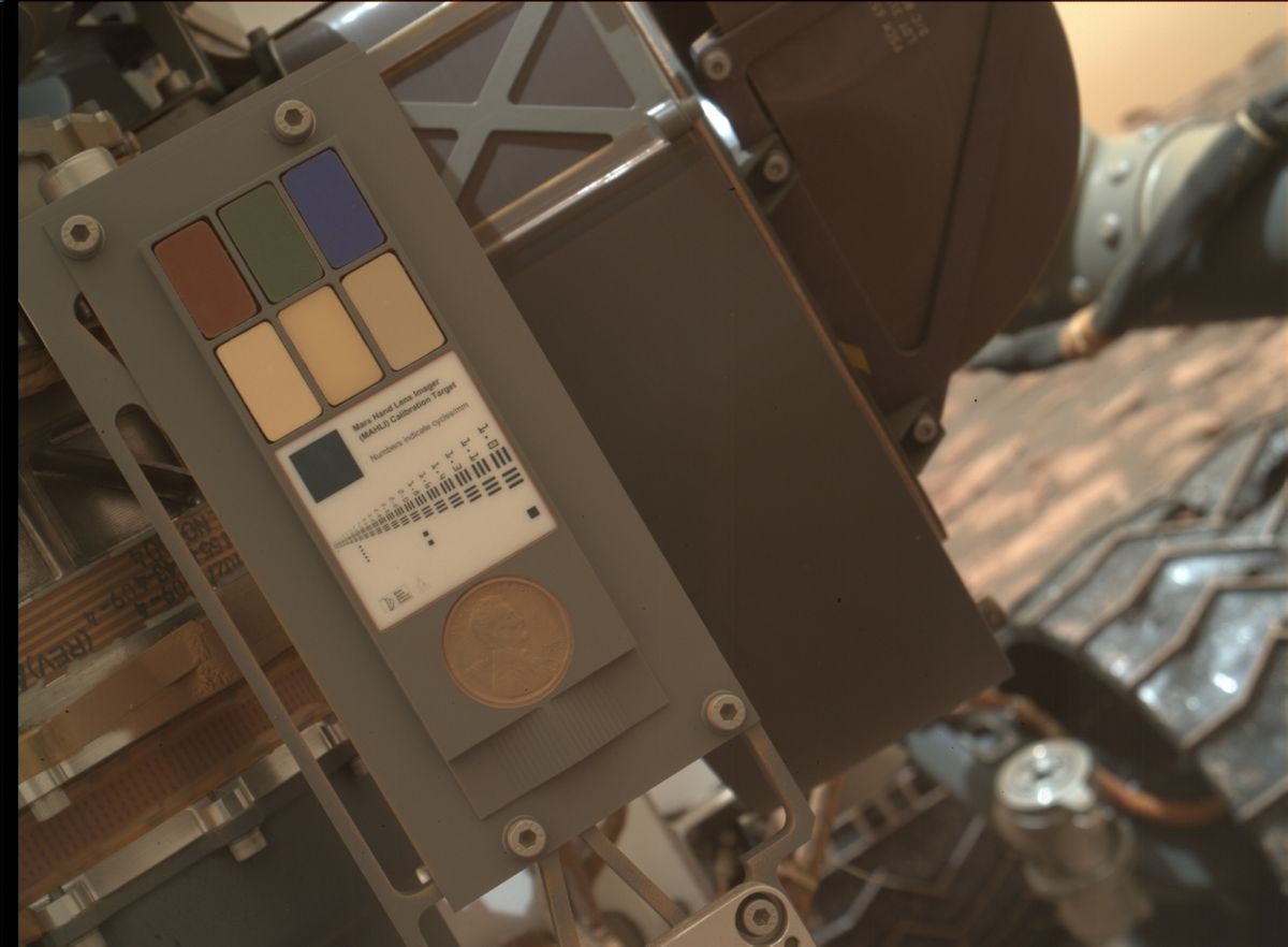
Mars Hand Lens Imager (MAHLI) calibration testing. Image taken on March 9, 2017, Sol 1632.
Credit: NASA/JPL-Caltech/MSSS
Dust cover issues resolved
The Mars Hand Lens Imager (MAHLI) images taken on Sol 1632 looked good, Herkenhoff adds, “and the dust cover is working properly, so MAHLI is ready to return to nominal operations!”
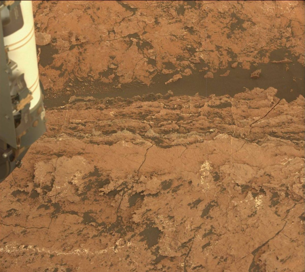
Contact science targets in front of the rover show interesting color variations.
This bedrock is too close to the rover to allow Chemistry & Camera (ChemCam) data to be safely acquired, so a nearby exposure was selected for an analogous measurement and named “Hurricane Mountain.”
Curiosity Navcam Left B image taken on Sol 1632, March 10, 2017.
Credit: NASA/JPL-Caltech
Bedrock target
A ChemCam observation was planned of a nearly-vertical layered bedrock target that is tagged “Hardwood Mountain.”
Curiosity’s Right Mastcam is slated to image selected targets and take a 4×3 mosaic of another bedrock block dubbed “Rocky Mountain.”
Also on tap, the robot’s Mastcam was to acquire a multispectral set of images of “North Haven,” a collection of pebbles near Hurricane Mountain, and survey the sky in the afternoon.
Curiosity Navcam Right B image taken on Sol 1632, March 9, 2017.
Credit: NASA/JPL-Caltech
Canada Falls
In the weekend plan, MAHLI is scheduled to take five images of “Canada Falls” from various distances before the Alpha Particle X-Ray Spectrometer (APXS) is to be placed on the first of three closely-spaced Canada Falls targets.
“After sunset, APXS data will be gathered on all three spots, using the arm to reposition the instrument between integrations,” Herkenhoff notes.
Then the plan for early Sol 1635 is for the rover’s Navcam to search for clouds and the robot’s Mastcam will measure the dust in the atmosphere.

This image was taken by ChemCam: Remote Micro-Imager photo taken on Sol 1633, March 10, 2017.
Credit: NASA/JPL-Caltech/LANL
Drill diagnostic tests
“Later in the day, more drill diagnostic tests are planned, followed by another set of Mastcam dust observations,” Herkenhoff explains.
“Then the rover will drive toward the nearby dune and acquire data that will be used to select a target for the next drive,” Herkenhoff concludes, “which will hopefully position the rover well for contact science on the dune sand.”
Travel map
Meanwhile, a new Curiosity traverse map through Sol 1632 has been issued.
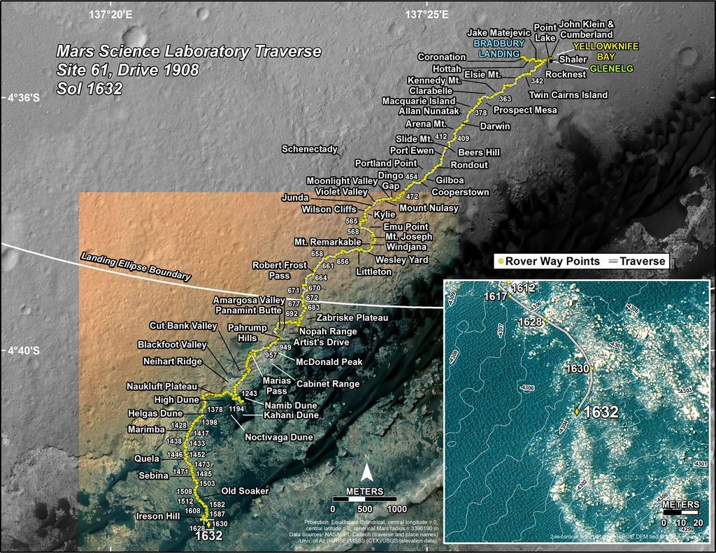
The base image from the map is from the High Resolution Imaging Science Experiment Camera (HiRISE) in NASA’s Mars Reconnaissance Orbiter.
Credit: NASA/JPL-CalTech/Univ. of Arizona
This map shows the route driven by NASA’s Mars rover Curiosity through the 1632 Martian day, or sol, of the rover’s mission on Mars as of March 10, 2017.
From Sol 1630 to Sol 1632, Curiosity has driven a straight line distance of about 87.96 feet (26.81 meters).
Since landing on Mars in August 2012, Curiosity’s total odometry for the mission is 9.77 miles (15.73 kilometers).

Credit: “The Martian”/Giles Keyte/20th Century Fox
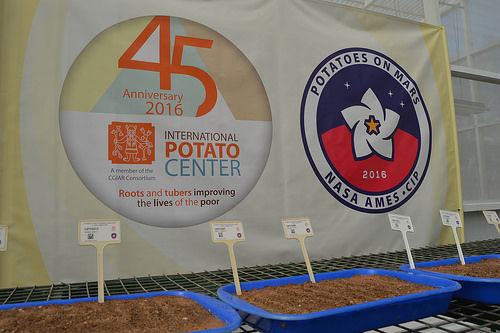
Yes, Mark Watney in “The Martian” would be potato proud.
Indicators show potatoes can grow on Mars according to The International Potato Center (CIP).
The Potatoes on Mars project was conceived by CIP to both understand how potatoes might grow in Mars conditions and also see how they survive in the extreme conditions similar to what parts of the world already suffering from climate change and weather shocks are now experiencing.
Cross-disciplinary
The Potatoes on Mars team is a cross-disciplinary group of CIP and NASA scientists representing the fields of agriculture, plant breeding, astrobiology, medicine, and physics. Together they are exploring how to grow potatoes on Mars while simultaneously benefiting farmers here on Earth.
According to a CIP press release, potato breeder Walter Amoros explains that researchers are breeding potato clones that tolerate conditions such as soil salinity and drought.
Credit: CIP
Dry, salty soil
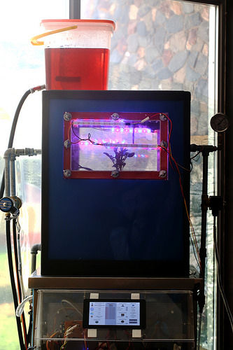
In 2016, CIP brought Mars analog soil from the Pampas de La Joya desert in Southern Peru to its experimental station in La Molina, Lima. There CIP was able to show proof that potatoes could grow in this dry, salty soil with some help from fertilized Earth soil for both nutrition and structure.
“We have been looking at the very dry soils found in the southern Peruvian desert. These are the most Mars-like soils found on Earth,” says Chris McKay of NASA’s Ames Research Center. “This [research] could have a direct technological benefit on Earth and a direct biological benefit on Earth,” McKay adds.
Credit: CIP
CIP scientists have concluded that future Mars missions that hope to grow potatoes will have to prepare soil with a loose structure and nutrients to allow the tubers to obtain enough air and water to allow it to tuberize.
CIP is part of the CGIAR, a global partnership that unites organizations engaged in research for a food secure future. CGIAR research is dedicated to reducing rural poverty, increasing food security, improving human health and nutrition, and ensuring more sustainable management of natural resources.
Resources
For more information on this innovative research, go to:
Live streams of the experiment can be viewed at: http://potatoes.space/mars/
The CIP website is at: www.CIPotato.org
A video on the research can be found here:
Tianzhou-1 supply ship is being readied for April launch.
Credit: CCTV-Plus
China’s state-run Xinhua news agency reports today that the final preparation for launching China’s first cargo spacecraft has begun.
The Tianzhou-1’s launcher has arrived at the Wenchang space complex.
Second phase
Tianzhou-1 is slated to be rocketed into Earth orbit atop a Long March-7, then dock with the now unoccupied Tiangong-2 space lab. A trio of dockings is planned between the space lab and the resupply vehicle.
Chinese space planners see the Tianzhou-1 mission, if successful, as moving into a second phase of their human space program.
China’s cargo ship will dock with the now-orbiting Tiangong-2 space lab and refuel that facility.
Credit: CMSE
Adding resupply to China’s space abilities is crucial to the country establishing a larger space station in the 2022 time period.
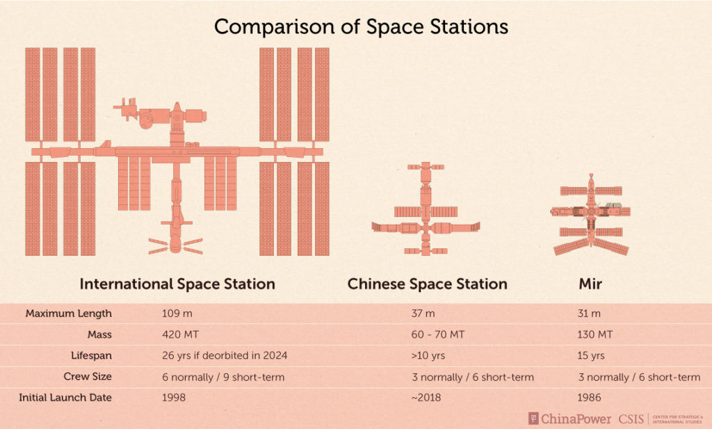
Credit: CSIS
Piloted Moon vehicle
Meanwhile, word is that China is pressing forward on a new piloted spacecraft – a “multi-purpose” crew vehicle capable of supporting human flight to the Moon.
Zhang Bainan, a chief designer of China’s spacecraft systems, is quoted in China’s Science and Technology Daily that the new vehicle can support a crew of six in low Earth orbit and three to four for Moon landing scenarios.
Back in June of last year, the maiden flight of the CZ-7 launch vehicle carried a subscale re-entry capsule of the multi-purpose crew vehicle. The test capsule was recovered in Inner Mongolia after 19 hours of flight in Earth orbit.

China’s prototype test capsule for larger multi-crew vehicle flew last year.
Credit: js7tv.cn
Multi-purpose crew vehicle
As reported by ChinaSpaceReport.com, the China Academy of Space Technology (CAST) has been developing a new-generation multi-purpose crew vehicle for future manned spaceflight missions to low Earth orbit and beyond.
The not-yet-named spacecraft will be capable of carrying 2 to 6 crew members to Earth orbit, the Moon, Lagrange Points, Near Earth Asteroids, and Mars. Two versions of the spacecraft based on the same crew module but with different propulsion systems have been proposed: a 14-tonne mass version for LEO and deep space missions, and a 20-tonne mass version for manned lunar landing, ChinaSpaceReport.com reports.
The multi-purpose crew vehicle will be launched atop the man-rated CZ-7 or CZ-5B launcher. For lunar landing and deep space missions, the spacecraft will need to carry up to 4 crew members. For ferry flights to the LEO space station, the spacecraft is required to carry up to 6.
Based on the concepts of future lunar landing and deep space missions, the spacecraft is required to be capable of operating independently on orbit for at least 21 days, or 2 years if docked with the space station. Two types of service modules can be used by the spacecraft to meet different mission requirements.
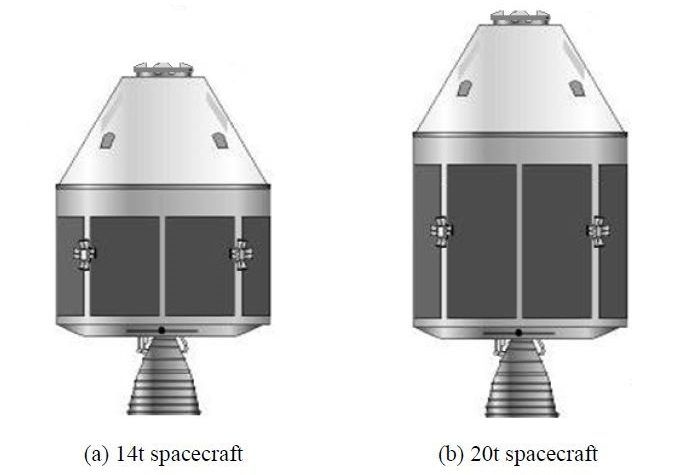
China’s multi-purpose piloted spacecraft, for low Earth orbit, the Moon…and beyond.
Courtesy: ChinaSpaceReport.com (used with permission)
Design features
ChinaSpaceReport.com drew from a Chinese Journal of Aeronautics paper, “Concept Definition of New-Generation Multi-Purpose Manned Spacecraft.”
Some of the proposed design features for China’s multi-purpose crew vehicle include:
— A two-module design, with a large habitable crew module at the front, and an uninhabitable cylindrical-shaped aft service module.
— The crew vehicle is twice the size of the Shenzhou re-entry module, capable of accommodating up to six astronauts.
— The spacecraft can be fitted with two different service modules, with different propulsion systems and propellant capacities.
— Instead of the bell-shaped re-entry module currently used by the Shenzhou spacecraft, the next-generation crew vehicle will have a blunt cone-shaped crew module, similar to that of the Boeing CST-100 or Orion CEV.
— The multi-purpose crew vehicle will be recovered at sea, at a location near the Earth equator off Chinese coast, while the land recovery capability is retained as backup.
Robotic moon mission
Zhang’s comments are prelude to an ambitious robotic lunar landing mission set for later this year.
Chang’e-5 is being readied for liftoff by a Long March-5 boost from Wenchang, a mission focused on landing, then gather lunar materials for return to Earth.

Hu Hao, the chief designer of the third phase of China’s lunar exploration program.
Credit: CCTV-Plus
According to Chinese news services, the over 8-ton Chang’e-5 is comprised of four parts: the “orbiter” “lander” “ascender” and a “returner” – an Earth reentry module.
If successful, the Chang’e-5 mission would be the first lunar sample return to Earth in over 40 years.

Credit: Bob Sauls – XP4D/Explore Mars, Inc. (used with permission)
Between the close of the Cold War and the more recent retirement of the U.S. shuttle fleet, we’ve long since left the first space age behind. But now it seems there’s a new space race brewing—one that may take humans out of our planet’s orbit.
At the height of the Cold War, the first space age was a geopolitical race between superpowers eager to outreach each other.
Today’s space race is a more complex interplay of networked nations and private players alternatively competing against, and collaborating with, each other.
New global players
Once the exclusive provenance of old power nations, space exploration has increasingly opened to new global players with India, China, Nigeria, Japan, the EU, and the UAE getting in the race.
Private enterprises are also playing an increasingly prominent role in our interplanetary yearnings, as evidenced by the ventures backed by Jeff Bezos, Elon Musk, and Richard Branson.
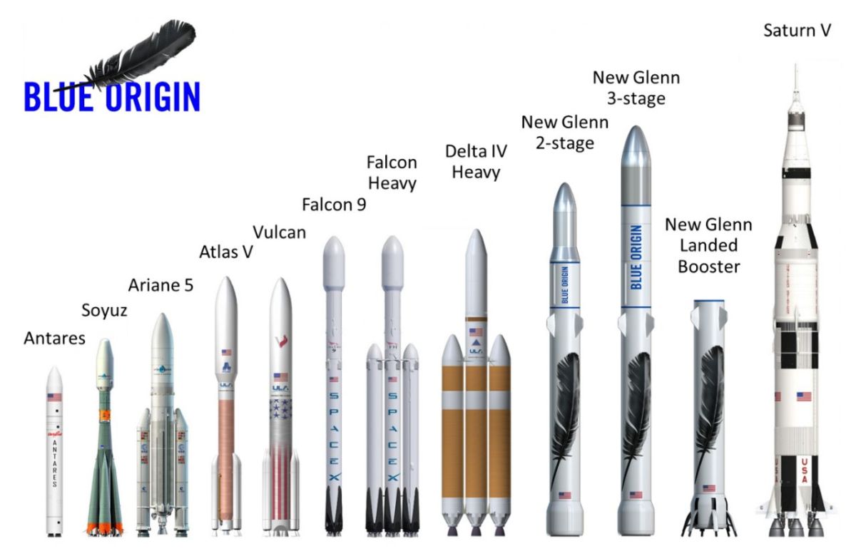
Credit: Blue Origin
NASA is still very much in the game but without a moonshot-like commitment for Mars, their projected 2040 piloted mission seems far off. A start-up company, or an upstart country, may beat us there—or perhaps help us all get there together as partners.
Check out this Wednesday, March 8th discussion sponsored by New America in Washington, D.C. to consider whether it will be competition or cooperation that finally gets us to Mars and beyond.
Check out this video of today’s gathering at:
https://www.youtube.com/watch?v=Z4Q2OOADaTc
![]() A House Space Subcommittee held a hearing today on regulating space, airing issues that touch on innovation, liberty, and international obligations.
A House Space Subcommittee held a hearing today on regulating space, airing issues that touch on innovation, liberty, and international obligations.
America’s future in outer space — from asteroid mining, to private moon missions, to satellite servicing — there is great promise that American commercial space companies could enjoy profits and discover scientific benefits to being in outer space.
This hearing explores an opportunity for Congress to streamline processes and enhance the strength of private sector space activities. For instance, stakeholders continue to raise concerns that they need certainty to attract investments and that they face pressing short-term launch dates and regulatory risks.
Written testimony:
Laura Montgomery, attorney and sole proprietor, Ground Based Space Matters, LLC
Dr. Eli Dourado, senior research fellow and director, Technology Policy Program, Mercatus Center, George Mason University
Mr. Douglas L. Loverro, former deputy assistant secretary of defense for space policy, U.S. Department of Defense
Mr. Dennis J. Burnett, adjunct professor of law, University of Nebraska-Lincoln, College of Law
Dr. Henry B. Hogue, specialist in American national government, Congressional Research Service
Letters for the record:
The Heritage Foundation
The Competitive Enterprise Institute
TechFreedom
The Niskanen Center
Go to hearing video at:
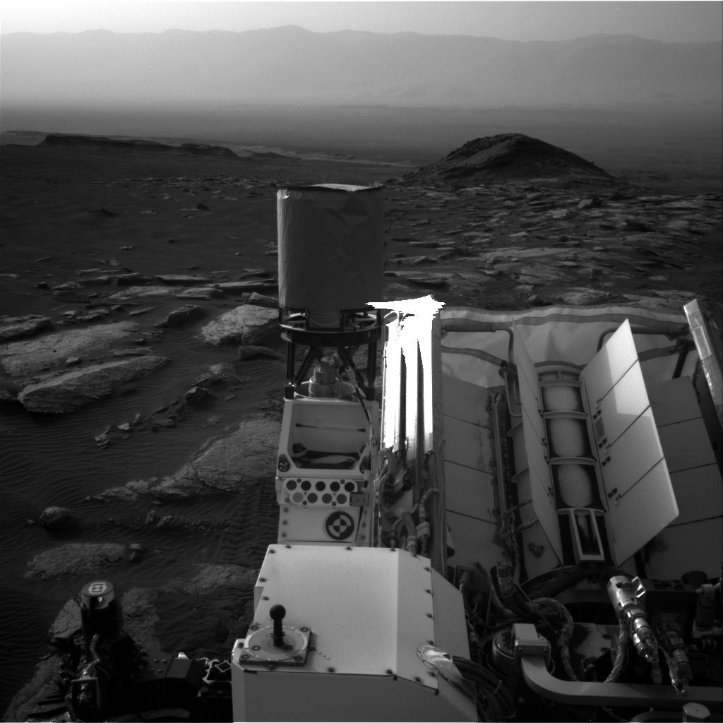
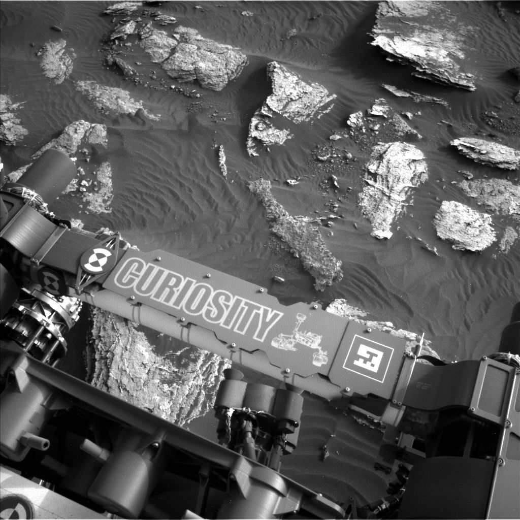
Curiosity Navcam Right B image taken on Sol 1628, March 6, 2017.
Credit: NASA/JPL-Caltech
NASA’s Curiosity rover on Mars is busy at work performing Sol 1631 duties.
Ryan Anderson, a planetary scientist at the USGS Astrogeology Science Center in Flagstaff, Arizona, reports that exciting news from a weekend plan is that the Mars Hand Lens Imager (MAHLI) dust cover closed as planned, “so we’re back in business with MAHLI.”
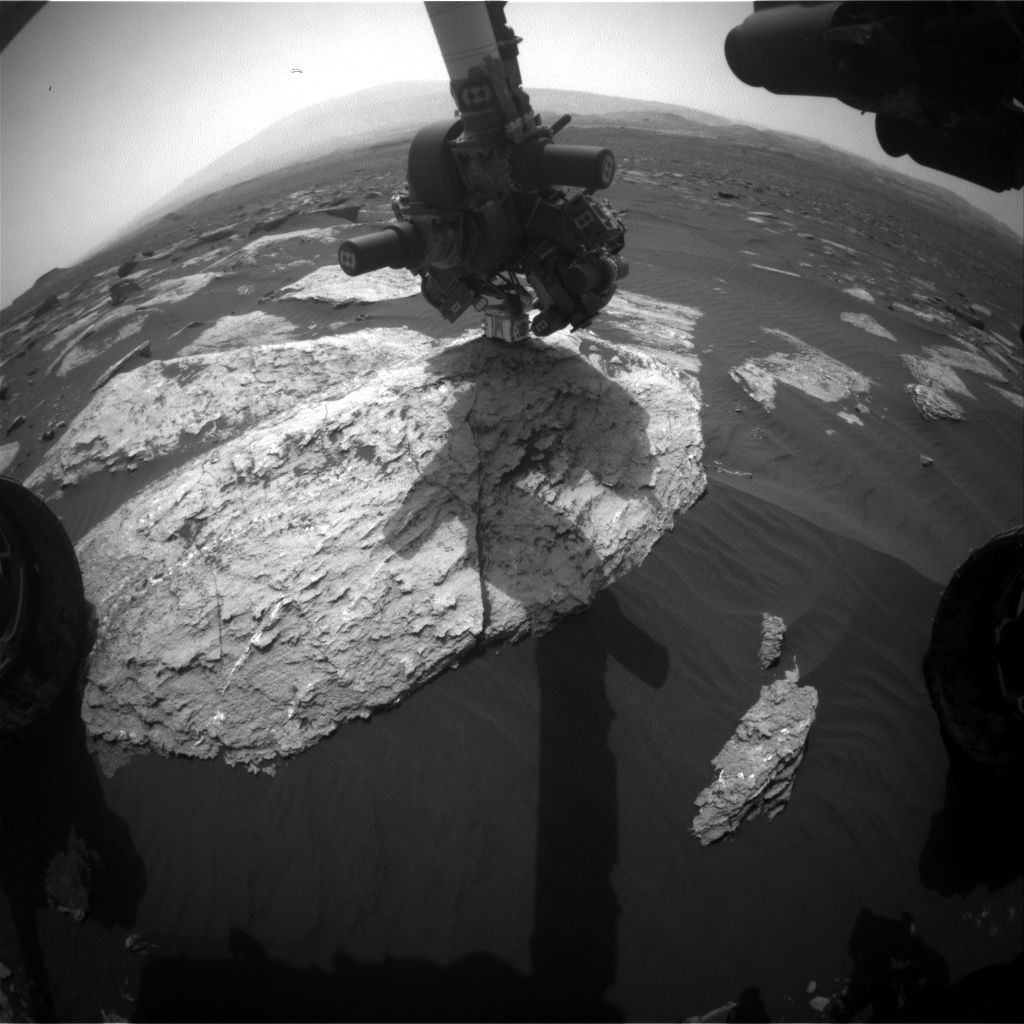
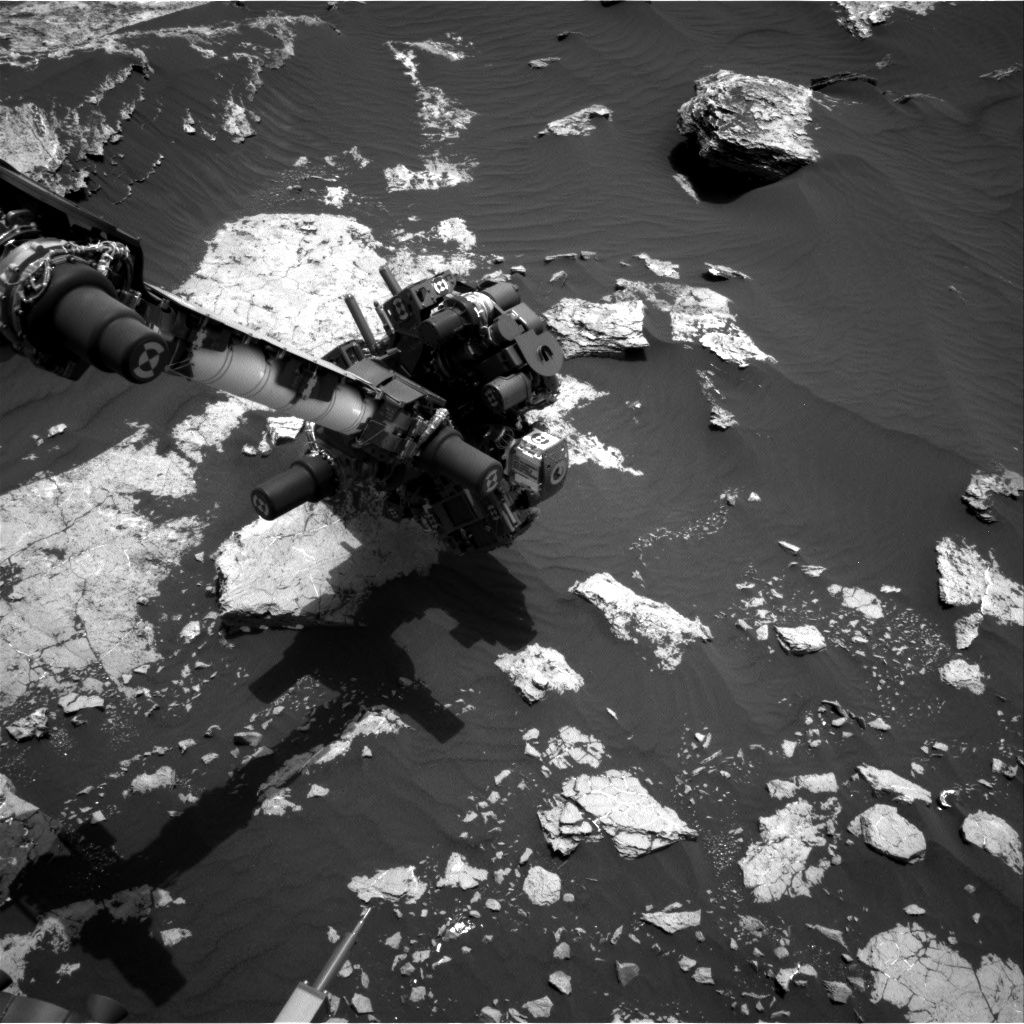
Curiosity Front Hazcam Right B image taken on Sol 1630, March 7, 2017.
Credit: NASA/JPL-Caltech
Vein observations
The Sol 1630 plan was slated to start with Chemistry & Camera (ChemCam) observations of a vein called “Temple Stream”, a soil target called “Mattawamkeag”, and the bedrock target “Vassalboro” to coordinate with an Alpha Particle X-Ray Spectrometer (APXS) observation of “Sangerville.”
Curiosity Mastcam Left image taken on Sol 1628, March 6, 2017.
Credit: NASA/JPL-Caltech/MSSS
MAHLI was slated to also observe Sangerville, and Mastcam will document each of these targets. After that, the plan is to drive roughly 130 feet (40 meters) and collect post-drive imaging.
Untargeted science
“Since we’re driving on Sol 1630, Sol 1631 will be dedicated to untargeted science,” Anderson explains.
Curiosity Navcam Left B image taken on Sol 1630, March 8, 2017.
Credit: NASA/JPL-Caltech
Curiosity’s ChemCam has an Autonomous Exploration for Gathering Increased Science (AEGIS) observation, as well as some calibration observations. AEGIS software analyzes images from a wide-angle camera as the basis for autonomously selecting rocks to photograph with a narrower-angle camera.
Curiosity Navcam Left B image taken on Sol 1628 March 6, 2017.
Credit: NASA/JPL-Caltech
This activity will be followed by Navcam and Mastcam atmospheric observations, including several observations to watch for dust devils, Anderson concludes.

