Archive for the ‘Space News’ Category

New Discovery! NASA’s Kepler Space Telescope has gazed at more than 150,000 stars and continues to transmit back data that leads to important discoveries of celestial objects in our galaxy, including first-time observations of planets outside our solar system.
Credits: NASA/Ames Research Center/Wendy Stenzel
What’s the new scoop of heavenly news from the planet-hunting Kepler space telescope?
NASA is set to announce the latest discovery at 1 p.m. eastern time on Thursday, December 14.
Machine learning
The discovery was made by researchers using machine learning from Google.
Machine learning is an approach to artificial intelligence, and demonstrates new ways of analyzing Kepler data.
Past its prime directive
When Kepler launched in March 2009, scientists didn’t know how common planets were beyond our solar system. Astronomers now believe there may be at least one planet orbiting every star in the sky.
Kepler completed its prime mission in 2012 and went on to collect data for an additional year in an extended mission.
In 2014, the spacecraft began a new extended mission called K2, which continues the search for planets outside our solar system, known as exoplanets, while introducing new research opportunities to study young stars, supernovae and other cosmic phenomena.

Moonwalking geologist, Apollo 17’s Jack Schmitt.
Credit: NASA
Apollo 17: Diary of the 12th Man is the continuing saga of America’s last deep space human mission of the 20th century.
Installment s of Apollo 17 astronaut Jack Schmitt’s diary are available, with a new post on December 7, 2017 – in commemoration of the 45th anniversary of his launch on this date in 1972 at 12:33 a.m. EST.
Critical minutes
The new Chapter 5, “30 Seconds and Counting”, continues the story that ended Chapter 4 with the words used as the title of this new addition. It comprises the crew’s tasks during the critical minutes after launch, including operations as they passed through the various emergency stages until achieving orbit.
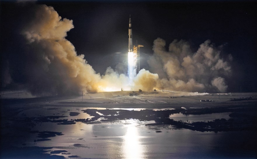
Nighttime liftoff of Apollo 17.
Credit: NASA
Following adjustments of the orbit are events related to TransLunar Injection (TLI), and a very important task of the journey, the removal of the Lunar Module (LM) from the S-IVB upper stage and the docking of the Command Service Module with the LM.
Schmitt’s personal thoughts during this critical first part of the mission give the reader an uncanny sense of presence, unavailable heretofore.
Go to Apollo 17: Diary of the 12th Man at:

Off-world geologist, Apollo 17’s Jack Schmitt.
Credit: NASA
Apollo 17 was the final act in the “opening curtain” for deep space exploration.
But that lowering of the human exploration curtain was in December of 1972.
Apollo 17 was the longest human lunar landing flight (301 hours, 51 minutes); longest lunar surface extravehicular activities (22 hours, 4 minutes); largest lunar sample return (an estimated 249 pounds (113 kilograms); and longest time in lunar orbit (147 hours, 48 minutes).
What was the value of Apollo and where next?
Check out my Space.com story with the last man to step onto the Moon, Jack Schmitt:
Q&A with Apollo 17’s Jack Schmitt: Remembering the Past, Looking to the Future
https://www.space.com/39009-apollo-17-astronaut-harrison-schmitt-interview.html
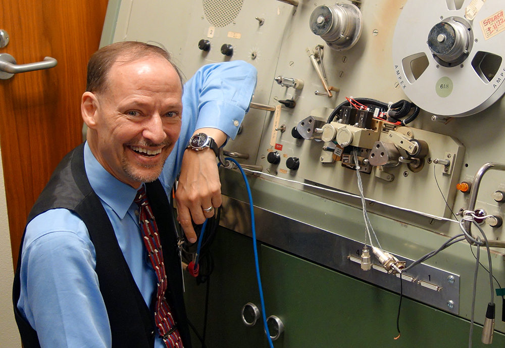
John H.L. Hansen stands next to the SoundScriber, the only device that could play the analog recordings of thousands of hours of communications during NASA’s lunar missions.
Credit: The University of Texas at Dallas
Listen up!
Previously unheard communication between Apollo astronauts, mission control and backroom support staff is now available given speech-processing technology utilized by a team of researchers at The University of Texas at Dallas.
ExploreApollo.org uses signal, speech and language processing algorithms to extract new information, merge information sources, and provide a new perspective on the NASA Apollo missions.
Analog tapes
Thousands of hours of communications remained stored on analog tapes at NASA for years.
From left: John H.L. Hansen, Chengzhu Yu, Abhijeet Sangwan and Lakshmish Kaushik. The four oversaw the project to develop speech processing techniques to reconstruct and transform thousands of hours of audio from NASA’s lunar missions.
Credit: The University of Texas at Dallas
Researchers at the University’s Center for Robust Speech Systems (CRSS) in the Erik Jonsson School of Engineering and Computer Science (ECS) received a National Science Foundation grant in 2012 to develop speech-processing techniques to reconstruct and transform the massive archive of audio into Explore Apollo.
The result: Explore Apollo is a website that provides public access to the materials. The project, in collaboration with the University of Maryland, included audio from all of Apollo 11 and most of the Apollo 13, Apollo 1 and Gemini 8 missions.

Explore Apollo website.
Credit: The University of Texas at Dallas
SoundScriber
When they began their work, researchers needed to digitize the audio.
However, transferring the audio to a digital format proved to be an engineering feat itself. The only way to play the reels was on a 1960s piece of equipment at the NASA Johnson Space Center in Houston called a SoundScriber.
“NASA pointed us to the SoundScriber and said do what you need to do,” said CRSS founder and director John H.L. Hansen. The device could read only one track at a time. The user had to mechanically rotate a handle to move the tape read head from one track to another.
Credit: The University of Texas at Dallas
Solution: 30-track read head
By Hansen’s estimate, it would take at least 170 years to digitize just the Apollo 11 mission audio using the technology.
“We couldn’t use that system, so we had to design a new one,” Hansen adds. “We designed our own 30-track read head, and built a parallel solution to capture all 30 tracks at one time. This is the only solution that exists on the planet.”
The results of their work can be found here at:
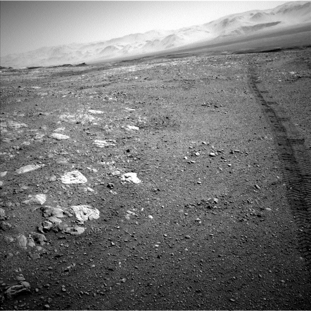
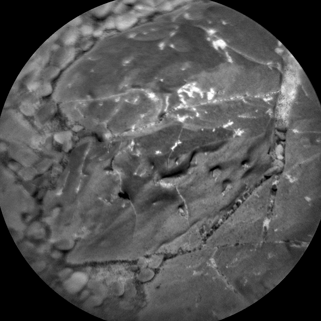
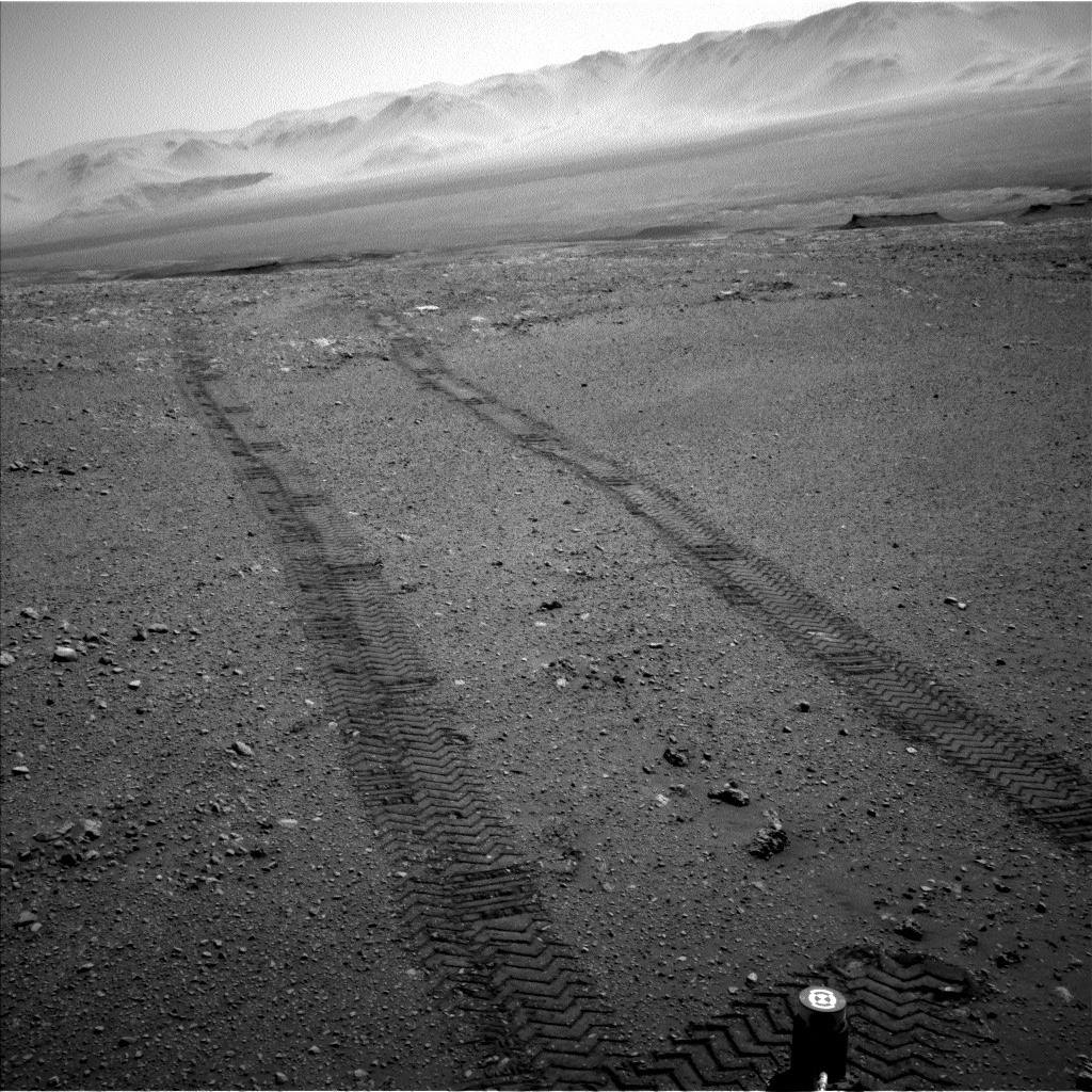
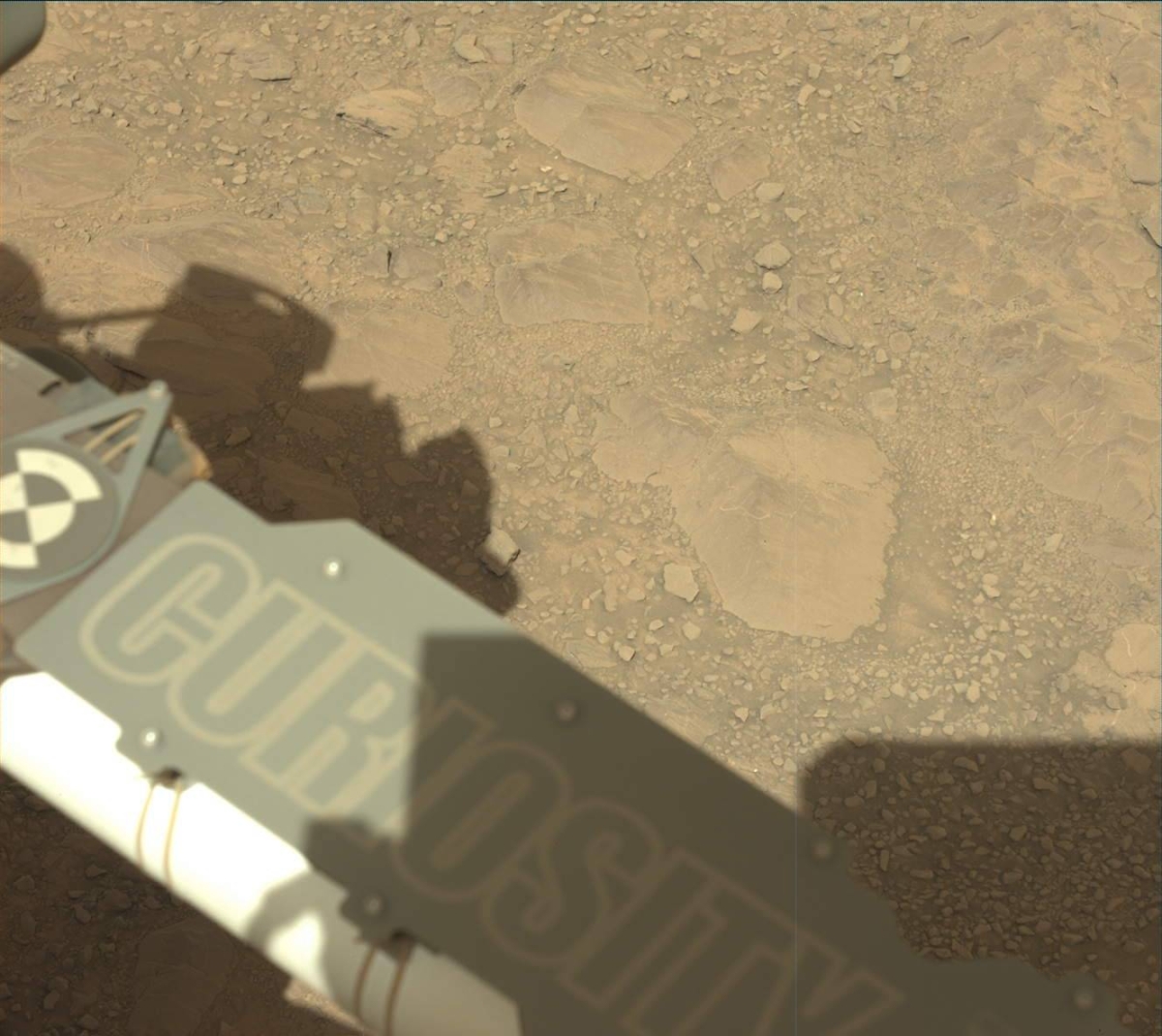
Curiosity Navcam Left B image taken on Sol 1896, December 6, 2017.
Credit: NASA/JPL-Caltech
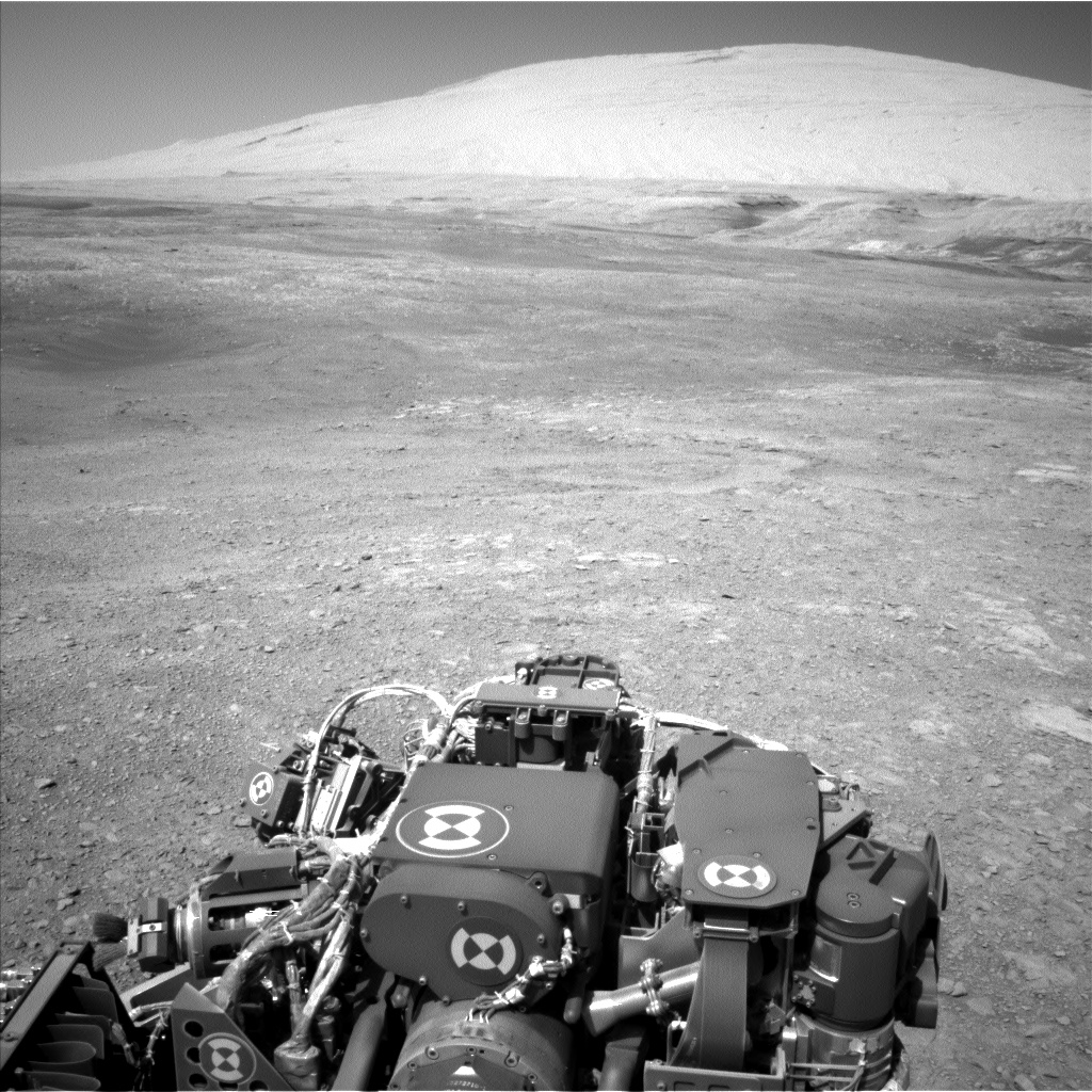
NASA’s Curiosity Mars rover is now deep into Sol 1897 operations.
Long wheel tracks in Sol 1896 imagery from the robot show a successful drive of roughly 82 feet (25 meters), bringing it to another stop along the route on Vera Rubin Ridge.
“We’ll actually spend a few days at this stop, where we plan to assess the surrounding bedrock, soil, and what we think might be a small impact crater,” reports Rachel Kronyak, a planetary geologist from the University of Tennessee in Knoxville.
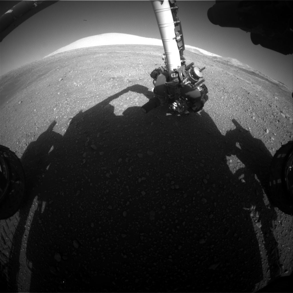
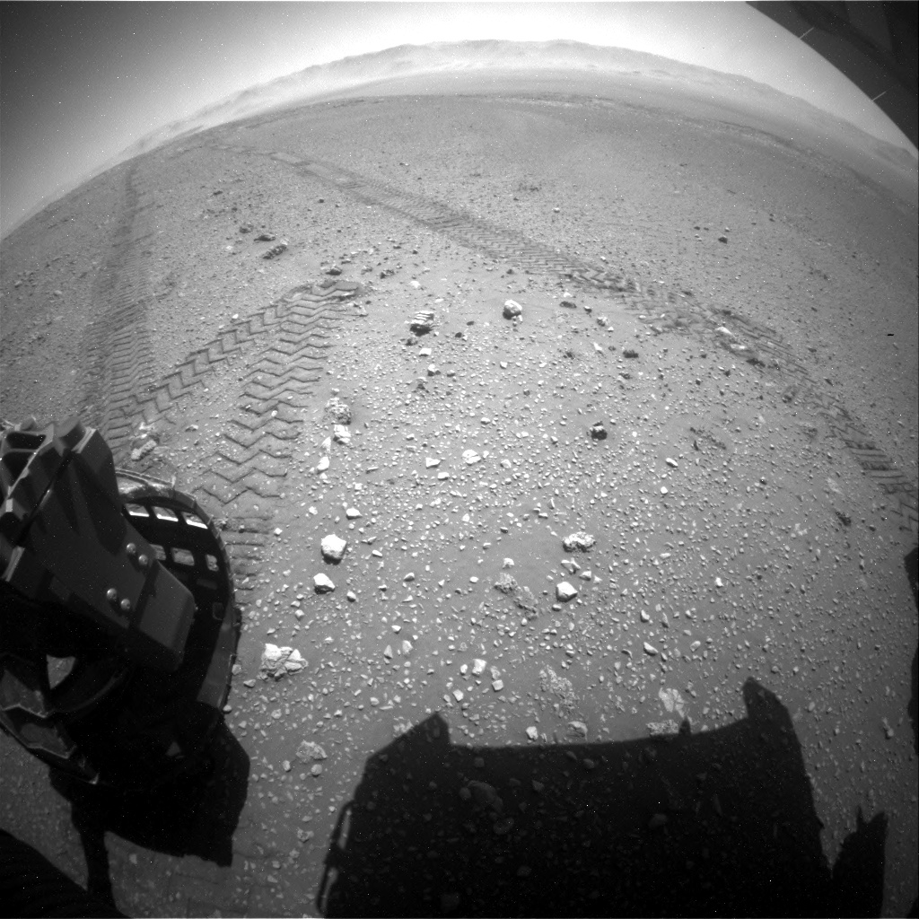
Curiosity Front Hazcam Right B photo acquired on Sol 1897, December 7, 2017.
Credit: NASA/JPL-Caltech
Bedrock rubble
The bedrock around the rover at the new stop is quite rubbly, which made choosing targets for Curiosity’s Alpha Particle X-Ray Spectrometer (APXS) and Mars Hand Lens Imager (MAHLI) measurements slightly more difficult, as it’s often hard to place the arm in contact with rough surfaces, Kronyak adds.
“Nevertheless,” Kronyak continues, “we planned a very busy 2 sols of science activities! We’ll spend Sol 1897 using the robotic arm to collect APXS and MAHLI data on two bedrock targets, named “Muck” and “Wick” and a soil target named “Sandness.”
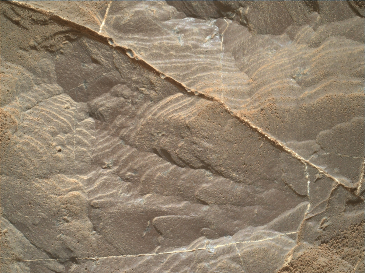
Curiosity Mastcam Left image acquired on Sol 1896, December 6, 2017.
Credit: NASA/JPL-Caltech/MSSS
Play it again SAM
Overnight on Sol 1897, a Sample Analysis at Mars (SAM) Instrument Suite (SAM) preconditioning activity is to be performed.
Doing so will mean carrying out a geochrononology experiment over the weekend on the onboard and stored “Ogunquit Beach” sand sample.
Suprahorizon movie
Sol 1898 is primarily devoted to remote science.
First, the rover will take some environmental measurements, including a suprahorizon movie, dust devil survey.
Next, the plan calls for analyzing the soil target “Sandwick” with the robot’s Chemistry and Camera (ChemCam) instrument, along with use of automated software called Autonomous Exploration for Gathering Increased Science, or AEGIS, on a selected target.
Curiosity Mastcam Left image talen on Sol 1896, December 6, 2017.
Credit: NASA/JPL-Caltech/MSSS
Sandy targets
“To wrap up our observations,” Kronyak notes, “we’ll take a series of Mastcam mosaics to capture the local geology, including the sand ripple target named “Loch Eil” and the coarse sandy target named “Ballantrae.” We’ll also take a few images of the terrain ahead to help assess our drive path along the Vera Rubin Ridge. We’ll remain at this location for the weekend as well.”
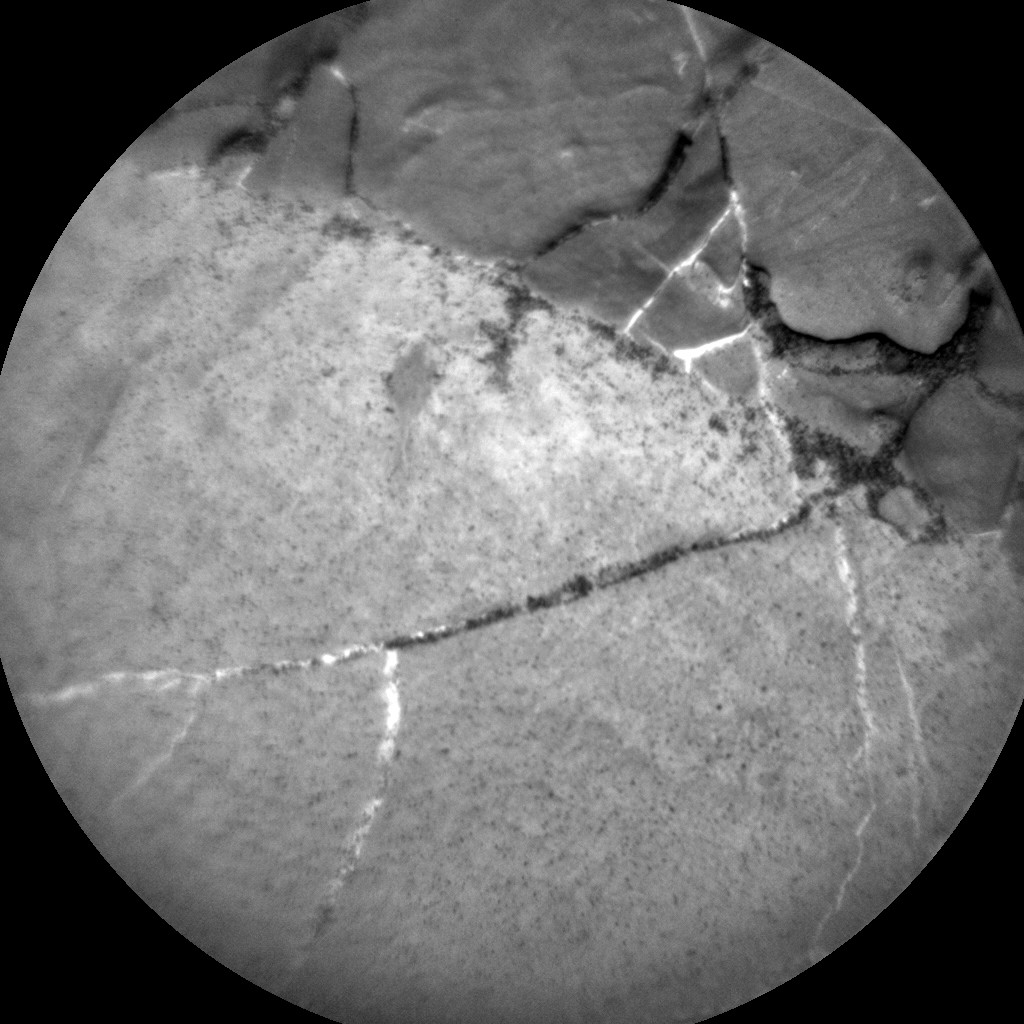
Curiosity ChemCam Remote Micro-Imager photo acquired on Sol 1895, December 5, 2017.
Credit: NASA/JPL-Caltech/LANL
Exciting news
Kronyak says there’s exciting news.
Curiosity has crossed into a new section of the science team’s geologic map. This means using a new theme for naming targets.
“The new quadrangle is named after Torridon, a village in the Northwest Highlands of Scotland that is near the Torridonian Supergroup, a geological formation that contains some of the oldest evidence of life of any rocks in the United Kingdom,” Kronyak explains. “We hope that this life-inspired Torridon quadrangle will give us good luck as we explore the ancient and potentially habitable environments along our trek up Mount Sharp!”
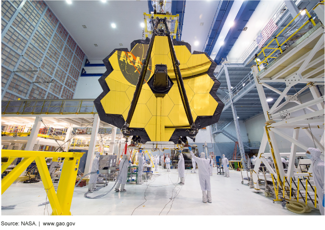
The James Webb Space Telescope Mirror
Credit: NASA
A U.S. House of Representatives Space Subcommittee hearing, “NASA’s Next Four Large Telescopes, was held on Wednesday, December 6, 2017.
The purpose of the hearing was to examine the development of the Transiting Exoplanet Survey Satellite (TESS), the James Webb Space Telescope (JWST), the Wide Field Infrared Survey Telescope (WFIRST) and the planning for a next generation space telescope.
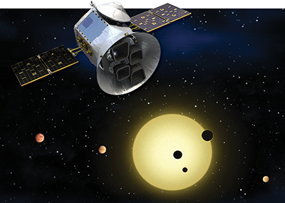
Transiting Exoplanet Survey Satellite (TESS)
Credit: NASA
Witness testimony:
Thomas Zurbuchen, Associate Administrator, Science Mission Directorate, National Aeronautics and Space Administration
Cristina Chaplain, Director, Acquisition and Sourcing Management, U.S. Government Accountability Office
A. Thomas Young, Former Director, Goddard Space Flight Center, NASA; Former
President and Chief Operating Officer, Martin Marietta Corporation
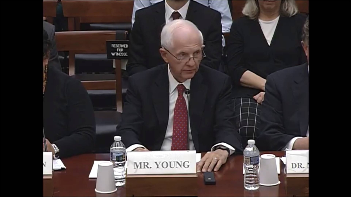
“The current assessment of JWST’s status is
that integration and test will take significantly longer than planned. The result is a launch schedule delay and the consumption of most of the remaining funding reserves. In my opinion, the launch date and required funding cannot be determined until a new plan is thoughtfully developed and verified by independent review.” – Thomas Young
Credit: Inside Outer Space
Matt Mountain, President, Association of Universities for Research in Astronomy
Chris McKee, Professor Emeritus of Astronomy, Physics, University of California, Berkeley, on behalf of the National Academies of Sciences, Engineering and Medicine
Also, go to:
NASA: Preliminary Observations on the Management of Space Telescopes
GAO-18-277T, December 6:
Testimony: http://www.gao.gov/products/GAO-18-277T
Highlights: http://www.gao.gov/assets/690/688771.pdf
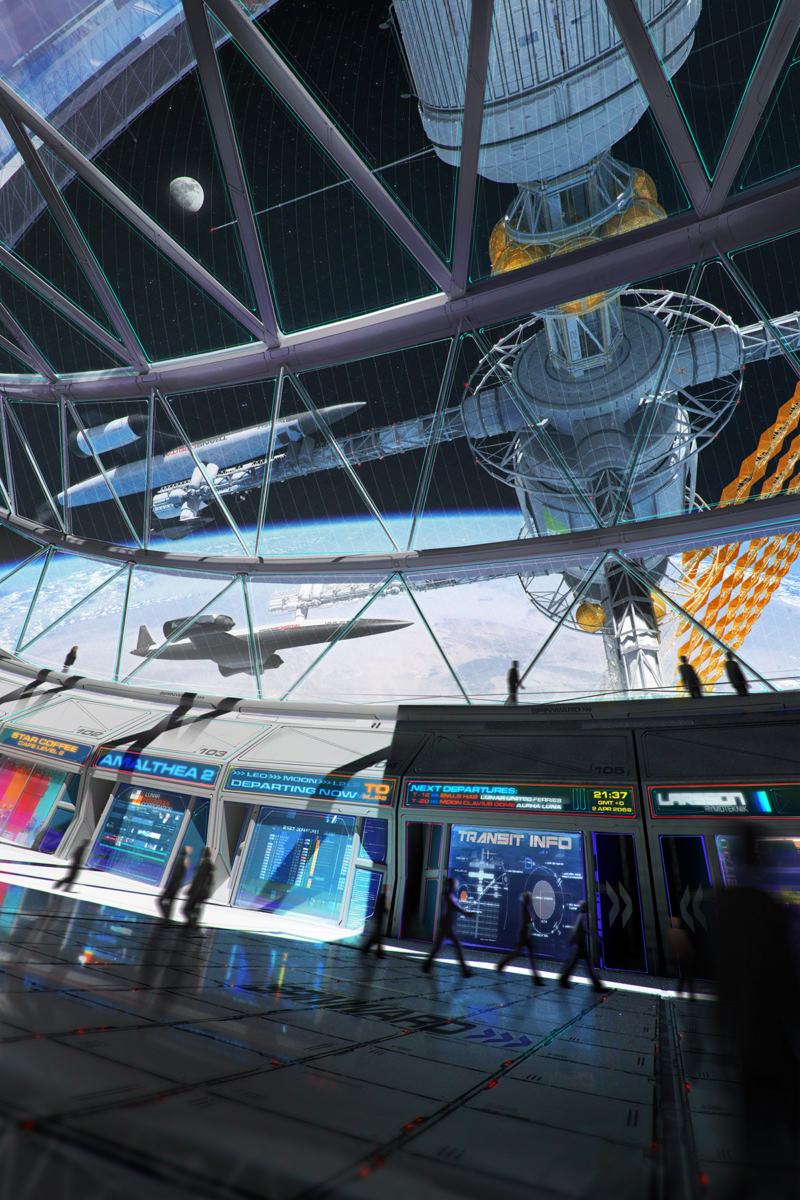
Credit: Maciej Rebisz
Arizona State University’s Center for Science and the Imagination has issued a free, downloadable book: Visions, Ventures, Escape Velocities.
This volume takes on the challenge of imagining new stories at the intersection of public and private—narratives that use the economic and social history of exploration, as well as current technical and scientific research, to inform scenarios for the future of the “new space” era.

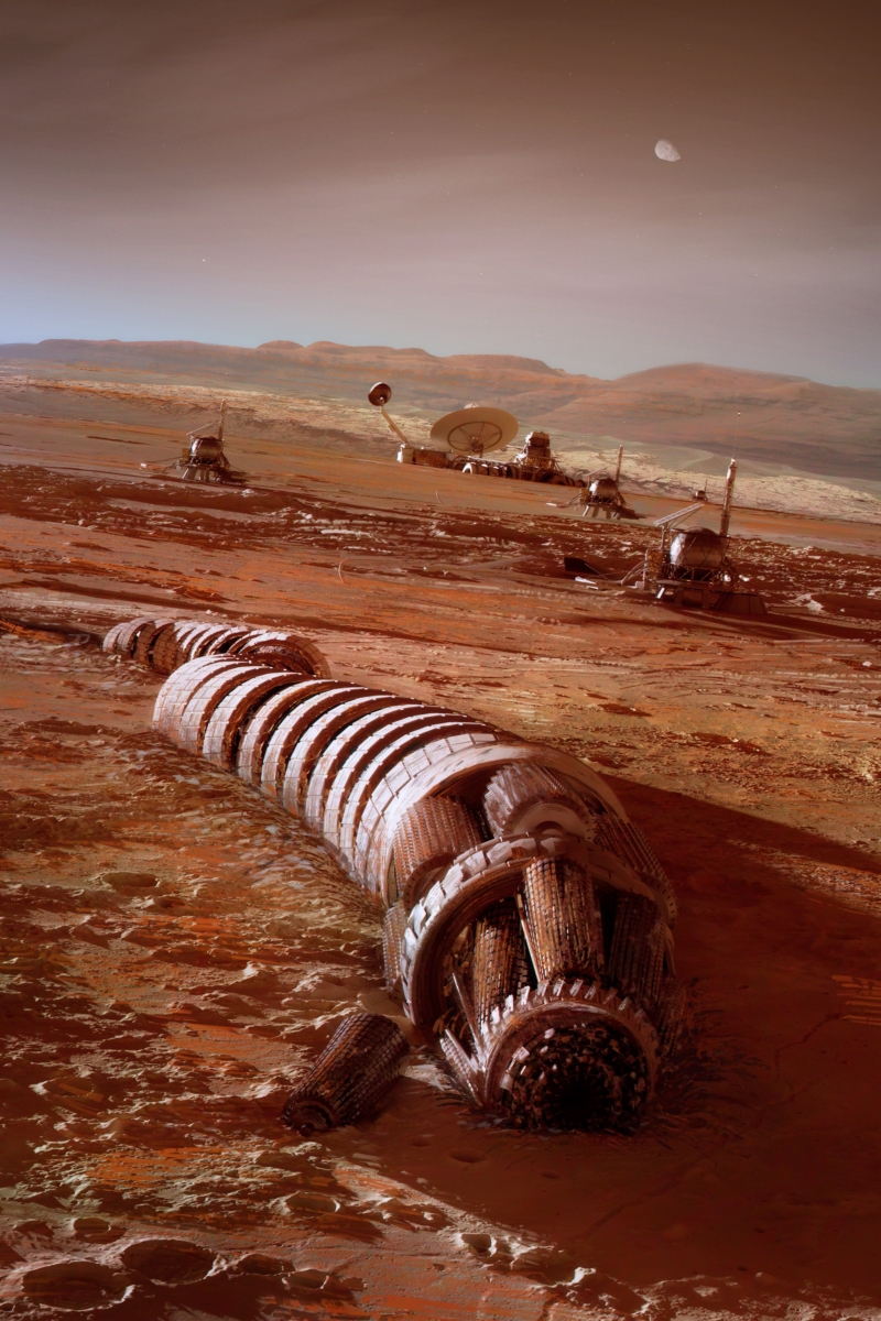
Credit: Maciej Rebisz.
Domestication of space
Visions, Ventures, Escape Velocities provides fresh insights into human activity in Low Earth Orbit, journeys to Mars, capturing and mining asteroids, and exploring strange and uncharted exoplanets.
The stories and essays within the volume imagine human expansion into space as a kind of domestication—not in the sense of taming nature but in the sense of creating a space for dwelling, a venue for human life and curiosity to unfurl in all their weirdness and complexity.
“Why should we go to space? Our answers to this question have changed significantly over the past 70 years as the people, the methods, and the funding for space exploration continue to change,” suggest Ed Finn and Joey Eschrich, editors of the book.
Credit: Maciej Rebisz.
Stories, essays, interview
This volume contains stories by: Madeline Ashby, Steven Barnes, Eileen Gunn, Ramez Naam, Carter Scholz, Karl Schroeder, Vandana Singh.
Essays by: Jim Bell, Lawrence Dritsas, Linda T. Elkins-Tanton, Emma Frow, Roland Lehoucq, Andrew D. Maynard, Clark A. Miller, Deji Bryce Olukotun, Steve Ruff, William K. Storey, Sara Imari Walker, G. Pascal Zachary.

Credit: Maciej Rebisz.
The volume also includes an interview with Kim Stanley Robinson.
This project was supported by a NASA grant. The stories and essays in this report reflect the views of its authors, and do not necessarily represent the views of NASA or the United States Government.
Creative thinkers
ASU’s Center for Science and the Imagination brings writers, artists and other creative thinkers into collaboration with scientists, engineers and technologists to reignite humanity’s grand ambitions for innovation and discovery.
The center serves as a network hub for audacious moonshot ideas and a cultural engine for thoughtful optimism. It provides a space for productive collaboration between the humanities and the sciences, bring human narratives to scientific questions, and explore the full social implications of cutting-edge research.

Credit: Maciej Rebisz.
Free to download
The collection is free to download in EPUB and MOBI e-book formats, as a PDF, and through Apple’s iBooks Store. You can also purchase a print-on-demand copy at cost for $20.09 (plus sales tax and shipping) from Blurb. The price covers printing costs only.
Profanity-Free Versions: A version of the book with all of the profanity in the narratives bleeped is available for kids, parents, educators, and anyone else who would prefer a profanity-free reading experience. Download the profanity-free version in EPUB, MOBI, or PDF.
Go to: http://csi.asu.edu/books/vvev/
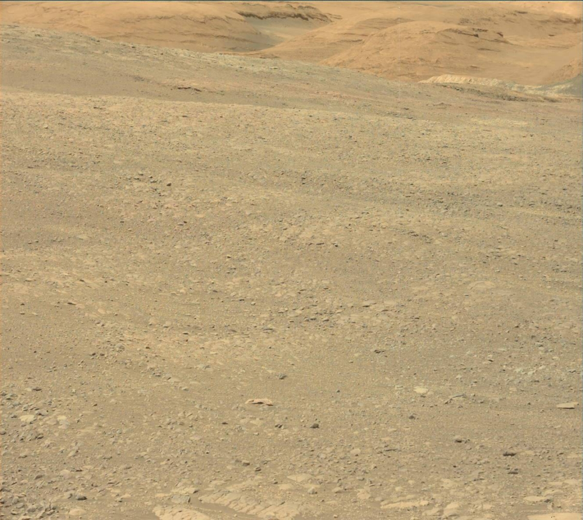
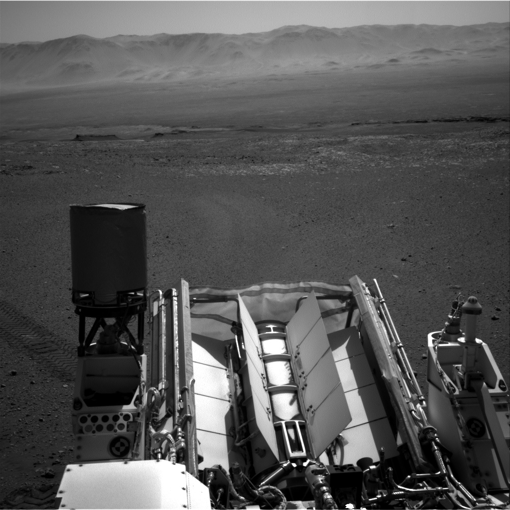
Curiosity Navcam Left B image acquired on Sol 1896, December 6, 2017.
Credit: NASA/JPL-Caltech
Now in Sol 1896, NASA’s Curiosity Mars Rover is wheeling across to new targets on Vera Rubin Ridge.
New December 6 imagery shows the Mars machinery moving into new science duties.
Curiosity Rear Hazcam Right B photo taken on Sol 1896, December 6, 2017.
Credit: NASA/JPL-Caltech
 Curiosity Navcam Right B image acquired on Sol 1896, December 6, 2017.
Credit: NASA/JPL-Caltech
Curiosity Mars Hand Lens Imager (MAHLI) photo acquired on Sol 1896, December 6, 2017.
Credit: NASA/JPL-Caltech/MSSS

Curiosity Front Hazcam Right B image taken on Sol 1896, December 6, 2017.
Credit: NASA/JPL-Caltech

Credit: U.S. Air Force
The U.S. government should learn to live with the proliferation of space capabilities, even in the face of potential threats, in order to maximize their potential benefits.
That’s one of the key points in a new Mitchell Policy Paper Release: Leading in a Rapidly Changing World: Policy Issues in Global Space Operations
The authors of the new paper: Jim Vedda, Senior Policy Analyst, Center for Space Policy and Strategy,The Aerospace Corporation and Peter Hays, Adjunct Professor of Space Policy and International Relations, Space Policy Institute at George Washington University.

An advanced ground-based radar system – a “Space Fence.”
Credit: Lockheed Martin
Key points
Other key points raised in the paper:
- The United States and the growing list of global space actors currently are participants in a fundamental reordering of many tenets and assumptions that have been long-standing attributes of U.S. national space policy and international agreements.
- The United States should lead by example. Part of this leadership is creating a path that does more than react to the technical evolution, programmatic developments, and perceived intentions of other countries.
- The path should serve U.S. national interests by expanding capabilities that enhance security, the economy, and science.
- The United States should embrace emerging technologies and services rather than try to restrain them.
- U.S. entities can be competitive or even dominant in the world market if the U.S. government encourages and facilitates new space applications.
Vedda and Hays closely analyze many dynamic aspects of civil and national security space operations they believe will demand the attention of decision-makers in the near future, such as space traffic management, the expanded use of small satellites or “smallsats,” satellite and orbital vehicle proximity operations, debris concerns, counterspace threats, and norms of behavior.
Resources
For a copy of “Leading in a Rapidly Changing World: Policy Issues in Global Space Operations,” go to:
http://docs.wixstatic.com/ugd/a2dd91_05d0e00bdd0b4cd9a0e384fd716943f9.pdf
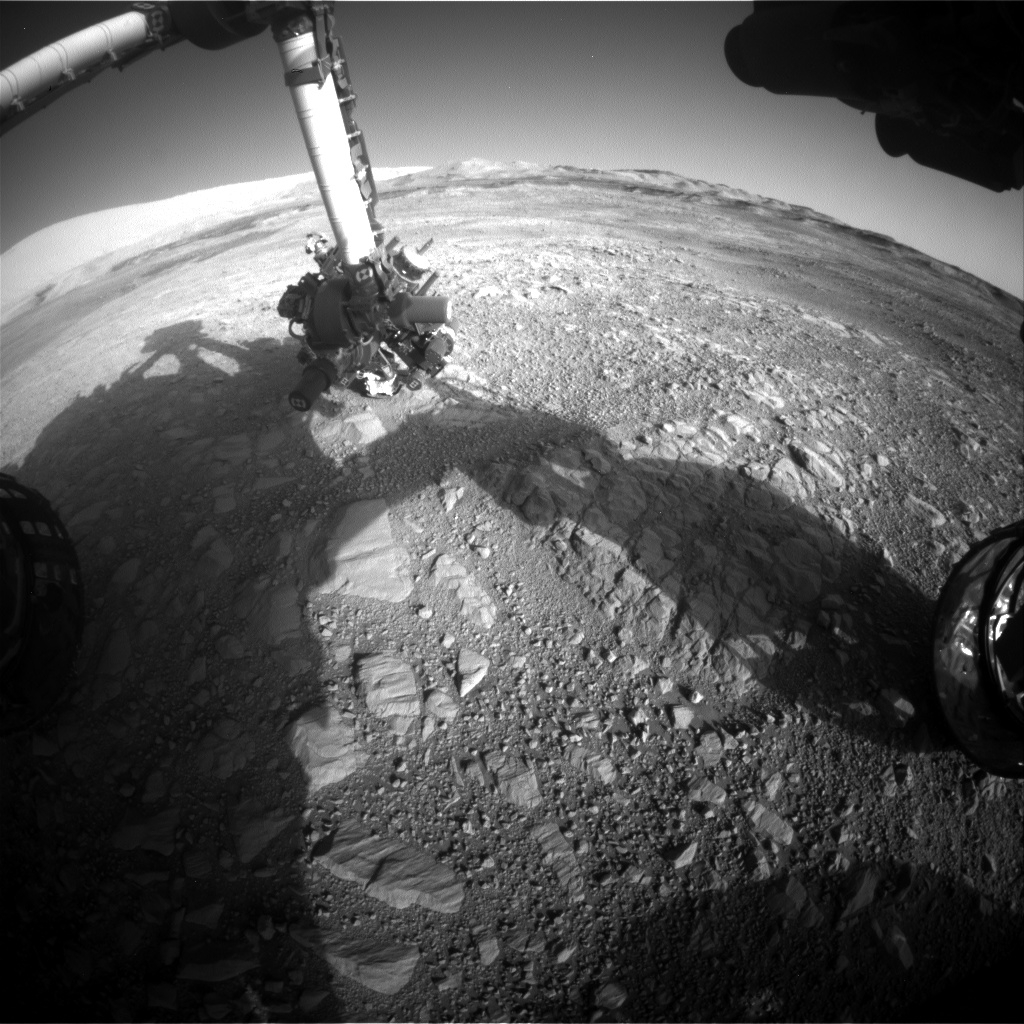
Curiosity Front Hazcam Right B image acquired on Sol 1895, December 5, 2017.
Credit: NASA/JPL-Caltech
Now in Sol 1895, NASA’s Curiosity Mars rover is slated to begin another “action-packed” science investigation for several days on Vera Rubin Ridge.
That’s the report from Mark Salvatore, a planetary geologist from the University of Michigan in Dearborn.
Curiosity spent last weekend analyzing the chemistry of several interesting targets.
Doglegging left
The robot has spent the last several weeks progressing largely to the south, Salvatore notes, with the science team starting to command Curiosity to head more towards the east, doglegging left along the nominal Mt. Sharp Ascent Route (MSAR).
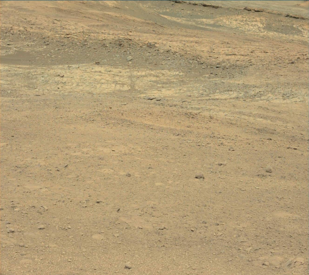
Curiosity Navcam Left B photo taken on Sol 1894, December 4, 2017.
Credit: NASA/JPL-Caltech
“Over the next few days, the plan is for Curiosity to investigate what appears to be a small eroded impact crater as well as an erosional window into some visually distinct bedrock outcrops,” Salvatore explains.
Before reaching these targets, Curiosity will conduct some additional investigations of the ridge and the local blocky materials.
Terrain targets
Curiosity Mastcam Left image acquired on Sol 1894, December 4, 2017.
Credit: NASA/JPL-Caltech/MSSS
Sol 1895 was slated to have a 1.5 hour block of time dedicated to remote observations of the surrounding terrain.
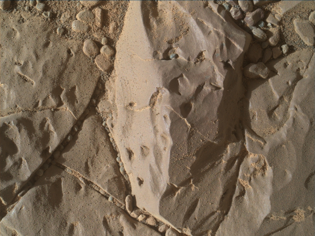
Curiosity will begin with some Mastcam color images of two interesting targets in front of the rover: a blocky exposure of fractured bedrock (named “Mapedi”) and a nodular piece of bedrock (named “Koonap”).
Afterwards, the rover’s Chemistry and Camera (ChemCam) will make active laser-induced breakdown spectroscopy (LIBS) measurements on three bedrock targets (named “Naute,” “Mzamba,” and “Nauga.” These targets are different in tone than other dusty materials in front of the rover.
Curiosity ChemCam Remote Micro-Imager photo taken on Sol 1895, December 5, 2017.
Credit: NASA/JPL-Caltech/LANL
Curiosity’s Mastcam is set to image and document this target area.
Bulk chemistry
Following these measurements, Salvatore adds that Curiosity’s arm will be unfurled and the robot will acquire high-resolution Mars Hand Lens Imager (MAHLI) images of the Mzamba target in addition to an overnight Alpha Particle X-Ray Spectrometer (APXS) analysis to derive the rock’s bulk chemistry.
“The next day, before heading towards the eroded impact crater, Curiosity will stow her arm in preparation for the roughly one-hour drive to the east,” Salvatore points out. “Following her drive, Curiosity will undertake the standard post-drive imaging sequence in addition to acquiring a MARDI image to document the terrain immediately under the rover’s belly.”
Curiosity Mars Hand Lens Imager (MAHLI) photo acquired on Sol 1894, December 4, 2017.
Credit: NASA/JPL-Caltech/MSSS
Ultra marathon
Salvatore notes a random fact of the day: One of the ChemCam targets is named “Naute,” which is the name of a dam in Namibia along a tributary of the Fish River. Namibia’s Fish River Canyon, he says, is the largest canyon in Africa, and is a widely visited tourist attraction for its scenic views. The Fish River Canyon is also home to an annual ultra marathon (100 kilometers distance) that travels through the difficult terrain along the margins of the river.
“As of today,” Salvatore concludes, “Curiosity only has another 82.174 kilometers to traverse before completing her own ultra marathon!”

