Archive for the ‘Space News’ Category
 Author:
  September 8th, 2026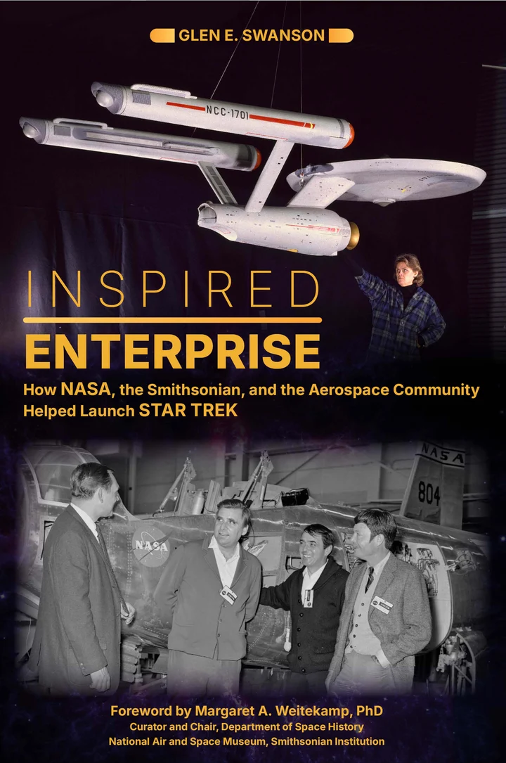
Inspired Enterprise: How NASA, the Smithsonian, and the Aerospace Community Helped Launch Star Trek by Glen E. Swanson and Foreword by Margaret A. Weitekamp of the Air and Space Museum; 2025; 288 pages (Hardcover); $35.00
Put aside the issue of cranky sliding doors on the USS Enterprise. Level out those pointy Spock ears and discount your own troubling encounters with tribbles.
But live long and prosper by reading this book. Also, your timing is great: Star Trek was first launched on the NBC Television Network on Sept. 8, 1966 – 60 years ago!
Swanson, a former chief historian at the NASA Johnson Space Center, has detailed how NASA, the Smithsonian, and aerospace businesses helped shape, legitimize, and popularize the now-beloved television show Star Trek, even including looks at the merchandising of the TV show and its syndication.
This is a scholarly look at Star Trek’s helmsman, Gene Roddenberry, and the science fiction world he created that drew upon smart storylines, visual effects, as well as plausible science and technology.
“As a baby boomer, Star Trek was a big part of my childhood,” an inspirational adventure, Swanson explains. “But little has been published about how Star Trek itself was inspired.”
Within its solid eight chapters, the author notes the role of the RAND Corporation, the military and nationalism in Star Trek, as well as the roles the aerospace industry, NASA and the Smithsonian played, leading to the show’s “vindication through syndication.”
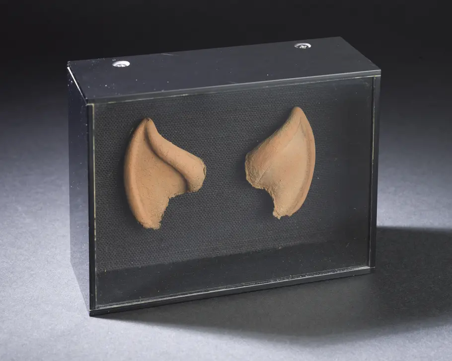
Spock ears in a box handmade by Leonard Nimoy.
Image credit: Smithsonian’s National Air and Space Museum
There is a wealth of well-researched facts and foundational observations offered in this book, replete with incredible endnotes and bibliography – assets that make this volume indispensible, not just for Star Trek fans, but those that deep dive into the meaning of space exploration.
Writes Swanson: “Is Star Trek an anomaly like the Apollo program? Both were products of the same decade. Apollo was the opening act to a period of time when our species could and did leave this world to venture out and explore another. Apollo was our first giant leap into space, and Star Trek was there to remind us not to get discouraged.”
So boldly go and get this terrific account of Star Trek’s beginnings and the evolving legacy it projects today.
For more information on this book, go to:
https://schifferbooks.com/products/inspired-enterprise
Also, you can test your Star Trek knowledge at this site, courtesy of the National Air and Space Museum’s Air and Space Quarterly at:
https://airandspace.si.edu/air-and-space-quarterly/issue-20/star-trek-museum-quiz
 Posted in

The Oscar- and Emmy-nominated documentarist Nanette Burstein working with co-screenwriter and editor Tal Ben-David, brings to life the story of Carl Sagan.
The new National Geographic documentary film, Carl Sagan: We Are Made Of Star Stuff, made its world premiere at the Telluride Film Festival.
The 53rd Telluride Film Festival was held September 4 through September 7.
Sagan archive
Gaining access to Sagan’s archive, including audio recordings made at the end of his life, “Burstein draws together these accomplishments with events in Sagan’s personal life: a painful and highly public divorce, an enduring love affair, life-threatening health crises, professional rivalries,” reports the Telluride Film Festival’s program guide.
For a review of the documentary, go to:

Image credit: Telluride Film Festival
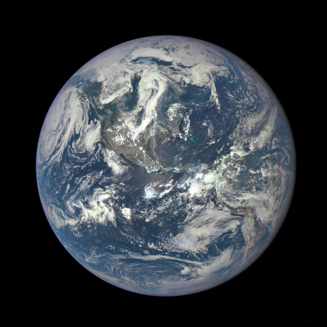
What’s going on down there? NASA’s Deep Space Climate Observatory satellite images the entire sunlit side of Earth from one million miles away.
Image credit: NASA
We are a “planet-based” species – all of us on a spin-filled Earth now housing 8.3 billion people.
That’s the gravity of the situation.
But we’re also a world of floods, typhoons, earthquakes, heat and cold calamities, volcanic eruptions, even encounters with Sun-caused aurora and bruises from incoming space rocks.
It’s quite a world worth watching – and for decades that’s what spacecraft have been doing.
But what do they view and who’s on the other end of the space-based microscopes capturing our daily doings, faults and all, down here on terra firma?
Go to my new Space.com story – “The future of Earth observation: Private satellites and AI bring benefits but also pose risks – Observing Earth from orbit is an increasingly private affair” – at:
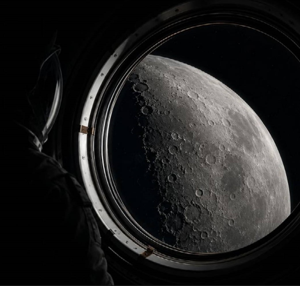
Image credit: Deloitte
Could Earth’s Moon be a witness plate, peppered with extraterrestrial material evidence of past extraterrestrial technology?
“Whereas electromagnetic SETI is restricted to contemporaneous transmitters, searches for artificially generated particles integrate over gigayear timescales and are therefore sensitive to technomaterial released by civilizations long extinct.”
The idea is that technogenic artifacts may survive natural interstellar transport and accumulate on solar system surfaces, such as our Moon.
Given that the lunar landscape’s minimal geochemical alteration and billions of years of exposure history, our Moon may well be an exceptionally stable long-duration collector of such material.
That’s the view from Lewis Pinault of the SETI Institute in Mountain View, California.
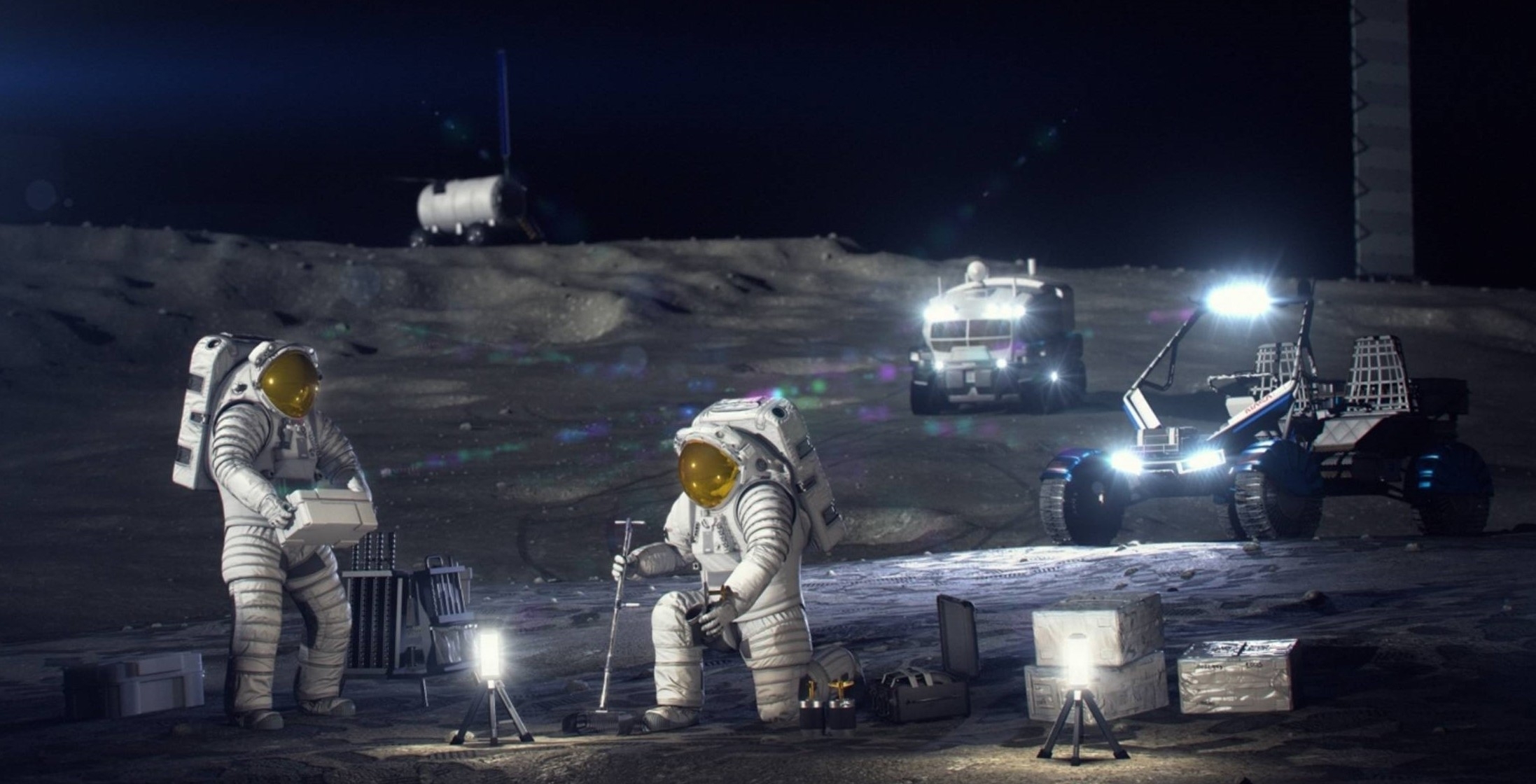
As human explorers visit the Moon on a recurring basis, time to keep an eye out for ET artifacts?
Image credit: NASA
Exo-archaeology
Pinault and colleagues suggest that identifying anomalous grains within a well-characterized natural background of the Moon, particulate technosignatures found could become an accessible form of exo-archaeology – and, in favorable cases, yield direct material evidence on the technological history of the Galaxy.
The possibility that the Moon may preserve material evidence of past extraterrestrial technology “strengthens the case for systematic, well-characterized regolith sampling,” the researchers explain.
Sifting through that lunar topside may offer the answer to one of astrobiology’s central questions: “whether technological life has ever arisen elsewhere in our Galaxy,” they report.
The exploratory paper, “Micron-Scale Technosignatures: How a Cubic Metre of Lunar Regolith May Begin to Constrain the Number of Past Technological Civilisations in the Galaxy” — a preprint version of which has been submitted to the International Journal of Astrobiology –– can be reviewed at:
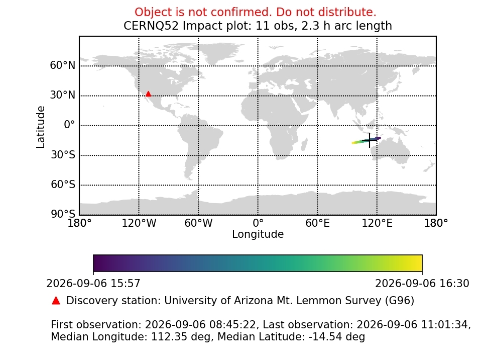
Image credit: European Space Agency’s Planetary Defense Office/Near-Earth Objects Coordination Center
The European Space Agency’s Planetary Defense Office/Near-Earth Objects Coordination Center has published the following Imminent Imactor based on 11 observations:
Imminent Impactor: CERNQ52
The Imminent Impactors page contains a list of the confirmed impacting objects detected by ESA’s Meerkat monitoring system in the last 15 days.
Meerkat computes impact solutions using the systematic ranging method. For each impactor, the table provides the nominal impact time, the nominal magnitude of the asteroid, and its nominal diameter based on an assumed albedo between 0.05 and 0.25. Additionally, the image displays the discovery station, the first and last observation, the number of observations processed, and the median impact time with its time range.
Nominal impact date and time: 2026-09-06 16:12:15 UTC
Diameter range in meters: 0.6 – 1.2
Please note: In a new posting, there are now 13 observations. The chart used in this imminent impactor states “Object is not confirmed. Do not distribute” while a line in the original posting says “Please feel free to forward this notification to potentially interested parties.” So pick one…
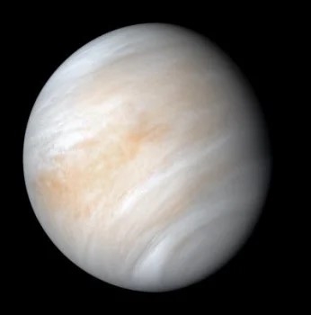
Enigmatic Venus. Cloudy with a scattering of life?
Image credit: NASA
Venus appears pale yellow in visible light, but ultraviolet images reveal dramatic dark and bright patterns moving with the planet’s upper sulfuric acid clouds.
Scientists have known about these markings for roughly a century, yet the chemical identity of the material responsible—the “unknown absorber”—remains unresolved.
An international research team has now placed new quantitative constraints on the properties of this mysterious absorber.
By combining observations of Venus with radiative-transfer modeling, the researchers estimated how strongly the liquid inside Venus’s cloud droplets would need to absorb light to reproduce the planet’s observed ultraviolet and blue reflectance.
New perspective
The study, published in Astrobiology, approached the mystery from a new perspective.
“Our model effectively asks what would happen if we could collect that cloud material into a cuvette and put it into a laboratory spectrometer,” said lead author Jan Spacek of the Foundation for Applied Molecular Evolution, USA. “This is important, as light absorption in a bulk liquid may be correlated with the concentration of light-absorbing material in the solution.”
Spacek noted that the findings of their research does not show that life exists in Venus’s clouds, nor do they demonstrate that the absorber is organic.
Instead, the study establishes quantitative requirements that any candidate—organic or inorganic—must satisfy, including absorption efficiency, concentration, atmospheric distribution, and compatibility with a realistic cloud-particle size distribution.
The newly-released study connects remote observations, laboratory chemistry, and future exploration in a new attempt to solve one of Venus’s longest-standing mysteries.
These constraints can now be tested experimentally and, ultimately, by on-the-sport exploration of Venus.
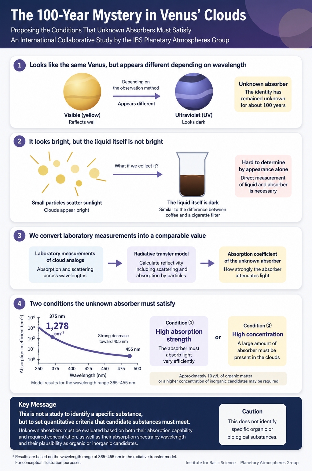
Image credit:: Foundation for Applied Molecular Evolution
Morning Star Missions
The Morning Star Missions to Venus initiative is developing in situ approaches to investigate Venusian cloud chemistry, including searches for complex organic molecules and measurements relevant to the unknown absorber.
On that initial sojourn, the MIT-provided Autofluorescence Nephelometer (AFN) is built to search Venus’s cloud particles for fluorescence that might be associated with organic molecules.
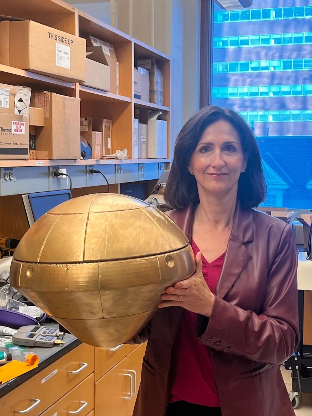
Sara Seager holds a mission to Venus probe to investigate its atmosphere.
Image credit: Sara Seager
However, that mission — as a Rocket Lab-provided departure — is in delay, as noted in this Space.com story:
For more details regarding this line of new Venus research, go to – “A Model of UV–Blue Absorbance in Bulk Liquid of Venusian Cloud Aerosols Is Consistent with Efficient Organic Absorbers at High Concentrations” – at:
https://journals.sagepub.com/doi/10.1177/15311074261477502

Image credit:: Foundation for Applied Molecular Evolution
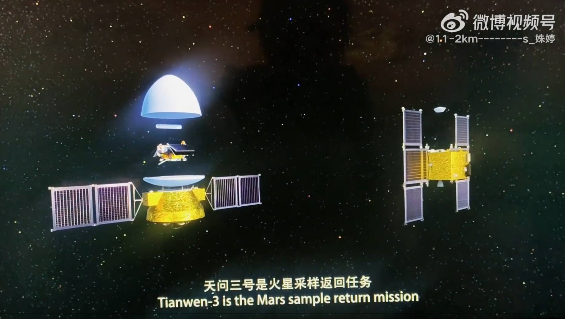
Image credit: Weibo/Inside Outer Space screengrab
China’s Tianwen-3 Mars Sample Return mission appears on track for launch next year, dedicated to return to Earth Red Planet collectibles in 2031.
A new video posted on Weibo is being shown by CNSPACE.dev, a website on China space development, noting that multi-site sampling by drone is not displayed in the video, only sampling done by a robotic arm on the lander.
CNSPACE.dev notes Tianwen-3 is due to launch in 2028, aimed to gather at least 500 grams of Mars samples for return to Earth.
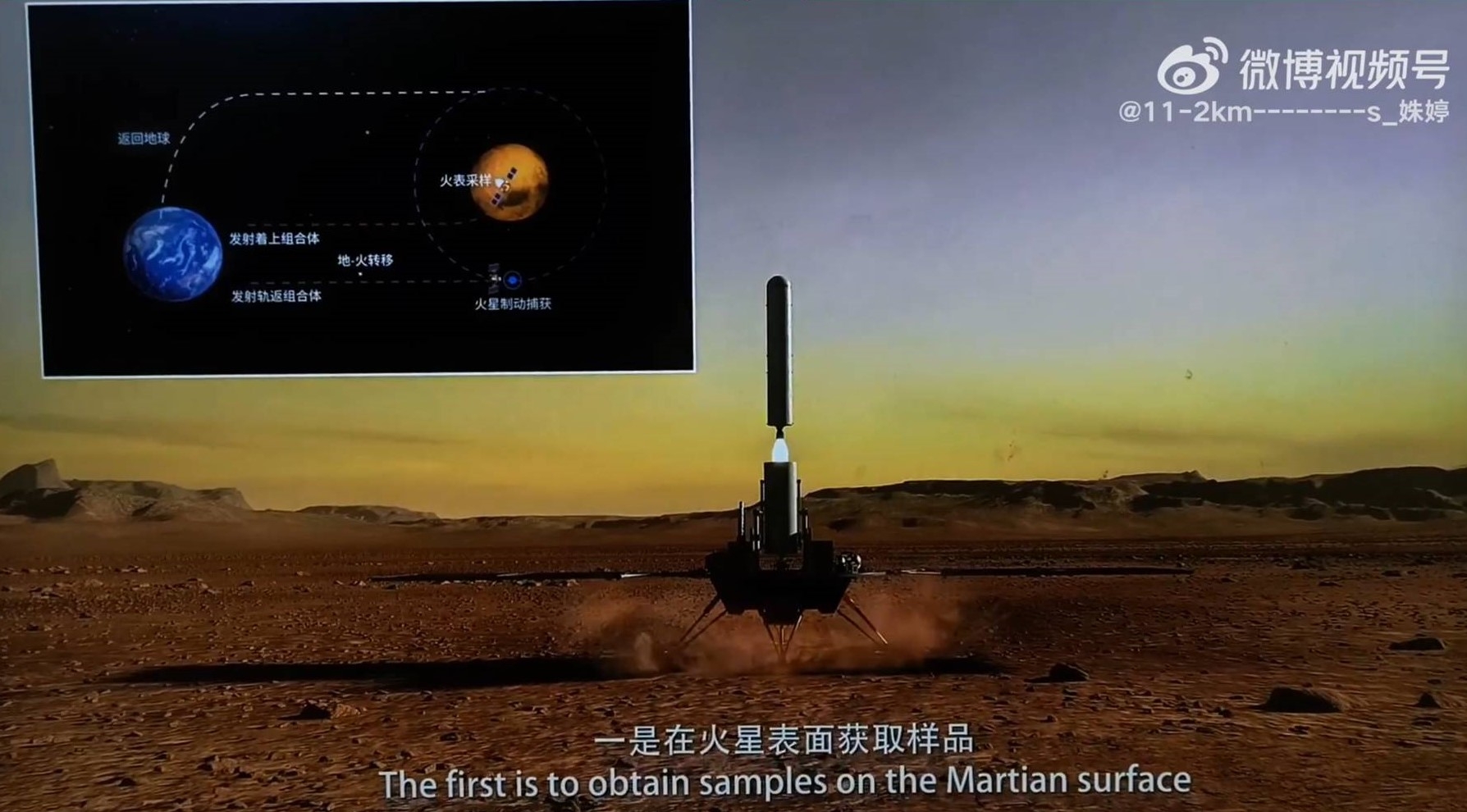
Image credit: Weibo/Inside Outer Space screengrab
Planetary protection lab
Last month, China’s Xinhua news agency, said that a “planetary protection laboratory” is to be built in the first phase of Hefei’s Deep-Space Science City in east China’s Anhui Province, citing the Deep Space Exploration Laboratory (DSEL), which will undertake part of the laboratory’s operation.
“The planetary protection laboratory will implement a two-way protection system that guards both the returning Martian samples and Earth’s biosphere,” Xinhua reports.
The lab’s tasks encompass sample sterilization, unsealing, processing and biological risk assessment. “The facility is designed to support the implementation of major deep-space missions and to enable scientific research on Martian samples,” adds Xinhua.
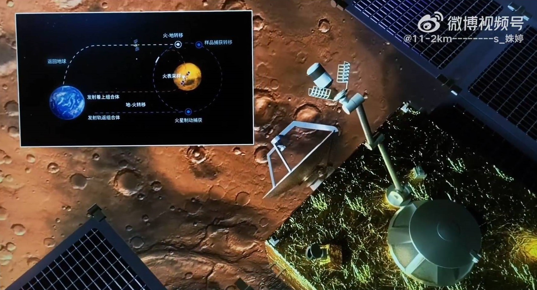
Image credit: Weibo/Inside Outer Space screengrab
Xinhua reports that Li Hang, director of the development planning department at DSEL, said the laboratory will serve scientific research findings from extraterrestrial samples.
Li also confirmed that China “will follow the planetary protection policies of the Committee on Space Research, to prevent biological contamination of Mars by terrestrial organisms and to protect Earth from any potential extraterrestrial life forms that may be carried back in the samples,” Xinhua reports.
Search for signs of life
CCTV/Inside Outer Space screengrab
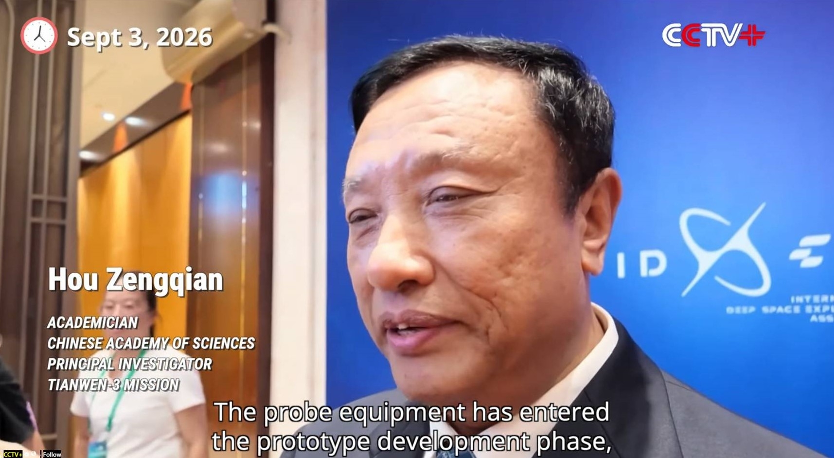
“Tianwen-3’s primary scientific objective is to search for signs of life. Therefore, we must land in a very precisely targeted area, which, both in theory and according to existing records, is the most likely to harbor life,” said Hou Zengqian, an academician with the Chinese Academy of Sciences.
Hou made the remarks on the sidelines of the International Deep Space Exploration Conference 2026, which opened on Thursday in Hefei City of east China’s Anhui Province.
According to the China National Space Administration, the Tianwen-3 probe will have five components — a lander, an ascender, a service capsule, an orbiter, and a reentry module. It will be launched around 2028 on two Long March-5 heavy-lift carrier rockets from the Wenchang Space Launch Site in China’s southernmost island province of Hainan.
To view the video, go to this Weibo-posting at:
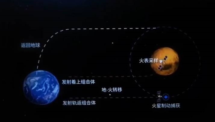
Image credit: Weibo/Inside Outer Space screengrab

NASA Dragonfly on Titan.
Image credit: NASA/Johns Hopkins APL/Steve Gribben
NASA’s Dragonfly spacecraft is scheduled to launch in summer 2028 and reach Saturn’s moon Titan in late 2034.
The rotorcraft’s landing area on Titan has been named – Ahmakiq Undae. The region consists of dunes and interdune areas to the south of Selk Crater, extending to the edge of a range of hills or mountains.
Ahmakiq Undae has a diameter of approximately 500 miles (810 kilometers) and borders the roughly 50-mile (80-kilometer) diameter Selk impact crater.
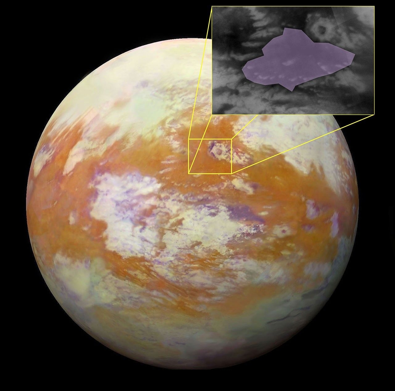
Dragonfly equatorial landing site on Titan.
Image credit: NASA/Jason Barnes
Once Dragonfly reaches Titan, the rotorcraft will conduct a 3.3 year primary mission, exploring diverse environments from organic dunes to deposits associated with Selk Crater, a place where liquid water and complex organic materials key to life once existed together.
“Scientific analysis indicates that the impact that formed Selk melted the icy bedrock, potentially creating a large temporary pool that could have remained liquid for hundreds to thousands of years under an insulating ice layer, like winter ponds on Earth,” explains a NASA statement.
The International Astronomical Union (IAU), the global body responsible for officially designating objects in space, has approved the name for the large dune field where Dragonfly will land on Titan.
Enigmatic Venus. Cloudy with a scattering of life?
Image credit: NASA
Getting a privately-backed robotic mission en route to Venus has become about as foggy as the planet itself.
Enter a Rocket Lab-backed kick-starter of a spacecraft hike to that cloud-enveloped world, matched up with the step-by-step agenda of a scientific group at the Massachusetts Institute of Technology (MIT).
The first step on that program is the Rocket Lab Mission to Venus, which will deploy a small, nose cone-like probe crafted to sample the Venusian atmosphere using a device called an autofluorescence nephelometer, mercifully shortened to AFN in space lingo.
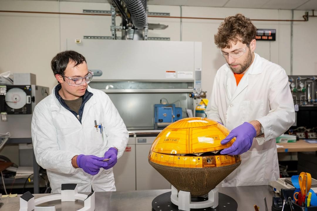
The Venus probe’s heat shield was developed by NASA’s Ames Research Center and called the Heatshield for Extreme Entry Environment Technology (HEEET).
Image credit: NASA/Brandon Torres Navarrete
That AFN can measure individual particles in Venusian clouds, constraining their size, shape, and composition in a search for signs of organic molecules.
But that undertaking, primarily fueled by private dollars, has been waylaid due to getting a needed booster flight-qualified.
For details, go to my new Space.com story – “Rocket issues delay 1st-ever private mission to Venus – ‘We are awaiting Neutron readiness’” – at:
Sara Seager holds a mission to Venus probe to investigate its atmosphere.
Image credit: Sara Seager

Image credit: White House/OSTP
A National Security Science and Technology Strategy has been issued August 31 by the White House Office of Science and Technology Policy.
The document is focused on science and technology competition as it relates to military capabilities, homeland defense and resilience, and other direct intersections with national security.
Priority areas
The strategy identifies three priority areas for U.S. battlefield dominance and power projection, among them space: “Clear technological superiority in the space domain, and ability to detect, characterize, and counter threats to U.S. space interests from very low-Earth orbit and through cislunar space,” the strategy points out.
Enabling space technologies
To maintain and advance U.S. dominance across the critical domain of space, relevant agencies should prioritize leadership in and application of key enabling space technologies. Items noted in the report are:
- Cost-effective on-demand and reusable space launch
- Advanced space vehicle power generation and propulsion
- Novel space vehicle thermal management
- Access to and use of cislunar space and novel orbits
- In-space aggregation and assembly
- Biotechnologies for space applications
- Crewed spaceflight enablers
To review the entire document – “National Security Science & Technology Strategy” – go to:
https://www.whitehouse.gov/wp-content/uploads/2026/08/NSSTS-082026.pdf
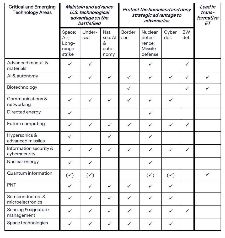
Image credit: White House/OSTP

