Archive for the ‘Space News’ Category

Credit: NASA
Robert Zubrin, president of Pioneer Astronautics and the Mars Society has scripted a “Moon Direct” master plan.
The Moon is “now within reach.” Zubrin explains in an op-ed that appeared in the March 26, 2018 issue of SpaceNews magazine. “We won’t just be getting a local outpost: we’ll be getting complete global access to an entire world,” he writes.

Credit: Robert Zubrin/SpaceNews
Foundation booster
Zubrin’s view is that the SpaceX Falcon Heavy rocket, which made its debut February 6, is the foundation of the Moon Direct master plan for affordably returning humans to the Moon within four years.

Early concept of Deep Space Gateway. Should it be deep-sixed?
Credit: NASA
Never shy on targeting NASA, Zubrin explains that the space agency’s lunar orbiting space station dubbed the Deep Space Gateway is a boondoggle with a price tag of several tens of billions of dollars. The Gateway serves no useful purpose whatsoever, he believes, except perhaps to provide a launch manifest for NASA’s big booster, the Space Launch System.
“If you want to get to the Moon, you need to go to the Moon,” Zubrin concludes. “We now have it in our power to do so. Let’s seize the time.”
To read the entire SpaceNews op ed, go to:
http://spacenews.com/op-ed-moon-direct-how-to-build-a-moonbase-in-four-years/
Credit: The Aerospace Corporation/CORDS
Round and round it goes – when and where it stops nobody knows.
China’s Tiangong – 1 space lab is in its last laps around Earth.

Credit: The Aerospace Corporation/CORDS
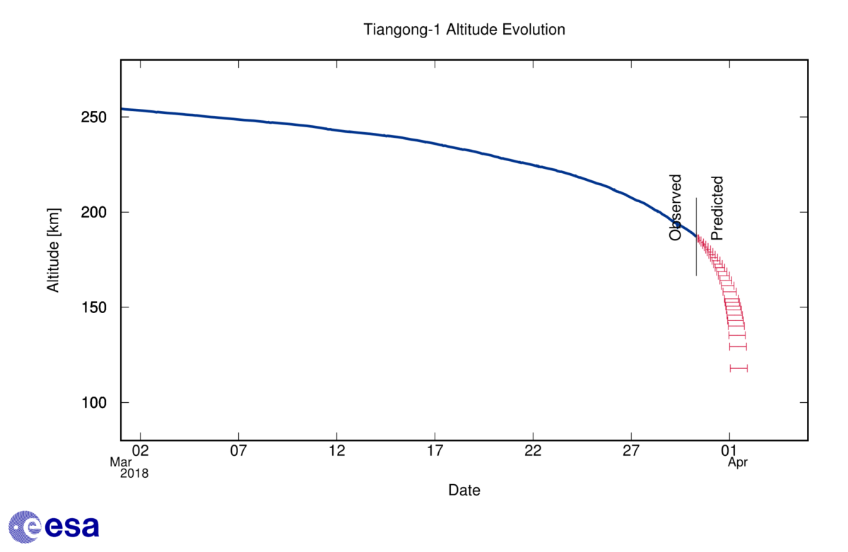
The latest reentry forecast provided by European Space Agency’s Space Debris Office in Darmstadt, Germany has issued a March 31 update.
The space debris team at ESA has adapted their reentry forecast over the last 24 hours “to take into consideration the conditions of low solar activity. New data received overnight gave further confirmation that the forecast window is moving to later on 1 April,” the ESA office explains.

Map showing the area between 42.8 degrees North and 42.8 degrees South latitude (in green), over which Tiangong-1 could reenter. Graph at left shows population density.
Credit: ESA CC BY-SA IGO 3.0
The team now are forecasting a window centered around 23:25 UTC on April 1 (01:25 CEST 2 April), and running from the afternoon of April 1 to the early morning on April 2. This remains highly variable.
Similarly, The Aerospace Corporation’s Tiangong-1 is currently predicted to reenter the Earth’s atmosphere around April 1st, 2018 20:30 UTC ± 8 hours.
This prediction was performed March 31 by The Aerospace Corporation’s Center for Orbital and Reentry Debris Studies (CORDS).
China to UN
In a “Note verbale” dated March 16, 2018 from the Permanent Mission of China to the United Nations (Vienna), it says “on the basis of further calculation and review, most structural parts of Tiangong-1 will burn up on re-entry. The probability of damage to aviation activities and human life and facilities on Earth is extremely low.”

Credit: The Aerospace Corporation/CORDS
Overhead pass-time
Meanwhile, sky watchers are reporting observations of the doomed Chinese spacecraft.
Thomas Dorman is a satellite tracker from Tahlequah, Oklahoma. He has been documenting flyovers of the spacecraft using telescopes, binoculars, video and still cameras, a DVD recorder, a computer and other gear since the space lab’s launch back in September 2011.
“I was able to spot Tiangong-1 this morning,” he advised Inside Outer Space. The vehicle was caught on video, he added, under poor conditions of high clouds and wind.
Dorman reports: “It was zipping right along! No ablation observed!” Caught on video, the station was around 14 seconds early based on orbit prediction data. The bright star also observed is Polaris.
To view his video, used with permission, go to:
Resources
BTW: Dorman was early in flagging the fall of Tiangong-1.
Go to my June 10, 2016 Space.com story:
When Will China’s ‘Heavenly Palace’ Space Lab Fall Back to Earth?
http://www.space.com/33140-china-tiangong-1-space-lab-falling-to-earth.html
To keep your own eye on the reentry of Tiangong-1, one popular and easy-to-use website:
Also, go to this informative video by China’s CGTN:
https://www.youtube.com/watch?v=CZSDifvYWdE&feature=youtu.be
Curiosity Navcam Left B photo taken on Sol 2007, March 30, 2018.
Credit: NASA/JPL-Caltech
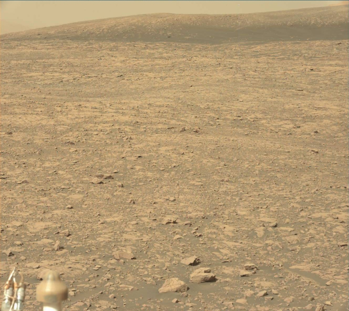
NASA’s Curiosity Mars rover is now performing Sol 2008 science duties, exploring variations in composition, texture, and color of its surroundings reports Lauren Edgar, a planetary geologist at the USGS in Flagstaff, Arizona.
Curiosity Navcam Left B image acquired on Sol 2007, March 30, 2018.
Credit: NASA/JPL-Caltech
Curiosity recently drove 115 feet (35 meters) to the southeast, “which set us up for some great contact science on the rim of a small impact crater,” Edgar adds.
The robot is working its way toward Region 13 on Vera Rubin Ridge and investigating changes in bedrock composition, texture, and color.
Scientific weekend
A 3-sol plan (Sol 2008-2010) has been scripted with a lot of great science for the weekend, Edgar notes.
Curiosity Mastcam Right image taken on Sol 2006, March 29, 2018.
Credit: NASA/JPL-Caltech/MSSS
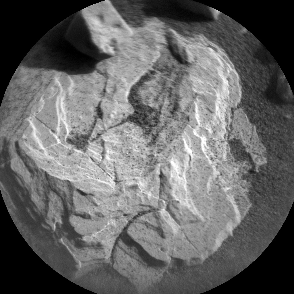
The first sol kicks off with Chemistry and Camera (ChemCam) observations of “Beinn Dearg Mhor,” “Dun Caan,” and “Dalbeattie” to look for changes in chemistry within the red bedrock in the rover’s workspace.
Curiosity will then acquire Mastcam documentation of those targets as well as a mosaic to characterize a sandy trough on the floor of the small crater at “Saxa Vord.”
Hematite signature
Also in the plan is carrying out contact science (including Dust Removal Tool (DRT), Mars Hand Lens Imager (MAHLI), and Alpha Particle X-Ray Spectrometer (APXS) on the targets “Lanark” and “Dun Caan” and some overnight APXS integrations.
“These observations will help to compare orbital observations to surface characteristics, particularly as we move through an area with a high hematite signature in orbital spectroscopic data,” Edgar reports.
Curiosity ChemCam Remote Micro-Imager photo taken on Sol 2008, March 31, 2018.
Credit: NASA/JPL-Caltech/LANL
Drive to southeast
On the second sol, Curiosity will acquire Mastcam multispectral observations of the DRT target “Lanark,” and the stratigraphy exposed in the wall of the small crater at the target “Stac Fada.”
“After completing science activities at this location,” Edgar continues, “Curiosity will drive to the southeast to investigate variations in color and sedimentary structures.”

Curiosity Mars Hand Lens Imager (MAHLI) photo produced on Sol 2005, March 28, 2018.
Credit: NASA/JPL-Caltech/MSSS
Mt. Sharp shots
On the third sol, the plan calls for an early science block for environmental monitoring activities. Later in the afternoon Curiosity will acquire long distance images using the Remote Micro-Imager (RMI) to characterize the yardangs and stratigraphy exposed higher on the slope of Mt. Sharp. Yardangs are sharp ridges formed by wind erosion.
Also on tap is acquiring several additional Navcam and Mastcam images to monitor atmospheric opacity, clouds, and scattering properties, Edgar concludes. “It’s going to be a busy weekend on Mars!”
Credit: NASA/JPL-Caltech/Univ. of Arizona
Traverse map
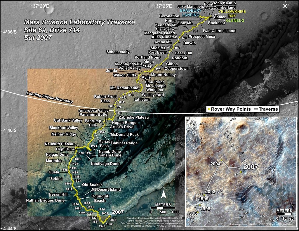
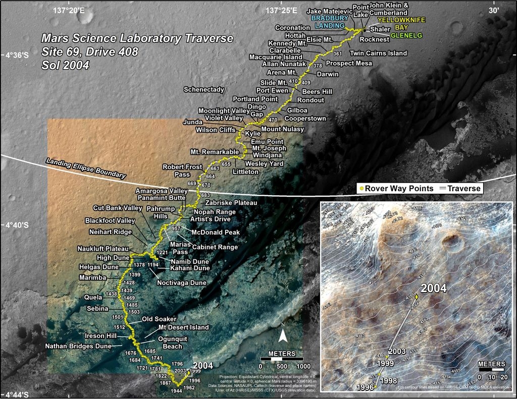
A new Curiosity traverse map shows the rover’s movement through Sol 2007.
The map shows the route driven by Curiosity through the 2007 Martian day, or sol, of the rover’s mission on Mars (March 30, 2018).
Numbering of the dots along the line indicate the sol number of each drive. North is up. The scale bar is 1 kilometer (~0.62 mile).
From Sol 2004 to Sol 2007, Curiosity had driven a straight line distance of about 103.75 feet (31.62 meters), bringing the rover’s total odometry for the mission to 11.54 miles (18.56 kilometers).
The base image from the map is from the High Resolution Imaging Science Experiment Camera (HiRISE) in NASA’s Mars Reconnaissance Orbiter.
Credit: The Aerospace Corporation/CORDS
The latest reentry forecast for the plunge of China’s Tiangong-1 space lab has been provided by the European Space Agency’s Space Debris Office in Darmstadt, Germany.
The current estimated reentry window runs from the night of March 31 to the late evening of April 1 (in UTC time), noting this is highly variable.
Credit: ESA
Noticeable change
“Today’s new forecast is a noticeable change from that of yesterday, and is due to solar activity,” the ESA office explains. One of the main reasons why it is so difficult to make an accurate reentry prediction, materialized during the last 24 hours, the notices adds.
“A high-speed stream of particles from the Sun, which was expected to reach Earth and influence our planet’s geomagnetic field, did, in fact, not have any effect, and calmer space weather around Earth and its atmosphere is now expected in the coming days.”
The density of the upper atmosphere, through which Tiangong-1 is moving, did not increase as predicted — which would have dragged the spacecraft down sooner — and hence the ESA Space Debris Office has adjusted the predicted decay rate.
Still uncertain
This implies that the new (and still uncertain) reentry window has shifted to later in the day on 1 April.
Credit: The Aerospace Corporation/CORDS
Similarly, The Aerospace Corporation’s Center for Orbital and Reentry Debris Studies (CORDS) explains today that Tiangong-1 is currently predicted to reenter the Earth’s atmosphere around April 1st, 2018 15:15 UTC, plus or minus 14 hours.

A composite image of the planet Venus as seen by the Japanese probe Akatsuki. The clouds of Venus could have environmental conditions conducive to microbial life.
Credit: JAXA
Nobody likes to have their life adrift.
But on Venus, the clouds of that hellish world could be a niche for extraterrestrial microbial life.
An international team of researchers led by planetary scientist Sanjay Limaye of the University of Wisconsin–Madison’s Space Science and Engineering Center lays out a case that the hunt for life beyond Earth should also include the clouds of Venus.
Limaye carries out his research as a NASA participating scientist in the Japan Aerospace Exploration Agency’s Akatsuki mission to Venus.
Dark patches
“Venus shows some episodic dark, sulfuric rich patches, with contrasts up to 30–40 percent in the ultraviolet, and muted in longer wavelengths. These patches persist for days, changing their shape and contrasts continuously and appear to be scale dependent,” says Limaye in a university press statement.
The particles that make up the dark patches have almost the same dimensions as some bacteria on Earth, although the instruments that have sampled Venus’ atmosphere to date are incapable of distinguishing between materials of an organic or inorganic nature.
The patches could be something akin to the algae blooms that occur routinely in the lakes and oceans of Earth, only these would need to be sustained in the Venusian atmosphere.

Proposed VAMP, or Venus Atmospheric Maneuverable Platform, is a craft that flies like a plane but floats like a blimp and could stay aloft in the planet’s cloud layer for up to a year gathering data and samples.
Credit: Northrop Grumman
Russian mission
The Wisconsin scientist and his colleagues are hopeful that an exobiological research chapter can be opened at Venus. There are ongoing discussions about possible NASA participation in Russia’s Roscosmos Venera-D mission, now slated for the late 2020s.
Current plans for Venera-D might include an orbiter, a lander and a NASA-contributed surface station and maneuverable aerial platform.
This new research and speculation can be found in a paper published online today in the journal Astrobiology.
Go to:
Venus’ Spectral Signatures and the Potential for Life in the Clouds

The Commercial Space Race is About to Accelerate
View an interactive live, streaming panel discussion: Lift Off the Page: The Commercial Space Race on Monday, April 9, at 7 p.m. (EDT), presented by the Embry–Riddle Alumni Association.
Tourists, space mining
Space experts predict that within the next year, tourists will travel into space and companies will begin planning to build hotels in orbit.
In the next few years, space–mining companies will launch their first exploratory missions to asteroids to search for and extract structural and precious metals and gather ice for fueling stations in space.
As early as 2022, telecom companies will have thousands of new, small satellites in low earth orbit that will provide global phone, internet and imaging services that will blanket the globe, providing greater speeds and uninterrupted service.
By 2025, aircraft will become operational that can travel at speeds exceeding Mach 3 (2,300 mph), paving the way for suborbital and orbital point-to-point transportation all over the world.
These topics and more will be discussed during the event.
Expert panel
Participants include:
Space law authority Dr. Diane Howard, an assistant professor in spaceflight operations at Embry-Riddle and executive secretary of the International Institute of Space Law.
Dr. Moriba Jah, an associate professor at the University of Texas at Austin and expert in astrodynamics-based space domain awareness.
Dr. Sonya A.H. McMullen, an assistant professor at Embry-Riddle’s College of Aeronautics, who served as a Space and Missile Operations Officer in the U.S. Air Force.
Location
Daytona Beach Campus and streaming live online.
All registrants will receive a link to join the discussion online.
For more information and how to register, go to:
MVP patch
Credit: Techshot
Next week, SpaceX is scheduled to launch the 14th Commercial Resupply Services flight to the International Space Station (ISS) via the Dragon spacecraft on a Falcon 9 rocket.
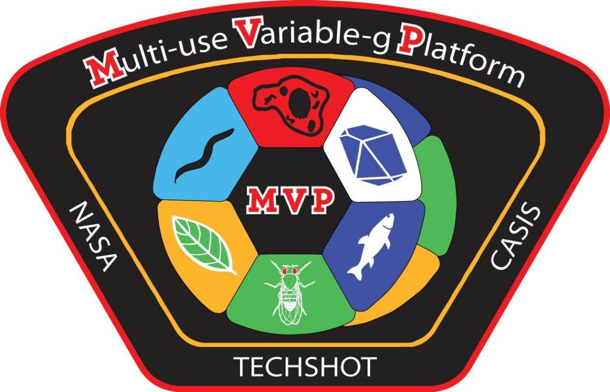
On board this flight will be a number of payloads, including the Multi-use Variable-gravity Platform, or MVP for short.
MVP, with its ability to provide fractional artificial gravity, some experiments are expected to help scientists understand more about how much gravity is enough to maintain crew health in space, on the Moon and on Mars.

Prototype Techshot MVP with door detached and two internal carousels partially removed.
Credit: Techshot
Commercially operated facility
Developed by Techshot of Greenville, Indiana, the MVP is a permanent, commercially operated facility onboard the ISS capable of producing artificial gravity in space.
This new research tool in space, spinning at varying gravity levels, can involve a wide variety of sample types – such as tissue chips, plants, fish, cells, protein crystals, worms and flies.
Roughly, the size of a microwave oven, MVP hosts six separate “experiment modules” on each of two internal carousels.

Prototype drosophila_experiment module
Credit: Techshot
Up to 2g
This new research platform is equipped with temperature, light cycle, and humidity control, video feed from inside the hardware, and the two identical and independently-controlled centrifuges that can generate artificial gravity from .1 to 2g.
Experiment modules launch separately in cargo resupply vehicles and are installed by the crew in MVP once they reach the station. Each is customized to accommodate the sample type and experiment protocol of a given research campaign.
Fruit fly flavored
The first experiment launching on the upcoming SpaceX CRS-14 will focus on Drosophila melanogaster (fruit flies). Known as MVP-Fly-01, this first campaign using the system will be conducted for a research team at NASA Ames Research Center in Mountain View, California.

Credit: NASA Ames
The MVP payload is sponsored by the ISS National Laboratory (managed by the Center for the Advancement of Science in Space) focusing on life sciences, biotech, and new facilities to engage further utilization of the ISS National Laboratory.
With NASA’s renewed focus on a return to the Moon, scientists need to better understand how much gravity is enough for human crews to remain healthy while living on the lunar surface. Research using the commercially developed, owned and operated Techshot Multi-use Variable-g Platform (MVP) is expected to help answer that question.
Go to this informative video at:
https://www.youtube.com/watch?time_continue=13&v=2AVvglUaa2g
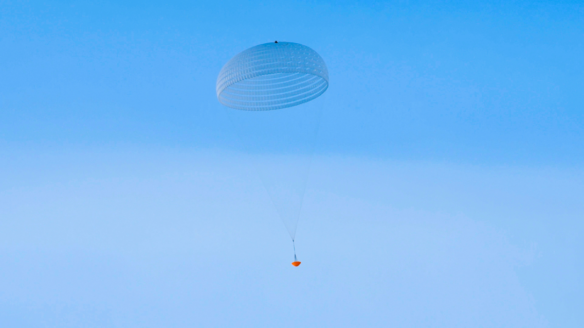
ExoMars parachute inflation.
Credit: ESA/I.Barel
The largest parachute ever to fly on a Mars mission is undergoing a series of tests for the European Space Agency’s ExoMars mission.
ESA’s ExoMars is due for launch in July 2020, with arrival at Mars in March 2021.
Inflation factor
The latest test was conducted in sub-zero conditions in Kiruna, Sweden earlier this month. The test focused on the deployment and inflation of the 115 feet (35 meters)-wide parachute, which will be the largest to fly on Mars.

Credit: ESA
The test demonstrated the deployment and inflation of the parachute with its 112 lines connected to a drop test vehicle, via the deployment of a smaller pilot chute. The assembly was lofted high above the ground with a helicopter, and the sequence initiated after the vehicle was released. About 12 seconds after the pilot chute was inflated, the second parachute release was triggered.
GoPro cameras on the test vehicle looked up at the parachute inflation, and onboard equipment sent telemetry in real time as it descended in about two and a half minutes to the ground.

Artist’s impression of the ExoMars 2020 rover and Russia’s stationary surface platform in background.
Credit:
ESA/ATG medialab
First of its kind
The ExoMars rover will be the first of its kind to drill below the surface and determine if evidence of life is buried underground, protected from the destructive radiation that strikes the surface of the Red Planet today.
A carrier module will transport the rover and a science platform to Mars within a single aeroshell. A descent module will separate from the carrier shortly before reaching the atmosphere, whereupon a heatshield, parachutes, thrusters and damping systems will reduce the speed, delivering them safely to the surface.
Program support
The ExoMars program is a joint endeavor between ESA and Russia’s Roscosmos.
The low-altitude test of the large parachute manufactured by Arescosmo was carried out by Vorticity Ltd at the Swedish Space Corporation Esrange facility. The test was performed under supervision of Thales Alenia Space France as responsible for the Parachute Assembly System, Thales Alenia Space Italy as the ExoMars Prime contractor, and ESA.
To view ESA video on the parachute testing, go to:
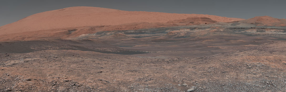
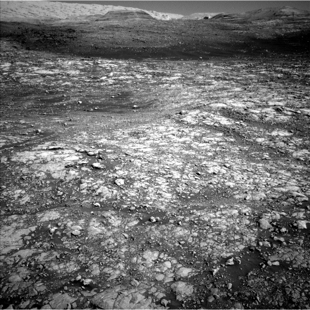
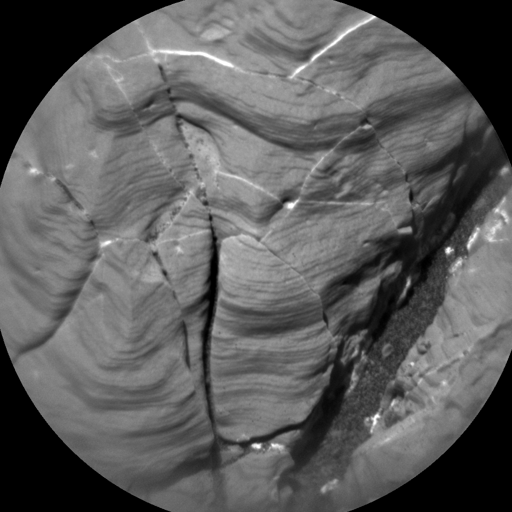
This mosaic taken by NASA’s Mars Curiosity rover looks uphill at Mount Sharp, which Curiosity has been climbing. Spanning the center of the image is an area with clay-bearing rocks that scientists are eager to explore; it could shed additional light on the role of water in creating Mount Sharp.
Credit: NASA/JPL-Caltech/MSSS
NASA’s Mars Curiosity rover is just starting to perform Sol 2006 science tasks.
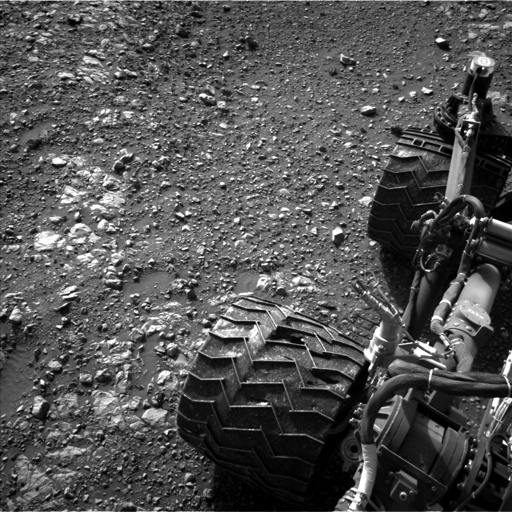
“Squarely in the red,” explains Christopher Edwards, a planetary geologist from Northern Arizona University in Flagstaff, saying the rover in a special spot.
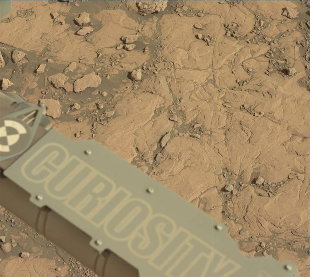
Curiosity Mastcam Left image taken on Sol 2004, March 27, 2018.
Credit: NASA/JPL-Caltech/MSSS
Scouting for hematite
After the robot completed a drive of nearly 180 (55 meters) drive, “Curiosity found itself sitting right in the middle of the strongest spectral detection of hematite identified along its path up Mt. Sharp,” reports Edwards.
“This strong spectral signature” is viewed both from orbit, where it was originally identified in the Mars Reconnaissance Orbiter’s Compact Reconnaissance Imaging Spectrometer data, and at ground level in the rover’s Mastcam multispectral data, Edwards observes.
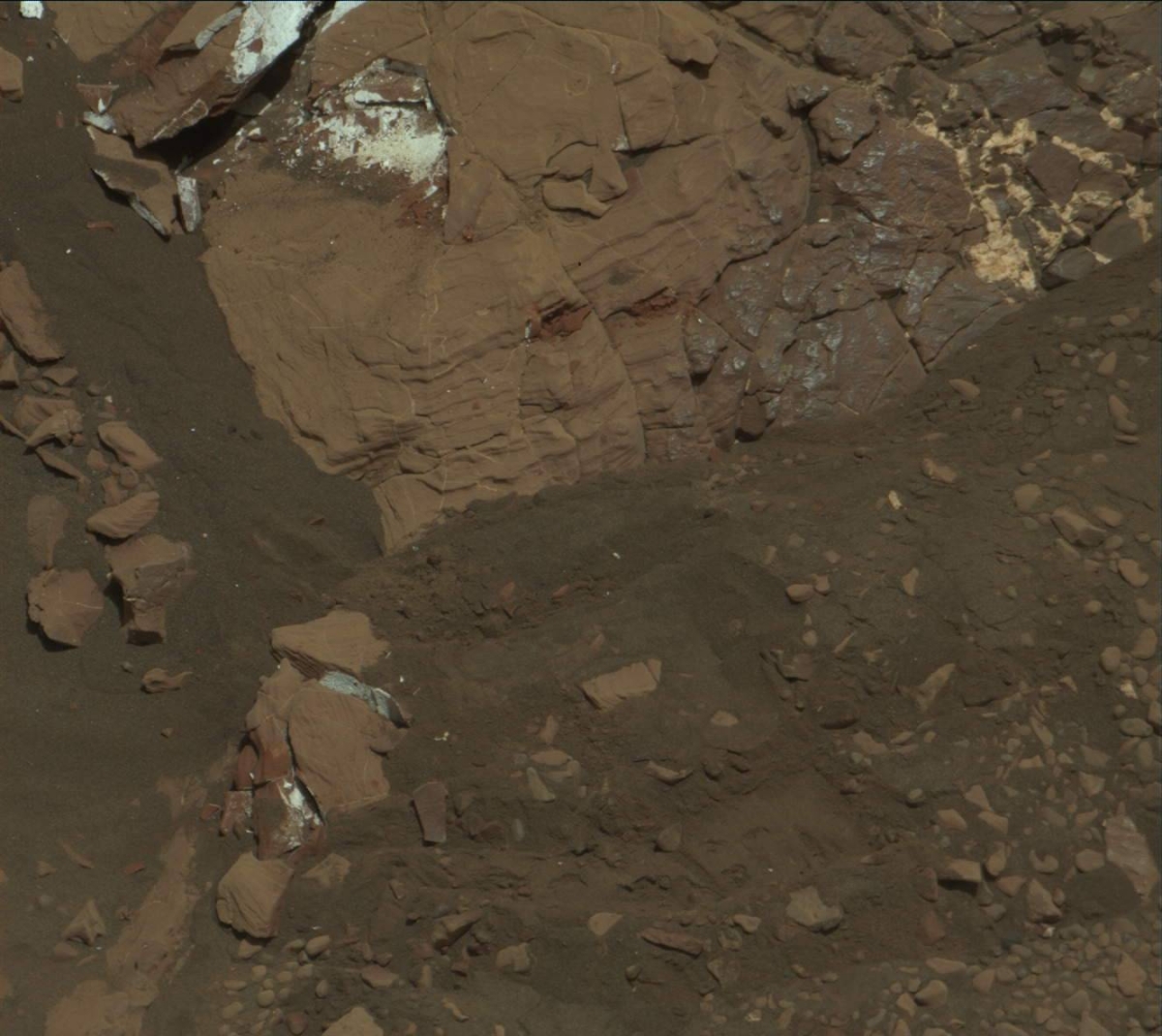
Curiosity Mastcam Left photo acquired on Sol 2004, March 27, 2018.
Credit: NASA/JPL-Caltech/MSSS
Current parking lot
“While Curiosity has definitely visited some areas that have the spectral fingerprint of hematite in previous sols, this is by far the best example we’ve seen over the mission,” Edwards adds. The rover science team is still trying to figure out “how this mineral formed and why we’re finding it where we are.”
Curiosity’s current parking spot will likely prove key to unraveling the geologic history of the Vera Rubin Ridge, when combined with other data acquired in Gale Crater, Edwards points out.
The rover has been busy and the science team now has a fabulous workspace to examine, Edwards notes.
Unique experiment
Two contact science targets (“Stranraer” and “Murchison”) were chosen to help examine the variability in chemistry related to different targets identified in color Mastcam data.
Curiosity ChemCam Remote Micro-Imager photo taken on Sol 2004, March 27, 2018.
Credit: NASA/JPL-Caltech/LANL
“For example, the Murchison target appears to be darker red than some of the other rocks like the Stranraer target. A unique experiment with Mastcam was designed to characterize the light scattering properties of the unit by taking 7 different observations over the course of the day,” Edwards reports.
Lastly, Curiosity’s Mastcam is slated to observe how the same spot on the surface changes its reflectivity properties with changing illumination, Edwards concludes, with the goal of providing insights into the nature of the hematite itself.
Credit: NASA/JPL-Caltech/Univ. of Arizona
New road map
Meanwhile, a new traverse map for Curiosity’s whereabouts has been issued, through Sol 2004.
The map shows the route driven by NASA’s Mars rover Curiosity through the 2004 Martian day, or sol, of the rover’s mission on Mars (March 28, 2018).
Numbering of the dots along the line indicate the sol number of each drive. North is up. The scale bar is 1 kilometer (~0.62 mile).
From Sol 2003 to Sol 2004, Curiosity had driven a straight line distance of about 178.15 feet (54.30 meters), bringing the rover’s total odometry for the mission to 11.51 miles (18.53 kilometers).
The base image from the map is from the High Resolution Imaging Science Experiment Camera (HiRISE) in NASA’s Mars Reconnaissance Orbiter.
Credit: The Aerospace Corporation/CORDS
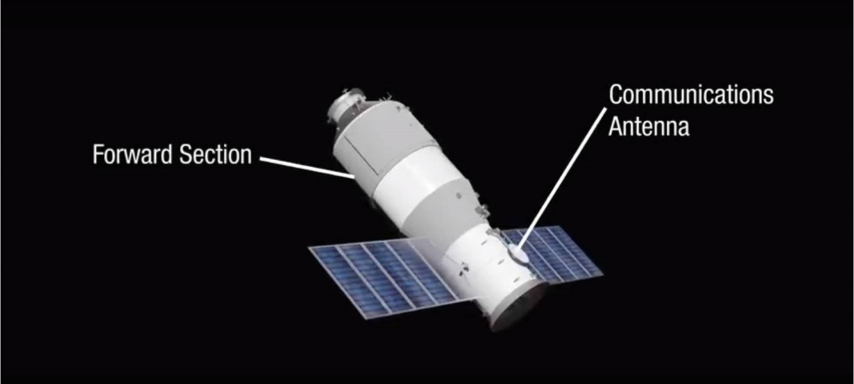
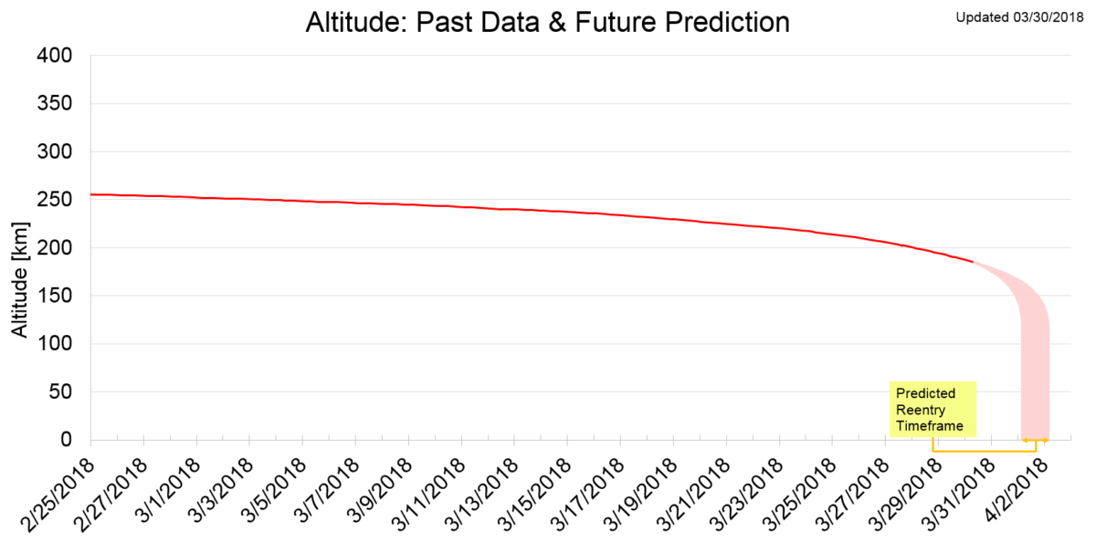
China’s Tiangong-1 space lab is headed for an uncontrolled and destructive nose-dive into Earth’s atmosphere. Latest reentry forecast provided by ESA’s Space Debris Office, in Darmstadt, Germany, updated March 27, 2018:
The current estimated reentry window runs from the morning of March 31 to the early morning of April 2 (in UTC time), with ESA’s office noting this is highly variable.
Heavenly Palace – 1
Launched atop a CZ-2F booster from the Jiuquan Satellite Launch Center on September 29, 2011, the 8.5 ton Tiangong-1 – meaning “Heavenly Palace 1″ – served as China’s first space station and was used as a target vehicle for three rendezvous and docking missions between November 2011 and June 2013.
For several years, Tiangong-1 underwent switches in its flying mode, orbit maintenance maneuvers, and other activities.
According to the China Manned Space Engineering Office (CMSE) the space lab in left-alone mode was outfitted with payloads such as Earth observation instrumentation and space environment detectors.
For more information, go to my new Space.com story at:

Tiangong-1 churned out “hyperspectral” imaging products, collecting information from across the electromagnetic spectrum.
Credit: Technology and Engineering Center for Space Utilization
China’s Doomed Space Station Did Some Science Work, Too
https://www.space.com/40108-china-space-station-tiangong-1-science-work.html

