Archive for the ‘Space News’ Category
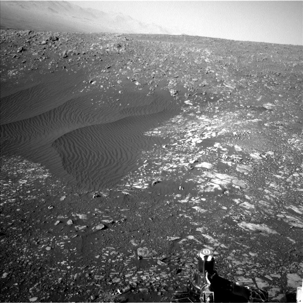
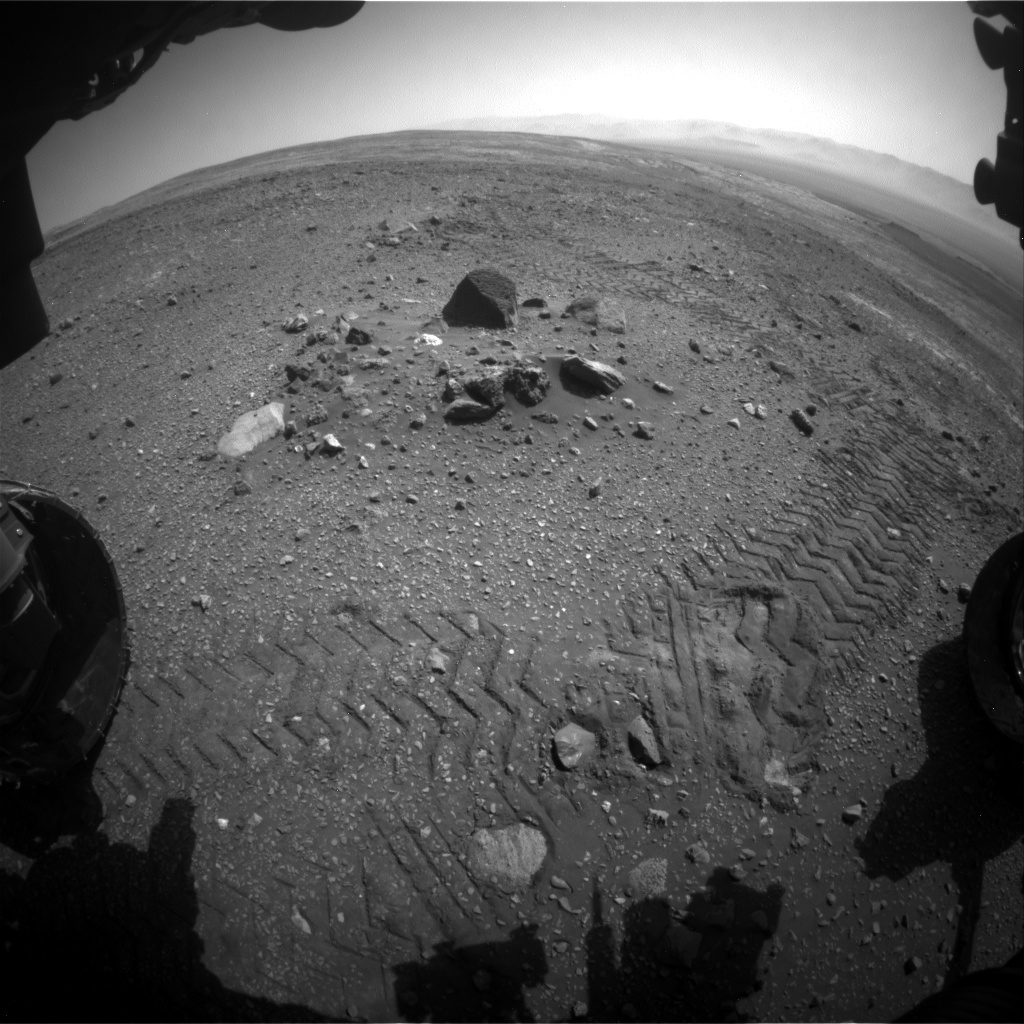
Curiosity Navcam Left B image acquired on Sol 2020,April 12, 2018.
Credit: NASA/JPL-Caltech
NASA’s Curiosity Mars rover is now performing Sol 2021 tasks.
Reports Ken Herkenhoff, a planetary geologist at the USGS in Flagstaff, Arizona, a top science priority for researchers working the rover is to acquire all of the data needed to adequately characterize the rocks at the current location before the robot drives away.
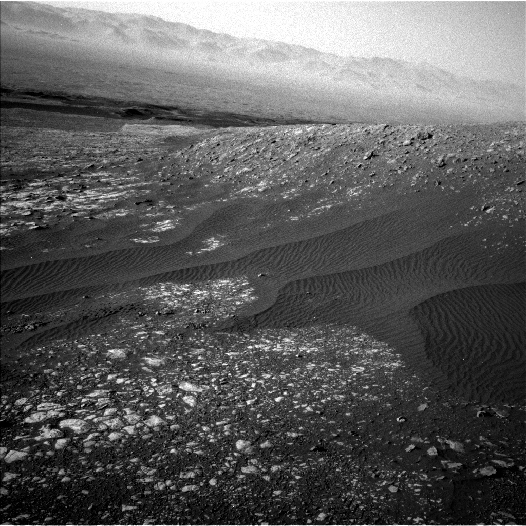
Curiosity Navcam Left B image taken on Sol 2020,April 12, 2018.
Credit: NASA/JPL-Caltech
Recently discussed are priorities of various proposed observations, including a Right Mastcam mosaic of the arm workspace and surrounding area. Also on tap is use of the robot’s Chemistry and Camera (ChemCam) Laser-induced Breakdown Spectroscopy (LIBS) targets, and a mosaic of the mid-field terrain toward the south.
Desired observations
“Fortunately, power modeling indicated that the pre-drive science block could be lengthened to 2 hours, which made it much easier to fit all of the desired observations into the plan,” Herkenhoff explains.
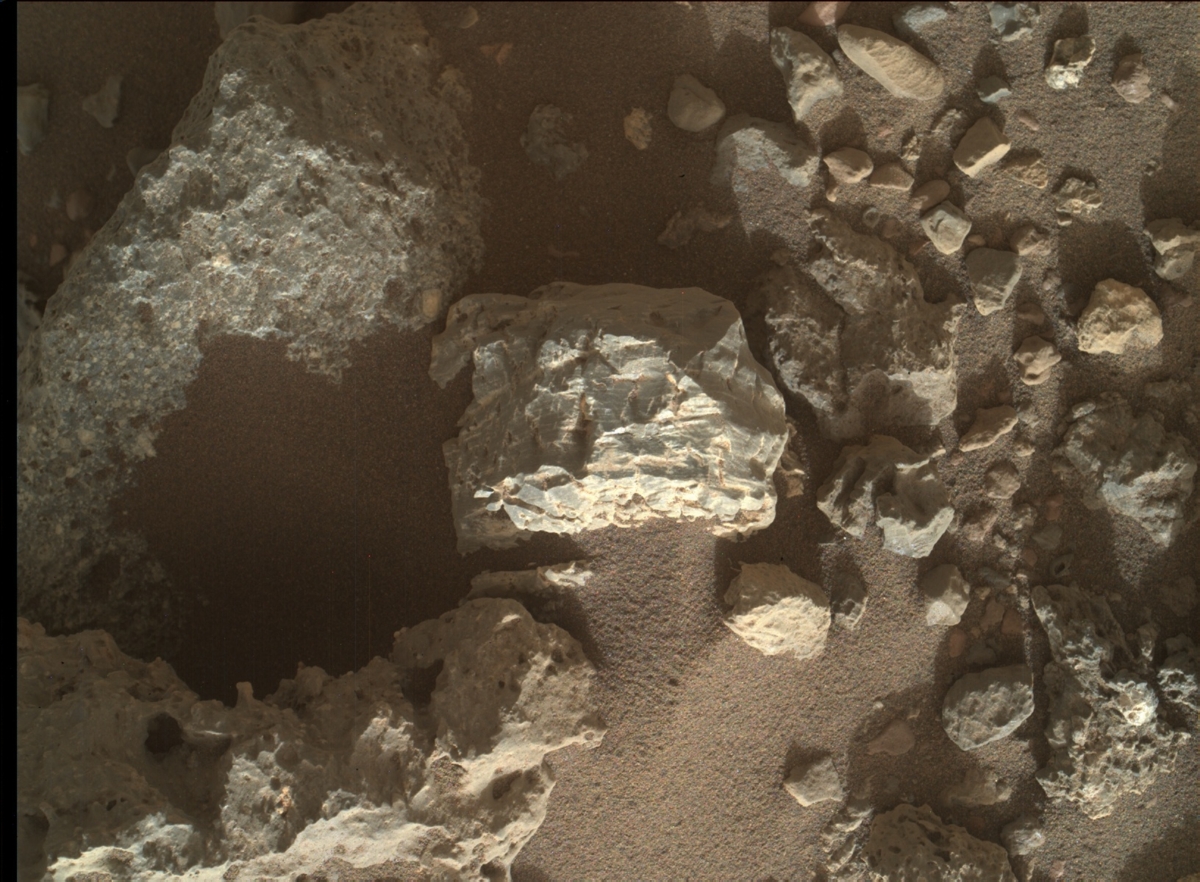
Curiosity Mars Hand Lens Imager (MAHLI) photo produced on Sol 2019, April 11, 2018.
Credit: NASA/JPL-Caltech/MSSS
First, ChemCam will measure the elemental chemistry of four nearby rock targets: “Ledmore 2,” “Minginish,” “Askival 3,” and “Tyndrum 3.”
Minginish has already been examined by Curiosity’s Mars Hand Lens Imager (MAHLI) and the Alpha Particle X-Ray Spectrometer (APXS).
Variety of rocks
Then the Right Mastcam will take images of Askival 3 and Ledmore 2, as well as a 9×1 mosaic of “Lorne Plateau” (the area to the south), a large mosaic to provide complete coverage of the area in front of the rover, named “Bressay,” and a 3×3 mosaic of the “Jedburgh” area closer the rover toward the south.
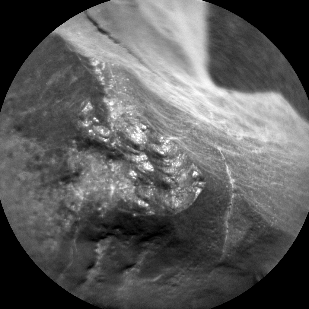
Curiosity ChemCam Remote Micro-Imager photo taken on Sol 2020, April 12, 2018.
Credit: NASA/JPL-Caltech/LANL
“All these data will give the science team plenty to think about as we try to better understand the variety of rocks at Bressay,” Herkenhoff notes. “We are transitioning into restricted planning again, so the drive away from Bressay is planned on Sol 2020.”
The drive target is a conglomerate rock named “Waternish.”
Curiosity Mastcam Right image acquired on Sol 2019. April 11, 2018.
Credit: NASA/JPL-Caltech/MSSS
Post-drive duties
After the drive, early on Sol 2021, Mastcam will measure the amount of dust in the atmosphere and Navcam will search for clouds. Later that sol, Navcam will search for dust devils and Mastcam will measure dust opacity again.
This is to be followed by ChemCam acquiring calibration data and will use special software to autonomously select and acquire LIBS data on a target in the new arm workspace.
Finally, Curiosity’s Mars Descent Imager (MARDI) will take an image of the ground under the rover during twilight, to sample the terrain once again, Herkenhoff concludes.
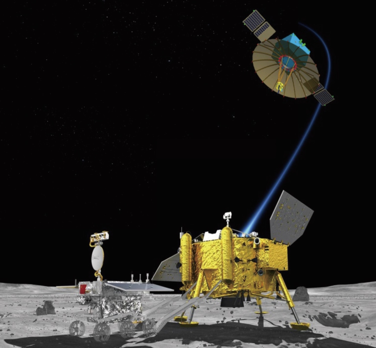
Chang’e-4 Moon lander and rover.
China is readying its Chang’e-4 lunar probe for liftoff later this year.
While attempting the first landing on the Moon’s far side – it’s got a “seedy side” too.
According to the state-run Xinhua news agency, the probe will carry a tin containing seeds of potato and arabidopsis, a small flowering plant related to cabbage and mustard. It may also tote along silkworm eggs to conduct the first biological experiment on the Moon.
Mini-biosphere
This “lunar mini biosphere” experiment was designed by 28 Chinese universities, led by southwest China’s Chongqing University, The cylindrical tin, made from special aluminum alloy materials, weighs roughly 7 pounds (3 kilograms).
The tin also contains water, a nutrient solution, and air. A tiny camera and data transmission system allows researchers to keep an eye on the seeds and see if they blossom on the Moon.

Von Karman Crater as viewed by the Lunar Reconnaissance Orbiter Camera, or LROC.
Credit: NASA/GSFC/Arizona State University
Long-term lunar residence
“We have to keep the temperature in the ‘mini biosphere’ within a range from 1 degree to 30 degrees, and properly control the humidity and nutrition. We will use a tube to direct the natural light on the surface of Moon into the tin to make the plants grow,” said Xie Gengxin, chief designer of the experiment, in the Xinhua story.
Added Liu Hanlong, chief director of the experiment and vice president of Chongqing University: “Our experiment might help accumulate knowledge for building a lunar base and long-term residence on the Moon.”
The Moon-bound mini biosphere experiment was selected from more than 200 submissions, according to the China National Space Administration (CNSA).
The Von Karman Crater in the Moon’s Aitken Basin is the anticipated landing site for Chang’e-4.

Credit: SWF
The Secure World Foundation (SWF) has issued a new report – Global Counterspace Capabilities: An Open Source Assessment – that focuses on space security.
“Over the last several years, there has been growing concern from multiple governments over the reliance on vulnerable space capabilities for national security, and the corresponding proliferation of offensive counterspace capabilities that could be used to disrupt, deny, degrade, or destroy space systems,” explains a SWF statement.
Global security
The impressive report of nearly a 150 pages is a compilation of publicly-available information for various countries developing counterspace capabilities across several categories: direct ascent, co-orbital, directed energy, electronic warfare, and cyber.
Included in the report are reviews of efforts by the People’s Republic of China, the Russian Federation, the United States, as well as the Islamic Republic of Iran, the Republic of India, the Democratic People’s Republic of Korea, and the Islamic Republic of Iran.
“Our global society and economy is increasingly dependent on space capabilities,” explains SWF, “and a future conflict in space could have massive, long-term negative repercussions that are felt here on Earth.”
Editors of the document are: SWF’s Brian Weeden, Director of Program Planning and Victoria Samson, Washington, D.C. Office Director.
For the report, go to:
https://swfound.org/media/206118/swf_global_counterspace_april2018.pdf

Support for a return to the Moon.
Photo Credit: NASA/GSFC
A letter signed by 72 leading lunar researchers from academia and the private sector has been sent to key congressional lawmakers in support of President Trump’s Space Policy Directive 1. That policy document refocuses NASA to rekindle human Moon exploration to enable eventual footprints on Mars.
“The U.S. lunar community is excited not only about the return to the Moon, but the new paradigm of private sector involvement that will begin to bring the Moon into our economic sphere of influence, while producing extremely significant lunar and Solar System science results,” Clive Neal, Professor in the Department of Civil Engineering & Geological Sciences at the University of Notre Dame, Indiana, told Inside Outer Space.

Credit: NASA
Budget request
The grass roots effort is tied to gaining support for the FY 2019 Budget Request for NASA’s Lunar Exploration and Discovery Program.
Also advocated in the April 10 letter is a request to fully fund the ongoing Lunar Reconnaissance Orbiter (LRO) mission, and restore America’s technical capability to access the lunar surface and to once again lead lunar exploration.

U.S. President Donald Trump holds up the Space Policy Directive – 1 after signing it, directing NASA to return to the Moon, alongside members of the Senate, Congress, NASA, and commercial space companies in the Roosevelt room of the White House in Washington, Monday, Dec. 11, 2017.
Credit: NASA/Aubrey Gemignani
“With the proposed Lunar Exploration and Discovery Program, NASA, in coordination with American universities, research institutions, and commercial companies will be empowered to address decades-long objectives on the Moon,” the letter, in part, explains.
Prospect for resources
“The new Lunar Exploration and Discovery program will give the United States the chance to, at long last, systematically prospect for resources on the Moon’s surface,” the letter continues, “gather comprehensive new samples from all over the surface, explore lunar lava tubes, investigate magnetic anomalies, and address a long list of unanswered geophysical questions whose answers have deep implications for understanding formation of the Solar System and planetary science.”
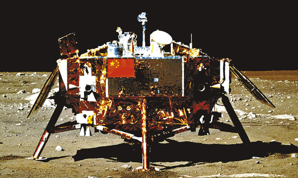
China’s Chang’e 3 Moon lander, imaged by Yutu lunar rover.
Lunar lander market
The start of a new lunar program could not be more timely for the United States, the letter notes.
“China has ramped up its lunar science and exploration program as a precursor to human missions, and the U.S. must move quickly, starting with missions in 2020, to regain its historic lead in lunar science and exploration. Other countries, like Japan, have committed nearly $1 billion towards the development of a commercial lunar lander to compete with emerging American systems. It is vital for our future in space that we not cede the lunar lander market and leadership to other countries,” the letter explains.
Among the over 70 individuals signing the letter, Apollo 17’s Harrison Schmitt, as well as Bob Richards, head of the commercial Moon Express and Dan Hendrickson, vice president of business development for Astrobotic that is also offering lunar lander services.
To take a view of the actual letter, go to:
https://www3.nd.edu/~cneal/Community-Support-Letter-NASA-Moon.pdf

China space travelers, Jing Haipeng and Chen Dong, onboard Tiangong-2 space lab.
Credit: CCTV
As China’s space station era draws closer, the country’s astronauts are receiving comprehensive training to assure longer stints in space, as well as carry out space walking tasks for in-orbit assembly and repair of the station.
An April 8 China Central Television (CCTV) interview with Chen Dong – who flew on the Shenzhou 11 mission in October 2016 to board the Tiangong-2 space lab – detailed the challenges ahead. Chen said the space station era has set higher requirements for the astronauts.

Inside Tiangong-2 as crew members carry out experiments. Mission lasted 33-days.
Credit: CCTV
More tasks
“The manned space program has entered the space station era, which means that the astronauts will stay in space for a longer time with more tasks to be performed. This has set higher requirements for our physical condition, knowledge, mental status and skills, and brought more challenges,” Chen explained.

Putting in place China’s space station will offer many new challenges.
Credit: CCTV/screengrab
The missions for the space station, Chen said, will feature long in-orbit stays, regular extra-vehicular activities, in-orbit assembling and repair of the station, which means more challenges for the astronauts.
“For example, during the Shenzhou-11 mission, we spent 33 days in space. We may stay three months, or even half a year in our follow-on missions, with more extra-vehicular activities to assemble and maintain the space station. So with so many new situations and new changes, we have also improved our current trainings,” Chen told CCTV.

The Tianhe core module for China’s Space Station undergoes ground testing.
Credit: CCTV/Screengrab
Station technology
According to Chen, China’s astronauts have begun the study of space station technology, mechanical arms and extra-vehicular activities. They have also gone through diving training for adaptation, and intensified their strength and stamina training.
“So all of these are prepared for the space station. I think the change is newer knowledge, harder operation and higher requirements. But we have the confidence and capability to fulfill the tasks,” Chen said.
Credit: NASA/JPL-Caltech/Univ. of Arizona
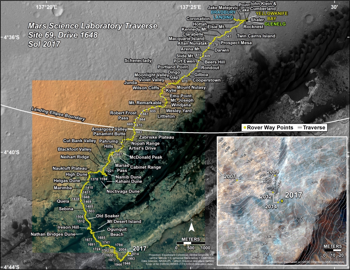
New Curiosity traverse map through Sol 2017:
This map shows the route driven by NASA’s Mars rover Curiosity through the 2017 Martian day, or sol, of the rover’s mission on the Red Planet (April 09, 2018).
Numbering of the dots along the line indicate the sol number of each drive. North is up. The scale bar is 1 kilometer (~0.62 mile).
From Sol 2014 to Sol 2017, Curiosity had driven a straight line distance of about 16.34 feet (4.98 meters), bringing the rover’s total odometry for the mission to 11.60 miles (18.68 kilometers). The rover landed on Mars in August of 2012.
The base image from the map is from the High Resolution Imaging Science Experiment Camera (HiRISE) in NASA’s Mars Reconnaissance Orbiter.
Meanwhile, the Mars robot is now carrying out Sol 2018 science duties.
Curiosity Front Hazcam Left B image acquired on Sol 2017, April 9, 2018.
Credit: NASA/JPL-Caltech
Eclectic mix of targets
“An eclectic mix of rock targets has kept our team’s attention for another sol today,” reports Scott Guzewich, an atmospheric scientist at NASA’s Goddard Space Flight Center in Greenbelt, Maryland. “The sheer number of possible science investigations led us to initially oversubscribing our science plan and thus needing to prioritize.
A full contact science sol is in the works to study targets “Hopeman” and “Askival”, “Tyndrum2” and “Ledmore.”
What is especially unusual about the plan, Guzewich adds, is use of the Mars Hand Lens Imager (MAHLI) MAHLI’s to shine a (UV) light on the situation and image “Askival” after sunset. Also a depth profile at Askival is on tap.
Curiosity Navcam Right B photo taken on Sol 2017, April 9, 2018.
Credit: NASA/JPL-Caltech
A depth profile, Guzewich explains, is where the rover’s Chemistry and Camera (ChemCam) shoots its laser at the same spot 150 times to measure how the composition changes with depth into the rock or soil.
“Last, but certainly not least to me as the environmental science theme lead today, is to conduct a dust devil survey around local solar noon. We are seeing a great deal of dust devil activity lately with a noticeable increase over the last few weeks as we move closer to the start of southern hemisphere spring,” Guzewich concludes.

Credit: NASA
Take a virtual tour of the Moon in all-new 4K resolution, thanks to data provided by NASA’s Lunar Reconnaissance Orbiter (LRO) spacecraft.
This visualization moves around the near side, far side, north and south poles, highlighting interesting features, sites, and information gathered on the lunar terrain.
Music Provided By Killer Tracks: “Never Looking Back” – Frederick Wiedmann. “Flying over Turmoil” – Benjamin Krause & Scott Goodman.
This video comes courtesy of the NASA Goddard Space Flight Center’s Scientific Visualization Studio.
Go to: https://www.youtube.com/watch?time_continue=28&v=nr5Pj6GQL2o

Credit: GAO
Hey all you space whistleblowers out there – suck in the new United States Government Accountability Office (GAO) report: NASA Contractor Whistleblowers – Steps Taken to Implement Program but Improvements to Timeliness and Guidance Needed.
Fulfilling its duty
The GAO notes that NASA relies on contractor employees to fulfill its mission—and these employees are legally protected from reprisal, such as demotion or firing, for whistleblowing.
The question: Is the agency fulfilling its duty to investigate reprisal complaints from these employees in a timely manner?
Credit: NASA
30-day clock ticking in a timely manner?
Since 2008, NASA has not made a final determination of whether or not a reprisal occurred in the required 30-day time frame, nor has the agency evaluated its process for reviewing those complaints in a timely manner.
The GAO has recommended that NASA take steps to ensure that it meets its 30-day time frame.
NASA agreed with the recommendations and plans to develop a documented process to ensure it reviews reprisal complaints in a timely manner and clarify guidance as appropriate, among other things.
For the GAO Highlights page, go to:
https://www.gao.gov/assets/700/690532.pdf
To access the full GAO report, go to:

Credit: CSIS
A discussion with Christian Davenport, author of The Space Barons: Elon Musk, Jeff Bezos, and the Quest to Colonize the Cosmos.
This event was held on Wednesday, April 4, 2018, staged by The Aerospace Security Project at the Center for Strategic and International Studies (CSIS) in Washington, D.C.

Credit: PublicAffairs
Billionaire entrepreneurs
The Space Barons is the story of a group of billionaire entrepreneurs who are pouring their fortunes into the epic resurrection of the American space program.
Nearly a half-century after Neil Armstrong walked on the moon, these Space Barons-most notably Elon Musk and Jeff Bezos, along with Richard Branson and Paul Allen-are using Silicon Valley-style innovation to dramatically lower the cost of space travel, and send humans even further than NASA has gone.

Space entrepreneur, Jeff Bezos.
Credit: Blue Origin
Biggest disruption
These entrepreneurs have founded some of the biggest brands in the world-Amazon, Microsoft, Virgin, Tesla, PayPal-and upended industry after industry. Now they are pursuing the biggest disruption of all: space.

Sir Richard Branson, founder of Virgin Galactic takes flight. Will public space travel?
Credit: Virgin Galactic
Based on years of reporting and exclusive interviews with all four billionaires, this authoritative account is a dramatic tale of risk and high adventure, the birth of a new Space Age, fueled by some of the world’s richest men as they struggle to end governments’ monopoly on the cosmos.

SpaceX’s Elon Musk has a visionary space agenda for Mars.
Credit: Rob Varnas
Hard-charging startups
The Space Barons is also a story of rivalry-hard-charging startups warring with established contractors, and the personal clashes of the leaders of this new space movement, particularly Musk and Bezos, as they aim for the moon and Mars and beyond.
To watch this informative interview with author Christian Davenport, conducted by Todd Harrison, Director, Defense Budget Analysis, Director, Aerospace Security Project and Senior Fellow, International Security Program, go to:

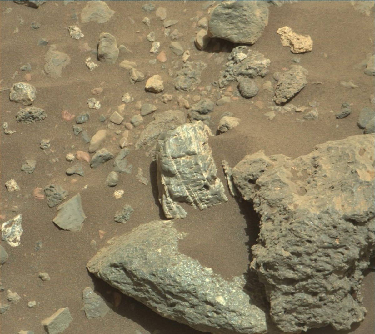
Curiosity Navcam Left B image acquired on Sol 2014, April 6, 2018.
Credit: NASA/JPL-Caltech
NASA’s Curiosity Mars rover is now performing Sol 2015 duties.
The rover has wheeled into a candy store of sorts, reports Michelle Minitti, a planetary geologist at Framework in Silver Spring, Maryland.
“Like Harry Potter in Honeydukes or Charlie in the Chocolate Factory, Curiosity rolled up to the proverbial candy store today,” Minitti adds, wondering “where to begin?!”

Curiosity Navcam Left B image acquired on Sol 2014, April 6, 2018.
Credit: NASA/JPL-Caltech
Picking favorites
“The variety of rock types in the workspace, the likes of which had not been seen for many hundreds of sols, made picking favorites a challenge,” Minitti explains.
The job of surveying the variety was made easier by the opportunities to get four targets with a combination of Mars Hand Lens Imager (MAHLI), Alpha Particle X-Ray Spectrometer (APXS) and the rover’s Chemistry and Camera (ChemCam).
MAHLI and APXS will image and analyze, respectively, the two large, gray blocks near the rover, “Staffa” and “Tyndrum.”

Curiosity Mastcam Left photo taken on Sol 2013, April 5, 2018.
Credit: NASA/JPL-Caltech/MSSS
Bright white rock
MAHLI and ChemCam will image and shoot, respectively, the targets “Askival,” a bright white rock positioned above Tyndrum, and “Hopeman,” a lumpy rock which might be a conglomerate, Minitti adds.
The robot’s Mastcam will cover much of the workspace taking imagery to get more detailed views of all the lithologies present, and will add multispectral observations over Hopeman, Askival and Tyndrum.
Embarrassment of riches
“The atmosphere also got plenty of attention,” Minitti says, with mid- and late-day dust devil movies, early morning and late day cloud and dust observations, and an APXS Argon analysis.

Curiosity Navcam Left B image acquired on Sol 2014, April 6, 2018.
Credit: NASA/JPL-Caltech
“Even with the embarrassment of riches in the weekend plan, the science team could not resist another shopping spree here,” Minitti concludes. “The weekend drive will pull us around the right side of the workspace to access some of the rocks that were not reachable from today’s parking spot. Stay tuned for more fun next week!”
New and different
Curiosity is exploring something new and different, explains Lauren Edgar, a planetary geologist at the USGS in Flagstaff, Arizona: “For much of the last year, Curiosity has been exploring fine-grained rocks along Vera Rubin Ridge, and investigating red and gray color variations. Recently, something else caught our eye: dark cobbles and boulders exposed in patches.”

Curiosity Front Hazcam Left B image acquired on Sol 2014, April 6, 2018.
Credit: NASA/JPL-Caltech
Edgar adds that the rover has surveyed some similar blocky deposits earlier in the mission, “but it’s definitely been a while.”
These interesting rocks, Edgar points out, led the science team to decide to spend the weekend at a patch of these dark blocky deposits.

Curiosity Navcam Left B image taken on Sol 2014, April 6, 2018.
Credit: NASA/JPL-Caltech
Erosional history
After Curiosity’s drive of roughly 60 feet (18 meters), the plan calls for taking post-drive imaging to prepare for contact science in the weekend plan, and we’ll acquire an overnight APXS atmospheric observation.
“I’m looking forward to learning more about these blocky deposits,” Edgar concludes, “and how they relate to the depositional and erosional history preserved at Vera Rubin Ridge!”

