Archive for the ‘Space News’ Category
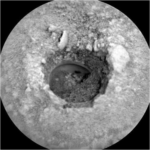
Curiosity ChemCam Remote Micro-Imager photo acquired on Sol 2142, August 15, 2018.
Credit: NASA/JPL-Caltech/LANL
NASA’s Curiosity Mars rover has just begun Sol 2143 operations.
Work is underway on the recent Stoer drill sample says Ashley Stroupe, a mission operations engineer at NASA/JPL in Pasadena, California, in a recent report.
The main activity is the drop-off of sample to the Chemistry & Mineralogy X-Ray Diffraction/X-Ray Fluorescence Instrument (CheMin), based on the characterization of the drop-off portion size done last weekend.

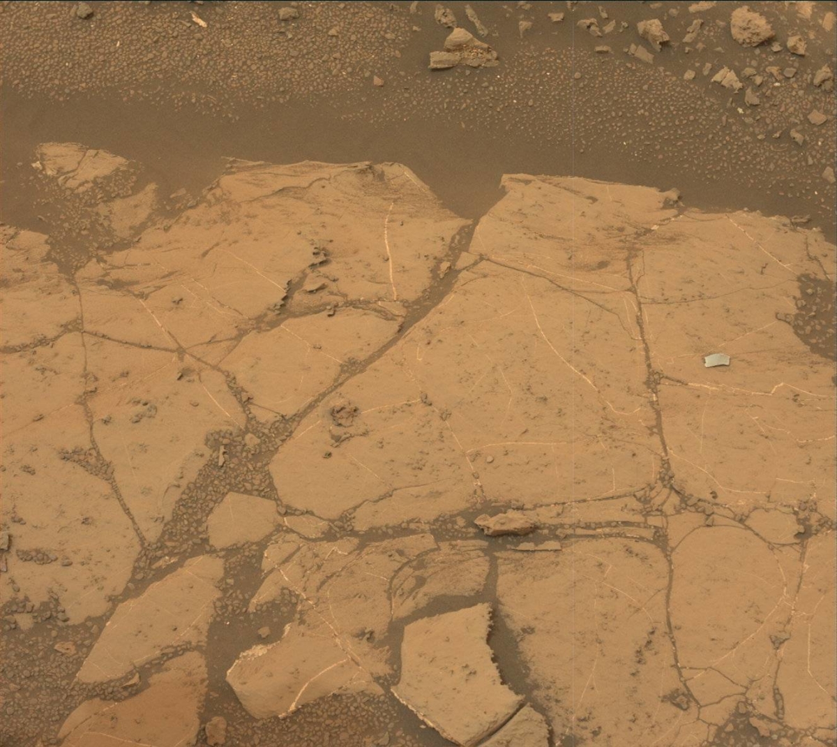
Curiosity Mastcam Left photo taken on Sol 2141, August 14, 2018.
Credit: NASA/JPL-Caltech/MSSS
Sample drop-off
Stroupe notes that care was to be taken in CheMin sample drop-off as there’s still a good bit of wind, so the drop-off was to take place around noon on Mars, during the calmest time.
A recent plan had Curiosity’s set to analyze the sample. Results from that action were to reach Earth late yesterday. That data can then inform decisions about dropping off sample material to the robot’s Sample Analysis at Mars (SAM) Instrument Suite “as early as this weekend’s plan for analysis early next week,” Stroupe adds.
Dust storm abating
Meanwhile, Curiosity was to continue atmospheric observations to monitor the dust storm “as it continues to abate,” Stroupe points out, with dust devil surveys, and zenith and horizon opacity imaging.
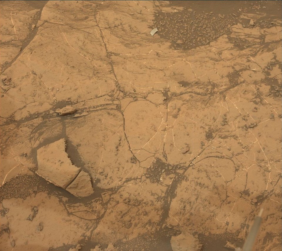
Mars oddity: Curiosity Mastcam Left image taken on Sol 2135, August 8, 2018.
Credit: NASA/JPL-Caltech/MSSS
Also on tap, collecting additional Chemistry and Camera (ChemCam) and Mastcam images of the drill hole, to look for vertical variability, and of the tailings, for change detection.
Movement of object. Photo taken by Curiosity Mastcam Left on Sol 2138, August 11, 2018.
Credit: NASA/JPL-Caltech/MSSS
Stroupe says that the rover’s ChemCam was also to focus on mapping the bedrock variability by looking at several targets at various distances from the drill hole: “Pitlochry,” “Ben Lui,” and “Caltron Hill.” Mastcam will be taking supporting documentation and additional change detection images on targets “Belhelvie,” “Camas Mor,” and “Sandray.”

Apollo 15 image captures landing locale of China’s Chang’e-5 Moon lander – the Mons Rümker region in the northern part of Oceanus Procellarum.
Credit: NASA
China’s bid to return to Earth samples from the Moon since the 1970s is slated for next year.
The 2019 liftoff of the highly complex mission of Chang’e-5 on a Long March 5 booster is targeted for the Moon’s Rümker region in Northern Oceanus Procellarum. Mons Rümker is seen as the most distinctive geological feature in the area, characterized by prolonged lunar volcanism forming multiple geologic units in the area.

Location of the Rümker region and previous landing sites. The Rümker region is located in northern Oceanus
Procellarum, away from previous sampling sites. The basemap is a Lunar Orbiter Laser Altimeter and Kaguya Terrain
Camera merged hillshade map (simple cylindrical projection).
Credit: Barker, et al., 2016
Four-part spacecraft
According to Chinese news services, Chang’e-5 is comprised of four parts: the orbiter, lander, ascender, and Earth reentry module.
The lander and ascender form a combination that will touch down on the Moon to conduct robotic lunar sampling duties. The specimens will then be rocketed into lunar orbit, followed by an auto-pilot docking and transfer of those collectibles into the mission’s Earth reentry module.
Large volcanic complexes
The significance of the Chang’e-5 return sample mission has been detailed in a new research paper, led by Yuqi Qian of the State Key Laboratory of Geological Processes and Mineral Resources, Planetary Science Institute, School of Earth Sciences at China University of Geosciences in Wuhan, China.

Chang’e-5 mission rocket’s lunar samples into Moon orbit.
Credit: CCTV/Screengrab
“Recent studies find that the geological features and volcanic history of the Moon are far more complex than previously thought,” the paper explains, “and many of the most interesting areas have been neither explored nor sampled.” One such area is the northern Oceanus Procellarum region which consists of very young mare materials and hosts one of the largest volcanic complexes on the Moon, Mons Rümker. The steep-sided domes and shallow domes on Mons Rümker were likely formed at different stages of evolution of this volcanic complex.

The location of proposed Chang’e-5 landing sites. Landing site A indicates the region of the Em4 mare unit, considered both the science-richest unit and also an area that’s suitable for landing.
Credit: Qian, et al.
Detailed mapping
The landing region for China’s Chang’E-5 lunar sample return mission has undergone detailed geological mapping using image, spectral, and altimetry data. Fourteen geological units were defined, a geologic map was constructed, and the geologic history has been outlined. To maximize the scientific value of the returned samples, lunar researchers assessed the scientific importance of each unit, suggesting that the young mare basalt unit is the most valuable for sample return and is a top priority.
Laboratory studies
A little over 4 pounds (2 kilograms) of lunar samples from the surface and subsurface — up to 6.5 feet (2 meters) in depth — are planned to be collected and returned to the Earth. Accomplishing that feat provides an opportunity to study new lunar samples in terrestrial laboratories since the former Soviet Union’s Luna-24 samples mission in 1976.
Laboratory studies of lunar samples from Apollo and Luna missions solved numerous fundamental scientific issues of selenology and heralded the beginning of a golden age of lunar research that continues to this day, the research paper explains. “However, most of the Moon remains unexplored and there are still many unanswered scientific questions that remain to be addressed by returned samples.”
China’s Chang’e-5 lunar sample return mission to the Rümker region provides a great opportunity to solve some of the significant outstanding questions of lunar science. Samples from each geologic unit in the area have specific scientific importance, which should be ranked to maximize the science outcomes.

Terrane camera (TC) morning map of the Rümker region (Lambert conformal conic projection). The white
box denotes the Chang’e-5 landing region. The yellow boxes represent other locations noted in the research paper. The yellow
dashed lines denote the ejecta from Harpalus carter. The blue dashed lines denote ejecta from Pythagoras crater. The
green dashed lines denote ejecta probably from Copernicus crater. Credit: Qian, et al.
Science-rich and safe site
The proposed landing site A (Em4) “is not only the very highest scientific priority but also very favorable from an engineering and landing safety point of view,” the research paper points out. “It offers a relatively safe landing site, which is regionally flat, young, and is really homogeneous and so does not require pin-point landing.” The research paper observes that Em4 is both the science-richest unit and also an area that’s suitable for landing.
To date, no samples have been returned from such young lunar units, and, thus, there is a high level of uncertainty in the size-frequency distribution ages in the last half of lunar impact chronology
If successful, Chang’e-5’s return of samples from these young basalts would provide an absolute calibration for the cratering flux, an accomplishment that will assist in understanding the geological evolution of planetary bodies throughout the Solar System.
To read the paper – “Geology and Scientific Significance of the Rümker Region in Northern Oceanus Procellarum: China’s Chang’E-5 Landing Region” — go to the American Geophysical Union’s Journal of Geophysical Research: Planets at:
https://agupubs.onlinelibrary.wiley.com/doi/abs/10.1029/2018JE005595
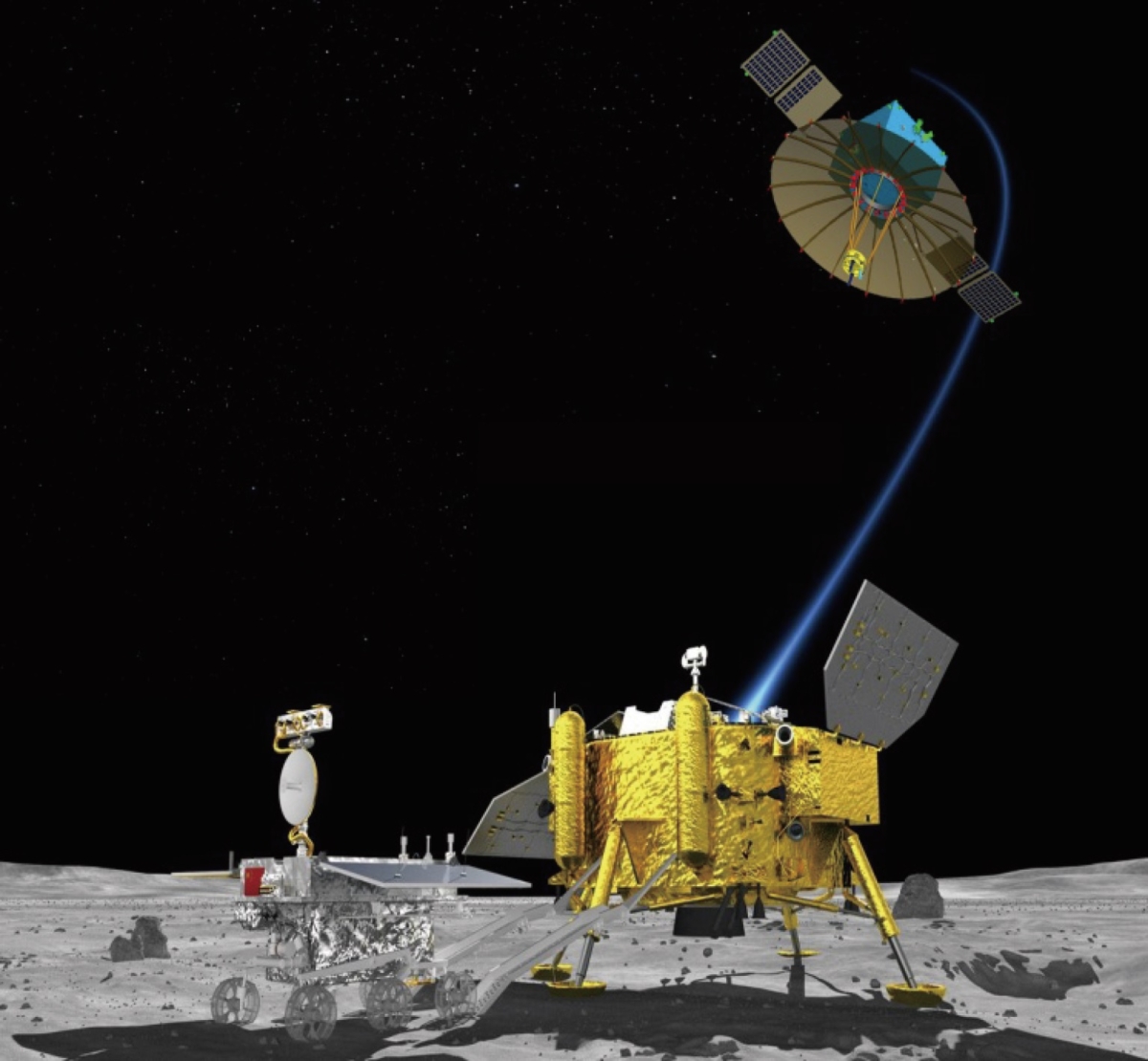
Chang’e-4 Moon lander and rover.
Credit: Chinese Academy of Sciences
If all remains on track, a new Chinese Moon mission, Chang’e‐4, will be launched in late 2018 to attempt the first farside landing in history, headed for the Von Kármán crater, within the South Pole‐Aitken (SPA) basin. The scientific instruments of China’s farside spacecraft, mounted on a lander and a rover, will analyze both surface and subsurface of this region.
The SPA basin on the farside of the Moon is the largest known impact structure in the solar system. It is the key area to answer several important questions about the Moon, including its internal structure and thermal evolution.

Secondary craters within the landing region of Chang’e-4 that are formed by the Antoniadi crater. (a) Great elliptic circle that linked the center of the Antoniadi crater to the selected Chang’E-4 landing site. The base image is from the global mosaic obtained by China’s Chang’e-2 mission. (b) Secondaries within the Chang’E-4 landing region that are delivered by the Antoniadi crater. White arrows mark the secondaries, and the yellow line is the possible trajectory of ejecta launched by Antoniadi. The location of this area is denoted as the white box in (a). The base image is obtained by Japan’s Kaguya lunar orbiter.
Credit: Jun Huang, et al.
Source craters
The Von Kármán crater is approximately 115 miles (186 kilometers) in diameter, lying in the northwestern SPA basin. The topography of the landing region is generally flat.
Secondary craters and ejecta materials have covered most of the mare unit and can be traced back to at least four source craters: Finsen, Von Kármán L, Von Kármán L’, and Antoniadi). Extensive sinuous ridges and troughs in the area are identified spatially related to Ba Jie crater.

Secondaries within the proposed Chang’e-4 landing region that are formed by the Von Karman L and Von Karman L’ craters. The two source craters are located to the south of the landing region. The great elliptic circles represent possible ballistic trajectories (blue lines) of impact ejecta from the source craters. (a) The NW – SE trending secondaries that are formed by the Von Karman L’ crater. (b) The NE–SW trending secondaries that are formed by the Von Karman L crater. Both the images are obtained by NASA’s Lunar Reconnaissance Orbiter Camera (LROC WAC) operated by Arizona State University.
Credit: Jun Huang, et al.
New paper
The Chang’e-4 mission has been addressed in a recent paper led by Jun Huang State Key Laboratory of Geological Processes and Mineral Resources, Planetary Science Institute, School of Earth Sciences, China University of Geosciences, Wuhan, China.
The paper’s key points are that a detailed 3-D geological analysis of the nature and history of Von Kármán crater has been done; the region contains farside mare basalts affected by linear features and ejecta material from a wide range of surrounding craters; and a new geological analysis provides a framework for the Chang’e-4 mission to carry out on-the-spot exploration.
Relay satellite
Already in place for the upcoming mission is the Chinese relay satellite Queqiao. It will enable farside communications for the Chang’e-4 and future farside missions.

Credit: CNSA
Queqiao was successfully launched in May on a Long March 4C from the Xichang Satellite Launch Center. That relay spacecraft has successfully reached an Earth-Moon L2 halo orbit to support communications between Earth and the Moon’s farside.

Group shot…China’s Chang’e 3 lander and Yutu rover.
Credit: Chinese Academy of Sciences
Lander, rover instruments
Since both the lander and the rover were designed as a backup for the December 2013 Chang’e-3 mission – a lander carrying the Yutu rover — some of the science payloads on Chang’e-4 are similar, such as a landing camera, a terrain camera, a panorama camera on the lander and a visible/near infrared imaging spectrometer, along with two ground penetrating radars able to reveal the subsurface structure of the landing area.
Additional instruments on the lander a low-frequency radio spectrometer to perform joint space physics observations with the low-frequency radio spectrometer on the Queqiao relay satellite.
Also onboard is a German lunar neutron and radiation dose detector to explore the farside surface radioactive environment. In addition, a lunar microecosystem is included for astrobiology experiments and public outreach.
A new instrument on the rover is the Swedish neutral atom detector designed to study the interaction between the solar wind and lunar surface materials.
Mini-biosphere
According to the state-run Xinhua news agency, the probe will carry a tin containing seeds of potato and arabidopsis, a small flowering plant related to cabbage and mustard. It may also tote along silkworm eggs to conduct the first biological experiment on the Moon.
This “lunar mini biosphere” experiment was designed by 28 Chinese universities, led by southwest China’s Chongqing University, The cylindrical tin, made from special aluminum alloy materials, weighs roughly 7 pounds (3 kilograms).
The tin also contains water, a nutrient solution, and air. A tiny camera and data transmission system allows researchers to keep an eye on the seeds and see if they blossom on the Moon.
The paper – “Geological Characteristics of Von Kármán Crater, Northwestern South Pole-Aitken Basin: Chang’E-4 Landing Site Region” – has been published in the American Geophysical Union’s Journal of Geophysical Research: Planets.
It can be found here:

Curiosity Mastcam Right photo taken on Sol 2138, August 11, 2018.
Credit: NASA/JPL-Caltech/MSSS
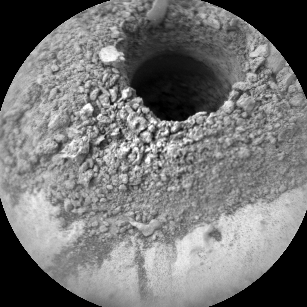
NASA’s Curiosity Mars rover is now performing Sol 2140 duties, and there’s confirmation of new drilling.
“Success at Pettegrove Point,” reports Catherine O’Connell-Cooper, a planetary geologist at the University of New Brunswick, New Brunswick, Canada.
On our third attempt at drilling within the Pettegrove Point member on the Vera Rubin Ridge, we have success! Curiosity has successfully drilled, and generated a pile of drill tailings.
Tailings
At the new Stoer drill hole, the tailings derived from the drill are under observation. A portion characterization is also being done prior to sending samples to the robot’s analytical instruments, the Sample Analysis at Mars (SAM) Instrument Suite and the Chemistry & Mineralogy X-Ray Diffraction/X-Ray Fluorescence Instrument (CheMin).
Curiosity ChemCam Remote Micro-Imager photo acquired on Sol 2136, August 9, 2018.
Credit: NASA/JPL-Caltech/LANL
This is being done to ensure that the materials will not pose any threat to the instruments, adds O’Connell-Cooper.
Chemistry and Camera (ChemCam) passive and Mastcam multispectral imaging will be taken of the drill tailings, O’Connell-Cooper explains, “to identify any potential differences between the surface and material from deeper within the drill hole.
The ChemCam laser (LIBS) will be used to characterize the Stoer drill hole and a bedrock target “Greian,” which appears to show some color variations. Mastcam will provide color documentation for Greian.

Curiosity Front Hazcam Right B image acquired on Sol 2139, August 13, 2018.
Credit: NASA/JPL-Caltech
Change detection
O’Connell-Cooper adds that there will also be Mastcam change detection on the drill tailings (to identify if there is any movement of the drill tailings) and continuing change detection on three targets (“Camas Mor,” “Belhelvie” and “Sandray”).
Environmental measurements are also planned to search for both cloud motion and dust devils.

Credit: Boeing
The U.S. Air Force X-37B mini-space plane has winged past 340 days of flight performing secretive duties during the program’s fifth flight.
Labeled the Orbital Test Vehicle (OTV-5), the robotic craft was rocketed into Earth orbit on September 7, 2017 atop a SpaceX Falcon 9 booster from Launch Complex 39A at NASA’s Kennedy Space Center in Florida.
Payload bay
On this latest clandestine mission of the space plane, all that’s known according to Air Force officials is that one payload flying on OTV-5 is the Advanced Structurally Embedded Thermal Spreader, or ASETS-11. Developed by the U.S. Air Force Research Laboratory (AFRL), this cargo is testing experimental electronics and oscillating heat pipes for long durations in the space environment.

Credit: Boeing
The X-37B space plane has a payload bay about the size of a pickup-truck bed, which can be outfitted with a robotic arm. X-37B has a launch weight of 11,000 lbs. (4,990 kilograms) and is powered on orbit by gallium-arsenide solar cells with lithium-ion batteries.
Record setting history
Each X-37B/OTV mission has set a new flight-duration record for the program:
OTV-1 began April 22, 2010, and concluded on Dec. 3, 2010, after 224 days in orbit.
OTV-2 began March 5, 2011, and concluded on June 16, 2012, after 468 days on orbit.
OTV-3 chalked up nearly 675 days in orbit before finally coming down on Oct. 17, 2014.
OTV-4 conducted on-orbit experiments for 718 days during its mission, extending the total number of days spent in space for the OTV program to 2,085 days.

Last Air Force’s X-37B Orbital Test Vehicle mission touched down at NASA ‘s Kennedy Space Center Shuttle Landing Facility May 7, 2017.
Credit: Michael Martin/USAF
Tarmac touchdown
After eclipsing 11 months in orbit, how long the unpiloted, reusable craft will stay aloft is unknown. The robotic vehicle is likely to land at Kennedy Space Center’s Shuttle Landing Facility, as the OTV-4 mission did back on May 7, 2017. That was a first for the program. All prior missions had ended with a tarmac touchdown at Vandenberg Air Force Base in California.
The classified X-37B program “fleet” consists of two known reusable vehicles, both of which were built by Boeing. Looking like a miniature version of NASA’s now-retired space shuttle orbiter, the military space plane is 29 feet (8.8 meters) long and 9.6 feet (2.9 m) tall, with a wingspan of nearly 15 feet (4.6 m).

The first X-37B Orbital Test Vehicle waits in the encapsulation cell of the Evolved Expendable Launch vehicle on April 5, 2010 at the Astrotech facility in Titusville, Fla. Half of the Atlas V five-meter fairing is visible in the background.
Credit: U.S. Air Force
Ground tracks
Ted Molczan, a Toronto-based satellite analyst, told Inside Outer Space that OTV 5’s initial orbit was about 220 miles (355 kilometers) high, inclined 54.5 degrees to the equator. “Its ground track nearly repeated every two days, after 31 revolutions.”
On April 19, the space drone lowered its orbit by 24 miles (39 kilometers) which caused its ground track to exactly repeat every five days, after 78 revolutions, Molczan said – a first for an OTV mission.
“Repeating ground tracks are very common,” Molczan added, “especially for spacecraft that observe the Earth. That said, I do not know why OTV has repeating ground tracks.”
Space force
Does the X-37B program fit into the Trump Administration’s call for a Space Force?
Responds Joan Johnson-Freese, a professor in the National Security Affairs Department at the Naval War College in Newport, Rhode Island: “Ironically, the X-37B is exactly the type of program — toward giving the U.S. flexibility of operations in space — that seems to be prompting the current push for a Space Force, yet are already underway.”

Credit: International Space Exploration Coordination Group (ISECG)
The European Space Agency (ESA) and Russia are working together to investigate the Moon’s resources – specifically water ice and other volatiles at the lunar poles.
Called the Package for Resource Observation and in-Situ Prospecting for Exploration, Commercial exploitation and Transportation (PROSPECT), this package will access and assess potential resources on the Moon and to prepare technologies that may be used to extract these resources in the future.

Credit: ESA
PROSPECT is a lunar drilling and sample analysis package provided by ESA to Russia’s Luna 27 mission, designed to operate at the surface of the Moon in 2022 – 2023, according to ESA. PROSPECT will enter its detailed design (Phase C) at the start of 2019.
ESA on August 10 released an Announcement of Opportunity, open to scientists working in ESA member states, for membership in the PROSPECT science team.

Credit: ESA
The Luna 27 mission is being orchestrated by the Russian Federal Space Agency, Roscosmos, a lander expected to touch down at the Moon’s South Pole–Aitken basin, an unexplored area on the far side of the Moon.
Drill, laboratory
As a package of gear, PROSPECT’s drill is called ProSEED. It will drill beneath the surface in the South Pole region of the Moon and extract samples, expected to contain water ice and other chemicals that can become trapped at the extremely low temperatures expected; typically -150 °C beneath the surface to lower than -200 °C in some areas.

Credit: ESA
Samples taken by the drill will then be passed to a chemical laboratory dubbed ProSPA. Once lunar specimens are in the lab they will be heated to extract cold-trapped volatiles. Thermochemical processes, at temperatures of up to 1000 °C, can then be used to further extract chemical species, including oxygen. This will test processes that could be applied for resource extraction in the future.
Extractability?
Cold-trapped volatiles at the lunar poles are potential resources for human exploration and provide a record of volatiles in the inner Solar System. However, we do not understand their origins, distribution, abundance, extractability, or the processes that put volatiles in place within the Earth-Moon system.

Credit: ESA
A volatile is a substance that changes readily from solid or liquid to a vapor.
Global effort
This investigation is part of a global effort to coordinate prospecting activities at the lunar poles where extreme cold conditions can trap water ice. Space exploration planners see these resources as enabling sustainable space exploration, but much remains unknown.
Luna 27 is part of a grander roster of Moon orbiters, landers, rovers and return sample spacecraft provided by Russia’s Roscosmos.
Reportedly, Luna 25 is planned to be launched very soon, perhaps next year. ESA’s contribution to Luna 25 includes PILOT-D, a demonstrator terrain relative navigation system that acts as a precursor to PILOT, which is the navigation and hazard detection and avoidance system included on Luna 27. Also in the works, Luna 26 in 2022, Luna 27 in 2022-2023, Luna 28 in 2024, and Lunas 29-31 in 2026.

DoD/Screengrab
On June 18, 2018, U.S. President Trump directed the Department of Defense to immediately begin the important process of establishing Space Force as the sixth branch of the armed forces. “I’m hereby directing the Department of Defense and Pentagon to immediately begin the process necessary to establish a space force as the sixth branch of the armed forces.”
Vice President Mike Pence spoke to a Pentagon audience to announce the administration’s plans to stand up a U.S. Space Force and related organizations on Aug. 9, 2018.

VP Pence introduced by Defense Secretary James Mattis.
Credit: DoD/Screengrab
Report issued
The Department of Defense issued a report, pursuant to the National Defense Authorization Act for Fiscal Year 2018, describing the following five actions that can be taken immediately to begin building the Space Force:
- Accelerate space technology and development initiatives, which were modernization priorities laid out in President Trump’s National Defense Strategy;
- Establish a Space Development Agency charged with developing and fielding new next-generation capabilities for national security space development;
- Establish a Space Operations Force of professionals who will form a new community of experts working to lead America’s national security space efforts into the future;
- Establish an operating structure and accountable civilian oversight for Space Force; and
- Create a United States Space Command, a unified combatant command, to improve, evolve, and plan space warfighting.
Private industry
“Space is also invaluable to American private industry, which is developing revolutionary technologies that will utilize space for exploration, resource extraction, and tourism,” noted a White House statement on the Space Force.
“The time has come to establish the United States Space Force,” Pence told a packed Pentagon auditorium.
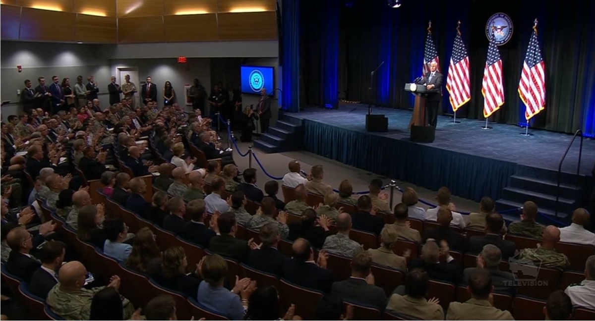
Space Force announcement at packed Pentagon auditorium.
Credit: DoD/Screengrab
The new branch will be separate from, but equal to, the five other branches, the Vice President said. “Creating a new branch of the military is not a simple process,” he noted. “It will require collaboration, diligence and, above all, leadership. As challenges arise and deadlines approach, there must be someone in charge who can execute, hold others accountable, and be responsible for the results.”
Congress: Marshal the resources
Ultimately, Congress must establish the new department, Pence said.
“Next February, in the president’s budget, we will call on the Congress to marshal the resources we need to stand up the Space Force, and before the end of next year, our administration will work with the congress to enact the statutory authority for the space force in the National Defense Authorization Act,” he said.
Final Report on Organizational and Management Structure for the National Security Space Components of the Department of Defense (August 9, 2018)
Go to:
To watch the Vice President’s Space Force speech, go to this video at:
https://www.defense.gov/Videos/videoid/618204/
Also, transcript of remarks by Vice President Pence on the Future of the U.S. Military in Space issued on: August 9, 2018. Go to:
Lastly, go to this policy paper:
Organizing Spacepower: Conditions for Creating a US Space Force
http://docs.wixstatic.com/ugd/a2dd91_2ff8dfe95e694f80b4139d05650843ed.pdf
As well as:
Space Farce? The Challenges of Creating a New Military Department in Just 2 Years: Podcast

Curiosity Front Hazcam Left B photo taken on Sol 2135, August 8, 2018.
Credit: NASA/JPL-Caltech
NASA’s Curiosity rover is now performing Sol 2136 duties.
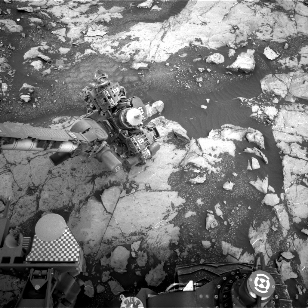
Sarah Lamm, a planetary geologist at Los Alamos National Laboratory in New Mexico reports that after two sols of analyzing an intended drill site in the Pettegrove Point member, plans are to drill the target “Stoer.”
Stoer has had Mastcam, Mars Hand Lens Imager (MAHLI), Alpha Particle X-Ray Spectrometer (APXS), and Chemistry and Camera (ChemCam) observations acquired over the past two sols.
Curiosity Navcam Right B image acquired on Sol 2135, August 8, 2018.
Credit: NASA/JPL-Caltech
Previous attempts
“The two previous drill attempts in this geologic member have not been able to get to successful depth since the rocks have been more resistant than what we saw earlier in the mission,” Lamm explains. “Pettegrove Point is an important area to get a drill sample from because it is categorized as lower Vera Rubin Ridge.”
Curiosity has previously visited this area of Pettegrove Point on Sol 2097. On that sol, the target was “Caithness” close to the new intended drill hole, Stoer.
Other targets
“This is the last drill attempt in Pettegrove Point,” Lamm adds.

Curiosity ChemCam Remote Micro-Imager photo taken on Sol 2135, August 8, 2018.
Credit: NASA/JPL-Caltech/LANL
“Besides drilling Stoer,” Lamm explains, “we have four other targets planned for these two sols.” The plan calls for one ChemCam target named “Glen Brittle,” and three Mastcam targets named “Belhelvie,” “Camas Mor,” and “Sandray.”

Mastcam Left image taken on Sol 2134, August 7, 2018.
Credit: NASA/JPL-Caltech/MSSS
Data backlog
Lamm adds that Curiosity data is currently backlogged.
“The downlink data is slowly trickling in, but uplink operations have not been slowed down. We still have enough information from the rover’s current location to send commands to the rover. Hopefully we can get all of the backlogged data soon and get caught up again,” Lamm concludes.

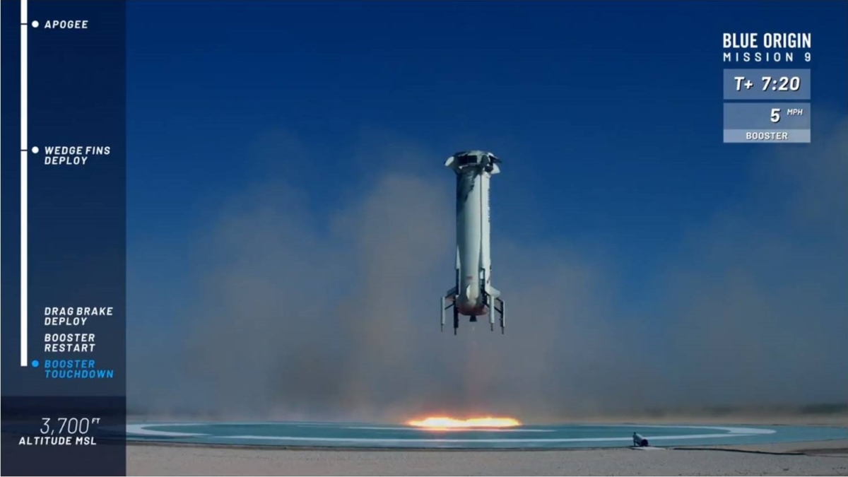
Blue Origin is one of six companies selected for NASA’s Tipping Point solicitation. Pictured here, Blue Origin’s New Shepard rocket lifted off July 18 carrying five NASA-supported technologies to flight test in space.
Credit: Blue Origin
Here’s an upshot from Blue Origin work in landing the group’s New Shepard suborbital rocketry.
NASA has announced new partnerships to develop space exploration technologies.
A new award to Blue Origin is to advance sensor technologies to enable landing anywhere on the Moon’s surface.
This project will mature critical technologies that enable precision and soft landing on the Moon.
Credit: Blue Origin/Screengrab
Navigation sensor work
The project team will integrate Terrain Relative Navigation (TRN), navigation doppler lidar, and altimetry sensors and conduct flight tests prior to lunar mission Pimplementation.
Testing will be performed at approximately 100 km altitude on board the Blue Origin New Shepard vertical takeoff vertical landing suborbital vehicle that has already undergone multiple test flights. The resulting sensor suite would exercise the ability to make precision landing anywhere on the lunar surface.
Ostensibly , this new award fits well within Blue Origin’s Blue Moon plans – an effort by the group to prepare the Earth’s Moon for an Amazon.com-like delivery service to the lunar surface, furthering the permanent settlement of humans on the lunar landscape.
Tipping point .
Blue Origin was one of six companies selected for NASA’s Tipping Point solicitation announced today.
According to a NASA statement, a technology is considered at a “tipping point” if investment in a ground or flight demonstration will result in significantly maturing the technology and improving the company’s ability to bring it to market.

Commercial TRN
Similarly, Astrobotic will lead a public-private partnership team that includes Moog Space and Defense, Moog Broad Reach, NASA Jet Propulsion Laboratory (JPL), and NASA Johnson Space Center (JSC) to develop a commercial TRN and visual velocimetry sensor for lunar and planetary landers.
The sensor will provide real-time vision-based navigation measurements, enabling a spacecraft to autonomously land within 100 meters of any destination on a mapped planetary surface.
This level of precision is orders of magnitude better than conventional landing systems, according to a statement by Astrobotic.

Astronaut Bob Behnken emerges from the top hatch of a new SpaceX Crew Dragon capsule at the company’s headquarters and factory in California. Astronaut Eric Boe (left) observes.
Credit: SpaceX/NASA
For the first time since NASA retired its space shuttle fleet in 2011, American astronauts will once again launch to the International Space Station from U.S. soil.
The U.S. space agency on August 3 named the teams of astronauts who will fly aboard the first “commercial crew missions” to and from low Earth orbit.

From left: Eric Boe, Nicole Mann, Chris Ferguson
New spacecraft
This time, it won’t be NASA providing the ride to space. Private companies SpaceX and Boeing have developed new spacecraft, the Crew Dragon and Starliner, respectively. Both are designed to launch from Kennedy Space Center in Florida to the space station, which orbits about 400 kilometers above the planet.
At an event announcing the newest commercial crew astronauts, space agency leader Jim Bridenstine said investment in NASA has kept America the leader in space. From the way we communicate to the way we produce food, “space has transformed the lives of not only every American, but every person on the face of the planet in so many ways that people usually don’t even recognize it,” he said.

Bob Behnken (left) and Doug Hurley
Credit: SpaceX/NASA
2019: target dates
Target dates for the new spacecraft are next year: SpaceX’s Crew Dragon is expected to launch with astronauts in April, and the Boeing Starliner is looking to launch in mid-2019.
For Starliner’s first crewed flight in mid-2019, Eric Boe, Nicole Aunapu Mann and Christopher Ferguson will put the craft through its paces. Boe and Ferguson flew on the space shuttle, and Mann is a U.S. Marine Corps pilot preparing for her first flight in space.
“As a test pilot, it doesn’t get any better than this,” she said.
More automation
Veteran astronauts Bob Behnken and Doug Hurley will pilot the first crewed mission of the SpaceX Crew Dragon. Behnken said he’s excited about the cutting-edge software on the spacecraft. In the space shuttle, with its thousands of controls, “there was no situation that the astronauts couldn’t make worse by touching the wrong switch at the wrong time,” Behnken said. The Crew Dragon incorporates much more automation.
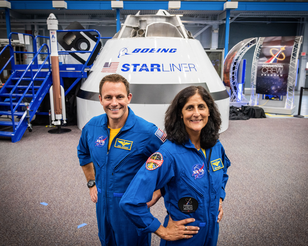
Josh Cassada (left) and Suni Williams
Credit: Boeing/NASA
Starliner: first mission
Josh Cassada and Suni Williams both have backgrounds as U.S. Navy test pilots.
Cassada joined the astronaut corps in 2013, when astronauts expected to fly to the International Space Station on Russia’s Soyuz rockets. “I’m sure that there’s at least one Russian-language instructor out there who thinks that having me fly on a U.S. vehicle is not a terrible idea,” he quipped. Williams said she is excited about showing off the spacecraft to international partners. “There’s a lot to be done, and we’re just the beginning,” she said.

Victor Glover (left) and Mike Hopkins
Credit: SpaceX/NASA
Dragon to ISS
Astronauts Victor Glover and Michael Hopkins will lead SpaceX’s first full mission to the International Space Station. Glover, who has flown more than 40 different aircraft for the U.S. Navy, said he is honored to be a part of a new chapter of American spaceflight. “This is the stuff of dreams,” he said.

The first U.S. astronauts who will fly on American-made, commercial spacecraft to and from the International Space Station, wave after being announced, Friday, Aug. 3, 2018 at NASA’s Johnson Space Center in Houston, Texas. The astronauts are, from left to right: Victor Glover, Mike Hopkins, Bob Behnken, Doug Hurley, Nicole Aunapu Mann, Chris Ferguson, Eric Boe, Josh Cassada, and Suni Williams. The agency assigned the nine astronauts to crew the first flight tests and missions of the Boeing CST-100 Starliner and SpaceX Crew Dragon.
Credit: NASA/Bill Ingalls
Note: Adapted from story written by Michael Buchanan/ShareAmerica, U.S. Department of State

