Archive for the ‘Space News’ Category
Curiosity Navcam Right B image acquired on Sol 2454, July 2, 2019.
Credit: NASA/JPL-Caltech
NASA’s Curiosity Mars rover is now in Sol 2455, performing science duties.
Curiosity Navcam Right B photo taken on Sol 2454, July 2, 2019.
Credit: NASA/JPL-Caltech
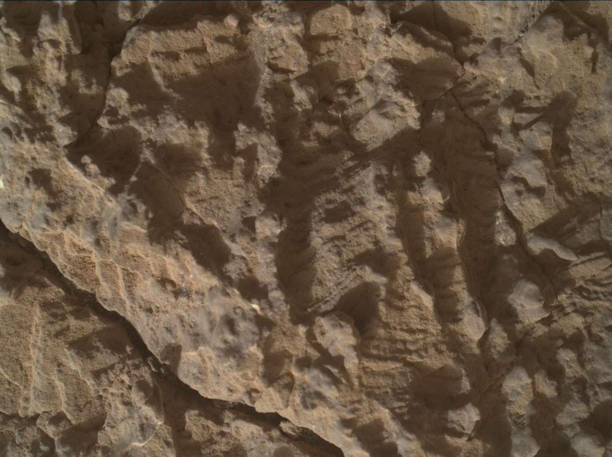
Reports Melissa Rice, a planetary geologist at Western Washington University, Bellingham, Washington: “Curiosity is currently near the top of Harlaw Rise, having made a slight diversion from the southward drive through the clay-bearing unit to explore the nice exposures of rocks on this hill.”
A recent plan called for Curiosity to investigate two rock targets in front of the rover: “Perth” and “Aberdeen.”
Curiosity Mars Hand Lens Imager (MAHLI) photo produced on Sol 2454, July 2, 2019.
Credit: NASA/JPL-Caltech/MSSS
Closer look
There is only enough time in this plan to put the arm on one of these two targets, Rice adds, so Perth will get a closer look with the Mars Hand Lens Imager (MAHLI) microscopic imager and Alpha Particle X-Ray Spectrometer (APXS) instrument, and “Aberdeen” will get shot by the Chemistry and Camera (ChemCam) laser.
“The Mastcam cameras will document both targets. After that, Curiosity will make a short drive further up the hill to a spot where both of these rock types might be better exposed,” Rice points out.

Curiosity Mastcam Left photo acquired on Sol 2453, July 1, 2019.
Credit: NASA/JPL-Caltech/MSSS
Name game
“Why do we give names like “Perth” and “Aberdeen” to Curiosity’s rock targets? How does the largest city in Western Australia end up right next to a Washington State timber town? As a Long-Term Planner for the Curiosity science team, one of my responsibilities is to keep track of the names that the team uses, and to make sure that they fit within the theme for this portion of the rover’s traverse,” Rice explains.
Curiosity is currently in a region of the team’s geologic map called the Torridon Quadrangle, named after a village in the Northwest Highlands of Scotland, Ricet adds, which is near an important geological formation called the Torridonian Supergroup.

Curiosity Mastcam Left photo acquired on Sol 2453, July 1, 2019.
Credit: NASA/JPL-Caltech/MSSS
“Therefore, all of the names assigned to targets in this region of Curiosity’s traverse come from landforms, geologic formations, and towns in that part of Scotland. So the namesakes of today’s ‘Perth’ and ‘Aberdeen’ rock targets on Mars are the same as those of all the other Perths and Aberdeens out there: Perth, Scotland, and Aberdeen, Scotland,” Rice says.
Front Hazcam Left B image taken on Sol 2454, July 2, 2019.
Credit: NASA/JPL-Caltech

Presently, the military use of space is focused on geosynchronous Earth orbit inward, an arena of critical, multi-faceted spacecraft. Could cis-lunar space and the Moon itself become part of the military equation?
Credit: U.S. Air Force/Staff Sgt. Corey Hook
Worth a read:
The fact that the Defense Innovation Unit (DIU) is even considering the idea of a space station in orbit is a pretty big deal — and an even bigger deal if it grows over time to accommodate a human crew.
Story by Theresa Hitchens at Breaking Defense. Go to:
https://breakingdefense.com/2019/07/pentagon-eyes-military-space-station/
Orbital outpost
According to the DIU posting, this “Orbital Outpost” involves the Department of Defense (DoD) seeking solutions for a self-contained and free flying orbital outpost.

Credit: U.S. Air Force
The solution must be capable of supporting space assembly, microgravity experimentation, logistics and storage, manufacturing, training, test and evaluation, hosting payloads, and other functions. Prospective bidders are invited to submit their proposals (“Solution Brief”) per the guidelines below.
Minimum Desired Specifications
Internal volume: 1 m3
Payload capacity: 80 kg
Power (continuous): 1 kW
Communications: 100 kbps
Pressurization: 0 to 1 Atmosphere
Multi-phased
Solutions must be established in low Earth orbit within 24 months of award and have guidance, navigation and control for sustained free-flight operations. Favorable characteristics include modularity and scalability. This prototype effort does not include the cost of launch.
This effort will be multi-phased. The first phase will include engineering and design work. The subsequent phases will focus on the fabrication and test of the prototype, based upon the availability of FY20 funding.
Future capabilities
- Desired future capabilities (available as options for initial or future implementation) include:
- Common berthing mechanism
- In-space assembly using one or more robotic manipulators and interfaces accepting standard flight fixtures
- Temporary or permanent attachment to other similar modular outposts (manned or unmanned)
- Servicing or re-provisioning to extend flight operations for a longer duration
- Human-rating
- Orbit transfer
- Radiation hardening for beyond LEO applications
- Other unique features contributing to national security or defense.

Credit: SatelliteInternet.com
In case you didn’t know – and time has flown by — July 2 is World UFO Day.
This year UFO supporters are in the spotlight thanks to a flood of UFO news, including: UFO incident reports from Navy pilots and former Pentagon intelligence officers and the release of classified UFO research from the NSA (National Security Agency).
All of this activity means that for the first time in years, UFO reports are being taken seriously by the media.

Credit: SatelliteInternet.com
State by state
Analysts at SatelliteInternet.com used data from the National UFO Reporting Center and the US Census to identify where you might have a higher likelihood of spotting a UFO in the US.

Credit: SatelliteInternet.com
“We used data from the National UFO Reporting Center’s online database to get the number of UFO sightings in each state,” reports Kristin Cooke of SatelliteInternet.com. “We then compared each state’s total number of sightings to US census data to find which states have the most UFO sightings per capita.”
For the full report, go to:
https://www.satelliteinternet.com/resources/states-with-the-most-ufo-sightings/

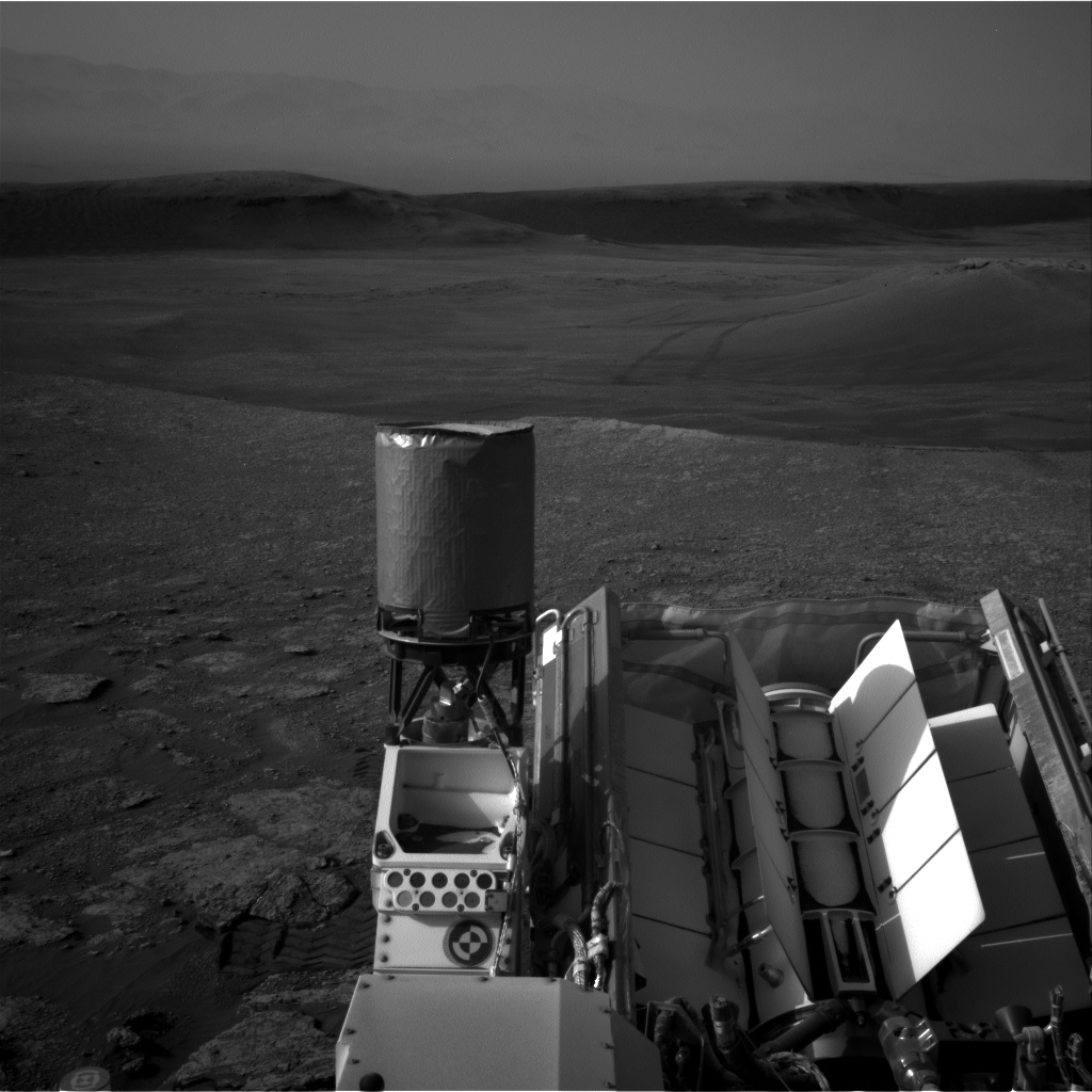
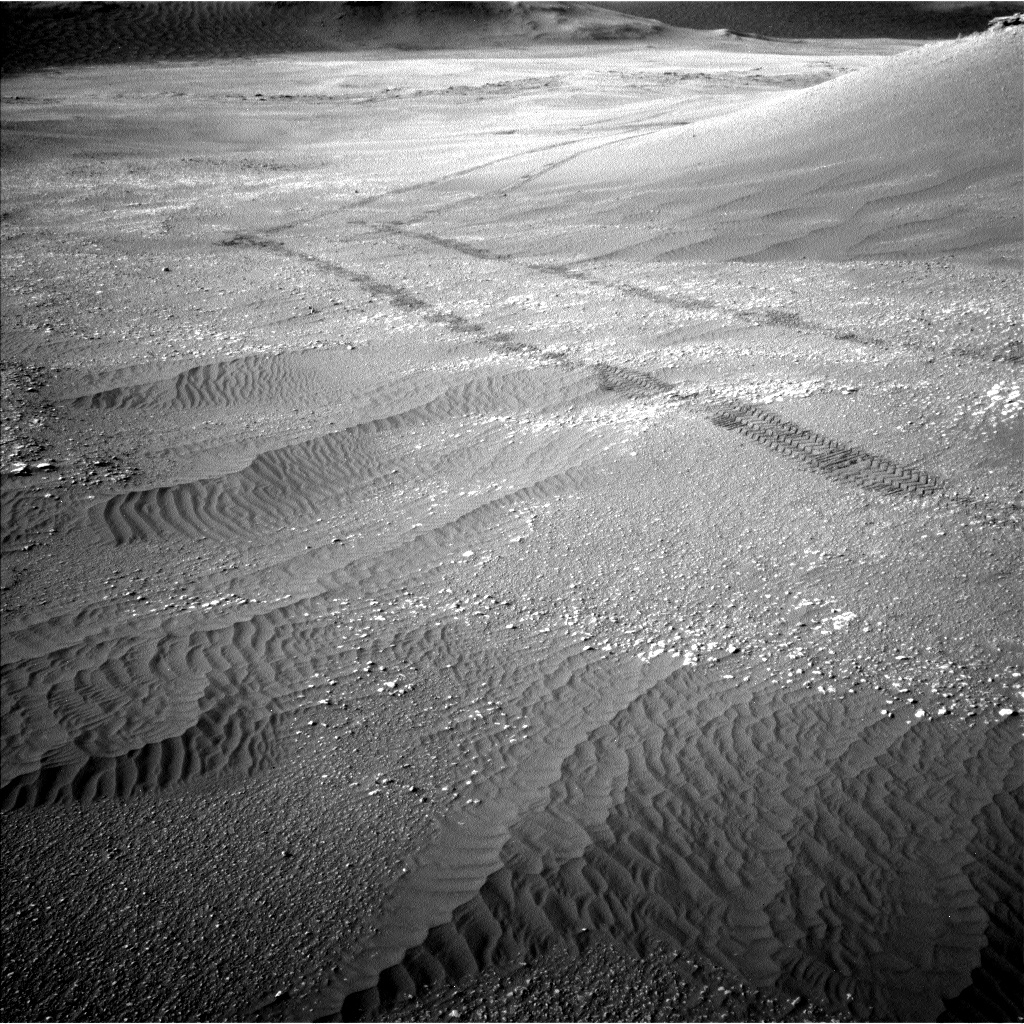
Image shows the rim of the crater once again visible above Vera Rubin Ridge. Photo taken by Navcam Left B on Sol 2449 June 27, 2019
Credit: NASA/JPL-Caltech
NASA’s Curiosity Mars rover is now performing Sol 2451 weekend tasks.
Reports Roger Wiens, a geochemist at Los Alamos National Laboratory in Los Alamos, New Mexico: “Curiosity has been a bit down lately-in elevation. After exploring the top of Vera Rubin Ridge (VRR) last year, the rover descended into a trough south of the ridge, dropping as much as 15 meters in elevation this spring to explore part of the clay-bearing unit.”
Wiens adds that Curiosity is now back to the highest elevation that it achieved before it left the ridge, about -4140 meters relative to the reference level representing zero elevation on Mars.

Curiosity Navcam Right B photo taken on Sol 2450, June 28, 2019.
Credit: NASA/JPL-Caltech
Climb higher
“Curiosity will continue to climb higher as it explores the rest of the Glen Torridon and then moves on to the sulfate unit and Greenheugh Pediment,” Wiens notes.
The rover team recently planned activities for the rover over the weekend.
Curiosity is wrapping up activities at the base of “Harlaw Rise” and will then drive further up the rise.

Curiosity Mastcam Left photo acquired on Sol 2449, June 27, 2019.
Credit: NASA/JPL-Caltech/MSSS
Weekend plan
On the first sol of the weekend plan the rover is on tap to mostly nap to recharge batteries.
Some Hazcam imaging will be done and Mastcam will take some nighttime images, according to the plan.
On the second sol, ChemCam is slated to shoot three targets near the rover: “Red_Point”, “North_Sea,” and “Roineva.”
Crater rim imaging
Mastcam is slated to take a crater rim extinction image. The arm will be deployed for imaging of gnarly rocks with the Mars Hand Lens Imager (MAHLI) and analysis with the Alpha Particle X-Ray Spectrometer (APXS).
Target names are “Earn” and “Magnus Bay.”
On the plan, Navcam will take zenith and superhorizon movies, and Mastcam will take another crater rim extinction image. Mastcam will image “Harlaw_Rise” and the “Tayside” and “Buckie” targets.
Curiosity MAHLI image produced on Sol 2450, June 28, 2019.
Credit: NASA/JPL-Caltech/MSSS
Drive ahead
After that, Wiens concludes, the plan for the rover is to do some deck monitoring; Navcam will do a 360 degree dust devil survey. The rover will drive 115 feet (35 meters) which should take it up “Harlaw Rise.”
As always, dates of planned rover activities are subject to change due to a variety of factors related to the Martian environment, communication relays and rover status.
Curiosity Navcam Left B image acquired on Sol 2449, June 27, 2019.
Credit: NASA/JPL-Caltech
NASA’s Curiosity Mars rover is now performing Sol 2450 science duties.
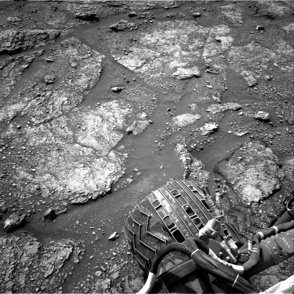
“We are continuing our exploration of Glen Torridon (the clay-bearing unit) and the varied lithologies exposed in this area of Gale crater, including more rubbly bedrock that is mixed with sand, and more coherent bedrock exposed both in the ground and capping prominent ridges,” reports Lucy Thompson, a planetary geologist at the University of New Brunswick, Fredericton, New Brunswick, Canada.

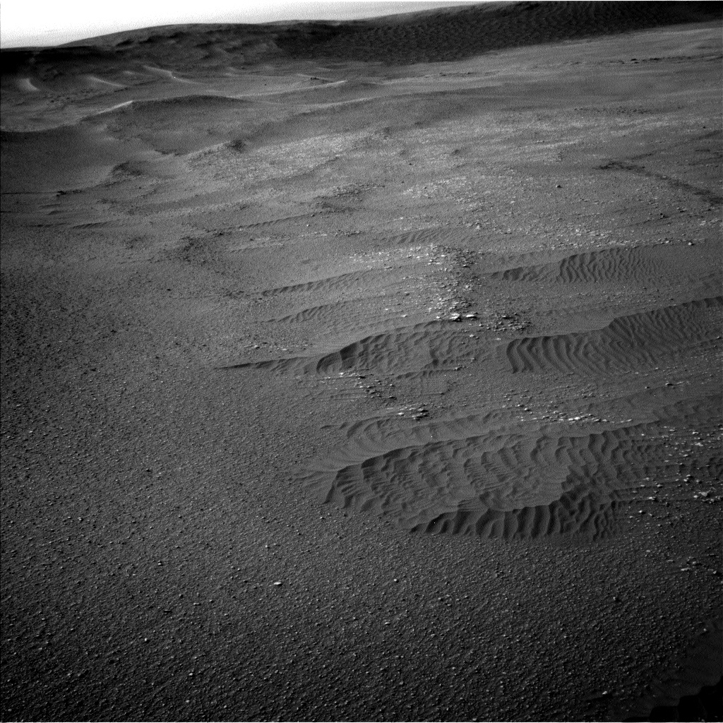
Curiosity Navcam Right B photo taken on Sol 2449, June 27, 2019.
Credit: NASA/JPL-Caltech
Curiosity has continued the drive away from one of these ridges, Teal Ridge, towards another low-lying lip and ridge of exposed bedrock that Mars researchers refer to as “Harlaw.”

Curiosity Front Hazcam Left B image taken on Sol 2449, June 27, 2019.
Credit: NASA/JPL-Caltech
Perfect position
A recent drive by the robot put the Mars machinery about 30 feet (9 meters) away from Harlaw and in a “perfect position” to get some context Mastcam mosaics of the area that will help scientists interpret the results of our planned closeup investigation of this area, Thompson notes.

Curiosity Mars Hand Lens Imager (MAHLI) photo acquired on Sol 2449, June 27, 2019.
Credit: NASA/JPL-Caltech/MSSS
Before a planned drive towards Harlaw, “we will examine the rubbly ground immediately in front of the rover,” Thompson adds, using the Alpha Particle X-Ray Spectrometer (APXS), the Mars Hand Lens Imager, Chemistry and Camera (ChemCam) and rover’s Mastcam.
Curiosity Navcam Left B image taken on Sol 2449, June 27, 2019.
Credit: NASA/JPL-Caltech
Rubbly bedrock
“We will get a short morning APXS integration, closeup MAHLI images and ChemCam on a target “Tolsta,” ChemCam only on a target ‘Yell Sound’ and accompanying Mastcam imaging of the workspace to continue monitoring the composition and texture of the rubbly bedrock as we traverse the Glen Torridon region,” Thompson reports.

Curiosity Navcam Right B photo taken on Sol 2449, June 27, 2019.
Credit: NASA/JPL-Caltech
Environmental observations by Curiosity included standard background Rover Environmental Monitoring Station (REMS) activities to monitor the daily martian weather, the Radiation Assessment Detector (RAD) to monitor the radiation environment and Dynamic Albedo of Neutrons (DAN) passive to study the abundance and distribution of subsurface hydrogen- and water-bearing materials.
Curiosity ChemCam Remote Micro-Imager photo taken on Sol 2449, June 27, 2019.
Credit: NASA/JPL-Caltech/LANL
Optical depth
A Navcam dust devil survey and suprahorizon movie are also planned. The suprahorizon movie will look for clouds and the optical depth of the atmosphere.
As well as monitoring activities, as the APXS strategic planner for this week, Thompson helped select the Tolsta target and prepared a weekly instrument update for the science team.

Curiosity Navcam Right B photo acquired on Sol 2449, June 27, 2019.
Credit: NASA/JPL-Caltech
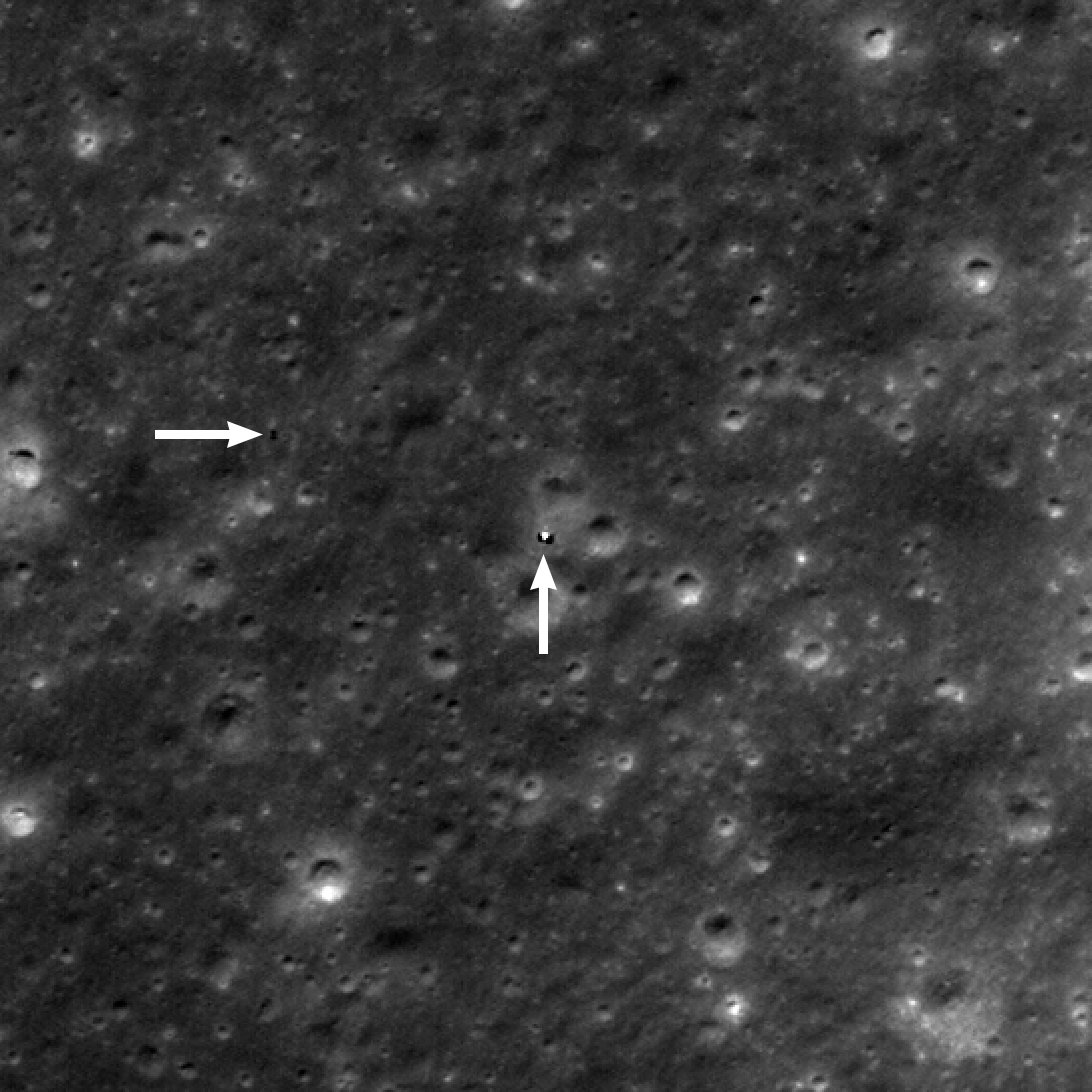
Yutu-2 (horizontal arrow) was about 130 meters west of the Chang’e 4 lander (vertical arrow) on June 3, 2019.
Credit: NASA/GSFC/Arizona State University
NASA’s Lunar Reconnaissance Orbiter (LRO) has snapped new imagery of China’s Yutu-2 rover that is still on the move!
The orbiter’s Lunar Reconnaissance Orbiter Camera (LROC) shows the wheeled rover about 426 feet (130 meters) west of the Chang’e-4 lander.
Once a month, LRO passes over the Chang’e 4 landing site, allowing LROC to capture a new image. LROC has now imaged the site five times (since the landing) on January 3 and observed Yutu-2 to have traveled a total of 610 feet (186 meters) – the distance measured using the rover tracks.

Credit: CNSA/CLEP
Slower progress
“Progress over the past two months has been slower than in previous months,” reports Mark Robinson, the LROC principal investigator at Arizona State University. “Perhaps the rover has found some interesting geology and is lingering to collect a comprehensive set of measurements!”
LROC will keep imaging the site as the Sun angles and look angles vary, to better understand the reflectance of this region, Robinson said, “and to watch Yutu-2 keep on roving and exploring!”
For full details on LROC’s recent imagery of China’s lander/rover mission on the Moon’s farside, go to:

Chang’e-4 farside mission – lander and Yutu-2 rover
Credit: CNSA/CLEP
China’s Chang’e-4 lander and the Yutu-2 have resumed work for the seventh lunar day on the farside of the Moon after “sleeping” during the extreme cold night.
Both are in normal working condition, according to the Lunar Exploration and Space Program Center of the China National Space Administration (CNSA).
China’s Xinhua news agency reports that the lander woke up at 9:45 a.m. Thursday, and the rover, Yutu-2 (Jade Rabbit-2), awoke at 1:26 p.m. Wednesday.
Scientific studies
The Yutu-2 rover has traveled more than 696 feet (212 meters) across the lunar landscape to conduct scientific studies.

Making tracks. China’s Yutu-2 robot.
Credit: CNSA/CLEP
The scientific tasks of the Chang’e-4 mission include low-frequency radio astronomical observation, surveying the terrain and landforms, detecting the mineral composition and shallow lunar surface structure and measuring neutron radiation and neutral atoms.

Von Kármán crater as viewed by the NASA Lunar Reconnaissance Orbiter Camera(LROC).
Credit: NASA/GSFC/Arizona State University
China’s Chang’e-4 farside lander/rover was launched on Dec. 8, 2018, making the first-ever soft landing within Von Kármán crater.

Curiosity Front Hazcam Left B image acquired on Sol 2448, June 26, 2019.
Credit: NASA/JPL-Caltech
NASA’s Curiosity Mars rover is now performing Sol 2449 science duties.
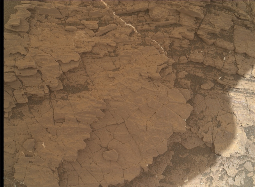
Reports Scott Guzewich, an atmospheric scientist at NASA/GSFC in Greenbelt, Maryland: A recent plan wrapped up time for the rover to study the Teal Ridge outcrop, then the robot is to drive toward the next waypoint in the clay-bearing unit of Gale Crater.
Lien list
There were several science tasks on our lien list to complete first, including Chemistry and Camera (ChemCam) laser-induced breakdown spectroscopy (LIBS) targets on the “rubbly” material in front of the outcrop.

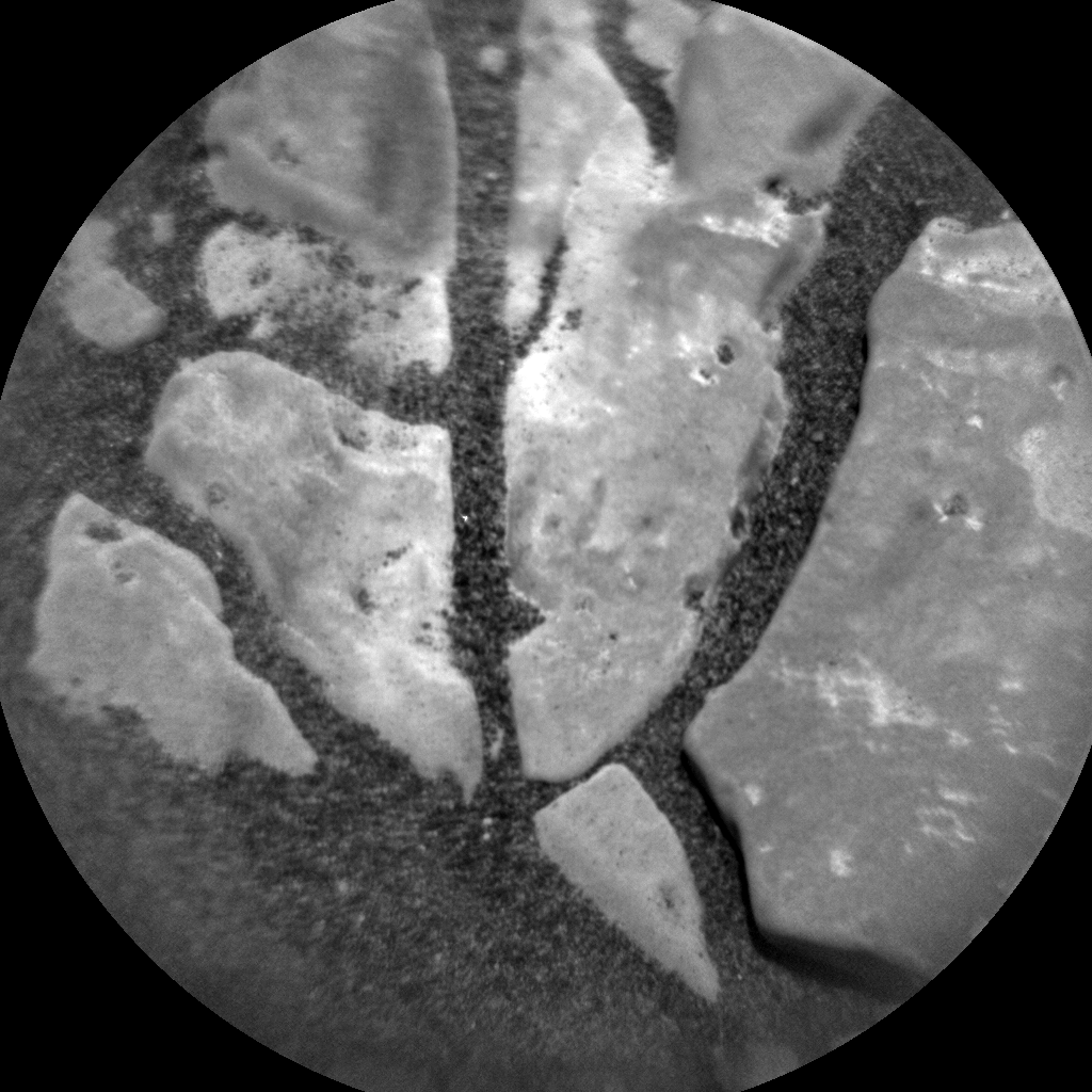
Curiosity Mars Hand Lens Imager (MAHLI) photo produced on Sol 2448, June 26, 2019.
Credit: NASA/JPL-Caltech/MSSS
Mars researchers identified a target named “Glencoe”), one on a dark vein structure within the outcrop (termed “Glenbuchat,” – incredible layered structure in Teal Ridge)
Also produced was a Mastcam multispectral image (where Mastcam uses its different filters to get a better understanding of a rock’s chemistry) of the “Beauly” target that received a thorough cleaning with the dust removal tool last week, Guzewich points out.

Curiosity Navcam Left B photo taken on Sol 2448, June 26, 2019.
Credit: NASA/JPL-Caltech

Curiosity Navcam Left B photo taken on Sol 2448, June 26, 2019.
Credit: NASA/JPL-Caltech
Next waypoint
“After the drive, we’ll be about halfway to our next waypoint and we’ll stop to conduct some post-drive science including imaging of the surrounding area and some late afternoon [environmental] ENV activities including a Mastcam sky survey (to help understand the properties of the airborne dust) and a Navcam zenith movie to search for clouds,” Guzewich adds.
“The ‘Aphelion Cloud Belt’ season is nearly upon us,” Guzewich concludes, “and we expect the skies to be getting much cloudier in the sols and weeks ahead.”

Curiosity Mastcam Left photo taken on Sol 2447, June 25, 2019.
Credit: NASA/JPL-Caltech/MSSS
New road map
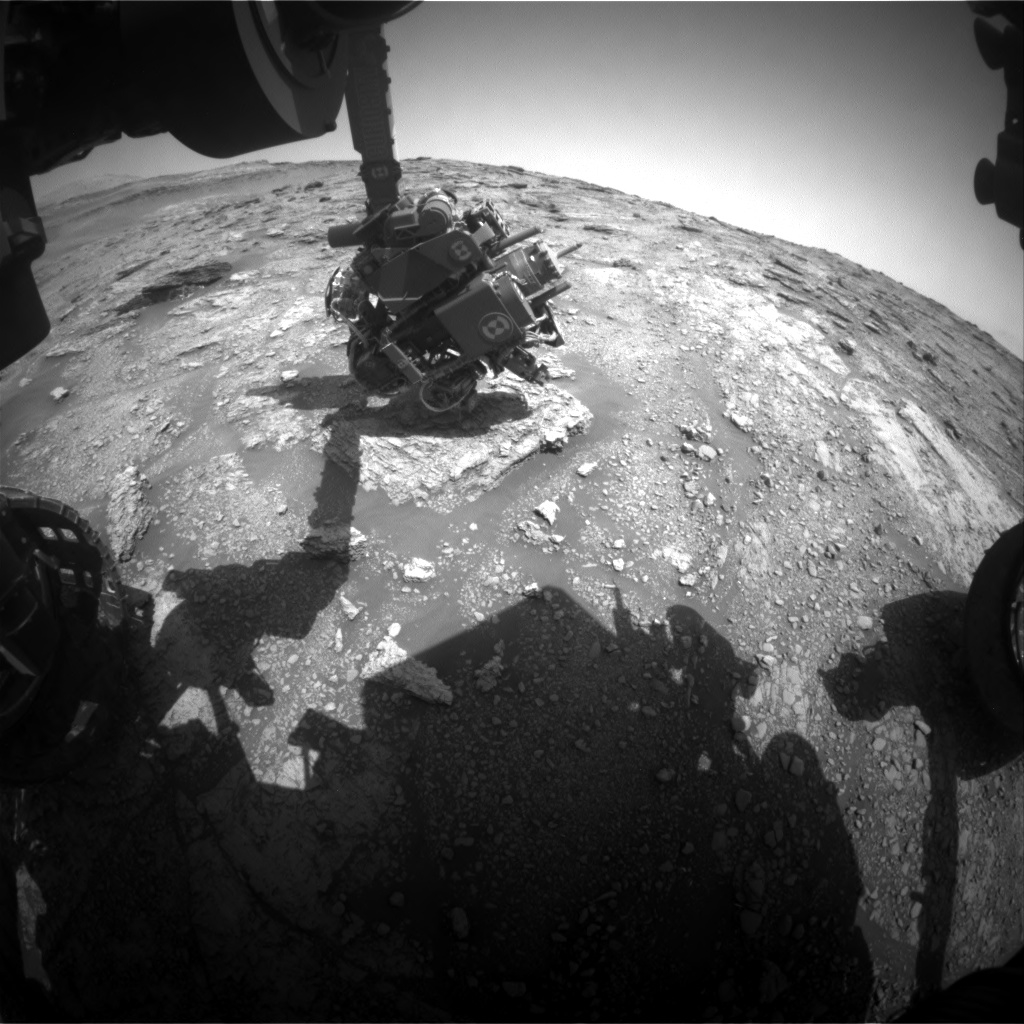
Meanwhile a new Curiosity Traverse Map Through Sol 2447 has been issued.
The map shows the route driven by NASA’s Mars rover Curiosity through the 2447 Martian day, or sol, of the rover’s mission on Mars (June 25, 2019).
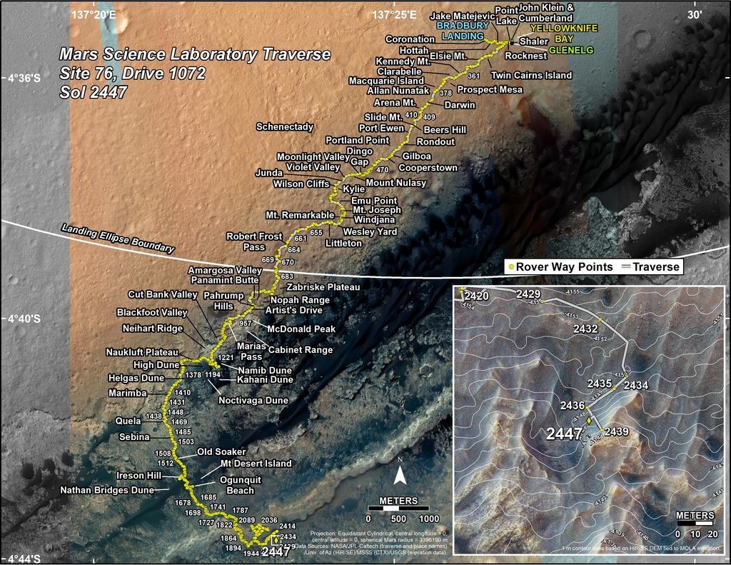
Credit: NASA/JPL-Caltech/Univ. of Arizona
Numbering of the dots along the line indicate the sol number of each drive. North is up. The scale bar is 1 kilometer (~0.62 mile).
From Sol 2439 to Sol 2447, Curiosity had driven a straight line distance of about 30.55 feet (9.31 meters), bringing the rover’s total odometry for the mission to 12.94 miles (20.83 kilometers).
The base image from the map is from the High Resolution Imaging Science Experiment Camera (HiRISE) in NASA’s Mars Reconnaissance Orbiter.

Credit: MUFON
In July the Mutual UFO Network (MUFON) celebrates 50 years of investigating and promoting research on the unidentified flying object phenomenon.
The all-volunteer, non-profit, scientific-based organization has endeavored since 1969 to hunt down answers about baffling vehicles of unknown origin.

The Pentagon’s Advanced Aerospace Threat Identification Program (AATIP) was created to research and investigate Unidentified Aerial Phenomena (UAP) including numerous videos of reported encounters, three of which were released to the public in 2017.
Credit: U.S. Department of Defense/To The Stars Academy of Arts & Science
After five decades, has there been any scientific pay dirt in studying UFOs? Are we inching closer to the truth that is perhaps out there?
Weirdness in the sky, then jumping to alien visitation from afar is a big leap. So too are interdimensional beings, wormhole hooligans, or time travelers. But who knows?
Go to my new Space.com story at:
UFOs Remain Elusive Despite Decades of Study
https://www.space.com/ufo-investigations-mufon-50-years.html

NASA is investing in a new research program – the Exploring Ocean Worlds (ExOW) project. The five-year effort is geared to understand the potential for life in the outer solar system and establishes a new Network for Ocean Worlds.

Credit: NASA
The focus of the effort would address a central question in astrobiology research today: On which ocean worlds, and using which measurements, do we have the highest probability of finding life beyond Earth within the next human generation?

Jupiter’s Europa could be site for water…and life?
Credit: NASA/JPL/Ted Stryk
Accelerating research
The project will form a cornerstone for NASA’s new Network for Ocean Worlds (NOW). NOW is an initiative aimed at accelerating research on planetary bodies with liquid water oceans that may harbor life or conditions that could support it by coordinating scientific studies nationwide that help advance understanding of ocean worlds.
The network will be co-led by Christopher German, a senior scientist at Woods Hole Oceanographic Institution, together with Alison Murray at the Desert Research Institute and Alyssa Rhoden at the Southwest Research Institute.
NOW is the latest of four research coordination networks to be established by NASA that will enable research covering different aspects of the search for life beyond Earth.

Ganymede, a moon of Jupiter.
Credit: NASA
Best bet
“If we hope to find evidence of life beyond Earth, within the next human generation, then our best bet is to look toward the growing list of ice-covered ocean worlds right here in our own solar system,” said German in a press statement.
“And looking further ahead,” German added, “if we want to understand the range of possible conditions that could support life anywhere beyond Earth, then we will simultaneously need to both continue exploring our own ocean for examples of extremes under which life can exist and continue developing exploration technologies that will be useful on any ocean world, including Earth.”

Chemical evidence consistent with serpentinization and water-rock interactions on
Enceladus and known hydrothermal activity make Enceladus a key target for astrobiology exploration.
Sampling the moon’s plumes would help to establish if life exists there now.
Credit: NASA/JPLCaltech/
Southwest Research Institute
Liquid water oceans
Ocean worlds beyond Earth have been a key research focus for NASA’s Planetary Science Division ever since the confirmation of ice-covered liquid water oceans on Jupiter’s moons Europa and Ganymede and, subsequently, Saturn’s moons Enceladus and Titan.

Titan as imaged by Cassini spacecraft.
Credit: NASA/JPL-Caltech/Space Science Institute
Ultimately, the ExOW team intends to construct a comprehensive theoretical model, informed and tested by experimental efforts, that connects a broad range of physical and chemical processes within an ocean system. The model will help determine the potential of that system to harbor life and to reveal evidence of that life to future NASA missions.

This artist’s rendering shows NASA’s Europa mission spacecraft, which is being developed for a launch sometime in the 2020s.
Credit: NASA/JPL-Caltech/M. Carroll
“Our approach is designed to provide a predictive framework applicable to all ocean worlds of this type, but will have clear, immediate and direct relevance to two high priority astrobiology targets: Europa and Enceladus,” said German. The project is designed to be completed just in time for the launch of Europa Clipper, NASA’s next major mission to an ocean world, which is currently scheduled for launch in the early 2020s.
For more information, go to:

