Archive for the ‘Space News’ Category

An artificial intelligence-imbued assistant has been tested aboard the International Space Station.
The free-flying, spherical technology demonstrator with AI showed off a number of its features during interactions with ESA astronaut Luca Parmitano.
CIMON-2 is an updated version of the Crew Interactive MObile companioN astronaut. The degree of autonomy of the battery-powered assistant has been increased by around 30% contrasted to CIMON-1.
The prototype of the technology experiment flew on board the ISS in a July 2018 to August 2019 time period, making its 90-minute debut – a world first – on November 15, 2018 with German ESA astronaut Alexander Gerst.

German ESA astronaut Alexander Gerst with CIMON prototype.
Credit: ESA/NASA
CIMON-2 was a payload on the CRS-19 supply mission to ISS back in early December 2019. It is scheduled to stay on the orbiting outpost for up to three years.
Taking inventory
Developed and built in Germany, CIMON is a technology experiment to support astronauts and increase the efficiency of their work. CIMON is able to show and explain information and instructions for scientific experiments and repairs.
The voice-controlled access to documents and media is an advantage, as the astronauts can keep both hands free. It can also be used as a mobile camera to save astronaut crew time.
In particular, CIMON could be used to perform routine tasks, such as documenting experiments, searching for objects and taking inventory.

ESA astronaut Luca Parmitano works with CIMON-2 aboard the International Space Station.
Credit: ESA/NASA
CIMON says
CIMON can also see, hear, understand and speak. CIMON is able to orientate itself using its ‘eyes’ – a stereo camera and a high-resolution camera that it uses for facial recognition – as well as two other cameras fitted to its sides that it uses for photos and video documentation.
Utilizing navigation capabilities, CIMON-2 was able to follow verbal commands to move to a particular location, regardless of where it was to begin with.
Additionally, ISS crew members can activate a feature on CIMON-2 that allows it to analyze emotion in language and show empathy when interacting with the astronauts.
CIMON lays the foundations for social assistance systems that could reduce stress resulting from isolation or group dynamics during long-term missions. Such systems could also possibly help to minimize similar problems back on Earth as well.

Earth orbiting research lab – the International Space Station (ISS).
Credit: NASA
Captain future
The interactive astronaut assistant CIMON was developed and built by Airbus in Friedrichshafen and Bremen on behalf of the German Aerospace Center Space Administration (Deutsches Zentrum für Luft- und Raumfahrt – DLR) and funded by the German Federal Ministry for Economic Affairs and Energy.
Watson AI technology from IBM Cloud provides voice-controlled artificial intelligence. Scientists from the Ludwig-Maximilian University Hospital in Munich (LMU) helped develop and oversee the human aspects of the assistance system. Biotesc at the University of Lucerne were also engaged to make sure that CIMON works perfectly in the Columbus module of the ISS and supports interaction of astronauts with CIMON.
According to an Airbus statement, it is no coincidence that CIMON’s name is reminiscent of “Professor Simon Wright — a human brain living in a transparent, nuclear-powered life support case, with tentacle-mounted optics — or the “flying brain” – from the Japanese science fiction series Captain Future.

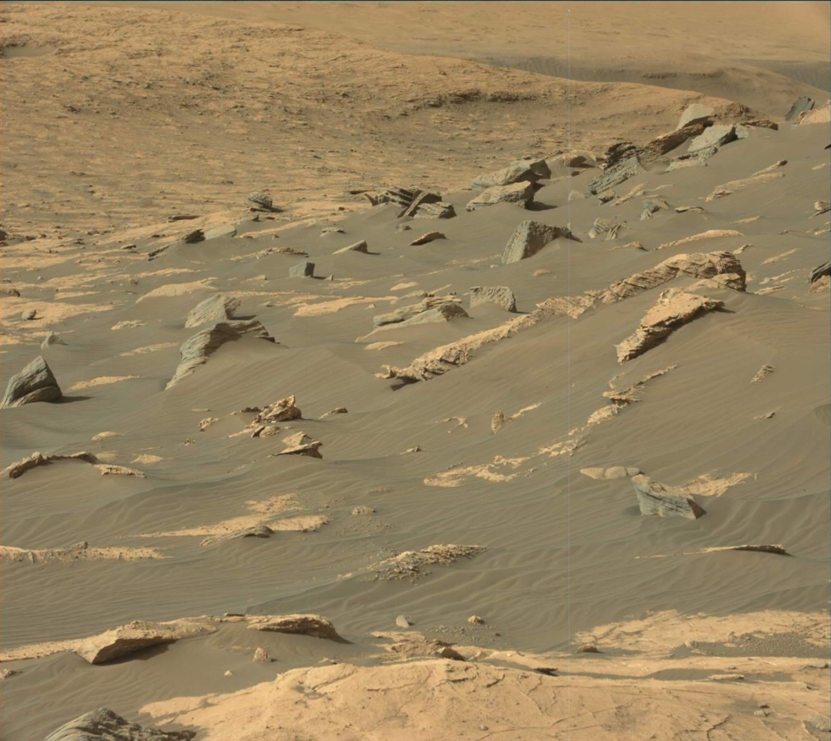
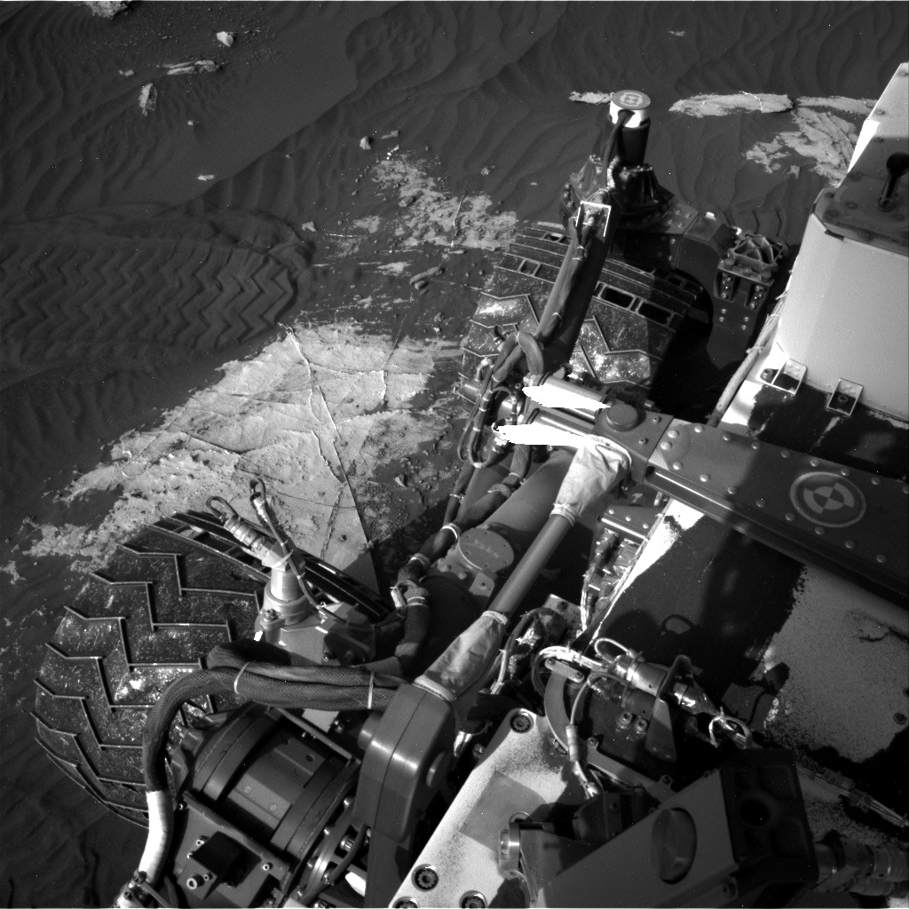
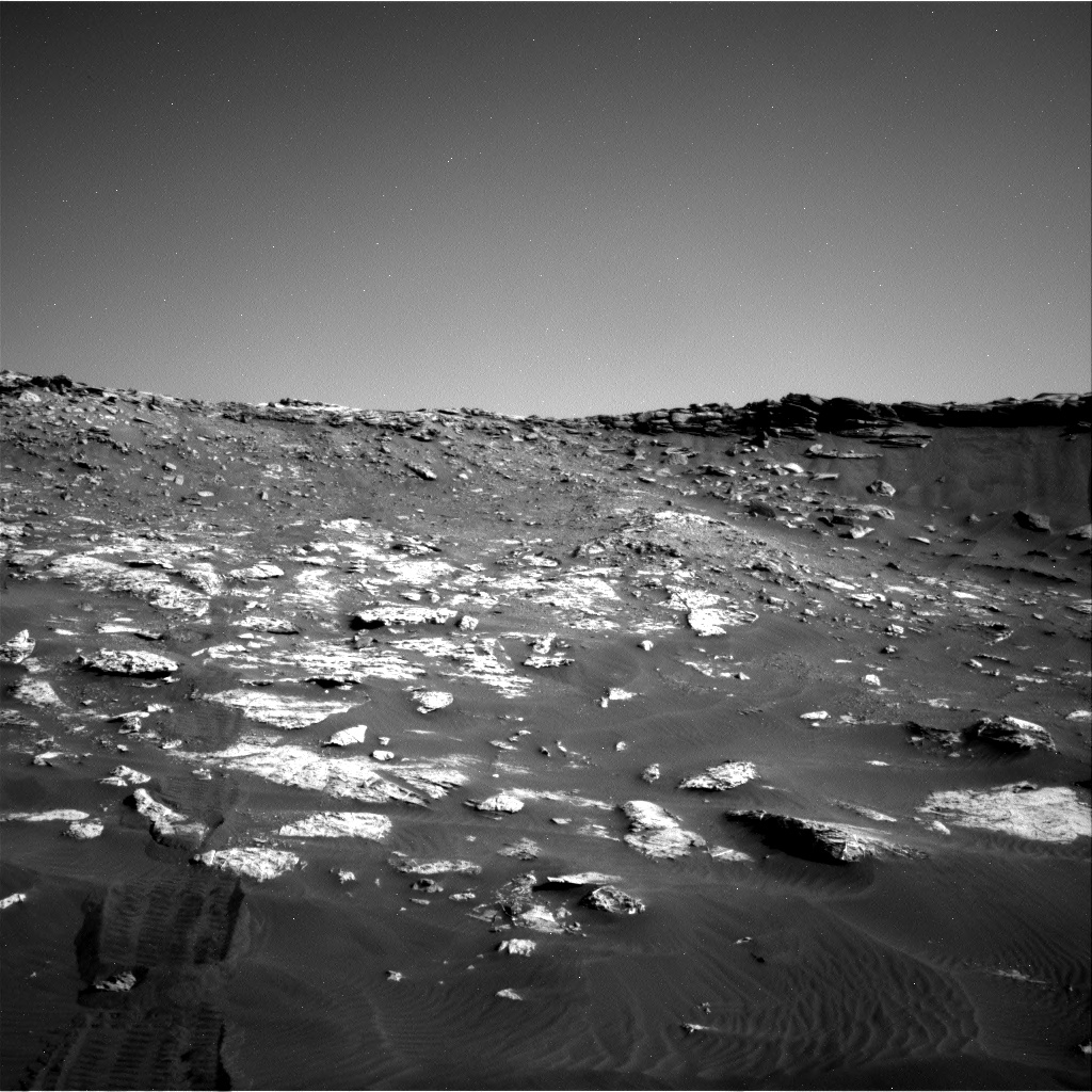
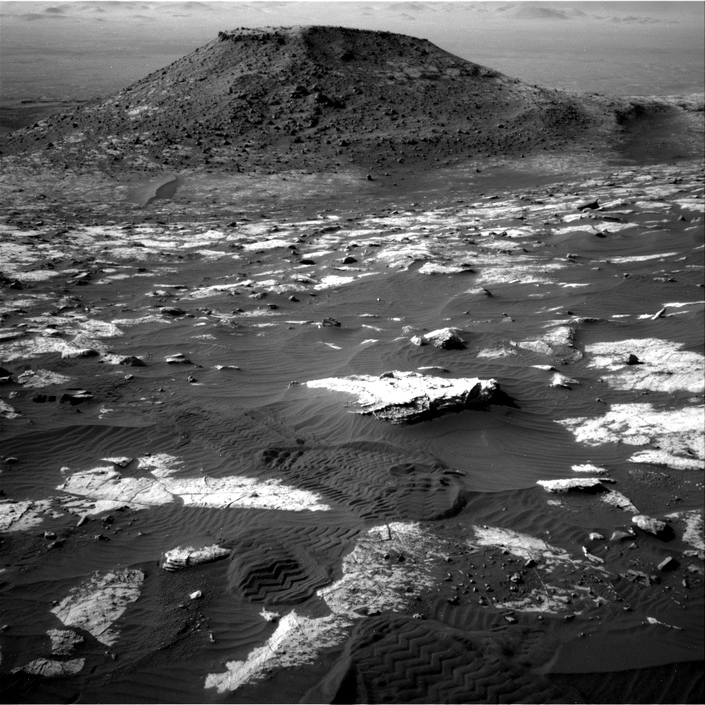
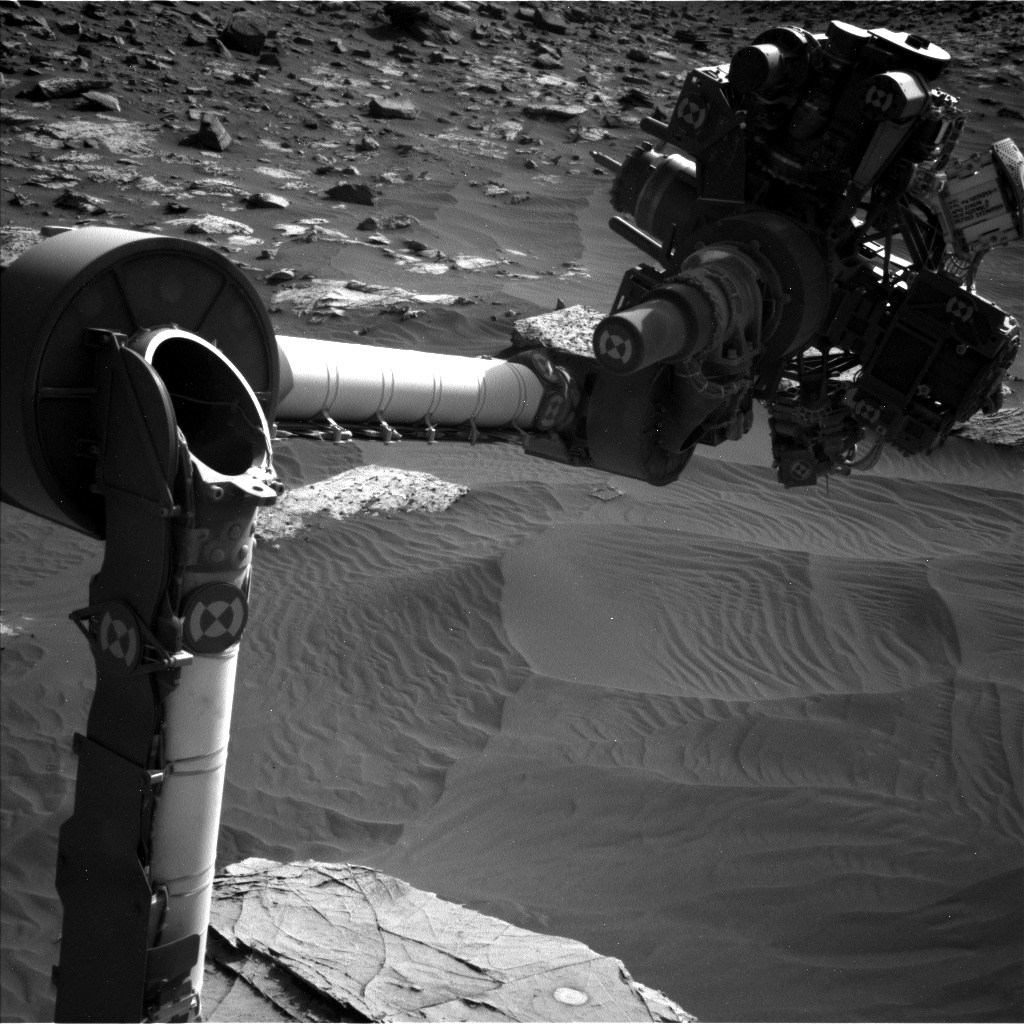
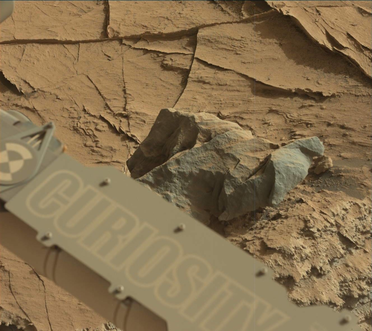
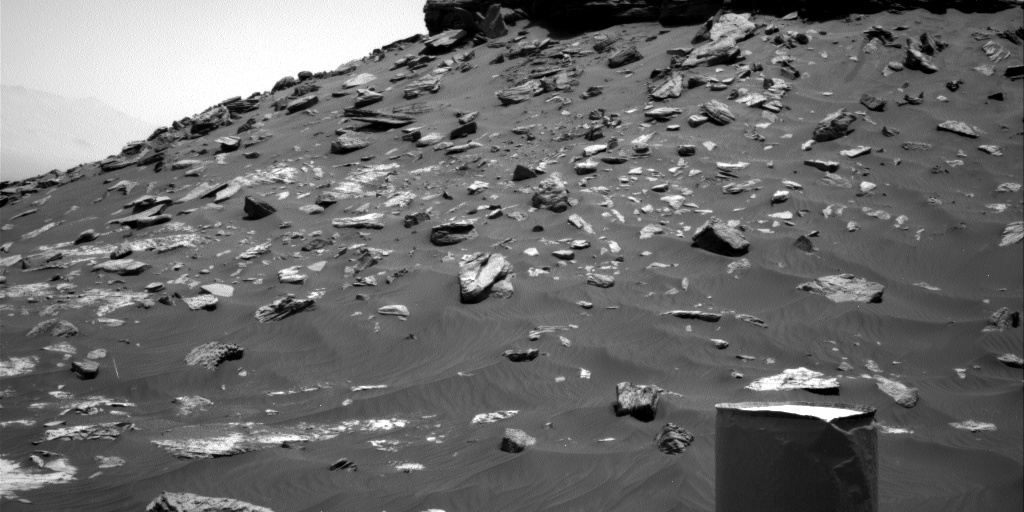
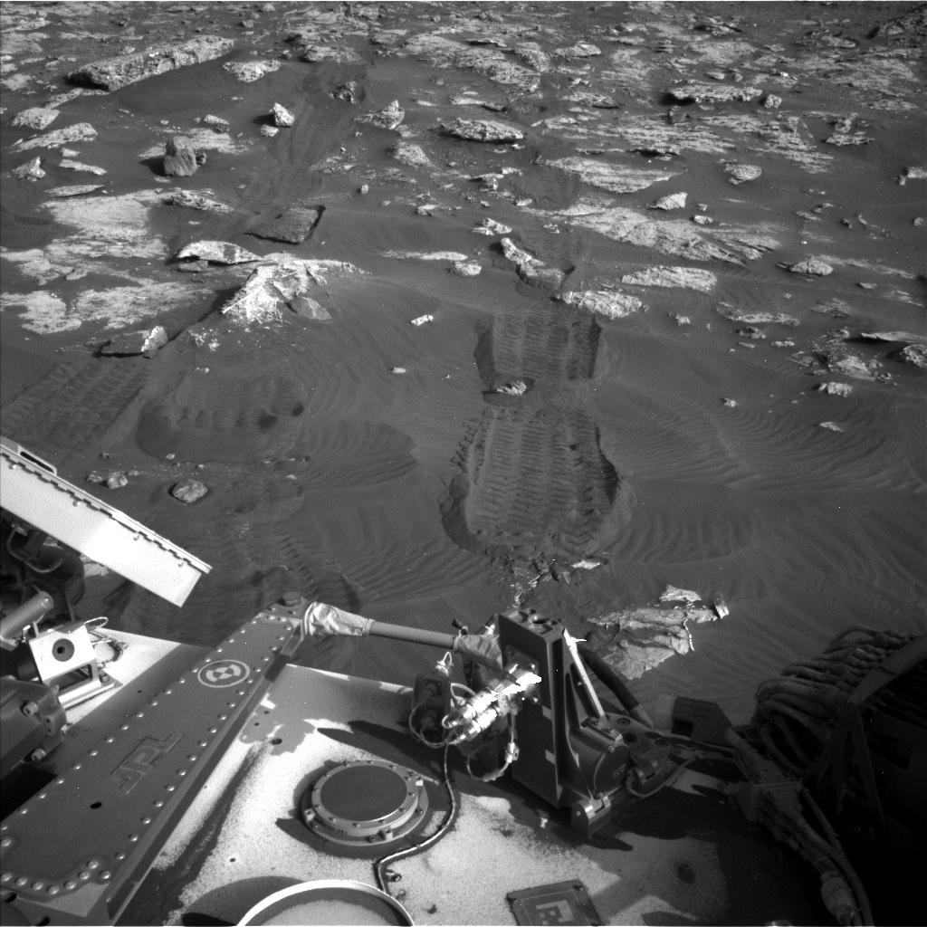
Curiosity Mast Camera Left photo taken on Sol 2736, April 17, 2020.
Credit: NASA/JPL-Caltech/MSSS
NASA’s Curiosity Mars rover is now engaged in Sol 2738 tasks.
A selection of new images showcases the robot’s surroundings:
Curiosity Mast Camera Left photo taken on Sol 2736, April 17, 2020.
Credit: NASA/JPL-Caltech/MSSS

Curiosity Mast Camera Left photo taken on Sol 2736, April 17, 2020.
Credit: NASA/JPL-Caltech/MSSS

Curiosity Mast Camera Left photo taken on Sol 2736, April 17, 2020.
Credit: NASA/JPL-Caltech/MSSS

Curiosity Mast Camera Left photo taken on Sol 2736, April 17, 2020.
Credit: NASA/JPL-Caltech/MSSS

Curiosity Mast Camera Left photo taken on Sol 2736, April 17, 2020.
Credit: NASA/JPL-Caltech/MSSS
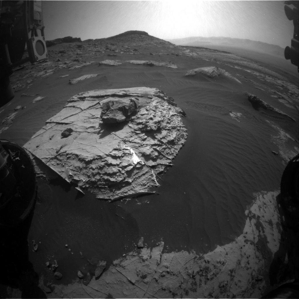
Curiosity Front Hazard Avoidance Camera Left B image acquired on Sol 2737, April 18, 2020.
Credit: NASA/JPL-Caltech
The prospects for further economic expansion into space seem full of promise with plans to send human exploration missions beyond Earth orbit to open new frontiers. To enable this process, there are a few fundamental questions:
— Why should we try to stimulate this economic expansion?
— What are the benefits to society?
— What steps can best facilitate it?
Credit: NASA/ESA
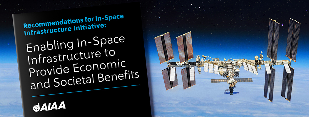
Opinion paper
The American Institute of Aeronautics and Astronautics (AIAA) has issued Recommendations for In-Space Infrastructure Initiative: Enabling In-Space Infrastructure to Provide Economic and Societal Benefits.
This AIAA opinion paper explains that in-space infrastructure would consist of the systems and services operating in Earth’s neighborhood to facilitate commerce, exploration, and scientific discovery.
Earth orbiting research lab – the International Space Station (ISS).
Credit: NASA
Immediate need
“We postulate that there is an immediate need for at least a ‘critical mass’ of in-space infrastructure to be planned, funded, and implemented to expedite broader, efficient, and easy access to cislunar space for all interested stakeholders/participants, and lay the foundation of a vibrant space-based economy,” the document notes.
“Since a fully developed space economy will have worldwide significance and impact, we further suggest that a global advocacy for development of an in-space infrastructure should be initiated,” explains the document.
To read the full AIAA opinion paper – Recommendations for In-Space Infrastructure Initiative: Enabling In-Space Infrastructure to Provide Economic and Societal Benefits – go to:

China plans to launch the ambitious Chang’e 5 lunar sample return mission later in 2020. (Image credit: Used with permission: Loren Roberts/The Planetary Society at https://www.planetary.org/)
China appears on track to launch the Chang’e-5 sample-return mission to the Moon later this year.
That venture represents the third phase of China’s lunar exploration project – returning samples from the Moon.

Part of China’s lunar sample receiving laboratory.
Credit: G. L. Zhang, et al.
If successful, China would become the third nation to haul back to Earth lunar collectibles.

Moonwalking geologist, Apollo 17’s Jack Schmitt.
Credit: NASA
The former Soviet Union did so by robotic means in the 1970s. During 1969-1972, six Apollo missions placed 12 moonwalkers on the Moon that gathered 842 pounds (382 kilograms) of lunar samples at different landing sites on the lunar surface. The stash included rocks, core samples, lunar soil and dust.
Credit: NASA
The Chang’e-5 mission is comprised of four parts including the orbiter, ascender, lander, and Earth reentry module containing the lunar specimens. In many ways, the robotic milestones required for this phase of China’s lunar exploration initiative mirror those of the Apollo human landing program.
Please go to my newly posted Space.com story:
China wants a piece of the moon. Here’s how it plans to handle lunar samples.
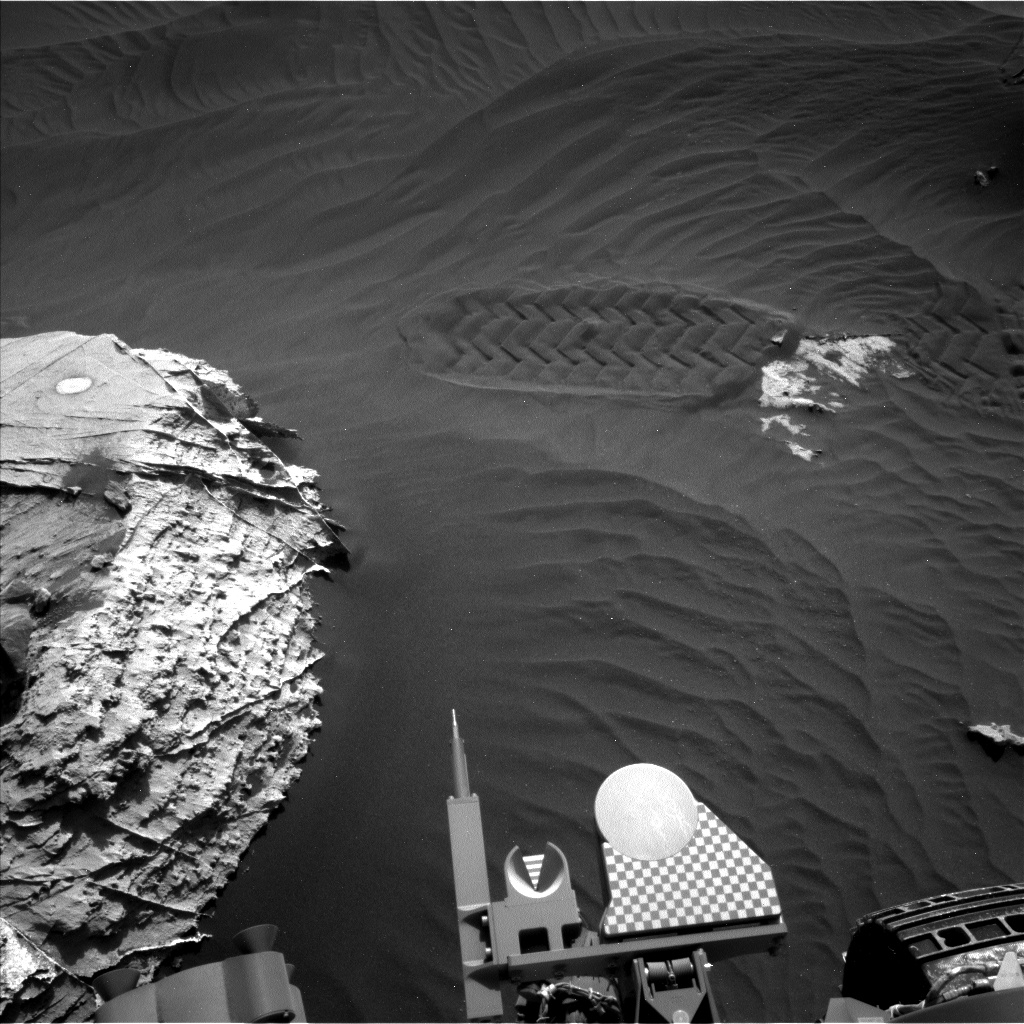
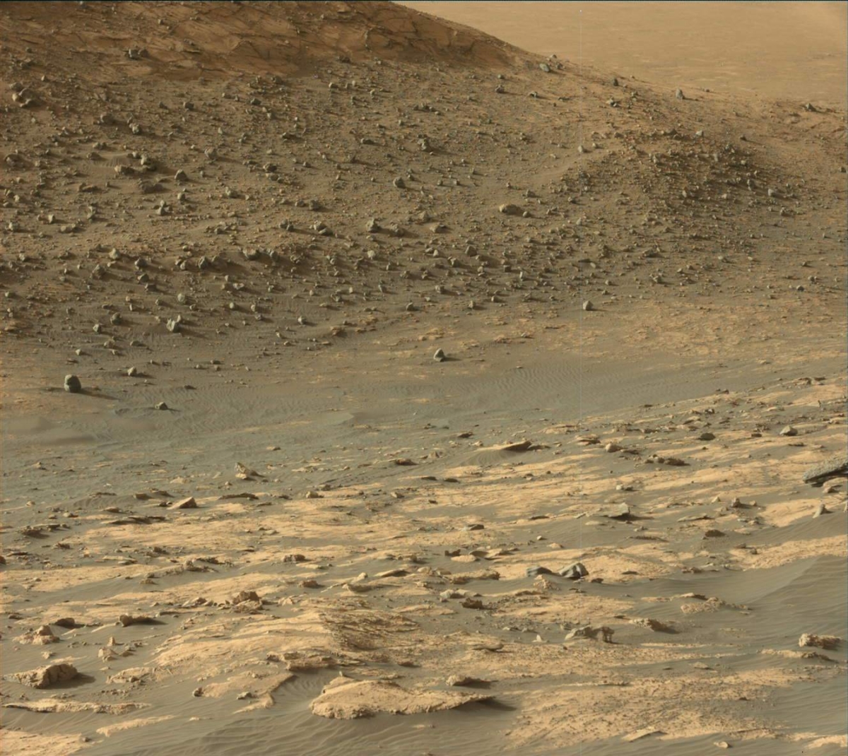
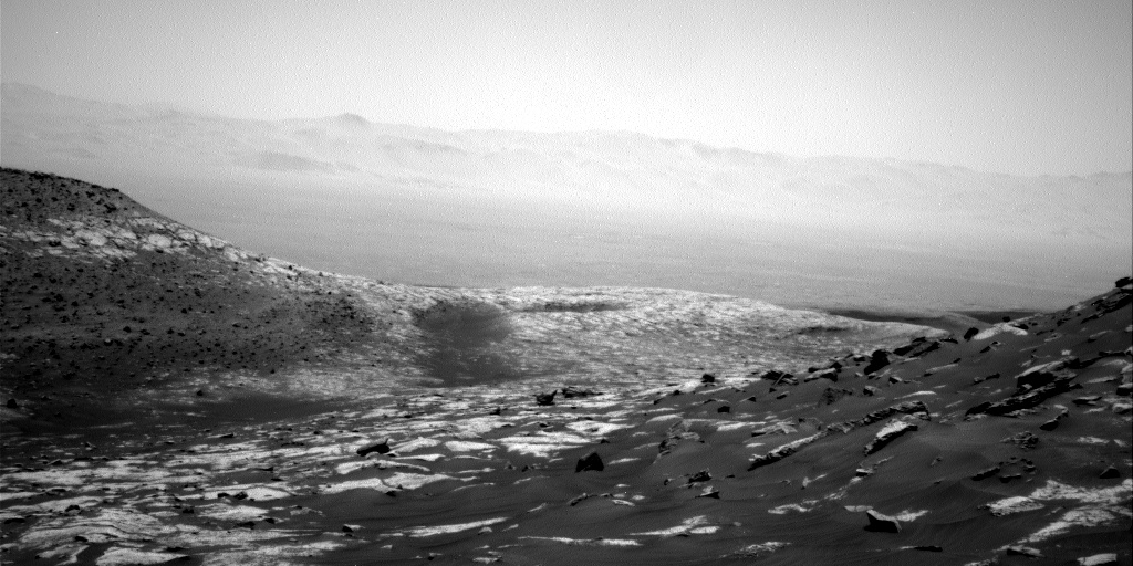
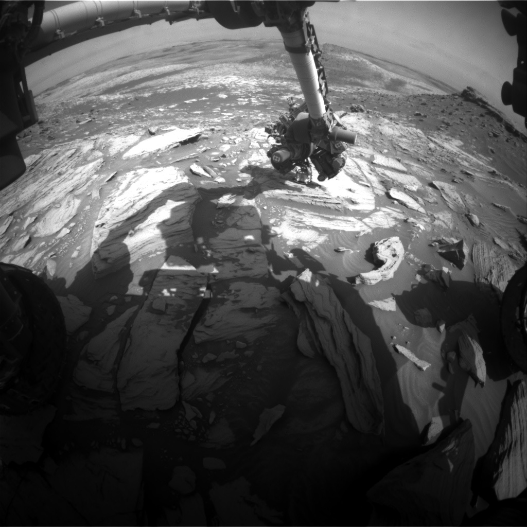
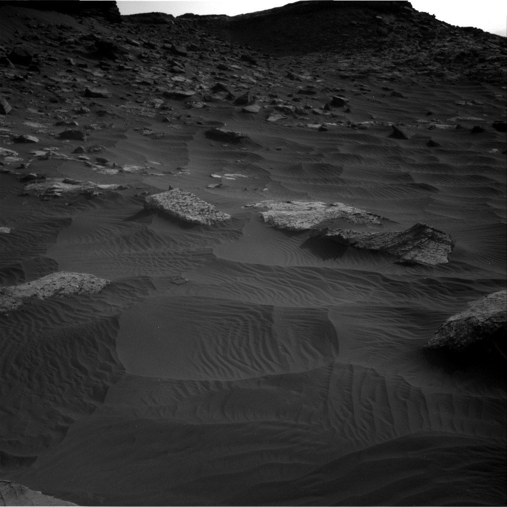
NASA’s Curiosity Mars rover is now performing Sol 2736 duties.
Here are a few select images as the robot traverses downhill:
Curiosity Right B Navigation Camera photo taken on Sol 2736, April 17, 2020.
Credit: NASA/JPL-Caltech
Curiosity Right B Navigation Camera photo taken on Sol 2736, April 17, 2020.
Credit: NASA/JPL-Caltech
Curiosity Right B Navigation Camera photo taken on Sol 2736, April 17, 2020.
Credit: NASA/JPL-Caltech
Curiosity Left B Navigation Camera image acquired on Sol 2736, April 17, 2020.
Credit: NASA/JPL-Caltech
Curiosity Left B Navigation Camera image acquired on Sol 2736, April 17, 2020.
Credit: NASA/JPL-Caltech
Curiosity Left B Navigation Camera image acquired on Sol 2736, April 17, 2020.
Credit: NASA/JPL-Caltech
Curiosity Mast Camera Right photo acquired on Sol 2735, April 16, 2020.
Credit: NASA/JPL-Caltech/MSSS
Curiosity Mast Camera Left image taken on Sol 2734, April 15, 2020.
Credit: NASA/JPL-Caltech/MSSS
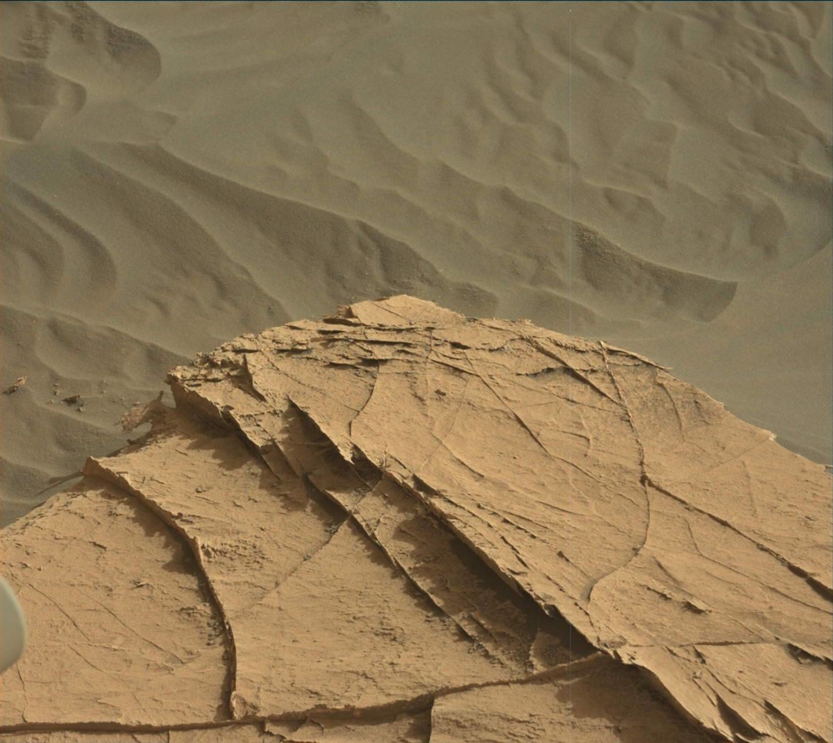
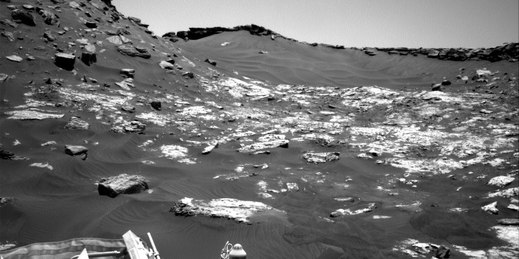
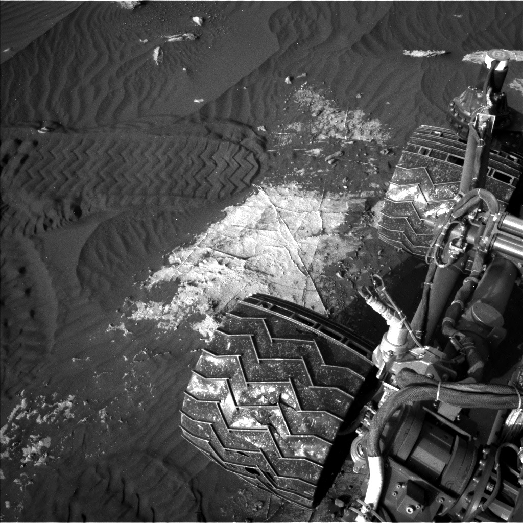
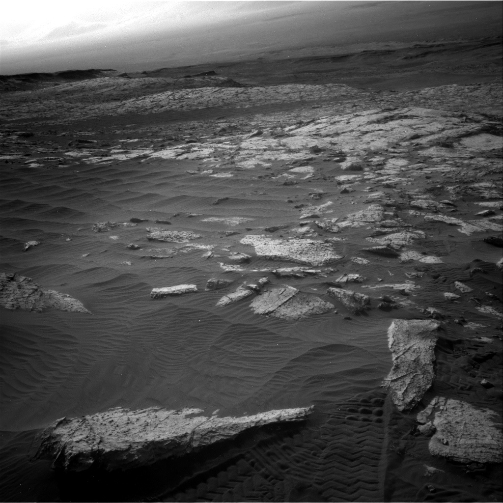
NASA’s Curiosity Mars rover is now carrying out Sol 2735 tasks.
Curiosity Mast Camera Left image taken on Sol 2734, April 15, 2020.
Credit: NASA/JPL-Caltech/MSSS
Susanne Schwenzer, a planetary geologist at The Open University, Milton Keynes, United Kingdom, reports that the rover is on its way back downhill, passing by previously surveyed structures, veins and nodules when the robot was climbing up that area.
Curiosity Mast Camera Left image taken on Sol 2734, April 15, 2020.
Credit: NASA/JPL-Caltech/MSSS
“As the time was pressing on our way up, we are now taking full advantage of a second serving of this piece of bedrock,” Schwenzer explains.
First, the Alpha Particle X-Ray Spectrometer (APXS) instrument is slated to study which elements are present in the bedrock.
“Back on sol 2659 there was only time for a ‘touch and go’ measurement, which are naturally of lower statistical quality than longer overnight integrations and do not allow us to brush the dust off before,” Schwenzer adds.
Dust off
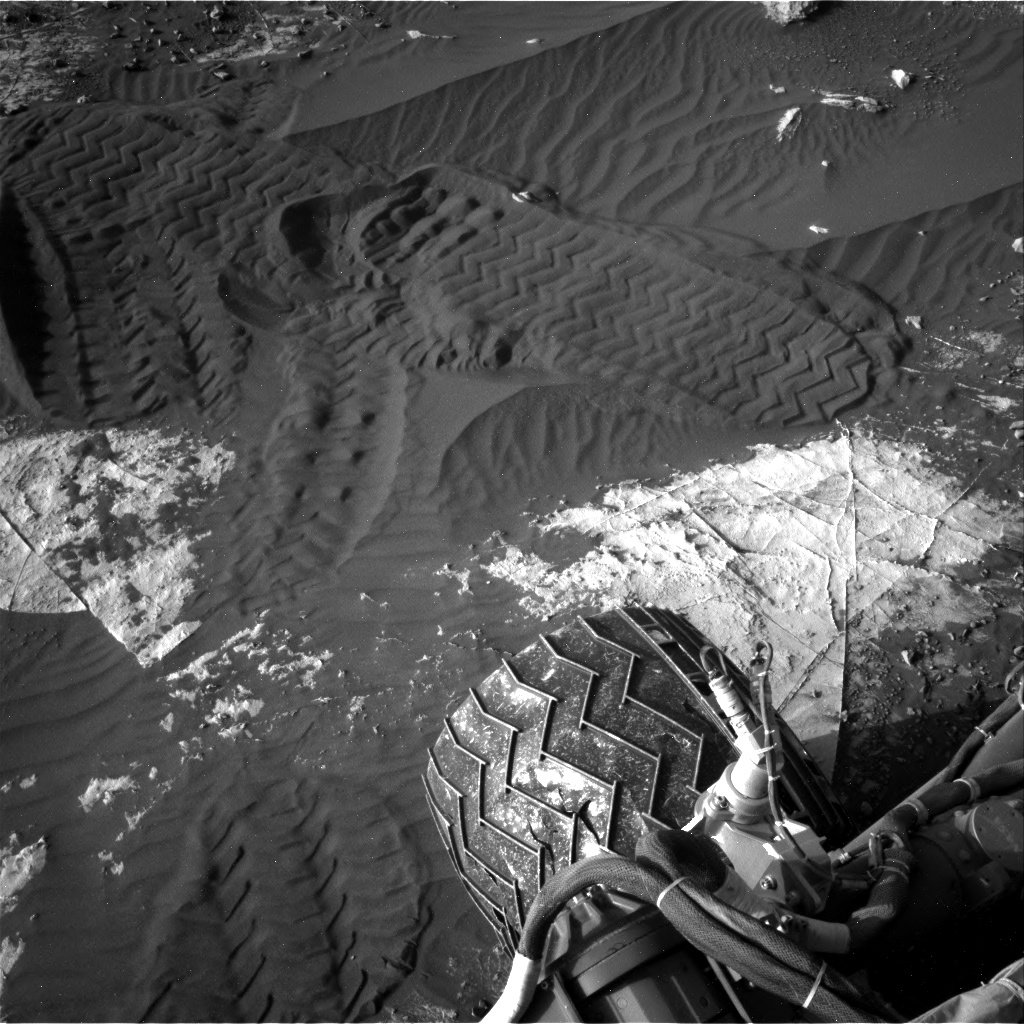
The rover’s Mars Hand Lens Imager (MAHLI) camera on the end of the robotic arm will document the measured area after the robot brushes dust off this spot with it Dust Removal Tool (DRT).
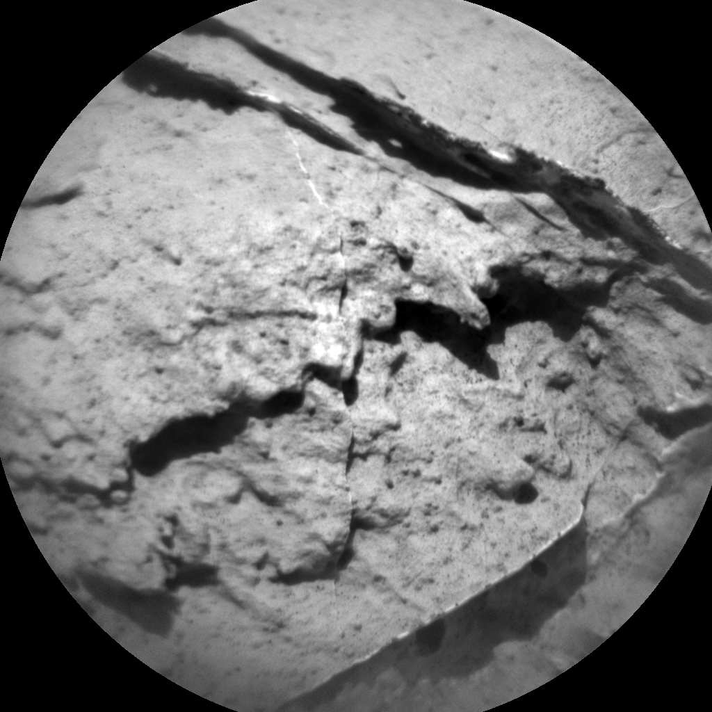
Curiosity Chemistry & Camera image acquired on Sol 2735, April 16, 2020.
Credit: NASA/JPL-Caltech/LANL
Thus, the target “Creig” is set to be an overnight APXS measurement after DRT of the area, improving the statistics on APXS bedrock measurements at this location.
Credit: NASA/JPL-Caltech/Univ. of Arizona
Chemistry and Camera (ChemCam) did get many bedrock points on the way up, for which reason the team focuses the instrument on the other features in the scene: documenting the workspace with a mosaic that includes all the activities by the chemistry experiments, Schwenzer says.
Last dust storm
“The environmental working group has their standard sequence of observations, Schwenzer points out, “which include Navcam line of sight, a dust devil movie, crater rim extinction, a dust devil movie and basic tau. This is especially important at this time of the year, since it is about now that the last big dust storm started.”
Curiosity’s Dynamic Albedo of Neutrons (DAN) instrument that measures hydrogen and chlorine, is in the plan, too, in active and passive mode.
“Finally, Curiosity is going on a long roll,” Schwenzer concludes, “driving all the way into the valley between the buttes to our next area of interest. Stay tuned to see the buttes from the bottom of the valley again after our exciting climb onto and decent from the high place!”
Road map
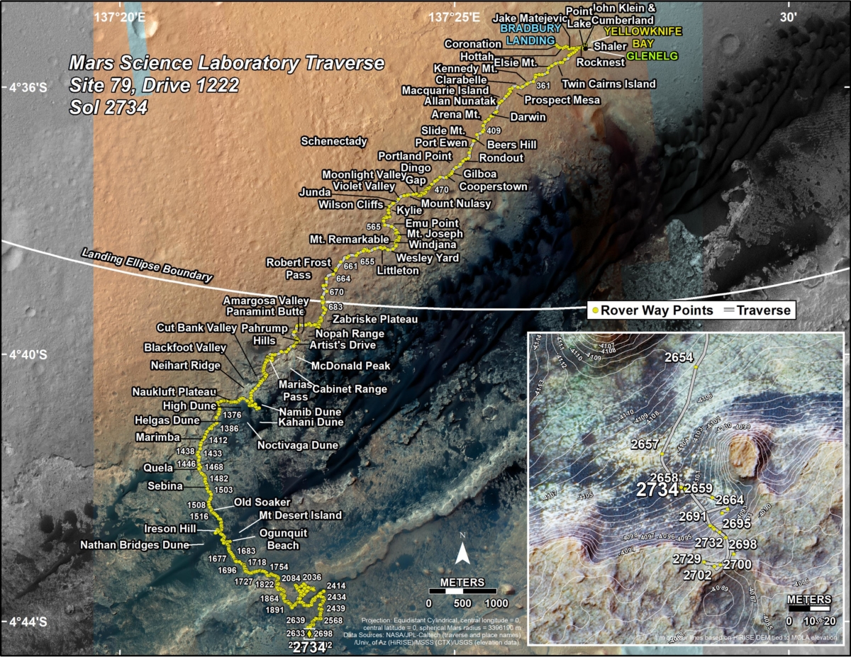
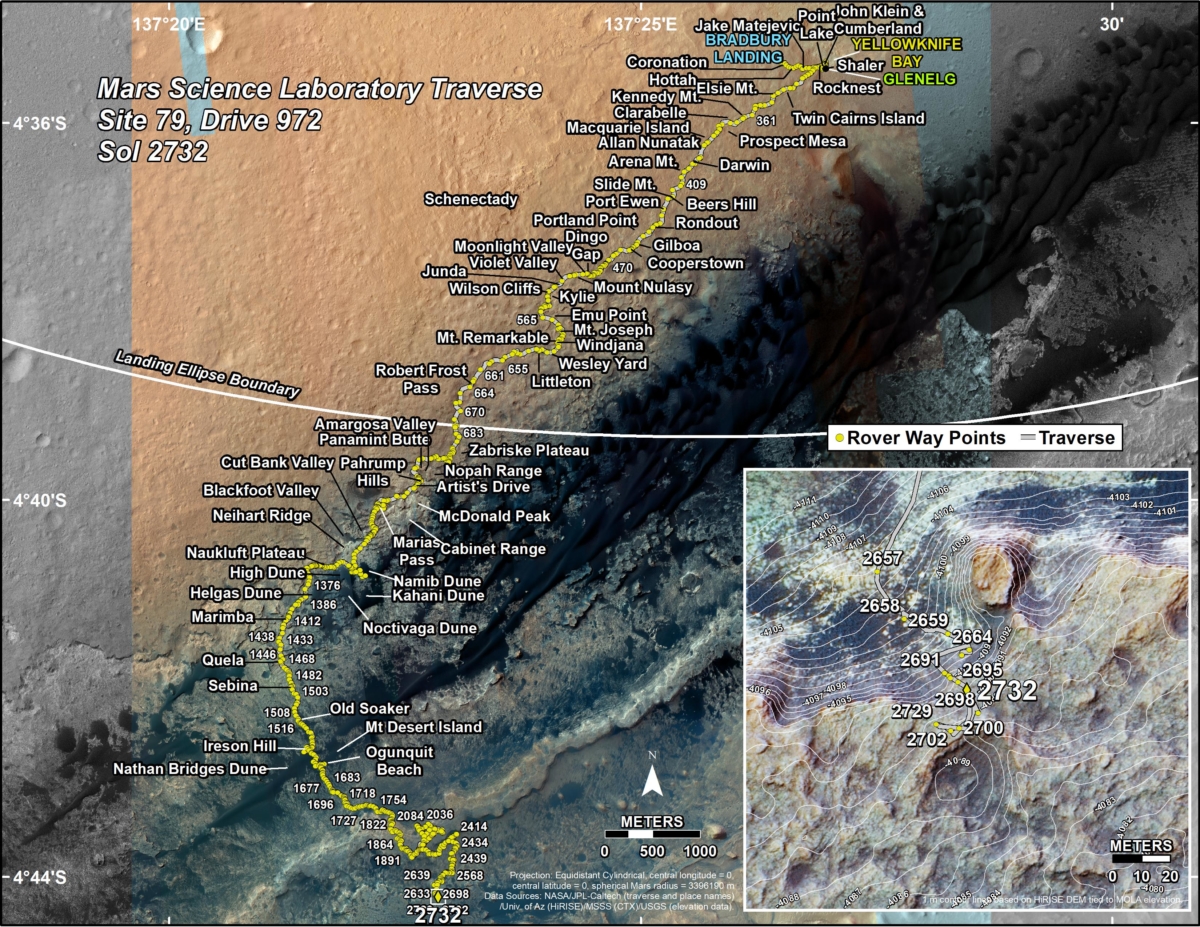
A new road map was issued yesterday showing the route driven by NASA’s Mars rover Curiosity through the 2734 Martian day, or sol, of the rover’s mission on Mars (April 15, 2020).
Numbering of the dots along the line indicate the sol number of each drive. North is up. The scale bar is 1 kilometer (~0.62 mile).
From Sol 2732 to Sol 2734, Curiosity had driven a straight line distance of about 101.86 feet (31.05 meters), bringing the rover’s total odometry for the mission to 13.66 miles (21.99 kilometers).
The base image from the map is from the High Resolution Imaging Science Experiment Camera (HiRISE) in NASA’s Mars Reconnaissance Orbiter.
Curiosity Front Hazard Avoidance Camera Left B photo taken on Sol 2735, April 16, 2020.
Credit: NASA/JPL-Caltech
Curiosity Left B Navigation Camera image taken on Sol 2735, April 16, 2020.
Credit: NASA/JPL-Caltech
Curiosity Right B Navigation Camera photo taken on Sol 2735, April 16, 2020.
Credit: NASA/JPL-Caltech
Curiosity Right B Navigation Camera photo taken on Sol 2735, April 16, 2020.
Credit: NASA/JPL-Caltech
Curiosity Right B Navigation Camera photo taken on Sol 2735, April 16, 2020.
Credit: NASA/JPL-Caltech
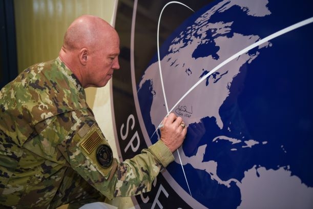
General John Raymond, U.S. Space Force chief of space operations, signs the United States Space Command sign inside of the Perimeter Acquisition Radar building Jan. 10, 2020, on Cavalier Air Force Station, North Dakota.
Credit: U.S. Air Force photo by Senior Airman Melody Howley
The U.S. Space Command is aware and tracking Russia’s direct-ascent anti-satellite (DA-ASAT) missile test today.
“Russia’s DA-ASAT test provides yet another example that the threats to U.S. and allied space systems are real, serious and growing,” said General John W. “Jay” Raymond, USSPACECOM commander and U.S. Space Force Chief of Space Operations. “The United States is ready and committed to deterring aggression and defending the Nation, our allies, and U.S. interests from hostile acts in space.”

General Jay Raymond the first Chief of Space Operations and first member of the Space Force.
Hypocritical advocacy
Russia’s missile system is capable of destroying satellites in low Earth orbit (LEO) and comes on the heels of Russia’s on-orbit testing the U.S. highlighted in February, namely COSMOS 2542 and COSMOS 2543.
These satellites, which behaved similar to previous Russian satellites that exhibited characteristics of a space weapon, conducted maneuvers near a U.S. Government satellite that would be interpreted as irresponsible and potentially threatening in any other domain, according to a U.S. Space Command statement.
“This test is further proof of Russia’s hypocritical advocacy of outer space arms control proposals designed to restrict the capabilities of the United States while clearly having no intention of halting their counterspace weapons programs,” Gen. Raymond said.

Anti-satellite painting by William K. Hartmann
Shared interest
“Space is critical to all nations and our way of life,” Raymond added. “The demands on space systems continue in this time of crisis where global logistics, transportation and communication are key to defeating the COVID-19 pandemic.
“It is a shared interest and responsibility of all spacefaring nations to create safe, stable and operationally sustainable conditions for space activities, including commercial, civil and national security activities,” Gen. Raymond concluded.
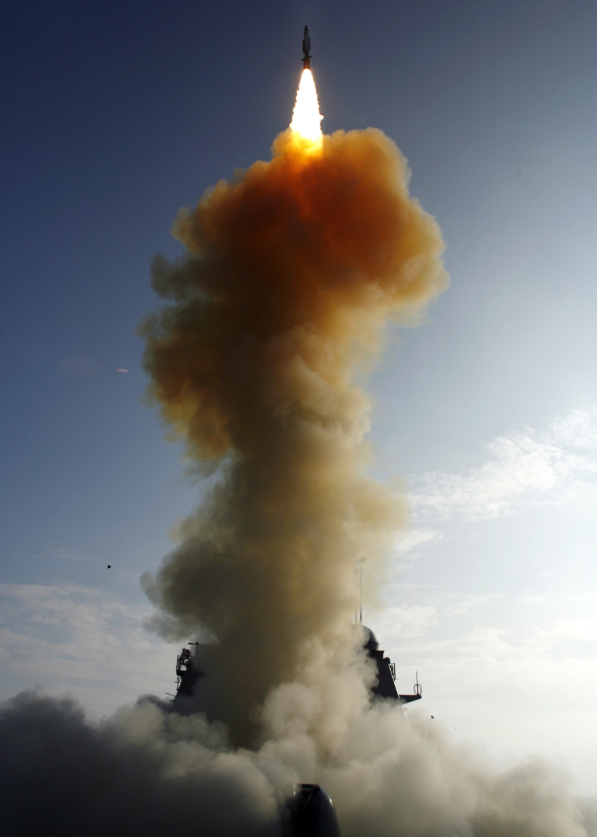
A single modified tactical Standard Missile-3 (SM-3) launches from the U.S. Navy AEGIS cruiser USS Lake Erie (CG 70), successfully impacting a non-functioning National Reconnaissance Office satellite approximately 133 nautical miles (247 kilometers) over the Pacific Ocean, as it traveled in space at more than 17,000 mph. President George W. Bush decided to bring down the satellite because of the likelihood that the satellite could release hydrazine fuel upon impact, possibly in populated areas.
Credit: U.S. Navy
U.S. ASAT work
In the United States, there has also been early testing of ASAT prowess.
Operation Burnt Frost was carried out in February 2008 when the US military shot a missile at a decaying satellite from the National Reconnaissance Office. That test was justified because the USA-193 spacecraft was loaded with toxic hydrazine fuel that was deemed hazardous to the public if parts of the satellite fell to Earth and reached land.

A highly modified F-15A scored a direct hit on a U.S. satellite in this Sept. 13, 1985 test shot over Edwards Air Force Base, Calif.
Credit: Edwards Air Force Base
The USS Lake Erie fired a Standard Missile-3 (SM-3) to shoot down the satellite, neutralizing the potential dangers the errant satellite originally imposed.
In an earlier ASAT test, a modified F-15A fighter jet scored a direct hit on a satellite in September 1985 that was orbiting 340 miles above the Earth.
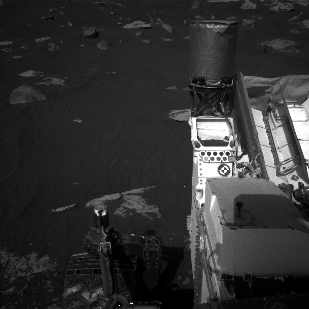
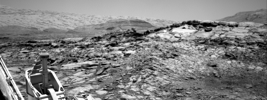
Curiosity Front Hazard Avoidance Camera image taken on Sol 2734, April 15, 2020.
Credit: NASA/JPL-Caltech
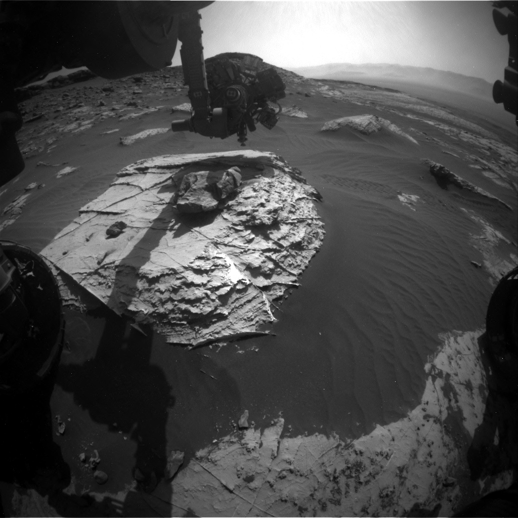
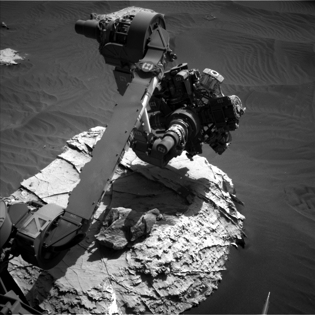
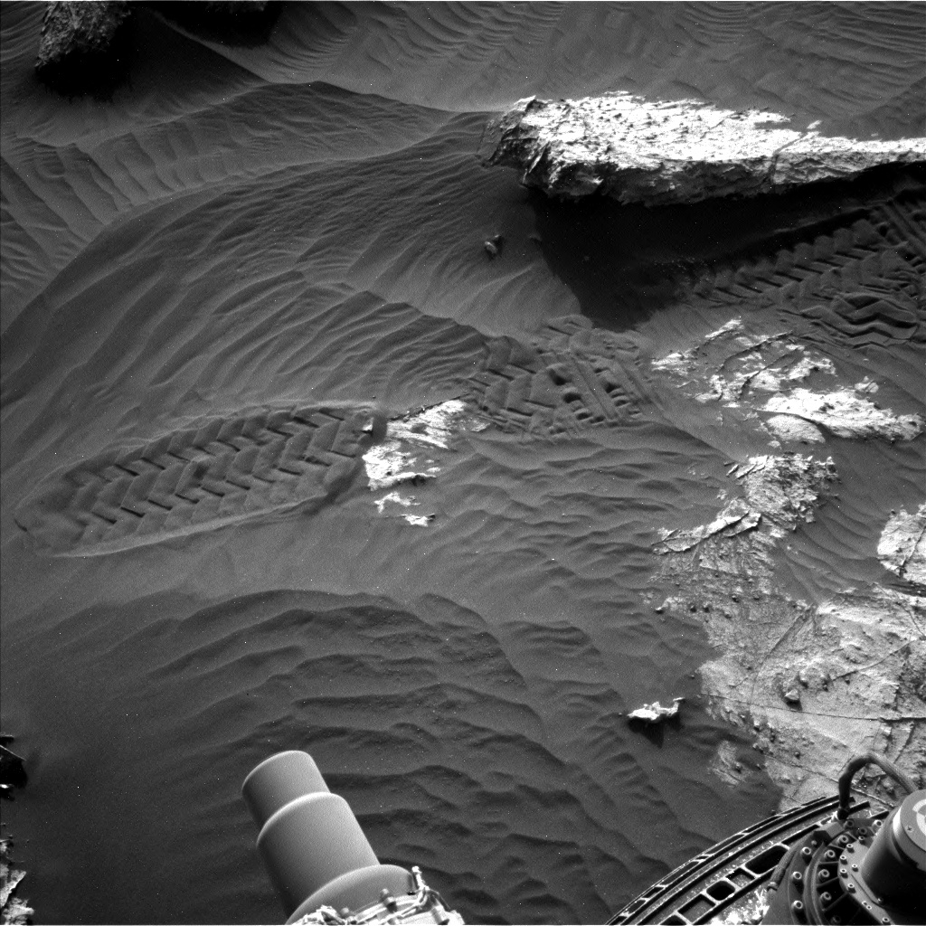
NASA’s Curiosity Mars rover is now performing Sol 2734 duties.

Curiosity Left B Navigation Camera image acquired on Sol 2734, April 15, 2020.
Credit: NASA/JPL-Caltech
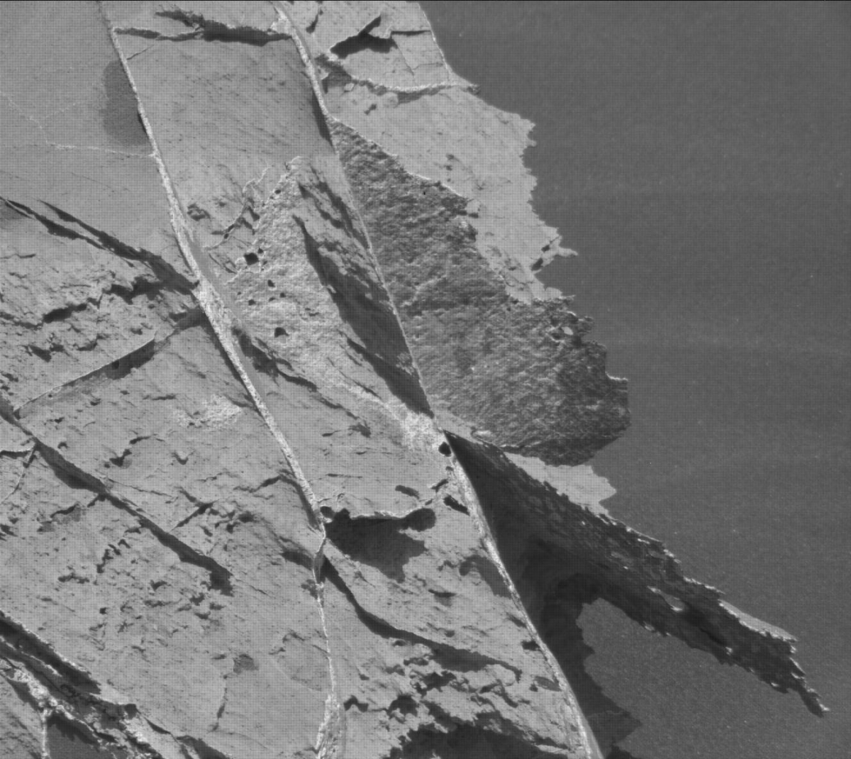
Reports Mark Salvatore, a planetary geologist at the University of Michigan: “In our last bit of science from on top of the flat topographically raised region known as the “Pediment,” we wanted to chemically characterize some small nodular bedrock targets that we’ve been noticing across the landscape.”
Curiosity Left B Navigation Camera image acquired on Sol 2734, April 15, 2020.
Credit: NASA/JPL-Caltech
Nodular targets
The original plan, Salvatore adds, was for a “touch-and-go,” which would mean a quick Alpha Particle X-Ray Spectrometer (APXS) integration over a target of interest before driving away to a new location.
However, the rover workspace contained plenty of great nodular targets, most were just outside of the reach of the rover’s arm, Salvatore notes.
“In addition, the timing of the short APXS integration was not ideal to collect clean data. So, instead, the “quaran-team” selected a small nodule that was within the arm’s reach, and planned overnight integrations on three nearby locations that will allow us to separate the composition of the nodule from the bedrock,” Salvatore says.
Credit: NASA/JPL-Caltech/Univ. of Arizona

Curiosity Left B Navigation Camera image acquired on Sol 2734, April 15, 2020.
Credit: NASA/JPL-Caltech
To accompany this APXS integration, scientists also identified both nodular and “typical” bedrock targets to characterize using the Chemistry and Camera (ChemCam) instrument, which will provide additional chemical analyses of the surface of the Pediment before dropping back into the Clay-Bearing Unit, Salvatore reports.
Road map
Meanwhile, a new road map shows the route driven by NASA’s Mars rover Curiosity through the 2732 Martian day, or sol, of the rover’s mission on Mars (April 13, 2020).
Numbering of the dots along the line indicate the sol number of each drive. North is up. The scale bar is 1 kilometer (~0.62 mile).
From Sol 2729 to Sol 2732, Curiosity had driven a straight line distance of about 52.78 feet (16.09 meters), bringing the rover’s total odometry for the mission to 13.64 miles (21.96 kilometers).
The base image from the map is from the High Resolution Imaging Science Experiment Camera (HiRISE) in NASA’s Mars Reconnaissance Orbiter.
Curiosity Left B Navigation Camera image acquired on Sol 2734, April 15, 2020.
Credit: NASA/JPL-Caltech
Curiosity Right B Navigation Camera image acquired on Sol 2734, April 15, 2020.
Credit: NASA/JPL-Caltech
Curiosity Right B Navigation Camera image acquired on Sol 2734, April 15, 2020.
Credit: NASA/JPL-Caltech
Curiosity Right B Navigation Camera image acquired on Sol 2734, April 15, 2020.
Credit: NASA/JPL-Caltech
Curiosity Right B Navigation Camera image acquired on Sol 2734, April 15, 2020.
Credit: NASA/JPL-Caltech
Curiosity Left B Navigation Camera image acquired on Sol 2734, April 15, 2020.
Credit: NASA/JPL-Caltech
Establishing an international long-term sustainable lunar presence in partnership with the private sector remains the core global focus of space exploration.
A new Euroconsult report — Prospects for Space Exploration – explains that global government investment in space exploration totaled nearly $20 billion in 2019, a 6% increase year-on-year. Thirty-one countries and space agencies lead this global investment with the U.S. accounting for 71% of spending.
Credit: NASA/ESA
Funding for space exploration is forecast to increase to $30 billion by 2029, driven by Moon exploration, transportation, and orbital infrastructure, the report states.
According to Euroconsult, approximately 130 missions are expected over the coming decade, compared to 52 missions conducted over the past 10 years.
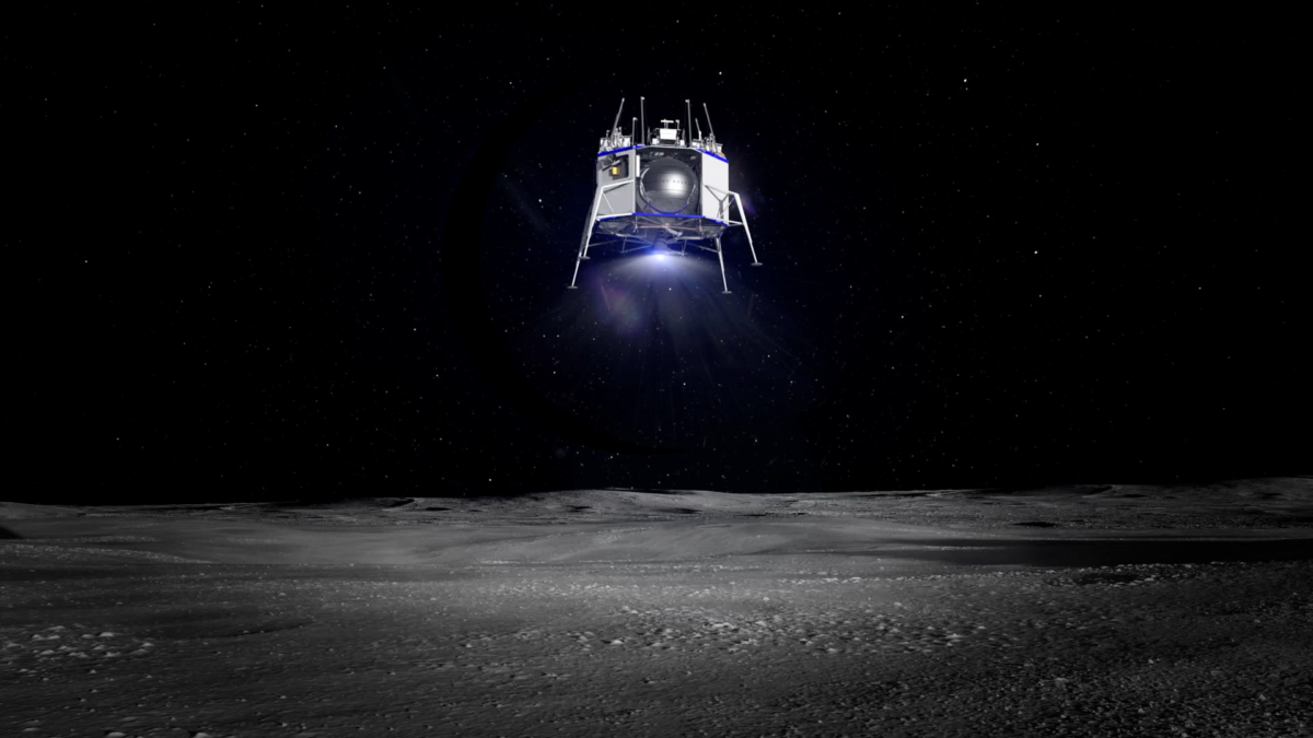
Credit: Blue Origin/Blue Moon
The report identifies existing and upcoming new entrants in space exploration, as well as global trends related to space exploration, and it analyzes collaborative undertakings for exploration, including both international space agency partnerships as well as public-private partnerships.
Large-scale plans
Natalia Larrea Brito, Principal Advisor at Euroconsult and editor of the newly released, April 2020 appraisal, says that exploration is the space application of the coming decade.
Credit: NASA
“Forecast funding growth of about 50% over the coming decade illustrates government support for large-scale plans that are now materializing, with the Moon as a core focus,” Brito explains in a Euroconsult statement. “Recent announcements – such as NASA’s Plan for Sustained Lunar Exploration and Development and the U.S. Executive Order on Space Resources – reaffirm governments’ ambitions to achieve long-term sustainability in lunar exploration.”
Brito adds that while the current health and economic crisis may impact near-term investment and strategies, they are less likely to disrupt long-term space exploration objectives.
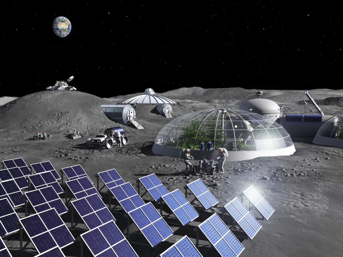
Artist impression of activities in a Moon Base.
Power generation from solar cells, food production in greenhouses and construction using mobile 3D printer-rovers.
Credit: ESA – P. Carril
Sustainable space exploration
“The next decade also promises numerous commercial exploration initiatives. This is having a significant impact on the strategic planning of governments in defining the agenda for space exploration,” Brito says. “New public-private contractual schemes are taking shape, reflecting the willingness of space agencies to act as both strategic partner and future customer of commercial services to achieve a cost-effective sustainable model for space exploration.”
The Euroconsult report focuses on six applications: Orbital infrastructure, transportation, Moon exploration, Mars exploration, other deep space exploration, astronomy, astrophysics and heliophysics.
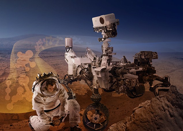
Humans and robots on Mars are likely to team up to augment the types of exploration avenues that can be done on the Red Planet.
Credit: NASA/Ames Research Center
The forecast includes both government and commercial programs. Two periods of reference are considered: 2010-2019 for historical trends and 2020-2029 for forecasts.
Sampling of key findings
• Transportation is the application area which leads and will continue to lead governments’ investments in space exploration. It is anticipated to increase to $14.2 billion in 2029. Growth will be supported by high investments in multiple countries, particularly in the U.S., to support the development of next-generation crew and/or cargo vehicles for LEO and BLEO activities (including human lunar landers).

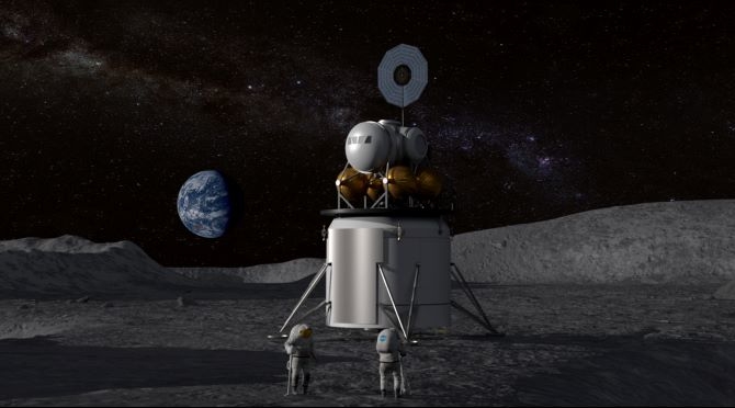
Orion approaches an evolved Gateway.
Credit: NASA
• Orbital infrastructure is the second-largest application with $4.4 billion in 2019 driven primarily by the ISS program and increased investments for China’s Space Station. It is anticipated that total world funding will continue to grow, driven by increasing funding for the development of the Lunar Gateway by ISS partners as well as the completion of the Chinese Space Station.
• Moon exploration experienced a high increase in the past two years as lunar exploration has become the central item in the exploration strategy of most agencies moving forward. It is anticipated to experience the highest sustained growth until reaching $2.7 billion by 2029. This will support future robotic government missions and commercial partnership programs.
• Mars exploration totalled $1.4 billion in 2019 driven by three missions planned for launch in 2020 (plus ExoMars being now pushed to 2022). Global funding is expected to drop as Moon programs shall be favored first. New investment cycles are expected in the second part of the decade to support plans such as Mars-sample return missions.
• Other deep space exploration programs have grown until reaching $1.8 billion in 2019 to support the development of multiple missions in the near-term (primarily from the U.S., ESA and Japan). Global funding is anticipated to reach $1.6 billion/year to support the various planned missions, including potential first endeavours from India and Russia.
• Astronomy, Astrophysics & Heliophysics programs reached $3.6 billion in 2019, currently in a peak phase to finance major flagship programs. This field will continue to be an essential application area for space agencies worldwide.
• Regarding missions, Moon exploration will dominate with close to 40% of all missions planned, reflecting the fact that lunar exploration remains the focus of stakeholders’ space exploration strategy. Commercial missions are forecasted to account for 18% of all missions to be launched in the decade, primarily driven by lunar initiatives.
Assessing trends
Euroconsult has maintained an expertise in assessing trends in the satellite industry, making use of proprietary databases and forecast models that are central to the publication of thematic research reports.
For details on this assessment — Prospects for Space Exploration (2020 Edition) – An economic & strategic assessment of the space exploration sector – go to:
http://www.euroconsult-ec.com/shop/index.php?id_product=129&controller=product
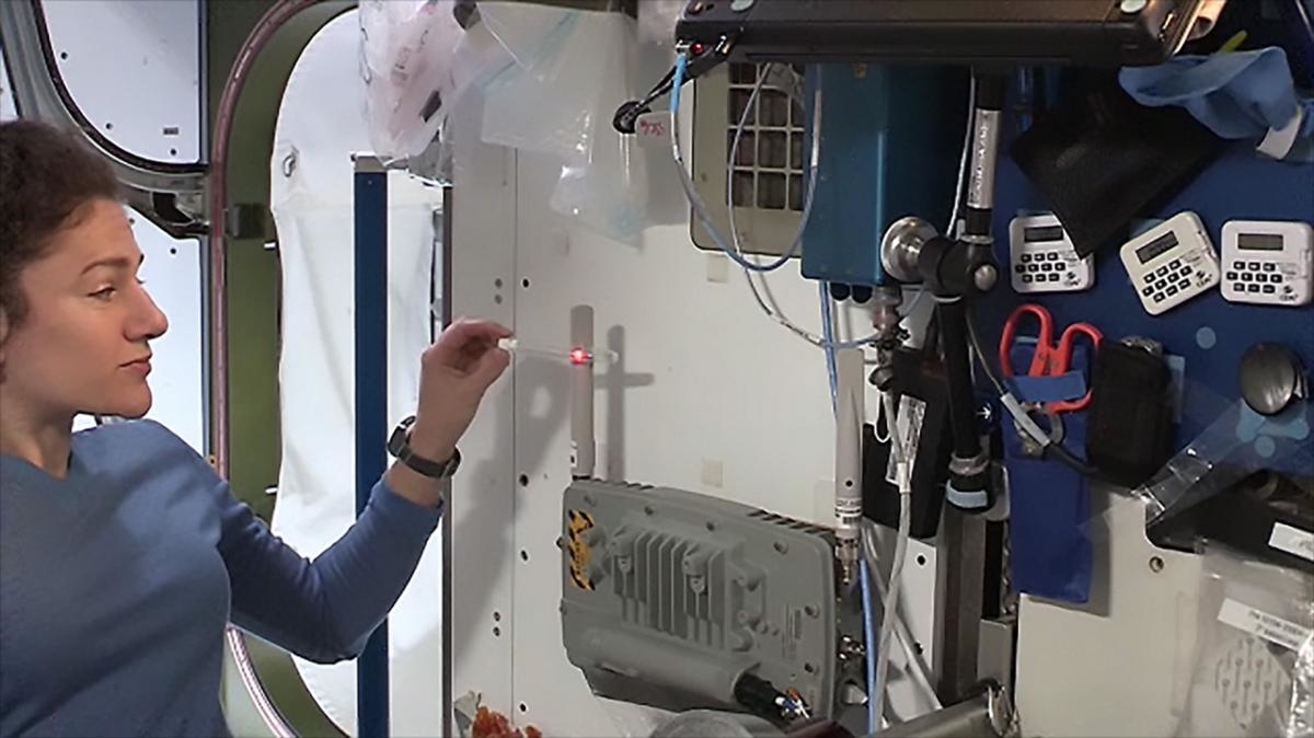
NASA astronaut Jessica Meir demonstrates how the LEctenna™, a light-emitting rectifying antenna constructed by the U.S. Naval Research Laboratory, converts electromagnetic waves into electric current on the International Space Station. Similar technology could be used on the Earth’s surface to convert electromagnetic waves beamed from space-based solar arrays.
Credit: NASA
A power-beaming demonstration in orbit onboard the International Space Station is being highlighted by the U.S. Naval Research Laboratory (NRL).
The first NRL power-beaming demo took place in mid-February, facilitated by ISS astronaut Jessica Meir. A device converted electromagnetic waves into electric current on the orbiting outpost.
Meir showed how NRL’s LEctenna™, a light-emitting rectifying antenna, converted a wireless network signal, similar to home networks, into electric power. While the current that was produced and the light emitted was a small amount, the setup proved the concept in space, notes an NRL statement on the experiment.
Military, civilian applications
The device is spearheaded by NRL electronics engineer Paul Jaffe. He and his colleagues are investigating space solar and power-beaming as a potential source of clean energy for a variety of military and civilian applications.
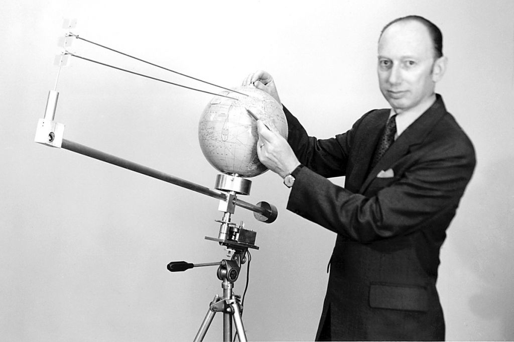
Peter Glaser, the father of the solar power satellite concept.
Credit: Arthur D. Little Inc.
Possible uses include wirelessly charging mobile devices, remotely powering drones, along with space-based solar panel arrays.

USAF has been studying use of power-beaming spacecraft.
Credit: Kirtland Public Affairs
Space solar is simply using solar panels in space to harvest the sun’s energy, where collecting rays would be unaffected by clouds or other interference. Power-beaming would send the collected energy down to Earth, where it would be converted back – as shown by the LEctenna – to usable energy.
The LEctenna demonstration proved the concept of power beaming in space, but was primarily a science, technology, engineering and math (STEM) project to inspire the next generation of innovators under the Department of Defense Space Test Program mission.
For more information on the LEctenna on ISS, go to this video at:
Also available is a video, How to Build a LEctenna, at:
Take a look at this video — Energy transmitted by laser in ‘historic’ power-beaming demonstration – at:

