Archive for the ‘Space News’ Category

After more than a year in a clay-rich region, Curiosity is making a mile-long journey around some deep sand so that it can explore higher up Mount Sharp.
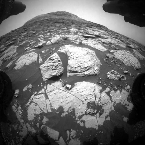
Stitched together from 28 images, NASA’s Curiosity Mars rover captured this view from “Greenheugh Pediment” on April 9, 2020, the 2,729th Martian day, or sol, of the mission. In the foreground is the pediment’s sandstone cap. At center is the “clay-bearing unit”; the floor of Gale Crater is in the distance.
Credit: NASA/JPL-Caltech/MSSS

Mast Camera image on Sol 2813 shows the view looking downhill across the clay unit, with Vera Rubin ridge” (VRR) in the background.
Credit: NASA/JPL-Caltech
NASA’s Curiosity Mars rover is now performing Sol 2817 duties.
“Curiosity is going downhill,” reports Roger Wiens, a geochemist at Los Alamos National Laboratory in New Mexico. “Not in the figurative sense—Curiosity’s 10 instruments all still work well, its six wheels are all doing well, and the drill has been working great for the last two years as well as earlier in the mission.”
Wiens adds that the rover’s power output is somewhat lower than when it started but, all in all, Curiosity is doing great.
Lower elevation
“No, Curiosity is just heading to a slightly lower elevation, to look for a location to potentially drill at least one more sample in the clay unit,” Wiens says. “Clay beds tend to signal habitable environments where water was present for a long time and they also tend to be good at preserving organic materials.”

Curiosity Front Hazard Avoidance Camera Right B image taken on Sol 2815, July 7, 2020.
Credit: NASA/JPL-Caltech
The drive is part of the robot’s “summer road trip” towards the sulfate unit, and will allow the team to potentially get another sample of the clay-rich region while Curiosity still has the opportunity.

Curiosity Mast Camera Left photo taken on Sol 2813, July 5, 2020.
Credit: NASA/JPL-Caltech/MSSS
Downhill drives
“Because Curiosity’s route has generally ascended Mt. Sharp, downhill drives of this magnitude have been rare,” Wiens explains. A little over two years ago Curiosity drove back down the front (north) side of “Vera Rubin ridge” (VRR) to pick up a drill sample of the “Blunts Point” member of the “Murray formation.”
“Early in 2019, Curiosity drove down the back (south) side of VRR into the clay unit, which is a slight depression in the side of Mt. Sharp,” Wiens adds. “And more recently, Curiosity has driven down from some buttes and down from a short excursion on “Greenheugh Pediment.” Other than that, Curiosity has been climbing most of the time.”
In the last several sols, the rover has already descended over 50 feet (16 meters) in elevation from its earlier perch on “Bloodstone Hill.”

Curiosity Mast Camera Left photo taken on Sol 2813, July 5, 2020.
Credit: NASA/JPL-Caltech/MSSS
Uplinked plan
In a recent uplink plan Curiosity will do several observations at its current location, then do a relatively long drive on the second sol, followed by additional observation activities, Wiens points out.
The rover’s Chemistry and Camera (ChemCam) and Mastcam will make observations of bedrock targets “Caldback” (rubbly textured) and “Portencross” (smooth).
Mastcam will also take stereo images of pebbles and of “Windy Gyle,” an outcrop to the east.
Terrain imaging
Curiosity will then take its drive — hoping to go a distance of over 328 feet (100 meters) — combining an initial drive on terrain scientists can see with autonomous driving in the later part on terrain that has not yet been imaged.
The drive will be followed by a Sun tau observation by Mastcam and by post-drive image documentation. The rover’s Mars Descent Imager (MARDI) will take an image of the ground at twilight.

Curiosity Mast Camera Left photo taken on Sol 2813, July 5, 2020.
Credit: NASA/JPL-Caltech/MSSS
Suprahorizon movie
On the second sol, Wiens reports, ChemCam is slated to make a passive observation of the sky to measure its dust and water-vapor content, and will make an observation of a bedrock target selected autonomously by the rover.
Radiation Assessment Detector (RAD), the Dynamic Albedo of Neutrons (DAN) and the Rover Environmental Monitoring Station (REMS) will continue taking data.
Also scheduled is use of Navcam to take a suprahorizon movie, and Mastcam will take another Sun tau measurement to check atmospheric dust, Wiens concludes.

Curiosity Front Hazard Avoidance Camera Right B photo taken on Sol 2815, July 7, 2020.
Credit: NASA/JPL-Caltech
NASA’s Curiosity Mars rover has just begun performing Sol 2816 functions.
The rover has taken a turn…to the north, reports Lucy Thompson, a planetary geologist at the University of New Brunswick; Fredericton, New Brunswick, Canada.

Curiosity Rear Hazard Avoidance Camera Right B image acquired on Sol 2815, July 7, 2020.
Credit: NASA/JPL-Caltech
“We returned to nominal planning…after successfully upgrading Curiosity’s flight software,” Thompson explains.
Recent drive
A just completed drive should take Curiosity a little to the north and east, towards its first planned stop on a summer road-trip to the sulfate-bearing unit.
“In order to preserve as much drive time and distance as possible, we kept the science activities relatively short and sweet,” Thompson adds.
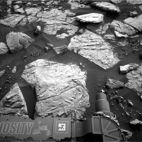
Prior to the drive, Curiosity was slated to acquire a Chemistry and Camera (ChemCam) compositional analysis of the typical bedrock exposure in the workspace (“Bow Fiddle”), as well as two Mastcam mosaics of the eastern-most exposures of the Greenheugh Pediment, which Mars researchers plan to visit later in the mission.

Curiosity Mast Camera Left photo taken on Sol 2813, July 5, 2020.
Credit: NASA/JPL-Caltech/MSSS
Capture the chemistry
“Following the drive, the ChemCam instrument will capture the chemistry of the rocks in the new workspace, using its autonomous targeting capabilities,” Thompson explains. “The remaining post-drive science activities will be devoted primarily to environment and atmospheric monitoring, which are particularly important during Mars’ current dusty season. These will include a large Navcam dust devil survey, a Navcam deck survey, Mastcam full tau imaging towards the Sun and a Mastcam sky survey.”

Curiosity Mast Camera Left photo taken on Sol 2813, July 5, 2020.
Credit: NASA/JPL-Caltech/MSSS
Maximize driving
A post-drive Mars Descent Imager (MARDI) science block is to monitor the ground beneath Curiosity’s wheels, as well as standard Rover Environmental Monitoring Station (REMS), Radiation Assessment Detector (RAD) and Dynamic Albedo of Neutrons (DAN) activities would round out a return to nominal planning.

Curiosity Mast Camera Left photo taken on Sol 2813, July 5, 2020.
Credit: NASA/JPL-Caltech/MSSS
As the Alpha Particle X-Ray Spectrometer (APXS) strategic planner, Thompson says, the plan calls for maximizing driving for distance on the robot’s summer road-trip.
“However, I am looking forward to Curiosity being able to stretch her arm over the weekend, to touch the rocks, and hopefully document the chemistry and textures with the contact science instruments (APXS and the Mars Hand Lens Imager (MAHLI).”
Dates of planned rover activities are subject to change due to a variety of factors related to the Martian environment, communication relays and rover status.

Credit: MBRSC/UAE Space Agency
The Emirates Mars Mission, the first interplanetary exploration undertaken by an Arab nation, today confirmed the launch of its Mars Hope Probe in 7 days – on July 15, 2020 at 5:51 a.m. (JST)/July 14, 2020 at 4:51 a.m. (EST) from Tanegashima Space Center in Kagoshima Prefecture, southwestern Japan, on a Mitsubishi MH-IIA rocket.
The launch will be live streamed at http://www.emm.ae/live
The Emirates Mars Mission (EMM) will send the Mars Hope probe to reach and orbit the Red Planet in February 2021.

Credit: MBRSC/UAE Space Agency
The Mars Hope Probe will reach Mars orbit in 2021, the 50th anniversary of The Emirates, which became an independent nation on December 2, 1971.
Climate watching
Hope aims to build the first full picture of Mars’ climate throughout the Martian year.
EMM will study the Martian atmosphere, the relationship between the upper layer and lower layer, and for the first time, scientists based in over 200 universities and institutes globally will have access to a holistic view of the Martian atmosphere at different times of the day, through different seasons.

Credit: MBRSC/UAE Space Agency
Mars Hope is a fully autonomous spacecraft, carrying three instruments to measure Mars’ atmosphere.
Academic partners
Weighing roughly 2,976 pounds (1,350 kilograms), and approximately the size of a small SUV, the spacecraft was designed and developed by Mohammed Bin Rashid Space Center (MBRSC) engineers working with academic partners, including the Laboratory for Atmospheric and Space Physics (LASP) at the University of Colorado, Boulder; Arizona State University and the University of California, Berkeley.
MBRSC was founded in 2006 and is home to the UAE National Space Program.

Credit: ACT
The European Space Agency’s Advanced Concepts Team (ACT) has a new issue of Acta Futura in the works, the latest dedicated to research on interstellar exploration.

Artist rendering of the Directed Energy Interstellar Study.
Credits: P. Lubin
“We hoped to create a snapshot as of 2020 of established results, visions, concepts, designs and technologies related to such a wonderful, albeit far-fetched endeavor. We hope, in doing so, to serve those future studies that will take the burden to further the interstellar exploration idea,” notes an ACT posting.
Article listing
Now available through Acta Future are these single articles.
The Path to Interstellar Flight
Project Icarus: Designing a Fusion Powered Interstellar Probe
Radiation Conditions in Relativistic Interstellar Flight
World Ships: Feasibility and Rationale
Artificial Gravity in Interstellar Travel
Language Development During Interstellar Travel
Considerations on Life Support Systems for Interstellar Travel: a Regenerative Story
Growing Plants in Human Space Exploration Enterprises

Credit: ACT
Long-term planning
The Advanced Concepts Team (ACT) is part of the ESA’s Directorate of Technical and Quality Management (TEC-SF).
The team is essentially a channel for the study of technologies and ideas that are of strategic importance in the long-term planning of ESA. It serves the function of a think tank providing decision makers the support of a highly multidisciplinary research group.
Based at the European Space Research and Technology Center (ESTEC), ACT carries out research work on advanced topics and emerging technologies and perform highly skilled analysis on a wide range of topics.
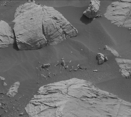
Curiosity Front Hazard Avoidance Camera Right B image taken on Sol 2809, July 1, 2020.
Credit: NASA/JPL-Caltech
NASA’s Curiosity Mars rover is now conducting Sol 2810 activities.
No holidays on Mars! To give the (American) Earthlings a holiday on Friday, Mars researchers have planned 5 sols of activities for Curiosity, reports Scott Guzewich, an atmospheric scientist at NASA’s Goddard Space Flight Center in Greenbelt, Maryland.
Curiosity Left B Navigation Camera photo taken on Sol 2809, July 1, 2020.
Credit: NASA/JPL-Caltech
Mix of activities
“But our rover will certainly not be taking any days off, with a mix of science and engineering activities over the long weekend,” Guzewich adds. “We are continuing to update the rover computer’s flight software, which will preclude nearly all science activities during the first and last sols of those 5 sols. In between is a fairly normal 3-sol weekend plan.”

Curiosity Right B Navigation Camera image acquired on Sol 2809, July 1, 2020.
Credit: NASA/JPL-Caltech
Guzewich notes that the robot had adjusted its position from a previous sol and the front left wheel moved downward onto the surface. This uncertainty in its position precluded contact science at this location, but still scheduled is a full list of remote sensing science with the Chemistry and Camera (ChemCam) and Mastcam before the rover drives away over the weekend.
Curiosity Mast Camera Left photo taken on Sol 2804, June 26, 2020.
Credit: NASA/JPL-Caltech/MSSS
Dusty season
“Mars is in the middle of the dusty season currently (southern hemisphere spring) and the amount of dust in the atmosphere has been increasing over the last 2 weeks, although it is still within typical values for the season above Gale Crater,” Guzewich report.
For the long weekend, additional activity for Curiosity is to monitor atmospheric dust devils so researchers are aware if any storms develop, Guzewich concludes.

Credit: SatelliteInternet.com
SatelliteInternet.com has issued “States with the Most UFO Sightings in 2020.”
According to the group, Americans reported almost twice as many UFO sightings last year to the National UFO Reporting Center than the previous year—jumping from 3,456 sightings in 2018 to 6,340 sightings in 2019.
Furthermore, in the first three months of 2020, the number of UFO sightings was 112% higher than the first three months of 2019. “We’ll see how that trend continues throughout 2020—after all, this is the year the world fell apart,” SatelliteInternet.com notes.

Starlink satellites.
Credit: SpaceX
Misidentified
The group explains that most UFOs are later identified as drones, satellites (including the SpaceX Starlink satellite trains), or weather balloons.
SatelliteInternet.com has listed the states with the most UFO sightings:
Idaho
Montana
New Hampshire
Maine
New Mexico
Vermont
Wyoming
Hawaii
Washington
Connecticut
Here are the states with the fewest UFO sightings:
Texas
Louisiana
New York
Maryland
Illinois
California
Alabama
Mississippi
Georgia
North Carolina
To highlight the states with the most UFO sightings, SatelliteInternet.com sourced data from the National UFO Reporting Center. Then, using state population data, the group ranked each state based on the number of UFO sightings per 100,000 people from January 2019 to June 2020.
For more information on their findings, go to:
https://www.satelliteinternet.com/resources/states-with-the-most-ufo-sightings/

Looking back up towards “Bloodstone Hill.” Curiosity Front Hazard Avoidance Camera Right B image taken on Sol 2804, June 26, 2020.
Credit: NASA/JPL-Caltech
NASA’s Curiosity Mars rover is now carrying out Sol 2805 tasks.

Curiosity Left B Navigation Camera image acquired on Sol 2804, June 26, 2020.
Credit: NASA/JPL-Caltech
The robot recently drove about 49 feet (15 meters), reports Catherine O’Connell-Cooper, a planetary geologist at the University of New Brunswick; Fredericton, New Brunswick, Canada. That drive ended up having the rover with bedrock and sand in its workspace.
“Normally, Fridays are our busiest day in the geology theme group (GEO). We choose targets for contact science, with lots of back and forth between all the geochemistry, camera and engineering teams, to pick the best ones, while the environment theme group (ENV) plans a range of environmental activities,” O’Connell-Cooper adds.

Curiosity Left B Navigation Camera image acquired on Sol 2804, June 26, 2020.
Credit: NASA/JPL-Caltech
Software updates
“Not this weekend though! Curiosity is taking some time to do routine software updates,” says O’Connell-Cooper, “so the next couple of plans will be concentrating on those, leaving not much room for anything else.”
ENV have planned Rover Environmental Monitoring Station (REMS) and Radiation Assessment Detector (RAD) environmental monitoring activities, part of their ongoing daily activities.

Credit: NASA/JPL-Caltech/Univ. of Arizona
“We will still be here next week, and we’ll pick up our contact science at that point, in time for the July 4th U.S. holiday,” O’Connell-Cooper concludes.
New road map
This map shows the route driven by NASA’s Mars rover Curiosity through the 2804 Martian day, or sol, of the rover’s mission on Mars (June 26, 2020).
Numbering of the dots along the line indicate the sol number of each drive. North is up. The scale bar is 1 kilometer (~0.62 mile).
From Sol 2802 to Sol 2804, Curiosity had driven a straight line distance of about 43.05 feet (13.12 meters), bringing the rover’s total odometry for the mission to 14.12 miles (22.72 kilometers).
The base image from the map is from the High Resolution Imaging Science Experiment Camera (HiRISE) in NASA’s Mars Reconnaissance Orbiter.

Curiosity Left B Navigation Camera image acquired on Sol 2804, June 26, 2020.
Credit: NASA/JPL-Caltech

Curiosity Front Hazard Avoidance Camera Left B photo taken on Sol 2804, June 26, 2020.
Credit: NASA/JPL-Caltech

Curiosity Left B Navigation Camera image taken on Sol 2804, June 26, 2020.
Credit: NASA/JPL-Caltech
NASA’s Curiosity Mars rover is now carrying out Sol 2805 tasks.

Curiosity Left B Navigation Camera image taken on Sol 2804, June 26, 2020.
Credit: NASA/JPL-Caltech
“As much as the science team loves seeing Mars up close, sometimes the view isn’t quite as pretty for the engineering team,” reports Fred Calef, a planetary geologist at NASA’s Jet Propulsion Laboratory. “As the rover gets closer to hills or cliffs, like “Bloodstone Hill” that we just left, we encounter boulders that have rolled downslope (as they are wont to do), creating visual obstacles in our path.”

Curiosity Left B Navigation Camera image taken on Sol 2804, June 26, 2020.
Credit: NASA/JPL-Caltech
As Curiosity gets closer to hills or cliffs, like “Bloodstone Hill” that the rover just left, Calef adds, “we encounter boulders that have rolled downslope (as they are wont to do), creating visual obstacles in our path.”
It’s also the case that sometimes Mars makes bouldery landscapes, Calef points out, like when the robot drove up towards Vera Rubin Ridge.
Path ahead
“The path ahead is very similar to that. Rover planners only want to drive where they can see in the navigation images from the Mars surface,” Calef explains. “The area that is visible from where you are is called a viewshed. You can imagine that for a big rock, if you’re standing several meters away, you only see one side of it.”

Curiosity Left B Navigation Camera image taken on Sol 2804, June 26, 2020.
Credit: NASA/JPL-Caltech
Calef notes that for moving the rover, you don’t want to “drive around a corner” and find yourself staring over a cliff, driving over pointy rocks, or ending up embedded in sand!
“Granted, we can see a lot of martian terrain from satellite imagery, but since there’s no tow service or garages in Gale Crater, we have to be cautious,” Calef says.

Curiosity Left B Navigation Camera image taken on Sol 2804, June 26, 2020.
Credit: NASA/JPL-Caltech
Longer drive
All that said, the robot’s next drive will be only about 49 feet (15 meters), so researchers can get a better view for a longer drive in the next planning cycle.
The Curiosity schedule plan for Sol 2803 is to scope out some of the local bedrock at the outskirts of Bloodstone Hill with ChemCam on “Powburn,” “Hunterian,” ‘Earl’s Palace,” and “Otterburn” with accompanying Mastcam images.

Curiosity Front Hazard Avoidance Camera Left B photo acquired on Sol 2804, June 26, 2020.
Credit: NASA/JPL-Caltech
The rover arm will be deployed to get some Alpha Particle X-Ray Spectrometer (APXS) chemistry, microscopic views with the rover’s Mars Hand Lens Imager (MAHLI), and Mastcam images on “Capercaillie,” a rock with multiple layers.

Curiosity Left B Navigation Camera image taken on Sol 2804, June 26, 2020.
Credit: NASA/JPL-Caltech

“Bloodstone Hill” appears just to the right as well as numerous decimeter-scale bounders on the bumpy road ahead up Mt. Sharp. Curiosity Left Navigation Camera image taken on Sol 2802 June 24, 2020.
Credit: NASA/JPL-Caltech
“Despite not being able to see too far ahead, we’ll still take some Mastcam mosaics of polygonally fractured bedrock and a look back at Bloodstone Hill. Environmental monitoring will include a line-of-sight view and dust devil search movie with Navcam. After a short drive on Sol 2805, we’ll take some views ahead and do a Mastcam clast survey, looking at the pebbles on the ground,” Calef reports. “Here’s to an expansive view of the road ahead!”

Credit: Highlands and Islands Enterprise
There has been a go-ahead for Space Hub Sutherland to be constructed near Melness on the northern coast of Scotland.
Orbex, the UK-based space launch company, has confirmed that Orbex Prime will be the first vertical launch vehicle to fly into orbit from the Space Hub.
The Highland Council’s decision will allow Orbex to complete the detailed scoping of its own launch site installation.

Credit: Highlands and Islands Enterprise
Recoverable and re-usable
Orbex Prime will use renewable biofuels to deliver an ultra-low CO2 footprint. The Orbex vehicle is intended to be recoverable and re-usable, normally leaving no debris in the ocean or in orbit around the Earth.
In January, the European Space Agency awarded Orbex a contract under its Future Launchers Preparatory Program covering the further development of REFLIGHT, a near zero-mass reusability system which will allow stage one boosters to be recovered and reused in multiple missions.

Credit: Orbex
“The Highland Council’s approval of the spaceport is a landmark in the history of spaceflight in Europe and will place the community around Tongue, Melness and Skerray, the Highlands Region, Scotland and the United Kingdom at the very heart of the European space launch industry,” said Chris Larmour, CEO of Orbex, in a press statement.
The planning application for Sutherland Space Hub was submitted by Highlands and Islands Enterprise.
Peatland
The first launch could be as early as 2022. Once the spaceport is fully operational, it could host up to 12 launches a year.
Space Hub Sutherland is proposed to be built on an area of peatland next to the A838 on the Melness Crofters Estate on the A’ Mhòine peninsula, around six miles from Tongue.
Launch-related infrastructure will include a control center, over one-and-a half miles (2.5 kilometers) of road and a launch pad, occupying a total of just over 10 acres of the 740-acre site.
A new video of the proposed Space Hub can be found here:
For more information on Orbex, go to:
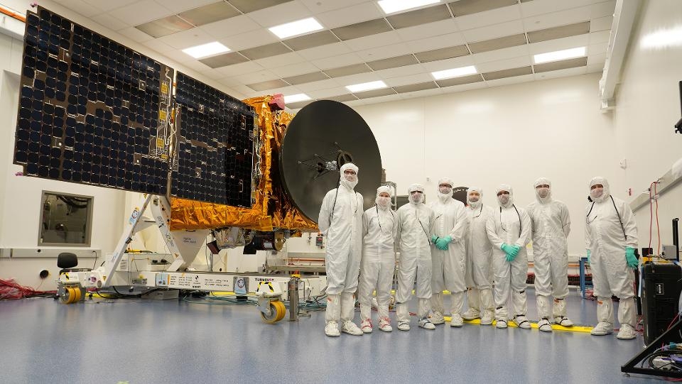
Credit: Mohammed Bin Rashid Space Center
Joining the U.S. and China in reaching for the Red Planet is the Emirates Mars Mission (EMM) – the first interplanetary exploration undertaken by an Arab nation.
EMM’s Mars Hope probe is launching on July 15 from Japan’s Tanegashima Space Center.
Hope will reach and orbit the Red Planet in February 2021.

Credit: Mohammed Bin Rashid Space Center
Mars climate
The mission of Hope is to build the first full picture of Mars’ climate throughout the Martian year and will include the study of the Martian atmosphere, the relationship between the upper layer and lower layer.
As a result, for the first time, scientists based in over 200 universities globally will have access to a holistic view of the Martian atmosphere at different times of the day, through different seasons.

Credit: Mohammed bin Rashid Space Centre
Partners
EMM and the Hope probe is a product of Emirati engineers working with partners (University of Colorado, Boulder, Arizona State University, University of California, Berkeley) to develop the UAE’s spacecraft design, engineering and manufacturing capabilities.
Mars Hope is a fully autonomous spacecraft, carrying three instruments to measure Mars’ atmosphere and weighing some 2,976 pounds (1,350 kilograms).
The scientific team for the mission is 90% female, and 100% Emirati – another first.
The Mars Hope Probe will reach Mars orbit in 2021, the 50th anniversary of The Emirates, which became an independent nation on 2nd December 1971.
For more information, go to:

