Archive for the ‘Space News’ Category
 Author:
  October 10th, 2022
Next up! China’s Mengtian lab for the country’s space station.
Credit: CCTV/Inside Outer Space screengrab
China’s next step in building out the country’s space station is nearing launch.
The Mengtian space lab has been fueled up for upcoming launch stated the China Manned Space Agency (CMSA) on Monday.
Scientific equipment carried in the Mengtian lab will be utilized for studying microgravity and carrying out experiments in fluid physics, materials science, combustion science and fundamental physics.

In-construction: China’s space station.
Credit: CMSA/CCTV/Inside Outer Space screengrab
According to the state-run Xinhua news agency a pre-launch operation was conducted on Sunday.
Launch date
The CMSA added that assembly and tests of the spacecraft were completed after its arrival at the Wenchang Spacecraft Launch Site in the southern province of Hainan.
Prior to launch, a joint check of system functions with the lab’s Long March-5B Y4 carrier rocket will be carried out.

Wrapped up Mengtian Laboratory Module.
Credit: CMS

Credit: The Aerospace Corporation
Reportedly, launch of the Mengtian module is slated for October 31, 2022. As was the case for the Wentian lab module launch, the Long March-5B Y4’s core stage is apparently headed for an uncontrolled re-entry – a fall of hardware that can cause worries to populations below.
At this moment, China’s in-construction Tiangong space station complex is composed of the Tianhe core module, the Wentian lab module, the Tianzhou-4 cargo vessel and the Shenzhou-14 crewed spaceship.
If all goes according to plan, China’s orbital space complex is to be completed by year’s end.
Go to this China Central Television (CCTV) video spotlighting the soon-to-fly lab module at:
 Posted in

Credit: Red Bull Stratos
Ten years ago, Austrian Felix Baumgartner made one small step from the edge of space. That resulting giant leap saw him plunge to Earth faster than the speed of sound.
The Red Bull Stratos effort proved that a human could break the speed of sound in freefall, with Baumgartner setting numerous benchmarks including three official world records: Maximum Vertical Speed (1,357.6kmh, 843.6mph/Mach 1.25), Highest Exit (jump) Altitude (38,969.4m, 127.852.4ft) and Vertical Distance of Freefall (36,402.6m, 119,431.1ft.
A new documentary is being released on October 14 — “SPACE JUMP: How Red Bull Stratos Captured the World’s Attention” – is to premier on Red Bull TV.

Credit: Red Bull Stratos
Years of work
The video documents the enterprising project and the spectacular jump on Friday 14, October 2022. On that date, Baumgartner launched from Roswell, New Mexico and ascended to the stratosphere in a helium balloon and made the jump. The event was the culmination of years of work by a world-leading team of experts.
“For the first time, fans and industry experts give their perspectives, as well as those who made it happen; from the technical project director, to one of the world’s biggest internet giants, whose servers reached near-breaking point to sustain the number of viewers, and from the world record holder himself, Baumgartner,” explains a Red Bull Stratos statement.

Credit: Red Bull Stratos
Life support in space
Given more than 5 years of development, the team took head-on the challenge of dealing with life support in space; space suits now offer better mobility, and new protocols exist to protect the lives of aviators exposed to high altitude.
“The effect that it had globally on education and on the next generation wanting to become aerospace or flight test engineers was huge,” says technical project director Art Thompson. “Additionally, the life support system that we designed on the capsule we used that technology and data to change the configuration for life support for [high altitude jets including] the U-2.”
For more information on Red Bull TV, go to:
https://www.redbull.com/us-en/discover
Get the Red Bull TV app for free at:

Credit: Jinzhu Ji. et al.
China has made available what it terms as “the first 1:2,500,000-scale global geologic map of the Moon.”
Published in the Science Bulletin (August 15, 2022), the map provides a state-of-the-art illustration of impact basins, craters, rocks, and structures of lunar surface, which reveals the geological processes and evolution of the Moon.
“For further investigation and to make the best use of the map, the geodatabases of the map will be publicly accessible,” according to lead author of the paper, Jinzhu Ji, a lecturer at School of Mining, Inner Mongolia University of Technology and visiting scholar at Center for Lunar and Planetary Science, Institute of Geochemistry, Chinese Academy of Sciences.

Credit: Jinzhu Ji. et al.
Unprecedented integrative product
“As unprecedented integrative product of lunar exploration results, the 1:2,500,000-scale lunar geologic map will play important role in the scientific study of the Moon and lunar exploration in the future,” Jinzhu and colleagues explain.
“With 10 years of endeavors, the experience we learned from this lunar mapping project lays the foundation for mapping other planets,” the research team adds.
To access the paper — “The 1:2,500,000-scale geologic map of the global Moon” — go to:
https://www.sciencedirect.com/science/article/pii/S2095927322002316?via%3Dihub

Credit: Visual Capitalist
Visual Capitalist has created an animated map of where here to find water on Mars.
The hunt for water on the Red Planet has always been a point of interest for researchers.
According to a Visual Capitalist posting:
Earth has life almost everywhere water exists. Water is an ideal target for finding lifeforms, like microbes, that may exist on other planets.
And if Mars is to become a future home, knowing where water exists will be necessary for our survival.
Both NASA and the European Space Agency (ESA) have special instruments searching for water on the red planet. After 10 years of in-depth investigation, their latest findings suggest a new “water map” for Mars.

The image is from ‘Hidden Valley’ in Gale Crater on Mars. Very fine-grained sediments, which slowly fell down through the water, were deposited right at the bottom of the crater lake. The sediment plates at the bottom are level, so everything indicates that the entire Gale Crater may have been a large lake.
Credit: NASA/JPL, MSSS
Where Did the Water Go?
Many people know Mars as a dry and dusty planet, but it hasn’t always been that way.
Approximately 4.1 to 3.8 billion years ago, Mars had a massive ocean called Oceanus Borealis. It dominated the northern hemisphere of the planet. Specific planetary conditions at that time let water exist on its surface. Changes in temperature, climate, and geology over the years gradually pushed water out to the atmosphere or into the ground.
Up to 99% of this ocean water is trapped within the planet’s crust, locked within special rocks called hydrous minerals.

Mosaic of the Valles Marineris hemisphere of Mars composed of 102 Viking Orbiter images of this huge feature on the Red Planet.
Credit: NASA, USGS, Viking Project
Hydrous Minerals
Hydrous minerals are essentially rocks that have water (or its two main elements, hydrogen and oxygen), incorporated into their chemical structure.
There are four main classes of hydrous minerals: silicates, sulfates, silicas, and carbonates. While these minerals look pretty similar to the naked eye, their chemical compositions and structural arrangements vary. They are detectable by sophisticated equipment and can tell scientists how water geologically changes over time.
The new water map of Mars actually highlights the location of these hydrous minerals. It is a geological map of the rocks that are holding what remains of Mars’s ancient ocean.
Other Sources of Water on Mars
Despite being a “graveyard” for the bulk of the planet’s ocean, hydrous minerals are not the only source of water on Mars.
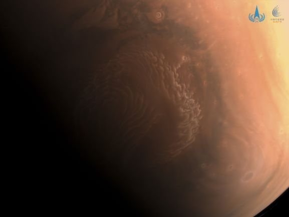
A color image taken by the Tianwen-1 orbiter’s medium-resolution camera is of Mars’ north pole region.
Water ice is present at both of Mars’s poles. The northern polar ice cap contains the only visible water on the planet, while the southern pole covers its water with a frozen carbon-dioxide cap.
In 2020, radar analyses suggested the presence of liquid water, potentially part of a network of underground saltwater lakes, close to the southern pole. In 2022, new evidence for this liquid water suggested that the planet may still be geothermally active.
More frozen water may be locked away in the deep subsurface, far below what current surveying equipment is able to inspect.
Mapping Out the Next Missions
The new water map is highlighting areas of interest for future exploration on Mars.

ESA Exomars robot.
Credit: ESA
There is a small chance that hydrous minerals may be actively forming near water sources. Finding where they co-exist with known areas of buried frozen water provides possible opportunities for extracting water.
ESA’s Rosalind Franklin Rover will land in Oxia Planum, a region rich in hydrous clays, to investigate how water shaped the region and whether life once began on Mars.
Many more investigations and studies are developing, but for now, scientists are just getting their toes wet as they explore what hydrous minerals can tell us of Mars’s watery past.
To access the Visual Capitalist Mars water map, go to:
https://www.visualcapitalist.com/a-new-water-map-of-mars/

Credit: Breakthrough Listen
What is the potential for geopolitical fallout from successful contact with intelligent life elsewhere?
There have been researchers that argue that “passive” search for extraterrestrial intelligence (SETI) involves an underexplored yet significant risk. The hazard stems from state-level actors that could seek to gain an “information monopoly” on communications with ET. These attempts could lead to international conflict and potentially disastrous consequences, so the argument goes.

The Atacama Large Millimeter/submillimeter Array (ALMA) in northern Chile’s Atacama desert.
Credit: ESO/B. Tafreshi (twanight.org)
Those views have been expressed by Kenneth Wisiana of the Center for Space Research, The University of Texas at Austin, and John Traphaganb (W&T) with the university’s Department of Religious Studies and Program in Human Dimensions of Organizations. Their thoughts can be found in the paper – “The Search for Extraterrestrial Intelligence: A Realpolitik Consideration” – at:
https://www.sciencedirect.com/science/article/abs/pii/S0265964620300199?via%3Dihub#!
Unlikely to work
“We find several flaws in their analysis,” retorts lead author, Jason Wright, a professor of astronomy and astrophysics at Penn State, in a new paper: “Geopolitical Implications of a Successful SETI Program.”
“While we do not dispute that a realpolitik response is possible, we uncover concerns with W&T’s presentation of the realpolitik paradigm, and we argue that sufficient reason is not given to justify treating this potential scenario as action-guiding over other candidate geopolitical responses.”

The late Frank Drake with cosmic equation to gauge the presence of intelligent life in the cosmos. The Drake Equation identifies specific factors believed to play a role in the development of civilizations in our galaxy.
Credit: SETI Institute
The new paper explains that it is highly unlikely that a nation could successfully monopolize communication with ET.
“Ultimately, we find that not only are W&T’s recommendations unlikely to work,” Wright and colleagues report, “they may also precipitate the very ills that they foresee. As an alternative, we recommend transparency and data sharing (which are consistent with currently accepted best practices), further development of post-detection protocols, and better education of policymakers in this space.”
To view the paper – “Geopolitical Implications of a Successful SETI Program” – go to: https://arxiv.org/abs/2209.15125
Also, go to this article focused on this complex topic at:
Credit: CCTV/Inside Outer Space screengrab
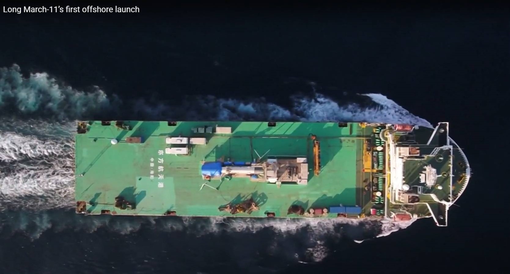
The first offshore launch of China’s Long March-11 took place Friday, lofting two spacecraft — the CentiSpace-S5/S6 test satellites — from an offshore site.
According to China Central Television (CCTV) the satellites will be used to monitor the performance of the global navigation satellite system in real time, and carry out navigation augmentation and intersatellite laser communication tests.
This was the fourth sea launching of Long March-11 rocket – but with a difference. This mission took place only a couple of miles (three kilometers) away from the shore.

Credit: CCTV/Inside Outer Space screengrab
To date, the Long March-11 rockets have carried out 10 inland launches and four sea launches successfully. China conducted four seaborne launches using its Long March-11 carrier rocket between June 2019 and October 2022, CCTV reports, laying a foundation for regular seaborne launch missions in the days to come.

Credit: CCTV/Inside Outer Space screengrab
Shorten launch cycle
Dong Xiaobin, deputy chief designer of Long March-11 rocket project with China Academy of Launch Vehicle Technology, told CCTV: “Compared with open sea, offshore areas are more suitable for rocket launch. The ship [that carried the rocket] can head out and come back within one day, unlike previous launches which needed days of sailing. This helps shorten the launch cycle.”

Credit: CCTV/Inside Outer Space screengrab
Zhang Ming, deputy chief designer of the Long March-11 rocket project with the First Academy of China Aerospace Science and Technology Corporation, told CCTV: “There are different launch sites to choose from for seaborne launch, making it easier to find a safe area for rocket debris to land. Therefore, it’s more convenient than land launch.”
Go to the video of the first offshore launch of the Long March-11 launch vehicle at:

Earth’s Moon, a dusty denizen of deep space. How as it formed?
Credit: NASA/Jeff Williams
The Moon is usually thought to have coalesced from the debris ejected by a giant impact onto the early Earth, hit by a Mars-sized impactor dubbed “Theia.”
But new research suggests giant impacts can immediately place a satellite with similar mass and iron content to the Moon into orbit far outside Earth’s “Roche limit.”
That limit is the distance from a celestial body within which a second celestial body — held together only by its own force of gravity — will disintegrate because the first body’s tidal forces exceed the second body’s gravitational self-attraction.
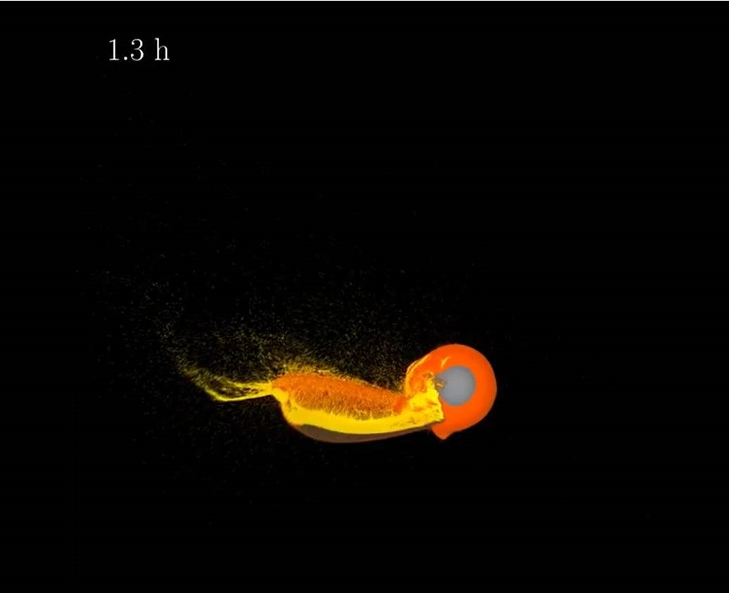
However, high-resolution simulations have revealed how giant impacts can immediately place a satellite into a wide orbit with a Moon-like mass and iron content.
Credit: Jacob Kegerreis, et al.
“The resulting outer layers rich in proto-Earth material and the new options opened up for the initial lunar orbit and internal structure could help to explain the isotopic composition of the Moon and other unsolved or debated lunar mysteries,” explains the research paper – “Immediate Origin of the Moon as a Post-impact Satellite” – appearing in The Astrophysical Journal Letters
The research is led by Jacob Kegerreis in the physics department at the Institute for Computational Cosmology, Durham University in the UK.
Impact scenarios – hotly debated
Past models struggle to explain the similar isotopic compositions of Earth and lunar rocks at the same time as the system’s angular momentum, and the details of potential impact scenarios are hotly debated, Kegerreis and colleagues report.
“Above a high resolution threshold for simulations, we find that giant impacts can immediately place a satellite with similar mass and iron content to the Moon into orbit far outside Earth’s Roche limit. Even satellites that initially pass within the Roche limit can reliably and predictably survive, by being partially stripped and then torqued onto wider, stable orbits,” the research team explains.

Credit: Jacob Kegerreis, et al.
The concept of immediate formation opens up new options for the Moon’s early orbit and evolution, the researchers add, including the possibility of a highly tilted orbit to explain the lunar inclination, and offers a simpler, single-stage scenario for the origin of the Moon.
This new data could help explain the isotopic composition of the Moon and other unsolved or debated lunar mysteries, Kegerreis and colleagues report.
To read the full paper – “Immediate Origin of the Moon as a Post-impact Satellite” – go to:
https://iopscience.iop.org/article/10.3847/2041-8213/ac8d96/pdf
Also, go to these striking videos at:
http://icc.dur.ac.uk/giant_impacts/moon_wide_orbit_slice.mp4
http://icc.dur.ac.uk/giant_impacts/moon_wide_orbit_houdini.mp4

Curiosity Chemistry & Camera (ChemCam) Remote Micro-Imager (RMI) photo acquired on Sol 3613. October 5, 2022.
Credit: NASA/JPL-Caltech/LANL
NASA’s Curiosity Mars rover at Gale Crater is now performing Sol 3614 duties.
The Curiosity team continues with the “Canaima” drill campaign, reports Elena Amador-French, science operations coordinator at NASA’s Jet Propulsion Laboratory.
A recently scripted two-sol plan (Sols 3614-3615) was set to provide a first look at the minerals present within this sample from drill hole #36, adds Amador-French.
This is complementary but different than the chemical compositions provided by the robot’s Chemistry and Camera (ChemCam) and the Alpha Particle X-Ray Spectrometer (APXS) pre-drilling.
Curiosity Mast Camera Right photo taken on Sol 3612, October 4, 2022 .
Credit: NASA/JPL-Caltech/MSSS
Diffraction pattern
The Chemistry & Mineralogy X-Ray Diffraction/X-Ray Fluorescence Instrument (CheMin) uses X-ray diffraction to confirm crystalline mineralogy, they direct a beam of X-rays, as fine as a human hair, through the drilled sample, Amador-French points out.

Curiosity Front Hazard Avoidance Camera Right B image taken on Sol 3613, October 5, 2022.
Credit: NASA/JPL-Caltech
“The X-rays interact with the material and then diffract at specific angles. This creates a diffraction pattern that can be used to uniquely identify the crystalline minerals present,” Amador-French adds. “Understanding the crystal structure provides a clearer picture of the environment in which they formed and how they’ve been altered subsequently.”
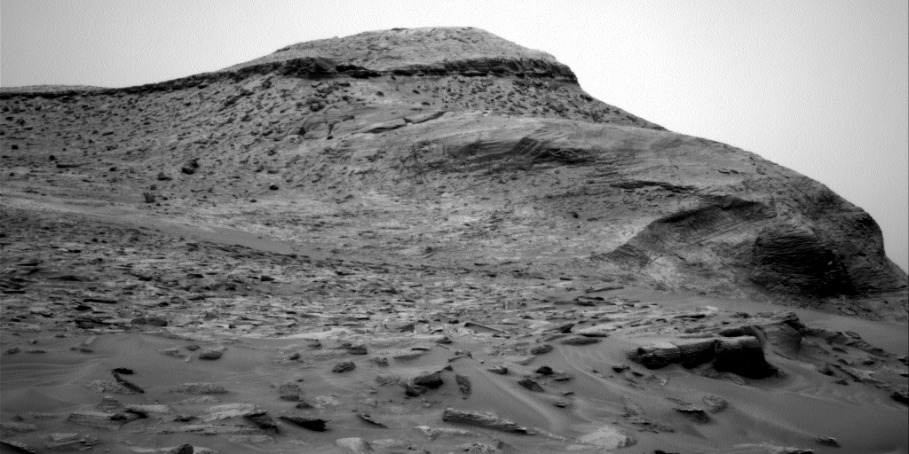
Curiosity Right B Navigation Camera image taken on Sol 3613, October 5, 2022.
Credit: NASA/JPL-Caltech
Sample cup
After delivering sample to CheMin with Curiosity’s robotic arm, CheMin will work through the night integrating and building a robust diffraction pattern to be sent back to Earth in the morning.
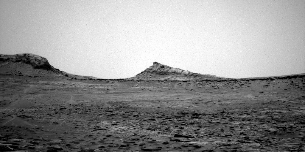
Curiosity Right B Navigation Camera image taken on Sol 3613, October 5, 2022.
Credit: NASA/JPL-Caltech
The robot’s Sample Analysis at Mars (SAM) Instrument Suite instrument will also prepare its sample cup to receive sample, pending the results from CheMin.
“In addition to these activities, we also used ChemCam to look inside the drill hole and the drill tailings left behind before they could be potentially mobilized by wind,” Amador-French concludes.
“As is a common theme, we continue with our regular cadence of environmental monitoring.”

New image shows 36th drill spot. Curiosity Front Hazard Avoidance Camera Right B photo taken on Sol 3612, October 4, 2022.
Credit: NASA/JPL-Caltech
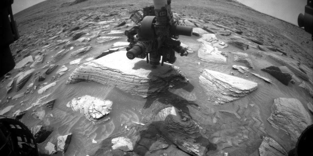
Curiosity Front Hazard Avoidance Camera Right B photo taken on Sol 3612, October 4, 2022.
Credit: NASA/JPL-Caltech
NASA’s Curiosity Mars rover at Gale Crater is now performing Sol 3613 duties.
Over last weekend, Curiosity took compositional measurements of the “Canaima” bedrock target in order to determine if the target merits collecting drilled sample, reports Elena Amador-French, a science operations coordinator at NASA’s Jet Propulsion Laboratory.
Stability of the rock
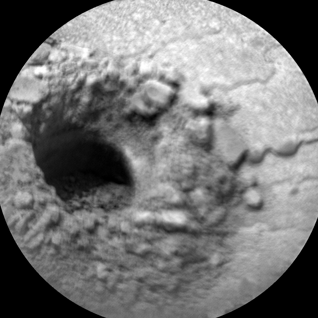
Curiosity Chemistry & Camera (ChemCam) Remote Micro-Imager (RMI) photo acquired on Sol 3613, October 5, 2022.
Credit: NASA/JPL-Caltech/LANL
Concurrently, the engineering team took preload measurements to determine the stability of the rock for drilling, with science and engineering teams later reviewing the information downlinked.

Curiosity Left B Navigation Camera image taken on Sol 3612, October 4, 2022.
Credit: NASA/JPL-Caltech
“We’re excited to approve moving forward with drilling Canaima,” Amador-French adds.
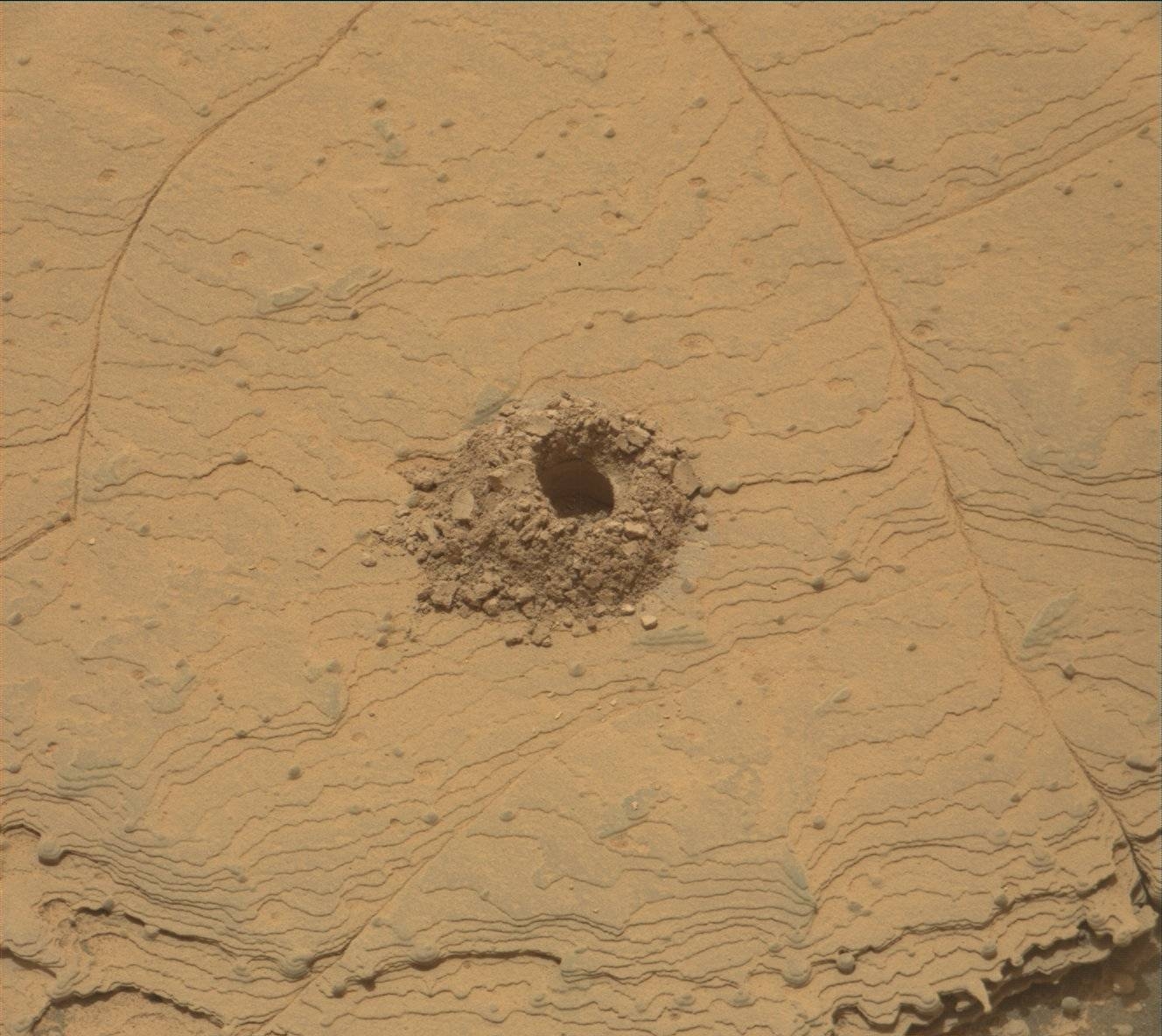
In a new plan, rover planners carefully sequenced the motions the rover’s arm and turret will make to drill to approximately 35 mm depth, creating a ~1.6 cm diameter hole (a little less than the diameter of a US dime).
“This seemingly small volume of drilled sample will be enough to ingest in our internal analytical laboratories to identify mineralogy with CheMin [Chemistry & Mineralogy X-Ray Diffraction/X-Ray Fluorescence Instrument],” Amador-French notes, “and search for organics with SAM [Sample Analysis at Mars (SAM) Instrument Suite] later this week, should the team choose to!”
Power intensive
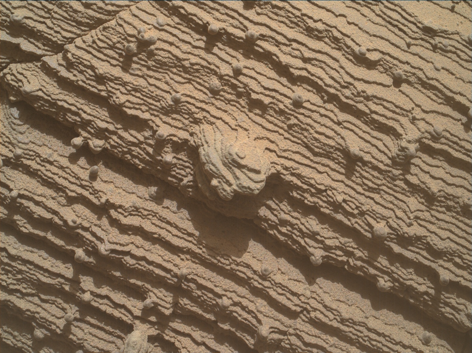
Using an onboard focusing process, the Mars Hand Lens Imager (MAHLI) acreated this product by merging two to eight images previously taken by the MAHLI, located on the turret at the end of the rover’s robotic arm.
Credit: NASA/JPL-Caltech/MSSS
These future measurements with CheMin and SAM are very power intensive.
“Even though we are not certain we will perform them,” Amador-French points out, the Mars research team was careful to conserve power in the event that they are used. “We therefore limited today’s plan to drilling activities and our regular environmental monitoring measurements and extra imaging to monitor for changes in dust levels in our atmosphere.”
Amador-French concludes: “Looking forward to our 36th drill hole!”

Using an onboard focusing process, the Mars Hand Lens Imager (MAHLI) created this product by merging two to eight images previously taken by the MAHLI, located on the turret at the end of the rover’s robotic arm. Curiosity performed the merge on October 1, 2022, Sol 3609.
Credit: NASA/JPL-Caltech/MSSS
Delicately thin
By the way, “Canaima,” is named for Canaima National Park in Venezuela which contains spectacular million-year-old, table-top mountains and is a UNESCO World Heritage Site.
“The observations thus far of this rock…are quite lovely,” explains Elena Amador-French, science operations coordinator at NASA’s Jet Propulsion Laboratory. “I particularly like how the layering is expressed on this rock. They are so delicately thin with more resistant nodules poking out – in what setting were they deposited and what kind of alteration have they been through since?”
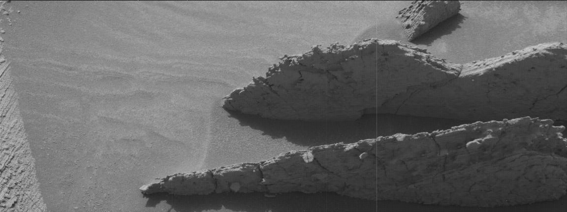
Curiosity Mast Camera Left image acquired on Sol 3610, October 2, 2022.
Credit: NASA/JPL-Caltech/MSSS
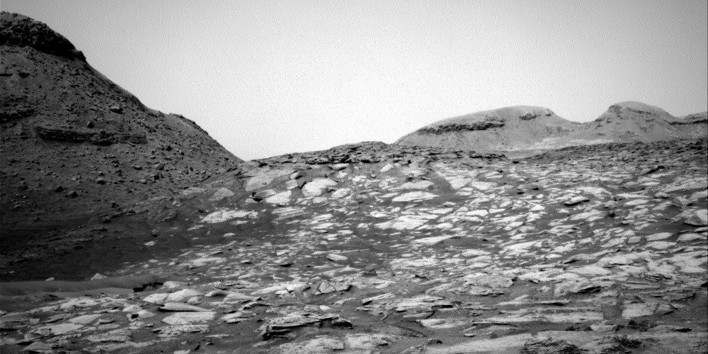
Curiosity Right B Navigation Camera image taken on Sol 3610, October 10, 2022.
Credit: NASA/JPL-Caltech

Wernher von Braun with his 1952 design of a lunar lande.
Credit: US Information Agency
Blowing off the dust of history regarding architecture on the Moon by the U.S. and Soviet space programs offers unique perspectives.
One example of engineering and management capabilities is the development and inclusion of the deployable lunar roving vehicle (LRV). Other examples include a US project Horizon – a study to set up a lunar military outpost conducted in 1959.
A new research paper – “Reflections on early lunar base design – From sketch to the first moon landing” – offers a glimpse into the past, to take a new look at Moon bases.
The paper was written by two space architects, Sandra Haeuplik-Meusburger and Olga Bannova, published in the journal Icarus.
Objectives: may change with time
Based on a historical overview of achievements, lunar architectural and design approaches offered design strategies for creating space systems, spacecraft and habitats for follow-on decades, the paper notes.
“History taught us that space mission scenarios and objectives often may change with time,” the researchers point out. Therefore, designers and architects looked for adaptable interior arrangements in order to meet various crew needs while complying with launch and landing restrictions.

Soviet-era crewed lunar lander design.
Credit: Sandra Haeuplik-Meusburger, et al.
“Developing a sustainable human exploration on the Moon proposes living off the lander during first surface missions and transferring to a larger habitat with a larger crew when it becomes feasible for the mission success,” the paper adds.
Capable of modifications
Multi-staged approaches to establishing surface settlements on the surface of the Moon have been long proposed.

Illustration of Moon Village concept
Credit: ESA/P. CARRIL
“After successful but expensive Apollo sortie missions, it became clear that sustainable lunar habitation and operations will require reusable systems and elements, where every surface element is designed for continuous operations and capable of modifications for diverse missions’ needs,” the paper explains.
To read – “Reflections on early lunar base design – From sketch to the first moon landing” – go to:
https://www.sciencedirect.com/science/article/pii/S0094576522004866?dgcid=raven_sd_aip_email#!

