Author Archive

Credit: CCTV
China’s latest set of space travelers — astronauts Jing Haipeng and Chen Dong – held a press briefing on Wednesday. It was their first public appearance since the return of the Shenzhou-11 manned spacecraft on November 18, after a three-week quarantine period.
The Shenzhou-11 piloted spacecraft blasted off on Oct. 17, 2016, then latched up with the Tiangong-2 space lab.
Rookie report
Chen was quick to note that his commander took care of the rookie flyer.
“Once in orbit, he told me about how to control the body, and advised me to take more rest so as to adapt to the weightless environment as quickly as possible. In the days up there, he suggested to me to eat more and often checked about my sleep quality,” Chen said. “He would hand me a towel when he saw me sweat while riding the bike for exercise. He would also hand me some water, warm water to my mouth. For bed time, he would tell interesting stories about his previous flights, including stories while he served in the air force. He was very considerate taking care of me, in every respect.”

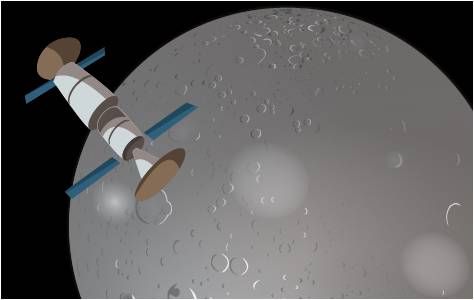
Image snagged by the Banxing-2 microsatellite that was deployed from the Tiangong-2 shows Shenzhou-11 (above) and Tiangong-2 docked in orbit on October 23, 2016.
Credit: Chinese Academy of Sciences via GBTimes
Perfect mission
According to CCTV-Plus, for his part, Jing said his third space travel was relaxing and he really enjoyed it.
“We had been trained numerous times for the mission before we went into space. Chen Dong didn’t make even a slightest error up there, that’s for one; and for two, he made no mistake when we were implementing our mission in space,” Jing recounted. “Therefore, we have met the overall requirement of the mission and the task, and lived up to the expectations of our superiors. It is zero error and zero slip. It is, therefore, a perfect mission, with a perfect result through a perfect process,” he said.
The Chinese space adventurers spent 33 days in space, a record in China’s space program. They also conducted nearly 40 experiments while in orbit. Both of them are in good condition after rounds of physical therapy and exercise.
To view video files on the astronaut press meeting, go to:
Also, go to:
http://cd-pv.news.cctvplus.com/2016/1208/8038103_Preview_1481201915729.mp4
Credit: ESA/DLR
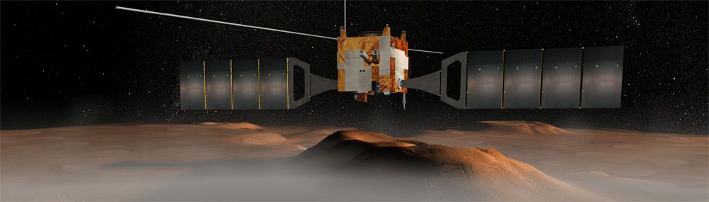
Take a trip down Mawrth Vallis – a dried-up outflow channel Mars.
This visual trek comes courtesy of the High Resolution Stereo Camera (HRSC) operated by the German Aerospace Center (Deutsches Zentrum für Luft- und Raumfahrt; DLR) on board the European Space Agency’s Mars Express spacecraft.

The first all-European mission to another planet – Mars Express – was launched on June 2, 2003. On board the spacecraft was the High Resolution Stereo Camera (HRSC), which was developed by the DLR Institute of Planetary Research. HRSC was the first camera system on a planetary mission to systematically acquire high-resolution, three-dimensional image data in color.
Credit: Deutsches Zentrum für Luft- und Raumfahrt e. V. German Aerospace Center (DLR)
Digging down
Mawrth Vallis is one of the potential targets for the second part of ESA’s ExoMars mission (2020), in which a rover will analyze rock samples down to a maximum depth of two meters.
The valley may have been capable of supporting life in the past. Some scientists even think it is possible that traces of life might still exist in the valley’s lower layers.

ExoMars 2020 rover.
Credit: ESA
Scientists from the Freie Universität Berlin have created a simulated overflight animation along the course of the valley from the digital terrain model calculated at the DLR Institute of Planetary Research.
Friendly to life?
Mawrth Vallis is thought to be an ideal locale for the search for life on Mars based on a couple of reasons:

Mawrth Vallis is one of four candidate landing sites under consideration for the ExoMars 2018 mission. It is one of the oldest outflow channels on Mars, at least 3.8 billion years old.
Credit: ESA/DLR/FU Berlin & NASA MGS MOLA Science Team
- Firstly from the volume of hydrated (water-retaining) minerals that can be identified using the cameras and spectrometer data from the various Mars spacecraft in orbit around the planet.
- Secondly, it is known from Earth that such clay minerals form in comparable – neither acidic nor alkaline – water. Such environmental conditions are also thought to be particularly friendly to life.
Visual field trip
Mawrth Vallis is roughly Approximately 373 miles (600 kilometers) long and up to 1.2 miles (two kilometers) deep.
Numerous impact craters and light and dark deposits can be seen. The light, layered sediments are among the largest deposits of sheet silicates on Mars. These clay minerals are found in numerous places and are an indication that liquid water existed in this region.
Mawrth Vallis is a potential ExoMars 2020 landing site target that is under consideration, as are Oxia Planum, Aram Dosum and Hypanis Vallis.
For your visual field trip, go to:
http://www.esa.int/spaceinvideos/Videos/2016/12/Fly_over_Mawrth_Vallis

Big eye in space – the James Webb Space Telescope.
Credit: NASA
The James Webb Space Telescope (JWST) is one of NASA’s most complex and expensive projects, at an anticipated cost of $8.8 billion.
Now in the midst of significant integration and testing that will last the two remaining years until the planned October 2018 launch date, the JWST project will need to continue to address many challenges and identify problems, some likely to be revealed during its rigorous testing.

Credit: GAO
According to a new Government Accountability Office (GAO) report, “the continued success of JWST hinges on NASA’s ability to anticipate, identify, and respond to these challenges in a timely and cost-effective manner to meet its commitments.”
Independent analysis
This is the fifth report from the GAO on JWST.
This report assesses the extent to which JWST is (1) managing technological and developmental challenges to meet its schedule commitments, and (2) meeting its committed cost levels and managing its workforce plans.

Credit: NASA
To conduct this work, GAO reviewed monthly JWST reports, reviewed relevant policies, conducted independent analysis of NASA and contractor data, and interviewed NASA and contractor officials.
Resources
Take a look at this GAO review:
James Webb Space Telescope: Project Meeting Cost and Schedule Commitments but Continues to Use Reserves to Address Challenges. GAO-17-71, December 7, 2016.
Go to:
Report: http://www.gao.gov/products/GAO-17-71
Highlights: http://www.gao.gov/assets/690/681471.pdf

Curiosity Mastcam Right image of rover’s drill, taken on Sol 1541, December 6, 2016.
Credit: NASA/JPL-Caltech/MSSS
Now in Sol 1542, NASA’s Curiosity Mars rover continues to be plagued by a drill anomaly issue.
Investigation of the issue is continuing with more diagnostic tests planned.
“Again, no mobility or other arm activities will be planned, so the science team added only remote sensing observations,” reports Ken Herkenhoff of the USGS Astrogeology Science Center in Flagstaff, Arizona.
Bedrock targets
The rover’s Chemistry & Camera (ChemCam) is to be used to observe once again Hunters Beach to further investigate the chemical variations that the laser-induced breakdown spectroscopy (LIBS) instrument measured there previously.
Also on tap, ChemCam and Right Mastcam observations of bedrock targets “Sargent Mountain” and “Youngs Mountain.”
Curiosity’s Navcam and Mastcam are slated to take one more set of images at 8 AM on Sol 1543, to complete the photometry dataset started on Sol 1537, Herkenhoff adds.
Distant butte
Previously, Lauren Edgar of the USGS reported that a rover weekend plan returned some great remote sensing data, including a Mastcam image of “Ireson Hill” to investigate the stratigraphy exposed in a distant butte.

Curiosity Mastcam Right image of “Ireson Hill” taken on Sol 1539 December 4, 2016.
Credit: NASA/JPL-Caltech/MSSS
While rover engineers worked on assessing the drill fault, the science team decided to carry out remote sensing duties and change detection observations.
That plan started with ChemCam observations of “Hunters Beach” and “Gorham Mountain” to investigate the chemistry of the Murray bedrock.
“Then we’ll acquire a Mastcam tau and crater rim extinction image to characterize the amount of dust in the atmosphere, followed by a Navcam dust devil search,” Edgar says.
Movement of sand
The plan also included a series of Hazcam observations taken approximately every hour until sunset, Edgar adds, and this will provide a very thorough dataset to monitor the movement of sand based on time of day.

Curiosity Mastcam Left image taken on Sol 1541, December 6, 2016.
Credit: NASA/JPL-Caltech/MSSS
This is really important for planning Mars Hand Lens Imager (MAHLI) observations, “because we’ve noticed a lot of movement of fines through this area at this time of year, and we’ve mostly been taking MAHLI images with the dust cover closed to protect the instrument,” Edgar adds. “If we can better understand when and where the sand is most active, we can better plan MAHLI observations, and we can improve our understanding of the eolian environment.”
Eolian observations pertain to sand or rock material carried or arranged by the wind.

Credit: Eyal Gever
Put aside the sci-fi axiom that nobody can hear you scream in space…but what about laughter?
Israeli artist Eyal Gever is working on “#LAUGH (2016)” — a global collaborative art project — to be launched into Earth orbit. It is set to become the first piece of art to be fabricated on a zero-gravity 3D-printer aboard the International Space Station.
The project began in 2014, when Gever, a digital artist and entrepreneur with more than 18 years experience in developing proprietary 3D technologies, got a phone call from the private group, Made In Space. He was offered the opportunity to become the first artist to make art in space.
“What would you do if you could create art in zero gravity?” was the high-bar challenge they set for him.
Universal appeal
From the view of Made In Space, if humanity is one day soon to thrive in space, then creating art and culture in space is equally as important as sending people into space and the technology to support them.
According to Gever, he knew that the project carried onerous responsibilities and that the subject he picked would have to have universal appeal, one that was neither country nor culturally-specific.

Talented artist, Eyal Gever, is preparing first 3D printed artwork.
Credit: Eyal Gever
Crowd-sourced laughter
After working on a range of ideas, he settled on #Laugh — a 3D sculpture fabricated from a sound simulation of crowd-sourced laughter.
People from all around the world can record themselves laughing, visualize it via an app and share it with their friends.
The laughter with the most shares and re-tweets after three months will be sent to the International Space Station to be 3D-printed and then released into orbit.
“The earliest cave paintings were of human hands which were a way of proclaiming and celebrating the presence of humanity,” says Gever.
“#Laugh will be the 21st century version of that,” Gever explains, “a mathematically-accurate encapsulation of human laughter, simply floating through space, waiting to be discovered.”
Public shout-out
To create a “#Laugh star” with just the sound of your voice and/or vote for your favorite star to be created in space, go to the site below.
Note that you have until midnight on December 31, 2016 to get the most “likes” and have your star 3D-printed in space onboard the International Space Station.
To take part in the art project, go to this iTunes site:
https://itunes.apple.com/gb/app/laugh-create-art-in-space/id1166572680?mt=8
For more information on this artistic effort, go to:

Virgin Spaceship Unity (VSS Unity) touches down after flying freely for the first time after being released from Virgin Mothership Eve (VMS Eve) on December 3, 2016 in the Mojave Desert.
Credit: Virgin Galactic
The sky above the Mojave Air and Space Port in California on December 3 was the site of Virgin Galactic’s first drop test of Spaceship Unity (VSS Unity).
VSS Unity’s test flight also marks the first time that a vehicle built by Virgin Galactic’s sister organization — The Spaceship Company — has flown fully under its own control.
VSS Unity was piloted by Mark Stucky and Dave Mackay, with pilots Mike Masucci and Todd Ericsson as well as flight test engineer Dustin Mosher in the WhiteKnightTwo drop plane.
Light and slow
For this initial glide test flight, VSS Unity was flying “light and slow,” achieving a maximum speed of approximately Mach 0.6 while gliding home from an altitude of 50,000 feet.

Virgin Spaceship Unity (VSS Unity) glides for the first time after being released from Virgin Mothership Eve (VMS Eve) over the Mojave Desert on 3rd, December 3, 2016.
Credit: Virgin Galactic
The one hour 20 minute flight, particularly the 10 minutes of free flight for SpaceShipTwo, permitted “our pilots, mission controllers, and ground crew collected valuable data,” noted a Virgin Galactic press statement.
An initial look at the data as well as feedback from VSS Unit’s two pilots indicate that the flight went extremely well, according to Virgin Galactic, “but we’ll take the time to properly and thoroughly analyze the vehicle’s performance before clearing the vehicle for our next test.”
Back to the skies
The December 3 test flight was the fifth flight of VSS Unity (and the 218th flight of WhiteKnightTwo), following several recent Captive Carry flights, in which the spaceship remains attached to the mothership.
Saturday morning’s glide flight was the first of many.
“We have not yet reached the rocket powered phase of the test flight program…first we need to gather test flight data to confirm our analyses and calculations about how VSS Unity will perform in a wide variety of real-world flight conditions,” explains the Virgin Galactic statement.
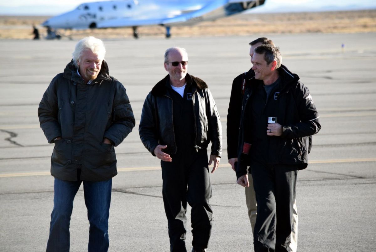
Virgin Galactic’s founder Sir Richard Branson and George Whitesides, CEO of Virgin Galactic and The Spaceship Company, congratulate Chief Pilot Dave Mackay and Test Pilot Mark Stucky after first glide flight of Virgin Spaceship Unity (VSS Unity) in Mojave Desert on December 3, 2016.
Credit: Virgin Galactic
“We’re looking forward to getting back into the skies as soon as the engineers say we are ready to do so,” concludes the Virgin Galactic press statement.
2014 mishap
The first drop test of the craft comes after a major mishap involving a SpaceShipTwo vehicle back in October 2014.
That incident was caused by premature deployment of the craft’s feather reentry tail section during powered flight. That mistake lead to breakup of the vehicle and death of the craft’s co-pilot, Michael Alsbury, with the pilot, Peter Siebold, receiving severe injuries. He successfully deployed his parachute after the craft disintegrated in the air.
The Virgin Galactic SpaceShipTwo/WhiteKnightTwo system is intended to offer commercial, pay-per-view suborbital flight to the edge of space, with tourists departing and landing at Spaceport America in New Mexico.
For video and imagery of the drop test, go to:
http://www.image.net/virgingalactic

Mars true-color globe showing Terra Meridiani.
Credits: NASA/Greg Shirah
NOTE: Frank White is the author of the seminal work — The Overview Effect: Space Exploration and Human Evolution — first published in 1987, re-issued in 1998 with a third edition of the book released in 2014.
The Overview Effect is an on-going phenomenon that impacts various aspects of world culture in the New Space Age. One of the principal areas of shifted awareness that accompanies the Overview Effect is our view of Earth’s environment, a shift that has affected space travelers circling our planet, as well as at lunar distance.
As part of my research for writing the new National Geographic book, Mars: Our Future on the Red Planet, I asked Frank White to consider a Mars Overview Effect.
Here is a new essay by White on this topic, and I’m pleased to publish it on my Inside Outer Space website:
New Thoughts on Mars
By Frank White
Mars has fascinated human beings for centuries, and the question is, “Why?” Our connection with the Red Planet makes us wonder if there is a “Mars Effect” that draws us to it. This would different from the “Overview Effect,” which resulted from seeing the Earth from orbit or the moon.
Our attraction to Mars began with viewing it through telescopes and has continued as we have sent orbiters and rovers there. We have always seen it from a distance, and we will continue to see it from a distance until we send our first astronauts to its surface.

Percival Lowell and his depiction of Martian canals, shown in this sketch of the Red Planet, circa 1895.
Credit: Lowell Observatory
From the beginning, people have imagined that they were seeing things there. The Italian astronomer Giovanni Schiaparelli saw lines on the surface that he called canali, (channels) which was mistranslated in English as “canals.” This in turn led to an entirely fanciful story told by the American astronomer Percival Lowell about Martians who were running out of water and desperately digging canals to survive.
This is not the place to recount the entire history of human fascination with Mars, which would include, of course, the famous “invasion” by Martians in 1938, staged by Orson Wells, which terrified a nation and set the tone for tales of extraterrestrial attacks. However, it is worth mentioning that the “father of modern rocketry,” Robert Goddard, was said to have had a vision of Mars while sitting in a cherry tree, and this led to his invention of liquid-fueled rockets.
Influence on the human psyche
Today, people are still seeing things on Mars, this time through the eyes of spacecraft orbiting the planet, and rovers on its surface. Perhaps most famous is the “Face on Mars,” which looks like the Sphinx staring up from the surface. Since rovers like Spirit, Opportunity, and Curiosity have been snapping multiple photos of the environment around them, people have been reporting everything from strange lights to spacecraft to beings.
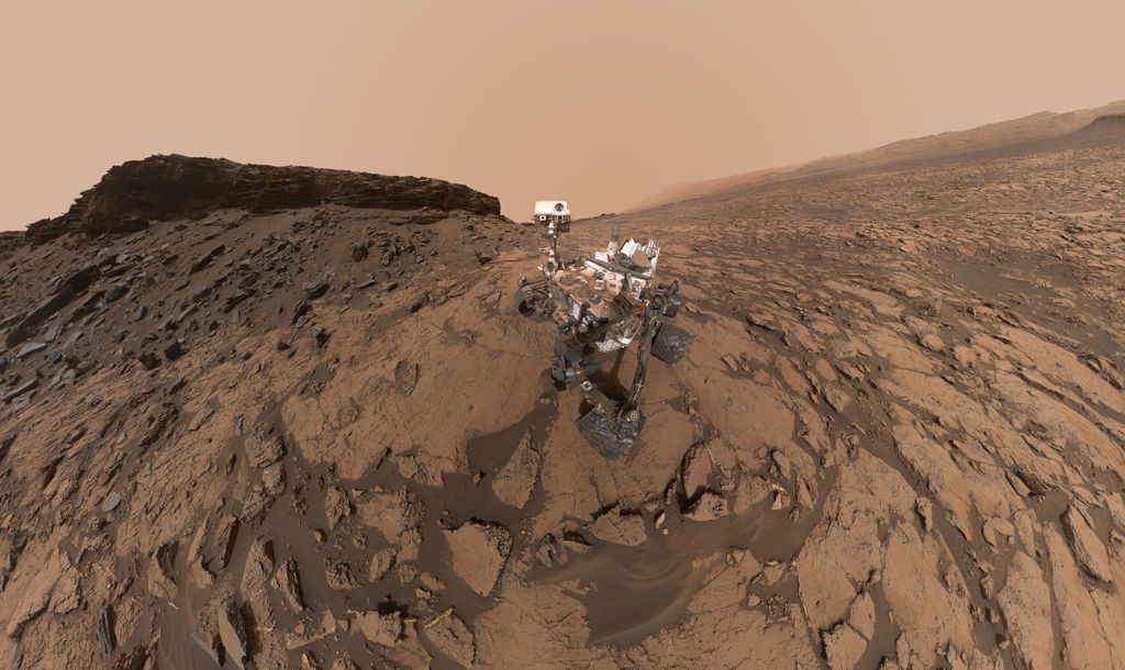
Self-portrait shows NASA’s Curiosity Mars rover at the “Quela” drilling location in the scenic “Murray Buttes” area on lower Mount Sharp. The panorama was stitched together from multiple images taken by the Mars Hand Lens Imager (MAHLI) camera at the end of the rover’s arm. The scene combines approximately 60 images
Credit: NASA/JPL-Caltech/MSSS
Being enticed to go to Mars by seeing intriguing features through telescopes or rover cameras is a powerful component of the “Mars Effect,” which seems to draw people to a place so far away from home. Ultimately, this influence of Mars on the human psyche remains a mystery, and perhaps that is as it should be, at least for now.
Overview moments
However, as one who is interested primarily in the view of the Earth from space and in space (“The Overview Effect”), I am focused more on what space travelers will see of their home planet as they move farther away and closer to Mars. There will be several “Overview Moments” that we can expect as the human “Journey to Mars” gets underway.
The first will be when the astronauts go beyond the moon and see the Earth from a distance greater than 240,000 miles. At that point, the Earth will still be visible as a planet, but in a new and different way. It will be unique, as was the moment when Yuri Gagarin went into orbit and became the first person to directly experience the Overview Effect, and the time when the Apollo 8 astronauts turned their cameras around and showed us the whole Earth (and, later, Earthrise).
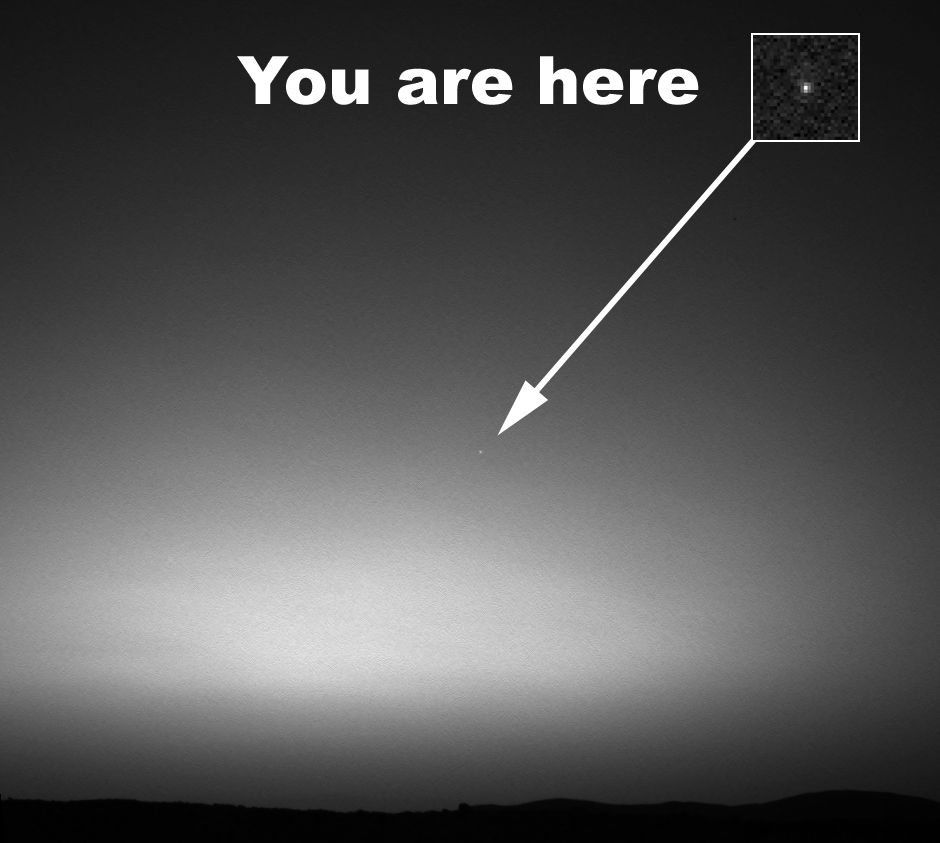
Earth From Mars image was captured in 2004 by NASA’s Mars Exploration Rover Spirit on March 8, 2004.
Credit: NASA/JPL/Cornell/Texas A&M
The second will be that moment when we can no longer see the Earth as a planet, but more like an unblinking star, the way we now see Mars. In other words, we will need a telescope to discern any details on our own planet. This will take place at some point on the journey outward, and will become solidified in the mind when astronauts land on the surface and the Earth is a constant in the Martian sky.
Copernican Perspective
Nick Kanas, MD, a psychiatrist, has called attention to “Earth out of view,” and points out that it will be an unprecedented moment in history. He also notes that we do not know what the impact of the experience will be. I agree with that statement. We should note that the rovers have sent back pictures of the Earth as seen from the surface of Mars, so that will not be new to people who remain behind, but it will be significant for the first astronauts who make the journey.

Credit: Bob Sauls – XP4D/Explore Mars, Inc. (used with permission)
Regardless, this will be the time when the a new shift in perspective, which I have called the Copernican Perspective, takes hold, and the humans having the experience began to feel more a part of the solar system and less a part of the Earth.
While there are many fascinating aspects of our efforts to become a multi-planet species, including how we can survive on a planet like Mars, we should not lose sight of the fact that the most significant aspects of space exploration may well be continuously unfolding understandings of the human place in the universe – a fundamental and irreversible shift in our collective identity.
For information on the book: The Overview Effect: Space Exploration and Human Evolution, go to:
For the 2014 edition, go to:
http://arc.aiaa.org/doi/book/10.2514/4.103223
For information on the Overview Institute, go to:
http://www.overviewinstitute.org/

Curiosity Front Hazcam Right B image taken on Sol 1536, December 1, 2016.
Credit: NASA/JPL-Caltech
The report from ground zero on Mars is that the Curiosity rover has encountered a drill fault.
The robot is now in Sol 1537, and reports Ken Herkenhoff of the USGS Astrogeology Science Center in Flagstaff, Arizona:
“Unfortunately, the much-anticipated rotary-only drilling experiment did not even start due to a drill fault that is currently being investigated,” he reports.

Curiosity Mastcam Right image of drill taken on Sol 1537, December 2, 2016.
Credit: NASA/JPL-Caltech/MSSS
Scramble plan
This type of drill fault appears to be unrelated to the previous short circuits during percussion, but more study is needed, Herkenhoff adds. “So the tactical planning team had to scramble to put together a plan while the drill experts work to recover from this anomaly.”

Curiosity Mastcam Left image taken on Sol 1535, November 30, 2016.
Credit: NASA/JPL-Caltech/MSSS
Herkenhoff notes that, luckily, the fault did not preclude non-drilling arm activities, “so we picked the bright target ‘Thomas Bay’ for contact science.”
Science observations
The Curiosity science team was able to fit remote science observations into the plan: A Navcam cloud movie, a Right Mastcam mosaic of “Squid Cove,” Mastcam measurements of dust in the atmosphere, and a small Mastcam stereo mosaic of “Baldwin Corners.”
At various times of day, the robot’s Navcam and Mastcam were to image the ground toward and opposite the azimuth of sunset to measure the photometric (light scattering) properties of the rocks and soils near the rover.

Curiosity Mastcam Right image taken on Sol 1535, November 30, 2016.
Credit: NASA/JPL-Caltech/MSSS
Curiosity’s Chemistry & Camera (ChemCam) and the Right Mastcam were also slated to observe bedrock target “Compass Harbor” and vein targets “Bartlett Narrows” and “Birch Point.”
Dusty lens?
“After drill diagnostics are performed, more Mastcam dust measurements and images of ‘Hulls Cove’ and ‘Big Heath’ are planned,” Herkenhoff notes.
Also, images using the robot’s Mars Hand Lens Imager (MAHLI) were to focus on the closing of a dust cover and find the best time to take images in full sunlight.

Mars Hand Lens Imager (MAHLI) is located on the turret at the end of the rover’s robotic arm. MAHLI took this image through protective dust cover on December 1, 2016, Sol 1536.
Credit: NASA/JPL-Caltech/MSSS
“Since the fine-grained Sebina sample was dumped, we are concerned about material blowing onto MAHLI’s lens and sticking to it,” Herkenhoff points out.
Editor’s Note: I’ve taken a quick scan of new images from MAHLI and this issue looked to have occurred. However, word is that the MAHLI images that look as if they are dusted-over were acquired with the dust cover closed, through its Lexan(TM) window. The dust cover received a thin film of dust during Sol 0 terminal descent. That film has never really cleaned itself off, but researchers are able to image through it.

Credit: ISECG
The International Space Exploration Coordination Group (ISECG) has just published the summary of its upcoming Science White Paper: “Scientific Opportunities Enabled by Human Exploration Beyond Low-Earth-Orbit.”
The science white paper will inform the next edition of the Global Exploration Roadmap, expected in late 2017.
The paper was developed by ISECG agencies together with a Science Advisory Group, including representatives from the international scientific community and reflecting the views and inputs from an open interaction with this community.
Ideal location
According to the white paper, the next step beyond low-Earth orbit and the International Space Station is the Moon.
“The vicinity of the Moon is the ideal location as the next step in the expansion of human space activity from the International Space Station leading to investigations of the Moon, asteroids, and Mars,” the document states.
“This deep space environment enables testing and validation of habitation systems and related operations techniques, while remaining close enough to Earth as we learn to manage exploration mission risks. Increasingly longer duration missions to a habitat in the deep space environment enable study of the interplay of radiation, microgravity and isolation on human health, valuable for future spaceflight to more distant destinations, notably Mars, as well as health research on Earth.”

Credit: ISECG
Exploration infrastructure
As explained in the white paper, that type of infrastructure can support cubesats and small satellites by providing services such as deployment and communication relay.
Furthermore, it can facilitate remote controlled robotic exploration on the lunar surface. It can also be used for investigations in areas such as astronomy, fundamental physics, collecting interplanetary materials, and heliophysics.”
Shared horizon goal
The newly released document notes that Mars is the “shared horizon goal” driving sustainable human exploration.
Mars has the greatest similarity to Earth in past and current planetary processes, and may have the best record of when life started in our Solar System and of catastrophic change in planetary evolution,” the document explains.
Asteroid research
Regarding asteroids, the documents observes that “the presence of humans, whether on a returned asteroid boulder in the lunar vicinity or on an asteroid in its native orbit, will permit placement of complex instruments on the asteroid surface, as well as the ability to sample surface and subsurface sites to obtain information on the ancient history of the Solar System which larger, evolved planetary bodies have lost.”
Credit: ISECG
The document adds that the ISECG “will also work to better understand the internal structures of Near-Earth Asteroids, a vital part of the puzzle needed in order to develop mitigation strategies for addressing threats from an Earth-bound asteroid.
ISECG agencies
Participating space agencies in the ISECG are:
In alphabetical order: ASI (Italy), CNES (France), CNSA (China), CSA (Canada), CSIRO (Australia), DLR (Germany), ESA (European Space Agency), ISRO (India), JAXA (Japan), KARI (Republic of Korea), NASA (United States of America), NSAU (Ukraine), Roscosmos (Russia), UKSA (United Kingdom).
For more information on the ISECG, go to:

Long March-5 ready for first liftoff.
Credit: CASC via GBTimesThis year alone has seen a series of noteworthy successes in China’s blossoming space program.
It was a big year for China’s space program.
A Chinese checklist of successes includes their longest piloted space mission; first use of a new Kennedy Space Center-like spaceport, the Wenchang Satellite Launch Center on Hainan Island off China’s southern coast; maiden flights of the Long March-7 and their heavy-lifter, the Long March-5.
Shoot for the moon
Both boosters are essential to an expansive space agenda – one dedicated to lofting and sustaining that nation’s multi-modular space station as well as, quite literally, shooting for the Moon.

2013 group shot…China’s Chang’e 3 lander and Yutu rover.
Credit: Chinese Academy of Sciences
And there’s more to come…take a read of my new Scientific American article:
China’s Big Year in Space Sparks Excitement and Speculation
The Chinese space agency launched a new space lab, sent up its longest crewed mission ever and tested out powerful new rockets
By Leonard David on November 30, 2016
Go to:

