Author Archive
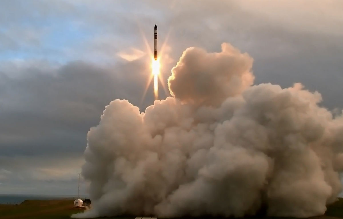
Putting some zeal into New Zealand – Rocket Lab’s Electron booster lifts off on maiden flight.
Credit: Rocket Lab
The private Rocket Lab orbital-class booster was successfully launched from the Mahia Peninsula in New Zealand.
While the Electron rocket’s maiden flight was heralded by the group, the vehicle did not reach orbit.
Peter Beck, CEO and founder of Rocket Lab, said in a press statement: “It was a great flight. We had a great first stage burn, stage separation, second-stage ignition and fairing separation. We didn’t quite reach orbit and we’ll be investigating why, however reaching space in our first test puts us in an incredibly strong position to accelerate the commercial phase of our program, deliver our customers to orbit and make space open for business.”
Next tests
The launch was the first of three test flights scheduled for this year.
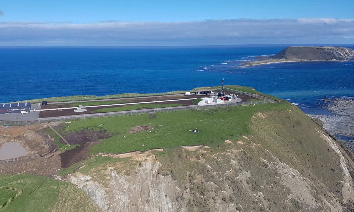
Rocket Lab’s New Zealand launch site.
Credit: Rocket Lab
Rocket Lab will target getting to orbit on the second test and look to maximize the payload the rocket can carry.
According to the private group, at full production, Rocket Lab expects to launch more than 50 times a year, and is regulated to launch up to 120 times a year.
Rocket Lab’s commercial phase will see Electron fly already-signed customers including NASA, Spire, Planet, Moon Express and Spaceflight.
Space economy
According to the newly created New Zealand Space Agency: “New Zealand’s unique location and conditions make it an attractive choice for an increasing amount of space activity.”

Credit: Mark Gee
The site explains that one of the world’s first private orbital launch ranges is sited on our North Island’s east coast ready for frequent rocket launches.
“High altitude balloons are lifting off from the South Island, and a new research institute plans to develop satellite data products to drive regional economic growth,” the site adds.
“We have scientists involved in international astronomy teams searching for planets orbiting distant stars, and companies and students building satellites. We have engineers and technologists working in space-related activities such as in advanced materials and rocketry. Our space economy is taking off!”
Visible sign
In a post-launch statement, the rocket launch is viewed as a huge step for New Zealand’s space industry by the country’s Minister for Economic Development, Simon Bridges.
“Today’s successful launch is a major milestone in the development of New Zealand’s space industry,” Bridges said in a press statement. “It is the first visible sign of a space industry in New Zealand and is an achievement Rocket Lab, and all New Zealanders can be proud of.”
The statement also notes that New Zealand is now one of 11 countries currently able to launch satellites into space from their own territory and the first to launch from a fully private orbital launch range.
Space tourism
“The potential benefits for our economy are very significant. These include opportunities to grow in areas related to the space industry such as research, materials development and testing, and to attract other space related companies to set up in New Zealand, and even space tourism,” Bridges said. “The Government is supportive of any industry that grows our economy through high-tech, innovative highly skilled activities.”
A range of government agencies, led by the Ministry of Business, Innovation and Employment, is also ensuring launch activities are safe and secure.
“We hope the launch will encourage others to come to New Zealand and enjoy the same attractive features that Rocket Lab is taking advantage of, including good access to orbits, clear skies, a skilled workforce and an innovation friendly environment,” Bridges concluded
Go to this Electron launch video:
https://twitter.com/RocketLabUSA/status/867612663764762624
For more information on Rocket Lab, go to:
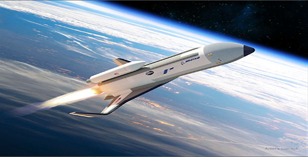
Credit: Boeing
The U.S. Defense Advanced Research Projects Agency (DARPA) announced today they are collaborating with Beoing to design, build and test a technology demonstration vehicle for the Experimental Spaceplane (XS-1) program.
Boeing’s Phantom Express aims to enable faster, more affordable small satellite launches.
In a Boeing statement, the aerospace firm will develop an autonomous, reusable spaceplane capable of carrying and deploying a small expendable upper stage to launch small (3,000 pound/1,361 kg) satellites into low Earth orbit.
Boeing and DARPA will jointly invest in the development.
Disrupt and transform
Once Phantom Express reaches the edge of space, it would deploy the second stage and return to Earth. It would then land on a runway to be prepared for its next flight by applying operation and maintenance principles similar to modern aircraft.
“Phantom Express is designed to disrupt and transform the satellite launch process as we know it today, creating a new, on-demand space-launch capability that can be achieved more affordably and with less risk,” said Darryl Davis, president, Boeing Phantom Works.
Phantom Express Technical Specifications
Length 100 ft (30.5 m)
Height 24 ft (7.3 m)
Diameter 13.7 ft (4.1 m)
Wing Span 62 ft (19 m)
Engine 1 Aerojet Rocketdyne AR-22
Fuel Liquid hydrogen
Oxidizer Liquid oxygen

Credit: Boeing
Legacy shuttle engines
Aerojet Rocketdyne also announced today it was selected to provide the main propulsion for the Boeing/DARPA XS-1. The main propulsion is based on the legacy space shuttle main engines (SSME).
For the XS-1 program, Aerojet Rocketdyne is providing two engines with legacy shuttle flight experience to demonstrate reusability, a wide operating range and rapid turnarounds. These engines will be designated as AR-22 engines and will be assembled from parts that remained in both Aerojet Rocketdyne and NASA inventories from early versions of the SSME engines. Assembly and ground testing will take place at NASA’s Stennis Space Center in Mississippi.

Phantom Express is envisioned as a highly autonomous experimental spaceplane, shown preparing for launch in this artist’s concept.
Credit: Boeing
Demonstration flights
Phantom Express would offer an advanced airframe design as well as third-generation thermal protection to create a vehicle capable of flying at high flight velocity, while carrying a smaller, more affordable expendable upper stage to achieve the mission objectives.
In the test phase of the program, Boeing and DARPA plan to conduct a demonstration of 10 flights over 10 days.
A DARPA statement notes that the XS-1 Phase 2 includes design, construction, and testing of the technology demonstration vehicle through 2019. It calls for initially firing the vehicle’s engine on the ground 10 times in 10 days to demonstrate propulsion readiness for flight tests.
Phase 3 objectives include 12 to 15 flight tests, currently scheduled for 2020. After multiple shakedown flights to reduce risk, the XS-1 would aim to fly 10 times over 10 consecutive days, at first without payloads and at speeds as fast as Mach 5. Subsequent flights are planned to fly as fast as Mach 10, and deliver a demonstration payload between 900 pounds and 3,000 pounds into low Earth orbit.
Check out this video at:
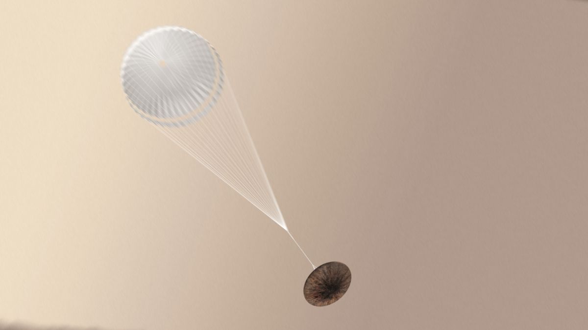
Artist impression of the Schiaparelli module with parachute deployed.
Credit: ESA/ATG medialab
A European Space Agency (ESA) and industry inquiry into last year’s crash-landing of the ExoMars Schiaparelli module on the Red Planet has concluded that conflicting information in the onboard computer caused the descent sequence to end prematurely.
According to a just-released final report, the Schiaparelli demonstrator was very close to successfully landing on Mars at the planned location.
Six-minute descent
The Schiaparelli entry, descent and landing demonstrator module separated from its mothership — the now orbiting Mars, Trace Gas Orbiter — as planned on October 16, 2016 and coasted towards Mars for three days.
Much of the six-minute descent onto Mars on October 19 went as expected: the module entered the atmosphere correctly, with the heatshield protecting it at supersonic speeds. Sensors on the front and back shields collected useful scientific and engineering data on the atmosphere and heatshield.

Schiaparelli’s heatshield was equipped with a variety of sensors designed to take measurements as the module entered the atmosphere. The Combined Aerothermal and Radiometer Sensors Instrument Package, COMARS+, used sensors on the back heatshield to measure pressure, temperature and heat flux. System sensors on the front shield were monitored by the data housekeeping system.
Credit: ESA/ATG medialab
Real-time telemetry
Telemetry from Schiaparelli was relayed to the main craft, which was entering orbit around the Red Planet at the same time – the first time this had been achieved in Mars exploration. This real-time transmission proved invaluable in reconstructing the unfolding chain of events.
At the same time as the orbiter recorded Schiaparelli’s transmissions, ESA’s Mars Express orbiter also monitored the lander’s carrier signal, as did the Giant Meterwave Radio Telescope in India.
Root causes
In the report, the following root causes for the mishap have been identified:
– Insufficient uncertainty and configuration management in the modeling of the parachute dynamics which led to expect much lower dynamics than observed in flight;
– Inadequate persistence time of the craft’s inertial measurement unit (IMU) saturation flag and inadequate handling of IMU saturation by the guidance, navigation and control (GNC) hardware;
– Insufficient approach to Failure Detection, Isolation and Recovery and design robustness;
– Mishap in management of subcontractors and acceptance of hardware.

Planned descent sequence of Schiaparelli Mars lander.
Credit: ESA
Spin rate
Also noted in the report is an unexpected evolution of the spin rate of the Entry, descent and landing Demonstrator Module (EDM) with no apparent links to the landing failure. The root cause of this anomaly is believed to be linked with uneven degradation of thermal blankets during entry and a possible slight twist in the parachute riser after deployment.
Within this report general recommendations to avoid such defects and weaknesses have been established and specific recommendations for the ExoMars 2020 lander mission have also been established.
To read the full report — EXOMARS 2016 – Schiaparelli Anomaly Inquiry — go to:
http://exploration.esa.int/mars/59176-exomars-2016-schiaparelli-anomaly-inquiry/
![]()
All the obstacles in spaceflight can theoretically be broken down in to subsets of risk.
Whether personal risk, programmatic risk, financial risk or professional risk, these are the things holding back individuals and organizations from accomplishing goals.
What does this mean for Mars and how can we overcome it?
Next steps
I was pleased to sit down with Jake Robins, the host and producer of WeMartians Podcast.
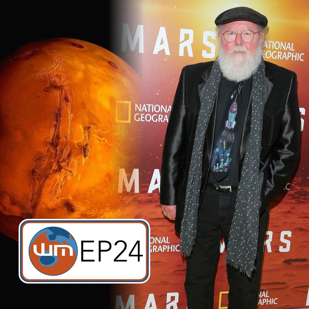
Credit: National Geographic/WeMartians Podcast
We explored the topic of risk and discussed what steps must be taken next to continue towards the objective of putting people on the Red Planet.
The WeMartians Podcast delves into all aspects of the exploration of Mars, including robotic/human spacecraft and rocket engineering, planetary science, astronomy and other upcoming technology. The episodes are research-supported and feature topical audio clips and special guests.
Resources
The WeMartians Podcast is available on iTunes, Stitcher, SoundCloud and Google Play Music.
Find it in your favorite Podcatcher app.
Go to:
Episode 24 – Risks and Rewards (feat. Leonard David)
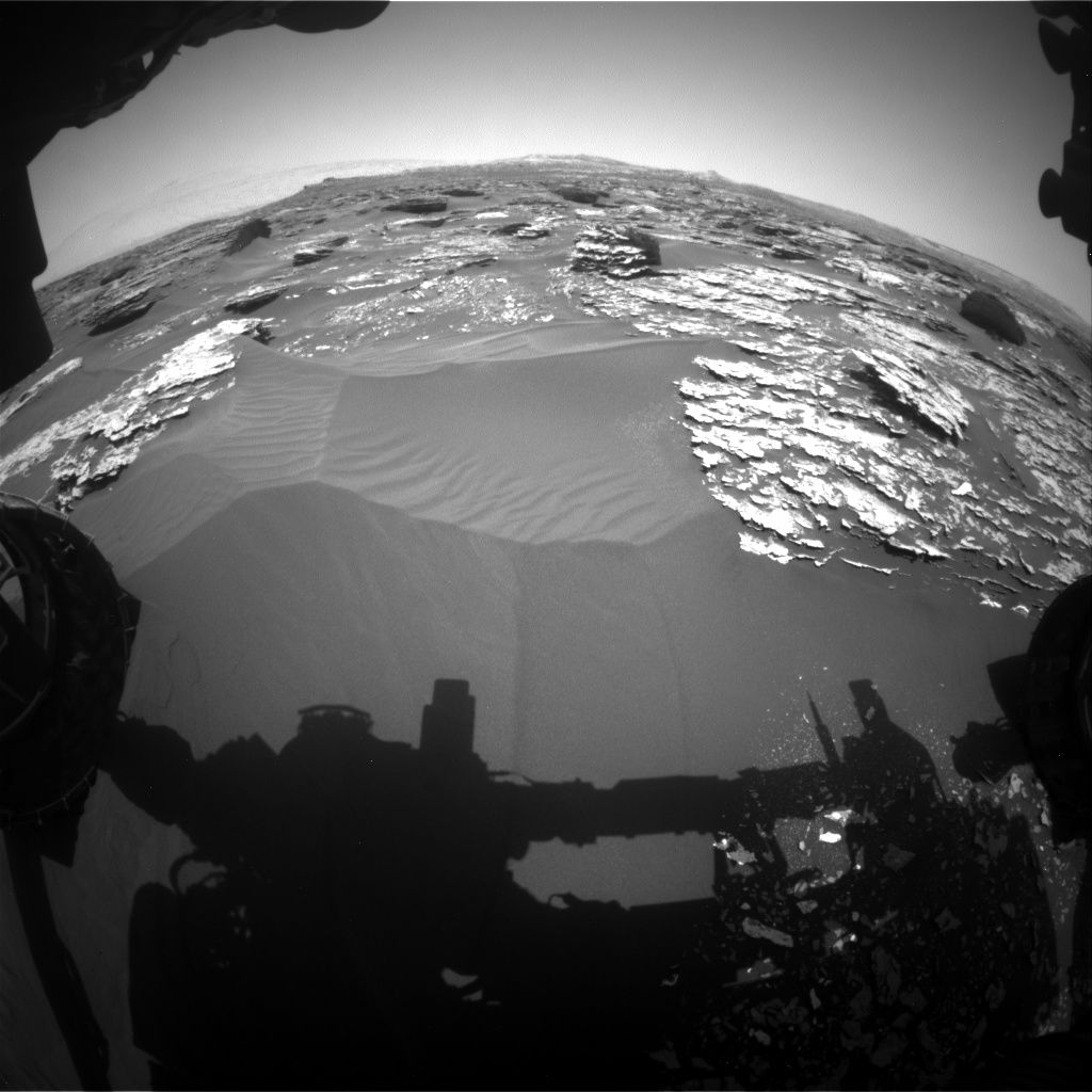
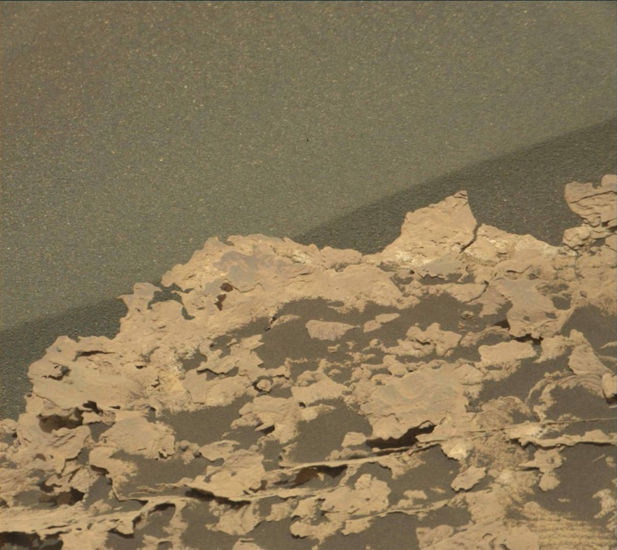
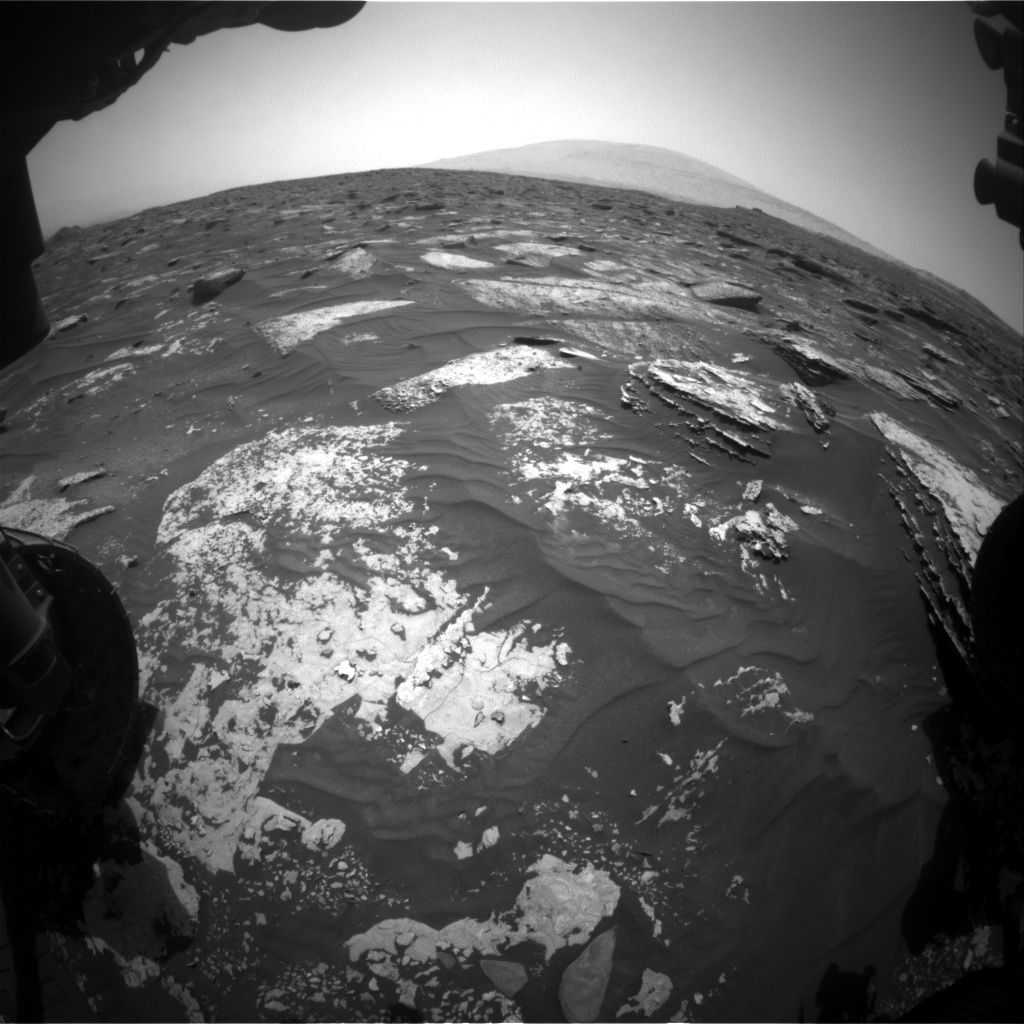
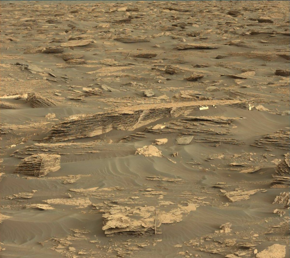
Curiosity Front Hazcam Left B image acquired on Sol 1703, May 21, 2017.
Credit: NASA/JPL-Caltech
NASA’s Curiosity Mars rover has just begun Sol 1705 duties.
Abigail Fraeman, a planetary geologist at NASA Jet Propulsion Laboratory (JPL) in Pasadena, California reports that Curiosity is continuing to make progress towards Vera Rubin Ridge along the Mt. Sharp ascent route.
In the planning of two sols — Sol 1705 and Sol 1706 – the script calls for remote sensing science on the bedrock in front of the robot, including Chemistry and Camera (ChemCam) observations of targets: “Turtle Island,” “Stony Brook,” and “Dike Peak.”
Fracture fills
“Turtle Island is typical Murray bedrock, Stony Brook has an interesting dark streak running through it, and Dike Peak is a neat looking block with dark colored fracture fills,” Fraeman notes. “We will complement these observations with Mastcam documentation imaging.”
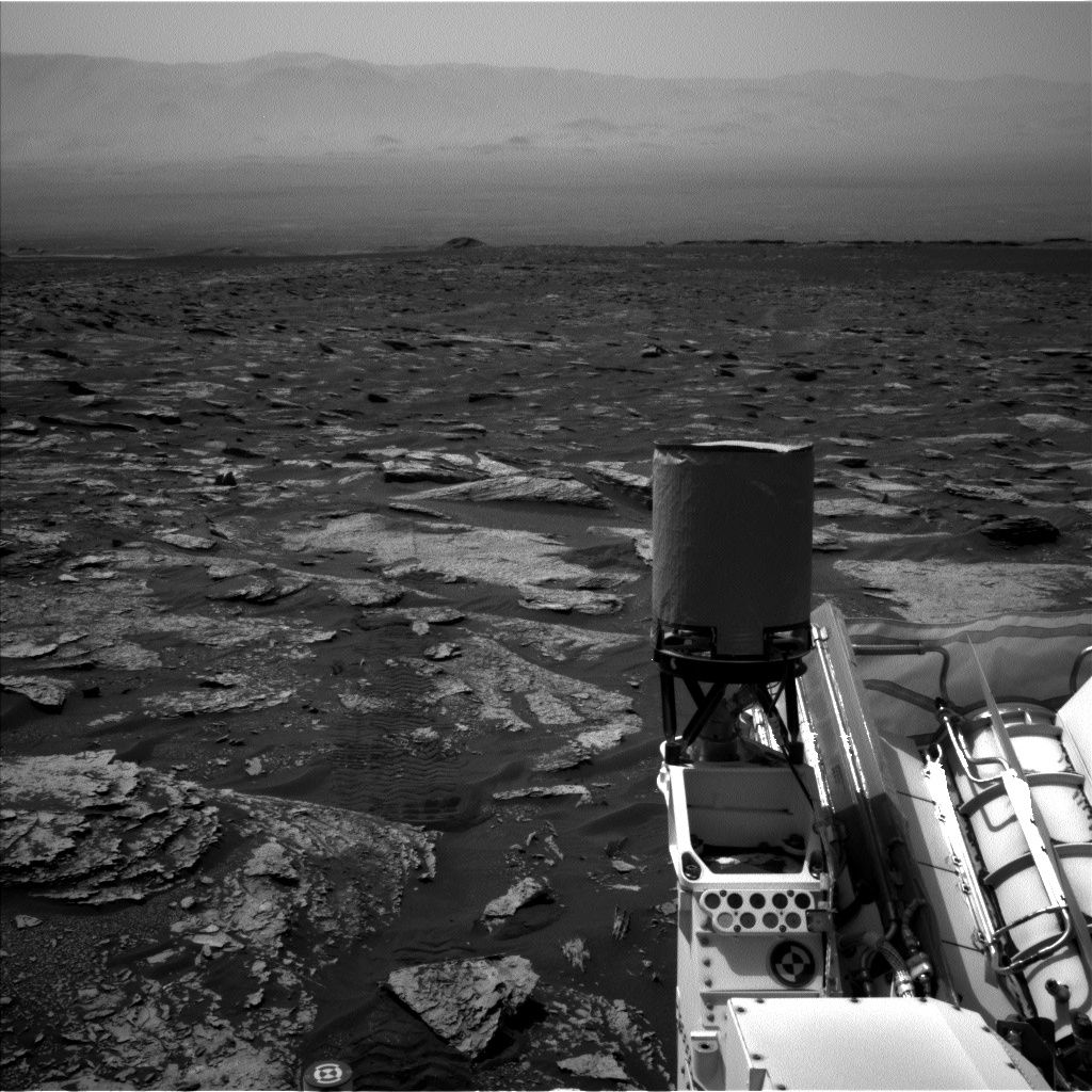
Curiosity Navcam Left B image acquired on Sol 1703, May 22, 2017.
Image Credit: NASA/JPL-Caltech
The plan then calls for the rover to take a short drive and perform post-drive imaging, as well as a ChemCam Autonomous Exploration for Gathering Increased Science (AEGIS) observation.
Challenging terrain
On the second sol of the plan, Fraeman explains, “Curiosity will be focused on taking atmospheric observations, including a dust devil search and images of the crater rim and sky above us.”
“We didn’t drive as far as we thought we would over the weekend. Software onboard Curiosity sensed the rover was struggling to travel over the challenging terrain more than we had anticipated, so it ended the drive early,” Fraeman notes.
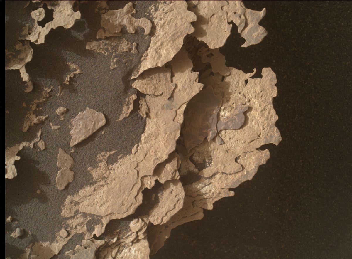
Curiosity Mars Hand Lens Imager (MAHLI) photo taken on Sol 1702, May 21, 2017. MAHLI is located on the turret at the end of the rover’s robotic arm.
Credit: NASA/JPL-Caltech/MSSS
Fraeman adds that she spent a shift looking at the Navcam and Hazcam data to understand what about the terrain was causing problems, and thinking about new paths to take that would still get the rover to the desired locale.
“I’m optimistic about our new drive route,” Fraeman concludes, “and I’m very glad we have six-wheel drive to help us climb this mountain!”
Curiosity Mastcam Right image acquired on Sol 1702, May 20, 2017.
Credit: NASA/JPL-Caltech/MSSS
New map
A new map of Curiosity’s traverse across Mars through Sol 1700 has been issued by JPL.
This map shows the route driven by NASA’s Mars rover Curiosity through the 1700 Martian day, or sol, of the rover’s mission on Mars (May 20, 2017).
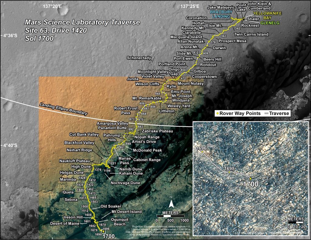
Credit: NASA/JPL-CALTECH/UNIV. OF ARIZONA
Numbering of the dots along the line indicate the sol number of each drive. North is up. The scale bar is 1 kilometer (~0.62 mile).
From Sol 1698 to Sol 1700, Curiosity had driven a straight line distance of about 98.00 feet (29.87 meters), bringing the rover’s total odometry for the mission to 10.24 miles (16.48 kilometers).
The base image from the map is from the High Resolution Imaging Science Experiment Camera (HiRISE) onboard NASA’s Mars Reconnaissance Orbiter.
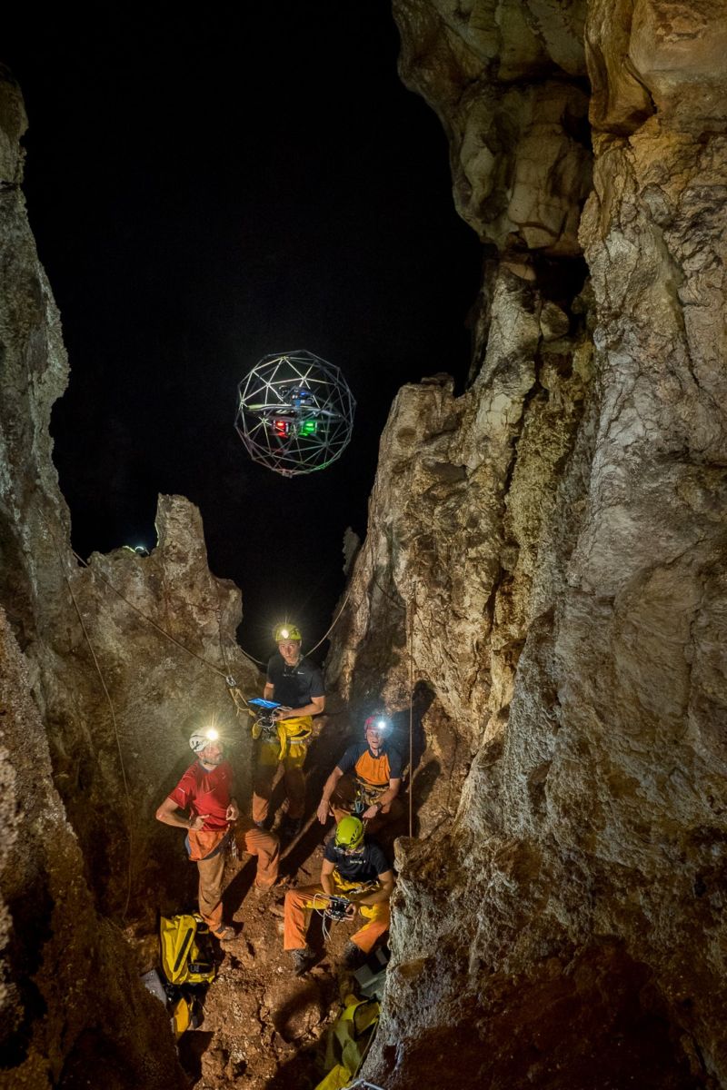
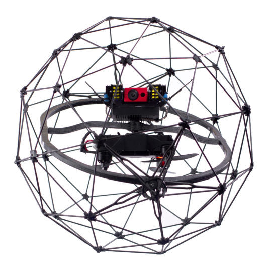
Flyability drone is unleashed in Cucchiara cave.
Credit: ESA
Cave divers have been utilizing a drone to explore caverns – a technology that could be a valuable plus in future exploration of lava tubes on Mars.
The drone was tested during the European Space Agency’s (ESA) Cooperative Adventure for Valuing and Exercising human behavior and performance Skills course (CAVES-X1) expedition. ESA astronaut Luca Parmitano took part in the caving expedition.
The scientific outing was organized by La Venta Association and the Commissione Grotte Eugenio Boegan and took place in the La Cucchiara caves near Sciacca, Sicily.
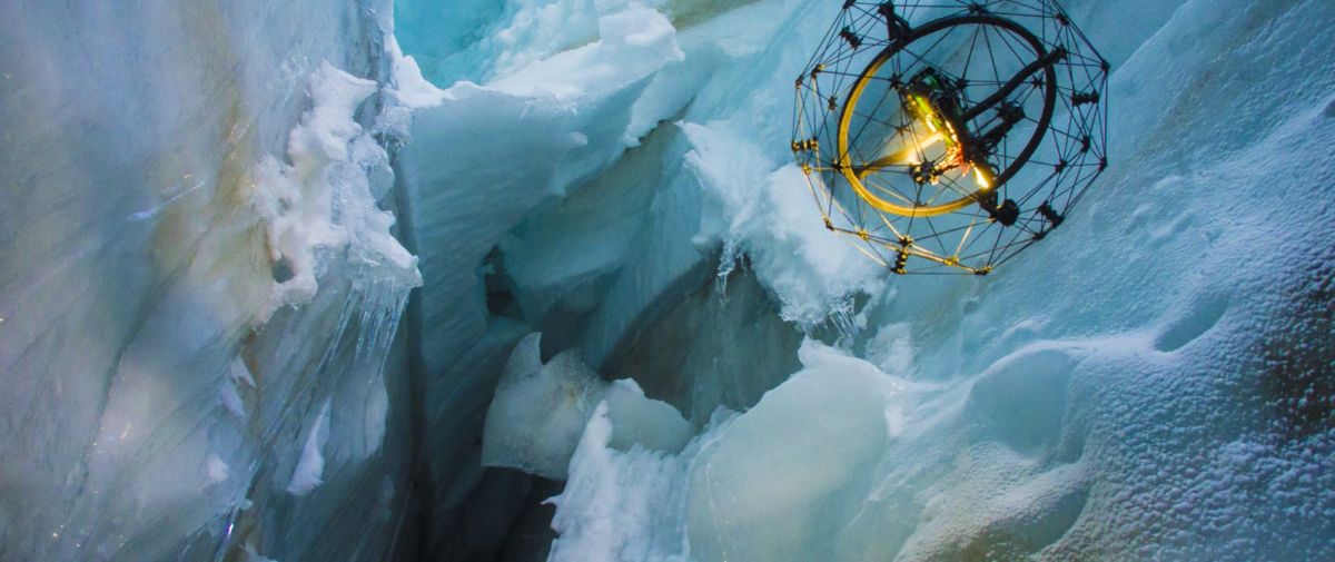
Drone dives into icy crevasse.
Credit: Flyability
Hard-to-reach spaces
Using a Flyability drone, the hardware can probe hard-to-reach spaces. The drone deliberately bumped into walls to learn how to navigate and to map tight areas that are too dangerous for humans.
ESA’s course coordinator, Francesco Sauro, an experienced caver and field geologist, said the drone used its thermal camera to map how the cave continued all the way to an unexplored area featuring water, impossible to reach for humans. “These tests will help us understand which technologies can be used in future exploration of lava tubes on Mars, for example,” he added in an ESA press statement.
Credit: Flyability
ESA’s strategy sees humans and robots working together to explore and build settlements on planetary bodies.
Nine flights
Within the caverns of Sicily, temperatures can rise to 37°C, making the exploration in darkness even more difficult.
The drone was launched into a 100 m-high vertical tunnel.
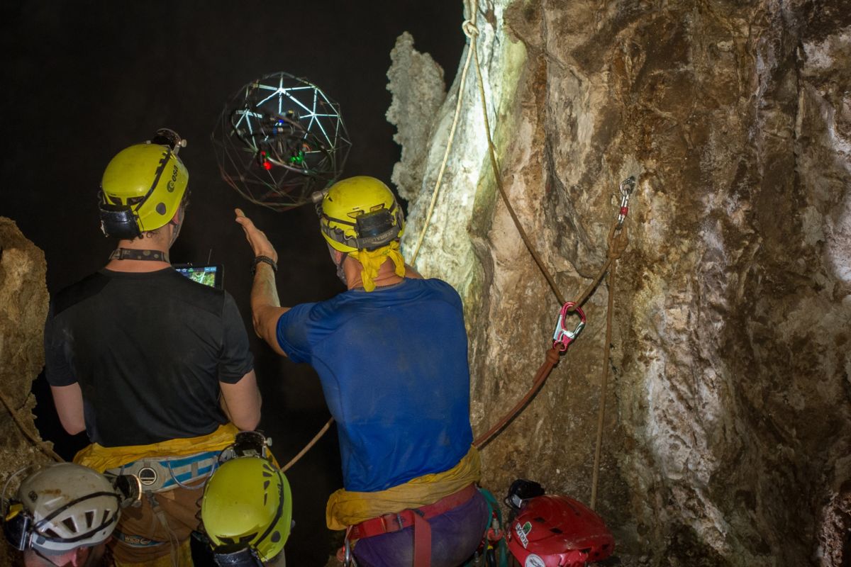
ESA astronaut Luca Parmitano with the Flyability team flying the drone in the Cucchiara Cave.
Credit: ESA–N. Russo www.natalinorusso.it
Two operators — one for the cameras and one for the drone itself — searched deep into the tunnel for hot spots and mapping never-seen-before areas. The thermal camera allowed the operators to pinpoint areas where temperatures are estimated to be higher than 40°C – circular conduits that are now earmarked for future exploration.
Inside the abyss, hot and cold air currents mix and form condensation so high it resembles continuous rain in the shaft. Despite these difficult conditions, ESA reports that the drone performed flawlessly over its nine flights.
For more information on the Flyability drone technology, go to the company’s website at:

Close-calls in the cosmos. A new appraisal of civil traffic control is to be undertaken by the FAA and the Department of the Defense.
Credit: Naval Research Laboratory (NRL)
The Federal Aviation Administration (FAA) and the Department of the Defense are embarking on a pilot program to define the pathway forward on Space Traffic Management and what functions may be better suited for a civil agency.
This joint-appraisal is to start this summer, likely in the August time frame.
Funding details are expected in the forthcoming White House FY18 Defense budget request.
The pilot program was discussed during last week’s Fiscal Year 2018 Priorities and Posture of the National Security Space Enterprise before the House Committee on Armed Services’ Strategic Forces Subcommittee.
Air-centric
Lieutenant General David Buck, Commander of the Joint Functional Component Command for Space, U.S. Strategic Command, testified May 19th that the military recognizes that some Space Traffic Management (STM) tasks are not central to their military mission. Those tasks include things like debris mitigation and providing conjunction data messages to satellite operators.
“As part of the pilot program, I anticipate a small footprint of FAA representatives working side-by-side with our space operators this year,” Buck noted in written testimony.

Earth orbit is a junkyard of human-made space clutter.
Credit: Space Junk 3D, LLC. Melrae Pictures
Buck said that the FAA sees this “as a real opportunity to do things that are more like air-centric,” he told lawmakers, such as establishing norms of behavior and establishing patterns of safety in space flight.
“They [the FAA] see some goodness in this and they are anxious to take on specific aspects of the Space Traffic Management mission,” Buck added.
Safe space operations
The FAA’s George Nield, Associate Administrator for Commercial Space Transportation, has previously outlined a Civil Space Traffic Management System (CSTMS).
The CSTMS would consist of the hardware, software, data and communications connectivity, and personnel that are needed to accept and process observations, create and maintain a catalog of space objects, perform safety-related analyses, and develop and distribute safety-related products and services.
The mission of the CSTMS would be to enhance the safety of space operations, and to preserve the space environment, Nield said March 30 during a Symposium on Space Situational Awareness, held in Washington, D.C. The meeting was organized by the Universities Space Research Association and the Space Policy Institute.

A CubeSat is deployed from the International Space Station.
Credit: NASA
Congested space
During that March meeting, Nield defined the challenges ahead. “Space is becoming more congested. Cubesats and other small satellites are being launched with increasing frequency. There are near-term plans for ‘Mega-constellations,’ with hundreds or even thousands of satellites,” he pointed out.
The Department of the Defense attempts to keep track of objects in space, “but they would like to be able to focus on national security issues, rather than on the safety of civil and commercial space operations,” Nield said.
However, there are no universally-accepted “Rules of the Road” for space operations, Nield said. “An increase in the number of collisions in space,” he said, “could put astronauts and critical national security spacecraft at risk, and even make some orbital regimes unusable for future operators.”

The crowded space environment may look like this a decade from now, with proposed mega-constellations.
Credit: Center for Space Policy & Strategy
Safety services
In his remarks last March, Nield said that the joint FAA and Department of Defense pilot effort is designed to demonstrate the ability of the FAA to provide orbital safety services as part of a Civil Space Traffic Management System.
Key steps in the process include being able to:
- Accept and process observations
- Compute orbital parameters and generate at least a partial catalog of space objects
- Analyze and assess potential conjunctions
- Generate collision avoidance warnings as required
Data produced during the pilot program will be compared and validated with Department of Defense data.
Important questions
In carrying out a pilot program, the FAA’s Nield explained, it could answer a set of important questions:
- In terms of completeness, accuracy, and timeliness, how would the products and services from an FAA-managed Civil Space Traffic Management System compare to those currently available from the Department of Defense (DoD)?
- What are the potential benefits of using observations from non-DoD sources, either instead of, or in addition to, the data currently being used by the DoD?
- Can innovative analysis techniques be used to decrease uncertainty and cut down on “false alarms” for potential collisions?
- Is it possible to increase transparency of the data and the process, while still protecting classified and/or sensitive national security information?

Central to preparing for the early colonization of Mars, why not first take up a seat at the Waterville Opera House in central Maine? Not only that, there’s a casting call for future Martians.
“One Way Trip To Mars-a rock opera” premieres at the Waterville Opera House August 24-27.
Emotional rollercoaster
The show is rooted in contemporary science and features 21 original songs by Maine-based songwriters Peter Alexander and Johannah Harkness and is accompanied by an “Art & Science Fair.” This fair involves students using the arts to explore the many areas of science involved in space travel and establishing a human colony on Mars.
Those tunes tell a fictional story about Paolo, the first human chosen to fly a solo, one-way mission to establish a human colony on Mars.
According to the opera’s website: “The show takes audiences on an emotional rollercoaster, from Paolo’s exuberance at being chosen for the mission, to his coming to grips with the reality of forever leaving behind his wife and everything he loves on earth. When catastrophic events on Earth — from nuclear terrorism to climate change and global war, cause communication links with Mars to go down — Paolo is left alone in the universe.”
From there the story accelerates to its dramatic conclusion, the website adds.

First flight
“One Way Trip to Mars” has had first flight as a multi-media concert on the main stage of the Chocolate Church Arts Center in Bath during the fall of 2016.
The show has been re-worked by dramatist and director Dennis St. Pierre as a fully-realized piece for musical theater and opens in a world premiere at the Waterville Opera House in Waterville, Maine at the end of August.

Credit: Waterville Opera House
A second round of auditions to play leading parts in the opera’s premiere will be taking place May 26 & 27 in New York.
For more information on auditions, go to:
http://onewaytriptomars.us/audition-notice/
The Rock Opera is similar in style to Tommy, Jesus Christ Superstar, Ziggy Stardust, Chess, The Great Comet.
More information about this innovative show can be found at:

Credit: Center for Space Policy & Strategy
Today’s House hearing on Fiscal Year 2018 Priorities and Posture of the National Security Space Enterprise was held by the House Committee on Armed Services’ Strategic Forces Subcommittee.
The witnesses and their prepared testimony:
- Lieutenant General David Buck, Commander, Joint Functional Component Command for Space, U.S. Strategic Command
http://docs.house.gov/meetings/AS/AS29/20170519/105974/HHRG-115-AS29-Wstate-BuckD-20170519.pdf
- Robert Cardillo, Director, National Geospatial Intelligence Agency
http://docs.house.gov/meetings/AS/AS29/20170519/105974/HHRG-115-AS29-Wstate-CardilloR-20170519.pdf
- John Hill, Performing the Duties of Deputy Assistant Secretary of Defense for Space Policy, Office of the Secretary of Defense for Policy
http://docs.house.gov/meetings/AS/AS29/20170519/105974/HHRG-115-AS29-Wstate-HillJ-20170519.pdf
- General John Raymond, Commander, Air Force Space Command
http://docs.house.gov/meetings/AS/AS29/20170519/105974/HHRG-115-AS29-Wstate-RaymondJ-20170519.pdf
- Betty Sapp, Director, National Reconnaissance Office
http://docs.house.gov/meetings/AS/AS29/20170519/105974/HHRG-115-AS29-Wstate-SappB-20170519.pdf
To view this very informative hearing, go to:
Curiosity Front Hazcam Left B image taken on Sol 1699, May 17, 2017.
Credit: NASA/JPL-Caltech
Curiosity continues towards Vera Rubin Ridge with a drive of 157 feet (48 meters), reports Michael Battalio, an atmospheric scientist from Texas A&M University, College Station, Texas.
The NASA Mars rover is now in Sol 1700 and has been performing touch-and-go activities using its Alpha Particle X-Ray Spectrometer (APXS) and Mars Hand Lens Imager (MAHLI) on “Ripple Pond,” a typical member of the Murray formation, Battalio adds.
Mastcam and Chemistry & Camera (ChemCam) is set to follow up with observations of Ripple Pond.
Titled layers
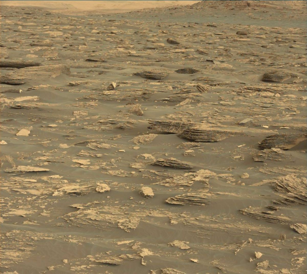
Curiosity Mastcam Left image taken on Sol 1698, May 17, 2017.
Credit: NASA/JPL-Caltech/MSSS
Curiosity’s Mastcam will next target “Rhodes Cliff,” Battalio notes, “which is especially interesting as it is tilted to show the Murray formation layers.”
Curiosity Mastcam Left image taken on Sol 1698, May 17, 2017.
Credit: NASA/JPL-Caltech/MSSS
Following these observations, Curiosity is slated to drive and capture standard imaging for targeting in the weekend plan.
After the drive, ChemCam will perform an automated Autonomous Exploration for Gathering Increased Science (AEGIS) activity to measure bright patches of outcrop.
Dusty atmosphere
Two measurements of dust in the atmosphere of Mars are to be captured by Mastcam on Sol 1700.

Tau image taken by Curiosity’s Mastcam Left camera on Sol April 18, 2017 Credit: NASA/JPL-Caltech/MSSS
One measurement will determine the optical depth vertically (tau), and a second will determine the amount of dust towards the direction of the crater rim (line-of-sight).
Optical depth describes the amount of light attenuated (scattered or absorbed) above Curiosity, Battalio explains. An optical depth measurement, or tau, is defined as the logarithm of the ratio of the transmitted energy flux through some layer of the atmosphere to the received energy flux.
Atmospheric profile
“By looking directly at the Sun with Mastcam, the amount of energy reaching the surface can be determined. This is the transmitted flux through the entire atmosphere,” Battalio adds. Combined with an estimate of the incident energy from the Sun at the top of the Mars atmosphere from satellite observations (the received flux), he says, a reliable measurement of the optical depth for the entire atmosphere can be made.
The second dust measurement – a line-of-sight extinction (LOS), does a similar calculation to the tau, except horizontally instead of vertically.
Dust devil movie
On Sol 1701, the robot’s Navcam will capture a supra-horizon cloud movie and will perform an independent LOS measurement for comparison to the Mastcam measurement.
Finally, a dust devil movie will be taken around local noon. Normal Rover Environmental Monitoring Station (REMS) and Radiation Assessment Detector (RAD) measurements as well as several Dynamic Albedo of Neutrons (DAN) passive measurements and one DAN active will be captured, Battalio concludes.

